world.wikisort.org - Japan
Kōzushima Village (神津島村, Kōzushima-mura) is a village located in Ōshima Subprefecture, Tokyo Metropolis, Japan. As of 1 June 2022[update], the village had an estimated population of 1,841, and a population density of 99 persons per km². Its total area is 18.58 square kilometres (7.17 sq mi).
This article needs additional citations for verification. (October 2022) |
Kōzushima
神津島村 | |
|---|---|
Village | |
|
Flag Seal | |
Location of Kōzushima in Tokyo Metropolis | |
 Kōzushima | |
| Coordinates: 34°12′19.1″N 139°08′3.8″E | |
| Country | Japan |
| Region | Kantō |
| Prefecture | Tokyo Metropolis |
| Area | |
| • Total | 18.58 km2 (7.17 sq mi) |
| Population (June 2022) | |
| • Total | 1,841 |
| • Density | 99/km2 (260/sq mi) |
| Time zone | UTC+9 (Japan Standard Time) |
| Phone number | 04992-8-0011 |
| Address | 904, Kōzushima-mura, Tōkyō-to 100-0601 |
| Climate | Cfa |
| Website | vill |

Geography
Kōzushima Village covers the islands of Kōzu-shima, one of the northern islands in the Izu archipelago in the Philippine Sea, 178 kilometres (111 mi) south of central Tokyo. Warmed by the Kuroshio Current, the town has a warmer and wetter climate than central Tokyo.
Neighboring municipalities
- Tokyo Metropolis
Climate
| Climate data for Kōzu-shima (2003−2020 normals, extremes 2003−present) | |||||||||||||
|---|---|---|---|---|---|---|---|---|---|---|---|---|---|
| Month | Jan | Feb | Mar | Apr | May | Jun | Jul | Aug | Sep | Oct | Nov | Dec | Year |
| Record high °C (°F) | 18.1 (64.6) |
19.3 (66.7) |
20.8 (69.4) |
23.2 (73.8) |
25.6 (78.1) |
28.5 (83.3) |
33.7 (92.7) |
31.8 (89.2) |
31.0 (87.8) |
27.8 (82.0) |
24.1 (75.4) |
22.7 (72.9) |
33.7 (92.7) |
| Average high °C (°F) | 10.6 (51.1) |
11.4 (52.5) |
13.9 (57.0) |
17.4 (63.3) |
20.9 (69.6) |
23.3 (73.9) |
26.8 (80.2) |
28.6 (83.5) |
26.3 (79.3) |
22.1 (71.8) |
18.2 (64.8) |
13.4 (56.1) |
19.4 (66.9) |
| Daily mean °C (°F) | 8.5 (47.3) |
9.1 (48.4) |
11.4 (52.5) |
15.0 (59.0) |
18.6 (65.5) |
21.2 (70.2) |
24.6 (76.3) |
26.3 (79.3) |
24.1 (75.4) |
20.0 (68.0) |
16.1 (61.0) |
11.2 (52.2) |
17.2 (62.9) |
| Average low °C (°F) | 6.3 (43.3) |
6.6 (43.9) |
8.7 (47.7) |
12.6 (54.7) |
16.4 (61.5) |
19.5 (67.1) |
23.0 (73.4) |
24.5 (76.1) |
22.2 (72.0) |
18.1 (64.6) |
13.9 (57.0) |
9.0 (48.2) |
15.1 (59.1) |
| Record low °C (°F) | −0.8 (30.6) |
−0.6 (30.9) |
1.2 (34.2) |
2.2 (36.0) |
9.8 (49.6) |
14.0 (57.2) |
17.9 (64.2) |
18.7 (65.7) |
15.3 (59.5) |
11.9 (53.4) |
5.0 (41.0) |
1.0 (33.8) |
−0.8 (30.6) |
| Average precipitation mm (inches) | 98.5 (3.88) |
128.0 (5.04) |
198.8 (7.83) |
170.5 (6.71) |
183.4 (7.22) |
262.8 (10.35) |
189.4 (7.46) |
197.1 (7.76) |
208.1 (8.19) |
334.0 (13.15) |
174.4 (6.87) |
126.3 (4.97) |
2,271.3 (89.42) |
| Average precipitation days (≥ 1.0 mm) | 8.1 | 9.6 | 12.1 | 10.6 | 10.1 | 13.3 | 9.4 | 8.2 | 11.8 | 12.4 | 10.9 | 8.9 | 125.4 |
| Source: JMA[1][2] | |||||||||||||
History
Kōzushima Village was founded on October 1, 1923, when the Izu islands were administratively divided into villages and town.
Economy
The village economy is dominated by commercial fishing and seasonal tourism. There is also some small-scale farming. In the middle of the 20th century, unsuccessful attempts were made to develop silkworm farming. Many tourists come for sports fishing and scuba diving. Its white sandy beaches make it an excellent place to swim in summer, since it receives considerably fewer visitors than the other islands in the Izu chain. There are many hiking courses around its volcano, Tenjō-san, which dominates the center of the island. However, winter visits are discouraged, cancellation of flights and ferries due to inclement weather can strand visitors. The island is also noted for its local Shōchū.
Transportation
Kōzushima is accessible by ferry from mainland Tokyo, Shimoda, Shizuoka, or other Izu Islands. There are also daily flights from Chōfu Airport, in western Tokyo to Kozushima Airport.
Education
The village operates one public elementary and one public middle school.
Tokyo Metropolitan Government Board of Education operates Kōzu High School , the only high school in the village.
Gallery
 Kōzushima port
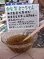 Tokoroten, a local specialty
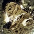 Tenjōsan, highest mountain
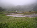 On the top of Tenjōsan


See also
References
- 観測史上1~10位の値(年間を通じての値). JMA. Retrieved February 23, 2022.
- 気象庁 / 平年値(年・月ごとの値). JMA. Retrieved February 23, 2022.
- "Home". Kozushima Junior High School. Retrieved 2022-11-05.
- "Home". Kozushima Elementary School. Retrieved 2022-11-05.
External links
- Kōzushima Village Official Website (in Japanese)
This Tokyo location article is a stub. You can help Wikipedia by expanding it. |
На других языках
- [en] Kōzushima, Tokyo
[ru] Кодзусима (село)
Кодзусима (яп. 神津島村 Ко:дзусима-мура) — село в Японии, находящееся в округе Осима префектуры Токио. Площадь села составляет 18,87 км²[1], население — 1857 человек (1 октября 2020)[2], плотность населения — 98,41 чел./км².Другой контент может иметь иную лицензию. Перед использованием материалов сайта WikiSort.org внимательно изучите правила лицензирования конкретных элементов наполнения сайта.
WikiSort.org - проект по пересортировке и дополнению контента Википедии