world.wikisort.org - Japan
Okutama (奥多摩町, Oku-Tama-machi) is a town located in the western portion of Tokyo Metropolis, Japan. As of 1 April 2021[update], the town had an estimated population of 4,949, and a population density of 22 persons per km2.[1] The total area of the town is 225.53 square kilometres (87.08 sq mi).
Okutama
奥多摩町 | |
|---|---|
Town | |
 Okutama Town Hall | |
 Flag  Seal | |
 Location of Okutama in Tokyo | |
 Okutama | |
| Coordinates: 35°48′34.4″N 139°5′46.3″E | |
| Country | Japan |
| Region | Kantō |
| Prefecture | Tokyo |
| District | Nishitama |
| First official recorded | 1st century AD (official) |
| Hikawa town settled | February 11, 1940 |
| Current name was changed | April 1, 1955 |
| Government | |
| • Mayor | Nobumasa Morooka (from May 2020) |
| Area | |
| • Total | 225.53 km2 (87.08 sq mi) |
| Population (April 2021) | |
| • Total | 4,949 |
| • Density | 22/km2 (57/sq mi) |
| Time zone | UTC+9 (Japan Standard Time) |
| Phone number | 042-557-0501 |
| Address | 215-6 Hikawa, Okutama-machi, Nishitama-gun, Tokyo 198-0212 |
| Climate | Cfa |
| Website | Official website |
| Symbols | |
| Bird | Copper pheasant |
| Flower | Azalea |
| Tree | Cryptomeria |

Geography
Okutama is located in the Okutama Mountains of far western Tokyo. It is geographically the largest municipality in Tokyo. Mount Kumotori, Tokyo's highest peak at 2017 m, divides Okutama from the Okuchichibu region of the neighboring Saitama and Yamanashi Prefectures. Tokyo's northernmost and westernmost points lie in Okutama, as does Lake Okutama, an important source of water for Tokyo, situated above the Ogōchi Dam in the town.[2]
Mountains
- Mount Kumotori
- Mount Kumotori, at 2017 m is the highest mountain in Tokyo and the westernmost place of Tokyo. Many plants grow here during the summer, most notably the tsuga. From the summit, there is a clear view of Mount Fuji and the Okuchichibu Mountains.[3]
- Mount Mitō
- Because it was forbidden to enter Mount Mitō during the Edo period, there are still many forests of enormous beech trees. Mount Fuji and Mount Kumotori can be seen from the summit, and it attracts many visitors especially during autumn. It is one of the Three Mountains of Okutama.[4]
- Mount Ōdake
- Mount Ōdake is one of the Three Mountains of Okutama. From the summit at 1266 m, Mount Fuji can be seen to the south and Mount Gozen to the west.[5]
- Mount Kawanori
- From Mount Kawanori, all mountains in Okutama can be seen. Also, the Hyakuhiro Waterfall is located here.[6]
- Mount Gozen
- Mount Gozen is well known for its oddly perfectly triangular shape. Like Mount Mitō, it attracts visitors in the fall.
Rivers
- Tama River
- The Tama River, with a length of 138 km, is the longest river in the prefecture. It flows through the entire prefecture, and the upstream of the river is located in Okutama.
- Hinohara River
- The Hinohara River is a rather short and small river located in the western portion of Tokyo.
Lakes
- Lake Okutama
- Lake Shiromaru
- Lake Shiromaru is a rather infamous dam on the Tama River. It has a height of 30.3 m, a length of 61 m, and a volume of 14,161 m3.
Surrounding municipalities
Tokyo Metropolis
- Chichibu
- Hannō
- Uenohara
- Kosuge
- Tabayama
Climate
Okutama has a Humid subtropical climate (Köppen Cfa) characterized by warm summers and cool winters with light to no snowfall. The average annual temperature in Okutama is 10.6 °C. The average annual rainfall is 2091 mm with September as the wettest month. The temperatures are highest on average in August, at around 22.1 °C, and lowest in January, at around minus 1.1 °C.[7]
| Climate data for Lake Okutama (1991−2020 normals, extremes 1976−present) | |||||||||||||
|---|---|---|---|---|---|---|---|---|---|---|---|---|---|
| Month | Jan | Feb | Mar | Apr | May | Jun | Jul | Aug | Sep | Oct | Nov | Dec | Year |
| Record high °C (°F) | 17.8 (64.0) |
20.9 (69.6) |
22.9 (73.2) |
30.6 (87.1) |
33.0 (91.4) |
34.3 (93.7) |
36.3 (97.3) |
36.4 (97.5) |
35.0 (95.0) |
30.2 (86.4) |
24.0 (75.2) |
22.8 (73.0) |
36.4 (97.5) |
| Average high °C (°F) | 6.8 (44.2) |
7.6 (45.7) |
10.9 (51.6) |
16.5 (61.7) |
21.1 (70.0) |
23.4 (74.1) |
27.4 (81.3) |
28.5 (83.3) |
24.3 (75.7) |
18.8 (65.8) |
14.0 (57.2) |
9.3 (48.7) |
17.4 (63.3) |
| Daily mean °C (°F) | 1.5 (34.7) |
2.2 (36.0) |
5.5 (41.9) |
10.8 (51.4) |
15.6 (60.1) |
18.9 (66.0) |
22.6 (72.7) |
23.5 (74.3) |
19.8 (67.6) |
14.3 (57.7) |
8.8 (47.8) |
3.9 (39.0) |
12.3 (54.1) |
| Average low °C (°F) | −2.4 (27.7) |
−1.9 (28.6) |
1.0 (33.8) |
5.8 (42.4) |
10.9 (51.6) |
15.3 (59.5) |
19.3 (66.7) |
20.1 (68.2) |
16.6 (61.9) |
10.9 (51.6) |
5.0 (41.0) |
0.1 (32.2) |
8.4 (47.1) |
| Record low °C (°F) | −9.3 (15.3) |
−11.6 (11.1) |
−8.1 (17.4) |
−3.8 (25.2) |
0.7 (33.3) |
7.5 (45.5) |
12.4 (54.3) |
13.2 (55.8) |
6.2 (43.2) |
1.0 (33.8) |
−2.1 (28.2) |
−6.9 (19.6) |
−11.6 (11.1) |
| Average precipitation mm (inches) | 49.5 (1.95) |
45.9 (1.81) |
88.5 (3.48) |
106.3 (4.19) |
118.7 (4.67) |
163.2 (6.43) |
205.6 (8.09) |
217.4 (8.56) |
270.2 (10.64) |
215.4 (8.48) |
68.9 (2.71) |
43.7 (1.72) |
1,608 (63.31) |
| Average precipitation days (≥ 1.0 mm) | 4.8 | 5.3 | 9.7 | 9.5 | 10.5 | 13.4 | 14.7 | 12.8 | 12.5 | 10.7 | 6.9 | 4.5 | 115.3 |
| Mean monthly sunshine hours | 206.5 | 187.7 | 173.0 | 178.4 | 172.2 | 104.2 | 124.8 | 144.6 | 104.5 | 128.7 | 164.5 | 186.5 | 1,874.6 |
| Source: JMA[8][9] | |||||||||||||
Demographics
Per Japanese census data,[10] the population of Okutama has decreased steadily since the 1950s, and is now two-thirds of what it was a century ago.
| Year | Pop. | ±% |
|---|---|---|
| 1920 | 9,514 | — |
| 1930 | 10,896 | +14.5% |
| 1940 | 12,543 | +15.1% |
| 1950 | 16,287 | +29.8% |
| 1960 | 13,785 | −15.4% |
| 1970 | 11,733 | −14.9% |
| 1980 | 9,808 | −16.4% |
| 1990 | 8,752 | −10.8% |
| 2000 | 7,575 | −13.4% |
| 2010 | 6,045 | −20.2% |
History
Prehistory
People began settling in Okutama from before the Jōmon Period and many archaeological sites have been found with ancient pottery. During the Yayoi period, rice cultivation began in the flatter lands of present-day Okutama, but most of the area remained covered by forests and only small flat lands existed.[11]
Premodern period
During the Edo period, the area included in present-day Okutama was divided into 16 villages within Musashi Province. In each village, there was one person who served as the mayor, another who served as the leader of a particular group, and another who served as a representative for the farmers. Also, entering Mount Takanosu was forbidden for people of low rank during this time. This was because the people of high rank (government officials and such) hunted with hawks at the mountain, and the officials wanted to keep the hunting grounds for themselves.[11]
Modern period
With the start of the Meiji period, the area of Okutama became part of Nirayama Prefecture except for Kotaba village, which was merged into Maebashi Domain, which then became part of Gunma Prefecture. While Kotaba village was turned into part of Maebashi city, the Okutama area was divided into three villages of Hikawa, Kori, and Ogouchi with the establishment of the modern municipalities system on April 1, 1889. In 1940, Hikawa was elevated to town status. In 1955, Hikawa town, Ogouchi village and Kori village were united, forming the town of Okutama.[11]
Government
Okutama has a mayor-council form of government with a directly elected mayor and a unicameral town council of 12 members. Okutama, collectively with the municipalities of Akiruno, Fussa, Hamura, Hinode, Hinohara and Mizuho, contributes two members to the Tokyo Metropolitan Assembly. In terms of national politics, the city is part of Tokyo 25th district of the lower house of the Diet of Japan.
Economy
Seasonal tourism, forestry and charcoal production are mainstays of the local economy.
Education
Okutama has two public elementary and one public junior high school operated by the town government.[12]
- Okutama Junior High School (奥多摩中学校)
- Hikawa Elementary School (氷川小学校)
- Kori Elementary School (古里小学校)
Okutama JHS was formed by the merger of Hikawa JHS (氷川中学校) and Kori JHS (古里中学校) in 2015.[13]
The town does not have a high school.
Transportation
Railway
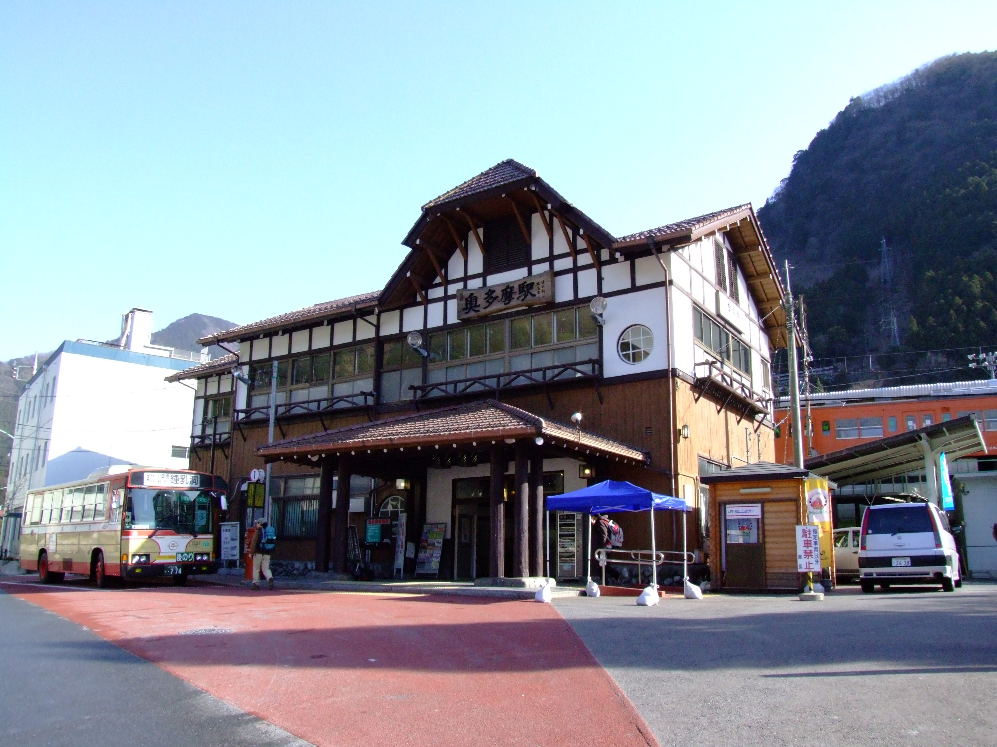
The East Japan Railway Company serves the town. The Ōme line, which connects the town with Tachikawa, terminates at Oku-Tama Station.
![]() JR East – - Ōme Line
JR East – - Ōme Line
Bus
The Nishi Tokyo Bus Co. carries passengers to Lake Okutama, the Nippara Limestone Cave, Tabayama village and Kosuge village (both in Yamanashi Prefecture) from Oku-Tama Station.
Highway
- National Highways
 National Route 139
 National Route 411
- Prefectural Roads
- Tokyo Prefectural Road 184 Okutama-Akiruno
- Tokyo Prefectural Road 204 Nippara Limestone Cave
- Tokyo Prefectural Road 205
- Tokyo Prefectural Road 206 Kawano-Kamikawa
Sister city relations
 Chun'an, Zhejiang, China
Local attractions

All of the town is located in Chichibu-Tama-Kai National Park.
- Lake Okutama
- Lake Okutama plays a major role in providing drinking water for the people of Tokyo. The largest lake in Tokyo, it also has a large dam.[14]
- Mount Takanosu
- During the Edo Period, the people of low rank were forbidden to enter Mount Takanosu, because it was a hawk hunting ground for the government and military officials. Now, it is open to hikers, and has an elevation of 1736.6 m.
- Tsurunoyu Onsen
- Until the construction of Ogouchi Dam, there was a spa town for Tsurunoyu Onsen. (It is now in the depths of the dam.) Now, there are a few inns that use the hot water from the hot spring for their spas. The hot spring is located about 20 minutes by bus from Oku-Tama Station.
- Hyakuhiro Waterfall

- Hyakuhiro Waterfall, with a height of 40 m, is a famous waterfall in the Okutama area. Located in Mount Kawanori, it is part of the Nippara River.
- Nippara Cave
- Nippara Cave is the second largest limestone cave in the Kantō region after the Fujido Cave in Gunma Prefecture, and attracts many visitors from around Japan.[15]
- Okuchichibu Mountains
- The Okuchichibu Mountains stretch from Nagano's Nobeyama region to Okutama and a portion of Saitama Prefecture and Yamanashi Prefecture. The highest mountain is Mount Kurogane (Yamanashi Prefecture), at 2232 m, and the lowest is Mount Azumaya (Saitama Prefecture), at 772 m.
- Okutama Onsen
- Okutama Onsen is a hot spring located in the town.
References
- "Okutama town official statistics" (in Japanese). Japan.
- 考える社会科地図 Kangaeru Shakaika Chizu. 四谷大塚出版 Yotsuya-Ōtsuka Shuppan. 2005. p. 113.
- 奥多摩町観光案内-奥多摩トレッキングコース-雲取山
- 奥多摩町観光案内-奥多摩トレッキングコース-御前山・三頭山 Archived 2007-11-15 at the Wayback Machine
- 奥多摩町観光案内-奥多摩トレッキングコース-大岳山・御岳山
- 奥多摩町観光案内-奥多摩トレッキングコース-川苔山
- Okutama climate data
- 観測史上1~10位の値(年間を通じての値). JMA. Retrieved February 23, 2022.
- 気象庁 / 平年値(年・月ごとの値). JMA. Retrieved February 23, 2022.
- Okutama population statistics
- Introduction to Okutama Archived 2007-08-24 at the Wayback Machine
- "小・中学校一覧". Okutama. Retrieved 2022-11-06.
- "奥多摩町学校施設長寿命化計画" (PDF). Okutama Town. Retrieved 2022-11-06.
町内の中学校は、[...]校となっています。
- 楽しく学ぶ小学生の地図帳 Tanoshiku Manabu Shogakusei no Chizucho. 帝国書院 Teikoku-Shoin. 2004. p. 37.
- "10 Lesser Known Places to Visit near Tokyo". 4 January 2015.
External links
 Media related to Okutama, Tokyo at Wikimedia Commons
- Okutama Town Official Website (in Japanese)
Authority control | |
|---|---|
| General | |
| National libraries | |
На других языках
[de] Okutama (Tokio)
Okutama (jap. 奥多摩町, -machi) ist ein Dorf im Landkreis Nishitama in der Präfektur Tokio, Japan.- [en] Okutama, Tokyo
[es] Okutama (Tokio)
Okutama (奥多摩町, Okutama-machi?) es un pueblo que se encuentra al extremo oeste de Tokio, Japón; específicamente dentro del distrito de Nishitama.[fr] Okutama
Okutama (奥多摩町, Okutama-machi?) est un bourg du district de Nishitama au Japon.[it] Okutama
Okutama (奥多摩町?) è una cittadina giapponese facente parte del Distretto di Nishitama, il cui territorio ricade sotto la giurisdizione del Governo Metropolitano di Tokyo.[ru] Окутама
Окутама (яп. 奥多摩町 Окутама-мати) — посёлок в Японии, находящийся в уезде Ниситама префектуры Токио. Площадь посёлка составляет 225,63 км²[1], население — 4752 человека (1 октября 2020)[2], плотность населения — 21,06 чел./км².Другой контент может иметь иную лицензию. Перед использованием материалов сайта WikiSort.org внимательно изучите правила лицензирования конкретных элементов наполнения сайта.
WikiSort.org - проект по пересортировке и дополнению контента Википедии