world.wikisort.org - Japan
Hachiōji (八王子市, Hachiōji-shi) is a city located in the western portion of Tokyo Metropolis, Japan. As of 31 March 2021[update], the city had an estimated population of 561,344, and a population density of 3000 persons per km2.[1] The total area of the city is 186.38 km2 (71.96 sq mi).
Hachiōji
八王子市 | |
|---|---|
Core city | |
 View of top left, Downtown Hachioji, Komiya Park, Naganuma Park, Mount Takao, stone fence and bridge in Hachioji Castle site, Yakuoin in Mount Takao, Hachioji Ramen, Hachioji Traditional Festival on August | |
 Flag  Seal | |
 Location of Hachiōji in Tokyo | |
 | |
 Hachiōji | |
| Coordinates: 35°39′59.2″N 139°18′57.6″E | |
| Country | Japan |
| Region | Kantō |
| Prefecture | Tokyo |
| First official recorded | 3rd century AD (official) |
| Town settled | April 1, 1889 |
| City settled | September1, 1917 |
| Government | |
| • Mayor | Takayuki Ishimori (石森 孝志, Takayuki Ishimori) |
| Area | |
| • Total | 186.38 km2 (71.96 sq mi) |
| Population (March 2021) | |
| • Total | 561,344 |
| • Density | 3,000/km2 (7,800/sq mi) |
| Time zone | UTC+9 (Japan Standard Time) |
| Phone number | 042-626-3111 |
| Address | 3-24-1 Motohongo-cho, Hachiōji-shi, Tokyo 192-8501 |
| Climate | Cfa |
| Website | Official website |
| Symbols | |
| Bird | Blue-and-white flycatcher |
| Flower | Lilium auratum |
| Tree | Ginkgo biloba |

Geography

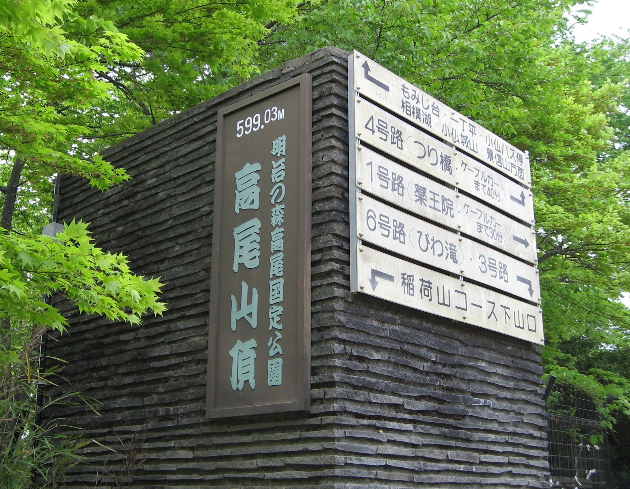
Hachiōji is located in the foothills of the Okutama Mountains of western Tokyo, about 40 kilometers west of the center of the 23 special wards of Tokyo. The city is surrounded on three sides by mountains, forming the Hachioji Basin which opens up toward the east in the direction of Tokyo. The mountain ranges in the southwest include Mount Takao (599 m) and Mount Jinba (857 m), two popular hiking destinations which can be reached by train and bus, respectively.
Surrounding municipalities
Tokyo Metropolis
Kanagawa Prefecture
- Sagamihara
Climate
Hachiōji has a Humid subtropical climate (Köppen Cfa) characterized by warm summers and cool winters with light to no snowfall. The average annual temperature in Hachiōji is 13.9 °C. The average annual rainfall is 1998 mm with September as the wettest month. The temperatures are highest on average in August, at around 25.3 °C, and lowest in January, at around 2.4 °C.[2]
| Climate data for Hachioji (1991−2020 normals, extremes 1976−present) | |||||||||||||
|---|---|---|---|---|---|---|---|---|---|---|---|---|---|
| Month | Jan | Feb | Mar | Apr | May | Jun | Jul | Aug | Sep | Oct | Nov | Dec | Year |
| Record high °C (°F) | 19.9 (67.8) |
24.0 (75.2) |
26.6 (79.9) |
32.2 (90.0) |
37.1 (98.8) |
36.0 (96.8) |
39.3 (102.7) |
39.3 (102.7) |
39.2 (102.6) |
32.7 (90.9) |
26.7 (80.1) |
26.0 (78.8) |
39.3 (102.7) |
| Average high °C (°F) | 9.3 (48.7) |
10.3 (50.5) |
13.7 (56.7) |
19.1 (66.4) |
23.6 (74.5) |
26.0 (78.8) |
30.1 (86.2) |
31.4 (88.5) |
27.1 (80.8) |
21.5 (70.7) |
16.4 (61.5) |
11.7 (53.1) |
20.0 (68.0) |
| Daily mean °C (°F) | 3.4 (38.1) |
4.5 (40.1) |
8.0 (46.4) |
13.3 (55.9) |
18.1 (64.6) |
21.4 (70.5) |
25.4 (77.7) |
26.4 (79.5) |
22.6 (72.7) |
16.9 (62.4) |
11.1 (52.0) |
5.9 (42.6) |
14.7 (58.5) |
| Average low °C (°F) | −1.8 (28.8) |
−0.9 (30.4) |
2.7 (36.9) |
7.7 (45.9) |
12.9 (55.2) |
17.4 (63.3) |
21.5 (70.7) |
22.4 (72.3) |
18.8 (65.8) |
13.0 (55.4) |
6.4 (43.5) |
0.8 (33.4) |
10.1 (50.2) |
| Record low °C (°F) | −8.7 (16.3) |
−8.8 (16.2) |
−8.1 (17.4) |
−2.0 (28.4) |
2.6 (36.7) |
10.0 (50.0) |
13.3 (55.9) |
15.4 (59.7) |
7.9 (46.2) |
2.4 (36.3) |
−2.3 (27.9) |
−7.6 (18.3) |
−8.8 (16.2) |
| Average precipitation mm (inches) | 54.1 (2.13) |
46.1 (1.81) |
102.9 (4.05) |
114.1 (4.49) |
124.7 (4.91) |
172.0 (6.77) |
188.3 (7.41) |
212.5 (8.37) |
264.4 (10.41) |
230.8 (9.09) |
80.1 (3.15) |
53.1 (2.09) |
1,643 (64.69) |
| Average precipitation days (≥ 1.0 mm) | 4.5 | 4.9 | 9.2 | 9.2 | 10.0 | 12.7 | 12.5 | 10.4 | 12.2 | 10.5 | 7.2 | 4.9 | 108.2 |
| Mean monthly sunshine hours | 201.1 | 179.7 | 174.9 | 179.3 | 176.0 | 119.7 | 145.1 | 177.3 | 128.0 | 132.4 | 157.0 | 184.2 | 1,954.5 |
| Source: JMA[3][4] | |||||||||||||
Demographics
Per Japanese census data,[5] the population of Hachiōji has increased steadily for over a century.
| Year | Pop. | ±% |
|---|---|---|
| 1920 | 78,705 | — |
| 1930 | 95,389 | +21.2% |
| 1940 | 111,028 | +16.4% |
| 1950 | 131,470 | +18.4% |
| 1960 | 164,622 | +25.2% |
| 1970 | 253,407 | +53.9% |
| 1980 | 387,178 | +52.8% |
| 1990 | 466,347 | +20.4% |
| 2000 | 536,046 | +14.9% |
| 2010 | 579,799 | +8.2% |
History
The area of present-day Hachiōji was part of ancient Musashi Province. It has been an important junction point and post town along the Kōshū Kaidō, the main road that connected the historical Edo (today's Tokyo) with western Japan. Hachiōji Castle was built during the Sengoku period in 1584 by Hōjō Ujiteru, but was destroyed in 1590 by Toyotomi Hideyoshi. During the Edo period, the area was tenryō controlled directly by the Tokugawa shogunate. In the post-Meiji Restoration cadastral reform of July 22, 1878, the area became part of Minamitama District in Kanagawa Prefecture. The town of Hachiōji was created on April 1, 1889, with the establishment of the modern municipalities system. Minaitama District was transferred to the administrative control of Tokyo Metropolis on April 1, 1893. Hachiōji gained city status on September 1, 1917.
During the 1964 Summer Olympics, the city played host to the road cycling events. A velodrome in the city played host to the track cycling events.[6]
Hachiōji became a Core city on April 1, 2015 with increased local autonomy.
Government
Hachiōji has a mayor-council form of government with a directly elected mayor and a unicameral city council of 40 members, whose members are elected for a four-year term. Hachiōji contributes five members to the Tokyo Metropolitan Assembly. In terms of national politics, the city is divided between the Tokyo 21st district and Tokyo 24th district of the lower house of the Diet of Japan.
Mayors of Hachiōji (1917–present)
|
|
| ||||||||||||||||||||||||||||||||||||||||||||||||||||||||||||||||||||||||||||||
Economy
During the Meiji period, Hachiōji prospered as an important location for the production of silk and silk textiles. The industry faded away, however, in the 1960s. Today, Hachiōji mainly serves as a commuter town for people working in Tokyo, and as a location for many large colleges and universities.
Education
Colleges and universities
- Chuo University (Tama Campus)
- Digital Hollywood University
- Kogakuin University (Hachioji Campus)
- Kyorin University (Hachioji Campus)
- Meisei University (Hino Campus)
- Nihon Bunka University
- Soka University
- Tama Art University (Hachioji Campus)
- Takushoku University (Hachioji Campus)
- Teikyo University (Hachioji Campus)
- Tokyo Junshin University
- Tokyo Kasei-Gakuin University (Machida Campus)
- Tokyo Metropolitan University (Minamiōsawa Campus)
- Tokyo University of Agriculture and Technology
- Tokyo University of Pharmacy and Life Sciences
- Tokyo University of Technology (Hachiōji Campus)
- Tokyo Zokei University
- Nippon Engineering College
Primary and secondary education
Hachiōji has 70 public elementary schools and 37 public middle schools operated by the city government, as well as four public combined elementary/middle schools. The Tokyo Metropolitan Government Board of Education operates nine public high schools, and there are also eleven private high schools.
The metropolis also operates the Hachioji School for the Blind.
Transportation
Railways

![]() JR East - Chūō Main Line
JR East - Chūō Main Line
- Hachiōji – Nishi-Hachiōji – Takao
![]() JR East - Yokohama Line
JR East - Yokohama Line
- Hachiōji-Minamino – Katakura – Hachiōji
![]() JR East - Hachikō Line
JR East - Hachikō Line
- Hachiōji – Kita-Hachiōji – Komiya
![]() Keio Corporation - Keiō Line
Keio Corporation - Keiō Line
![]() Keio Corporation - Keiō Takao Line
Keio Corporation - Keiō Takao Line
![]() Keio Corporation - Sagamihara Line
Keio Corporation - Sagamihara Line
- Keiō-Horinouchi – Minami-Ōsawa
![]() Tokyo Tama Intercity Monorail - Tama Toshi Monorail Line
Tokyo Tama Intercity Monorail - Tama Toshi Monorail Line
- Chūō-Daigaku-Meisei-Daigaku – Ōtsuka-Teikyō-Daigaku – Matsugaya
- Takaotozan Railway
Highways
 Ken-Ō Expressway
 Chūō Expressway
 National Route 16
 National Route 20
 National Route 411
Sister city relations
 Kaohsiung, Taiwan[7] - friendship city since November 1, 2006
 Siheung, Gyeonggi Province, South Korea[7] - friendship city since November 7, 2006
 Tai'an, Shandong, People's Republic of China[7] - friendship city since September 23, 2006
Local attractions
Hachioji stretches over a large area, combining such diverse parts as the densely populated city center and its shopping district with the hardly populated rural areas in the west.
- Mt. Takao (599 m) is a popular hiking destination in the southwest, easily accessible through the Keiō Takao Line. It is famous for the Shingon Buddhist temple Takao-san Yakuōin Yūkiji (高尾山薬王院有喜寺).
- Mt. Jinba (855 m) is more difficult to reach, requiring a one-hour bus ride from the city center. It is popular, however, because of the scenic view toward Mt. Fuji.
- Tama Forest Science Garden
- Tokyo Fuji Art Museum
- Kamiyugi Park Baseball Field
- Kamiyugi Park Athletic Stadium
- Musashi Imperial Graveyard houses the remains of the Taishō and Shōwa emperors.
- Takiyama Castle, A castle ruin in the Sengoku period, one of the Continued Top 100 Japanese Castles.[8]
- Hachiōji Castle, A castle ruin in the Sengoku period, one of the Japan's Top 100 Castles.

 Shōwa emperor's grave
 Taishō emperor's grave
 Reconstructed bridge of Takiyama Castle
 Stone wall and gate of Hachiōji Castle


References
- 1964 Summer Olympics official report. Volume 2. Part 1. p. 263.
- "Hachiōji city official statistics" (in Japanese). Japan.
- "Hachiōji climate: Average Temperature, weather by month, Hachiōji weather averages - Climate-Data.org". en.climate-data.org. Retrieved 2021-08-12.
- 観測史上1~10位の値(年間を通じての値). JMA. Retrieved February 23, 2022.
- 気象庁 / 平年値(年・月ごとの値). JMA. Retrieved February 23, 2022.
- "Tōkyō (Japan): Metropolitan Prefecture, Cities, Towns and Villages - Population Statistics, Charts and Map". www.citypopulation.de. Retrieved 2021-08-12.
- 1964 Summer Olympics official report. Volume 1. Part 1. p. 115.
- "International Exchange". List of Affiliation Partners within Prefectures. Council of Local Authorities for International Relations (CLAIR). Archived from the original on 5 March 2016. Retrieved 1 July 2016.
- "続日本100名城" (in Japanese). 日本城郭協会. 29 November 2017. Retrieved 25 July 2019.
External links
- Hachiōji City Official Website (in Japanese)
| |||||||
| Special Wards of Tokyo | |||||||
| Western (Tama area) |
| ||||||
| Insular Area | |||||||
| |||||||
|

| 2,000,000 and more | |
|---|---|
| 1,000,000–1,999,999 | |
| 500,000–999,999 | |
| 200,000–499,999 |
|
Authority control | |
|---|---|
| General | |
| National libraries | |
| Scientific databases | |
| Other |
|
На других языках
[de] Hachiōji
Hachiōji (japanisch 八王子市, -shi) ist eine Stadt am westlichen Rand der Kantō-Ebene in Japan und Teil der Agglomeration Tokio. Mit mehr als einer halben Million Einwohnern ist sie Zentrum der Tama-Region, des Westteils der Präfektur Tokio.- [en] Hachiōji
[es] Hachiōji (Tokio)
Hachiōji (八王子市, Hachiōji-shi?) es una ciudad localizada dentro de Tokio, Japón, a 40 km al oeste del centro de Tokio. Tiene un área de 186,31 km² y una población de 545.695 personas.[ru] Хатиодзи
Хатио́дзи (яп. 八王子市 Хатио:дзи-си) — центральный город, расположенный в столичном округе Токио в районе Канто в 40 километрах к западу от центра Большого Токио.Другой контент может иметь иную лицензию. Перед использованием материалов сайта WikiSort.org внимательно изучите правила лицензирования конкретных элементов наполнения сайта.
WikiSort.org - проект по пересортировке и дополнению контента Википедии