world.wikisort.org - Japan
Ibaraki Prefecture (茨城県, Ibaraki-ken) is a prefecture of Japan located in the Kantō region of Honshu.[1] Ibaraki Prefecture has a population of 2,871,199 (1 June 2019) and has a geographic area of 6,097.19 square kilometres (2,354.14 square miles). Ibaraki Prefecture borders Fukushima Prefecture to the north, Tochigi Prefecture to the northwest, Saitama Prefecture to the southwest, Chiba Prefecture to the south, and the Pacific Ocean to the east.
This article may be expanded with text translated from the corresponding article in Japanese. (December 2016) Click [show] for important translation instructions.
|
Ibaraki Prefecture
茨城県 | |
|---|---|
Prefecture | |
| Japanese transcription(s) | |
| • Japanese | 茨城県 |
| • Rōmaji | Ibaraki-ken |
 Ibaraki Prefectural City Hall | |
 Flag  Symbol | |
| Anthem: Ibaraki kenmin no uta | |
 | |
| Country | |
| Region | Kantō |
| Island | Honshu |
| Capital | Mito |
| Subdivisions | Districts: 7, Municipalities: 44 |
| Government | |
| • Governor | Kazuhiko Ōigawa |
| Area | |
| • Total | 6,097.19 km2 (2,354.14 sq mi) |
| • Rank | 24th |
| Population (December 1, 2020) | |
| • Total | 2,852,515 |
| • Rank | 11th |
| • Density | 470/km2 (1,200/sq mi) |
| • Dialect | Ibaraki dialect |
| ISO 3166 code | JP-08 |
| Website | www |
| Symbols | |
| Bird | Eurasian Skylark (Alauda arvensis) |
| Flower | Rose (Rosa) |
| Tree | Ume tree (Prunus mume) |

Mito, the capital, is the largest city in Ibaraki Prefecture. Other major cities include Tsukuba, Hitachi, and Hitachinaka.[2] Ibaraki Prefecture is located on Japan's eastern Pacific coast to the northeast of Tokyo, and is part of the Greater Tokyo Area, the most populous metropolitan area in the world. Ibaraki Prefecture features Lake Kasumigaura, the second-largest lake in Japan; the Tone River, Japan's second-longest river and largest drainage basin; and Mount Tsukuba, one of the most famous mountains in Japan. Ibaraki Prefecture is also home to Kairaku-en, one of the Three Great Gardens of Japan, and is an important center for the martial art of Aikido.
History
This section needs expansion. You can help by adding to it. (June 2008) |
Ibaraki Prefecture was previously known as Hitachi Province. In 1871, the name of the province became Ibaraki, and in 1875 it became its current size, by annexing some districts belonging to the extinct Shimōsa Province.
Paleolithic
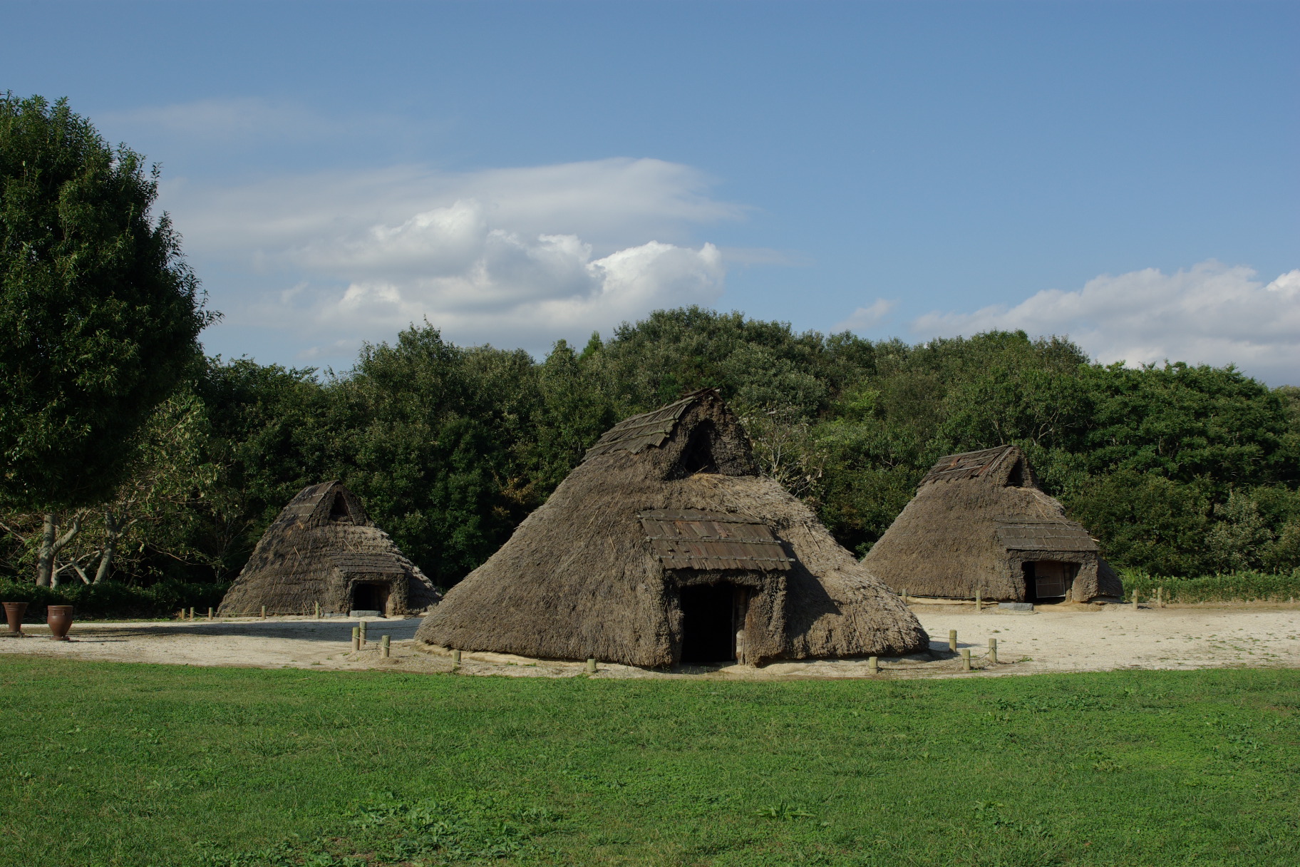
In Japanese Paleolithic, humans are believed to have started living in the present-day prefecture area before and after the deposition of the volcanic ash layer from the Aira Caldera about 24,000 years ago. At the bottom of this layer are local tools of polished stone and burnt pebbles.
Asuka Period
During the Asuka period the provinces of Hitachi and Fusa were created. Later Fusa was divided, among them, the Shimōsa Province.
Muromachi Period
At the beginning of the Muromachi period, in the 14th century, Kitabatake Chikafusa made of the Oda Castle his field headquarters for over a year, and wrote the Jinnō Shōtōki (Chronicles of the Authentic Lineages of the Divine Emperors), while he was at castle.

Edo Period
In Edo period, one of the three houses or clans originating from Tokugawa Ieyasu (Gosanke 御 三家, three houses), settled in the Mito Domain, known as Mito Tokugawa family or Mito Clan. Mito Domain, was a Japanese domain of the Edo period it was associated with Hitachi Province.
In 1657 the Mitogaku school was created, when Tokugawa Mitsukuni, head of the Mito Domain, commissioned the compilation of the Dai Nihonshi.
Meiji Period
In Meiji era, during the Meiji Restoration, the political map changes, the old provinces are converted or merged, to create the current prefectures, in this case the Ibaraki Prefecture.
Geography

City Town Village Lake


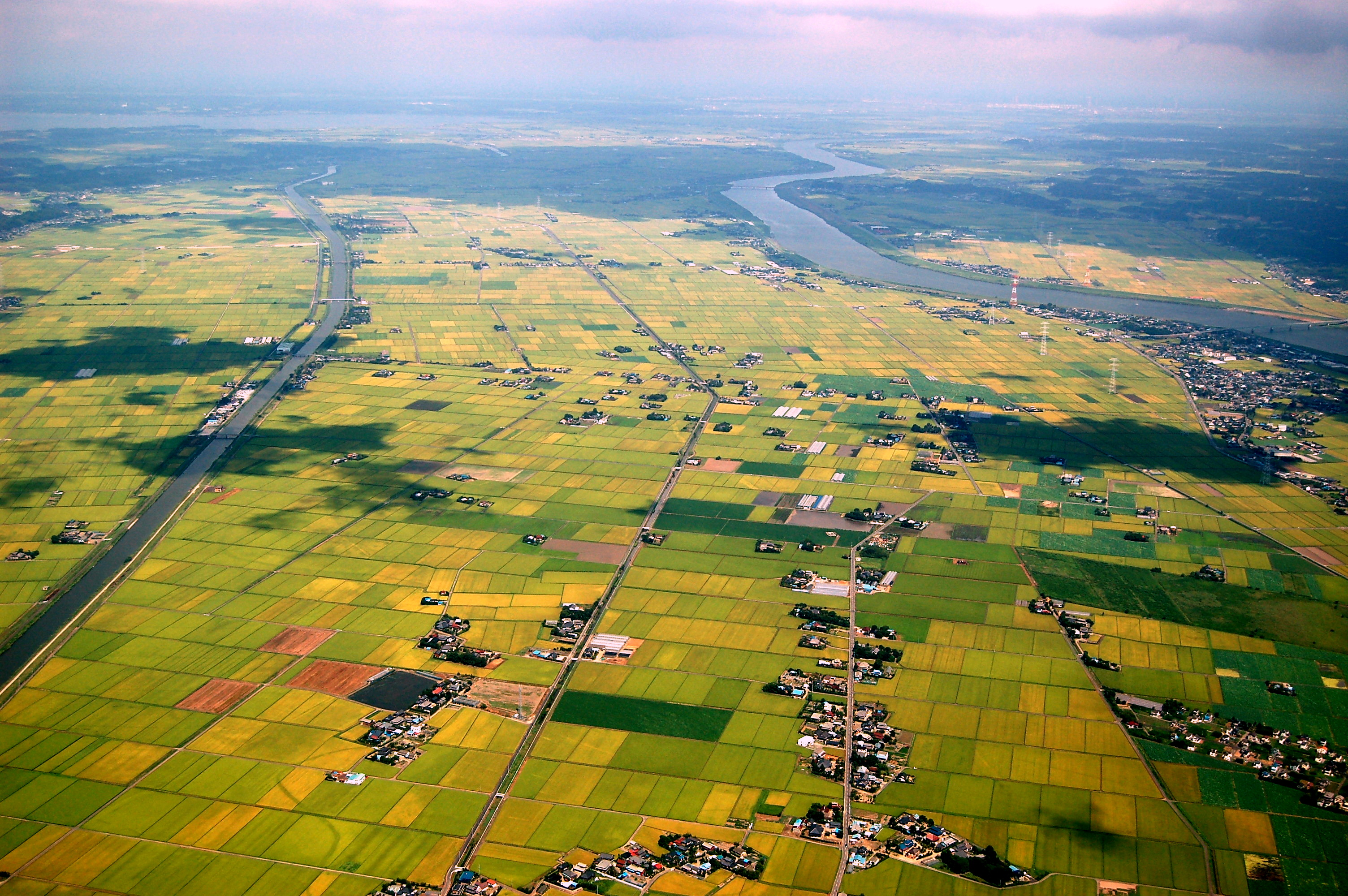
Ibaraki Prefecture is the northeastern part of the Kantō region, stretching between Tochigi Prefecture and the Pacific Ocean and bounded on the north and south by Fukushima Prefecture and Chiba Prefecture. It also has a border on the southwest with Saitama Prefecture. The northernmost part of the prefecture is mountainous, but most of the prefecture is a flat plain with many lakes and is part of Kantō Plain.
Natural Parks
As of 1 April 2012[update], 15% of the total land area of the prefecture was designated as Natural Parks, namely Suigo-Tsukuba Quasi-National Park, and nine Prefectural Natural Parks.[3] Also, Ibaraki has one Prefectural Geopark. The Suigo-Tsukuba Quasi-National Park, also includes the northeast area of Chiba Prefecture.
Mountains
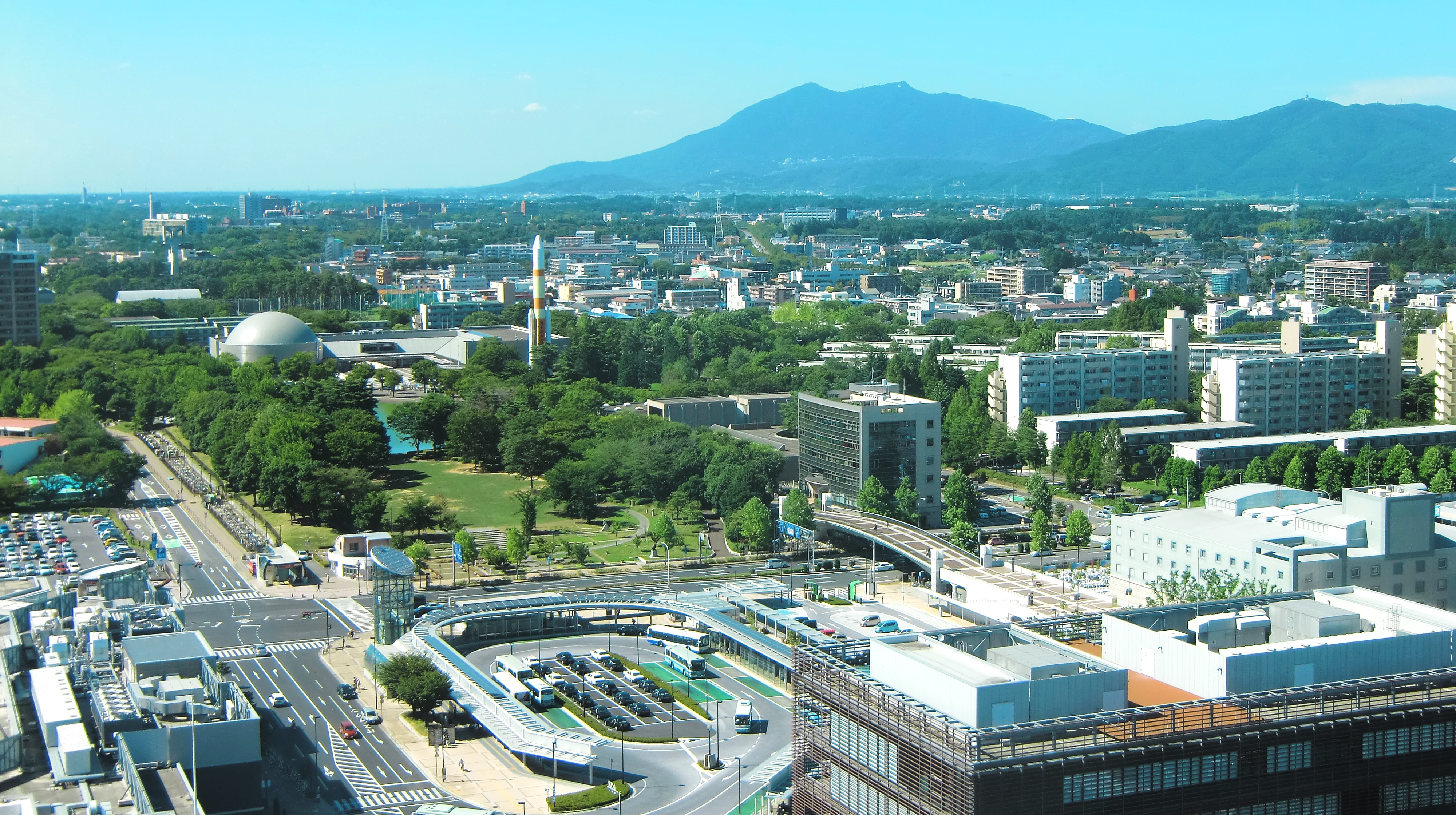
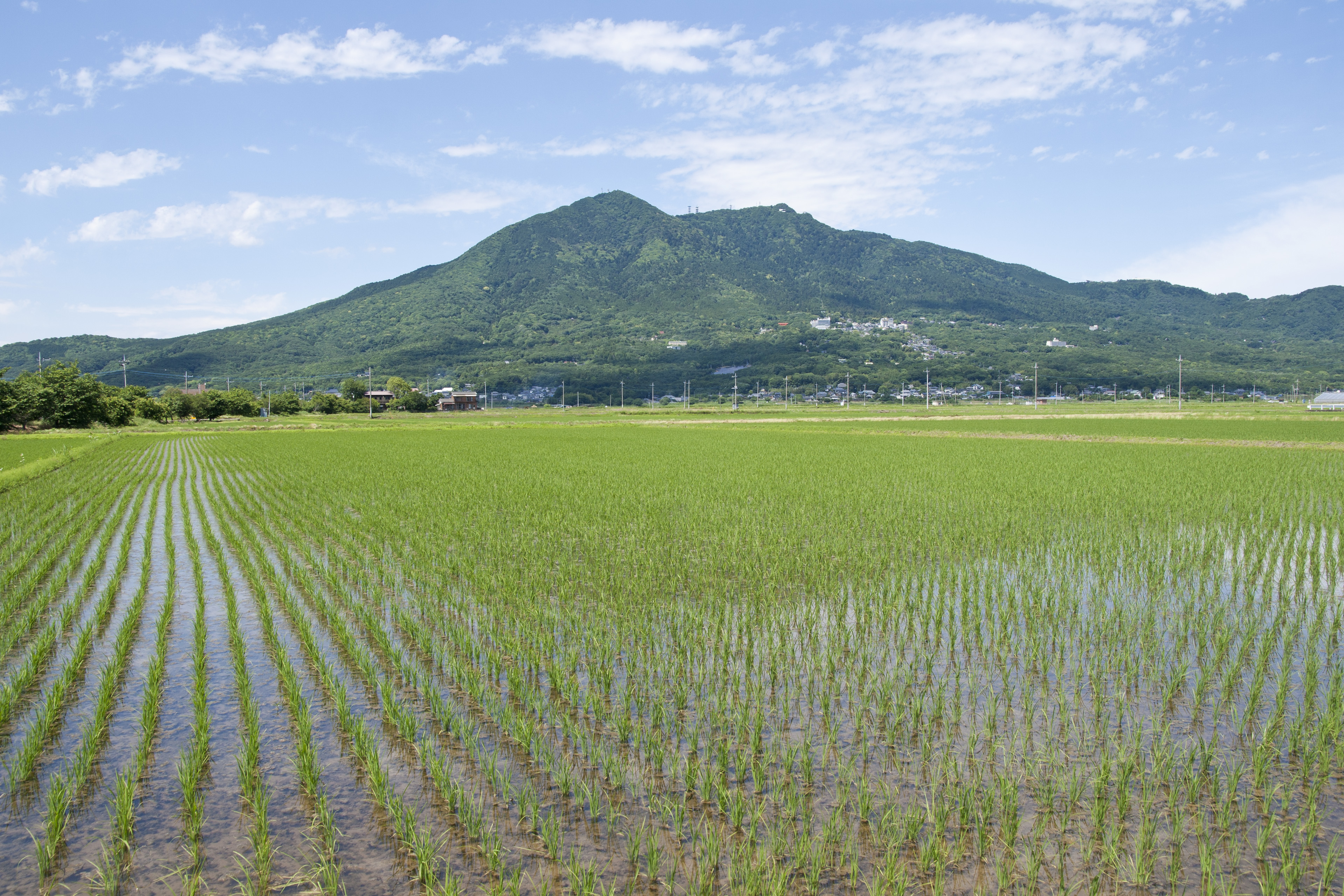
The northern third of the prefecture is mountainous and in the center is the Tsukuba Mountains (筑波 山地). Its main mountains are: mount Yamizo with an elevation of 1022 m on the border with Fukushima and Tochigi prefectures (tripoint), mount Takasasa with 922 m, mount Tsukuba with two peaks Nyotai-San at 877 m and Nantai-San at 871 m, mount Osho at 804 m, mount Hanazono at 798 m, and mount Kaba at 709 m.
Water system
The main rivers that flow through the prefecture include the Tone, Naka (Ibaraki), and Kuji rivers, all of which flow into the Pacific Ocean. Before the seventeenth century, the lower reaches of the Tone were different from its current layout, and the Tone ran south and emptied into Tokyo Bay, and tributaries such as the Watarase and Kinu rivers had independent water systems.
The main tributaries of the Tone River basin are the Kinu River and Kokai River, which flow from north to south in the western part of the prefecture. The Shintone and Sakura rivers flow into Lake Nishiura.
The Edo River flows into Tokyo Bay; its source currently rises as an arm of the Tone River. In the past, the course of the Edo River was different, its source was corrected and diverted to the Tone River in the 17th century by the Tokugawa shogunate to protect the city of Edo (now Tokyo) from flooding.
The Tone River, in addition to the Edo River, is part of the southern border of Ibaraki Prefecture with Chiba Prefecture, and the Watarase River, Tone River, Gongendō River, and Naka River (Saitama) in the southwestern border of Ibaraki with Saitama Prefecture. The Watarase River has become a small boundary of the southern border between Ibaraki and Tochigi prefectures.
From ancient times to the beginning of the Edo period, the lower reaches of the Tone River did not exist and the mouth of the Tone was in Tokyo Bay. On the plain was the Katori Sea, which existed in ancient times,[4] the Lake Kasumigaura and other lagoons in present-day Chiba prefecture are remnants of that sea. Katori Sea was connected to the Kashima-nada (Pacific Ocean).
Lake Kasumigaura is currently divided into three lakes: Nishiura, Kitaura, Sotonasakaura. In addition, in the prefecture there are freshwater lagoons such as Hinuma, Senba, and Ushiku.
Fukuoka Dam, is a dam that spans the Kokai River in Tsukubamirai, it is one of the three largest dams in the Kantō region. Ryūjin Dam in Hitachiōta, is a beautiful dam on the Ryūjin River with a large pedestrian suspension bridge above the dam lake.
Cities
Thirty-two (32) cities are located in Ibaraki Prefecture:
- Mito (capital city of the prefecture)
- Bandō
- Chikusei
- Hitachi
- Hitachinaka
- Hitachiōmiya
- Hitachiōta
- Hokota
- Inashiki
- Ishioka
- Itako
- Jōsō
- Kamisu
- Kasama
- Kashima
- Kasumigaura
- Kitaibaraki
- Koga
- Moriya
- Naka
- Namegata
- Omitama
- Ryūgasaki
- Sakuragawa
- Shimotsuma
- Takahagi
- Toride
- Tsuchiura
- Tsukuba
- Tsukubamirai
- Ushiku
- Yūki
Towns and villages
These are the towns and villages in each district, 10 towns and 2 villages in 7 districts:
Mergers
Economy
Ibaraki's economy is based on energy production (particularly nuclear energy), chemical and precision machining industries, research institutes, and tourism. Agriculture, fishing, and livestock are also important sectors in the prefecture.[5]
Ibaraki's vast flat terrain make it highly suitable for industrial development. This complements its proximity to the Tokyo metropolitan area, giving it a high reputation as an industrial base. The prefecture is also home to Tsukuba, Japan's most extensive research and academic city, and the birthplace of Hitachi, Ltd.[6]

Agriculture
With extensive flat lands, abundant water, and suitable climate, Ibaraki is among the prefectures with the highest agricultural production in Japan. It plays an important role in supplying food to the Tokyo metropolitan area. Its main products include melons, pears, peppers, various varieties of rice and sugar cane, as well as flowers and ornamental plants.
It also supplies other food crops to the rest of the country. As of March 2011, the prefecture produced 25% of Japan's bell peppers and Chinese cabbage.[7]
Fishing
It is one of the prefectures with the highest fish production in the country; in the Pacific Ocean, Lake Kasumigaura, other lagoons and rivers, various species of fish are obtained.
Cattle
The Hitachigyū cattle (常 陸 牛 - ひたちぎゅう - Hitachi-gyū, Hitachi-ushi), which is a prefectural bovine breed, is noteworthy in livestock. The name comes from the kanji 常 陸 (Hitachi), the name of the ancient Hitachi Province and 牛 (ushi or gyū, beef).[8]
Background. In 1833 Tokugawa Nariaki (徳川 斉昭) established the breeding of black cattle in the present Migawa-chō (見川 町) of the city of Mito. Originally it remained mainly in the northern part of the prefecture, but later it spread throughout the prefecture.

Industrial centers
- Hitachi area. Grouping of industries, such as electrical, electronic and machinery. More than 1,300 companies; many of them hired by the Hitachi company, which was founded in Sukegawa (Hitachi City) in 1910.
- Tōkai area. Atomic Energy Research Organization Grouping. J-PARC, Proton Accelerator Research Complex.
- Tsukuba area. 32 institutes for education and research. Manipulation of matter at the level of atoms (nanotechnology). Robotic security center for support in daily life. Space center.
- Kashima area. Grouping of materials industries, such as steel and petrochemicals, around 160 companies.
Demographics
| Year | Pop. | ±% p.a. |
|---|---|---|
| 1890 | 1,025,497 | — |
| 1903 | 1,200,475 | +1.22% |
| 1913 | 1,328,329 | +1.02% |
| 1920 | 1,350,400 | +0.24% |
| 1925 | 1,409,092 | +0.85% |
| 1930 | 1,487,097 | +1.08% |
| 1935 | 1,548,991 | +0.82% |
| 1940 | 1,620,000 | +0.90% |
| 1945 | 1,944,344 | +3.72% |
| 1950 | 2,039,418 | +0.96% |
| 1955 | 2,064,037 | +0.24% |
| 1960 | 2,047,024 | −0.17% |
| 1965 | 2,056,154 | +0.09% |
| 1970 | 2,143,551 | +0.84% |
| 1975 | 2,342,198 | +1.79% |
| 1980 | 2,558,007 | +1.78% |
| 1985 | 2,725,005 | +1.27% |
| 1990 | 2,845,382 | +0.87% |
| 1995 | 2,955,530 | +0.76% |
| 2000 | 2,985,676 | +0.20% |
| 2005 | 2,975,167 | −0.07% |
| 2010 | 2,969,770 | −0.04% |
| 2015 | 2,917,857 | −0.35% |
| 2020 | 2,854,131 | −0.44% |
| source:[9] | ||
Ibaraki's population is decreasing more rapidly than any other prefecture.[10][11]
Culture
Ibaraki is known for nattō, or fermented soybeans, in Mito, watermelons in Kyōwa (recently merged into Chikusei), and chestnuts in the Nishiibaraki region.[12]
Ibaraki is famous for the martial art of Aikido founded by Morihei Ueshiba, also known as Osensei. Ueshiba spent the latter part of his life in the town of Iwama, now part of Kasama, and the Aiki Shrine and dojo he created still remain.[13]
Kasama is famous for Shinto (Kasama Inari Shrine), Ibaraki Ceramic Art Museum, house museum of the calligrapher and ceramist Kitaōji Rosanjin, Kasama Nichidō Museum of Art, residence of Morihei Ueshiba, founder of the martial art Aikidō.[14]
The capital Mito is home to Kairakuen, one of Japan's three most celebrated gardens, and famous for its over 3,000 Japanese plum trees of over 100 varieties.
Kashima Shrine (Jingū) Ibaraki's cultural heritage.
Mito Tōshō-gū, is the memorial shrine of Tokugawa Ieyasu in Mito.
Seizansō was the retirement villa of Tokugawa Mitsukuni.
Mito Municipal Botanical Park, is a botanical garden in Mito.
Park Ibaraki Nature Museum in Bandō.
There are castle ruins in many cities, including Mito Castle, Yūki Castle, Kasama Castle, Tsuchiura Castle, Oda Castle.
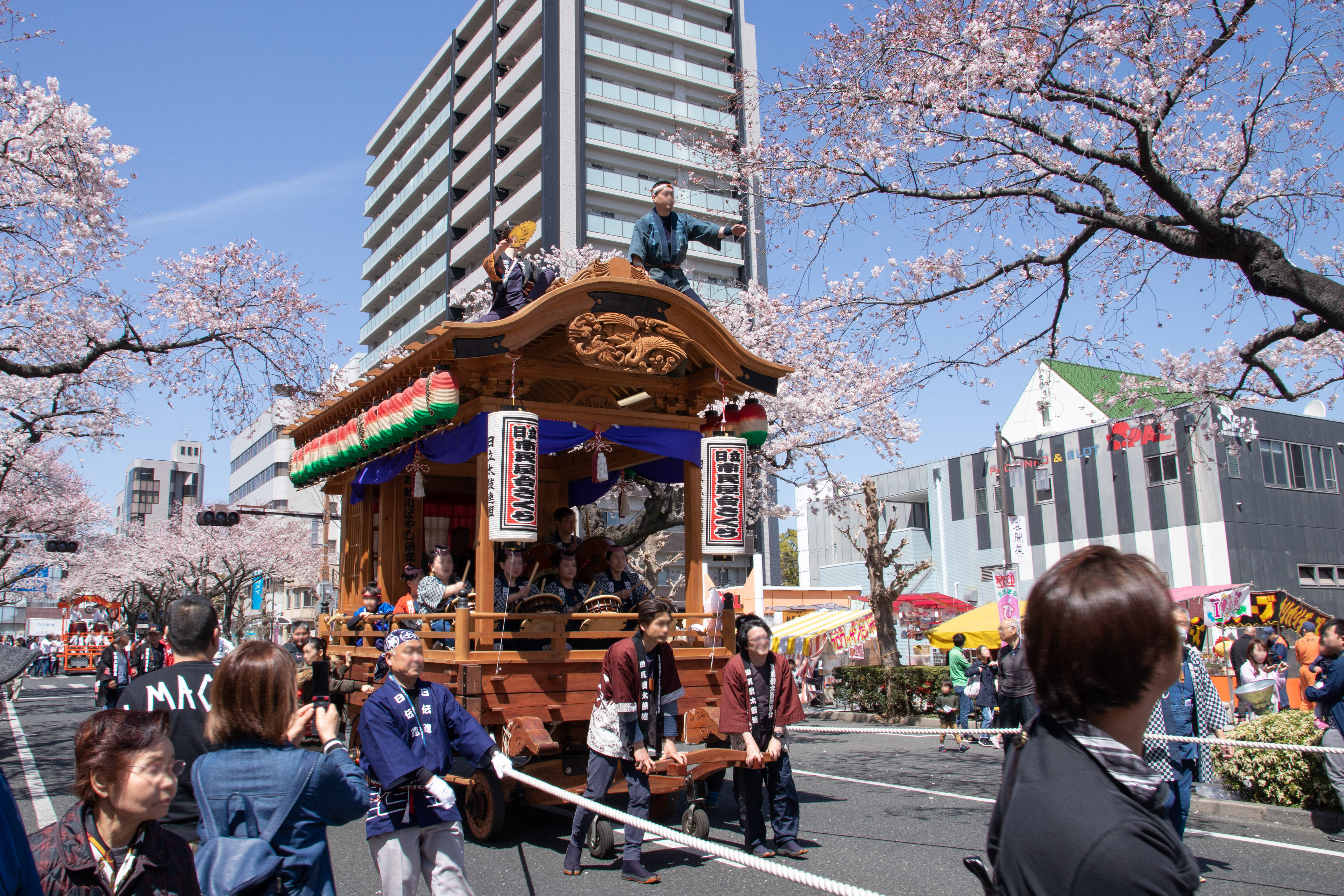
Hitachi Fūryūmono, a puppet float theater festival, Intangible Cultural Heritage of Humanity.
Makabe Hina Doll Festival - Hinamatsuri - (Sakuragawa City).
Yūki-tsumugi (silk weaving technique) Intangible Cultural Heritage of Humanity, Kasama ware, Makabe Stone Lamp, Kagami Crystal Glass Factory, old glass factory in Ryūgasaki City.
Education
University
- Ami
- Ibaraki Prefectural University of Health Sciences
- Hitachi
- Ibaraki Christian University

- Mito
- Ibaraki University
- Tokiwa University
- Ryūgasaki
- Ryūtsū Keizai University
- Toride
- Tokyo University of the Arts
- Tsuchiura
- Tsukuba International University
- Tsukuba
- Tsukuba University
- Tsukuba Gakuin University
- Tsukuba University of Technology
Sports
The sports teams listed below are based in Ibaraki.
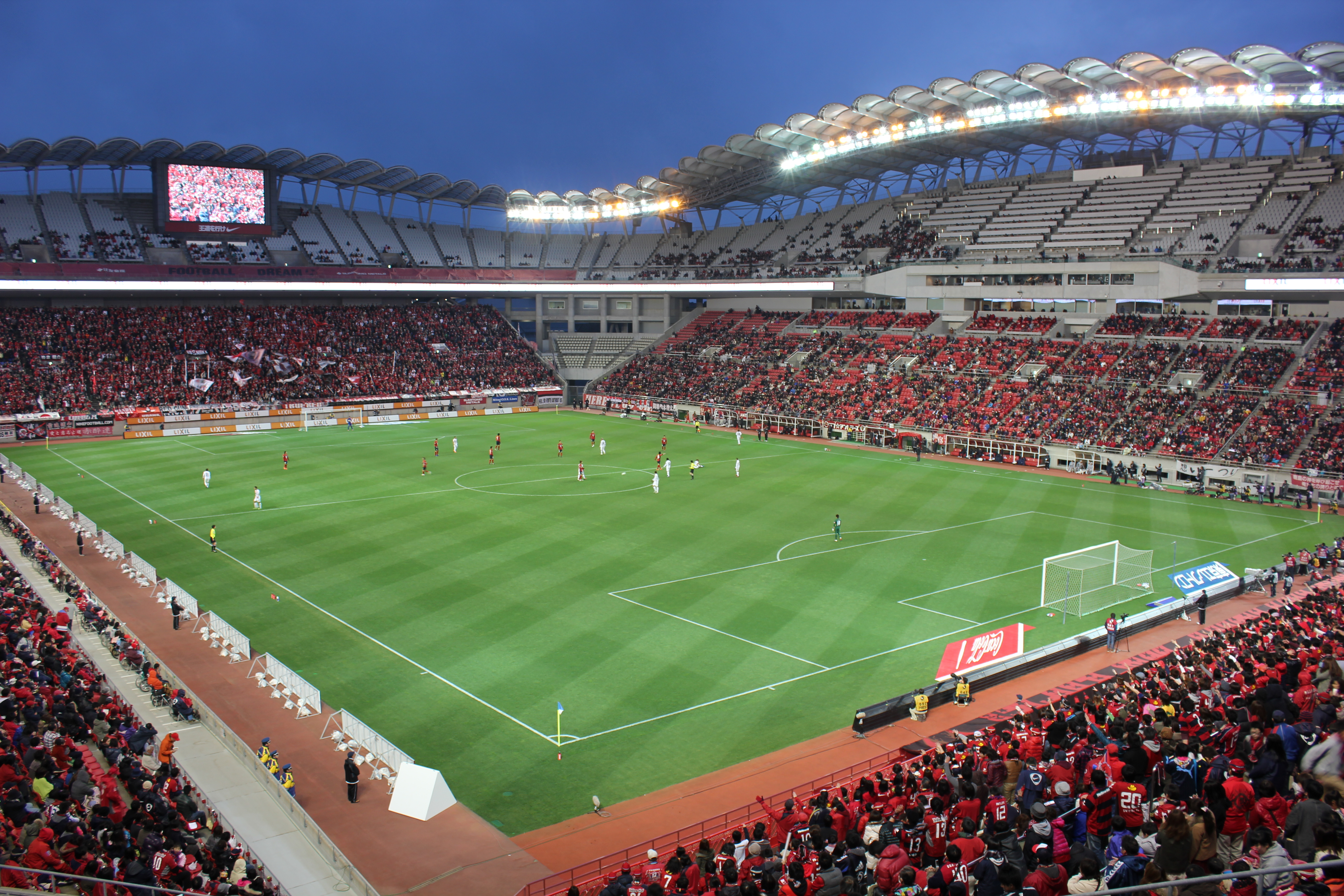

Football (soccer)
Volleyball
- Hitachi Rivale (Women's) (Hitachinaka)
Rugby
- Stags - Kashima Rugby Football Club RFC (Kashima)
American football
- Tsukuba University (Tsukuba)
Baseball
- Ibaraki Astro Planets (Yūki) (Baseball Challenge League)
- Ibaraki Golden Golds (Regional club) (Tsukuba)
Wrestling
- Hitachi Pro Wrestling (Regional group) (Hitachi)
Basketball
- Ibaraki Robots (Mito)
Motorsport race
Tourism
- Kairaku-en (garden)
- Mount Tsukuba
- Lake Kasumigaura
- Kashima Shrine
- Ibaraki Prefectural Museum of History
- Tsukuba Science City
- Ushiku Daibutsu
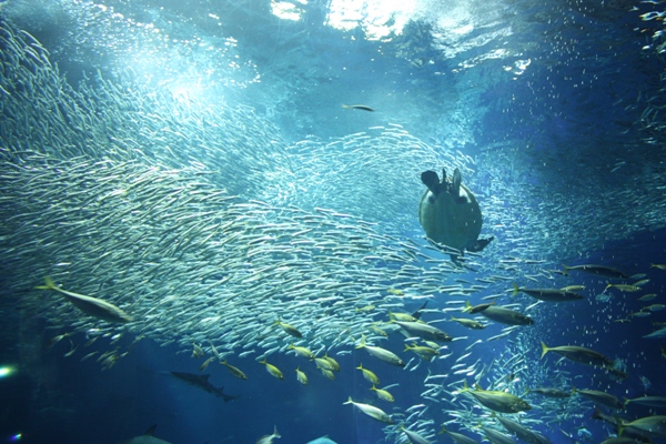
- Ōarai Aquarium
- Fukuroda Falls
 Hobikibune (Sailboat) on Lake Kasumigaura
 Fukuroda Falls in Daigo
 A view of Mount Tsukuba, from Tsukuba City
 A view of Suigō Itako Iris Garden
 A view of Rokkakudō and Pacific Ocean in Kitaibaraki
 Torii of Ōarai Coast
 Nemophila in spring in Hitachi Seaside Park
 Kairaku-en
 Kashima Shrine


Transportation and access


Railways
- East Japan Railway Company
- Jōban Line
- Utsunomiya Line (Tōhoku Main Line)
- Mito Line
- Suigun Line
- Kashima Line
- Metropolitan Intercity Railway Company
- Tsukuba Express
- Kantō Railway
- Jōsō Line
- Ryūgasaki Line
- Kashima Rinkai Railway
- Ōarai Kashima Line
- Kashima Rinkō Line
- Hitachinaka Seaside Railway
- Minato Line
- Mooka Railway
- Mooka Line
Cable cars
- Tsukuba Kankō Railway
- Mount Tsukuba Cable Car
- Mount Tsukuba Ropeway
Roads
Expressways
 Jōban Expressway
 Ken-Ō Expressway
 Kita-Kantō Expressway
 Higashi-Kantō Expressway
National highways
![]() Ibaraki Prefecture with the following national routes:
Ibaraki Prefecture with the following national routes:
- National Route 4 (around Koga area)
- National Route 6 (Nihonbashi of Tokyo-Toride-Tsuchiura-Mito-Hitachi-Iwaki-Sendai)
- National Route 50
- National Route 51 (Mito-Kashima-Itako-Narita-Chiba)
- National Route 118
- National Route 123
- National Route 124
- National Route 125 (Katori-Tsuchiura-Tsukuba-Koga-Gyōda-Kumagaya)
- National Route 245
- National Route 293
- National Route 294
- National Route 349
- National Route 354
- National Route 355
- National Route 400 (Mito-Nakagawa-Nikko-Minamiaizu-Nishiaizu
- National Route 408
- National Route 461
Prefectural routes
![]() Ibaraki Prefecture with more than 300 prefectural routes.
Ibaraki Prefecture with more than 300 prefectural routes.
Ports
- Port of Ibaraki
- Port of Kashima
Airports
- Ibaraki Airport
- Ryūgasaki Airfield
- Tsukuba Heliport
- Ōtone Airstrip 大利根飛行場 (おおとねひこうじょう, Ōtone Hikōjō) is an airfield located on the Tone River in Kawachi.
Pronunciation
The prefecture is often alternatively pronounced "Ibaragi" by those who speak the regional dialect known as Ibaraki-ben. However, the standard pronunciation is "Ibaraki". According to the author of "Not Ibaragi, Ibaraki",[15] this is most likely due to a mishearing of the softening of the "k" sound in Ibaraki dialect.
Sister regions
Ibaraki is twinned with:
 Essonne, France
See also
- 2005 Ibaraki gubernatorial election
Notes
- Nussbaum, Louis-Frédéric. (2005). "Ibaraki-ken" in Japan Encyclopedia, p. 367, at Google Books; "Kantō" in Japan Encyclopedia, p. 479, at Google Books.
- Nussbaum, "Mito" at Japan Encyclopedia, p. 642, at Google Books.
- "General overview of area figures for Natural Parks by prefecture" (PDF). Ministry of the Environment. 1 April 2012. Retrieved 9 November 2013.
- "歌垣発祥の地を訪ねる「筑波山・香取の海」(in Japanese) - To visit the birthplace of Utagaki「Mt. Tsukuba ・ Katori Sea」-". utakura.com. Retrieved November 12, 2021.
- "About Ibaraki". invest.indus.pref.ibaraki.jp. Retrieved November 12, 2021.
- "data | Attractive Local Regions in Japan - Investing in Japan - Japan External Trade Organization". ジェトロ. Retrieved 2022-07-04.
- Schreiber, Mark, "Japan's food crisis goes beyond recent panic buying", The Japan Times, 17 April 2011, p. 9.
- "Breed info, About Hitachiwagyū Beef". hitachiwagyu.com. Retrieved November 12, 2021.
- Statistics Bureau of Japan
- "Gov't data show exodus to Tokyo from other parts of Japan continues". Japan Today. 1 February 2019. Archived from the original on 3 February 2019.
- "茨城県の人口と世帯(推計)-令和2年(2020年)12月1日現在 - (in Japanese) - Population and households in Ibaraki Prefecture (estimated)-As of December 1, 2020-,". pref.ibaraki.jp, December 22, 2020. Retrieved November 19, 2021.
- "Ibaraki Guide". ibarakiguide.org. Retrieved November 12, 2021.
- Aikikai Foundation Ibaraki Branch Dojo " Founder and Iwama", Retrieved August 25, 2017
- "Kasamashiko – A Journey Through Japan's Pottery Culture". ibarakiguide.org. Retrieved November 12, 2021.
- いばらぎじゃなくていばらき [Ibaragi ja Nakute Ibaraki]
References
- Nussbaum, Louis-Frédéric and Käthe Roth. (2005). Japan Encyclopedia. Cambridge: Harvard University Press. ISBN 978-0-674-01753-5. OCLC 58053128.
External links
- Ibaraki Prefecture Official Website (in Japanese)
- Ibaraki Prefecture Official Website (in English)
Mito (capital) | ||
| Core city | ||
| Special city | ||
| Cities | ||
| Districts | ||
List of mergers in Ibaraki Prefecture | ||
Regions and administrative divisions of Japan | |||||||||||||||||
|---|---|---|---|---|---|---|---|---|---|---|---|---|---|---|---|---|---|
| |||||||||||||||||
| Regions |  | ||||||||||||||||
| 47 Prefectures |
| ||||||||||||||||
| |||||||||||||||||
Authority control | |
|---|---|
| General | |
| National libraries | |
| Scientific databases | |
| Other |
|
На других языках
[de] Präfektur Ibaraki
Die Präfektur Ibaraki (jap. 茨城県, Ibaraki-ken) ist eine der Präfekturen Japans und liegt in der Region Kantō auf der Insel Honshū in Japan. Sitz der Präfekturverwaltung ist Mito.- [en] Ibaraki Prefecture
[ru] Ибараки
Ибара́ки (яп. 茨城県 Ибараки-кэн) — префектура, расположенная в регионе Канто на острове Хонсю, Япония. Площадь префектуры составляет 6,094 км², население — 2 857 387 человека (1 июня 2020), плотность населения — 469 чел./км²[1]. Административный центр префектуры — город Мито.[2]Другой контент может иметь иную лицензию. Перед использованием материалов сайта WikiSort.org внимательно изучите правила лицензирования конкретных элементов наполнения сайта.
WikiSort.org - проект по пересортировке и дополнению контента Википедии