world.wikisort.org - Japan
Ibaraki (茨城町, Ibaraki-machi) is a town located in Ibaraki Prefecture, Japan. As of 1 July 2020[update], the town had an estimated population of 31,596 in 12,052 households and a population density of 260 inhabitants per square kilometre (670/sq mi). The percentage of the population aged over 65 was 34.9%.[1] The total area of the town is 121.58 square kilometres (46.94 sq mi).
Ibaraki
茨城町 | |
|---|---|
Town | |
 Ibaraki town office | |
 Flag  Seal | |
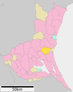 Location of Ibaraki in Ibaraki Prefecture | |
 Ibaraki | |
| Coordinates: 36°17′12.8″N 140°25′28.3″E | |
| Country | Japan |
| Region | Kantō |
| Prefecture | Ibaraki |
| District | Higashiibaraki |
| Area | |
| • Total | 121.58 km2 (46.94 sq mi) |
| Population (1 September 2020) | |
| • Total | 31,412 |
| • Density | 260/km2 (670/sq mi) |
| Time zone | UTC+9 (Japan Standard Time) |
| - Tree | Prunus mume |
| - Flower | Sakura |
| - Bird | Japanese bush warbler |
| Phone number | 029-292-1111 |
| Address | 1080 Ozutsumi, Ibaraki-machi, Higashiibaraki-gun, Ibaraki-ken 311-3192 |
| Website | Official website |

Geography
Located in central Ibaraki Prefecture, south of prefectural capital of Mito, Ibaraki is located in the flatlands near the Pacific Ocean, and almost encompasses Lake Hinuma, the 30th largest body of freshwater in Japan.
Surrounding municipalities
Climate
Ibaraki has a humid continental climate (Köppen Cfa) characterized by warm summers and cold winters with light snowfall. The average annual temperature in Ibaraki is 13.9 °C. The average annual rainfall is 1367 mm with September as the wettest month. The temperatures are highest on average in August, at around 25.7 °C, and lowest in January, at around 3.1 °C.[2]
Demographics
Per Japanese census data,[3] the population of Ibaraki has remained relatively steadily for the past 40 years.
| Year | Pop. | ±% |
|---|---|---|
| 1950 | 31,639 | — |
| 1960 | 30,845 | −2.5% |
| 1970 | 29,956 | −2.9% |
| 1980 | 32,901 | +9.8% |
| 1990 | 35,651 | +8.4% |
| 2000 | 35,296 | −1.0% |
| 2010 | 34,513 | −2.2% |
| 2020 | 31,401 | −9.0% |
History
The villages of Nagaoka, Kawane, Kaminoai and Ishizaki were created within Higashiibaraki District and the village of Numasaki was created within Kashima District with the establishment of the modern municipalities system on April 1, 1889. Nagaoka was elevated to town status on February 11, 1955 and merged with Kawane and Kaminoai to form the town of Ibaraki the same day. Ibaraki annexed neighboring Ishizaki on March 5, 1958. The town was set to merge with Mito, on December 8, 2007, but following the election of a new mayor in April 2007, these plans were abandoned.
Government
Ibaraki has a mayor-council form of government with a directly elected mayor and a unicameral town council of 16 members. Ibaraki, together with neighboring Hokota and Ōarai, contributes two members to the Ibaraki Prefectural Assembly. In terms of national politics, the town is part of Ibaraki 2nd district of the lower house of the Diet of Japan.
Economy
The economy of Ibaraki is primarily agricultural.
Education
- Ibaraki has four public elementary schools and two public middle schools operated by the town government, and one public high school operated by the Ibaraki Prefectural Board of Education.
Transportation
Railway
- Ibaraki does not have any passenger train service.
Highway
 Kita-Kantō Expressway – Ibarakimachi-Nishi Interchange, Ibarakimachi Junction, Ibarakimachi-Higashi Interchange
 Higashi-Kantō Expressway – Ibaraki Kuko Kita Interchange, Ibarakimachi Interchange
 National Route 6
Local attractions
- Hinuma Hydrangea Festival
- Ibaraki Festival
Noted people from Ibaraki
- Hideaki Tomiyama, Olympic gold medalist in wrestling
- Kami, drummer of Malice Mizer
References
- "Ibaraki prefectural official statistics" (in Japanese). Japan.
- Ibaraki climate data
- Ibaraki population statistics
External links
![]() Media related to Ibaraki, Ibaraki at Wikimedia Commons
Media related to Ibaraki, Ibaraki at Wikimedia Commons
- Official Website (in Japanese)
Mito (capital) | ||
| Core city | ||
| Special city | ||
| Cities | ||
| Districts | ||
List of mergers in Ibaraki Prefecture | ||
На других языках
[de] Ibaraki (Ibaraki)
Ibaraki (jap. 茨城町 .mw-parser-output .Latn{font-family:"Akzidenz Grotesk","Arial","Avant Garde Gothic","Calibri","Futura","Geneva","Gill Sans","Helvetica","Lucida Grande","Lucida Sans Unicode","Lucida Grande","Stone Sans","Tahoma","Trebuchet","Univers","Verdana"}Ibaraki-machi) ist eine Stadt (-machi) im Kreis (-gun) Ost-Ibaraki (Higashi-Ibaraki) der japanischen Präfektur (-ken) Ibaraki. Sie liegt im Zentrum etwas abseits der Küste von Ibaraki am Westufer des Brackwassersses Hinuma (涸沼), unmittelbar südlich der Hauptstadt Mito. Von Westen durch die Stadt fließt der Fluss (-gawa) Hinuma, der den See speist.- [en] Ibaraki, Ibaraki
[es] Ibaraki (Ibaraki)
Ibaraki (茨城町, Ibaraki-machi?) es una población situada en el Distrito de Higashiibaraki de la Prefectura de Ibaraki en Japón.[ru] Ибараки (посёлок)
Ибараки (яп. 茨城町 Ибараки-мати) — посёлок в Японии, находящийся в уезде Хигасиибараки префектуры Ибараки. Площадь посёлка составляет 121,64 км²[1], население — 33 169 человек (1 августа 2014)[2], плотность населения — 272,68 чел./км².Другой контент может иметь иную лицензию. Перед использованием материалов сайта WikiSort.org внимательно изучите правила лицензирования конкретных элементов наполнения сайта.
WikiSort.org - проект по пересортировке и дополнению контента Википедии