world.wikisort.org - Japan
Tomakomai (苫小牧市, Tomakomai-shi) is a city and port in Iburi Subprefecture, Hokkaido, Japan. It is the largest city in the Iburi Subprefecture, and the fourth largest city in Hokkaido. As of 29 February 2012, it had an estimated population of 174,216, with 83,836 households, and a population density of 310.27 persons per km2 (803.60 persons per sq. mi.). The total area is 561.49 km2 (216.79 sq mi).
This article needs additional citations for verification. (January 2014) |
Tomakomai
苫小牧市 | |
|---|---|
City | |
 | |
 Flag  Seal | |
 Location of Tomakomai in Hokkaido (Iburi Subprefecture) | |
 Tomakomai Location in Japan | |
| Coordinates: 42°38′N 141°36′E | |
| Country | Japan |
| Region | Hokkaido |
| Prefecture | Hokkaido (Iburi Subprefecture) |
| First official recorded | 1799 AD |
| City settled | 1 April 1948 |
| Government | |
| • Mayor | Hirofumi Iwakura |
| Area | |
| • Total | 561.49 km2 (216.79 sq mi) |
| Population (29 February 2012) | |
| • Total | 174,216 |
| • Density | 310.27/km2 (803.6/sq mi) |
| Time zone | UTC+09:00 (JST) |
| City hall address | 4-5-6 Asahimachi, Tomakomai-shi, Hokkaido 053-8722 |
| Climate | Dfb |
| Website | www |
| Symbols | |
| Bird | Swan |
| Flower | Tree flower: Hasukappu (Lonicera caerulea var. emphyllocalyx) Grass flower: Hanashōbu (Iris ensata var. ensata) |
| Tree | Japanese Rowan |


History
The name of Tomakomai is derived from Ainu words "to" and "makomai", meaning "Marsh" and "River which goes into the depths of the mountain", respectively.[1][2]
- 1879: Yūfutsu branch of Hokkaidō Development Commission was transferred into Tomakomai (Foundation anniversary).
- 1902: Tomakomai became second class village.
- 1918: Tomakomai village became Tomakomai town.
- 1948: Tomakomai town became Tomakomai city.
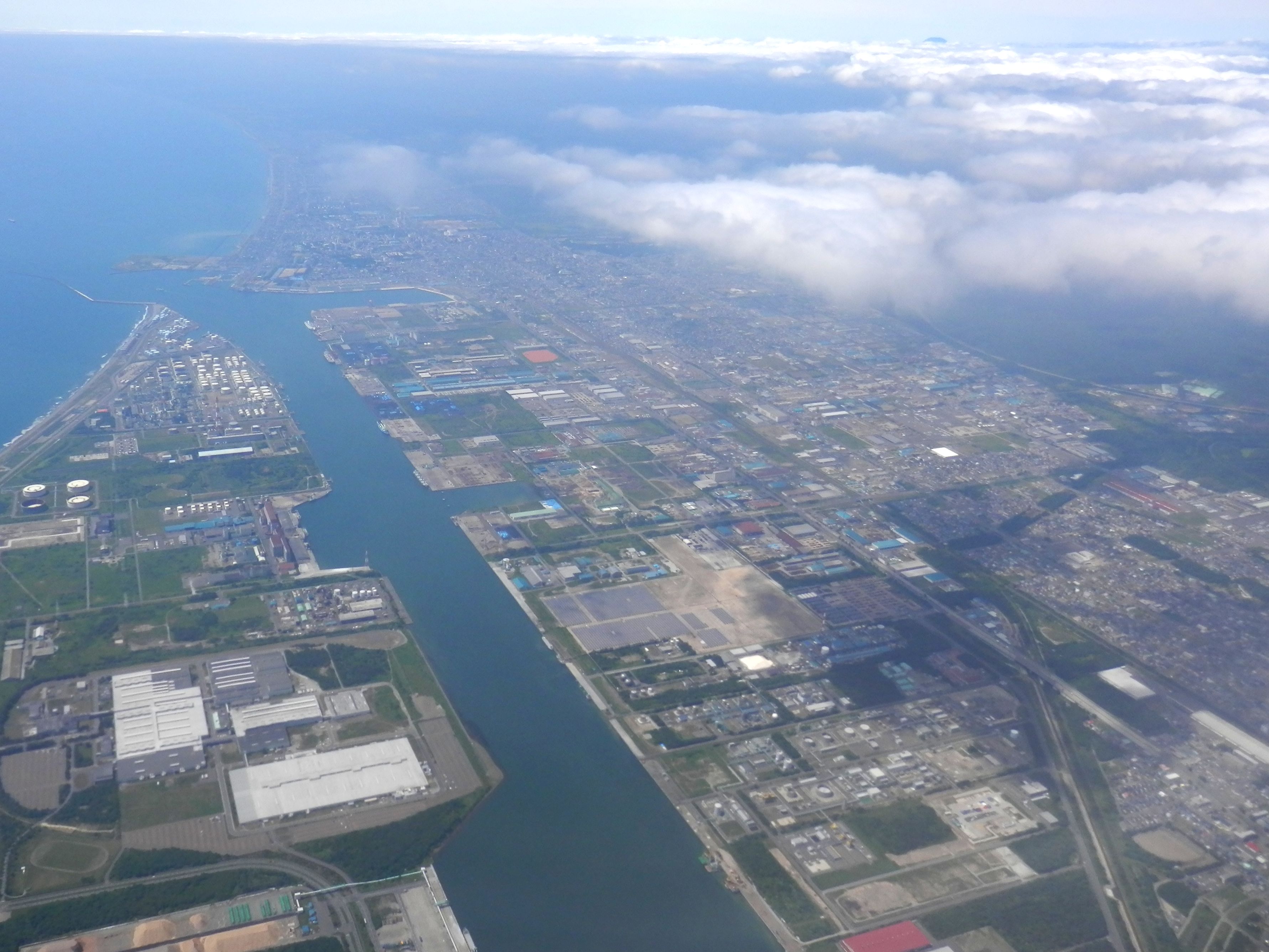
- 1963: Tomakomai Port (West) was opened.
- 1980: Tomakomai Port (East) was opened.
- 6 September 2018: Tomakomai City is the nearest city from the epicenter of the 2018 Hokkaido Eastern Iburi earthquake.
Geography
Mount Tarumae is located in the northwest of Tomakomai and belongs to Shikotsu-Tōya National Park.
Climate
Tomakomai has a humid continental climate typical of Hokkaido.
| Climate data for Tomakomai (1991−2020 normals, extremes 1942−present) | |||||||||||||
|---|---|---|---|---|---|---|---|---|---|---|---|---|---|
| Month | Jan | Feb | Mar | Apr | May | Jun | Jul | Aug | Sep | Oct | Nov | Dec | Year |
| Record high °C (°F) | 10.0 (50.0) |
9.3 (48.7) |
15.5 (59.9) |
21.8 (71.2) |
27.3 (81.1) |
30.6 (87.1) |
33.3 (91.9) |
35.5 (95.9) |
29.5 (85.1) |
24.4 (75.9) |
19.1 (66.4) |
14.8 (58.6) |
35.5 (95.9) |
| Average high °C (°F) | 0.5 (32.9) |
0.9 (33.6) |
4.4 (39.9) |
9.6 (49.3) |
14.1 (57.4) |
17.3 (63.1) |
21.0 (69.8) |
23.4 (74.1) |
21.7 (71.1) |
16.2 (61.2) |
9.2 (48.6) |
2.8 (37.0) |
11.8 (53.2) |
| Daily mean °C (°F) | −3.6 (25.5) |
−3.2 (26.2) |
0.5 (32.9) |
5.3 (41.5) |
10.0 (50.0) |
14.0 (57.2) |
18.2 (64.8) |
20.4 (68.7) |
17.8 (64.0) |
11.5 (52.7) |
4.9 (40.8) |
−1.2 (29.8) |
7.9 (46.2) |
| Average low °C (°F) | −8.1 (17.4) |
−7.9 (17.8) |
−3.7 (25.3) |
1.3 (34.3) |
6.6 (43.9) |
11.5 (52.7) |
16.1 (61.0) |
18.0 (64.4) |
13.8 (56.8) |
6.4 (43.5) |
0.2 (32.4) |
−5.4 (22.3) |
4.1 (39.3) |
| Record low °C (°F) | −21.3 (−6.3) |
−20.9 (−5.6) |
−19.8 (−3.6) |
−9.8 (14.4) |
−4.2 (24.4) |
1.8 (35.2) |
6.5 (43.7) |
9.2 (48.6) |
2.4 (36.3) |
−5.1 (22.8) |
−12.6 (9.3) |
−20.4 (−4.7) |
−21.3 (−6.3) |
| Average precipitation mm (inches) | 38.7 (1.52) |
37.5 (1.48) |
53.5 (2.11) |
75.7 (2.98) |
130.8 (5.15) |
111.6 (4.39) |
163.5 (6.44) |
197.5 (7.78) |
174.9 (6.89) |
113.2 (4.46) |
85.7 (3.37) |
56.6 (2.23) |
1,239.2 (48.79) |
| Average snowfall cm (inches) | 42 (17) |
42 (17) |
26 (10) |
2 (0.8) |
0 (0) |
0 (0) |
0 (0) |
0 (0) |
0 (0) |
0 (0) |
4 (1.6) |
29 (11) |
145 (57) |
| Average rainy days | 7.3 | 7.6 | 8.9 | 8.9 | 9.9 | 8.7 | 11.1 | 11.8 | 10.4 | 9.7 | 9.3 | 8.1 | 111.7 |
| Average snowy days | 10.6 | 10.9 | 7.4 | 0.7 | 0 | 0 | 0 | 0 | 0 | 0 | 0.9 | 6.6 | 37.1 |
| Average relative humidity (%) | 70 | 70 | 71 | 74 | 79 | 86 | 88 | 86 | 80 | 74 | 71 | 70 | 77 |
| Mean monthly sunshine hours | 142.0 | 144.7 | 165.6 | 173.5 | 171.9 | 119.7 | 108.1 | 122.2 | 153.1 | 156.0 | 127.1 | 127.6 | 1,711.5 |
| Source 1: JMA[3] | |||||||||||||
| Source 2: JMA[4] | |||||||||||||
Transportation
Airport
Rail
- Muroran Main Line: Nishikioka - Itoi - Aoba - Tomakomai - Numanohata
- Chitose Line: Numanohata - Uenae
- Hidaka Main Line: Numanohata - Yūfutsu
Road
- Hokkaidō Expressway
- Hidaka Expressway
Seaport
- Tomakomai West Port Ferry Terminal: connected with regular ferry services by MOL Ferry, Taiheiyō Ferry, K Line Kinkai.
Education
University
- Hokuyou University
College
- National Institute of Technology, Tomakomai College
High schools
Public
- Hokkaido Tomakomai Higashi High School
- Hokkaido Tomakomai Minami High School
- Hokkaido Tomakomai Nishi High School
- Hokkaido Tomakomai Technical High School
- Hokkaido Tomakomai Sogokeizai High School
Private
- Tomakomai Chuo High School
- Komazawa University Tomakomai High School
Sports
In 2014, Tomakomai hosted the World Broomball Championships.[5]
Sister cities and friendship city
Sister cities
 Hachioji, Tokyo, Japan (since 1973)[6]
 Napier, Hawke's Bay Region, New Zealand (since 1980)
- Nikko, Tochigi, Japan (since 1982)
Friendship city
 Qinhuangdao, Hebei, China (since 1998)
Notable people from Tomakomai
This section needs additional citations for verification. (April 2014) |
- Tsutomu Kawabuchi, ice hockey player and coach, member of the IIHF Hall of Fame[7]
- Asami Kimura, singer in Hello! Project and former Country Musume member and leader
- Eiichi Kudo, film director
- Junko Misaki, enka singer
- Kei Sanbe, manga artist[citation needed]
- Naoki Sano, professional wrestler
- Takuya Onodera, professional wrestler best known as T-Hawk
- Hisayoshi Sato, swimmer[8]
- Yushiro Hirano, ice hockey player, Abbotsford Canucks[9]
References
- The outline of Tomakomai
- The history of Tomakomai
- 観測史上1~10位の値(年間を通じての値). JMA. Retrieved February 18, 2022.
- 気象庁 / 平年値(年・月ごとの値). JMA. Retrieved February 18, 2022.
- "2014 – IFBA World Broomball Championship, Tomakomai, Japan (December Update)". IFBA. 14 December 2013. Retrieved 7 January 2014.
- Sister cities and friendship city of Tomakomai
- "Mr. Kawabuchi died, 88 years old Tomakomai comes from the international hall of fame with ice hockey". 47news (in Japanese). 2014-01-20. Archived from the original on 2014-02-27. Retrieved 2019-03-05.
- "Hisayoshi Sato". sports-reference.com. Archived from the original on 17 April 2020. Retrieved 19 April 2014.
- "Yushiroh Hirano Hockey Stats and Profile at hockeydb.com". www.hockeydb.com. Retrieved 2022-09-27.
External links
- Official Website (in Japanese)
Sapporo (capital) | ||||||||||||
| ||||||||||||
| ||||||||||||
| ||||||||||||
| ||||||||||||
| ||||||||||||
| ||||||||||||
| ||||||||||||
| ||||||||||||
| ||||||||||||
| ||||||||||||
| ||||||||||||
| ||||||||||||
| ||||||||||||
| ||||||||||||
List of mergers in Hokkaido | ||||||||||||
Authority control | |
|---|---|
| General | |
| National libraries | |
| Other |
|
На других языках
[de] Tomakomai
Tomakomai (jap. .mw-parser-output .Hani{font-size:110%}苫小牧市, -shi) ist die größte Hafenstadt in der Unterpräfektur Iburi auf der Insel Hokkaidō (Japan).- [en] Tomakomai
[ru] Томакомай
Тома́комай (яп. 苫小牧市 Томакомай-си) — город-порт на острове Хоккайдо, Япония. Находится в уезде Ибури. Площадь города составляет 561,49 км²[1], население — 174 070 человек (30 июня 2014)[2], плотность населения — 310,01 чел./км². Город основан 1 апреля 1948 года.Другой контент может иметь иную лицензию. Перед использованием материалов сайта WikiSort.org внимательно изучите правила лицензирования конкретных элементов наполнения сайта.
WikiSort.org - проект по пересортировке и дополнению контента Википедии