world.wikisort.org - Japan
Tsubetsu (津別町, Tsubetsu-chō) is a town located in Okhotsk Subprefecture, Hokkaido, Japan.
 | This article has multiple issues. Please help improve it or discuss these issues on the talk page. (Learn how and when to remove these template messages)
|


Tsubetsu
津別町 | |
|---|---|
Town | |
 Tsubetsu town | |
 Flag  Seal | |
 Location of Tsubetsu in Hokkaido (Okhotsk Subprefecture) | |
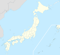  Tsubetsu Location in Japan | |
| Coordinates: 43°42′N 144°2′E | |
| Country | Japan |
| Region | Hokkaido |
| Prefecture | Hokkaido (Okhotsk Subprefecture) |
| District | Abashiri |
| Government | |
| • Mayor | Taichi Satō |
| Area | |
| • Total | 716.60 km2 (276.68 sq mi) |
| Population (September 30, 2016) | |
| • Total | 5,011 |
| • Density | 7.0/km2 (18/sq mi) |
| Time zone | UTC+09:00 (JST) |
| City hall address | 41 Aza Sachimachi, Tsubetsu-chō, Abashiri-gun, Hokkaidō 092-0292 |
| Climate | Dfb |
| Website | www |
| Symbols | |
| Flower | Lily of the Valley |
| Tree | Jezo Spruce |
As of September 2016, the town has an estimated population of 5,011 and a population density of 7 persons per km2. The total area is 716.60 km2.
History
- 1919: Tsubetsu Village founded, split from Bihoro Village (now Town).
- 1921: Part of Bihoro Village incorporated.
- 1946: Tsubetsu Village becomes Tsubetsu Town.
Climate
| Climate data for Tsubetsu (1991−2020 normals, extremes 1988−present) | |||||||||||||
|---|---|---|---|---|---|---|---|---|---|---|---|---|---|
| Month | Jan | Feb | Mar | Apr | May | Jun | Jul | Aug | Sep | Oct | Nov | Dec | Year |
| Record high °C (°F) | 9.5 (49.1) |
11.7 (53.1) |
16.4 (61.5) |
31.1 (88.0) |
38.0 (100.4) |
36.7 (98.1) |
37.1 (98.8) |
37.7 (99.9) |
32.7 (90.9) |
26.7 (80.1) |
20.8 (69.4) |
15.3 (59.5) |
38.0 (100.4) |
| Average high °C (°F) | −2.3 (27.9) |
−1.5 (29.3) |
3.2 (37.8) |
10.8 (51.4) |
17.5 (63.5) |
21.2 (70.2) |
24.6 (76.3) |
25.4 (77.7) |
21.7 (71.1) |
15.6 (60.1) |
7.8 (46.0) |
0.5 (32.9) |
12.0 (53.7) |
| Daily mean °C (°F) | −8.5 (16.7) |
−7.9 (17.8) |
−2.3 (27.9) |
4.7 (40.5) |
10.8 (51.4) |
15.0 (59.0) |
18.8 (65.8) |
19.8 (67.6) |
15.7 (60.3) |
9.1 (48.4) |
2.2 (36.0) |
−5.4 (22.3) |
6.0 (42.8) |
| Average low °C (°F) | −15.3 (4.5) |
−15.3 (4.5) |
−8.6 (16.5) |
−1.2 (29.8) |
4.6 (40.3) |
9.5 (49.1) |
14.0 (57.2) |
15.2 (59.4) |
10.4 (50.7) |
3.2 (37.8) |
−3.1 (26.4) |
−11.5 (11.3) |
0.2 (32.3) |
| Record low °C (°F) | −28.0 (−18.4) |
−28.7 (−19.7) |
−21.6 (−6.9) |
−14.4 (6.1) |
−4.1 (24.6) |
−0.7 (30.7) |
4.1 (39.4) |
5.9 (42.6) |
0.6 (33.1) |
−5.8 (21.6) |
−17.0 (1.4) |
−24.0 (−11.2) |
−28.7 (−19.7) |
| Average precipitation mm (inches) | 41.6 (1.64) |
28.5 (1.12) |
33.4 (1.31) |
48.0 (1.89) |
56.3 (2.22) |
65.7 (2.59) |
90.7 (3.57) |
126.7 (4.99) |
122.2 (4.81) |
79.4 (3.13) |
45.2 (1.78) |
49.5 (1.95) |
787.1 (30.99) |
| Average snowfall cm (inches) | 126 (50) |
108 (43) |
99 (39) |
22 (8.7) |
2 (0.8) |
0 (0) |
0 (0) |
0 (0) |
0 (0) |
0 (0) |
15 (5.9) |
107 (42) |
480 (189) |
| Average rainy days | 9.6 | 7.4 | 9.3 | 9.3 | 9.8 | 10.2 | 11.4 | 12.2 | 11.4 | 9.2 | 8.0 | 9.4 | 117.2 |
| Average snowy days | 12.5 | 11.5 | 11.1 | 2.2 | 0.2 | 0 | 0 | 0 | 0 | 0 | 1.8 | 10.2 | 49.5 |
| Mean monthly sunshine hours | 124.2 | 134.5 | 164.2 | 164.5 | 173.6 | 160.6 | 157.5 | 152.1 | 150.8 | 160.7 | 137.1 | 130.9 | 1,810.9 |
| Source 1: JMA[1] | |||||||||||||
| Source 2: JMA[2] | |||||||||||||
Mascot

Tsubetsu's mascot is Maruta-kun (まる太くん). He is an honest and energetic mizunara wood log bear kamuy who likes to play rugby. As such, he trains rugby players from all over the world.[3][4]
References
- 観測史上1~10位の値(年間を通じての値). JMA. Retrieved February 18, 2022.
- 気象庁 / 平年値(年・月ごとの値). JMA. Retrieved February 18, 2022.
- "まる太くん班 成果報告" (PDF). Tsubetsu.
- "まる太くん (北海道)". Yuru-Chara Grand Prix.
External links
 Media related to Tsubetsu, Hokkaidō at Wikimedia Commons
- Official Website (in Japanese)

Sapporo (capital) | ||||||||||||
|  | |||||||||||
|
| ||||||||||||
| ||||||||||||
| ||||||||||||
| ||||||||||||
| ||||||||||||
| ||||||||||||
| ||||||||||||
| ||||||||||||
| ||||||||||||
| ||||||||||||
| ||||||||||||
| ||||||||||||
List of mergers in Hokkaido | ||||||||||||

Authority control | |
|---|---|
| General | |
| National libraries | |

 | This Hokkaidō location article is a stub. You can help Wikipedia by expanding it. |
На других языках
- [en] Tsubetsu, Hokkaido
[ru] Цубецу
Цубецу (яп. 津別町 Цубэцу-тё:) — посёлок в Японии, находящийся в уезде Абасири округа Охотск губернаторства Хоккайдо. Площадь посёлка составляет 716,60 км²[1], население — 5310 человек (30 июня 2014)[2], плотность населения — 7,41 чел./км².Текст в блоке "Читать" взят с сайта "Википедия" и доступен по лицензии Creative Commons Attribution-ShareAlike; в отдельных случаях могут действовать дополнительные условия.
Другой контент может иметь иную лицензию. Перед использованием материалов сайта WikiSort.org внимательно изучите правила лицензирования конкретных элементов наполнения сайта.
Другой контент может иметь иную лицензию. Перед использованием материалов сайта WikiSort.org внимательно изучите правила лицензирования конкретных элементов наполнения сайта.
2019-2026
WikiSort.org - проект по пересортировке и дополнению контента Википедии
WikiSort.org - проект по пересортировке и дополнению контента Википедии