world.wikisort.org - Japan
Uryū (雨竜町, Uryū-chō) is a town located in Sorachi Subprefecture, Hokkaido, Japan.
This article needs additional citations for verification. (October 2022) |
Uryū
雨竜町 | |
|---|---|
Town | |
 Uryunuma Wetland | |
 Flag  Seal | |
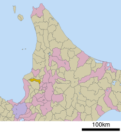 Location of Uryū in Hokkaido (Sorachi Subprefecture) | |
 Uryū Location in Japan | |
| Coordinates: 43°39′N 141°53′E | |
| Country | Japan |
| Region | Hokkaido |
| Prefecture | Hokkaido (Sorachi Subprefecture) |
| District | Uryū |
| Area | |
| • Total | 190.91 km2 (73.71 sq mi) |
| Population (September 30, 2016) | |
| • Total | 2,546 |
| • Density | 13/km2 (35/sq mi) |
| Time zone | UTC+09:00 (JST) |
| Website | www |
As of September 2016, the town has an estimated population of 2,546, and a density of 13.3 persons per km2. The total area is 190.91 square kilometres (73.71 sq mi).[1]
Etymology
The name of the town is from the Ainu language, but the origin of name has been lost. Urir-o-pet, one possibility, means "cormorant river".[1]
In Japanese, the name of the town is written with ateji, or kanji characters used to phonetically represent native or borrowed words. The first, 雨, means "rain", and the second, 竜, means "dragon".
Neighboring municipalities
- Sorachi Subprefecture
- Rumoi Subprefecture
References
- "雨竜(町)" [Uryū]. Nihon Daihyakka Zensho (Nipponika) (in Japanese). Tokyo: Shogakukan. 2012. OCLC 153301537. Archived from the original on 2007-08-25. Retrieved 2012-08-07.
External links
 Media related to Uryū, Hokkaidō at Wikimedia Commons
- Official Website (in Japanese)
Sapporo (capital) | ||||||||||||
| ||||||||||||
| ||||||||||||
| ||||||||||||
| ||||||||||||
| ||||||||||||
| ||||||||||||
| ||||||||||||
| ||||||||||||
| ||||||||||||
| ||||||||||||
| ||||||||||||
| ||||||||||||
| ||||||||||||
| ||||||||||||
List of mergers in Hokkaido | ||||||||||||
This Hokkaidō location article is a stub. You can help Wikipedia by expanding it. |
На других языках
- [en] Uryū, Hokkaido
[ru] Урю (посёлок)
Урю (яп. 雨竜町 Урю:-тё:) — посёлок в Японии, находящийся в уезде Урю округа Сорати губернаторства Хоккайдо. Площадь посёлка составляет 190,91 км²[1], население — 2714 человек (30 июня 2014)[2], плотность населения — 14,22 чел./км².Текст в блоке "Читать" взят с сайта "Википедия" и доступен по лицензии Creative Commons Attribution-ShareAlike; в отдельных случаях могут действовать дополнительные условия.
Другой контент может иметь иную лицензию. Перед использованием материалов сайта WikiSort.org внимательно изучите правила лицензирования конкретных элементов наполнения сайта.
Другой контент может иметь иную лицензию. Перед использованием материалов сайта WikiSort.org внимательно изучите правила лицензирования конкретных элементов наполнения сайта.
2019-2025
WikiSort.org - проект по пересортировке и дополнению контента Википедии
WikiSort.org - проект по пересортировке и дополнению контента Википедии