world.wikisort.org - Japan
Noboribetsu (登別市, Noboribetsu-shi, Ainu: nupur-pet) is a city in Iburi Subprefecture, Hokkaido, Japan. Part of Shikotsu-Toya National Park, it is southwest of Sapporo, west of Tomakomai and northeast of Hakodate.
This article needs additional citations for verification. (September 2015) |
Noboribetsu
登別市 | |
|---|---|
City | |
 View of Noboribetsu Marine Park Nixe, with aquarium | |
 Flag  Chapter | |
 Location of Noboribetsu in Hokkaido (Iburi Subprefecture) | |
 Noboribetsu Location in Japan | |
| Coordinates: 42°25′N 141°6′E | |
| Country | Japan |
| Region | Hokkaido |
| Prefecture | Hokkaido (Iburi Subprefecture) |
| Government | |
| • Mayor | Haruichi Ogasawara |
| Area | |
| • Total | 212.11 km2 (81.90 sq mi) |
| Population (30 September 2016) | |
| • Total | 49,523 |
| • Density | 230/km2 (600/sq mi) |
| Time zone | UTC+09:00 (JST) |
| City hall address | 6–11 Chūōchō, Noboribetsu-shi, Hokkaidō 059-8701 |
| Climate | Dfb |
| Website | www |
| Symbols | |
| Flower | Chrysanthemum |
| Tree | Platanus |
As of September 2016, the city has an estimated population of 49,523, and a population density of 230 persons per km2. The total area is 212.11 km2. The city office is in Horobetsu. The town of Noboribetsu is at the mouth of the Noboribetsu river and is therefore a much narrower area.
Geography
The mountains dominate the west and north while the plains dominate around five km within the coastline. There are three towns along the Pacific Ocean: from northeast to southwest, Noboribetsu, Horobetsu and Washibetsu. These betsu are derived from "river" in the Ainu language. Noboribetsu is on the Noboribetsu River. Horobetsu and Washibetsu are on the Iburi-horobetsu River and the Washibetsu River respectively.
Origin of name
The name, Noboribetsu, derives from an Ainu word, nupur-pet, which means dark-colored river; the kanji 登別, meaning "climbing different", are used for their phonetic value only, and have no relation to the original meaning.
Climate
| Climate data for Noboribetsu (1991−2020 normals, extremes 1977−present) | |||||||||||||
|---|---|---|---|---|---|---|---|---|---|---|---|---|---|
| Month | Jan | Feb | Mar | Apr | May | Jun | Jul | Aug | Sep | Oct | Nov | Dec | Year |
| Record high °C (°F) | 6.7 (44.1) |
9.6 (49.3) |
15.0 (59.0) |
23.5 (74.3) |
29.4 (84.9) |
29.1 (84.4) |
32.4 (90.3) |
32.4 (90.3) |
30.3 (86.5) |
24.7 (76.5) |
19.4 (66.9) |
12.9 (55.2) |
32.4 (90.3) |
| Average high °C (°F) | −1.2 (29.8) |
−0.6 (30.9) |
3.0 (37.4) |
9.3 (48.7) |
15.0 (59.0) |
18.3 (64.9) |
21.7 (71.1) |
23.3 (73.9) |
20.9 (69.6) |
15.0 (59.0) |
7.8 (46.0) |
1.0 (33.8) |
11.1 (52.0) |
| Daily mean °C (°F) | −4.1 (24.6) |
−3.8 (25.2) |
−0.4 (31.3) |
5.1 (41.2) |
10.3 (50.5) |
14.0 (57.2) |
17.9 (64.2) |
19.6 (67.3) |
16.7 (62.1) |
10.8 (51.4) |
4.2 (39.6) |
−1.9 (28.6) |
7.4 (45.3) |
| Average low °C (°F) | −7.3 (18.9) |
−7.2 (19.0) |
−3.8 (25.2) |
1.2 (34.2) |
6.1 (43.0) |
10.4 (50.7) |
15.0 (59.0) |
16.6 (61.9) |
12.8 (55.0) |
6.5 (43.7) |
0.6 (33.1) |
−4.9 (23.2) |
3.8 (38.9) |
| Record low °C (°F) | −18.1 (−0.6) |
−19.4 (−2.9) |
−14.5 (5.9) |
−8.5 (16.7) |
−2.0 (28.4) |
0.1 (32.2) |
6.7 (44.1) |
7.7 (45.9) |
2.9 (37.2) |
−2.1 (28.2) |
−9.9 (14.2) |
−14.1 (6.6) |
−19.4 (−2.9) |
| Average precipitation mm (inches) | 53.8 (2.12) |
53.5 (2.11) |
75.8 (2.98) |
110.1 (4.33) |
167.0 (6.57) |
183.0 (7.20) |
251.7 (9.91) |
297.9 (11.73) |
259.3 (10.21) |
176.1 (6.93) |
113.2 (4.46) |
70.0 (2.76) |
1,811.2 (71.31) |
| Average snowfall cm (inches) | 127 (50) |
117 (46) |
94 (37) |
19 (7.5) |
0 (0) |
0 (0) |
0 (0) |
0 (0) |
0 (0) |
0 (0) |
11 (4.3) |
82 (32) |
454 (179) |
| Average precipitation days (≥ 1.0 mm) | 9.4 | 9.4 | 10.8 | 10.4 | 11.2 | 11.0 | 14.2 | 14.6 | 12.9 | 12.5 | 12.4 | 10.8 | 139.6 |
| Average snowy days | 15.4 | 14.2 | 11.4 | 2.2 | 0 | 0 | 0 | 0 | 0 | 0 | 1.6 | 11.0 | 55.8 |
| Mean monthly sunshine hours | 109.6 | 114.1 | 157.6 | 185.7 | 192.8 | 142.8 | 111.4 | 125.4 | 150.1 | 157.7 | 117.4 | 101.9 | 1,666.5 |
| Source: JMA[1][2] | |||||||||||||
History
- 1919: Horobetsu village was founded.[3]
- 1951: Horobetsu village became Horobetsu town.
- 1961: Horobetsu town renamed to Noboribetsu town.
- 1970: Noboribetsu town became Noboribetsu city.
Education
High school
- Hokkaido Noboribetsu Seiryo High School (登別市立西陵中学校)
Secondary school
- Hokkaido Noboribetsu Akebi Secondary School (北海道登別明日中等教育学校)
Transportation
- Muroran Main Line: Washibetsu – Horobetsu – Tomiura – Noboribetsu
- Hokkaido Expressway: Noboribetsu-Muroran IC – Tomiura PA – Noboribetsu-Higashi IC
- Route 36
Sightseeing

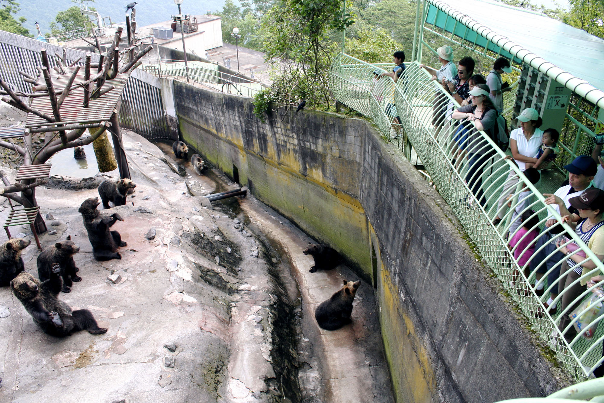
6 km inland from Noboribetsu City in the river valley is the smaller town of Noboribetsu-onsen (登別温泉). The town has a range of onsen for bathing as well as other hot springs formed from different minerals for scenic viewing, and is also known for its bear park. Noboribetsu-onsen is one of many well-known resorts in Japan, with many hotels and ryokan, and is the largest "hot spring town" in Hokkaido.
Twin cities
International
 Faaborg-Midtfyn Municipality, Denmark[4]
 Saipan, United States
 Guangzhou, Guangdong, China
Domestic
Notable people from Noboribetsu
- Yoshida Brothers, Japanese shamisenist musicians
- Masayuki Kono, Japanese professional wrestler and former mixed martial artist
- Takashi Narita, former volleyball player
- Toma Ikuta, Japanese actor (Hanazakari no Kimitachi e, Honey & Clover, Sensei!, Ouroboros, Hanamizuki and Ningen Shikkaku)
- Rina Sumioka, Japanese female singer-songwriter and J-pop idol
- Yukie Chiri, Ainu transcriber and translator of Yukar (Ainu epic tales).
- Kazuki Kushibiki, Japanese football player
- Dawn, Pokémon Coordinator
- Samizu Matsuki Artist, classical realism painting, drawing, emigre.
References
- 観測史上1~10位の値(年間を通じての値). JMA. Retrieved 22 February 2022.
- 気象庁 / 平年値(年・月ごとの値). JMA. Retrieved 22 February 2022.
- History of Noboribetsu
- Friendship cities of Noboribetsu
- Sister cities of Noboribetsu
External links
- Official Website (in Japanese)
- noboribetsu-spa
Sapporo (capital) | ||||||||||||
| ||||||||||||
| ||||||||||||
| ||||||||||||
| ||||||||||||
| ||||||||||||
| ||||||||||||
| ||||||||||||
| ||||||||||||
| ||||||||||||
| ||||||||||||
| ||||||||||||
| ||||||||||||
| ||||||||||||
| ||||||||||||
List of mergers in Hokkaido | ||||||||||||
This Hokkaidō location article is a stub. You can help Wikipedia by expanding it. |
На других языках
[de] Noboribetsu
Noboribetsu (jap. .mw-parser-output .Hani{font-size:110%}登別市, -shi) ist eine Stadt in der Unterpräfektur Iburi auf der Insel Hokkaidō (Japan).- [en] Noboribetsu
[ru] Ноборибецу
Ноборибе́цу[1] (яп. 登別市 Ноборибэцу-си) — город в Японии, находящийся в округе Ибури губернаторства Хоккайдо. Площадь города составляет 212,11 км²[2], население — 50 718 человек (30 июня 2014)[3], плотность населения — 239,11 чел./км².Другой контент может иметь иную лицензию. Перед использованием материалов сайта WikiSort.org внимательно изучите правила лицензирования конкретных элементов наполнения сайта.
WikiSort.org - проект по пересортировке и дополнению контента Википедии