world.wikisort.org - Japan
Nanae (七飯町, Nanae-chō) is a town located in Oshima Subprefecture, Hokkaido, Japan. In April 2017, the town had an estimated population of 28,514, with 13,639 households,[1] and a density of 130 persons per km2. The total area is 216.61 km2.
Nanae
七飯町 | |
|---|---|
Town | |
| Japanese transcription(s) | |
| • Hepburn romanization | Nanae-chō |
 Nanae Town Hall (May 2009) | |
 Flag  Seal | |
 The location of Nanae in Oshima Subprefecture. | |
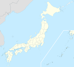  Nanae Location of Nanae in Japan | |
| Coordinates: 41°54′N 140°42′E | |
| Country | Japan |
| Prefecture | Hokkaido |
| Subprefecture | Oshima Subprefecture |
| District | Kameda |
| Government | |
| • Mayor | Yasuichi Chūgō (安一 中宮) |
| Area | |
| • Total | 216.61 km2 (83.63 sq mi) |
| Population (April 30, 2017) | |
| • Total | 28,514 |
| • Density | 130/km2 (340/sq mi) |
| Post code | 041-1192 |
| Area code | 01337 |
| Official Tree | Japanese Red Pine |
| Official Flower | Apple |
| Government Office Address | 6-1-1 Hon-chō, Nanae-chō, Kameda-gun, Hokkaidō 041-1192 |
| Government Office Telephone | 0138-65-2511 |
| Website | www |
Geography
Nanae is at the southern end of the Oshima Peninsula, about 16 km away from Hakodate.[2] The name of "Nanae" (七飯) is derived from two former villages, Nanae (七重) and Iida (飯田).
- Highest mountain: Hokkaidō Koma-ga-take (駒ヶ岳, Koma-ga-take) 1133m, a stratovolcano
History
- 1897: Nanae village and Iida village was merged to form Nanae village.[3]
- 1902: Nanae village was merged with neighboring villages and became a Second Class Village.
- 1957: Nanae village became Nanae town.
Transportation
- Hakodate Main Line: Ōnakayama - Nanae - Oshima-Ōno(Hokuto) - Niyama - Ōnuma - Ōnuma-Kōen
- Hakodate Main Line (Sawara Branch Line): Ōnuma - Ikedaen - Nagareyama Onsen - Chōshiguchi
- Route 5
Education
- High school
- Hokkaido Nanae High School[4]
Sister cities
 Concord, Massachusetts (United States)[5][6]
 Miki, Kagawa (Japan)[7]


See also
- Ōnuma Quasi-National Park
References
- "Official website of Nanae Town" (in Japanese). Japan: Nanae Town. Retrieved 16 May 2017.
- 町のすがた. Official Website (in Japanese). Nanae Town. Archived from the original on 27 September 2011. Retrieved 22 April 2010.
- 七飯町史
- 北海道七飯高等学校
- "Human Services: Concord-Nanae Network Sister City". Official Website. Town of Concord Massachusetts. Archived from the original on 6 June 2010. Retrieved 22 April 2010.
- コンコード町との交流. Official Website (in Japanese). Nanae Town. Retrieved 22 May 2015.
- 交流のあゆみ. Official Website (in Japanese). Nanae Town. Retrieved 22 May 2015.
External links
 Media related to Nanae, Hokkaidō at Wikimedia Commons
- Official Website (in Japanese)
 Hokkaido Hokkaido | ||||||||||||
|---|---|---|---|---|---|---|---|---|---|---|---|---|
Sapporo (capital) | ||||||||||||
|  | |||||||||||
|
| ||||||||||||
| ||||||||||||
| ||||||||||||
| ||||||||||||
| ||||||||||||
| ||||||||||||
| ||||||||||||
| ||||||||||||
| ||||||||||||
| ||||||||||||
| ||||||||||||
| ||||||||||||
List of mergers in Hokkaido | ||||||||||||
Authority control | |
|---|---|
| General | |
| National libraries | |
| Other |
|

На других языках
- [en] Nanae, Hokkaido
[ru] Нанаэ
Нанаэ (яп. 七飯町 Нанаэ-тё:) — посёлок в Японии, находящийся в уезде Камеда округа Осима губернаторства Хоккайдо. Площадь посёлка составляет 216,61 км²[1], население — 28 732 человека (30 июня 2014)[2], плотность населения — 132,64 чел./км².Текст в блоке "Читать" взят с сайта "Википедия" и доступен по лицензии Creative Commons Attribution-ShareAlike; в отдельных случаях могут действовать дополнительные условия.
Другой контент может иметь иную лицензию. Перед использованием материалов сайта WikiSort.org внимательно изучите правила лицензирования конкретных элементов наполнения сайта.
Другой контент может иметь иную лицензию. Перед использованием материалов сайта WikiSort.org внимательно изучите правила лицензирования конкретных элементов наполнения сайта.
2019-2026
WikiSort.org - проект по пересортировке и дополнению контента Википедии
WikiSort.org - проект по пересортировке и дополнению контента Википедии