world.wikisort.org - Japan
Shibecha (標茶町, Shibecha-chō) is a town located in Kushiro Subprefecture, Hokkaido, Japan. As of September 2016, it has an estimated population of 7,862 and an area of 1,099.41 km2.
 | This article has multiple issues. Please help improve it or discuss these issues on the talk page. (Learn how and when to remove these template messages)
|


Shibecha
標茶町 | |
|---|---|
Town | |
 Shibecha town hall | |
 Flag  Seal | |
 Location of Shibecha in Hokkaido (Kushiro) | |
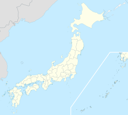  Shibecha Location in Japan | |
| Coordinates: 43°18′N 144°36′E | |
| Country | Japan |
| Region | Hokkaido |
| Prefecture | Hokkaido (Kushiro) |
| District | Kawakami |
| Area | |
| • Total | 1,099.41 km2 (424.48 sq mi) |
| Population (September 30, 2016) | |
| • Total | 7,862 |
| • Density | 7.2/km2 (19/sq mi) |
| Time zone | UTC+09:00 (JST) |
| Climate | Dfb |
| Website | www |
History
- 1923: Kumaushi Village (熊牛村) is formed.
- 1929: Village renamed to Shibecha.
- 1950: Shibecha Village becomes Shibecha Town.
Climate
| Climate data for Shibecha (1991−2020 normals, extremes 1977−present) | |||||||||||||
|---|---|---|---|---|---|---|---|---|---|---|---|---|---|
| Month | Jan | Feb | Mar | Apr | May | Jun | Jul | Aug | Sep | Oct | Nov | Dec | Year |
| Record high °C (°F) | 7.8 (46.0) |
9.5 (49.1) |
15.1 (59.2) |
26.7 (80.1) |
32.8 (91.0) |
32.7 (90.9) |
34.4 (93.9) |
34.6 (94.3) |
31.7 (89.1) |
25.1 (77.2) |
21.0 (69.8) |
14.1 (57.4) |
34.6 (94.3) |
| Average high °C (°F) | −1.4 (29.5) |
−0.9 (30.4) |
3.2 (37.8) |
9.8 (49.6) |
15.6 (60.1) |
18.8 (65.8) |
22.0 (71.6) |
23.5 (74.3) |
20.8 (69.4) |
15.5 (59.9) |
8.5 (47.3) |
1.3 (34.3) |
11.4 (52.5) |
| Daily mean °C (°F) | −7.9 (17.8) |
−7.1 (19.2) |
−2.1 (28.2) |
3.6 (38.5) |
9.0 (48.2) |
13.0 (55.4) |
16.9 (62.4) |
18.4 (65.1) |
15.3 (59.5) |
8.9 (48.0) |
2.0 (35.6) |
−5.2 (22.6) |
5.4 (41.7) |
| Average low °C (°F) | −15.2 (4.6) |
−14.7 (5.5) |
−8.1 (17.4) |
−2.3 (27.9) |
3.1 (37.6) |
8.4 (47.1) |
13.0 (55.4) |
14.6 (58.3) |
10.2 (50.4) |
2.3 (36.1) |
−4.4 (24.1) |
−12.1 (10.2) |
−0.4 (31.2) |
| Record low °C (°F) | −29.5 (−21.1) |
−29.4 (−20.9) |
−24.3 (−11.7) |
−14.6 (5.7) |
−7.1 (19.2) |
−2.8 (27.0) |
2.6 (36.7) |
3.5 (38.3) |
−1.7 (28.9) |
−8.3 (17.1) |
−16.2 (2.8) |
−26.0 (−14.8) |
−29.5 (−21.1) |
| Average precipitation mm (inches) | 35.4 (1.39) |
22.8 (0.90) |
49.3 (1.94) |
76.3 (3.00) |
105.7 (4.16) |
97.2 (3.83) |
119.1 (4.69) |
158.8 (6.25) |
152.9 (6.02) |
111.0 (4.37) |
70.7 (2.78) |
56.0 (2.20) |
1,054.9 (41.53) |
| Average snowfall cm (inches) | 86 (34) |
70 (28) |
73 (29) |
31 (12) |
trace | 0 (0) |
0 (0) |
0 (0) |
0 (0) |
0 (0) |
8 (3.1) |
69 (27) |
338 (133) |
| Average precipitation days (≥ 1.0 mm) | 5.8 | 5.1 | 7.4 | 9.4 | 10.7 | 9.9 | 11.2 | 11.8 | 11.7 | 9.7 | 8.5 | 7.2 | 108.4 |
| Average snowy days (≥ 3 cm) | 10.8 | 8.5 | 9.2 | 4.5 | 0.1 | 0 | 0 | 0 | 0 | 0 | 1.0 | 9.0 | 43.1 |
| Mean monthly sunshine hours | 149.8 | 152.3 | 171.6 | 160.2 | 161.4 | 131.4 | 108.4 | 112.3 | 128.7 | 152.4 | 145.5 | 145.1 | 1,719 |
| Source: Japan Meteorological Agency[1][2] | |||||||||||||
Mascots

Kushiro's mascots is Milkcook (ミルクック, Mirukukku) and Kurobe Happy (ハッピーくろべえ, Happī Kurobe). They are bovines with a strong sense of justice.[3]
- Milkcook is a mild-mannered dairy cow. She is a chef who can cook fast. She will moo if she fails to cook good something. As a result of her cooking skills, she promotes hospitality in the town while promoting the importance of milk. She became mascot in Spring 2006.
- Kurobe Happy is an optimistic bull who loves matsuris. He wears a blue happi. As a result of his fascination of festivals, he promotes events in the town while promoting the importance of beef. He became mascot during the 2011 Fall Matsuri.
Notable people from Shibecha
- Nobukatsu Fujioka, professor of education
- Keiko Takahashi, actress
References
- 観測史上1~10位の値(年間を通じての値). JMA. Retrieved March 3, 2022.
- 気象庁 / 平年値(年・月ごとの値). JMA. Retrieved March 3, 2022.
- "標茶町PRキャラクター" (PDF). Kushiro.
External links
 Media related to Shibecha, Hokkaidō at Wikimedia Commons
- Official Website (in Japanese)

Sapporo (capital) | ||||||||||||
|  | |||||||||||
|
| ||||||||||||
| ||||||||||||
| ||||||||||||
| ||||||||||||
| ||||||||||||
| ||||||||||||
| ||||||||||||
| ||||||||||||
| ||||||||||||
| ||||||||||||
| ||||||||||||
| ||||||||||||
List of mergers in Hokkaido | ||||||||||||


 | This Hokkaidō location article is a stub. You can help Wikipedia by expanding it. |
На других языках
- [en] Shibecha, Hokkaido
[ru] Сибетя
Сибетя (яп. 標茶町 Сибэтя-тё:) — посёлок в Японии, находящийся в уезде Каваками округа Кусиро губернаторства Хоккайдо. Площадь посёлка составляет 1099,41 км²[1], население — 8033 человека (30 июня 2014)[2], плотность населения — 7,31 чел./км².Текст в блоке "Читать" взят с сайта "Википедия" и доступен по лицензии Creative Commons Attribution-ShareAlike; в отдельных случаях могут действовать дополнительные условия.
Другой контент может иметь иную лицензию. Перед использованием материалов сайта WikiSort.org внимательно изучите правила лицензирования конкретных элементов наполнения сайта.
Другой контент может иметь иную лицензию. Перед использованием материалов сайта WikiSort.org внимательно изучите правила лицензирования конкретных элементов наполнения сайта.
2019-2026
WikiSort.org - проект по пересортировке и дополнению контента Википедии
WikiSort.org - проект по пересортировке и дополнению контента Википедии