world.wikisort.org - USA
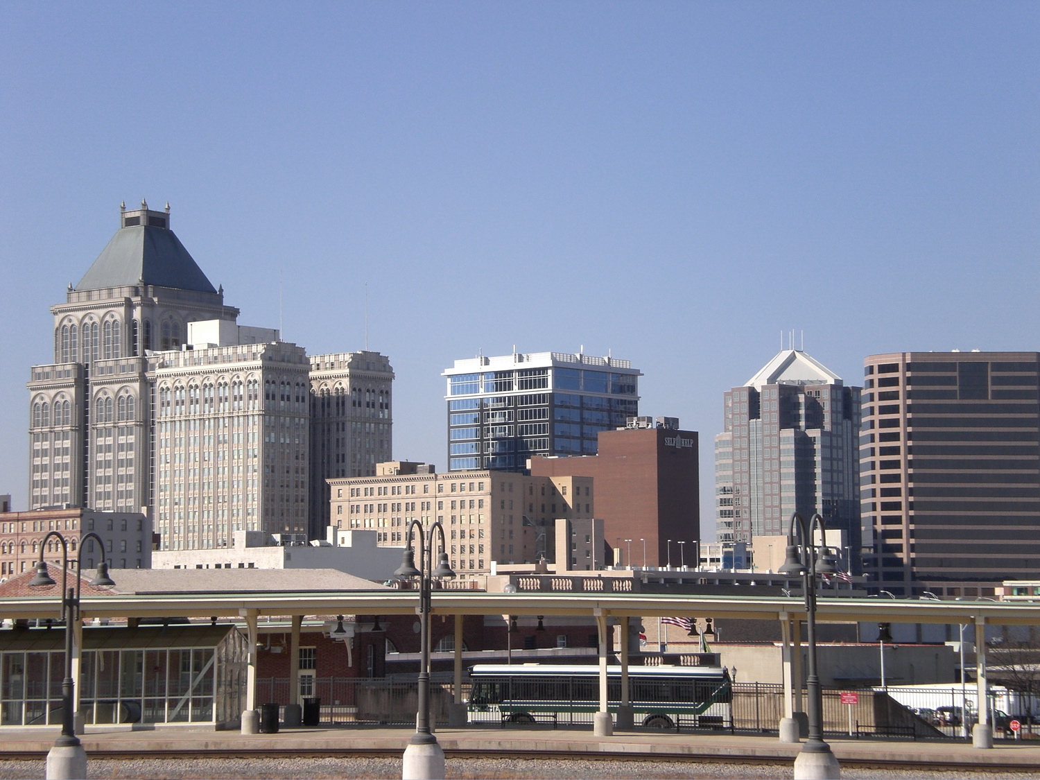
The Piedmont Triad (or simply the Triad) is a metropolitan region in the north-central part of the U.S. state of North Carolina anchored by three cities: Greensboro, Winston-Salem, and High Point. This close group of cities lies in the Piedmont geographical region of the United States and forms the basis of the Greensboro–Winston-Salem–High Point Combined Statistical Area. As of 2012, the Piedmont Triad has an estimated population of 1,611,243 making it the 33rd largest combined statistical area in the United States.[1]
Piedmont Triad | |
|---|---|
   | |
| Country | United States |
| State | North Carolina |
| Largest city | Greensboro |
| Counties | Guilford Forsyth Alamance Davidson Randolph Rockingham Surry Stokes Davie Yadkin |
| Area Codes | 336/743 |
| Area | |
| • Land | 5,954 sq mi (15,420 km2) |
The metropolitan area is connected by Interstates 40, 85, 73, and 74 and is served by the Piedmont Triad International Airport. Long known as one of the primary manufacturing and transportation hubs of the southeastern United States, the Triad is also an important educational, healthcare, and cultural region and occupies a prominent place in the history of the American Civil Rights Movement.[2]
The Triad is not to be confused with the "Triangle" region (Raleigh–Durham–Chapel Hill), directly to the east.
Counties
As part of a redefining of metropolitan areas by the US Census Bureau, the old Greensboro–Winston-Salem–High Point Metropolitan Statistical Area was broken up in 2003 into five separate areas—three Metropolitan Statistical Areas and two Micropolitan Areas. In some ways, however, the region still functions as a single metropolitan area.[3]

| County | 2021 Estimate | 2020 Census | Change |
|---|---|---|---|
| Guilford County[4] | 542,410 | 541,299 | +0.21% |
| Forsyth County[5] | 385,523 | 382,590 | +0.77% |
| Alamance County | 173,877 | 171,415 | +1.44% |
| Davidson County | 170,637 | 168,930 | +1.01% |
| Randolph County | 145,172 | 144,171 | +0.69% |
| Rockingham County[6] | 91,266 | 91,096 | +0.19% |
| Surry County | 71,152 | 71,359 | −0.29% |
| Stokes County | 44,553 | 44,520 | +0.07% |
| Davie County | 43,533 | 42,712 | +1.92% |
| Yadkin County | 37,192 | 37,214 | −0.06% |
| Total | 1,705,315 | 1,699,123 | +0.36% |
Municipalities

- The name in italics is the county in which the city is located.
Primary cities
- Greensboro Guilford – 299,035
- Winston-Salem Forsyth – 249,545
- High Point Guilford, Forsyth, Davidson & Randolph – 114,059
Secondary cities over 10,000 in population
- Burlington Alamance & Guilford 55,481
- Thomasville Davidson 27,183
- Asheboro Randolph 27,156
- Kernersville Forsyth & Guilford 26,449
- Clemmons Forsyth 21,163
- Lexington Davidson – 19,632
- Eden Rockingham 15,527
- Reidsville Rockingham 14,520
- Graham Alamance 14,153
- Lewisville Forsyth 12,639
- Archdale Randolph & Guilford 11,415
- Mebane Alamance & Orange 11,393
- Mount Airy Surry 10,388
- Summerfield Guilford 10,232
Other municipalities under 10,000 in population
|
† Indicates municipalities in Montgomery and Caswell (counties usually locally included as part of Piedmont Triad) |
Education
K–12 education
The area is served by the Winston-Salem/Forsyth County Schools and Guilford County Schools. The area is home to a number of religious schools, as well as a number of independent schools including Wesleyan Christian Academy and High Point Christian Academy in High Point, Summit School in Winston-Salem, Forsyth Country Day School in Lewisville, Greensboro Day School and Greensboro Montessori School in Greensboro.
Educational institutions
More than 20 institutions of higher education are located within the Triad, including:


- Alamance Community College
- Bennett College
- Bridges Christian College
- Carolina University
- Davidson-Davie Community College
- Elon University
- Forsyth Technical Community College
- Greensboro College
- Guilford College
- Guilford Technical Community College
- High Point University
- North Carolina Agricultural and Technical State University[7]
- University of North Carolina School of the Arts
- Randolph Community College
- Rockingham Community College
- Salem College
- Surry Community College
- University of North Carolina at Greensboro[8]
- Wake Forest University[9]
- Winston-Salem State University[10]
Three prominent boarding schools also call the Triad home: Salem Academy, Oak Ridge Military Academy, and the American Hebrew Academy.
Museums
Major art and historical museums contribute to the cultural climate of the region, including the Southeastern Center for Contemporary Art (SECCA), The Reynolda House Museum of American Art, Old Salem, High Point Historical Museum, Mendenhall Plantation, the Weatherspoon Museum of Modern Art (located on the campus of UNCG), Blandwood Mansion and Gardens, the Greensboro Historical Museum, Guilford Battleground National Military Park, and the Charlotte Hawkins Brown State Museum. The area also has its fair share of scientific museums, such as SciWorks, the International Civil Rights Center and Museum, the Wake Forest Museum of Anthropology, and the Greensboro Science Center. The North Carolina Zoo, the world's largest open-air natural habitat zoo, is located just outside the Randolph County city of Asheboro.
Economy
The economy in the Piedmont Triad is a mixed economy.[11]
Industry and manufacturing
The Triad area is notable for large textile, tobacco, and furniture corporations. The Triad remains a national center for textile manufacturing, represented by corporations including Hanes based in Winston-Salem, Glen Raven, Inc. based in Glen Raven, and International Textile Group, based in Greensboro. Tobacco remains a prominent crop in the Triad's rural areas and many tobacco companies like Lorillard Tobacco Company of Greensboro and Reynolds American, based in Winston-Salem, call the Piedmont Triad home. Numerous furniture manufacturers are also headquartered in the Triad area, especially in the cities of High Point (deemed the "Furniture Capital of the World"), Thomasville (known as the "Chair City"), and Lexington. The furniture and textile industries have in turn spawned large trucking, logistics, and warehousing businesses in the area. Popular brands like "Thomasville" and "Lexington" are derived from the names of these cities. Recently, however, many furniture and tobacco factories have been closing and/or laying off workers across the region in response to escalating industrial globalization.
Technology and biotechnology
After many of the old industries in the area began to die out, many Piedmont Triad cities began encouraging technological businesses to move into the Triad. Winston-Salem, for instance, founded within its downtown the Piedmont Triad Research Park, now known as Wake Forest Innovation Quarter, a highly interactive, 200-acre, master-planned innovation community developed to support life science and information technology research and development. Dell, Inc. in the early 2000s struck a deal with local officials allowing for the construction of a new computer assembly plant near the Triad city of Kernersville. Dell pulled out of its contract with the city, however, and left after only a few years. Additionally, the University of North Carolina at Greensboro, the largest institution of higher learning in the region, and North Carolina A&T State University have joined forces to establish the Gateway University Research Park, a technology-based entity that will focus its efforts on a host of biological, life, and environmental science research projects. Upon full build out of the project, it is expected to be housed by two 75-acre (300,000 m2) campuses, employ approximately 2,000 people, and generate $50 million per year to the Triad economy. LabCorp, one of the largest clinical laboratories in the world, has its corporate headquarters and several of its testing facilities in Burlington.
Shopping
The following are the most prominent regional shopping centers/malls in the Piedmont Triad region:
- Four Seasons Town Centre, Greensboro[12]
- Friendly Center, Greensboro[13]
- Hanes Mall, Winston-Salem[14]
- Alamance Crossing, Burlington
- Burlington Outlet Village, Burlington
- Holly Hill Mall, Burlington
- Tanger Outlets, Mebane
- Marketplace Mall, Winston-Salem
- Randolph Mall, Asheboro[15]
Transportation

Primary highways
The Triad is home to an extensive freeway network, which is in the process of undergoing a major expansion. Four major Interstate highways and numerous secondary Interstate routes and US routes serve the region:
- Interstate highways
 I-40, the primary east–west route across the region. In the eastern Triad, it is conjoined with I-85. The two routes split in Greensboro.
 I-840 (Painter Boulevard), part of the Greensboro Urban Loop, currently under construction. When complete, I-840 will form the northern half of the loop.
 I-73, the primary north–south route across the region, much of which has yet to be constructed. The route mostly carries portions of US 220 along it, with the exception of the portion along Bryan Boulevard, and another segment that shares the southwestern portion of the Greensboro Outer Loop, and was briefly designated as I-40 before its opening in February, 2008. This portion was originally designated as I-40, with the current and original I-40 being re-designated as Business 40.
 I-74, running across the region from southeast to northwest. Like I-73, much of the route has yet to be constructed, but several disjointed segments are currently open and signed as either I-74 or "FUTURE I-74". The route enters the region from the south conjoined with I-73, and diverges from there north of Asheboro toward High Point. The southern segment presently terminates at an intersection with I-40 east of Winston-Salem; new freeway is being built that will form the eastern segment of the Winston-Salem Beltway. The northern segment leaves US 52 in Mount Airy, heading northwest out of the region.
 I-274, currently only in the planning stages, is the proposed designation for the western half of the Winston-Salem Beltway.
 I-85, connects the region to Charlotte and points southwest. Enters from the east conjoined with I-40, and splits from that route in Greensboro.
 I-85 Business (Green-85), a business route between Lexington and Greensboro, consists of a former temporary alignment of I-85 that is a partial-controlled access highway. A former northern segment, which received its designation when a new I-85 was opened as part of the Greensboro Urban Loop, is entirely freeway.
 I-285, connecting Winston-Salem to Lexington, is currently part of the US 52 freeway being upgraded to Interstate standards.
 I-785, connecting Greensboro to Danville, Virginia, the route is under development. It is currently part of US 29, much of which is not Interstate standard.
- US highways
 US 29 runs roughly northeast to southwest across the region. Most of the route is either concurrent with, or parallel to Interstate highways, including I-785 (when completed) and I-85 (parallel).
 US 52 runs north–south through the region, serving as the main north–south freeway route through Winston-Salem. The entire freeway is planned for upgrade to Interstate standards. North of Winston-Salem most of the route is scheduled to become part of I-74 (until Exit 140 where existing I-74 starts and travels west along its own freeway, and US 52 continues north into town via expressway), while south of the city it is cosigned with I-285.
 US 64 is an east–west highway through the southern Triad, connecting Asheboro, Lexington, and Mocksville.
 US 70 is an east–west highway that closely parallels I-85 through the entire region.
 US 158 runs roughly northeast–southwest across the region, terminating in Mocksville at US 601 and US 64, just south of I-40.
 US 220 is currently the primary north–south route through Greensboro, and travels nearly symmetrically through the middle of the region; most of the route runs along I-73, except between Greensboro and Summerfield where it is named "Battleground Avenue" .
 US 311 is a nominally north–south route that runs northeast–southwest between Danville, VA and Winston-Salem. The former alignment south of Winston-Salem has been fully signed as I-74; work has begun on US 311 signage removal on this alignment.
 US 421 enters the region from the southeast, and joins I-85 in Greensboro. It then takes I-85 South to I-73 North to western Greensboro. The route is then co-signed with I-40 briefly. After leaving Greensboro, it continues westward through Winston-Salem, the rural area of Yakdinville, and continues into Wilkesboro.
- Other routes and highways
- The Greensboro Urban Loop is a partially completed freeway that loops around Greensboro. The routes I-73, I-85, I-785, I-840, and US 421 are currently on the loop.
- The Winston-Salem Beltway is an under construction freeway that will loop around Winston-Salem with a portion of it opening in September 2020 between the US 421 and US 158 interchanges. The route NC 74 is currently designated on said section.
- Wendover Avenue is primarily a limited-access corridor that traverses through Greensboro from High Point. The route also bypasses downtown Greensboro. The road connects NC 68 to Interstate 73, U.S. 421, Interstate 40, US 220, US 29, and US 70.
- Silas Creek Parkway is primarily a limited-access corridor that serves as the partial loop that traverses through the western side of Winston-Salem. Most of the road runs with NC 67 and serves as a popular connector to drivers on Interstate 40 and U.S. 421 to locations such as Wake Forest University, Forsyth Tech, and Hanes Mall.
Air
Piedmont Triad International Airport (PTI)
Mass transportation
Piedmont Authority for Regional Transportation (PART) is the Triad's 10-county regional organization with the goal of enhancing all forms of transportation through regional cooperation. PART Express Bus provides express service to each major Triad city from Piedmont Triad International Airport, while Connections Express connects the Triad to Duke and UNC Medical Centers. PART also has Express Bus service to outlying counties that surround the Triad including Surry, Stokes, Davidson, Yadkin, and Randolph Counties and soon to be Davie County. PART is also administering and developing several rail service studies that include both commuter and intercity rail.
Government
The region is served by the Piedmont Triad Regional Council (PTRC). The PTRC was formed by the merger of the Northwest Piedmont Council of Governments and Piedmont Triad Council of Governments on July 1, 2011. The PTRC is a membership organization of the 12 counties and 62 municipalities in the Triad region.
Protected areas
The Piedmont Triad has several protected areas, which lay entirely or partly in the region:
- Blue Ridge Parkway, partly within Surry and Wilkes counties
- Boone's Cave Park, Davidson County
- Deep River State Trail, partly within Guilford and Randolph counties
- Guilford Courthouse National Military Park, Guilford County
- Hanging Rock State Park, Stokes County
- High Rock Lake, Davidson and Rowan counties
- Haw River State Park, Guilford and Rockingham counties
- Mayo River State Park, Rockingham County
- Mountains-to-Sea Trail, partly within Alamance, Forsyth, Guilford, Stokes, Surry, and Wilkes counties
- Overmountain Victory National Historic Trail, partly within Surry and Wilkes counties
- Pilot Mountain State Park, Surry and Yadkin counties
- Uwharrie National Forest, Davidson, Montgomery and Randolph counties
- Wil-Cox Bridge at Yadkin River Park, Davidson County
- Yadkin River State Trail, partly within Davidson, Davie, Forsyth, Surry, Wilkes, and Yadkin counties
Media
Newspapers
The following are prominent newspapers in the Piedmont Triad region and the counties each newspaper covers.
- Greensboro News & Record, Guilford County
- The Carolina Peacemaker, Guilford County
- ¨Hola Noticias¨, The Triad
- Winston-Salem Journal, Forsyth County
- Burlington Times-News, Alamance County
- Mebane Enterprise, Alamance County
- Courier-Tribune, Randolph County
- Thomasville Times, Davidson County
- The Dispatch, Davidson County
- High Point Enterprise, High Point, Guilford County
- Archdale-Trinity News, Randolph County
- The Stokes News, Stokes County
- The Reidsville Review, Rockingham County
- The Tribune, Surry, Wilkes, and Yadkin counties
- Mount Airy News, Surry County
- Qué Pasa, The Triad
- YES! Weekly, Guilford County, Forsyth County
- Triad City Beat, Guilford County, Forsyth County
- The Jamestown News, Guilford County
- The Stokesdale News, Guilford County
- Northwest Observer, Guilford County
Other
- The Old Gold & Black, a free daily student newspaper at Wake Forest University in Winston-Salem
Television stations
All of the Piedmont Triad region belongs to the Greensboro/Winston-Salem/High Point television designated market area (DMA). The following are stations that broadcast to this DMA. These stations are listed by call letters, virtual channel number, network and city of license.
- WFMY-TV, 2, CBS, Greensboro
- WGHP, 8, Fox, High Point
- WXII, 12, NBC, Winston-Salem
- Spectrum News, 14, Greensboro (Charter Communications)
- WGPX, 16, Ion, Burlington
- WCWG, 20, CW, Lexington
- WUNL-TV, 26, PBS/UNC-TV, Winston-Salem
- WLXI-TV, 43, TCT, Greensboro
- WXLV-TV, 45, ABC, Winston-Salem
- WGSR-LD, 47, Independent, Reidsville
- WMYV, 48, My, Greensboro
Radio
FM stations
- WFDD (88.5, News/Talk/Classical music, NPR affiliate), operated by Wake Forest University
- WBFJ-FM (89.3, Contemporary Christian)
- WNAA (90.1, Variety), operated by North Carolina A&T State University
- WSNC (90.5, Jazz), operated by Winston-Salem State University
- WQFS (90.9, Variety), operated by Guilford College
- WXRI (91.3, Southern gospel)
- WKRR (92.3, Classic rock)
- WPAW (93.1, Country music)
- WWLV (94.1, Contemporary Christian)
- WPTI (94.5, Talk radio)
- WHPE-FM (95.5, Christian talk)
- WQMG (97.1, urban Adult contemporary)
- WIST-FM (98.3, Regional Mexican)
- WSMW (98.7, Adult hits)
- WMAG (99.5, Adult contemporary)
- WMKS (100.3, Contemporary hit radio)
- WYMY (101.1, Regional Mexican)
- WJMH (102.1, Rhythmic contemporary)
- WUAG (103.1, Variety), operated by University of North Carolina at Greensboro
- WTQR (104.1, Country music)
- WFOZ-LP (105.1, Variety), operated by Forsyth Technical Community College
- WVBZ (105.5, Mainstream rock)
- WKZL (107.5, Top 40 Mainstream)
AM stations
- WSJS (600, sports)
- WZOO (700, classic hits)
- WPAQ (740, Americana and bluegrass)
- WBLO (790, Spanish adult contemporary)
- WTRU (830, Christian talk)
- WPIP (880, religious)
- WPCM (920, sports)
- WPET (950, religious)
- WTOB (980, classic hits)
- WSGH (1040, Spanish)
- WGOS (1070, Spanish religious)
- WKTE (1090, oldies)
- WMFR (1230, sports)
- WCOG (1320, oldies)
- WPOL (1340, gospel music)
- WLXN (1440, Contemporary worship music)
- WWBG (1470, oldies)
- WLOE (1940, news/talk)
- WSMX (1500, Contemporary Christian)
- WEAL (1510, gospel music)
- WDSL (1520, classic country, bluegrass, and gospel)
- WBFJ (1550, Christian talk)
- WYZD (1560, Christian)
- WYSR (1590, Spanish)
See also
- I-85 Corridor
- Piedmont Atlantic
- Piedmont Crescent
References
- "Population Estimates 2012 Combined Statistical Areas: April 1, 2010 to July 1, 2012". U.S. Census Bureau. Archived from the original on March 17, 2013. Retrieved 2013-03-14.
- "Greensboro Sit-In". HISTORY. Retrieved 2020-04-10.
- Catanoso, Justin. "Commute patterns 'rescue' Triad MSA". Triad Business Journal. The Business Journals. Retrieved 23 November 2021.
- "Guilford County (1771)". North Carolina History Project. Retrieved June 3, 2020.
- "Forsyth County (1849)". North Carolina History Project. Retrieved June 3, 2020.
- "Rockingham County (1785)". North Carolina History Project. Retrieved June 3, 2020.
- "North Carolina A&T State University". ncat.edu. Retrieved June 3, 2020.
- "UNC Greensboro". uncg.edu. Retrieved June 3, 2020.
- "Wake Forest University". wfu.edu. Retrieved June 3, 2020.
- "Winston-Salem State University". wssu.edu. Retrieved July 19, 2022.
- Barron, Richard (December 30, 2021). "Greensboro and Triad mirror nation's mixed economy, with a positive outlook". Greensboro News & Record. Retrieved July 19, 2022.
- "Four Seasons Town Centre: Shopping Mall in Greensboro, NC". shopfourseasons.com. Retrieved July 19, 2022.
- "Friendly Center – Greensboro". friendlycenter.com. Retrieved July 19, 2022.
- "Hanes Mall". shophanesmall.com. Retrieved July 19, 2022.
- "Asheboro Mall". shopasheboromall.com. Retrieved July 19, 2022.
| Location |
|  |
|---|---|---|
| Cities | ||
| Counties | ||
| Newspapers |
| |
| Higher education |
| |
| Protected areas |
| |
| Transportation |
| |
Другой контент может иметь иную лицензию. Перед использованием материалов сайта WikiSort.org внимательно изучите правила лицензирования конкретных элементов наполнения сайта.
WikiSort.org - проект по пересортировке и дополнению контента Википедии