world.wikisort.org - USA
The Spokane–Spokane Valley Metropolitan Statistical Area, as defined by the United States Census Bureau, is an area consisting of Spokane and Stevens counties in Washington state, anchored by the city of Spokane and its largest suburb, Spokane Valley.[1] As of July 1, 2021, the MSA had an estimated population of 593,466.[2] The Spokane Metropolitan Area and the neighboring Coeur d'Alene metropolitan area, make up the larger Spokane–Coeur d'Alene combined statistical area. The urban areas of the two MSAs largely follow the path of Interstate 90 between Spokane and Coeur d'Alene. In 2010, the Spokane–Spokane Valley MSA had a gross metropolitan product of $20.413 billion.[3]
Spokane metropolitan area | |
|---|---|
Metropolitan statistical area | |
| Spokane–Spokane Valley Metropolitan Statistical Area | |
From top: Downtown Spokane from the south, Spokane Valley from the air | |
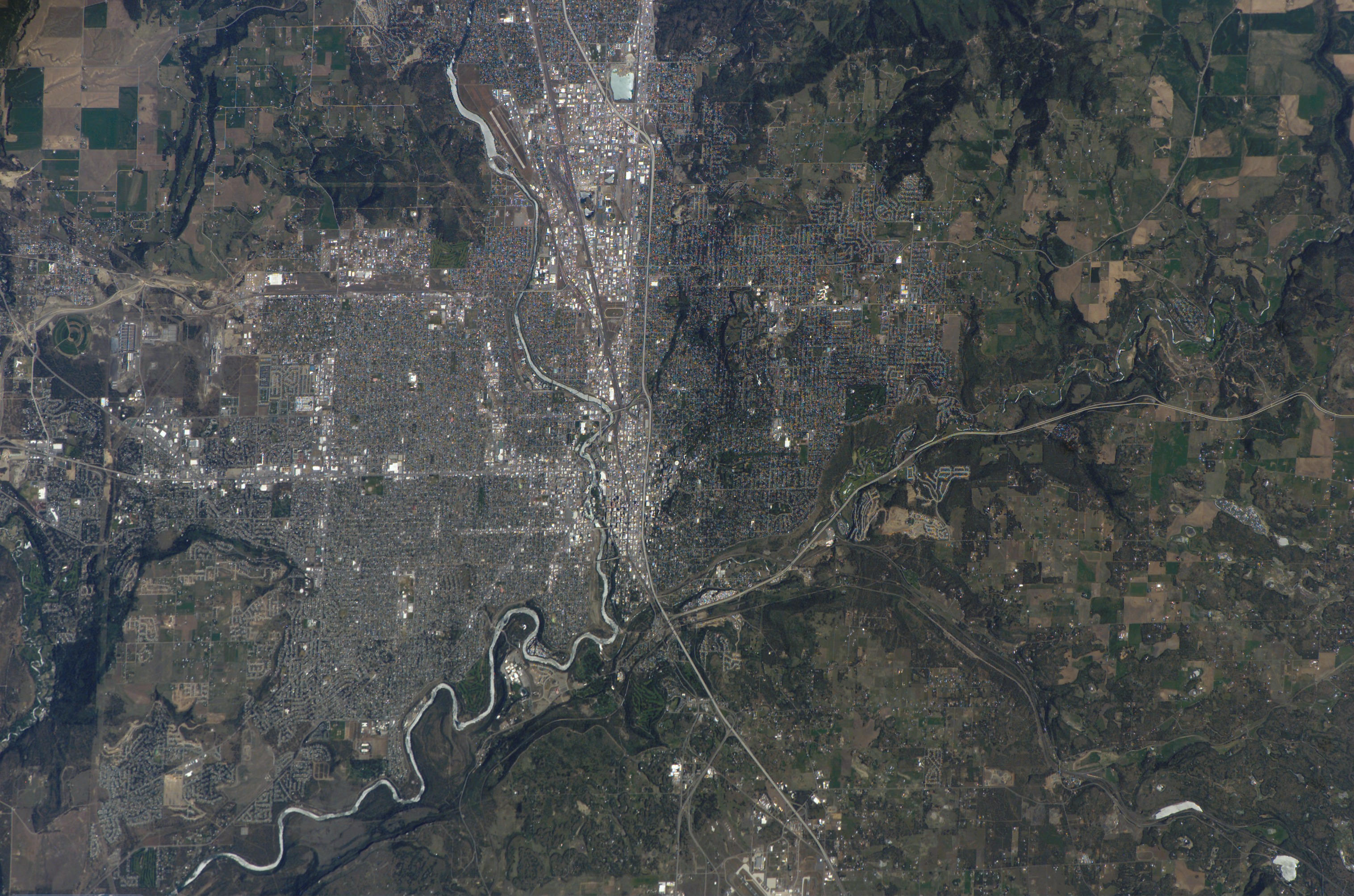
 A map of the Spokane MSA. | |
| Country | United States |
| State(s) | Washington |
| Largest city | Spokane (228,989) |
| Other cities | - Spokane Valley (102,976) - Cheney (13,255) - Liberty Lake (12,003) - Airway Heights (10,757) |
| Area | |
| • Total | 5,641.5 sq mi (14,611 km2) |
| Highest elevation | 7,320 ft (2,230 m) |
| Lowest elevation | 1,273 ft (338 m) |
| Population | |
| • Total | 593,466 |
| • Rank | 98th in the U.S. |


Counties
- Spokane
- Stevens
Communities
Over 200,000 inhabitants
- Spokane - (principal city)
50,000 to 199,999 inhabitants
- Spokane Valley - (principal city)
10,000 to 49,999 inhabitants
- Airway Heights
- Cheney
- Fairwood
- Liberty Lake
5,000 to 9,999 inhabitants
- Country Homes
- Fairchild AFB
- Mead
- Medical Lake
- Otis Orchards-East Farms
- Town and Country
1,000 to 4,999 inhabitants
1,000 inhabitants or fewer
- Addy
- Clayton
- Fairfield
- Four Lakes
- Green Bluff
- Latah
- Loon Lake
- Marcus
- Northport
- Rockford
- Spangle
- Springdale
- Waverly
- Valley
Unincorporated places
- Amber
- Arden
- Bluecreek
- Cedonia
- Chattaroy
- Colbert
- Echo
- Elk
- Espanola
- Evans
- Ford
- Four Lakes
- Freedom
- Fruitland
- Gifford
- Green Bluff
- Greenacres
- Hunters
- Lakeside
- Marshall
- Mead
- Mica
- Milan
- Newman Lake
- Nine Mile Falls
- Onion Creek
- Plaza
- Rice
- Ruby
- Spokane Bridge
- Suncrest (part of Nine Mile Falls)
- Tumtum (also known as Tum Tum)
- Tyler
- Valleyford
- Wellpinit
Demographics
As of 2020, there were 585,784 people and 224,385 households residing within the MSA.[4] The racial makeup of the MSA was 86% White, 2% Black, 1% Native, 2% Asian, 0% Islander, and 5% Hispanic. According to the Association of Religion Data Archives' 2010 Metro Area Membership Report, the denominational affiliations of the Spokane MSA are 64,277 Evangelical Protestant, 682 Black Protestant, 24,826 Mainline Protestant, 754 Orthodox, 66,202 Catholic, 31,674 Other, and 339,338 Unclaimed.[5]
| Historical population | |||
|---|---|---|---|
| Census | Pop. | %± | |
| 1860 | 1,992 | — | |
| 1870 | 2,734 | 37.2% | |
| 1880 | 5,507 | 101.4% | |
| 1890 | 41,828 | 659.5% | |
| 1900 | 68,058 | 62.7% | |
| 1910 | 164,701 | 142.0% | |
| 1920 | 169,257 | 2.8% | |
| 1930 | 176,182 | 4.1% | |
| 1940 | 191,083 | 8.5% | |
| 1950 | 247,554 | 29.6% | |
| 1960 | 303,131 | 22.5% | |
| 1970 | 310,197 | 2.3% | |
| 1980 | 379,394 | 22.3% | |
| 1990 | 401,227 | 5.8% | |
| 2000 | 469,737 | 17.1% | |
| 2010 | 527,753 | 12.4% | |
| 2020 | 585,784 | 11.0% | |
| 2021 (est.) | 593,466 | 1.3% | |
| U.S. Decennial Census[6][2] | |||
See also
- Washington census statistical areas
References
- "Combined Statistical Areas of the United States and Puerto Rico" (PDF). census.gov. U.S. Census Bureau. Retrieved 30 April 2022.
- "QuickFacts: Stevens County, Washington; Spokane County, Washington". census.gov. U.S. Census Bureau. Retrieved 30 April 2022.
- "GDP & Personal Income". United States Department of Commerce: Bureau of Economic Analysis. Retrieved April 10, 2018.
- "QuickFacts: Spokane County, Washington; Stevens County, Washington". census.gov. U.S. Census Bureau. Retrieved 3 May 2022.
- "Spokane-Spokane Valley, WA". Metro-Area Membership Report. The Association of Religion Data Archives, Pennsylvania State University. 2010. Retrieved January 2, 2014.
- "U.S. Decennial Census". United States Census Bureau. Archived from the original on May 7, 2015. Retrieved April 12, 2020.
| Authority control |
|
|---|
Другой контент может иметь иную лицензию. Перед использованием материалов сайта WikiSort.org внимательно изучите правила лицензирования конкретных элементов наполнения сайта.
WikiSort.org - проект по пересортировке и дополнению контента Википедии