world.wikisort.org - USA
Craven County is located in the U.S. state of North Carolina. As of the 2020 Census, the population was 100,720.[1] Its county seat is New Bern.[2] The county was created in 1705 as Archdale Precinct from the now-extinct Bath County. It was renamed Craven Precinct in 1712 and gained county status in 1739.[3][4] It is named for William, Earl of Craven, who lived from 1606 to 1697. Craven County is part of the New Bern, NC, Metropolitan Statistical Area.
Craven County | |
|---|---|
U.S. county | |
| County of Craven | |
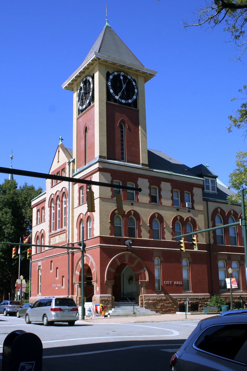 New Bern City Hall | |
 Flag  Seal Logo | |
 Location within the U.S. state of North Carolina | |
 North Carolina's location within the U.S. | |
| Coordinates: 35°06′33″N 77°04′09″W | |
| Country | |
| State | |
| Founded | 1712 |
| Named for | William, Earl of Craven |
| Seat | New Bern |
| Largest city | New Bern |
| Area | |
| • Total | 774 sq mi (2,000 km2) |
| • Land | 709 sq mi (1,840 km2) |
| • Water | 65 sq mi (170 km2) 8.4% |
| Population | |
| • Estimate (2021) | 100,674 |
| • Density | 142/sq mi (55/km2) |
| Time zone | UTC−5 (Eastern) |
| • Summer (DST) | UTC−4 (EDT) |
| Congressional district | 3rd |
| Website | www |
History
On August 4, 1661, George Durant purchased land from Cisketando, king of the Yeopim Indian tribe. On March 13, 1662, a second purchase was made from Kilcocanen, another Yeopim. By 1662 Durant was living in Virginia on a tract of land along the Perquimans River which flows into Albemarle Sound, which became part of the Carolina colony in 1665.[5]
Craven County was established in 1712 as Craven Precinct, a precinct of Bath County. It was named after William, Lord Craven, one of the Lords Proprietors. That year Christopher Gale became the first chief justice of North Carolina.[6][7] During the initial years of colonization, the population of Craven County was sparse and grew slowly. By 1740, however, the town of New Bern began growing rapidly and became the seat for the Governorship.[8] John Carter served as the first sheriff of Craven County, but died in 1740 in the line of duty, when ambushed by an outlaw he was trying to apprehend. In 1746 an act was passed establishing New Bern as the capital of the province and, although the act was later repealed, the General Court met at New Bern in Craven County after 1747.[6]
In 1749 James Davis, the colony's first printer, arrived at New Bern and became the official printer for the North Carolina Assembly.[9] In 1751, Davis established and began printing the North-Carolina Gazette, North Carolina's first newspaper.[10] In 1754 he was elected Sheriff of Craven County.[11]
Geography

According to the U.S. Census Bureau, the county has a total area of 774 square miles (2,000 km2), of which 709 square miles (1,840 km2) is land and 65 square miles (170 km2) (8.4%) is water.[12]
National protected area
- Catfish Lake South Wilderness (part)
- Croatan National Forest (part)
State and local protected areas
- Croatan Game Land (part)
- Great Lake Recreation Site (part)
- Pine Cliff Recreation Area
- Latham-Whitehurst Nature Park
- Special Secondary Nursery Areas
Major water bodies
- Adams Creek
- Alligator Gut
- Catfish Lake
- Clubfoot Creek
- Ellis Simon Lake
- Hancock Creek
- Intracoastal Waterway
- Little Lake
- Long Lake
- Neuse River
- Trent River
- Great Lake
- Upper Broad Creek
Adjacent counties
- Pitt County - north
- Beaufort County - north
- Pamlico County - east
- Carteret County - south
- Jones County - west
- Lenoir County - west
Major highways

 Future I-42 (Concurrency with US 70)
 US 17
US 17 US 17 Bus. (New Bern)
- US 17 Bus. (Vanceboro)
 US 70
US 70 NC 41
NC 41 NC 43
NC 43 NC 55
NC 55 NC 101
 NC 118
 NC 306
Major infrastructure
- Amtrak Thruway (New Bern and Havelock)
- Cherry Branch - Minnesott Beach Ferry (To Pamlico County)
- Coastal Carolina Regional Airport
- MCAS Cherry Point, military base located in Havelock
Demographics
| Historical population | |||
|---|---|---|---|
| Census | Pop. | %± | |
| 1790 | 10,474 | — | |
| 1800 | 10,245 | −2.2% | |
| 1810 | 12,676 | 23.7% | |
| 1820 | 13,394 | 5.7% | |
| 1830 | 13,734 | 2.5% | |
| 1840 | 13,438 | −2.2% | |
| 1850 | 14,709 | 9.5% | |
| 1860 | 16,268 | 10.6% | |
| 1870 | 20,516 | 26.1% | |
| 1880 | 19,729 | −3.8% | |
| 1890 | 20,533 | 4.1% | |
| 1900 | 24,160 | 17.7% | |
| 1910 | 25,594 | 5.9% | |
| 1920 | 29,048 | 13.5% | |
| 1930 | 30,665 | 5.6% | |
| 1940 | 31,298 | 2.1% | |
| 1950 | 48,823 | 56.0% | |
| 1960 | 58,773 | 20.4% | |
| 1970 | 62,554 | 6.4% | |
| 1980 | 71,043 | 13.6% | |
| 1990 | 81,613 | 14.9% | |
| 2000 | 91,436 | 12.0% | |
| 2010 | 103,505 | 13.2% | |
| 2020 | 100,720 | −2.7% | |
| 2021 (est.) | 100,674 | [13] | 0.0% |
| U.S. Decennial Census[14] 1790-1960[15] 1900-1990[16] 1990-2000[17] 2010-2013[18] 2020[19] | |||
2020 census
| Race | Number | Percentage |
|---|---|---|
| White (non-Hispanic) | 64,933 | 64.47% |
| Black or African American (non-Hispanic) | 19,903 | 19.76% |
| Native American | 318 | 0.32% |
| Asian | 3,059 | 3.04% |
| Pacific Islander | 150 | 0.15% |
| Other/Mixed | 5,162 | 5.13% |
| Hispanic or Latino | 7,195 | 7.14% |
As of the 2020 United States census, there were 100,720 people, 42,221 households, and 28,502 families residing in the county.
2000 census
As of the census[21] of 2000, there were 91,436 people, 34,582 households, and 25,071 families residing in the county. The population density was 129 people per square mile (50/km2). There were 38,150 housing units at an average density of 54 per square mile (21/km2). The racial makeup of the county was 69.94% White, 25.12% Black or African American, 0.42% Native American, 0.99% Asian, 0.06% Pacific Islander, 1.78% from other races, and 1.68% from two or more races. 4.02% of the population were Hispanic or Latino of any race.
There were 34,582 households, out of which 33.30% had children under the age of 18 living with them, 56.80% were married couples living together, 12.50% had a female householder with no husband present, and 27.50% were non-families. 23.40% of all households were made up of individuals, and 8.90% had someone living alone who was 65 years of age or older. The average household size was 2.50 and the average family size was 2.93.
In the county, the population was spread out, with 24.60% under the age of 18, 12.80% from 18 to 24, 27.90% from 25 to 44, 21.20% from 45 to 64, and 13.40% who were 65 years of age or older. The median age was 34 years. For every 100 females there were 101.90 males. For every 100 females age 18 and over, there were 101.50 males.
The median income for a household in the county was $35,966, and the median income for a family was $42,574. Males had a median income of $28,163 versus $21,412 for females. The per capita income for the county was $18,423. About 9.90% of families and 13.10% of the population were below the poverty line, including 18.50% of those under age 18 and 11.00% of those age 65 or over.
Government and politics
Craven is a typical “Solid South” county in its presidential voting patterns. It was solidly Democratic until the 1960s: in five elections from 1932 to 1948 the Republican Party did not reach fifteen percent of the vote, and only in 1928 when a large anti-Catholic vote was cast against Al Smith did the GOP reach twenty percent between at least 1900 and 1948. The national Democratic party's support for the Civil Rights Movement caused its white electorate to defect to George Wallace’s American Independent campaign in 1968. Since that time, Craven has become a strongly Republican county. The last Democrat to carry Craven County was Jimmy Carter in 1976.
| Year | Republican | Democratic | Third party | |||
|---|---|---|---|---|---|---|
| No. | % | No. | % | No. | % | |
| 2020 | 31,032 | 58.48% | 21,148 | 39.85% | 885 | 1.67% |
| 2016 | 27,731 | 59.00% | 17,630 | 37.51% | 1,640 | 3.49% |
| 2012 | 26,928 | 58.32% | 18,763 | 40.64% | 479 | 1.04% |
| 2008 | 24,901 | 55.83% | 19,352 | 43.39% | 345 | 0.77% |
| 2004 | 23,575 | 62.44% | 14,019 | 37.13% | 162 | 0.43% |
| 2000 | 19,494 | 60.95% | 12,213 | 38.18% | 278 | 0.87% |
| 1996 | 13,264 | 52.65% | 10,317 | 40.96% | 1,610 | 6.39% |
| 1992 | 11,575 | 45.77% | 9,998 | 39.54% | 3,714 | 14.69% |
| 1988 | 12,057 | 62.10% | 7,313 | 37.66% | 47 | 0.24% |
| 1984 | 12,893 | 64.04% | 7,186 | 35.69% | 55 | 0.27% |
| 1980 | 8,554 | 50.97% | 7,781 | 46.36% | 448 | 2.67% |
| 1976 | 5,881 | 43.42% | 7,553 | 55.77% | 109 | 0.80% |
| 1972 | 9,372 | 78.74% | 2,384 | 20.03% | 147 | 1.23% |
| 1968 | 2,991 | 21.77% | 4,240 | 30.86% | 6,509 | 47.37% |
| 1964 | 4,691 | 38.73% | 7,422 | 61.27% | 0 | 0.00% |
| 1960 | 3,680 | 33.95% | 7,158 | 66.05% | 0 | 0.00% |
| 1956 | 2,956 | 31.88% | 6,317 | 68.12% | 0 | 0.00% |
| 1952 | 2,822 | 31.66% | 6,092 | 68.34% | 0 | 0.00% |
| 1948 | 745 | 11.87% | 5,039 | 80.26% | 494 | 7.87% |
| 1944 | 826 | 14.50% | 4,872 | 85.50% | 0 | 0.00% |
| 1940 | 626 | 11.30% | 4,916 | 88.70% | 0 | 0.00% |
| 1936 | 453 | 7.56% | 5,543 | 92.44% | 0 | 0.00% |
| 1932 | 466 | 9.59% | 4,375 | 90.02% | 19 | 0.39% |
| 1928 | 2,237 | 47.28% | 2,494 | 52.72% | 0 | 0.00% |
| 1924 | 325 | 9.82% | 2,942 | 88.86% | 44 | 1.33% |
| 1920 | 731 | 17.64% | 3,413 | 82.36% | 0 | 0.00% |
| 1916 | 542 | 23.34% | 1,780 | 76.66% | 0 | 0.00% |
| 1912 | 79 | 3.78% | 1,819 | 87.12% | 190 | 9.10% |
| 1908 | 449 | 24.30% | 1,399 | 75.70% | 0 | 0.00% |
| 1904 | 268 | 14.70% | 1,555 | 85.30% | 0 | 0.00% |
| 1900 | 1,502 | 42.55% | 2,028 | 57.45% | 0 | 0.00% |
| 1896 | 2,921 | 60.50% | 1,810 | 37.49% | 97 | 2.01% |
| 1892 | 1,648 | 50.49% | 1,305 | 39.98% | 311 | 9.53% |
| 1888 | 2,618 | 65.73% | 1,359 | 34.12% | 6 | 0.15% |
| 1884 | 2,539 | 65.62% | 1,330 | 34.38% | 0 | 0.00% |
| 1880 | 2,809 | 69.00% | 1,180 | 28.99% | 82 | 2.01% |
Craven County is a member of the regional Eastern Carolina Council of Governments.
Communities

Cities
Towns
Census-designated places
Other unincorporated communities
- Adams Creek
- Ernul
- Fort Barnwell
- Harlowe
- Askin
See also
- List of counties in North Carolina
- National Register of Historic Places listings in Craven County, North Carolina
- Tryon Palace, famous palace located in New Bern
- PepsiCo, birthplace of this drink is located in New Bern
- North Carolina Ferry System
- List of wilderness areas of the United States
- List of future Interstate Highways
Sources
- Connor, Robert Digges Wimberly (1919). History of North Carolina. Vol. I. Chicago : New York : Lewis Publishing Co.
- Crittenden, Charles christopher; Lacy, Dan, eds. (1938). The historical records of North Carolina : the county records. Vol. I. Raleigh : The North Carolina Historical Commission.
- Crittenden, Charles christopher; Lacy, Dan, eds. (1938). The historical records of North Carolina : the county records. Vol. II. Raleigh : The North Carolina Historical Commission.
- Dill, Alonzo Thomas Jr. (January 1946). "Eighteenth Century New Bern". Dill, Eighteenth-Century New Bern. North Carolina Office of Archives and History. 23 (1): 47–48. JSTOR 23515401.
- Powell, William S., ed. (2000). Dictionary of North Carolina biography. University of North Carolina Press. ISBN 978-0-8078-67013. - link to Davis biography
- Thomas, Isaiah (1874). The history of printing in America, with a biography of printers. Vol. I. New York, B. Franklin.
- —— (1874). The history of printing in America, with a biography of printers. Vol. II. New York, B. Franklin.
- Wroth, Lawrence C. (1938). The Colonial Printer. Portland, Me., The Southworth-Anthoensen press.
References
- "U.S. Census Bureau QuickFacts: Craven County, North Carolina". www.census.gov. Retrieved April 19, 2022.
- "Find a County". National Association of Counties. Archived from the original on May 31, 2011. Retrieved June 7, 2011.
- "North Carolina: Individual County Chronologies". North Carolina Atlas of Historical County Boundaries. The Newberry Library. 2009. Archived from the original on March 4, 2016. Retrieved January 22, 2015.
- "Craven County". NCpedia. State Library of North Carolina. January 1, 2006. Retrieved January 22, 2015.
- Connor, 1919, Vol. I, pp. 26-27
- The historical records of North Carolina, Vol. I, p. 58
- The historical records of North Carolina, Vol. II, p. 2
- dill, 1946, p. 47
- Wroth, 1938, p. 48
- Thomas, 1874, Vol. I, p. 338; Vol. II, p. 166
- Powell, 2000, pp. 34-35
- "2010 Census Gazetteer Files". United States Census Bureau. August 22, 2012. Archived from the original on January 12, 2015. Retrieved January 13, 2015.
- "U.S. Census Bureau QuickFacts: Craven County, North Carolina". www.census.gov. Retrieved May 31, 2022.
- "U.S. Decennial Census". United States Census Bureau. Retrieved January 13, 2015.
- "Historical Census Browser". University of Virginia Library. Retrieved January 13, 2015.
- Forstall, Richard L., ed. (March 27, 1995). "Population of Counties by Decennial Census: 1900 to 1990". United States Census Bureau. Retrieved January 13, 2015.
- "Census 2000 PHC-T-4. Ranking Tables for Counties: 1990 and 2000" (PDF). United States Census Bureau. April 2, 2001. Retrieved January 13, 2015.
- "State & County QuickFacts". United States Census Bureau. Archived from the original on July 28, 2011. Retrieved October 18, 2013.
- "U.S. Census Bureau QuickFacts: Craven County, North Carolina". www.census.gov. Retrieved May 31, 2022.
- "Explore Census Data". data.census.gov. Retrieved December 24, 2021.
- "U.S. Census website". United States Census Bureau. Retrieved January 31, 2008.
- Leip, David. "Dave Leip's Atlas of U.S. Presidential Elections". uselectionatlas.org. Retrieved March 15, 2018.
- "Our Campaigns - U.S. President". Retrieved January 22, 2021.
Further reading
- Browning, Judkin. Shifting Loyalties: The Union Occupation of Eastern North Carolina (Univ of North Carolina Press, 2011). focus on Craven County
- Kinsey, Marissa N. "Beyond the Vale: Visualizing Slavery in Craven County, North Carolina." (2017). online
- Farmer, Vina Hutchinson. New Bern (Arcadia Publishing, 2007).
- Todd, Vincent H., ed. (1920). Christoph von Graffenried's Account of the Founding of New Bern. Publications of the North Carolina Historical Commission. Raleigh: Edwards & Broughton Printing Co. LCCN 21027196. OCLC 1107613. OL 6640211M – via Internet Archive.
- Watson, Alan D. A History of New Bern and Craven County (Tryon Palace Commission, 1987).
External links
- Official website
- New Bern Sun Journal
- Havelock Chamber of Commerce
- New Bern Chamber of Commerce
- Craven County Economic Development
- Craven County, NCGenWeb
Places adjacent to Craven County, North Carolina | ||||||||||||||||
|---|---|---|---|---|---|---|---|---|---|---|---|---|---|---|---|---|
| ||||||||||||||||
Municipalities and communities of Craven County, North Carolina, United States | ||
|---|---|---|
County seat: New Bern | ||
| Cities |  | |
| Towns | ||
| CDPs | ||
| Other community |
| |
| Military base | ||
| ||
Authority control | |
|---|---|
| General | |
| National libraries | |
| Other |
|
На других языках
[de] Craven County
Craven County[1] ist ein County im Bundesstaat North Carolina der Vereinigten Staaten. Der Verwaltungssitz (County Seat) ist New Bern, das nach der Herkunft der meisten Siedler, der Stadt Bern in der Schweiz, benannt wurde.- [en] Craven County, North Carolina
[ru] Крейвен (округ)
Округ Крейвен (англ. Craven County) расположен в США, на востоке штата Северная Каролина. В 2000 году население округа было 94 875.[1]. Окружным центром является город Нью-Берн. Расположен в регионе Внутренние отмели.Другой контент может иметь иную лицензию. Перед использованием материалов сайта WikiSort.org внимательно изучите правила лицензирования конкретных элементов наполнения сайта.
WikiSort.org - проект по пересортировке и дополнению контента Википедии