world.wikisort.org - USA
Alleghany County (/ælɪˈɡeɪniː/[1]) is a county located in the U.S. state of North Carolina. As of the 2020 Census, the population was 10,888.[2] Its county seat is Sparta.[3]
Alleghany County | |
|---|---|
U.S. county | |
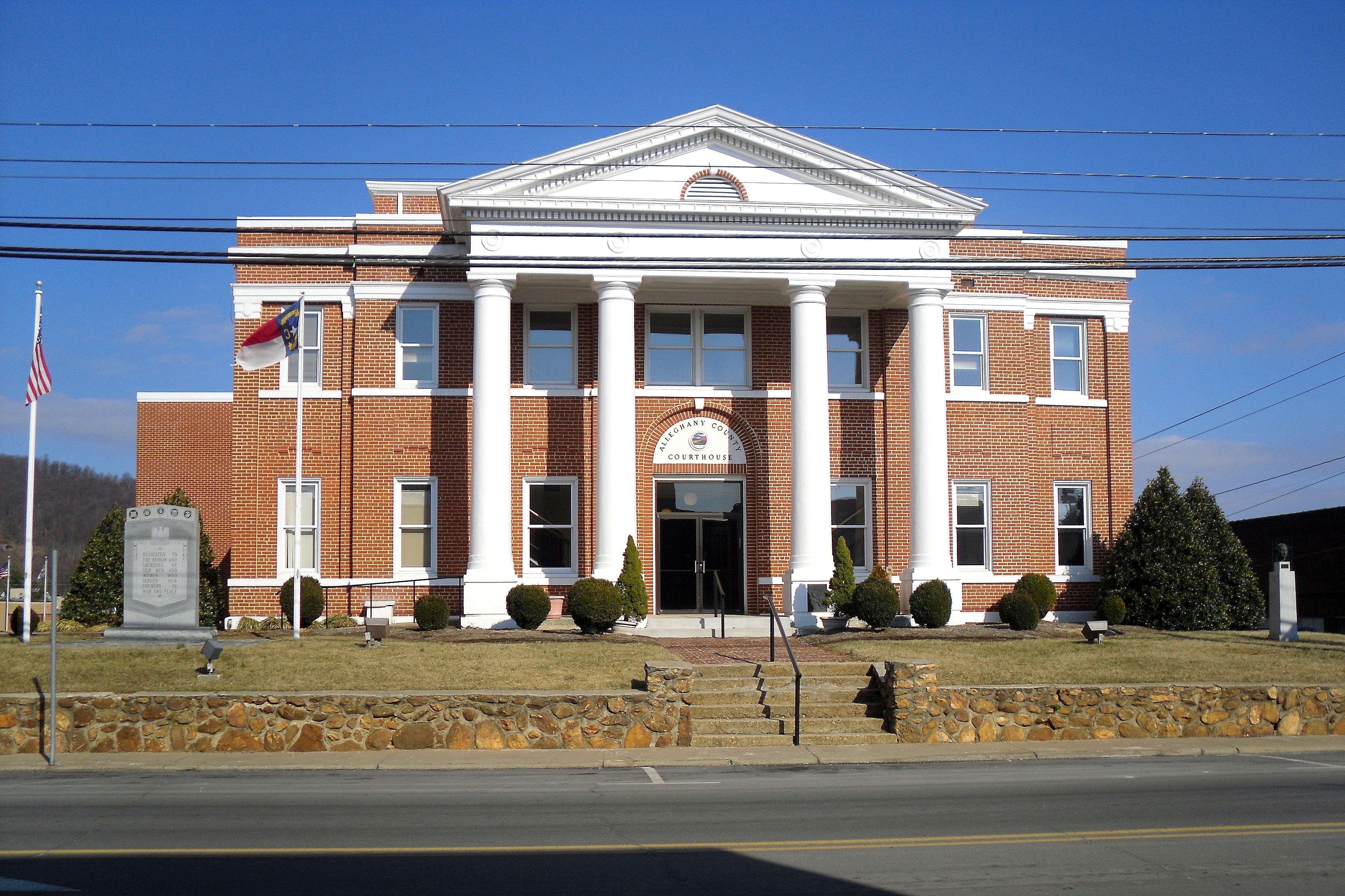 Alleghany County Courthouse | |
 Flag  Seal Logo | |
| Nickname: Heart Of The Blue Ridge Parkway | |
| Motto: "Authentically Alleghany" | |
 Location within the U.S. state of North Carolina | |
 North Carolina's location within the U.S. | |
| Coordinates: 36°29′N 81°08′W | |
| Country | |
| State | |
| Founded | 1859 |
| Named for | Allegheny Mountains |
| Seat | Sparta |
| Largest town | Sparta |
| Area | |
| • Total | 237 sq mi (610 km2) |
| • Land | 235 sq mi (610 km2) |
| • Water | 1.5 sq mi (4 km2) 0.6% |
| Population | |
| • Estimate (2021) | 11,049 |
| • Density | 47/sq mi (18/km2) |
| Time zone | UTC−5 (Eastern) |
| • Summer (DST) | UTC−4 (EDT) |
| Congressional district | 5th |
| Website | www |
History
The county was formed in 1859 from the eastern part of Ashe County and was named for the Allegheny Mountains.[4] Numerous boundary adjustments have been made since it was established, but none of these have resulted in new counties.[5]
Geography

According to the U.S. Census Bureau, the county has a total area of 235 square miles (610 km2), of which 235 square miles (610 km2) is land and 1.5 square miles (3.9 km2) (0.6%) is water.[6] It is the fourth-smallest county in North Carolina by total area with just over 235 square miles, ranking 97 out of 100 total counties in the state.[7]
Alleghany County is located in northwestern North Carolina, and its northern border is with the State of Virginia. The county is located entirely within the Appalachian Mountains region of western North Carolina. Most of the county is located atop a rolling plateau that ranges from 2,500 feet (760 m) to 3,000 feet (910 m) above sea level. The southern border of the county drops abruptly nearly 1,500 feet (460 m) to the Foothills region of North Carolina. The plateau is crossed by numerous hills and mountains. The highest point in the county is Peach Bottom Mountain - Catherine Knob at 4,175 feet (1,273 m) above sea level.[8] The major rivers of Alleghany County are the New River, and the Little River; the latter flows through the town of Sparta, the county seat.
Isolated by mountainous terrain from the remainder of North Carolina to the east, Alleghany County was described in the 19th and early 20th centuries as one of the Lost Provinces of North Carolina.[9]
Due to its elevation, Alleghany County enjoys slightly cooler summers than the lowland areas to the east and south, with temperatures seldom rising over 90 °F (32 °C). In the winter, however, temperatures can frequently be colder than would be expected in a southern state. Daytime highs can fall into the teens or lower, and snowfall can be extremely heavy at times. According to USClimateData.com, the average temperature is 52.85 °F (11.58 °C).
National protected area
- Blue Ridge Parkway (part)
State and local protected areas
- Bullhead Mountain State Natural Area
- Cumberland Knob Recreation Area (part)
- Doughton Recreation Area (part)
- New River State Park (park)
- Raven Knob Scout Reservation (part)
- Stone Mountain State Park (part)
- Thurmond Chatham Wildlife Management Area (part)
Major water bodies
- Brush Creek
- Elk Creek
- Laurel Creek
- Little River
- New River (Kanawha River tributary)
- Pine Swamp Creek
- Prather Creek
- Rock Creek
- South Fork New River
Adjacent counties
- Grayson County, Virginia - north
- Surry County - east
- Wilkes County - south
- Ashe County - west
Major highways
 US 21
US 21 US 21 Truck
 US 221
 NC 18
NC 18 NC 88
NC 88 NC 93
NC 93 NC 113
Demographics
| Historical population | |||
|---|---|---|---|
| Census | Pop. | %± | |
| 1860 | 3,590 | — | |
| 1870 | 3,691 | 2.8% | |
| 1880 | 5,486 | 48.6% | |
| 1890 | 6,523 | 18.9% | |
| 1900 | 7,759 | 18.9% | |
| 1910 | 7,745 | −0.2% | |
| 1920 | 7,403 | −4.4% | |
| 1930 | 7,186 | −2.9% | |
| 1940 | 8,341 | 16.1% | |
| 1950 | 8,155 | −2.2% | |
| 1960 | 7,734 | −5.2% | |
| 1970 | 8,134 | 5.2% | |
| 1980 | 9,587 | 17.9% | |
| 1990 | 9,590 | 0.0% | |
| 2000 | 10,677 | 11.3% | |
| 2010 | 11,155 | 4.5% | |
| 2020 | 10,888 | −2.4% | |
| 2021 (est.) | 11,049 | [10] | 1.5% |
| U.S. Decennial Census[11] 1790-1960[12] 1900-1990[13] 1990-2000[14] 2010-2013[15] 2020[16] | |||
2020 census
| Race | Number | Percentage |
|---|---|---|
| White (non-Hispanic) | 9,186 | 84.37% |
| Black or African American (non-Hispanic) | 103 | 0.95% |
| Native American | 35 | 0.32% |
| Asian | 15 | 0.14% |
| Pacific Islander | 6 | 0.06% |
| Other/Mixed | 255 | 2.34% |
| Hispanic or Latino | 1,288 | 11.83% |
As of the 2020 United States census, there were 10,888 people, 4,920 households, and 3,390 families residing in the county.
2000 census
As of the census[18] of 2000, there were 10,677 people, 4,593 households, and 3,169 families residing in the county. The population density was 46 people per square mile (18/km2). There were 6,412 housing units at an average density of 27 per square mile (11/km2). The racial makeup of the county was 95.69% White, 1.23% Black or African American, 0.26% Native American, 0.20% Asian, 0.01% Pacific Islander, 1.75% from other races, and 0.86% from two or more races. 4.96% of the population were Hispanic or Latino of any race.
There were 4,593 households, out of which 24.80% had children under the age of 18 living with them, 58.30% were married couples living together, 7.50% had a female householder with no husband present, and 31.00% were non-families. 27.80% of all households were made up of individuals, and 14.00% had someone living alone who was 65 years of age or older. The average household size was 2.28 and the average family size was 2.75.
In the county, the population was spread out, with 19.40% under the age of 18, 7.40% from 18 to 24, 26.30% from 25 to 44, 27.70% from 45 to 64, and 19.20% who were 65 years of age or older. The median age was 43 years. For every 100 females there were 97.10 males. For every 100 females age 18 and over, there were 95.50 males.
The median income for a household in the county was $29,244, and the median income for a family was $38,473. Males had a median income of $25,462 versus $18,851 for females. The per capita income for the county was $17,691. About 11.30% of families and 17.20% of the population were below the poverty line, including 20.80% of those under age 18 and 25.00% of those age 65 or over.
Government and politics
Alleghany County is a member of the regional High Country Council of Governments.
| Year | Republican | Democratic | Third party | |||
|---|---|---|---|---|---|---|
| No. | % | No. | % | No. | % | |
| 2020 | 4,527 | 74.51% | 1,486 | 24.46% | 63 | 1.04% |
| 2016 | 3,814 | 71.76% | 1,306 | 24.57% | 195 | 3.67% |
| 2012 | 3,390 | 66.90% | 1,583 | 31.24% | 94 | 1.86% |
| 2008 | 3,124 | 59.36% | 2,021 | 38.40% | 118 | 2.24% |
| 2004 | 2,883 | 59.73% | 1,922 | 39.82% | 22 | 0.46% |
| 2000 | 2,531 | 58.68% | 1,715 | 39.76% | 67 | 1.55% |
| 1996 | 1,936 | 45.71% | 1,801 | 42.53% | 498 | 11.76% |
| 1992 | 1,853 | 39.18% | 2,271 | 48.01% | 606 | 12.81% |
| 1988 | 2,174 | 50.98% | 2,087 | 48.94% | 3 | 0.07% |
| 1984 | 2,589 | 56.08% | 2,013 | 43.60% | 15 | 0.32% |
| 1980 | 1,995 | 46.29% | 2,198 | 51.00% | 117 | 2.71% |
| 1976 | 1,532 | 37.40% | 2,550 | 62.26% | 14 | 0.34% |
| 1972 | 2,158 | 61.29% | 1,304 | 37.03% | 59 | 1.68% |
| 1968 | 1,695 | 45.80% | 1,102 | 29.78% | 904 | 24.43% |
| 1964 | 1,573 | 39.91% | 2,368 | 60.09% | 0 | 0.00% |
| 1960 | 1,978 | 48.26% | 2,121 | 51.74% | 0 | 0.00% |
| 1956 | 1,699 | 50.43% | 1,670 | 49.57% | 0 | 0.00% |
| 1952 | 1,789 | 49.72% | 1,809 | 50.28% | 0 | 0.00% |
| 1948 | 1,374 | 42.39% | 1,667 | 51.43% | 200 | 6.17% |
| 1944 | 1,495 | 45.23% | 1,810 | 54.77% | 0 | 0.00% |
| 1940 | 1,217 | 38.40% | 1,952 | 61.60% | 0 | 0.00% |
| 1936 | 1,498 | 38.98% | 2,345 | 61.02% | 0 | 0.00% |
| 1932 | 810 | 29.18% | 1,951 | 70.28% | 15 | 0.54% |
| 1928 | 1,368 | 49.17% | 1,414 | 50.83% | 0 | 0.00% |
| 1924 | 1,234 | 42.80% | 1,643 | 56.99% | 6 | 0.21% |
| 1920 | 1,201 | 46.02% | 1,409 | 53.98% | 0 | 0.00% |
| 1916 | 641 | 44.61% | 796 | 55.39% | 0 | 0.00% |
| 1912 | 208 | 18.64% | 652 | 58.42% | 256 | 22.94% |
Communities

Town
- Sparta (county seat and largest town)
Townships
- Cherry Lane
- Cranberry
- Gap Civil
- Glade Creek
- Piney Creek
- Prathers Creek
- Whitehead
Unincorporated communities
- Cherry Lane
- Ennice
- Glade Valley
- Laurel Springs
- Piney Creek
- Roaring Gap
- Scottville
- Twin Oaks
Population ranking
The population ranking of the following table is based on the 2022 Estimates of Alleghany County.[20]
† county seat
| Rank | City/Town/etc. | Municipal type | Population (2022 Estimate) |
|---|---|---|---|
| only incorporated community | † Sparta | Town | 1,790 |
Notable people
- Robert L. Doughton (1863–1954), United States Congressman from Alleghany County from 1911 to 1953. From 1933 to 1947 he was the Chairman of the House Ways and Means Committee. He used his influence as Chairman to create the Blue Ridge Parkway, which runs along the county's eastern and southern borders. Doughton Park, the largest and most popular park on the Parkway, is named in his honor. He also played a major role in the passage of the Social Security Act.
- Rufus A. Doughton (1857–1946), older brother of Robert Doughton. He served as the Speaker of the North Carolina House of Representatives, and was Lieutenant Governor of North Carolina from 1893 to 1897.
- Del Reeves (1932–2007), country music entertainer on the United Artists record label. He became a member of the Grand Ole Opry in 1966 and his record "Girl on the Billboard" sold over a million copies.
- Zach Galifianakis (born 1969), stand-up comedian and actor, lives on a farm near Sparta and splits his time between the farm and his work in New York City.
- Bertie Dickens (1902-1994), old-time banjo player who lived most of her life in Ennice, North Carolina. She received the North Carolina Heritage Award in 1992.
See also
- List of counties in North Carolina
- National Register of Historic Places listings in Alleghany County, North Carolina
- List of Highway Historical Markers in Alleghany County, North Carolina
- North Carolina State Parks
- National Park Service
References
- Talk Like A Tarheel Archived 2013-06-22 at the Wayback Machine, from the North Carolina Collection website at the University of North Carolina at Chapel Hill. Retrieved 2013-01-29.
- "U.S. Census Bureau QuickFacts: Alleghany County, North Carolina". www.census.gov. Retrieved May 2, 2022.
- "Find a County". National Association of Counties. Archived from the original on May 31, 2011. Retrieved June 7, 2011.
- "Alleghany County | NCpedia". www.ncpedia.org. Retrieved May 24, 2022.
- "History of Alleghany County, NC". www.moonzstuff.com. Retrieved May 24, 2022.
- "2010 Census Gazetteer Files". United States Census Bureau. August 22, 2012. Archived from the original on January 12, 2015. Retrieved January 11, 2015.
- "NACo – Find a county". National Association of Counties. Archived from the original on December 11, 2011. Retrieved August 31, 2011.
- "NC DEQ: NC Geological Survey". www.geology.enr.state.nc.us. Retrieved March 14, 2018.
- Tabler, Dave (August 30, 2016). "The Lost Provinces". Appalachian History. Archived from the original on February 5, 2018. Retrieved February 4, 2018.
- "U.S. Census Bureau QuickFacts: Alleghany County, North Carolina". www.census.gov. Retrieved May 31, 2022.
- "U.S. Decennial Census". United States Census Bureau. Retrieved January 11, 2015.
- "Historical Census Browser". University of Virginia Library. Retrieved January 11, 2015.
- Forstall, Richard L., ed. (March 27, 1995). "Population of Counties by Decennial Census: 1900 to 1990". United States Census Bureau. Retrieved January 11, 2015.
- "Census 2000 PHC-T-4. Ranking Tables for Counties: 1990 and 2000" (PDF). United States Census Bureau. April 2, 2001. Archived (PDF) from the original on March 27, 2010. Retrieved January 11, 2015.
- "State & County QuickFacts". United States Census Bureau. Archived from the original on May 12, 2001. Retrieved October 17, 2013.
- "U.S. Census Bureau QuickFacts: Alleghany County, North Carolina". www.census.gov. Retrieved May 31, 2022.
- "Explore Census Data". data.census.gov. Retrieved December 20, 2021.
- "U.S. Census website". United States Census Bureau. Retrieved January 31, 2008.
- Leip, David. "Dave Leip's Atlas of U.S. Presidential Elections". uselectionatlas.org. Retrieved March 14, 2018.
- "Alleghany County NC - Cities, Towns, Neighborhoods, & Subdivisions". northcarolina.hometownlocator.com. Retrieved May 2, 2022.
External links
![]() Media related to Alleghany County, North Carolina at Wikimedia Commons
Media related to Alleghany County, North Carolina at Wikimedia Commons
Places adjacent to Alleghany County, North Carolina | ||||||||||||||||
|---|---|---|---|---|---|---|---|---|---|---|---|---|---|---|---|---|
| ||||||||||||||||
Municipalities and communities of Alleghany County, North Carolina, United States | ||
|---|---|---|
County seat: Sparta | ||
| Town | 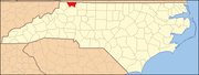 | |
| Townships |
| |
| Unincorporated communities |
| |
| ||
Authority control | |
|---|---|
| General | |
| National libraries | |
| Other |
|
На других языках
[de] Alleghany County (North Carolina)
Alleghany County[1] ist ein County im Bundesstaat North Carolina der Vereinigten Staaten. Der Verwaltungssitz (County Seat) ist Sparta, das nach der gleichnamigen Stadt Sparta in Griechenland benannt wurde.- [en] Alleghany County, North Carolina
[fr] Comté d'Alleghany (Caroline du Nord)
Le Comté d'Alleghany est un comté situé dans l'État de Caroline du Nord aux États-Unis. Sa population en 2010 était de 11 155 habitants et son siège est situé à Sparta.[it] Contea di Alleghany (Carolina del Nord)
La contea di Alleghany, in inglese Alleghany County, è una contea dello Stato della Carolina del Nord, negli Stati Uniti. La popolazione al censimento del 2000 era di 10.677 abitanti. Il capoluogo di contea è Sparta.[ru] Аллегейни (округ, Северная Каролина)
Аллеге́йни (англ. Alleghany County) — округ в штате Северная Каролина, США. По данным переписи 2010 года, численность населения составила 11 155 человек[1]. Окружным центром является город Спарта.Другой контент может иметь иную лицензию. Перед использованием материалов сайта WikiSort.org внимательно изучите правила лицензирования конкретных элементов наполнения сайта.
WikiSort.org - проект по пересортировке и дополнению контента Википедии