world.wikisort.org - USA
Scotland County is a county located in the southern part of the U.S. state of North Carolina. As of the 2020 census, the population was 34,174.[1] Its county seat is Laurinburg.[2]
Scotland County | |
|---|---|
U.S. county | |
| County of Scotland | |
 The historic E. Hervey Evans House, also known as Thomas Walton Manor, located at Laurinburg | |
 Flag  Seal Logo | |
| Motto: "Future Focused" | |
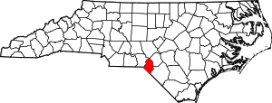 Location within the U.S. state of North Carolina | |
 North Carolina's location within the U.S. | |
| Coordinates: 34°50′N 79°29′W | |
| Country | |
| State | |
| Founded | February 16, 1899 |
| Named for | Scotland |
| Seat | Laurinburg |
| Largest city | Laurinburg |
| Area | |
| • Total | 320 sq mi (800 km2) |
| • Land | 319 sq mi (830 km2) |
| • Water | 1.5 sq mi (4 km2) 0.5% |
| Population (2020) | |
| • Total | 34,174 |
| • Density | 110/sq mi (41/km2) |
| Time zone | UTC−5 (Eastern) |
| • Summer (DST) | UTC−4 (EDT) |
| Congressional district | 9th |
| Website | www |
Scotland County comprises the Laurinburg, NC Micropolitan Statistical Area, which is also included in the Fayetteville-Lumberton-Laurinburg, NC Combined Statistical Area.
The county was founded in 1899 from the southeastern part of Richmond County. The county name documents the strong historic and cultural influence from the early settlers from Scotland.
History
The earliest residents of the land which became Scotland County were Cheraw Native Americans. Scottish Highlanders and some English Quakers began colonizing the area as early as the 1720s when it was within the British Province of North Carolina.[3] The land encompassing Scotland County was originally under the jurisdiction of Bladen County. As North Carolina grew, its original counties were subdivided and the future Scotland portion was placed in the new Anson County.[4] The relevant portion was then moved into the new Richmond County in 1779.[4][5] Richmond County was bisected by the Sandhills, leaving the eastern portion of future Scotland geographically separated from the rest of the county.[6]
More immigrants came after the American Revolutionary War, especially one large group of Highland Scots which came from the Cape Fear River. The group split and settled two areas in the county, Johns and Laurel Hill, the latter in the vicinity of the Laurel Hill Presbyterian Church, established in 1797.[4] Laurel Hill became the first major community in the region, prospering as a post-revolution trading center.[7] More immigrants settled the area at this time, including Germans, Welsh, English, and Ulster Scots. Enslaved Africans were also brought into the area.[4] The Laurel Hill community largely moved south in 1861 after the Wilmington, Charlotte and Rutherford Railroad laid a line through the area.[7] Laurinburg was incorporated in 1877.[8]
By the late 1800s Richmond County had a majority black population and tended to support the Republican Party in elections, while the state of North Carolina was dominated by the Democratic Party. As a result of this, white Democrats built up a political base in Laurinburg and on February 20, 1899, the town and the surrounding area was split off from Richmond into the new Scotland County,[9][10] named in homage to the Scottish settlers.[11] Laurinburg was declared the seat of Scotland County in 1900[12] and the first courthouse was erected the following year.[13] A county road law was passed by the state in 1903, leading the county to construct its first improved roads of sand and clay. Another road law passed six years later led the county to greatly increase its road building program and erect its first concrete bridges.[6] A new courthouse was built in 1964.[13]
Geography

Located within the southeastern portion of the state of North Carolina,[11] Scotland County rests at the border between the Coastal Plain and Piedmont regions.[14] It is bordered by Hoke, Robeson, Richmond, and Moore counties, and the state of South Carolina.[11] According to the U.S. Census Bureau, the county has a total area of 320 square miles (830 km2), of which 319 square miles (830 km2) is land and 1.5 square miles (3.9 km2) (0.5%) is water.[15] It is the smallest North Carolina county by area.[9]
State and local protected areas
- Lumber River State Park (part)
- Sandhills Game Land (part)[16]
Major water bodies
- Gum Swamp Creek
- Joes Creek
- Jorden Creek
- Leith Creek
- Lower Beaverdam Creek
- Lumber River
- McNeil Pond
- Richmond Mill Lake
- Shoe Heel Creek
Major highways

 Future I-74 (Concurrency with US 74)
 US 15
US 15 US 15 Bus.
 US 74[17]
 US 401
- US 401 Bus.
 US 501
 NC 71
NC 71 NC 79
NC 79 NC 144
 NC 381
Major infrastructure
- Laurinburg–Maxton Airport[17] (Also home to the Charlotte Aircraft Corporation)
- Luzon Drop Zone, Military airfield.
- Mackall Army Air Field (MAAF), Military base mostly located in Richmond County.
Demographics
| Historical population | |||
|---|---|---|---|
| Census | Pop. | %± | |
| 1900 | 12,553 | — | |
| 1910 | 15,363 | 22.4% | |
| 1920 | 15,600 | 1.5% | |
| 1930 | 20,174 | 29.3% | |
| 1940 | 23,232 | 15.2% | |
| 1950 | 26,336 | 13.4% | |
| 1960 | 25,183 | −4.4% | |
| 1970 | 26,929 | 6.9% | |
| 1980 | 32,273 | 19.8% | |
| 1990 | 33,754 | 4.6% | |
| 2000 | 35,998 | 6.6% | |
| 2010 | 36,157 | 0.4% | |
| 2020 | 34,174 | −5.5% | |
| 2021 (est.) | 34,227 | [18] | 0.2% |
| U.S. Decennial Census[19] 1790-1960[20] 1900-1990[21] 1990-2000[22] 2010-2013[23] 2020[24] | |||
2020 census
| Race | Num. | Perc. |
|---|---|---|
| White (non-Hispanic) | 14,247 | 41.69% |
| Black or African American (non-Hispanic) | 13,094 | 38.32% |
| Native American | 3,705 | 10.84% |
| Asian | 339 | 0.99% |
| Pacific Islander | 15 | 0.04% |
| Other/Mixed | 1,668 | 4.88% |
| Hispanic or Latino | 1,106 | 3.24% |
As of the 2020 United States census, there were 34,174 people, 12,922 households, and 8,593 families residing in the county.
2000 census
As of the census[26] of 2000, there were 35,998 people, 13,399 households, and 9,674 families residing in the county. The population density was 113 people per square mile (44/km2). There were 14,693 housing units at an average density of 46 per square mile (18/km2). The racial makeup of the county was 51.49% White, 37.32% Black or African American, 8.88% Native American, 0.51% Asian, 0.02% Pacific Islander, 0.46% from other races, and 1.33% from two or more races. 1.18% of the population were Hispanic or Latino of any race.
In 2005 49.4% of Scotland County's population was non-Hispanic whites.
In 2000 there were 13,399 households, out of which 34.40% had children under the age of 18 living with them, 47.10% were married couples living together, 20.40% had a female householder with no husband present, and 27.80% were non-families. 24.40% of all households were made up of individuals, and 8.90% had someone living alone who was 65 years of age or older. The average household size was 2.61 and the average family size was 3.10.
In the county, the population was spread out, with 28.10% under the age of 18, 9.50% from 18 to 24, 27.60% from 25 to 44, 23.40% from 45 to 64, and 11.30% who were 65 years of age or older. The median age was 35 years. For every 100 females there were 88.40 males. For every 100 females age 18 and over, there were 83.00 males.
The median income for a household in the county was $31,010, and the median income for a family was $39,178. Males had a median income of $31,212 versus $23,172 for females. The per capita income for the county was $15,693. About 17.40% of families and 20.60% of the population were below the poverty line, including 29.80% of those under age 18 and 17.20% of those age 65 or over.
Law and government
Scotland County is governed by a county commission. The commission is funded by a 2% share of local sales tax revenue and the local property tax.[9] The county charges the highest property tax rate in the state, 0.99 percent.[27] A third of the county's land is owned by the United States Forestry Service and the United States Armed Forces, from whom no tax revenue is collected.[9]
Scotland County is a member of the Lumber River Council of Governments, a regional planning board representing five counties.[28]
Politics
Scotland County is located entirely in North Carolina's 9th congressional district.[29] It is represented in the 116th United States Congress by Dan Bishop (R). The county has only voted for 3 Republican presidential candidates since 1900: Richard Nixon in 1972, Ronald Reagan in 1984, and Donald Trump in 2020. It was the only county in North Carolina to flip from Democratic to Republican between 2016 and 2020.[citation needed] As of 2022, it is home to about 20,600 registered voters, of whom 10,000 are registered Democrats, 4,200 are registered Republicans and 6,300 are unaffiliated.[29]
| Year | Republican | Democratic | Third party | |||
|---|---|---|---|---|---|---|
| No. | % | No. | % | No. | % | |
| 2020 | 7,473 | 50.58% | 7,186 | 48.64% | 116 | 0.79% |
| 2016 | 6,256 | 44.92% | 7,319 | 52.55% | 353 | 2.53% |
| 2012 | 5,831 | 41.19% | 8,215 | 58.03% | 110 | 0.78% |
| 2008 | 6,005 | 42.24% | 8,151 | 57.33% | 61 | 0.43% |
| 2004 | 5,141 | 44.52% | 6,386 | 55.30% | 20 | 0.17% |
| 2000 | 3,740 | 39.77% | 5,627 | 59.84% | 36 | 0.38% |
| 1996 | 2,858 | 34.44% | 4,870 | 58.68% | 571 | 6.88% |
| 1992 | 2,980 | 31.84% | 5,175 | 55.29% | 1,205 | 12.87% |
| 1988 | 3,199 | 45.16% | 3,865 | 54.56% | 20 | 0.28% |
| 1984 | 4,077 | 50.23% | 4,028 | 49.62% | 12 | 0.15% |
| 1980 | 2,133 | 31.45% | 4,446 | 65.56% | 203 | 2.99% |
| 1976 | 1,932 | 30.26% | 4,430 | 69.39% | 22 | 0.34% |
| 1972 | 3,485 | 63.69% | 1,938 | 35.42% | 49 | 0.90% |
| 1968 | 1,717 | 28.69% | 2,252 | 37.63% | 2,016 | 33.68% |
| 1964 | 1,229 | 24.23% | 3,844 | 75.77% | 0 | 0.00% |
| 1960 | 1,279 | 25.99% | 3,643 | 74.01% | 0 | 0.00% |
| 1956 | 1,171 | 27.79% | 3,042 | 72.21% | 0 | 0.00% |
| 1952 | 1,590 | 35.32% | 2,912 | 64.68% | 0 | 0.00% |
| 1948 | 359 | 12.74% | 1,957 | 69.42% | 503 | 17.84% |
| 1944 | 303 | 11.33% | 2,372 | 88.67% | 0 | 0.00% |
| 1940 | 250 | 7.74% | 2,981 | 92.26% | 0 | 0.00% |
| 1936 | 314 | 8.98% | 3,183 | 91.02% | 0 | 0.00% |
| 1932 | 208 | 7.37% | 2,608 | 92.42% | 6 | 0.21% |
| 1928 | 588 | 25.03% | 1,761 | 74.97% | 0 | 0.00% |
| 1924 | 205 | 12.17% | 1,469 | 87.18% | 11 | 0.65% |
| 1920 | 306 | 15.22% | 1,705 | 84.78% | 0 | 0.00% |
| 1916 | 137 | 12.74% | 938 | 87.26% | 0 | 0.00% |
| 1912 | 9 | 1.08% | 751 | 89.94% | 75 | 8.98% |
Economy
Scotland County's economy is largely based in agriculture. Area farmers mostly grow corn, cotton, tobacco, and soybeans, and raise hogs. Forestry products including lumber and paper are also sourced in the county.[3] Manufacturing firms increased in the county after 1950.[4] The local manufacturing industry produces textiles, cabinet accessories, mobile homes, hospital equipment,[3] and automotive parts.[17] Following a national trend, manufacturing—especially in textiles—has declined since 2000, damaging the economy of the county.[9] In the early 2020s retail grew along the U.S. Route 74 corridor.[17] The North Carolina Department of Commerce classifies Scotland as one of the state's most economically distressed counties.[31]
Tourism
Primary tourism draws include:[32]
- Festivals (Scotland County Highland Games, Storytelling Festival of Carolinas, John Blue Festival)
- Historical sites (John Blue House (Laurinburg, North Carolina), Old Laurel Hill Church)
- Museums and heritage (Scotland County Museum, Indian Museum, Scottish Heritage Center)
- The outdoors (Cypress Bend Vineyards, St. Andrews Equestrian Center, Chalk Banks, Lumber River), and
- The local college: St. Andrews University.
Communities

City
- Laurinburg (county seat and largest city)
Towns
Census-designated places
Other unincorporated communities
- East Laurinburg
- Montclair
Townships
See also
- List of counties in North Carolina
- National Register of Historic Places listings in Scotland County, North Carolina
- North Carolina State Parks
- List of future Interstate Highways
- Sandhills (Carolina), region in south North Carolina.
- Lumbee, State-recognized tribe that mostly lives in Scotland and Robeson County.
References
- "U.S. Census Bureau QuickFacts: Scotland County". U.S. Census Bureau. May 31, 2022. Retrieved May 31, 2022.
{{cite web}}: CS1 maint: url-status (link) - "Find a County". National Association of Counties. Retrieved June 7, 2011.
- Martin, Jonathan. "Scotland County (1899)". North Carolina History Project. John Locke Foundation. Retrieved July 21, 2022.
- Stewart & Stewart 2001, p. 7.
- Martin, Jonathan. "Richmond County (1779)". North Carolina History Project. John Locke Foundation. Retrieved July 21, 2022.
- "Scotland County 1906---1916". The Laurinburg Exchange. Vol. XXXIV, no. 26 (anniversary ed.). June 29, 1916. p. 5.
- Marks 2021, pp. 10–11.
- Marks 2021, p. 10.
- Elder, Renee (August 13, 2021). "Black residents in a small NC town say their community is neglected. What happens now?". Border Belt Independent. Retrieved July 21, 2022.
- Stewart & Stewart 2001, p. 8.
- Powell 1976, p. 443.
- Covington & Ellis 1999, p. 1.
- Myers, Betty P. "History". City of Laurinburg, NC. Retrieved July 27, 2017.
- Mazzocchi, Jay (2006). "Scotland County". NCPedia. North Carolina Government & Heritage Library. Retrieved July 21, 2022.
- "2010 Census Gazetteer Files". United States Census Bureau. August 22, 2012. Archived from the original on January 12, 2015. Retrieved January 19, 2015.
- Center, Richmond Country Tourism Development Authority/ Richmond County Visitor's. "Sandhills Game Land". Richmond Country Tourism Development Authority/ Richmond County Visitor's Center. Retrieved July 18, 2022.
- Nguyen, Britney (June 15, 2021). "Scotland County, halfway between Charlotte and the NC coast, looks to distribution". Border Belt Independent. Retrieved July 21, 2022.
- "U.S. Census Bureau QuickFacts: Scotland County, North Carolina". www.census.gov. Retrieved May 31, 2022.
- "U.S. Decennial Census". United States Census Bureau. Retrieved January 19, 2015.
- "Historical Census Browser". University of Virginia Library. Retrieved January 19, 2015.
- Forstall, Richard L., ed. (March 27, 1995). "Population of Counties by Decennial Census: 1900 to 1990". United States Census Bureau. Retrieved January 19, 2015.
- "Census 2000 PHC-T-4. Ranking Tables for Counties: 1990 and 2000" (PDF). United States Census Bureau. April 2, 2001. Retrieved January 19, 2015.
- "State & County QuickFacts". United States Census Bureau. Retrieved October 30, 2013.
- "U.S. Census Bureau QuickFacts: Scotland County, North Carolina". www.census.gov. Retrieved May 31, 2022.
- "Explore Census Data". data.census.gov. Retrieved December 10, 2021.
- "U.S. Census website". United States Census Bureau. Retrieved January 31, 2008.
- Nagem, Sarah (July 7, 2022). "Scotland County lowers property tax rate, but it's still the highest in North Carolina". Border Belt Independent. Retrieved July 20, 2022.
- "Richardson explains role of LRCOG to Rotary Club". The Laurinburg Exchange. January 28, 2020. Retrieved July 21, 2022.
- Nagem, Sarah (April 20, 2022). "Here are races to watch as Scotland County voters go to the polls for May 17 primary". Border Belt Independent. Retrieved July 21, 2022.
- Leip, David. "Dave Leip's Atlas of U.S. Presidential Elections". uselectionatlas.org. Retrieved March 17, 2018.
- Woltz, Rebecca (July 15, 2021). "New community center will serve Scotland County families in need". Border Belt Independent. Retrieved July 21, 2022.
- "Soul of the Carolinas". Scotland County Tourism Development Authority. Retrieved November 19, 2012.
Bibliography
- Covington, Howard E., Jr; Ellis, Marion A. (1999). Terry Sanford: Politics, Progress, and Outrageous Ambitions. Durham: Duke University Press. ISBN 9780822323563.
- Marks, Stuart A. (2021). Southern Hunting in Black and White: Nature, History, and Ritual in a Carolina Community. Princeton University Press. ISBN 9780691226866.
- Powell, William S. (1976). The North Carolina Gazetteer: A Dictionary of Tar Heel Places. Chapel Hill: The University of North Carolina Press. ISBN 9780807812471.
- Stewart, John Douglas; Stewart, Sara (2001). Scotland County. Arcadia Publishing. ISBN 9780738513584.
External links
Places adjacent to Scotland County, North Carolina | ||||||||||||||||
|---|---|---|---|---|---|---|---|---|---|---|---|---|---|---|---|---|
| ||||||||||||||||
Municipalities and communities of Scotland County, North Carolina, United States | ||
|---|---|---|
County seat: Laurinburg | ||
| City |  | |
| Towns | ||
| CDPs | ||
| Other community |
| |
| Footnotes | ‡This populated place also has portions in an adjacent county or counties | |
| ||
Authority control | |
|---|---|
| General | |
| National libraries | |
| Other | |
На других языках
[de] Scotland County (North Carolina)
Scotland County[1] ist ein County im Bundesstaat North Carolina der Vereinigten Staaten. Der Verwaltungssitz (County Seat) ist Laurinburg, das nach der Familie McLaurin benannt wurde, frühen Siedlern in diesem Gebiet.- [en] Scotland County, North Carolina
[ru] Скотленд (округ, Северная Каролина)
Округ Скотленд (англ. Scotland County) располагается в штате Северная Каролина, США. Официально образован в 1899 году. По состоянию на 2010 год, численность населения составляла 36 157 человек.Другой контент может иметь иную лицензию. Перед использованием материалов сайта WikiSort.org внимательно изучите правила лицензирования конкретных элементов наполнения сайта.
WikiSort.org - проект по пересортировке и дополнению контента Википедии