world.wikisort.org - USA
Robeson County is a county in the southern part of the U.S. state of North Carolina. As of the 2020 census, the population was 116,530.[2] Its county seat is Lumberton.[3] The county was formed in 1787 from part of Bladen County. It was named in honor of Col. Thomas Robeson of Tar Heel, a hero of the Revolutionary War.[4]
Robeson County | |
|---|---|
U.S. county | |
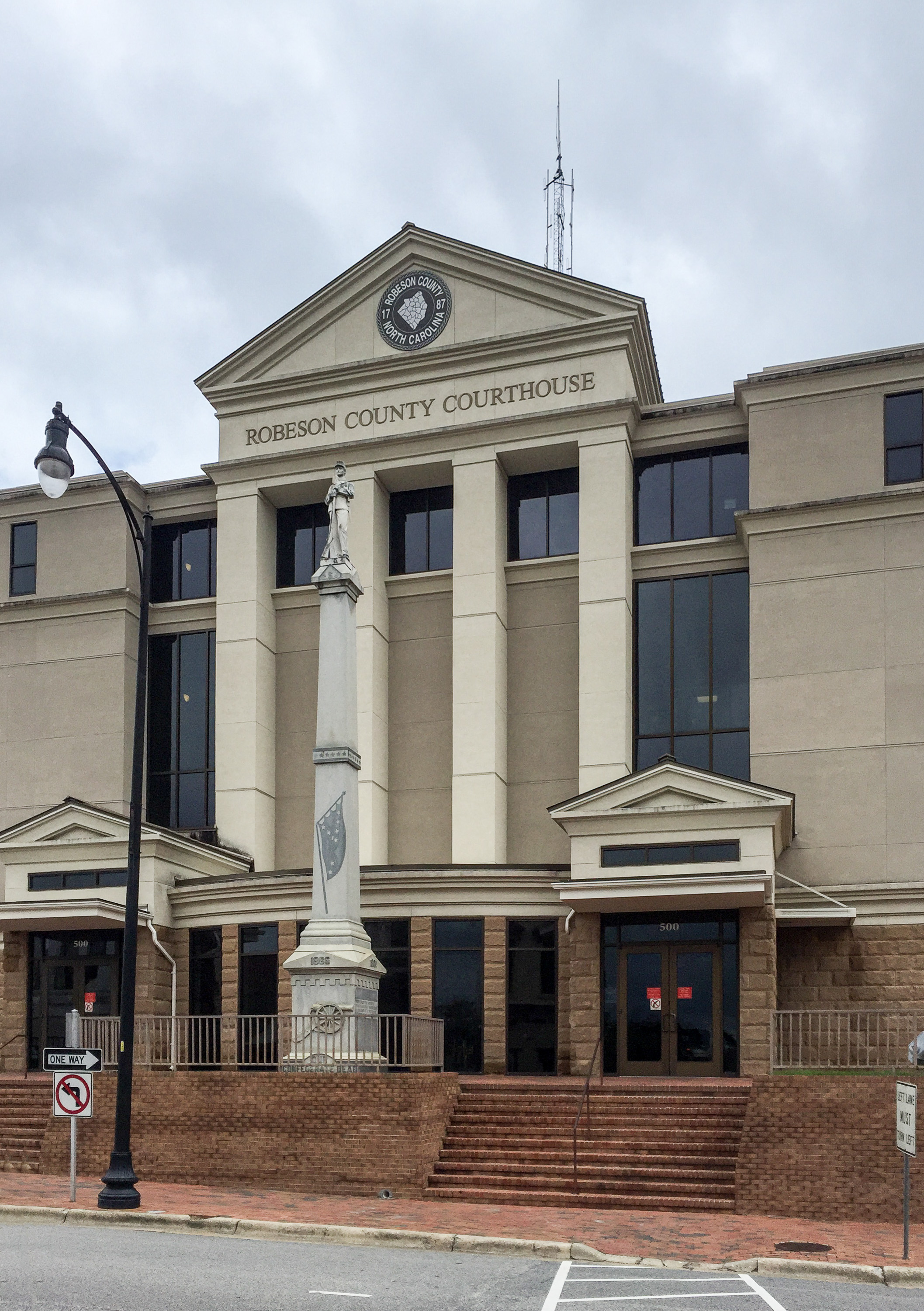 Robeson County Courthouse in Lumberton | |
 Flag  Seal Logo | |
| Motto(s): "We invite you to explore our beautiful county and experience true southern hospitality!" | |
 Location within the U.S. state of North Carolina | |
 North Carolina's location within the U.S. | |
| Coordinates: 34°38′N 79°07′W | |
| Country | |
| State | |
| Founded | 1787 |
| Named for | Colonel Thomas Robeson[1] |
| Seat | Lumberton |
| Largest city | Lumberton |
| Area | |
| • Total | 951 sq mi (2,460 km2) |
| • Land | 949 sq mi (2,460 km2) |
| • Water | 1.8 sq mi (5 km2) 0.2% |
| Population | |
| • Estimate (2021) | 116,328 |
| • Density | 122.6/sq mi (47.3/km2) |
| Time zone | UTC−5 (Eastern) |
| • Summer (DST) | UTC−4 (EDT) |
| Congressional district | 7th |
| Website | www |
Robeson County comprises the Lumberton, NC Micropolitan Statistical Area, which is included in the Fayetteville–Lumberton–Laurinburg, NC Combined Statistical Area.[5]
Since 2008, Robeson County has been identified as among the 10% of United States counties that are majority-minority;[6] its combined population of American Indian, African American and Hispanic residents constitute more than 68 percent of the total. Members of the state-recognized Lumbee Tribe of North Carolina, make up most of the 38 percent of the population who identify as Native American.[7]
The University of North Carolina at Pembroke is located in the county. It developed from a normal school established here in the late 19th century for the training of teachers of students classified as Indian, from mixed-race families who had been free before the Civil War. In the late 1880s, local state legislator Hamilton McMillan gained state authorization for separate schools for this population, which he theorized were descended from Croatan Indians.[8] The public system was otherwise racially segregated into blacks (mostly freedmen's children) and whites.
History


Early history
Archaeological excavation performed in Robeson County reveals widespread, continuous occupation of the region by various cultures of indigenous peoples since the end of the last ice age. They had camps and settlements near the Lumber River for its water, transportation, fish and related wildlife resources. Local excavations reveal that Native American peoples made stone tools, using materials brought to present-day Robeson County from the Carolina Piedmont. The large amounts of ancient pottery found at some Robeson County sites have been dated to the early Archaic Woodland period. Materials show that local settlements were part of an extensive Native American trade network with other regions. Portions of the river basin show that Robeson County was a "zone of cultural interactions."[9]
Swamps, streams, and artesian wells provided an excellent supply of water for Native peoples. Fish were plentiful, and the region's lush vegetation included numerous food crops. "Carolina bays" continue to dot the landscape. Numerous 10,000-year-old Clovis points found along their banks indicate indigenous peoples used these depressions as campsites.
Colonial era
Early written sources specific to the territory of Robeson County region are few for the post-contact period of European colonization until the later 18th century and after.
Governor Arthur Dobbs related a report from his agent, Col. Rutherford, head of a Bladen County militia, that a "mixed crew" of 50 families were living along Drowning Creek. They were referred to as "mullatos," generally meaning people of African and European descent.[10]
The anthropologist John R. Swanton of the Smithsonian Institution tried to identify the origin of the ethnic group known as Lumbee Indians since the late 19th century. Swanton posited that the multi-racial people were the descendants of Siouan-speaking peoples, of which the most prominent in the area were the Cheraw and Keyauwee.[11]
After the American Revolution, the newly established state used a lottery to dispose of lots for developing Lumberton. The town was incorporated in 1788, and John Willis proposed the name "Lumberton", after the important lumber and naval stores industry. This dominated the otherwise agricultural economy of Robeson County throughout the nineteenth century[12]
Lumberton was developed at a section known throughout that century as "Drowning Creek," a term still used for the headwater portions of the river. The first Robeson County courthouse was erected on land of the Red Bluff Plantation, donated for that purpose by Lumberton founder John Willis. Robeson County's post office was established in 1794. In 1809, the state legislature renamed Drowning Creek as the Lumber River, after the area's major industry.[13]
In the 1790–1810 censuses, descendants of these families were classified as both white (European American) and free people of color, a classification which included people of African-European, Native American, and tri-racial ancestry. These settlers were subsistence farmers and held few slaves.
In the nineteenth century, mixed-race people sometimes identified as Indian, Portuguese or Arab, to account for physical differences from northern Europeans and to escape the racial segregation associated with descendants of Africans. Some may have descended from Atlantic Creoles, men of mixed African-Portuguese ancestry identified by the historian Ira Berlin as part of the "charter generation" of slaves. Some likely intermarried with remnants of Indian tribes who remained in the area. Names on early land deeds and other historic documents in Robeson County correspond to many of the families of free people of color, including ancestors of contemporary Lumbee.[14] Settlements included Prospect and Red Banks.
19th century
By 1835, in the wake of Nat Turner's Slave Rebellion of 1831, North Carolina like other southern states reduced the rights of free people of color. Out of fear of slave rebellion aided by free blacks, the legislature withdrew the rights of free people of color to vote, serve on juries, own and use firearms, and learn to read and write.
During the 1830s, the federal government forced Indian Removal, relocating the Cherokee and others of the Five Civilized Tribes of the Deep South and lower Southeast to Indian Territory west of the Mississippi River. Native Americans who stayed in the Southeast tended to live in frontier and marginal areas to avoid white supervision.[15]
In 1848 a new county courthouse was constructed to replace the original building.[16]
By the beginning of the American Civil War, many remnant Native Americans in the Upper South struggled to survive and their status continued to decline. From 1790, Native Americans in the southern states were enumerated as "free persons of color" on the local and federal census, included with free African Americans.
North Carolina seceded from the Union in 1861. A major yellow fever epidemic in 1862 killed 10 percent of the Cape Fear region's population.[17] Most white men of military age had either enlisted with the Confederacy or left the region. The Confederate Army conscripted African-American slaves as workers to build a system of forts to defend Fort Fisher, near Wilmington. Some free people of color from as far away as Robeson County (80–90 miles) were also impressed as laborers.
Robeson County's home guard included county magistrates, clergymen, and lawyers, who mainly represented the interests of the planter class. During the war, large slaveholders were exempted from participation in the army. The Confederate Home Guard raided local farmers, taking food supplies and livestock for the Confederate Army and their own use. When they raided the farmstead of Allen Lowrie, they killed Lowrie and his son William.[18]
His surviving son Henry Berry Lowrie, a mixed-race man of Amerindian and White heritage, swore revenge and led an insurgency against the upper class, raiding homesteads and driving off livestock.
Late in the Civil War, General William Tecumseh Sherman and his army began to push their way toward Robeson County as they headed north. After hearing of the Union Army's burning of Columbia, South Carolina on February 17, 1865, residents of Robeson County worried about the troops' advance. Washington Sandford Chaffin, a Methodist minister in Lumberton speculated in his diary about how the county might be treated by Sherman and his Yankees. Chaffin noted that Henry Berry Lowry and his gang were "doing much mischief in this country." Lowry's gang had "torn up and destroyed" Confederate white homesteads.[19] In the late stages of the war, such gangs and insurgents carried out private feuds.
During the next seven years, Henry Lowry led a group of free people of color, poor whites and blacks in one of many postwar insurgent movements during years of social disruption. He campaigned against the white elite. His activities made him a folk hero to many of the poorer folk.[20]
In a county with a high proportion of people of color, both Native Americans and African Americans were oppressed by the Jim Crow system established in the state after white conservative Democrats regained power following the Reconstruction era. The state legislature passed laws to raise barriers to voter registration and disenfranchise minorities. In 1900 the Democrats adopted a constitutional suffrage amendment which lengthened the residence period required before registration (which worked against sharecroppers and tenant farmers), and enacted both an educational qualification (to be assessed by a registrar, who were white and applied it subjectively) and prepayment of a poll tax (difficult for poor people to raise who did not use much cash). A grandfather clause exempted from the poll tax those entitled to vote on January 1, 1867.[21] The effect in North Carolina was the complete elimination of black and mixed-race voters from voter rolls by 1904. Contemporary accounts estimated that 75,000 black male citizens across the state lost the vote.[22]
20th century
Racial segregation continued through the 20th century, affecting the criminal justice system and the administration of federal aid programs in the state and county. Racial discrimination has been documented in farm and other aid programs.[23][24] The county's first cotton mill opened in 1900.[25] In 1909 the county's third courthouse was constructed. It remained in use until 1969.[16] Bouts of typhoid, hookworm, smallpox, and a high infant mortality rate led Robeson's government to organize the first county-level public health department in the United States in 1912.[26]
During the Great Depression of the 1930s, local farmers in 1938 formed a mutual-aid cooperative, known as the Red Banks Mutual Association. They made a 99-year lease on a large plot of land, which they farmed together through the association until 1968. Historian Ryan K. Anderson explored this association for its contributions not only to members' survival during the Depression, but its influence in building stability and networks within the community.[27]
As in other southern states, local Ku Klux Klan chapters persisted in North Carolina into the late 20th century. In early 1958 they called for a gathering in Maxton, intended to intimidate the Lumbee and other people of color. On January 18, 1958, armed Lumbee responded by gathering many more men and they chased off an estimated 50 Klansmen and supporters led by grand wizard James W. "Catfish" Cole in what became known as the Battle of Hayes Pond, after the site of the action.[28]
Pembroke State College racially integrated in the 1950s and 1960s.[29] After 1965, the rate of black and Native American voter registration substantially increased. By 1968, black and Native voters outnumbered whites.[30] In 1970 the federal government ordered the county school board to integrate its institutions. The board responded by dissolving special Native American districts and consolidating Native students with black and white schools. This did not affect most white students in the county, who were largely served by independent municipal school districts.[31] Feeling a loss of control over their traditional schools, many Lumbees and Tuscaroras protested integration and resisted the assignment of black staff and white and black students to their institutions.[32] In early 1973, dozens of buildings in the county, most of them owned by whites, were set ablaze. In March, Old Main, a historic building on Pembroke State's campus which had symbolic importance to the Native American community, was burned.[33] In 1974, a federal court ruled that the "double voting" system used by the county school board, whereby both county residents and municipal residents could vote for board members—despite the latter not being served by the county school system, was unconstitutional.[34]
Robeson County became one of the top moonshine-producing counties in North Carolina in the 20th century. The prevalence of poverty enticed many Robesonians to sell moonshine to supplement their incomes, and the large number of isolated swamps and woods offered many places where stills could be concealed.[35] Many Lumbees and Tuscaroras produced moonshine into the 1970s.[36] The trade of marijuana eventually supplanted moonshine before being overtaken by cocaine trafficking in the 1980s, which was enabled by the county's midway location between Miami and New York City along Interstate 95.[37][38] The drug trade was fueled by worsening economic prospects in the region which began with the 1970s energy crisis and increased living costs. By the mid-1980s, local agriculture was in decline and manufacturing jobs were not providing sufficient employment and stability to residents. Over a quarter of county residents lived below the poverty threshold, over half of most adults over the age of 25 lacked a high school diploma, and the local unemployment rate was higher than the state average.[39]
Native Americans and blacks suffered disproportionately from the lack of prosperity, and many Native Americans partook in the drug trade.[40] Narcotics-related activities led to murders and stoked social unrest, political tensions, and police corruption.[37] Robeson's homicide rate grew to four times worse than the national average[41] and the county had the highest numbers of drug-related arrests in the state in 1985 and 1986.[42] In February 1988, two Tuscarora held the staff of the county newspaper, The Robesonian, hostage to protest local corruption.[43] The county's reputation among North Carolinians suffered as a result of these events.[44] Political action motivated by discontent led to an increasing number of blacks and Native Americans to run for office.[45]
21st century
In 2002, the North Carolina State Bureau of Investigation open an inquiry into corruption allegations in the Robeson County Sheriff's Office. Their subsequent Operation Tarnished Badge became the largest police corruption investigation in state history, and led to 22 officers, including Sheriff Glenn Maynor, being convicted for various crimes.[46]
In the 2020 Presidential Election, Donald Trump held a rally in Robeson County to shore up support among Native Americans.[47]
Geography

According to the U.S. Census Bureau, the county has a total area of 951 square miles (2,460 km2), of which 949 square miles (2,460 km2) is land and 1.8 square miles (4.7 km2) (0.2%) is water.[48] It is the largest county in North Carolina by area.[49]
Robeson County is bordered by the state of South Carolina, and the North Carolina counties of Bladen, Columbus, Cumberland, Hoke, and Scotland.[50]
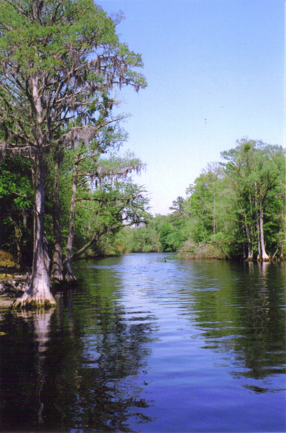
The topography is mostly level to undulating coastal plain, largely made up of sandhills and coastal dunes with elevations above mean sea level that vary from 60 feet in the extreme southeastern portion of the county to 250 feet in the north, to the west of Parkton. Moreover, numerous swamps that generally flow in a northwest to southeast course, characterize the area and eventually drain into the Lumber River. The highest density of swamps is in that part of the county that is most populated by the Lumbee Tribe of North Carolina, a state recognized tribe.[51]
State and local protected areas
- Lumber River State Park (part)
- Warwick Mill Bay State Natural Area
Major water bodies
- Big Swamp[52]
- Lumber River
Major highways

 I-74 / Future I-74 (Small section of Interstate officially designated from Exit -213 to Exit 194)
 I-95
I-95 I-295 (Small section in the north of the county)
 US 74
US 74 US 74 Alt.
 US 74 Bus.
 US 301
 US 501
 NC 20
NC 20 NC 41
NC 41 NC 71
NC 71 NC 72
NC 72 NC 83
NC 83 NC 130
- NC 130 Bus.
 NC 211
 NC 710
 NC 711
 NC 904
Major infrastructure
- Lumberton Regional Airport[53]
Demographics
| Historical population | |||
|---|---|---|---|
| Census | Pop. | %± | |
| 1790 | 5,343 | — | |
| 1800 | 6,839 | 28.0% | |
| 1810 | 7,528 | 10.1% | |
| 1820 | 8,204 | 9.0% | |
| 1830 | 9,433 | 15.0% | |
| 1840 | 10,370 | 9.9% | |
| 1850 | 12,826 | 23.7% | |
| 1860 | 15,489 | 20.8% | |
| 1870 | 16,262 | 5.0% | |
| 1880 | 23,880 | 46.8% | |
| 1890 | 31,483 | 31.8% | |
| 1900 | 40,371 | 28.2% | |
| 1910 | 51,945 | 28.7% | |
| 1920 | 54,674 | 5.3% | |
| 1930 | 66,512 | 21.7% | |
| 1940 | 76,860 | 15.6% | |
| 1950 | 87,769 | 14.2% | |
| 1960 | 89,102 | 1.5% | |
| 1970 | 84,842 | −4.8% | |
| 1980 | 101,610 | 19.8% | |
| 1990 | 105,179 | 3.5% | |
| 2000 | 123,339 | 17.3% | |
| 2010 | 134,168 | 8.8% | |
| 2020 | 116,530 | −13.1% | |
| 2021 (est.) | 116,328 | [54] | −0.2% |
| U.S. Decennial Census[55] 1790–1960[56] 1900–1990[57] 1990–2000[58] 2010–2019[59] 2020[60] | |||
2020 census
| Race | Num. | Perc. |
|---|---|---|
| White (non-Hispanic) | 29,159 | 25.02% |
| Black or African American (non-Hispanic) | 26,218 | 22.5% |
| Native American | 43,536 | 37.36% |
| Asian | 897 | 0.77% |
| Pacific Islander | 63 | 0.05% |
| Other/Mixed | 4,900 | 4.2% |
| Hispanic or Latino | 11,757 | 10.09% |

Native American 30–40%40–50%50–60%60–70%70–80%80–90%Black or African American30–40%40–50%50–60%70–80%Non-Hispanic White 20–30%30–40%40–50%50–60%Hispanic or Latino30–40%
As of the 2020 United States census, there were 116,530 people, 46,272 households, and 30,034 families residing in the county.
2010 census
As of the census[62] of 2010, there were 134,168 people. In 2000 there were 43,677 households, and 32,015 families residing in the county. The population density was 130 people per square mile (50/km2). There were 47,779 housing units at an average density of 50 per square mile (19/km2).
2000 census
As of 2000, the racial makeup of the county was:
- 38.02% American Indian
- 32.80% White
- 25.11% Black or African-American
- 4.86% Hispanic or Latino of any race
- 0.33% Asian
- 0.06% Pacific Islander
- 2.26% from other races
- 1.41% from two or more races
In 2005 38.5% of the population identified as Native American, likely mostly associated with the state-recognized Lumbee Tribe of North Carolina, which is prominent in the county. Some 29.1% of the county population was non-Hispanic whites. 24.3% of the population identified as African American. 7.4% of the population identified as Latino.

Native Americans
The Lumbees of North Carolina, a state-recognized tribe, constitutes more than one-half the state of North Carolina's indigenous population of 101,000. With a population of 58,443 (reflecting a 34.5% increase from the 1980 population of 43,465 members), the Lumbee reside primarily in Robeson, Hoke, Cumberland, and Scotland counties. In Robeson County, people identifying as Native Americans number 46,869 out of a total county population of 123,339. Most identify as Lumbee. The Lumbees make up 38.02%, comprising the largest ethnic group in the county. The Lumbees are the amalgamation of various Siouan, Algonquian, and Iroquoian speaking tribes.
The Lumbee comprise the largest non-federally recognized tribe east of the Mississippi River, and the ninth largest non-federally recognized tribe in the United States. Several majority-Lumbee communities are located within Robeson County.[63]
Law and government
A county commission, with members elected from single-member districts, forms the government of the county.
Robeson County is a member of the Lumber River Council of Governments, a regional planning board representing five counties.[64]
Robeson County is located in North Carolina's 7th congressional district. As of 2022, it hosts about 70,400 registered voters, comprising about 36,500 registered Democrats, 12,300 registered Republicans and 21,300 unaffiliated.[65]
Politics
Robeson County has historically been one of the most Democratic counties in North Carolina; with the exception of Richard Nixon's 1972 landslide, no Republican presidential candidate won the county in the 20th century. However, Donald Trump won the county in 2016 with 50.8% of the vote, helped by the Lumbee tribe trending towards him.[66] In 2020, Trump's support only expanded in this county and most other ancestrally Democratic Trump-swinging counties, with his vote share increasing to 59.01% to Democrat Joe Biden's 40.37%. As such, Biden became the first Democrat to ever win the presidency without carrying Robeson County.
| Year | Republican | Democratic | Third party | |||
|---|---|---|---|---|---|---|
| No. | % | No. | % | No. | % | |
| 2020 | 27,806 | 59.01% | 19,020 | 40.37% | 292 | 0.62% |
| 2016 | 20,762 | 50.82% | 19,016 | 46.54% | 1,080 | 2.64% |
| 2012 | 17,510 | 40.77% | 24,988 | 58.18% | 448 | 1.04% |
| 2008 | 17,433 | 42.69% | 23,058 | 56.47% | 343 | 0.84% |
| 2004 | 15,909 | 46.97% | 17,868 | 52.75% | 94 | 0.28% |
| 2000 | 11,721 | 39.40% | 17,834 | 59.95% | 192 | 0.65% |
| 1996 | 8,146 | 29.44% | 17,361 | 62.74% | 2,164 | 7.82% |
| 1992 | 7,777 | 25.52% | 19,378 | 63.59% | 3,319 | 10.89% |
| 1988 | 9,908 | 36.70% | 16,988 | 62.92% | 104 | 0.39% |
| 1984 | 12,947 | 45.76% | 15,257 | 53.93% | 87 | 0.31% |
| 1980 | 6,982 | 27.89% | 17,618 | 70.39% | 430 | 1.72% |
| 1976 | 4,907 | 19.09% | 20,695 | 80.53% | 97 | 0.38% |
| 1972 | 11,362 | 59.99% | 7,391 | 39.02% | 188 | 0.99% |
| 1968 | 4,526 | 23.55% | 8,248 | 42.92% | 6,441 | 33.52% |
| 1964 | 3,591 | 20.65% | 13,796 | 79.35% | 0 | 0.00% |
| 1960 | 3,580 | 23.55% | 11,623 | 76.45% | 0 | 0.00% |
| 1956 | 2,785 | 20.94% | 10,516 | 79.06% | 0 | 0.00% |
| 1952 | 4,127 | 30.71% | 9,311 | 69.29% | 0 | 0.00% |
| 1948 | 1,036 | 11.34% | 7,056 | 77.26% | 1,041 | 11.40% |
| 1944 | 1,118 | 13.32% | 7,278 | 86.68% | 0 | 0.00% |
| 1940 | 931 | 9.14% | 9,251 | 90.86% | 0 | 0.00% |
| 1936 | 732 | 6.65% | 10,280 | 93.35% | 0 | 0.00% |
| 1932 | 783 | 9.01% | 7,860 | 90.48% | 44 | 0.51% |
| 1928 | 2,767 | 36.91% | 4,730 | 63.09% | 0 | 0.00% |
| 1924 | 314 | 7.15% | 4,064 | 92.53% | 14 | 0.32% |
| 1920 | 2,220 | 26.42% | 6,183 | 73.58% | 0 | 0.00% |
| 1916 | 1,453 | 33.43% | 2,894 | 66.57% | 0 | 0.00% |
| 1912 | 154 | 4.38% | 2,706 | 76.88% | 660 | 18.75% |
| 1908 | 1,300 | 32.52% | 2,698 | 67.48% | 0 | 0.00% |
| 1904 | 982 | 30.10% | 2,274 | 69.71% | 6 | 0.18% |
| 1900 | 1,144 | 25.86% | 3,280 | 74.14% | 0 | 0.00% |
| 1896 | 2,429 | 41.25% | 3,457 | 58.70% | 3 | 0.05% |
| 1892 | 1,117 | 26.15% | 2,312 | 54.13% | 842 | 19.71% |
| 1888 | 1,970 | 40.29% | 2,879 | 58.88% | 41 | 0.84% |
| 1884 | 2,278 | 47.65% | 2,503 | 52.35% | 0 | 0.00% |
| 1880 | 1,960 | 46.72% | 2,235 | 53.28% | 0 | 0.00% |
Education
The Public Schools of Robeson County operates public schools in the area. The county's per-pupil spending rate is lowest of all of North Carolina's County's, and county students suffer from lower test scores and subject proficiency rates than the state averages.[69]
Communities

City
- Lumberton (county seat and largest city)
Towns
Townships
Robeson County townships include:[70]
- Alfordsville
- Back Swamp
- Barnesville
- Britts
- Burnt Swamp
- East Howellsville
- Gaddy
- Parkton
- Philadelphus
- Raft Swamp
- Rennert
- Saddletree
- Shannon
- Smiths
- Smyrna
- Sterlings
- Thompson
- Tolarsville
- Union
- West Howellsville
- Whitehouse
- Wishart
Census-designated places

Unincorporated communities
- Bloomingdale
- Five Forks
- Red Banks
- Moss Neck
- Pates
Notable people
People born in Robeson County:
- James McNair Baker (1821-1892), politician
- Benjamin B. Chavis, educator
- Frank Galbreath (1912-1971), jazz trumpeter
- Michael K. Garrett (born c.1985), politician
- James Johnson (1811-1891), politician
- Benjamin Lee (1774-1828), militia general
- Henry Berry Lowrie (1845-c.1872), outlaw who disappeared
- Rhoda Strong Lowry (1849-1909), wife of Henry
- Jana Mashonee (born 1982), musician
- James McCallum (1806–1889), representative
- Angus Wilton McLean (1870-1935), Governor of North Carolina from 1924–1928
- Roger McLean (born 1949), politician
- Lawrence McNeill (1849-1915), businessman
- John McQueen (1804-1867), lawyer
- Margaret Marley Modlin (1927-1998), surrealist painter
- Thomas Avery Nye Jr. (born 1940), politician
- Henry Ward Oxendine (1940-2020), politician
- Gilbert B. Patterson (1863-1922), politician
- G.L. Pridgen (born c.1944), republican
- McNeill Smith (1918-2011), politician
- Robert K. W. Stewart (born 1963), mass murderer
- A.B. Swindell (born 1945), democrat
- Francis M. Wishart (1837-1872), military officer
- Ruth Dial Woods (born 1938), educator
See also
- List of counties in North Carolina
- National Register of Historic Places listings in Robeson County, North Carolina
- The Lowry War
- Robeson Planetarium
- North Carolina State Parks
- Hurricane Matthew, major hurricane that lead to the flooding of the Lumber River.
References
- "Region of Responsibility, Robeson" (PDF). www.files.nc.gov. Retrieved June 13, 2022.
- "U.S. Census Bureau QuickFacts: Robeson County, North Carolina". www.census.gov. Retrieved April 27, 2022.
- "Find a County". National Association of Counties. Retrieved June 7, 2011.
- "Region of Responsibility" (PDF). NC.gov. May 25, 2022. Retrieved May 25, 2022.
- "Fayetteville - Sanford - Lumberton (Combined Statistical Area, Combined Metropolitan Areas (Tibet), USA) - Population Statistics, Charts, Map and Location". www.citypopulation.de. Retrieved May 25, 2022.
- Kelvin Pollard and Mark Mather, "10% of U.S. Counties Now 'Majority-Minority'", 2008
- "Statistics on Robeson County, North Carolina | The Lumbee Indians". lumbee.library.appstate.edu. Retrieved May 25, 2022.
- "University of North Carolina at Pembroke | NCpedia". www.ncpedia.org. Retrieved May 25, 2022.
- "History and Culture Backup". lumbee-tribe-of-nc. Retrieved May 25, 2022.
- Colonial Records: North Carolina 1890; 768 and North Carolina 1887; 161, respectively
- John R. Swanton, The Indian Tribes of North America, Smithsonian Institution, Bureau of American Ethnology Bulletin, No. 145. Washington: GPO, 1952
- "History | Lumberton, NC". www.ci.lumberton.nc.us. Retrieved May 25, 2022.
- "History | NC State Parks". www.ncparks.gov. Retrieved May 25, 2022.
- Paul Heinegg, Free African Americans in Virginia, North Carolina, South Carolina, Maryland and Delaware, 2005
- "May 28, 1830 CE: Indian Removal Act | National Geographic Society". education.nationalgeographic.org. Retrieved May 25, 2022.
- Tyner 2003, p. 68.
- Townsend, Bob. "Yellow fever caused panic in Wilmington 150 years ago". wect.com. Retrieved May 25, 2022.
- "March 1865: Executions Spark the Lowry War – NC Miscellany". Retrieved May 25, 2022.
- "Forgotten Triumph: Union Victories at the Battle of Chaffin's Farm | Black Virginians in Blue". community.village.virginia.edu. Retrieved May 25, 2022.
- Evans, William McKee (1996). To Die Game: The Story of the Lowry Band, Indian Guerrillas of Reconstructioin. Syracuse University Press. ISBN 0815603592.
- Richard H. Pildes, ‘Democracy, Anti-Democracy, and the Canon’, Constitutional Commentary, Vol. 17, 2000
- Albert Shaw, The American Monthly Review of Reviews, Vol.XXII, Jul–Dec 1900, p.274
- "Triracial Segregation in Robeson County". www.ncpedia.org. Retrieved May 25, 2022.
- robesonian (July 24, 2015). "Brown v. Topeka Board: Desegregation in Robeson". Robesonian. Retrieved November 7, 2022.
- Tyner 2003, p. 27.
- Tyner 2003, p. 69.
- Ryan K. Anderson, "Lumbee Kinship, Community, and the Success of the Red Banks Mutual Association", American Indian Quarterly Vol. 23, No. 2 (Spring, 1999), pp. 39–58; Published by: University of Nebraska Press, DOI: 10.2307/1185966; available via JSTOR. Retrieved May 8, 2017
- Peng, Ilena, "The Day the Native Americans Drove the KKK Out of Town", Narratively, October 14, 2019.
- Lowery 2018, p. 156.
- Lowery 2018, p. 149.
- Lowery 2018, p. 146.
- Lowery 2018, pp. 147–148.
- Lowery 2018, pp. 158–159.
- Lowery 2018, p. 158.
- Pierce 2019, pp. 59–60.
- Pierce 2019, p. 60.
- Pierce 2019, p. 249.
- Lowery 2018, p. 168.
- Lowery 2018, pp. 166–168.
- Lowery 2018, pp. 168–169.
- Lowery 2018, p. 169.
- Lowery 2018, p. 172.
- Lowery 2018, pp. 187–188.
- Haladay & Hicks 2017, pp. 20–21.
- Lowery 2018, p. 198.
- Rockett, Ali (June 10, 2013). "Operation Tarnished Badge: Years later, tarnish remains". The Fayetteville Observer. Archived from the original on September 14, 2019. Retrieved October 5, 2021.
- "Trump Fights to Keep North Carolina Red", New York Times, Nov. 5, 2020 Trump Fights to Keep North Carolina Red
- "2010 Census Gazetteer Files". United States Census Bureau. August 22, 2012. Archived from the original on January 12, 2015. Retrieved January 19, 2015.
- Tyner 2003, p. 7.
- Powell 1976, p. 419.
- "Who Are The Lumbee?". October 7, 2013. Archived from the original on October 7, 2013. Retrieved September 17, 2021.
- "Big Swamp (in Robeson County, NC)". northcarolina.hometownlocator.com. Retrieved August 4, 2022.
- "Airport | Lumberton, NC". www.ci.lumberton.nc.us. Retrieved July 27, 2022.
- "U.S. Census Bureau QuickFacts: Robeson County, North Carolina". www.census.gov. Retrieved May 31, 2022.
- "U.S. Decennial Census". United States Census Bureau. Retrieved January 19, 2015.
- "Historical Census Browser". University of Virginia Library. Retrieved January 19, 2015.
- Forstall, Richard L., ed. (March 27, 1995). "Population of Counties by Decennial Census: 1900 to 1990". United States Census Bureau. Retrieved January 19, 2015.
- "Census 2000 PHC-T-4. Ranking Tables for Counties: 1990 and 2000" (PDF). United States Census Bureau. April 2, 2001. Retrieved January 19, 2015.
- "State & County QuickFacts". United States Census Bureau. Archived from the original on August 11, 2011. Retrieved October 29, 2013.
- "U.S. Census Bureau QuickFacts: Robeson County, North Carolina". www.census.gov. Retrieved May 31, 2022.
- "Explore Census Data". data.census.gov. Retrieved December 10, 2021.
- "U.S. Census website". United States Census Bureau. Retrieved January 31, 2008.
- "Lumbee Indians - Part 1: Introduction | NCpedia". www.ncpedia.org. Retrieved May 25, 2022.
- "Richardson explains role of LRCOG to Rotary Club". The Laurinburg Exchange. January 28, 2020. Retrieved July 21, 2022.
- Nagem, Sarah (April 20, 2022). "Robeson County voters will go to the polls May 17. Here are some primary races to watch". Border Belt Independent. Retrieved July 21, 2022.
- Mosley, Tonya; Raphelson, Samantha (September 15, 2020). "Lumbee Tribe Emerges As Pivotal Swing Vote In North Carolina". wbur. Retrieved October 15, 2020.
- Leip, David. "Dave Leip's Atlas of U.S. Presidential Elections". uselectionatlas.org. Retrieved March 17, 2018.
- http://geoelections.free.fr/. Retrieved January 13, 2021.
{{cite web}}: Missing or empty|title=(help) - Haladay & Hicks 2017, p. 23.
- Powell 1976, p. 428.
Works cited
- Haladay, Jane; Hicks, Scott, eds. (2017). Narratives of Educating for Sustainability in Unsustainable Environments. East Lansing: Michigan State University Press. ISBN 9781611862645.
- Lowery, Malinda Maynor (2018). The Lumbee Indians: An American Struggle. Chapel Hill: UNC Press Books. ISBN 9781469646381.
- Pierce, Daniel S. (2019). Tar Heel Lightnin': How Secret Stills and Fast Cars Made North Carolina the Moonshine Capital of the World. Chapel Hill: The University of North Carolina Press. ISBN 9781469653563.
- Powell, William S. (1976). The North Carolina Gazetteer: A Dictionary of Tar Heel Places. Chapel Hill: The University of North Carolina Press. ISBN 9780807812471.
- Tyner, K. Blake (2003). Robeson County. Arcadia Publishing. ISBN 9780738515236.
Other sources
- Chaffin, Washington Sandford. "February 25 – March 1, 1865", in Diary. Durham, North Carolina: Duke University Archives.
- Evans, William McKee. To Die Game: The Story of the Lowry Band: Indian Guerillas of Reconstruction. Baton Rouge: Louisiana State University Press, 1971.
- Glatthaar, Joseph T. The March to the Sea and Beyond: Sherman's Troops in the Savannah and Carolinas Campaigns. New York: New York University Press, 1985.
- Gorman, John C. "Recollections." Thomas A. Norment affidavit, December 8, 1865. Superior Court of North Carolina Records: Criminal action papers concerning Henry Berry Lowry, Robeson County, 1862–1865.
- Gragg, Rod. Confederate Goliath: The Battle of Fort Fisher. New York: HarperCollins, 1991.
- Hauptman, Lawrence M. "River Pilots and Swamp Guerillas: Pamunkee and Lumbee Unionists." In Between Two Fires: American Indians in the Civil War. New York: Free Press, 1995.
- McKinnon, Henry A. Jr. Historical Sketches of Robeson County. N.P.: Historic Robeson, Inc., 2001.
- "North Carolina: Indian raid." Newsweek 51 (Jan 27, 1958): 27.
- Swanton, John R. "Probable Identity of the 'Croatan' Indians." [National Anthropological Archives, Smithsonian Institution, Washington, D.C. MS 4126].
- Taukchiray, Wesley D., "American Indian References in the South Carolina Gazette and Country Journal, Royal South Carolina Gazette, South Carolina Gazette and Public Advertiser, and State Gazette of South Carolina, 1766–1792", South Carolina Historical Magazine 100 (Oct. 1999), pp. 319–27.
- U.S. Bureau of the Census. The First Census of the U.S.: 1790. Heads of Families at the First Census of the United States: North Carolina. Washington, D.C.: Government Printing Office, 1908.
- U.S. Bureau of the Census. We the People: https://www.census.gov/main/www/cen2000.html
- William McKee Evans, "To Die Game: The Story of the Lowry Band, Indian Guerrillas of Reconstruction", Syracuse University Press, 1995
- Adolph L. Dial, David K. Eliades, "The Only Land I Know: A History of the Lumbee Indians", Syracuse University Press, 1996
- Karen I. Blu, "The Lumbee Problem: The Making of an American Indian", University of Nebraska Press, 2001
- E. Stanly Godbold Jr. and Mattie U. Russell, "Confederate Colonel And Cherokee Chief: The Life Of William Holland Thomas", University of Tennessee Press, 1990
External links
- Official website
- NCGenWeb Robeson County – free genealogy resources for the county
Places adjacent to Robeson County, North Carolina | |
|---|---|
Municipalities and communities of Robeson County, North Carolina, United States | ||
|---|---|---|
County seat: Lumberton | ||
| City |  | |
| Towns | ||
| CDPs | ||
| Unincorporated communities |
| |
| Footnotes | ‡This populated place also has portions in an adjacent county or counties | |
| ||
Authority control | |
|---|---|
| General | |
| National libraries | |
| Other |
|
На других языках
[de] Robeson County
Robeson County[1] ist ein County im Bundesstaat North Carolina der Vereinigten Staaten. Der Verwaltungssitz (County Seat) ist Lumberton, das nach seiner Lage am Lumber River benannt wurde.- [en] Robeson County, North Carolina
[ru] Робсон (округ)
Округ Робсон (англ. Robeson County) располагается в штате Северная Каролина, США. Официально образован в 1787 году. По состоянию на 2010 год, численность населения составляла 134 168 человек.Другой контент может иметь иную лицензию. Перед использованием материалов сайта WikiSort.org внимательно изучите правила лицензирования конкретных элементов наполнения сайта.
WikiSort.org - проект по пересортировке и дополнению контента Википедии