world.wikisort.org - USA
Forsyth County is located in the northwest Piedmont of the U.S. state of North Carolina. As of the 2020 census, the population was 382,590,[1] making it the fourth-most populous county in North Carolina. Its county seat is Winston-Salem.[2] Forsyth County is part of the Winston-Salem, NC, Metropolitan Statistical Area, which is also included in the Greensboro-Winston-Salem-High Point, NC, Combined Statistical Area. Portions of Forsyth County are in the Yadkin Valley wine region.
Forsyth County | |
|---|---|
U.S. county | |
 Forsyth County Courthouse in Winston-Salem. | |
 Flag  Seal Logo | |
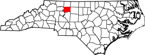 Location within the U.S. state of North Carolina | |
 North Carolina's location within the U.S. | |
| Coordinates: 36°08′N 80°16′W | |
| Country | |
| State | |
| Founded | 1849 |
| Named for | Colonel Benjamin Forsyth |
| Seat | Winston-Salem |
| Largest city | Winston-Salem |
| Area | |
| • Total | 413 sq mi (1,070 km2) |
| • Land | 408 sq mi (1,060 km2) |
| • Water | 4.5 sq mi (12 km2) 1.1% |
| Population (2020) | |
| • Total | 382,590 |
| • Density | 930/sq mi (360/km2) |
| Time zone | UTC−5 (Eastern) |
| • Summer (DST) | UTC−4 (EDT) |
| Congressional districts | 5th, 6th |
| Website | www |
History
The county was formed in 1849 from Stokes County. It was named for Colonel Benjamin Forsyth, who was killed in the War of 1812.[3]
Geography

According to the U.S. Census Bureau, the county is in the outer Appalachian Mountains, and has a total area of 413 square miles (1,070 km2), of which 408 square miles (1,060 km2) is land and 4.5 square miles (12 km2) (1.1%) is water.[4]
The northeast section of Forsyth County, including Belews Creek and parts of Rural Hall, Walkertown, and Kernersville, is drained by tributaries of the Dan River. A small portion of Kernersville is in the Cape Fear River basin.[5] Most of the county is drained by tributaries of the Yadkin River, which forms the western boundary of the county. The lowest elevation in the county is 660 feet, on the Yadkin River at the southwest corner of the county.[6] The highest is 1100 feet, at a point just off Jefferson Church Road on the outskirts of King, immediately south of the county line.
State and local protected areas/sites
- Cascades Preserve (part)
- Emily Allen Wildflower Preserve
- Historic Bethabara Park
- Old Salem Museums & Gardens
- Shell-Shaped Shell Station
- Tanglewood Park
Major water bodies
- Abbotts Creek
- Belews Creek
- Belews Lake
- Beaver Dam Creek
- Brushy Creek
- Blanket Creek
- Buffalo Creek
- Crooked Run Creek
- Lick Creek
- Little Creek
- Little Yadkin River
- Mill Creek
- Muddy Creek
- Old Field Creek
- Reedy Fork
- Salem Creek
- Silas Creek
- South Fork Muddy Creek
- Yadkin River
Adjacent counties
- Stokes County - north
- Rockingham County - northeast
- Guilford County - east
- Davidson County - south
- Davie County - southwest
- Yadkin County - west
- Surry County - northwest
Major highways
 I-40
I-40
 I-74 / Future I-74 (Designated section from I-40 to county line with Guilford County)
 Future I-274 (Future Loop around Winston Salem)
 I-285
I-285 Future I-685 (Concurrency with US 421)
 US 52
US 52 US 158
 US 311
 US 421
 NC 8
NC 8 NC 65
NC 65 NC 66
NC 66 NC 67
NC 67 NC 74 (Component highway for I-74)
 NC 109
 NC 150
 NC 192
 NC 452 (Future component highway for I-274)
Major infrastructure
- Amtrak Thruway (Winston-Salem)
- Smith Reynolds Airport
Demographics
| Historical population | |||
|---|---|---|---|
| Census | Pop. | %± | |
| 1850 | 11,168 | — | |
| 1860 | 12,692 | 13.6% | |
| 1870 | 13,050 | 2.8% | |
| 1880 | 18,070 | 38.5% | |
| 1890 | 28,434 | 57.4% | |
| 1900 | 35,261 | 24.0% | |
| 1910 | 47,311 | 34.2% | |
| 1920 | 77,269 | 63.3% | |
| 1930 | 111,681 | 44.5% | |
| 1940 | 126,475 | 13.2% | |
| 1950 | 146,135 | 15.5% | |
| 1960 | 189,428 | 29.6% | |
| 1970 | 214,348 | 13.2% | |
| 1980 | 243,683 | 13.7% | |
| 1990 | 265,878 | 9.1% | |
| 2000 | 306,067 | 15.1% | |
| 2010 | 350,670 | 14.6% | |
| 2020 | 382,590 | 9.1% | |
| 2021 (est.) | 385,523 | [7] | 0.8% |
| U.S. Decennial Census[8] 1790-1960[9] 1900-1990[10] 1990-2000[11] 2010-2013[1] 2020[12] | |||
2020 census
| Race | Number | Percentage |
|---|---|---|
| White (non-Hispanic) | 208,126 | 54.4% |
| Black or African American (non-Hispanic) | 93,738 | 24.5% |
| Native American | 978 | 0.26% |
| Asian | 9,179 | 2.4% |
| Pacific Islander | 233 | 0.06% |
| Other/Mixed | 15,648 | 4.09% |
| Hispanic or Latino | 54,688 | 14.29% |
As of the 2020 United States census, there were 382,590 people, 148,151 households, and 90,837 families residing in the county.
2000 census
As of the census[14] of 2000, there were 306,067 people, 123,851 households, and 81,741 families residing in the county. The population density was 747 people per square mile (289/km2). There were 133,093 housing units, at an average density of 325 per square mile (125/km2). The racial makeup was 68.47% White, 25.61% Black or African American, 0.30% Native American, 1.04% Asian, 0.03% Pacific Islander, 3.25% from other races, and 1.30% from two or more races. 6.40% of the population were Hispanic or Latino of any race.
There were 123,851 households, out of which 30.50% had children under the age of 18 living with them, 48.90% were married couples living together, 13.50% had a female householder with no husband present, and 34.00% were non-families. 28.90% of all households were made up of individuals, and 9.30% had someone living alone who was 65 years of age or older. The average household size was 2.39, and the average family size was 2.94.

Non-Hispanic White 30–40%40–50%50–60%60–70%70–80%80–90%90%+Black or African American 30–40%40–50%50–60%60–70%70–80%80–90%Hispanic or Latino40–50%
The median age was 36 years, with 23.90% under the age of 18, 9.60% from 18 to 24, 31.10% from 25 to 44, 22.80% from 45 to 64, and 12.60% who were 65 years of age or older. For every 100 females there were 91.50 males. For every 100 females age 18 and over, there were 87.40 males.
The median household income was $42,097, and the median family income was $52,032. Males had a median income of $36,158, versus $27,319 for females. The per capita income was $23,023. About 7.90% of families and 11.00% of the population were below the poverty line, including 15.10% of those under age 18 and 9.70% of those age 65 or over.
Law and government

The Forsyth County Government Center is located at 201 North Chestnut Street in Downtown Winston-Salem. Forsyth County is a member of the regional Northwest Piedmont Council of Governments.
The Forsyth County Public Library, founded in 1906, is free for residents of Forsyth and surrounding counties, while all others must pay a small yearly fee for a library card. The library runs Adult, Children's, and Hispanic Outreach programs. Its main "Central Library" is in downtown Winston-Salem, with branches all across the county.[15]
The Forsyth County Department of Public Health is located at 799 North Highland Avenue near downtown Winston-Salem.
Politics
Like most major urban counties, Forsyth has seen a trend towards the Democratic Party in recent elections after having voted Republican at every election between 1980 and 2004.
| Year | Republican | Democratic | Third party | |||
|---|---|---|---|---|---|---|
| No. | % | No. | % | No. | % | |
| 2020 | 85,064 | 42.26% | 113,033 | 56.16% | 3,173 | 1.58% |
| 2016 | 75,975 | 42.61% | 94,464 | 52.98% | 7,873 | 4.42% |
| 2012 | 79,768 | 45.83% | 92,323 | 53.04% | 1,978 | 1.14% |
| 2008 | 73,674 | 44.35% | 91,085 | 54.83% | 1,374 | 0.83% |
| 2004 | 75,294 | 54.12% | 63,340 | 45.53% | 491 | 0.35% |
| 2000 | 67,700 | 55.98% | 52,457 | 43.37% | 785 | 0.65% |
| 1996 | 59,160 | 52.81% | 46,543 | 41.54% | 6,330 | 5.65% |
| 1992 | 52,787 | 45.40% | 49,006 | 42.15% | 14,481 | 12.45% |
| 1988 | 57,688 | 59.02% | 39,726 | 40.65% | 321 | 0.33% |
| 1984 | 59,208 | 61.54% | 36,814 | 38.26% | 189 | 0.20% |
| 1980 | 42,389 | 49.99% | 38,870 | 45.84% | 3,539 | 4.17% |
| 1976 | 38,886 | 49.34% | 39,561 | 50.20% | 361 | 0.46% |
| 1972 | 46,415 | 67.69% | 20,928 | 30.52% | 1,226 | 1.79% |
| 1968 | 31,623 | 46.79% | 20,281 | 30.01% | 15,681 | 23.20% |
| 1964 | 30,276 | 48.92% | 31,615 | 51.08% | 0 | 0.00% |
| 1960 | 33,374 | 58.13% | 24,035 | 41.87% | 0 | 0.00% |
| 1956 | 29,368 | 64.99% | 15,819 | 35.01% | 0 | 0.00% |
| 1952 | 26,436 | 51.86% | 24,535 | 48.14% | 0 | 0.00% |
| 1948 | 10,147 | 41.04% | 12,201 | 49.35% | 2,377 | 9.61% |
| 1944 | 10,014 | 37.93% | 16,390 | 62.07% | 0 | 0.00% |
| 1940 | 7,125 | 25.64% | 20,664 | 74.36% | 0 | 0.00% |
| 1936 | 5,256 | 21.91% | 18,734 | 78.09% | 0 | 0.00% |
| 1932 | 5,727 | 28.49% | 14,016 | 69.73% | 357 | 1.78% |
| 1928 | 13,258 | 66.63% | 6,639 | 33.37% | 0 | 0.00% |
| 1924 | 5,315 | 40.33% | 7,404 | 56.18% | 459 | 3.48% |
| 1920 | 6,792 | 45.54% | 8,123 | 54.46% | 0 | 0.00% |
| 1916 | 3,585 | 45.16% | 4,115 | 51.84% | 238 | 3.00% |
| 1912 | 1,689 | 26.72% | 3,042 | 48.12% | 1,591 | 25.17% |
| 1908 | 2,876 | 52.28% | 2,472 | 44.94% | 153 | 2.78% |
| 1904 | 2,209 | 47.94% | 2,301 | 49.93% | 98 | 2.13% |
| 1900 | 2,588 | 50.77% | 2,482 | 48.70% | 27 | 0.53% |
| 1896 | 3,888 | 57.85% | 2,778 | 41.33% | 55 | 0.82% |
| 1892 | 2,447 | 42.13% | 2,880 | 49.59% | 481 | 8.28% |
| 1888 | 2,613 | 53.28% | 2,238 | 45.64% | 53 | 1.08% |
| 1884 | 1,941 | 48.46% | 2,060 | 51.44% | 4 | 0.10% |
| 1880 | 1,791 | 49.42% | 1,778 | 49.06% | 55 | 1.52% |
Education
Forsyth County is served by the Winston-Salem/Forsyth County Schools School district.
Communities

Cities
- Winston-Salem (county seat and largest city)
- High Point (mostly in Guilford County, also in Randolph County, Davidson County)
- King (mostly in Stokes County)
Towns
- Bethania
- Kernersville (partially in Guilford County)
- Lewisville
- Rural Hall
- Walkertown
Villages
- Clemmons
- Tobaccoville (also in Stokes County)
Census-designated place
Townships
- Abbots Creek
- Belews Creek
- Bethania
- Broadbay
- Clemmonsville
- Kernersville
- Lewisville
- Middle Fork I
- Middle Fork II
- Old Richmond
- Old Town
- Salem Chapel
- South Fork
- Vienna
- Winston
Former township
- Middle Fork Township was split into Middle Fork I Township and Middle Fork II Township in 2003.[17]
Unincorporated communities
See also
- List of counties in North Carolina
- National Register of Historic Places listings in Forsyth County, North Carolina
- List of future Interstate Highways
- Adelaide Fries, author of the 1898 Forsyth County
- Arts Council of Winston-Salem Forsyth County
References
- "State & County QuickFacts". United States Census Bureau. Retrieved February 15, 2022.
{{cite web}}: CS1 maint: url-status (link) - "Find a County". National Association of Counties. Archived from the original on May 31, 2011. Retrieved June 7, 2011.
- Gannett, Henry (1905). The Origin of Certain Place Names in the United States. Govt. Print. Off. pp. 128.
- "2010 Census Gazetteer Files". United States Census Bureau. August 22, 2012. Archived from the original on January 12, 2015. Retrieved January 14, 2015.
- Haw River, North Carolina, American Rivers, Washington, DC. Retrieved December 22, 2021.
- Clemmons Topo Map in Forsyth County, NC, TopoZone, Locality, LLC. Retrieved December 22, 2021.
- "U.S. Census Bureau QuickFacts: Forsyth County, North Carolina". www.census.gov. Retrieved May 31, 2022.
- "U.S. Decennial Census". United States Census Bureau. Retrieved January 14, 2015.
- "Historical Census Browser". University of Virginia Library. Retrieved January 14, 2015.
- Forstall, Richard L., ed. (March 27, 1995). "Population of Counties by Decennial Census: 1900 to 1990". United States Census Bureau. Retrieved January 14, 2015.
- "Census 2000 PHC-T-4. Ranking Tables for Counties: 1990 and 2000" (PDF). United States Census Bureau. April 2, 2001. Retrieved January 14, 2015.
- "U.S. Census Bureau QuickFacts: Forsyth County, North Carolina". www.census.gov. Retrieved May 31, 2022.
- "Explore Census Data". data.census.gov. Retrieved December 20, 2021.
- "U.S. Census website". United States Census Bureau. Retrieved January 31, 2008.
- "Locations". Forsyth County Public Library website. Forsyth County. Retrieved June 6, 2012.
- Leip, David. "Dave Leip's Atlas of U.S. Presidential Elections". uselectionatlas.org. Retrieved March 15, 2018.
- "Middle Fork Township". Geographic Names Information System. United States Geological Survey, United States Department of the Interior.
External links
- Digital Forsyth, a collaborative digitization project of historic images
- Forsyth County government official website
- NCGenWeb Forsyth County - free genealogy resources for the county
Places adjacent to Forsyth County, North Carolina | ||||||||||||||||
|---|---|---|---|---|---|---|---|---|---|---|---|---|---|---|---|---|
| ||||||||||||||||
Municipalities and communities of Forsyth County, North Carolina, United States | ||
|---|---|---|
County seat: Winston-Salem | ||
| Cities |  | |
| Towns | ||
| Villages | ||
| Townships |
| |
| CDP | ||
| Unincorporated communities | ||
| Footnotes | ‡This populated place also has portions in an adjacent county or counties | |
| ||
Authority control | |
|---|---|
| General | |
| National libraries | |
| Other |
|
На других языках
[de] Forsyth County (North Carolina)
Forsyth County[1] ist ein County im Bundesstaat North Carolina der Vereinigten Staaten. Der Verwaltungssitz (County Seat) ist Winston-Salem, das nach Joseph Winston benannt wurde, einem Major während des Amerikanischen Unabhängigkeitskrieges.- [en] Forsyth County, North Carolina
[ru] Форсайт (округ, Северная Каролина)
Форсайт (англ. Forsyth) — округ в штате Северная Каролина, США. По данным переписи 2010 года, численность населения составила 350 670 человек.[1] Окружным центром является город Уинстон-Сейлем.Другой контент может иметь иную лицензию. Перед использованием материалов сайта WikiSort.org внимательно изучите правила лицензирования конкретных элементов наполнения сайта.
WikiSort.org - проект по пересортировке и дополнению контента Википедии