world.wikisort.org - USA
Washington County is a county located in the U.S. state of North Carolina. As of the 2020 Census, the population was 11,003.[1] Its county seat is Plymouth.[2] The county was formed in 1799 from the western third of Tyrrell County. It was named for George Washington.
Washington County | |
|---|---|
U.S. county | |
 Somerset Place, a former plantation near Creswell. | |
 Seal Logo | |
| Nickname: Bear-olina | |
| Motto(s): "Where traffic ends and adventure begins." | |
 Location within the U.S. state of North Carolina | |
 North Carolina's location within the U.S. | |
| Coordinates: 35°50′N 76°34′W | |
| Country | |
| State | |
| Founded | 1799 |
| Named for | George Washington |
| Seat | Plymouth |
| Largest town | Plymouth |
| Area | |
| • Total | 424 sq mi (1,100 km2) |
| • Land | 348 sq mi (900 km2) |
| • Water | 76 sq mi (200 km2) 18% |
| Population | |
| • Estimate (2021) | 10,892 |
| • Density | 31.3/sq mi (12.1/km2) |
| Time zone | UTC−5 (Eastern) |
| • Summer (DST) | UTC−4 (EDT) |
| Congressional district | 1st |
| Website | www |
History
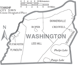
There are three incorporated towns in Washington County; Plymouth is the county seat, while other towns are Roper and Creswell. Washington County is known for rich farmland, extensive forests and abundant public access waters.[3] The Roanoke River and Albemarle Sound form the northern boundary. Lake Phelps is 16,000 acres and is part of Pettigrew State Park in Creswell. Somerset Place is a restored antebellum plantation and NC Historic Site on Lake Phelps.[4]
The Pungo Unit of the Pocosin Lakes National Wildlife Refuge in the southern part of the county is said to have the best public black bear viewing in North Carolina. This part of the state is known for having the world's largest black bears and highest black bear densities[5] The award-winning NC Black Bear Festival takes place in Plymouth on the first weekend in June.
Geography

According to the U.S. Census Bureau, the county has a total area of 424 square miles (1,100 km2), of which 348 square miles (900 km2) is land and 76 square miles (200 km2) (18%) is water.[6] The county borders the Albemarle Sound.
National protected area
- Pocosin Lakes National Wildlife Refuge (part)
State and local protected areas/sites
- Pettigrew State Park (part)
- Somerset Place
- Van Swamp Game Lands (part)
Major water bodies
Adjacent counties
- Chowan County - north
- Perquimans County - northeast
- Tyrrell County - east
- Hyde County - southeast
- Beaufort County - southwest
- Martin County - west
- Bertie County - northwest
Major highways
 US 64
US 64 NC 32
NC 32 NC 37
NC 37 NC 45
NC 45 NC 94
NC 94 NC 99
NC 99 NC 149
 NC 308
Demographics
| Historical population | |||
|---|---|---|---|
| Census | Pop. | %± | |
| 1800 | 2,422 | — | |
| 1810 | 3,464 | 43.0% | |
| 1820 | 3,986 | 15.1% | |
| 1830 | 4,552 | 14.2% | |
| 1840 | 4,525 | −0.6% | |
| 1850 | 5,664 | 25.2% | |
| 1860 | 6,357 | 12.2% | |
| 1870 | 6,516 | 2.5% | |
| 1880 | 8,928 | 37.0% | |
| 1890 | 10,200 | 14.2% | |
| 1900 | 10,608 | 4.0% | |
| 1910 | 11,062 | 4.3% | |
| 1920 | 11,429 | 3.3% | |
| 1930 | 11,603 | 1.5% | |
| 1940 | 12,323 | 6.2% | |
| 1950 | 13,180 | 7.0% | |
| 1960 | 13,488 | 2.3% | |
| 1970 | 14,038 | 4.1% | |
| 1980 | 14,801 | 5.4% | |
| 1990 | 13,997 | −5.4% | |
| 2000 | 13,723 | −2.0% | |
| 2010 | 13,228 | −3.6% | |
| 2020 | 11,003 | −16.8% | |
| 2021 (est.) | 10,892 | [7] | −1.0% |
| U.S. Decennial Census[8] 1790-1960[9] 1900-1990[10] 1990-2000[11] 2010-2013[12] 2020[13] | |||
2020 census
| Race | Number | Percentage |
|---|---|---|
| White (non-Hispanic) | 4,958 | 45.06% |
| Black or African American (non-Hispanic) | 5,350 | 48.62% |
| Native American | 15 | 0.14% |
| Asian | 37 | 0.34% |
| Pacific Islander | 3 | 0.03% |
| Other/Mixed | 269 | 2.44% |
| Hispanic or Latino | 371 | 3.37% |
As of the 2020 United States census, there were 11,003 people, 4,977 households, and 2,655 families residing in the county.
2000 census
As of the census[15] of 2000, there were 13,723 people, 5,367 households, and 3,907 families residing in the county. The population density was 39 people per square mile (15/km2). There were 6,174 housing units at an average density of 18 per square mile (7/km2). The racial makeup of the county was 48.28% White, 48.94% Black or African American, 0.05% Native American, 0.32% Asian, 0.04% Pacific Islander, 1.66% from other races, and 0.70% from two or more races. 2.27% of the population were Hispanic or Latino of any race.
There were 5,367 households, out of which 31.70% had children under the age of 18 living with them, 50.10% were married couples living together, 18.80% had a female householder with no husband present, and 27.20% were non-families. 24.70% of all households were made up of individuals, and 11.70% had someone living alone who was 65 years of age or older. The average household size was 2.52 and the average family size was 2.99.
In the county, the population was spread out, with 26.00% under the age of 18, 7.70% from 18 to 24, 25.00% from 25 to 44, 25.80% from 45 to 64, and 15.50% who were 65 years of age or older. The median age was 39 years. For every 100 females there were 89.70 males. For every 100 females age 18 and over, there were 86.10 males.
The median income for a household in the county was $28,865, and the median income for a family was $34,888. Males had a median income of $27,058 versus $19,477 for females. The per capita income for the county was $14,994. About 17.60% of families and 21.80% of the population were below the poverty line, including 31.50% of those under age 18 and 19.20% of those age 65 or over.
Government and politics
Washington County is a member of the Albemarle Commission regional council of governments.
Washington County was one of the proposed sites for a Navy outlying landing field. This practice airfield would allow pilots to simulate landings on an aircraft carrier. Plans for construction have been scrapped due to public backlash and potential ecological impact.[16]
| Year | Republican | Democratic | Third party | |||
|---|---|---|---|---|---|---|
| No. | % | No. | % | No. | % | |
| 2020 | 2,781 | 44.82% | 3,396 | 54.73% | 28 | 0.45% |
| 2016 | 2,564 | 41.59% | 3,510 | 56.93% | 91 | 1.48% |
| 2012 | 2,622 | 40.34% | 3,833 | 58.98% | 44 | 0.68% |
| 2008 | 2,670 | 41.37% | 3,748 | 58.07% | 36 | 0.56% |
| 2004 | 2,484 | 45.40% | 2,969 | 54.27% | 18 | 0.33% |
| 2000 | 2,169 | 44.36% | 2,704 | 55.30% | 17 | 0.35% |
| 1996 | 1,562 | 34.47% | 2,790 | 61.56% | 180 | 3.97% |
| 1992 | 1,780 | 33.89% | 2,902 | 55.24% | 571 | 10.87% |
| 1988 | 2,186 | 43.69% | 2,806 | 56.08% | 12 | 0.24% |
| 1984 | 2,731 | 46.67% | 3,114 | 53.21% | 7 | 0.12% |
| 1980 | 1,943 | 38.57% | 3,008 | 59.72% | 86 | 1.71% |
| 1976 | 1,486 | 34.07% | 2,840 | 65.12% | 35 | 0.80% |
| 1972 | 2,559 | 61.65% | 1,546 | 37.24% | 46 | 1.11% |
| 1968 | 1,016 | 21.26% | 1,898 | 39.71% | 1,866 | 39.04% |
| 1964 | 1,144 | 31.35% | 2,505 | 68.65% | 0 | 0.00% |
| 1960 | 1,027 | 29.84% | 2,415 | 70.16% | 0 | 0.00% |
| 1956 | 1,033 | 34.66% | 1,947 | 65.34% | 0 | 0.00% |
| 1952 | 774 | 28.17% | 1,974 | 71.83% | 0 | 0.00% |
| 1948 | 333 | 16.19% | 1,675 | 81.43% | 49 | 2.38% |
| 1944 | 497 | 21.81% | 1,782 | 78.19% | 0 | 0.00% |
| 1940 | 362 | 17.35% | 1,724 | 82.65% | 0 | 0.00% |
| 1936 | 535 | 22.20% | 1,875 | 77.80% | 0 | 0.00% |
| 1932 | 619 | 26.77% | 1,681 | 72.71% | 12 | 0.52% |
| 1928 | 1,183 | 56.85% | 898 | 43.15% | 0 | 0.00% |
| 1924 | 834 | 48.40% | 883 | 51.25% | 6 | 0.35% |
| 1920 | 971 | 46.53% | 1,116 | 53.47% | 0 | 0.00% |
| 1916 | 486 | 42.74% | 651 | 57.26% | 0 | 0.00% |
| 1912 | 384 | 37.07% | 503 | 48.55% | 149 | 14.38% |
Education
- Creswell High School
- Plymouth High School
- Pocosin Innovative Charter[18]
Communities
Towns
Unincorporated communities
- Lake Phelps
- Mackeys
- Pea Ridge
Townships
- Plymouth
- Lees Mill
- Scuppernong
- Skinnersville
See also
- List of counties in North Carolina
- National Register of Historic Places listings in Washington County, North Carolina
- North Carolina State Parks
References
- "U.S. Census Bureau QuickFacts: Washington County, North Carolina". www.census.gov. Retrieved April 18, 2022.
- "Find a County". National Association of Counties. Retrieved June 7, 2011.
- "Quiet Washington County rich in coastal NC history". Coastal Review. April 25, 2022. Retrieved May 24, 2022.
- "Somerset Place | NC Historic Sites". historicsites.nc.gov. Retrieved May 24, 2022.
- Smith, Donna Campbell (April 12, 2020). "Bear Watching at Pungo National Wildlife Refuge". The Grey Area News. Retrieved May 24, 2022.
- "2010 Census Gazetteer Files". United States Census Bureau. August 22, 2012. Archived from the original on January 12, 2015. Retrieved January 20, 2015.
- "U.S. Census Bureau QuickFacts: Washington County, North Carolina". www.census.gov. Retrieved May 31, 2022.
- "U.S. Decennial Census". United States Census Bureau. Retrieved January 20, 2015.
- "Historical Census Browser". University of Virginia Library. Retrieved January 20, 2015.
- Forstall, Richard L., ed. (March 27, 1995). "Population of Counties by Decennial Census: 1900 to 1990". United States Census Bureau. Retrieved January 20, 2015.
- "Census 2000 PHC-T-4. Ranking Tables for Counties: 1990 and 2000" (PDF). United States Census Bureau. April 2, 2001. Archived (PDF) from the original on March 27, 2010. Retrieved January 20, 2015.
- "State & County QuickFacts". United States Census Bureau. Retrieved October 30, 2013.
- "U.S. Census Bureau QuickFacts: Washington County, North Carolina". www.census.gov. Retrieved May 31, 2022.
- "Explore Census Data". data.census.gov. Retrieved December 23, 2021.
- "U.S. Census website". United States Census Bureau. Retrieved January 31, 2008.
- WRAL (November 16, 2007). "WRAL Archive: Navy Landing Field Controversy". WRAL.com. Retrieved May 24, 2022.
- Leip, David. "Dave Leip's Atlas of U.S. Presidential Elections". uselectionatlas.org. Retrieved March 17, 2018.
- "Pocosin Innovative Charter School". pocosin.instructure.com. Retrieved September 27, 2022.
External links
Places adjacent to Washington County, North Carolina | ||||||||||||||||
|---|---|---|---|---|---|---|---|---|---|---|---|---|---|---|---|---|
| ||||||||||||||||
Municipalities and communities of Washington County, North Carolina, United States | ||
|---|---|---|
County seat: Plymouth | ||
| Towns |  | |
| Unincorporated communities |
| |
| ||
Authority control | |
|---|---|
| General | |
| National libraries | |
| Other | |
На других языках
[de] Washington County (North Carolina)
Washington County[1] ist ein County im Bundesstaat North Carolina der Vereinigten Staaten. Der Verwaltungssitz (County Seat) ist Plymouth.- [en] Washington County, North Carolina
[fr] Comté de Washington (Caroline du Nord)
Le comté de Washington est un comté des États-Unis, situé dans l'État de Caroline du Nord.[it] Contea di Washington (Carolina del Nord)
La contea di Washington in inglese Washington County è una contea dello Stato della Carolina del Nord, negli Stati Uniti. La popolazione al censimento del 2000 era di 13.723 abitanti. Il capoluogo di contea è Plymouth.[ru] Вашингтон (округ, Северная Каролина)
Округ Вашингтон (англ. Washington County) располагается в США, штате Северная Каролина. Официально образован в 1799 году. По состоянию на 2010 год, численность населения составляла 13 723 человек. Получил своё название по имени первого президента США Джорджа Вашингтона.Другой контент может иметь иную лицензию. Перед использованием материалов сайта WikiSort.org внимательно изучите правила лицензирования конкретных элементов наполнения сайта.
WikiSort.org - проект по пересортировке и дополнению контента Википедии