world.wikisort.org - USA
Caldwell County is a county in the U.S. state of North Carolina. It is located in the foothills of the Blue Ridge Mountains. As of the 2020 census, the population was 80,652.[1] Its county seat is Lenoir.[2] Caldwell County is part of the Hickory–Lenoir–Morganton, NC Metropolitan Statistical Area.
Caldwell County | |
|---|---|
U.S. county | |
 Caldwell County Courthouse in Lenoir | |
 Flag  Seal Logo | |
 Location within the U.S. state of North Carolina | |
 North Carolina's location within the U.S. | |
| Coordinates: 35°57′N 81°33′W | |
| Country | |
| State | |
| Founded | 1841 |
| Named for | Joseph Caldwell |
| Seat | Lenoir |
| Largest city | Lenoir |
| Area | |
| • Total | 474 sq mi (1,230 km2) |
| • Land | 472 sq mi (1,220 km2) |
| • Water | 2.7 sq mi (7 km2) 0.6% |
| Population (2020) | |
| • Total | 80,652 |
| • Density | 170.9/sq mi (66.0/km2) |
| Time zone | UTC−5 (Eastern) |
| • Summer (DST) | UTC−4 (EDT) |
| Congressional districts | 5th, 10th |
| Website | www |
History
The county was formed in 1841 from parts of Burke County and Wilkes County. It was named for Joseph Caldwell, presiding professor and the first president of the University of North Carolina at Chapel Hill.
A series of reductions to the county's territory have taken place since its initial formation. In 1847, parts of Caldwell County, Iredell County, and Wilkes County were combined to form Alexander County. In 1849, parts of Caldwell County, Ashe County, Wilkes County, and Yancey County were combined to form Watauga County. In 1861, parts of Caldwell County, Burke County, McDowell County, Watauga County, and Yancey County were combined to form Mitchell County. Finally, in 1911 parts of Caldwell County, Mitchell County, and Watauga County were combined to form Avery County.
Geography

According to the U.S. Census Bureau, the county has a total area of 474 square miles (1,230 km2), of which 472 square miles (1,220 km2) is land and 2.7 square miles (7.0 km2) (0.6%) is water.[3]
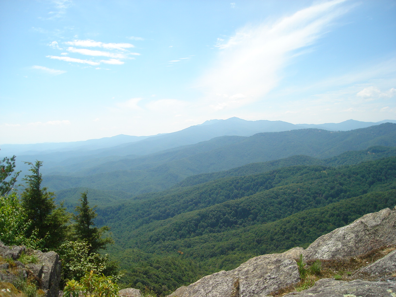
Caldwell County is divided into three distinct geographic sections: the Blue Ridge Mountains, which dominate the northern and western parts of the county; the gently rolling Piedmont country in the middle and southern parts of the county; and the Brushy Mountains, an isolated remnant of the Blue Ridge Mountains. The "Brushies", as they are often called, run across much of Caldwell County's eastern section. Hibriten Mountain, located within the city limits of Lenoir, the county's largest city, marks the western end of the Brushy Mountain range. In the western part of the county is the Wilson Creek area.
National protected areas
- Blue Ridge Parkway (part)
- Pisgah National Forest (part)
State and local protected areas
- Backbone Ridge State Forest
- Grandfather Mountain State Park (part)
- Tuttle Educational State Forest
Major water bodies
- Beaver Creek
- Blue Creek
- Catawba River
- Gunpowder Creek
- Husband Creek
- Johns River
- Lake Hickory
- Little Gunpowder Creek
- Little King Creek
- Lower Creek
- Mill Creek
- Mulberry Creek
- Rhodhiss Lake
- Rock Creek
- Silver Creek
- Upper Little River
- Wilson Creek
- Yadkin River
Adjacent counties
- Watauga County - north
- Wilkes County - northeast
- Alexander County - east
- Catawba County - southeast
- Burke County - south
- Avery County - west
Major highways
 US 64
US 64 US 221
 US 321 is the busiest highway in the county with an annual average daily traffic count of 39,000.[4]
 US 321A
 NC 18
NC 18 NC 90
NC 90 NC 268
- Blue Ridge Parkway also crosses the northern tip of the county.
Major infrastructure
- Caldwell County has one railroad, the Caldwell County Railroad which interchanges with the Norfolk Southern Railway in Hickory, North Carolina.[5]
- Foothills Regional Airport (Partially in Burke County)
Demographics
| Historical population | |||
|---|---|---|---|
| Census | Pop. | %± | |
| 1850 | 6,317 | — | |
| 1860 | 7,497 | 18.7% | |
| 1870 | 8,476 | 13.1% | |
| 1880 | 10,291 | 21.4% | |
| 1890 | 12,298 | 19.5% | |
| 1900 | 15,694 | 27.6% | |
| 1910 | 20,579 | 31.1% | |
| 1920 | 19,984 | −2.9% | |
| 1930 | 28,016 | 40.2% | |
| 1940 | 35,795 | 27.8% | |
| 1950 | 43,352 | 21.1% | |
| 1960 | 49,552 | 14.3% | |
| 1970 | 56,699 | 14.4% | |
| 1980 | 67,746 | 19.5% | |
| 1990 | 70,709 | 4.4% | |
| 2000 | 77,415 | 9.5% | |
| 2010 | 83,029 | 7.3% | |
| 2020 | 80,652 | −2.9% | |
| 2021 (est.) | 80,463 | [6] | −0.2% |
| U.S. Decennial Census[7][8] 1790-1960[9] 1900-1990[10] 1990-2000[11] 2010-2014[12] 2020[13] | |||
2020 census
| Race | Number | Percentage |
|---|---|---|
| White (non-Hispanic) | 67,868 | 84.15% |
| Black or African American (non-Hispanic) | 3,843 | 4.76% |
| Native American | 196 | 0.24% |
| Asian | 527 | 0.65% |
| Pacific Islander | 15 | 0.02% |
| Other/Mixed | 3,280 | 4.07% |
| Hispanic or Latino | 4,923 | 6.1% |
As of the 2020 United States census, there were 80,652 people, 32,513 households, and 20,975 families residing in the county.
2010 census
As of the census of 2010,[15] there were 83,029 people, 33,388 households, and 23,456 families residing in the county. The population density was 176.1 people per square mile (109.4/km2). There were 37,659 housing units at an average density of 79.9 per square mile (49.6/km2). The racial makeup of the county was 90.24% White, 4.92% Black or African American, 0.52% Asian, 0.31% Native American, 0.03% Pacific Islander, 2.47% from other races, and 1.51% from two or more races. The Hispanic or Latino (of any race) population was 4.57%.
There were 33,388 households, of which 32.40% had children under the age of 18 living with them, 52.16% were married couples living together, 12.52% had a female householder with no husband present, and 29.75% were non-families. 25.39% of all households were made up of individuals living alone, and 41.16% of those households had someone living alone who was 65 years of age or older. The average household size was 2.46 and the average family size was 2.91.
Of the county's entire population, 22.63% was under the age of 18, 18.33% were 18 to 34, 22.44% were 35 to 49, 21.17% were 50 to 64, and 15.44% were 65 years of age or older. The median age was 41.3 years. For every 100 females there were 96.84 males. For every 100 females age 18 and over, there were 95.06 males.
The median income for a household in the county was $34,853, and the median income for a family was $47,028. Males had a median income of $36,429 versus $31,221 for females. The per capita income for the county was $19,397. About 15.3% of families and 20.50% of the population were below the poverty line, including 51.8% of single mothers and 13.2% of people age 65 or over.
Government and politics
The county is governed by a five-member Board of Commissioners. They are elected by popular vote and appoint a County Manager to handle daily operations.[16][17] The members of the Board of Commissioners are Jeff Branch, Randy Church, Mike LaBrose, Donnie Potter, and Robbie Wilkie.[18] Caldwell County's sheriff is Alan C. Jones.[19] The Clerk of Superior Court is Angela Ashley Kidd.[20] The County's Register of Deeds is Wayne Rash.[21] Caldwell County is a member of the regional Western Piedmont Council of Governments.[22]
In the North Carolina General Assembly, the county is represented by Republican Warren Daniel in the North Carolina Senate, as part of N.C. Senate District 46, and by Republican Destin Hall in the North Carolina House of Representatives, as N.C. House District 87.[23][24]
Caldwell County is part of North Carolina's 5th congressional district in the United States House of Representatives and is represented by Republican Virginia Foxx. The county was moved from North Carolina's 11th congressional district in 2021 due to court ordered redistricting in North Carolina. North Carolina's congressional districts for 2023 and beyond have not yet been approved.[25][26][27][28]
Caldwell County's partisan lean is very Republican. Of the county's elected legislative representatives at the county, state, and national level, all are Republicans. Since 2010, the average federal election vote in Caldwell County goes over 70% Republican.[29][30][31][32][33]
| Year | Republican | Democratic | Third party | |||
|---|---|---|---|---|---|---|
| No. | % | No. | % | No. | % | |
| 2020 | 32,119 | 74.99% | 10,245 | 23.92% | 465 | 1.09% |
| 2016 | 26,621 | 73.30% | 8,425 | 23.20% | 1,274 | 3.51% |
| 2012 | 23,229 | 66.88% | 10,898 | 31.38% | 605 | 1.74% |
| 2008 | 22,526 | 64.08% | 12,081 | 34.36% | 548 | 1.56% |
| 2004 | 21,186 | 67.58% | 9,999 | 31.90% | 163 | 0.52% |
| 2000 | 17,337 | 66.39% | 8,588 | 32.89% | 190 | 0.73% |
| 1996 | 12,653 | 55.18% | 8,050 | 35.11% | 2,228 | 9.72% |
| 1992 | 12,543 | 49.04% | 9,033 | 35.32% | 4,000 | 15.64% |
| 1988 | 15,176 | 65.78% | 7,862 | 34.08% | 33 | 0.14% |
| 1984 | 17,024 | 69.79% | 7,311 | 29.97% | 59 | 0.24% |
| 1980 | 12,965 | 58.11% | 8,738 | 39.17% | 607 | 2.72% |
| 1976 | 9,872 | 45.15% | 11,894 | 54.39% | 100 | 0.46% |
| 1972 | 12,976 | 71.41% | 4,886 | 26.89% | 309 | 1.70% |
| 1968 | 10,433 | 51.46% | 4,746 | 23.41% | 5,095 | 25.13% |
| 1964 | 8,733 | 44.60% | 10,846 | 55.40% | 0 | 0.00% |
| 1960 | 11,553 | 56.98% | 8,722 | 43.02% | 0 | 0.00% |
| 1956 | 10,833 | 61.22% | 6,861 | 38.78% | 0 | 0.00% |
| 1952 | 9,160 | 54.87% | 7,533 | 45.13% | 0 | 0.00% |
| 1948 | 4,987 | 46.24% | 5,033 | 46.67% | 765 | 7.09% |
| 1944 | 4,365 | 44.61% | 5,419 | 55.39% | 0 | 0.00% |
| 1940 | 3,005 | 32.18% | 6,334 | 67.82% | 0 | 0.00% |
| 1936 | 3,421 | 33.44% | 6,809 | 66.56% | 0 | 0.00% |
| 1932 | 3,750 | 40.43% | 5,479 | 59.07% | 46 | 0.50% |
| 1928 | 4,207 | 64.74% | 2,291 | 35.26% | 0 | 0.00% |
| 1924 | 2,503 | 42.59% | 3,348 | 56.97% | 26 | 0.44% |
| 1920 | 3,298 | 52.95% | 2,931 | 47.05% | 0 | 0.00% |
| 1916 | 1,659 | 49.02% | 1,725 | 50.98% | 0 | 0.00% |
| 1912 | 482 | 14.66% | 1,627 | 49.50% | 1,178 | 35.84% |
Education
Elementary schools
- Baton
- Davenport
- Dudley Shoals
- Gamewell
- Granite Falls
- Hudson
- Lower Creek
- Sawmills
- Valmead
- West Lenoir
- Whitnel
K-8 schools
- Collettsville
- Happy Valley
- Kings Creek
- Oak Hill Charter School
Middle schools
- Gamewell
- Granite Falls
- Hudson
- William Lenoir
High schools
- Caldwell Applied Sciences Academy
- Caldwell Early College
- Hibriten
- South Caldwell
- West Caldwell
Alternative schools
- Horizons Elementary
- Gateway School
Private schools
- Heritage Christian School (K-12)
Independent school
- Moravian Prep
College
- Caldwell Community College & Technical Institute[35]
- Appalachian State University Center at Caldwell (a distance education site for Appalachian State University)[36]
Communities

Townships[37]
- Globe
- Hudson
- Johns River
- Kings Creek
- Lenoir
- Little River
- Lovelady
- Lower Creek
- Mullberry
- North Catawba
- Paterson
- WIlson Creek
- Yadkin Valley
City
- Lenoir (county seat and largest city)
Towns
Village
Census-designated place
Other unincorporated communities
See also
- List of counties in North Carolina
- National Register of Historic Places listings in Caldwell County, North Carolina
- North Carolina State Parks
- National Park Service
- List of North Carolina state forests
- List of national forests of the United States
References
- "QuickFacts Caldwell County, North Carolina". Census.gov. U.S. Census Bureau. Retrieved October 11, 2021.
- "Find a County". National Association of Counties. Archived from the original on May 31, 2011. Retrieved June 7, 2011.
- "2010 Census Gazetteer Files". United States Census Bureau. August 22, 2012. Archived from the original on January 12, 2015. Retrieved January 12, 2015.
- "2014 AADT PDF Report" (PDF). North Carolina Department of Transportation. Archived from the original (PDF) on November 25, 2015. Retrieved May 7, 2016.
- Infrastructure, Caldwell County Economic Development Commission (retrieved 16 June 2014)
- "U.S. Census Bureau QuickFacts: Caldwell County, North Carolina". www.census.gov. Retrieved May 31, 2022.
- "U.S. Decennial Census". United States Census Bureau. Archived from the original on April 26, 2015. Retrieved January 12, 2015.
- "Caldwell County, North Carolina; United States". QuickFacts. U.S. Census Bureau. Retrieved October 11, 2021.
- "Historical Census Browser". University of Virginia Library. Retrieved January 12, 2015.
- Forstall, Richard L., ed. (March 27, 1995). "Population of Counties by Decennial Census: 1900 to 1990". United States Census Bureau. Retrieved January 12, 2015.
- "Census 2000 PHC-T-4. Ranking Tables for Counties: 1990 and 2000" (PDF). United States Census Bureau. April 2, 2001. Retrieved January 12, 2015.
- "State & County QuickFacts". United States Census Bureau. Archived from the original on June 6, 2011. Retrieved October 18, 2013.
- "U.S. Census Bureau QuickFacts: Caldwell County, North Carolina". www.census.gov. Retrieved May 31, 2022.
- "Explore Census Data". data.census.gov. Retrieved December 21, 2021.
- "Caldwell County North Carolina Quickfacts". United States Census Bureau. Retrieved May 7, 2016.
- "NC SBE Contest Results". er.ncsbe.gov. Retrieved July 7, 2018.
- "Administration". Retrieved March 29, 2018.
- "Commissioners". Caldwell County Government. Retrieved March 29, 2018.
- "Sheriff's Office". Caldwell County Government. Retrieved March 20, 2016.
- "11/06/2018 OFFICIAL GENERAL ELECTION RESULTS - CALDWELL". ncsbe.gov. North Carolina State Board of Elections. Retrieved October 1, 2019.
- "About Your Register". Caldwell County Register of Deeds. Retrieved March 30, 2018.
- "WPCOG". Western Piedmont Council of Governments. Retrieved March 30, 2018.
- "Senator Warren Daniel (Republican, 2019-2020 Session)". North Carolina General Assembly. Retrieved October 1, 2019.
- "Representative Destin Hall (Republican, 2017-2018 Session)". North Carolina General Assembly. Retrieved March 30, 2018.
- "HB 1029, 3rd Edition map". North Carolina General Assembly. Retrieved October 8, 2021.
- "Representatives". house.gov. United States House of Representatives. Retrieved October 8, 2021.
- "Multitude of Candidates Have Filed for Avery County, State and Federal Government Offices; Foxx No Longer Will Represent Avery Following Court Ruling". highcountrypress.com/. High Country Press. December 20, 2019. Retrieved January 14, 2020.
- "New NC political maps coming soon, as redistricting starts". newsobserver.com. The News & Observer. Retrieved October 8, 2021.
- "NC SBE Contest Results". NC SBE Contest Results. North Carolina State Board of Elections. Retrieved January 14, 2020.
- "NC SBE Contest Results". NC SBE Contest Results. North Carolina State Board of Elections. Retrieved January 14, 2020.
- "NC SBE Contest Results". NC SBE Contest Results. North Carolina State Board of Elections. Retrieved January 14, 2020.
- "NC SBE Contest Results". NC SBE Contest Results. North Carolina State Board of Elections. Retrieved January 14, 2020.
- "NC SBE Contest Results". NC SBE Contest Results. North Carolina State Board of Elections. Retrieved January 14, 2020.
- Leip, David. "Dave Leip's Atlas of U.S. Presidential Elections". uselectionatlas.org. Retrieved March 14, 2018.
- "Caldwell County Schools - School Directory". Caldwell County Schools. Retrieved March 20, 2016.
- "ASU Center at Caldwell (located on the Hudson Campus of Caldwell Community College and Tech Institute)". Appalachian State University. Retrieved May 7, 2016.
- "Mindat.org". www.mindat.org. Retrieved October 8, 2022.
External links
- Caldwell County Economic Development Commission
- Caldwell County government official website
 Geographic data related to Caldwell County, North Carolina at OpenStreetMap
Places adjacent to Caldwell County, North Carolina | ||||||||||||||||
|---|---|---|---|---|---|---|---|---|---|---|---|---|---|---|---|---|
| ||||||||||||||||
Municipalities and communities of Caldwell County, North Carolina, United States | ||
|---|---|---|
County seat: Lenoir | ||
| Cities |  | |
| Towns | ||
| Village | ||
| CDP | ||
| Unincorporated communities | ||
| Footnotes | ‡This populated place also has portions in an adjacent county or counties | |
| ||
Authority control | |
|---|---|
| General | |
| National libraries | |
| Other |
|
На других языках
[de] Caldwell County (North Carolina)
Caldwell County[1] ist ein County im Bundesstaat North Carolina der Vereinigten Staaten. Der Verwaltungssitz (County Seat) ist Lenoir, das nach William Lenoir benannt wurde, einem General im Amerikanischen Unabhängigkeitskrieg.- [en] Caldwell County, North Carolina
[ru] Колдуэлл (округ, Северная Каролина)
Округ Колдуэлл (англ. Caldwell County) располагается в штате Северная Каролина, США. Официально образован в 1841 году. По состоянию на 2010 год, численность населения составляла 83 029 человек.Другой контент может иметь иную лицензию. Перед использованием материалов сайта WikiSort.org внимательно изучите правила лицензирования конкретных элементов наполнения сайта.
WikiSort.org - проект по пересортировке и дополнению контента Википедии