world.wikisort.org - China
Yingtan (simplified Chinese: 鹰潭; traditional Chinese: 鷹潭; pinyin: Yīngtán; lit. 'Eagle Pond') is a prefecture-level city in the east of Jiangxi province, People's Republic of China, bordering Fujian to the southeast. Its location near the trisection of Jiangxi, Fujian, and Zhejiang has made it a strategically important city for centuries. Today, it continues to be a major rail transport hub. It is best known as the Capital of Copper, and here placed Jiangxi Copper and its smelting factory.
Yingtan
鹰潭市 | |
|---|---|
Prefecture-level city | |
 Downtown | |
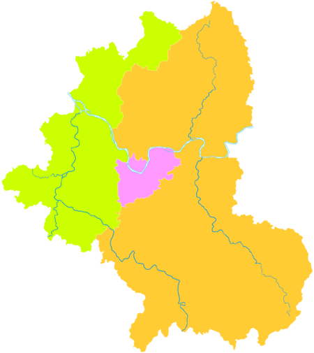
 Location of Yingtan City jurisdiction in Jiangxi | |
| Coordinates (Yingtan municipal government): 28°16′20″N 117°02′22″E | |
| Country | People's Republic of China |
| Province | Jiangxi |
| Municipal seat | Yuehu District |
| Government | |
| • Mayor | Yu Xiuming |
| Area | |
| • Total | 3,554 km2 (1,372 sq mi) |
| Population (2010) | |
| • Total | 1,124,906 |
| • Density | 320/km2 (820/sq mi) |
| Time zone | UTC+8 (China Standard) |
| Postal code | 335000 |
| Area code | 0701 |
| ISO 3166 code | CN-JX-06 |
| Website | yingtan |
Near the city of Yingtan is the resort area Mount Longhu which purports to be the birthplace of Taoism and hence has great symbolic value to Taoists. The region has many interesting temples, cave complexes, mountains and villages.
Administration
The municipal executive, legislature and judiciary are in Yuehu District (月湖区), together with the CPC and Public Security bureaux.
Yingtan oversees two districts and a county-level city:
- Yuehu District (月湖区)
- Yujiang District (余江区)
- Guixi City (贵溪市)
Tourism Zone
- Longhu Mountain Scenic Area (龙虎山风景旅游区)
| Map | |||||
|---|---|---|---|---|---|
Climate
| Climate data for Yingtan (1981−2010) | |||||||||||||
|---|---|---|---|---|---|---|---|---|---|---|---|---|---|
| Month | Jan | Feb | Mar | Apr | May | Jun | Jul | Aug | Sep | Oct | Nov | Dec | Year |
| Record high °C (°F) | 25.1 (77.2) |
30.1 (86.2) |
34.8 (94.6) |
35.3 (95.5) |
36.5 (97.7) |
38.1 (100.6) |
40.1 (104.2) |
40.4 (104.7) |
38.1 (100.6) |
37.6 (99.7) |
32.8 (91.0) |
24.3 (75.7) |
40.4 (104.7) |
| Average high °C (°F) | 9.9 (49.8) |
12.6 (54.7) |
16.7 (62.1) |
23.3 (73.9) |
28.2 (82.8) |
30.7 (87.3) |
35.0 (95.0) |
34.2 (93.6) |
30.6 (87.1) |
25.3 (77.5) |
18.8 (65.8) |
12.7 (54.9) |
23.2 (73.7) |
| Daily mean °C (°F) | 6.1 (43.0) |
8.6 (47.5) |
12.3 (54.1) |
18.5 (65.3) |
23.4 (74.1) |
26.3 (79.3) |
30.1 (86.2) |
29.3 (84.7) |
25.8 (78.4) |
20.4 (68.7) |
14.1 (57.4) |
8.0 (46.4) |
18.6 (65.4) |
| Average low °C (°F) | 3.4 (38.1) |
5.9 (42.6) |
9.2 (48.6) |
15.0 (59.0) |
19.7 (67.5) |
23.1 (73.6) |
26.2 (79.2) |
25.5 (77.9) |
22.2 (72.0) |
16.9 (62.4) |
10.7 (51.3) |
4.7 (40.5) |
15.2 (59.4) |
| Record low °C (°F) | −4.8 (23.4) |
−3.5 (25.7) |
−1.6 (29.1) |
6.0 (42.8) |
10.4 (50.7) |
15.6 (60.1) |
20.1 (68.2) |
20.3 (68.5) |
14.6 (58.3) |
4.3 (39.7) |
0.6 (33.1) |
−4.8 (23.4) |
−4.8 (23.4) |
| Average relative humidity (%) | 78 | 79 | 79 | 77 | 75 | 78 | 71 | 74 | 75 | 74 | 76 | 74 | 76 |
| Source: China Meteorological Data Service Center[1] | |||||||||||||
Notes and references
- 中国地面气候标准值月值(1981-2010) (in Simplified Chinese). China Meteorological Data Service Center. Retrieved 16 August 2022.
External links
- (in Chinese) Official Yingtan city website
Jiangxi topics | |
|---|---|
Nanchang (capital) | |
| General |
|
| Geography |
|
| Education |
|
| Culture |
|
| Visitor attractions |
|
| |
Notes: *Provincial capitals, ★Sub-provincial cities, ☆Sub-provincial autonomous prefecture *Sub prefectural-level divisions, ✧"Comparatively larger city" (较大的市) as approved by the State Council | ||||||||||||||||||||||||||||||||||||||||||||||||||||||||||||||||
|  | |||||||||||||||||||||||||||||||||||||||||||||||||||||||||||||||
|
See also: List of prefectures in China, List of cities in China | ||||||||||||||||||||||||||||||||||||||||||||||||||||||||||||||||
This Jiangxi location article is a stub. You can help Wikipedia by expanding it. |
На других языках
- [en] Yingtan
[ru] Интань
Инта́нь (кит. упр. 鹰潭, пиньинь Yīngtán, буквально: «орлиный пруд») — городской округ в провинции Цзянси КНР.Другой контент может иметь иную лицензию. Перед использованием материалов сайта WikiSort.org внимательно изучите правила лицензирования конкретных элементов наполнения сайта.
WikiSort.org - проект по пересортировке и дополнению контента Википедии