world.wikisort.org - China
Langfang (Chinese: 廊坊) is a prefecture-level city of Hebei Province, which was known as Tianjin Prefecture until 1973. It was renamed Langfang Prefecture after Tianjin became a municipality and finally upgraded into a prefecture-level city in 1988. Langfang is located approximately midway between Beijing and Tianjin. At the 2020 census, the population of Langfang was 5,464,087, of whom 1,147,591 lived in the built-up (or metro) area made of Guangyang and Anci districts; its total area is around 6,417.28 km2 (2,477.73 sq mi). Langfang borders Baoding to the southwest, Cangzhou to the south (both prefecture-level cities of Hebei), Beijing to the north and Tianjin to the east. Sanhe City and Dachang Hui County are now conurbated with Beijing, so that they form part of the same built-up area. Langfang is the smallest prefecture-level city of Hebei Province by land area.
Parts of this article (those related to demographic data are 10-16 years old) need to be updated. (September 2020) |
Langfang
廊坊市 | |
|---|---|
Prefecture-level city | |
Clockwise from the top: Mingtang Hot Spring Resort, Jingkelong, Beijing Daxing International Airport, Oriental University City, Downtown Langfang at night | |
 | |
 Location of Langfang City jurisdiction in Hebei | |
 Langfang Location of the city centre in Hebei  Langfang Langfang (Northern China)  Langfang Langfang (China) | |
| Coordinates (Langfang municipal government): 39°32′18″N 116°41′01″E | |
| Country | People's Republic of China |
| Province | Hebei |
| Settled | 1948 |
| Established | September 13, 1988 |
| Municipal seat | Guangyang District |
| Area | |
| • Prefecture-level city | 6,417.28 km2 (2,477.73 sq mi) |
| • Urban | 961.8 km2 (371.4 sq mi) |
| • Metro | 961.8 km2 (371.4 sq mi) |
| Population (2020 census)[1] | |
| • Prefecture-level city | 5,464,087 |
| • Density | 850/km2 (2,200/sq mi) |
| • Urban | 1,147,591 |
| • Urban density | 1,200/km2 (3,100/sq mi) |
| • Metro | 1,147,591 |
| • Metro density | 1,200/km2 (3,100/sq mi) |
| Time zone | UTC+8 (China Standard) |
| ISO 3166 code | CN-HE-10 |
| License Plate Prefix | 冀R |
| Website | lf |


| Langfang | |||||||
|---|---|---|---|---|---|---|---|
| Simplified Chinese | 廊坊 | ||||||
| Literal meaning | "assistant minister's dwelling" | ||||||
| |||||||
Administrative divisions
Langfang consists of 2 county-level districts, 2 county-level cities, 5 counties, 1 autonomous county, and one economic development zone (开发区).
| Map | |||||
|---|---|---|---|---|---|
| Name | Hanzi | Hanyu Pinyin | Population (2004 est.) |
Area (km2) | Density (/km2) |
| Anci District | 安次区 | Āncì Qū | 350,000 | 595 | 588 |
| Guangyang District | 广阳区 | Guǎngyáng Qū | 410,000 | 313 | 1,310 |
| Bazhou City | 霸州市 | Bàzhōu Shì | 570,000 | 784 | 727 |
| Sanhe City | 三河市 | Sānhé Shì | 480,000 | 643 | 747 |
| Gu'an County | 固安县 | Gù'ān Xiàn | 390,000 | 697 | 560 |
| Yongqing County | 永清县 | Yǒngqīng Xiàn | 370,000 | 774 | 478 |
| Xianghe County | 香河县 | Xiānghé Xiàn | 310,000 | 458 | 677 |
| Dacheng County | 大城县 | Dàchéng Xiàn | 460,000 | 910 | 505 |
| Wen'an County | 文安县 | Wén'ān Xiàn | 460,000 | 980 | 769 |
| Dachang Hui Autonomous County |
大厂回族自治县 | Dàchǎng Huízú Zìzhìxiàn |
110,000 | 176 | 625 |

Development district:
- Langfang Economic and Technological Development Area (廊坊经济技术开发区)
Geography

Considering Langfang's position between these two prominent cities, it is a relatively green city. Every 300 to 500 m (980 to 1,640 ft) along the city's major streets are parks where local people stroll and take exercise. Langfang's five-kilometer long pedestrian street is now the longest in China.[citation needed] On the other hand, air pollution is a severe problem and in 2013 it was ranked among the 10 worst cities in China for air pollution, along with 6 other cities in Hebei including Xingtai, Shijiazhuang, Baoding, Handan, Hengshui and Tangshan, are among China's 10 most polluted cities.[2]
The "Northern Three Counties" Exclave
The "Northern Three Counties of Langfang" exclave, separated from the rest of the province, is a part of Langfang City. The exclave comprises Sanhe City, Xianghe County, and Dachang Hui Autonomous County and is located between the municipalities of Beijing and Tianjin.
Climate
| Climate data for Langfang (1981–2010) | |||||||||||||
|---|---|---|---|---|---|---|---|---|---|---|---|---|---|
| Month | Jan | Feb | Mar | Apr | May | Jun | Jul | Aug | Sep | Oct | Nov | Dec | Year |
| Average high °C (°F) | 1.8 (35.2) |
5.7 (42.3) |
12.5 (54.5) |
21.0 (69.8) |
26.9 (80.4) |
30.9 (87.6) |
31.6 (88.9) |
30.4 (86.7) |
26.6 (79.9) |
19.8 (67.6) |
10.2 (50.4) |
3.6 (38.5) |
18.4 (65.2) |
| Daily mean °C (°F) | −4.1 (24.6) |
−0.5 (31.1) |
6.0 (42.8) |
14.3 (57.7) |
20.3 (68.5) |
24.6 (76.3) |
26.5 (79.7) |
25.2 (77.4) |
20.2 (68.4) |
13.2 (55.8) |
4.3 (39.7) |
−1.9 (28.6) |
12.3 (54.2) |
| Average low °C (°F) | −8.8 (16.2) |
−5.5 (22.1) |
0.5 (32.9) |
8.1 (46.6) |
13.9 (57.0) |
18.9 (66.0) |
22.1 (71.8) |
21.0 (69.8) |
15.1 (59.2) |
7.8 (46.0) |
−0.5 (31.1) |
−6.3 (20.7) |
7.2 (44.9) |
| Average precipitation mm (inches) | 3.3 (0.13) |
4.4 (0.17) |
9.2 (0.36) |
22.4 (0.88) |
32.4 (1.28) |
69.9 (2.75) |
146.1 (5.75) |
139.3 (5.48) |
47.6 (1.87) |
25.4 (1.00) |
11.1 (0.44) |
2.5 (0.10) |
513.6 (20.21) |
| Average relative humidity (%) | 51 | 49 | 48 | 49 | 56 | 63 | 76 | 79 | 72 | 64 | 60 | 55 | 60 |
| Source: China Meteorological Administration[3] | |||||||||||||
History
On June 26, 1900, during the Boxer Movement, belligerent European forces heading towards Beijing were stopped by Boxers at the Battle of Langfang, and were defeated and forced to turn back to Tianjin. The Chinese forces were victorious.[4]
It was the site of another battle during the Second Sino-Japanese War.
Economy
Langfang's economy emphasizes computers and technology and manufacturing. To that effect Langfang is home to an Export Processing Zone, an area for factories, and the Oriental University City, a 4-billion yuan investment that began construction in 1999, where some 30 universities enroll about 50,000 students.
There are two national oil and gas companies based in Langfang. The China Petroleum Pipeline Bureau, the primary builder of pipelines in China, and the ENN Group, a natural gas company, are both based in the city.[5]
Development Zone
- Langfang Export Processing Zone
The Langfang Export Processing Zone (Langfang EPZ) was established by the State Council in 2005. It has a planned area of 0.5 km2 and commenced operation in October 2008. It is the only state-level development zone in Langfang. Langfang EPZ is located in the Langfang Economic and Technical Development Zone (Langfang ETDZ), which is a province-level development zone. It is 38 km (24 mi) from Beijing's third ring-road, and 50 km (31 mi) from down-town Tianjin. It is 60 km (37 mi) from Beijing Capital International Airport, and 70 km (43 mi) from Tianjin Binhai International Airport, airports which are China's first and twelfth largest airports in terms of cargo transport, respectively. The nation's fourth largest seaport, Tianjin Port, is 105 km (65 mi) from Langfang EPZ.[6]
Transport

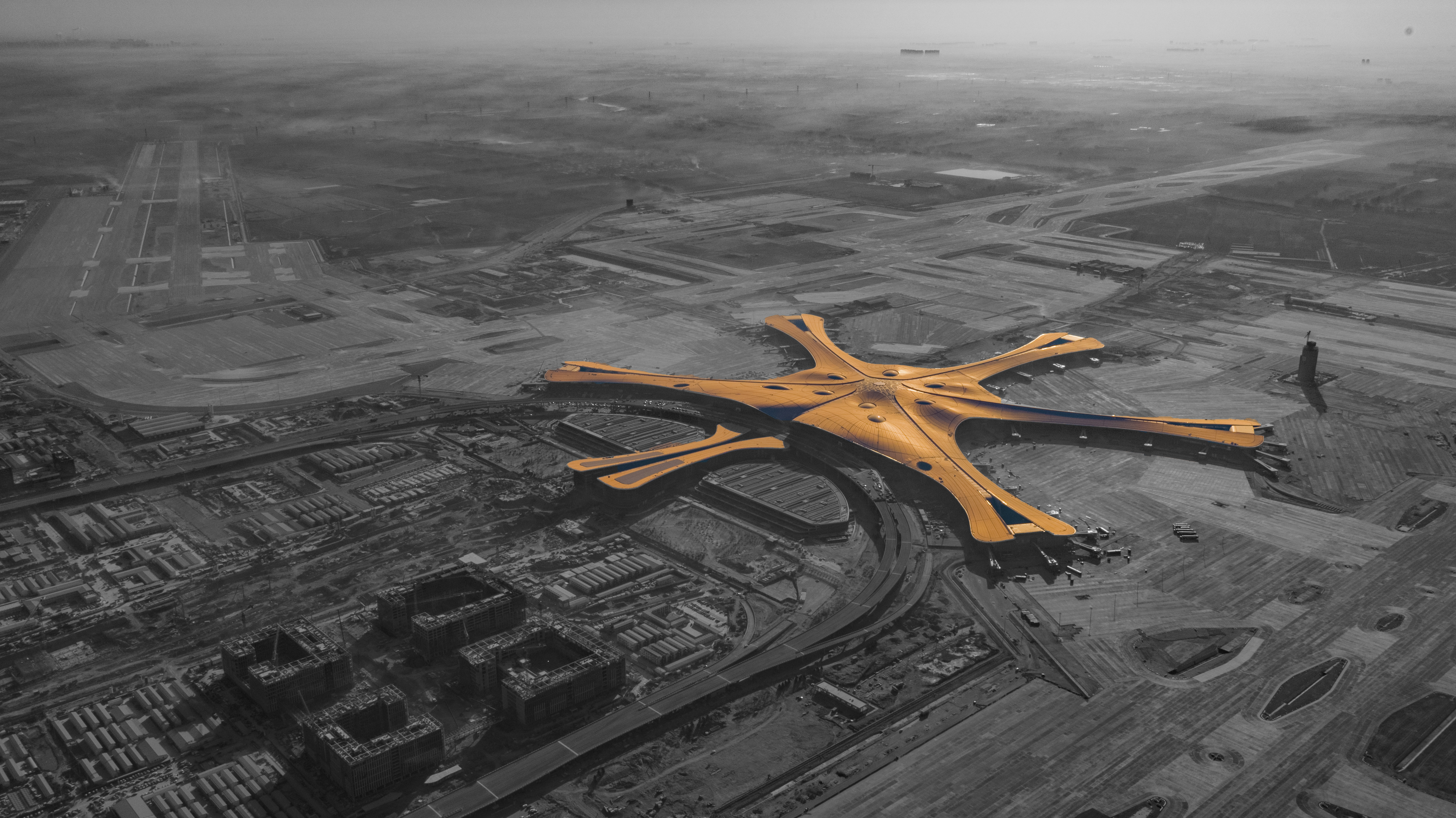
Langfang contains part of the Beijing Daxing International Airport (IATA: PKX, ICAO: ZBAD), opened in September 2019. It is also only a one-hour drive from Beijing Capital International Airport (IATA: PEK, ICAO: ZBAA) and the Tianjin New Port. The Langfang North railway station serves the older Beijing–Shanghai railway, while the newer Langfang railway station opened in July 2011 as the penultimate stop on the Beijing–Shanghai high-speed railway.[7]
References
- "China: Hébĕi (Prefectures, Cities, Districts and Counties) - Population Statistics, Charts and Map".
- Bildner, Eli (February 27, 2013). "Interactive Maps of China's Most–and Least–Polluted Places". Global Voices China. http://newsmotion.org. Archived from the original on 3 September 2014. Retrieved 1 September 2014.
{{cite news}}: External link in|agency= - 中国气象数据网 - WeatherBk Data. China Meteorological Administration. Retrieved 2018-11-09.
- Paul A. Cohen (1997). History in three keys: the boxers as event, experience, and myth. Columbia University Press. p. 49. ISBN 0-231-10651-3. Retrieved 2010-06-28.
dong fuxiang major victory seymour tianjin.
- "China National Wins Reliance Gas Pipeline Contract in India". Bloomberg. July 8, 2014.
- RightSite.asia | Langfang Export Processing Zone
- 京沪高铁公布23个站名 6月1日起正式启用. 2011-05-26. Archived from the original on 2011-08-08. Retrieved 2012-04-14.
External links
- Official website
- http://www.langfang.net/
- https://web.archive.org/web/20090122140613/http://www.langfangtv.com/ - TV station
- http://www.lfnews.cn - news
- http://www.lfsfxy.edu.cn Langfang Teachers College
Hebei topics | |
|---|---|
Shijiazhuang (capital) | |
| General | |
| Geography |
|
| Education |
|
| Culture |
|
| Visitor attractions |
|
| |
Notes: *Provincial capitals, ★Sub-provincial cities, ☆Sub-provincial autonomous prefecture *Sub prefectural-level divisions, ✧"Comparatively larger city" (较大的市) as approved by the State Council | ||||||||||||||||||||||||||||||||||||||||||||||||||||
|  | |||||||||||||||||||||||||||||||||||||||||||||||||||
|
See also: List of prefectures in China, List of cities in China | ||||||||||||||||||||||||||||||||||||||||||||||||||||
Authority control | |
|---|---|
| General | |
| National libraries | |
| Other |
|
На других языках
- [en] Langfang
[ru] Ланфан
Ланфа́н (кит. упр. 廊坊, пиньинь Lángfāng) — городской округ в провинции Хэбэй КНР. В состав округа также входит эксклав Саньхэ (состоящий из городского уезда Саньхэ, уезда Сянхэ и Дачан-Хуэйского автономного уезда), полностью заключённый между территориями городов центрального подчинения Пекин и Тяньцзинь.Другой контент может иметь иную лицензию. Перед использованием материалов сайта WikiSort.org внимательно изучите правила лицензирования конкретных элементов наполнения сайта.
WikiSort.org - проект по пересортировке и дополнению контента Википедии