world.wikisort.org - China
Zhangzhou (/ˈdʒæŋˈdʒoʊ/),[3] alternately romanized as Changchow, is a prefecture-level city in Fujian Province, China. The prefecture around the city proper comprises the southeast corner of the province, facing the Taiwan Strait and surrounding the prefecture of Xiamen.
This article may be expanded with text translated from the corresponding article in Chinese. (August 2012) Click [show] for important translation instructions.
|
Zhangzhou
漳州市 Changchow | |
|---|---|
Prefecture-level city | |
 | |
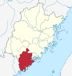 Location of Zhangzhou City jurisdiction in Fujian | |
 Zhangzhou Location in China | |
| Coordinates (Zhangzhou municipal government): 24°30′47″N 117°38′49″E | |
| Country | People's Republic of China |
| Province | Fujian |
| Municipal seat | Xiangcheng District |
| Area | |
| • Prefecture-level city | 12,882.27 km2 (4,973.87 sq mi) |
| • Urban | 2,590.23 km2 (1,000.09 sq mi) |
| • Metro | 4,290.84 km2 (1,656.70 sq mi) |
| Population (2020 census)[1] | |
| • Prefecture-level city | 5,054,328 |
| • Density | 390/km2 (1,000/sq mi) |
| • Urban | 939,943 |
| • Urban density | 360/km2 (940/sq mi) |
| • Metro | 7,284,148 |
| • Metro density | 1,700/km2 (4,400/sq mi) |
| Time zone | UTC+8 (China Standard) |
| Postal code | 363000 |
| Area code(s) | 596 |
| ISO 3166 code | CN-FJ-06 |
| GDP | 2016[2] |
| - Total | CNY 312.534 billion (US$47.052 billion) |
| - Per capita | CNY 62,196 (US$9,364) |
| - Growth | |
| License Plate | 闽E |
| Local dialect | Min Nan: Zhangzhou dialect |
| City trees | Cinnamomum camphora |
| City flowers | Narcissus tazetta |
| Website | zhangzhou |
| Zhangzhou | |||||||||||||||||||
|---|---|---|---|---|---|---|---|---|---|---|---|---|---|---|---|---|---|---|---|
 "Zhangzhou" in regular Chinese characters | |||||||||||||||||||
| Chinese | 漳州 | ||||||||||||||||||
| Postal | Changchow | ||||||||||||||||||
| |||||||||||||||||||
Name
Zhangzhou is the atonal pinyin romanization of the city's Chinese name 漳州, using its pronunciation in Standard Mandarin. The name derives from the city's former status as the seat of the imperial Chinese Zhang Prefecture. The same name was romanized as "Changchow" on the Chinese Postal Map and Chang-chou in Wade-Giles. Other romanizations include Chang-chow.[4]
It also appears as Chang-chu,[5] Chiang-chiu,[6] Chiang-chew, or Chiang Chew[citation needed] from the city's local Hokkien name Chiang-chiu. This name appeared in Spanish and Portuguese Jesuit sources as Chincheo, which was anglicized as Chinchew. By the 19th century, however, this name had migrated and was used to refer to Quanzhou, a separate port about 65 miles (105 km) east-northeast of central Zhangzhou.[7]
Geography
Zhangzhou proper lies on the banks of the Jiulong River in southern Fujian about 35 miles (56 km) from central Xiamen,[4] whose urban core has grown to form a single urbanized area with it. The prefecture of Zhangzhou comprises the southeastern corner of the province, surrounding Xiamen. The prefecture of Quanzhou lies to its northeast, Longyan to its northwest, and Shantou in Guangdong to its southwest.
Climate
Zhangzhou has a monsoon-influenced humid subtropical climate (Köppen Cfa), with mild to warm winters and long, very hot and humid summers. The monthly 24-hour average temperature ranges from 13.2 °C (55.8 °F) in January to 28.8 °C (83.8 °F) in July, and the annual mean is 21.3 °C (70.3 °F). The frost-free period lasts 330 days.
| Climate data for Zhangzhou (1971−2000) | |||||||||||||
|---|---|---|---|---|---|---|---|---|---|---|---|---|---|
| Month | Jan | Feb | Mar | Apr | May | Jun | Jul | Aug | Sep | Oct | Nov | Dec | Year |
| Record high °C (°F) | 28.8 (83.8) |
30.3 (86.5) |
33.7 (92.7) |
35.1 (95.2) |
37.5 (99.5) |
37.6 (99.7) |
38.6 (101.5) |
38.1 (100.6) |
37.1 (98.8) |
34.6 (94.3) |
35.2 (95.4) |
29.1 (84.4) |
38.6 (101.5) |
| Average high °C (°F) | 18.0 (64.4) |
18.0 (64.4) |
20.3 (68.5) |
24.6 (76.3) |
27.8 (82.0) |
31.0 (87.8) |
33.6 (92.5) |
33.1 (91.6) |
31.2 (88.2) |
28.2 (82.8) |
24.4 (75.9) |
20.3 (68.5) |
25.9 (78.6) |
| Daily mean °C (°F) | 13.2 (55.8) |
13.5 (56.3) |
15.9 (60.6) |
20.2 (68.4) |
23.7 (74.7) |
26.8 (80.2) |
28.8 (83.8) |
28.3 (82.9) |
26.7 (80.1) |
23.5 (74.3) |
19.3 (66.7) |
15.1 (59.2) |
21.3 (70.3) |
| Average low °C (°F) | 10.0 (50.0) |
10.7 (51.3) |
13.0 (55.4) |
17.1 (62.8) |
20.9 (69.6) |
23.8 (74.8) |
25.3 (77.5) |
25.1 (77.2) |
23.5 (74.3) |
20.1 (68.2) |
15.6 (60.1) |
11.4 (52.5) |
18.0 (64.5) |
| Record low °C (°F) | 1.3 (34.3) |
1.3 (34.3) |
3.0 (37.4) |
7.3 (45.1) |
12.3 (54.1) |
17.0 (62.6) |
21.0 (69.8) |
21.3 (70.3) |
16.8 (62.2) |
7.6 (45.7) |
4.8 (40.6) |
−0.1 (31.8) |
−0.1 (31.8) |
| Average rainfall mm (inches) | 41.0 (1.61) |
84.8 (3.34) |
114.0 (4.49) |
168.4 (6.63) |
207.2 (8.16) |
278.6 (10.97) |
171.9 (6.77) |
232.8 (9.17) |
170.0 (6.69) |
63.0 (2.48) |
38.2 (1.50) |
34.5 (1.36) |
1,604.4 (63.17) |
| Average rainy days (≥ 0.1 mm) | 8.5 | 12.2 | 14.9 | 15.2 | 16.9 | 17.7 | 12.5 | 14.3 | 11.2 | 5.5 | 5.1 | 5.6 | 139.6 |
| Source: Weather China | |||||||||||||
History
According to Odoric of Pordenone, Zhangzhou was a prosperous city twice the size of Bologna.[8]
During the early Qing, Zhangzhou was the primary Fujianese port trading with Portuguese Macao and Spanish Manila. For a time, the Portuguese maintained a factory in the city.[7]
During the late Qing, Zhangzhou remained a center of silk, brick, and sugar production with about a million people and extensive internal and maritime trade. Its city wall had a circumference of about 4.5 miles (7.2 km) but included a good deal of open ground and farmland. Its streets were paved with granite but badly maintained. The 800-foot (240 m) bridge across the Jiulong River consisted of wooden planks laid between 25 piles of stones at roughly equal intervals.[4] The port of Xiamen in an island at the mouth of the Jiulong principally functioned as a trading center for the produce and wares of Zhangzhou and its hinterland;[5] both suffered economically when Indian tea plantations cratered demand for Fujianese tea in the late 19th century.[9]
The old city of Zhangzhou (now Xiangcheng District) was occupied in April and May 1932 by a column of Communist guerrillas under Mao Zedong. Due to the presence of Western gunboats in Xiamen Bay, arms shipments from the Soviet Union were unable to get up the Jiulong River to Mao's forces and the main Communist bases. Discovering this, Mao retreated from the city, according to some accounts with a substantial amount of loot taken from its residents.[10]
Administrative divisions
Zhangzhou comprises 4 urban districts, and 7 counties.
- Xiangcheng District (芗城区)
- Longwen District (龙文区)
- Longhai District (龙海区)
- Changtai District (长泰区)
- Dongshan County (东山县)
- Hua'an County (华安县)
- Nanjing County (南靖县)
- Pinghe County (平和县)
- Yunxiao County (云霄县)
- Zhangpu County (漳浦县)
- Zhao'an County (诏安县)
| Map |
|---|

Xiangcheng
Longwen
Longhai
Changtai
Zhangpu
County Zhao'an
County Dongshan
County Nanjing
County Pinghe
County Hua'an
County |
Demographics
During the 2020 Chinese census, the entire area of Zhangzhou was home to 5,054,328 inhabitants. Along with the 2,120,178 people of central Xiamen, its urban districts of Xiangcheng, Longwen, Longhai and Changtai, form a single metropolitan area of about 7,284,148 people.
The main language of the Zhangzhou Hokkiens is the local dialect of Min Nan, part of the Southern Min branch of Min Chinese. Government, education, and official business, however, are carried out in Mandarin.[citation needed]
Hakka is also spoken in the rural peasant area of Zhangzhou in the west and south.
Economy
This section needs expansion. You can help by adding to it. (July 2016) |
Babao seal paste was invented by the druggist Wei Changan as a traditional medicine in 1673. It was repurposed for artistic use a few years later and gained imperial favor under the Qianlong Emperor. It remains prized for its bright color and pleasant smell.
A major petrochemical plant, producing paraxylene, owned by Taiwan-based Xianglu Group is located in Zhangzhou's Gulei Peninsula. The plant suffered major fires in 2013 and 2015.[11]
Transportation
Two passenger stations serve Zhangzhou:
- Zhangzhou East Railway Station on the older Yingtan–Xiamen Railway, northeast of the city;
- Zhangzhou Railway Station, the junction of the high-speed Xiamen–Shenzhen Railway and Longyan–Xiamen Railway, opened in 2012, south of the city.
Education
This section needs expansion. You can help by adding to it. (July 2016) |
- Minnan Normal University
- Tenfu Tea College
Notable residents
- Chen Yuanguang (657–711), a leader of the movement to sinicize Fujian and northern Guangdong.
- Khaw Soo Cheang (1786–1882), merchant and governor of a Thai province.
- Lim Gu Tong (1895–1976), international author, cultural ambassador and inventor.
- Fang Zhouzi (1967), science writer.
Sister city
Zhangzhou is twinned with the following regions, cities and towns:[12]
 Palembang, South Sumatra (since 2002)[13]
 Isahaya, Nagasaki
- Date, Iburi Subprefecture
 Gödöllő, Pest County
 Wageningen, Gelderland
 Honolulu, Hawaii
See also
- List of twin towns and sister cities in China
- Yuegang, important seaport during Ming and Ming-Qing transition in morden Zhangzhou and Xiamen
References
- "China: Fújiàn (Prefectures, Cities, Districts and Counties) - Population Statistics, Charts and Map".
- 漳州市2009年国民经济和社会发展统计公报 (in Chinese). Zhangzhou Municipal Statistic Bureau. 2010-03-12. Retrieved 2010-05-03.
- "Zhangzhou". Collins English Dictionary.
- Baynes, T. S., ed. (1878), , Encyclopædia Britannica, vol. 5 (9th ed.), New York: Charles Scribner's Sons, p. 391
- Baynes, T. S., ed. (1878), , Encyclopædia Britannica, vol. 1 (9th ed.), New York: Charles Scribner's Sons, p. 748.
- Pitcher, Philip Wilson (1893). Fifty Years in Amoy or A History of the Amoy Mission, China. New York: Reformed Church in America. p. 33.
- Yule, Henry (1878), , in Baynes, T. S. (ed.), Encyclopædia Britannica, vol. 5 (9th ed.), New York: Charles Scribner's Sons, p. 673
- Yule, Henry (2002). The Travels of Friar Odoric. p. 123.
- Chisholm, Hugh, ed. (1911), , Encyclopædia Britannica, vol. 1 (11th ed.), Cambridge University Press, p. 878.
- Zhang Rong; et al. (2005), Mao: The Unknown Story, p. 117.
- A contentious chemical plant in China has exploded for the second time in two years
- "福建省与国外友城关系一览表" (in Simplified Chinese). 福建省人民政府外事办公室. Archived from the original on 2008-03-16. Retrieved 2009-09-07.
- "南苏门答腊省概况" (in Chinese). Retrieved 17 December 2020.
External links
| Wikimedia Commons has media related to Zhangzhou. |
| Look up Zhangzhou, Chang-chou, or Chiangchew in Wiktionary, the free dictionary. |
- Official website (in Chinese)
- Historic US Army map of Zhangzhou, 1945
Fujian topics | |
|---|---|
| |
| General |
|
| Geography |
|
| Education |
|
| Culture |
|
| Cuisine |
|
| Visitor attractions |
|
| |
Notes: *Provincial capitals, ★Sub-provincial cities, ☆Sub-provincial autonomous prefecture *Sub prefectural-level divisions, ✧"Comparatively larger city" (较大的市) as approved by the State Council | ||||||||||||||||||||||||||||||||||||||||||||||||||||||||||||||||
|  | |||||||||||||||||||||||||||||||||||||||||||||||||||||||||||||||
|
See also: List of prefectures in China, List of cities in China | ||||||||||||||||||||||||||||||||||||||||||||||||||||||||||||||||
Authority control | |
|---|---|
| General |
|
| National libraries | |
| Other |
|
На других языках
[de] Zhangzhou
Zhangzhou (chinesisch .mw-parser-output .Hani{font-size:110%}漳州市, Pinyin Zhāngzhōu shì, veraltet nach Post Changchew) ist die südlichste der neun bezirksfreien Städte der chinesischen Provinz Fujian. Sie ist in China bekannt als Stadt der Narzissen (水仙花, shuixianhua). Zhangzhou hat eine Küstenlinie von 680 Kilometer Länge mit vielen natürlichen Tiefwasserhäfen. Es grenzt an die Nachbarprovinz Guangdong im Südwesten und an die Stadt Xiamen im Nordosten. Außerdem hat es über die Lage an der Taiwanstraße Zugang zum Pazifik. Zhangzhou ist in China bekannt für den Anbau einer Reihe von tropischen Früchten und Blumen.- [en] Zhangzhou
[ru] Чжанчжоу
Чжанчжо́у (кит. упр. 漳州, пиньинь Zhāngzhōu) — городской округ в провинции Фуцзянь КНР.Другой контент может иметь иную лицензию. Перед использованием материалов сайта WikiSort.org внимательно изучите правила лицензирования конкретных элементов наполнения сайта.
WikiSort.org - проект по пересортировке и дополнению контента Википедии