world.wikisort.org - China
Bijie (simplified Chinese: 毕节; traditional Chinese: 畢節; pinyin: Bìjíe) is a prefecture-level city in northwestern Guizhou Province, China, bordering Sichuan to the north and Yunnan to the west.
Bijie
毕节市 Pikieh, Pichieh | |
|---|---|
Prefecture-level city | |
 Location of Bijie City jurisdiction in Guizhou | |
 Bijie Location of the city center in Guizhou  Bijie Bijie (Southwest China) | |
| Coordinates (Bijie municipal government): 27°17′02″N 105°17′31″E | |
| Country | People's Republic of China |
| Province | Guizhou |
| Municipal seat | Qixingguan District |
| Area | |
| • Total | 26,853 km2 (10,368 sq mi) |
| Elevation | 1,723 m (5,653 ft) |
| Population (2010) | |
| • Total | 6,536,370 |
| • Density | 240/km2 (630/sq mi) |
| Time zone | UTC+8 (China Standard) |
| Postal code | 551700 |
| Area code | 0857 |
| ISO 3166 code | CN-GZ-05 |
| Licence plate prefixes | 贵F |
| Website | bijie |
The Daotianhe Reservoir, located to the north of the town was commissioned in 1965 with a rated annual capacity of 6.5 million cubic meters.
On 10 November 2011, the former Bijie Prefecture (毕节地区) was converted to a prefecture-level city, and the former county-level city of Bijie was rechristened Qixingguan District.[1]
Geography and climate

Bijie borders Zunyi to the east, Anshun and Liupanshui to the south, Zhaotong and Qujing (Yunnan) to the west, and Luzhou (Sichuan) to the north. It spans latitude 26°21′−27°46′ N and longitude 105°36′−106°43′ E, and is marked heavily by the presence of the Wumeng Mountains (乌蒙山) as well as karst topography. The Wu, Beipan, and Chishui Rivers are the most important rivers that originate here. The highest elevation is Jiucaiping (韭菜坪), at 2,900.6 m (9,516 ft), on the border of Hezhang and Weining counties.
Due to its low latitude and elevation above 1,700 m (5,600 ft), Bijie has a monsoon-influenced subtropical highland climate (Köppen Cwb), bordering on a humid subtropical climate (Köppen Cwa) with very warm, rainy summers and cool, damp winters. The monthly 24-hour average temperature ranges from 2.9 °C (37.2 °F) in January to 21.7 °C (71.1 °F) in July, while the annual mean is 13.01 °C (55.4 °F). Rainfall is very common year-round, occurring on 206 days of the year, but over half of the annual total (866 mm or 34.1 in) occurs from June to August. With monthly percent possible sunshine ranging from 15% in January to 44% in August, the city receives 1,218 hours of bright sunshine annually; spring is sunnier and features warmer daytime temperatures than autumn.
| Climate data for Bijie (1981−2010 normals) | |||||||||||||
|---|---|---|---|---|---|---|---|---|---|---|---|---|---|
| Month | Jan | Feb | Mar | Apr | May | Jun | Jul | Aug | Sep | Oct | Nov | Dec | Year |
| Record high °C (°F) | 24.4 (75.9) |
28.9 (84.0) |
33.8 (92.8) |
33.1 (91.6) |
36.2 (97.2) |
34.2 (93.6) |
33.8 (92.8) |
33.9 (93.0) |
35.1 (95.2) |
30.5 (86.9) |
27.0 (80.6) |
23.3 (73.9) |
36.2 (97.2) |
| Average high °C (°F) | 6.6 (43.9) |
9.2 (48.6) |
14.4 (57.9) |
19.1 (66.4) |
22.6 (72.7) |
24.4 (75.9) |
26.9 (80.4) |
26.8 (80.2) |
23.4 (74.1) |
17.8 (64.0) |
14.0 (57.2) |
8.9 (48.0) |
17.8 (64.1) |
| Daily mean °C (°F) | 2.9 (37.2) |
4.9 (40.8) |
9.0 (48.2) |
13.6 (56.5) |
17.2 (63.0) |
19.6 (67.3) |
21.7 (71.1) |
21.2 (70.2) |
18.2 (64.8) |
13.6 (56.5) |
9.5 (49.1) |
4.7 (40.5) |
13.0 (55.4) |
| Average low °C (°F) | 0.8 (33.4) |
2.4 (36.3) |
5.7 (42.3) |
10.0 (50.0) |
13.5 (56.3) |
16.3 (61.3) |
18.1 (64.6) |
17.4 (63.3) |
14.7 (58.5) |
11.0 (51.8) |
6.7 (44.1) |
2.2 (36.0) |
9.9 (49.8) |
| Record low °C (°F) | −7.0 (19.4) |
−6.0 (21.2) |
−4.4 (24.1) |
0.4 (32.7) |
3.7 (38.7) |
9.9 (49.8) |
8.9 (48.0) |
10.9 (51.6) |
6.3 (43.3) |
1.1 (34.0) |
−2.6 (27.3) |
−6.6 (20.1) |
−7.0 (19.4) |
| Average precipitation mm (inches) | 16.3 (0.64) |
17.2 (0.68) |
28.0 (1.10) |
54.5 (2.15) |
94.9 (3.74) |
148.6 (5.85) |
173.5 (6.83) |
140.9 (5.55) |
90.7 (3.57) |
61.7 (2.43) |
27.7 (1.09) |
12.1 (0.48) |
866.1 (34.11) |
| Average precipitation days (≥ 0.1 mm) | 18.8 | 18.3 | 16.8 | 17.4 | 19.5 | 19.0 | 16.4 | 15.4 | 16.0 | 18.0 | 14.8 | 15.6 | 206.0 |
| Average relative humidity (%) | 86 | 84 | 80 | 78 | 77 | 80 | 80 | 79 | 80 | 85 | 84 | 84 | 81 |
| Mean monthly sunshine hours | 49.1 | 51.6 | 95.9 | 116.5 | 116.1 | 106.3 | 171.5 | 176.7 | 117.8 | 81.7 | 70.7 | 63.7 | 1,217.6 |
| Percent possible sunshine | 15 | 16 | 26 | 31 | 28 | 26 | 41 | 44 | 32 | 23 | 22 | 20 | 27 |
| Source: China Meteorological Administration (precipitation days and sunshine 1971–2000)[2][3] | |||||||||||||
Administration

Bijie City consists of one district, one county-level city, five counties and one autonomous county. These are:
- Qixingguan District (七星关区; Qīxīngguān Qū);
- Qianxi City (黔西市; Qiánxī Shì);
- Dafang County (大方县; Dàfāng Xiàn);
- Jinsha County (金沙县; Jīnshā Xiàn);
- Zhijin County (织金县; Zhījīn Xiàn);
- Nayong County (纳雍县; Nàyōng Xiàn);
- Hezhang County (赫章县; Hèzhāng Xiàn);
- Weining Yi Hui and Miao Autonomous County (威宁彝族回族苗族自治县; Wēiníng yízú huízú Miáozú Zìzhìxiàn).
| Map |
|---|

Demographics
| Division name | ||||
|---|---|---|---|---|
| Permanent residents[4](Nov. 2010) | Hukou population[5] (Late 2010) | |||
| Total | Percentage | Population density (/km2) | ||
| Bijie City | 6,536,370 | 100 | 243.41 | 8,338,858 |
| Qixingguan District | 1,136,905 | 17.39 | 333.21 | 1,483,697 |
| Dafang County | 776,246 | 11.88 | 221.66 | 1,080,406 |
| Qianxi County | 695,735 | 10.64 | 272.41 | 914,025 |
| Jinsha County | 560,651 | 8.58 | 221.78 | 669,661 |
| Zhijin County | 783,951 | 11.99 | 273.44 | 1,086,150 |
| Nayong County | 669,781 | 10.25 | 273.60 | 938,435 |
| Weining Yi Hui and Miao Autonomous County | 1,263,816 | 19.34 | 200.73 | 1,392,117 |
| Hezhang County | 649,285 | 9.93 | 200.09 | 774,367 |
According to the 2010 Sixth National Census, Bijie City had a permanent resident population of 6,536,370, an increase of 208,899 (3.3% or 0.33% annually), 3,400,195 (52.02%) of which were male, producing a male-female ratio of 108.42:100. Children aged 0−14 numbered 2,029,934人 (31.06%), persons aged 15−64 numbered 4,018,583 (61.48), and seniors 65+ numbered 487,853 (7.46%). The urban population stood at 1,711,222 (26.18%). Persons of Han ethnicity numbered 4,824,015 (73.80%), while minorities formed the other 26.20%.
Transport
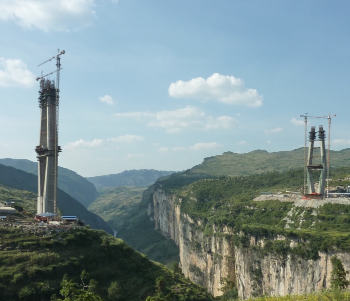
At present the backbone of the transport network in Bijie City is formed by China National Highways 321 and 326. As of 2013[update], Bijie is the only prefecture-level city of Guizhou to lack rail service;[6] this changed with the 2020 opening of the Leshan (Sichuan)−Guiyang Railway (成贵客运专线).[7] Other projected rail lines are Bijie−Shuicheng−Xingyi (毕水兴铁路) and Zhaotong (Yunnan)−Weining−Bijie−Jinsha−Zunyi.[8] The city is served by the Bijie Feixiong Airport (IATA: BFJ).
Historical sites
Notable historical sites in Bijie include the following:[9]
- Historical inscriptions
- Ma'an Mountain, Qianxi Yi Cliff Inscription (黔西马鞍山彝文岩刻): located in Bakuaitian, Chengguan Township, Qianxi (黔西县城关镇八块田村)
- Wopo, Hezhang Cliff Inscription (赫章窝颇写字岩摩崖): located in Xique, Wopo Township, Hezhang (赫章县窝颇乡喜鹊)
- Qixingguan, Bijie Cliff Inscription (毕节七星关摩崖): located in Qixing Township (七星乡), along the border between Hezhang County and Qixingguan District
- Chekaiqing, Nayong Chinese-Yi Cliff Inscription (纳雍扯垲箐汉彝文摩崖石刻): located in Kaiqing, Poqi Township, Zhikun District (治昆区坡其乡垲箐村)
- Guanyindong, Jinsha Buddha Image Cliff Inscription (金沙观音洞佛像摩崖): located in Yankong (岩孔镇), near the local elementary school
- Qianxi "Reverse Cliff Inscription" (黔西"反字岩"): located in Zhongguan, Zhongjian Township (中建乡中广村)
- Dafang Shuixi Dadu River Bridge Inscription (大方水西大渡河桥碑): located on the banks of the Dadu River (大渡河) between Huangnitang (黄泥塘镇), Dafang County, and Aoshui Township (凹水乡), Qianxi County
- Dafang Hejia Bridge Yi Inscription (大方何家桥彝文碑): located on the banks of the Mudu River (墓都河) in Shishu Township (柿树乡)
- Dafang Mayi River Bridge Inscription (大方蚂蚁河桥碑): located on the Mayi River Bridge (蚂蚁河桥) in Songhe Township (松鹤乡)
- Dafang Yi Ancestral Origin Inscription (大方彝文祖源碑): located in Qingjiao, Shishu Township (柿树乡箐脚)
References
- 国务院批准毕节撤地设市 (in Simplified Chinese). 12 November 2011. Retrieved 23 November 2011.
- 中国气象数据网 – WeatherBk Data (in Chinese (China)). China Meteorological Administration. Retrieved 15 April 2020.
- 中国地面国际交换站气候标准值月值数据集(1971-2000年). China Meteorological Administration. Archived from the original on 21 September 2013. Retrieved 25 May 2010.
- 《毕节地区2010年第六次全国人口普查主要数据公报》[full citation needed]
- 《中华人民共和国全国分县市人口统计资料2010》[full citation needed]
- 毕节铁路建设迎来发展春天. Archived from the original on 24 April 2013. Retrieved 30 May 2013.
- 成贵高铁全线开通 毕节正式进入高铁时代. Archived from the original on 10 September 2020. Retrieved 10 September 2020.
- "三纵三横"铁路规划使毕节通江达海. Archived from the original on 2 May 2013. Retrieved 30 May 2013.
- 毕节地区志: 文物名胜志 [Almanac of Bijie Prefecture: Directory of cultural and historical sites]. Guizhou People's Press. 1994.
External links
| |||||||||||||||||||||||


Authority control | |
|---|---|
| General |
|
| National libraries | |
На других языках
- [en] Bijie
[ru] Бицзе
Бицзе́ (кит. упр. 毕节, пиньинь Bìjíe) — городской округ в провинции Гуйчжоу КНР.Другой контент может иметь иную лицензию. Перед использованием материалов сайта WikiSort.org внимательно изучите правила лицензирования конкретных элементов наполнения сайта.
WikiSort.org - проект по пересортировке и дополнению контента Википедии