world.wikisort.org - China
Huaxi District (Chinese: 花溪区; pinyin: Huāxī Qū) is one of 6 urban districts of the prefecture-level city of Guiyang, the capital of Guizhou Province, Southwest China.It is a resort and a national minority cultural center[citation needed]
Huaxi
花溪区 | |
|---|---|
District | |
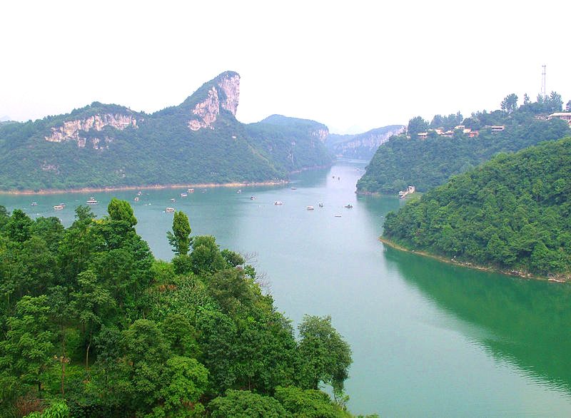 A far view of Banbianshan (半边山) - Half-Axed Mount | |
 Huaxi in Guiyang | |
 Guiyang in Guizhou | |
| Coordinates (Huaxi District government): 26°24′35″N 106°40′13″E | |
| Country | People's Republic of China |
| Province | Guizhou |
| Prefecture-level city | Guiyang |
| Area | |
| • Total | 957.6 km2 (369.7 sq mi) |
| Population (2010) | |
| • Total | 608,213 |
| • Density | 640/km2 (1,600/sq mi) |
| Time zone | UTC+8 (China Standard) |
| Website | http://www.hxgov.gov.cn/ |
Huaxi has an area of 957.6 km2 (369.7 sq mi) and a population of 328,700.[when?] Its GDP was 4.35 billion RMB in 2006.
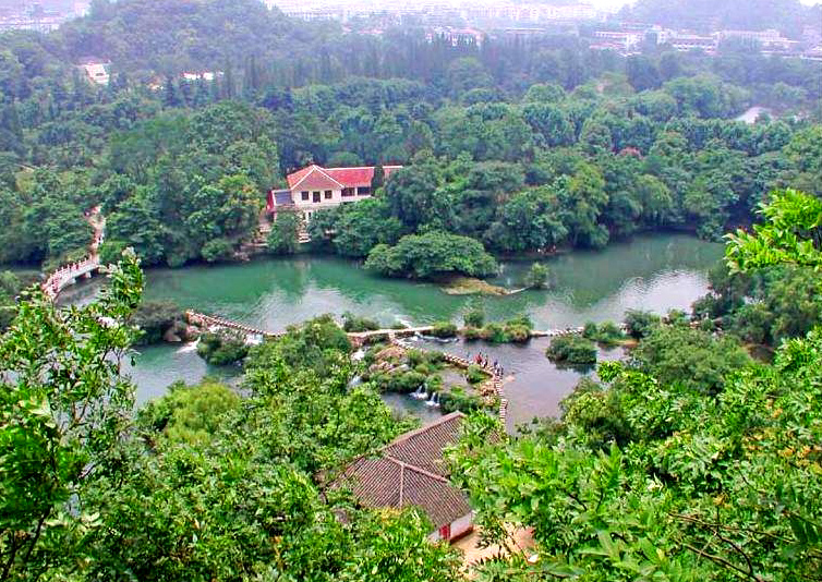
It is named after the Huaxi River (the "Flower Brook") that meanders through the town. The North Campus and South Campus of Guizhou University and Guizhou University for Nationalities are located in town. The educational facilities and natural environment make it a renowned educational and cultural center as well as an important tourist destination of Guizhou and southwest China.[1]
Climate
| Climate data for Huaxi (1981−2010) | |||||||||||||
|---|---|---|---|---|---|---|---|---|---|---|---|---|---|
| Month | Jan | Feb | Mar | Apr | May | Jun | Jul | Aug | Sep | Oct | Nov | Dec | Year |
| Record high °C (°F) | 21.8 (71.2) |
28.5 (83.3) |
30.7 (87.3) |
32.9 (91.2) |
33.2 (91.8) |
32.2 (90.0) |
33.5 (92.3) |
33.4 (92.1) |
33.6 (92.5) |
29.7 (85.5) |
25.8 (78.4) |
23.4 (74.1) |
33.6 (92.5) |
| Average high °C (°F) | 8.7 (47.7) |
11.3 (52.3) |
15.9 (60.6) |
20.9 (69.6) |
24.0 (75.2) |
25.9 (78.6) |
27.5 (81.5) |
27.8 (82.0) |
25.2 (77.4) |
20.2 (68.4) |
16.1 (61.0) |
11.1 (52.0) |
19.5 (67.2) |
| Daily mean °C (°F) | 4.9 (40.8) |
6.9 (44.4) |
10.8 (51.4) |
15.8 (60.4) |
19.3 (66.7) |
21.7 (71.1) |
23.2 (73.8) |
22.8 (73.0) |
20.0 (68.0) |
15.9 (60.6) |
11.6 (52.9) |
6.8 (44.2) |
15.0 (58.9) |
| Average low °C (°F) | 2.5 (36.5) |
4.1 (39.4) |
7.5 (45.5) |
12.2 (54.0) |
15.8 (60.4) |
18.7 (65.7) |
20.1 (68.2) |
19.4 (66.9) |
16.5 (61.7) |
13.0 (55.4) |
8.6 (47.5) |
3.9 (39.0) |
11.9 (53.4) |
| Record low °C (°F) | −5.6 (21.9) |
−4.9 (23.2) |
−3.8 (25.2) |
2.5 (36.5) |
7.0 (44.6) |
11.7 (53.1) |
10.7 (51.3) |
13.6 (56.5) |
6.8 (44.2) |
2.3 (36.1) |
−2.8 (27.0) |
−9.7 (14.5) |
−9.7 (14.5) |
| Average precipitation mm (inches) | 23.7 (0.93) |
25.8 (1.02) |
36.2 (1.43) |
83.0 (3.27) |
154.9 (6.10) |
209.0 (8.23) |
202.1 (7.96) |
127.8 (5.03) |
95.2 (3.75) |
84.9 (3.34) |
42.2 (1.66) |
19.9 (0.78) |
1,104.7 (43.49) |
| Average relative humidity (%) | 83 | 81 | 79 | 79 | 80 | 83 | 84 | 83 | 82 | 84 | 81 | 80 | 82 |
| Source: China Meteorological Data Service Center | |||||||||||||
References
- "Huaxi District". Guiyang Official Website. Retrieved 19 November 2020.
External links
This Guizhou location article is a stub. You can help Wikipedia by expanding it. |
На других языках
- [en] Huaxi District
[ru] Хуаси (Гуйчжоу)
Хуаси́ (кит. упр. 花溪, пиньинь Huāxī) — район городского подчинения городского округа Гуйян провинции Гуйчжоу (КНР).Другой контент может иметь иную лицензию. Перед использованием материалов сайта WikiSort.org внимательно изучите правила лицензирования конкретных элементов наполнения сайта.
WikiSort.org - проект по пересортировке и дополнению контента Википедии