world.wikisort.org - China
Xingyi (simplified Chinese: 兴义; traditional Chinese: 興義; pinyin: Xīngyì) is a county-level city administered by the Qianxinan Buyei and Miao Autonomous Prefecture, in the southwest of Guizhou Province, China.
Xingyi
兴义市 | |
|---|---|
County level city | |
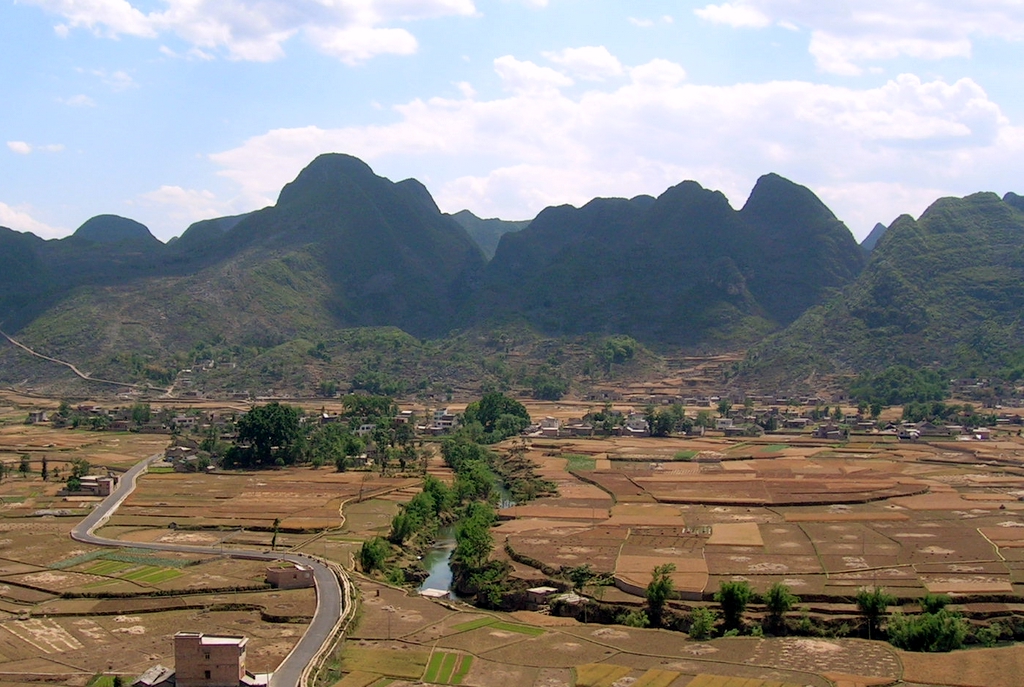 Countryside near Xingyi | |
 Xingyi is the division at the southwest corner in this map of Qianxinan | |
 Qianxi'nan in Guizhou | |
| Coordinates (Xingyi municipal government): 25°05′31″N 104°53′44″E | |
| Country | People's Republic of China |
| Province | Guizhou |
| Autonomous prefecture | Qianxi'nan |
| Area | |
| • Total | 2,911 km2 (1,124 sq mi) |
| Population (2010) | |
| • Total | 784,032 |
| • Density | 270/km2 (700/sq mi) |
| Time zone | UTC+8 (China Standard Time) |
| Postal code | 562400 |
| Area code | (0)859 |
| License plate prefixes | 贵E |
| Website | www.gzxy.gov.cn (Chinese) |
Geography
The city has an area of 2911 square kilometers, and a population of 784,032 as of 2010.[1] It is under the administration of the Qianxinan Buyei and Miao Autonomous Prefecture.

Transportation
Xingyi is served by the Nanning–Kunming Railway and by the Xingyi Wanfenglin Airport.
Biodiversity hotspot
Based on Red Data Book listed endangered species of fish, amphibians, reptiles, and mammals, Xingyi is one of nine vertebrate biodiversity hotspots of China.[2]
Climate
| Climate data for Xingyi (1981−2010 normals) | |||||||||||||
|---|---|---|---|---|---|---|---|---|---|---|---|---|---|
| Month | Jan | Feb | Mar | Apr | May | Jun | Jul | Aug | Sep | Oct | Nov | Dec | Year |
| Record high °C (°F) | 27.6 (81.7) |
31.0 (87.8) |
33.8 (92.8) |
34.5 (94.1) |
36.5 (97.7) |
33.7 (92.7) |
33.5 (92.3) |
32.1 (89.8) |
33.6 (92.5) |
30.4 (86.7) |
28.2 (82.8) |
26.5 (79.7) |
36.5 (97.7) |
| Average high °C (°F) | 11.7 (53.1) |
14.7 (58.5) |
19.4 (66.9) |
24.0 (75.2) |
25.7 (78.3) |
26.3 (79.3) |
26.9 (80.4) |
27.1 (80.8) |
25.1 (77.2) |
21.0 (69.8) |
17.6 (63.7) |
13.3 (55.9) |
21.1 (69.9) |
| Daily mean °C (°F) | 7.6 (45.7) |
10.0 (50.0) |
13.8 (56.8) |
18.3 (64.9) |
20.6 (69.1) |
21.9 (71.4) |
22.5 (72.5) |
22.3 (72.1) |
20.5 (68.9) |
16.9 (62.4) |
13.2 (55.8) |
9.1 (48.4) |
16.4 (61.5) |
| Average low °C (°F) | 5.0 (41.0) |
6.9 (44.4) |
10.2 (50.4) |
14.3 (57.7) |
16.9 (62.4) |
18.8 (65.8) |
19.6 (67.3) |
19.2 (66.6) |
17.3 (63.1) |
14.2 (57.6) |
10.3 (50.5) |
6.3 (43.3) |
13.3 (55.8) |
| Record low °C (°F) | −3.3 (26.1) |
−2.1 (28.2) |
−1.6 (29.1) |
3.6 (38.5) |
8.5 (47.3) |
12.8 (55.0) |
14.1 (57.4) |
14.3 (57.7) |
10.0 (50.0) |
6.4 (43.5) |
0.8 (33.4) |
−4.7 (23.5) |
−4.7 (23.5) |
| Average precipitation mm (inches) | 26.9 (1.06) |
33.5 (1.32) |
37.8 (1.49) |
50.6 (1.99) |
152.2 (5.99) |
298.3 (11.74) |
299.0 (11.77) |
230.5 (9.07) |
150.3 (5.92) |
101.4 (3.99) |
48.0 (1.89) |
22.4 (0.88) |
1,450.9 (57.11) |
| Average relative humidity (%) | 84 | 78 | 72 | 70 | 75 | 83 | 84 | 83 | 81 | 84 | 82 | 82 | 80 |
| Source: China Meteorological Data Service Center[3] | |||||||||||||
External links
References
- "Profile of Xingyi" (in Simplified Chinese). XZQH.org. Archived from the original on January 22, 2009. Retrieved 2009-01-28.
- Chen, Yang; An-Ping Chen; Jing-Yun Fang (2002). "Geographical distribution patterns of endangered fishes, amphibians, reptiles and mammals and their hotspots in China: a study based on "China Red Data Book of Endangered Animals"". Biodiversity Science. 10 (4): 359–368. doi:10.17520/biods.2002050.
- 中国地面气候标准值月值(1981-2010) (in Simplified Chinese). China Meteorological Data Service Center. Retrieved 5 November 2022.
|


| Authority control |
|
|---|
На других языках
- [en] Xingyi, Guizhou
[ru] Синъи
Синъи́ (кит. упр. 兴义, пиньинь Xīngyì) — городской уезд Цяньсинань-Буи-Мяоского автономного округа провинции Гуйчжоу (КНР).Текст в блоке "Читать" взят с сайта "Википедия" и доступен по лицензии Creative Commons Attribution-ShareAlike; в отдельных случаях могут действовать дополнительные условия.
Другой контент может иметь иную лицензию. Перед использованием материалов сайта WikiSort.org внимательно изучите правила лицензирования конкретных элементов наполнения сайта.
Другой контент может иметь иную лицензию. Перед использованием материалов сайта WikiSort.org внимательно изучите правила лицензирования конкретных элементов наполнения сайта.
2019-2026
WikiSort.org - проект по пересортировке и дополнению контента Википедии
WikiSort.org - проект по пересортировке и дополнению контента Википедии