world.wikisort.org - China
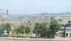
Guiding County (simplified Chinese: 贵定县; traditional Chinese: 貴定縣; pinyin: Guìdìng Xiàn) is a county of south-central Guizhou, People's Republic of China. It is under the administration of the Qiannan Buyei and Miao Autonomous Prefecture. The county seat is located in the town of Chengguan.
Guiding County
贵定县 Kweiting | |
|---|---|
County | |
 | |
| Coordinates (Guiding County government): 26°33′26″N 107°13′56″E | |
| Country | People's Republic of China |
| Province | Guizhou |
| Autonomous prefecture | Qiannan |
| Area | |
| • Total | 1,631 km2 (630 sq mi) |
| Population (2010) | |
| • Total | 231,015 |
| • Density | 140/km2 (370/sq mi) |
| Time zone | UTC+8 (China Standard) |
| Postal code | 551300 |
| Area code | 0854 |
| Website | http://www.guiding.gov.cn/ |
The town of Changmingzhen (昌明镇) has a Laoganma factory that opened during the COVID-19 pandemic in China.[1]
Transportation
Rail
- Guizhou–Guangxi Railway
Climate
| Climate data for Guiding (1981−2010) | |||||||||||||
|---|---|---|---|---|---|---|---|---|---|---|---|---|---|
| Month | Jan | Feb | Mar | Apr | May | Jun | Jul | Aug | Sep | Oct | Nov | Dec | Year |
| Record high °C (°F) | 22.8 (73.0) |
29.8 (85.6) |
31.9 (89.4) |
33.8 (92.8) |
35.5 (95.9) |
33.3 (91.9) |
35.1 (95.2) |
35.2 (95.4) |
33.9 (93.0) |
30.8 (87.4) |
27.3 (81.1) |
24.9 (76.8) |
35.5 (95.9) |
| Average high °C (°F) | 8.4 (47.1) |
10.8 (51.4) |
15.5 (59.9) |
20.9 (69.6) |
24.4 (75.9) |
26.5 (79.7) |
28.5 (83.3) |
28.7 (83.7) |
25.6 (78.1) |
20.4 (68.7) |
16.3 (61.3) |
11.3 (52.3) |
19.8 (67.6) |
| Daily mean °C (°F) | 4.7 (40.5) |
6.7 (44.1) |
10.7 (51.3) |
15.8 (60.4) |
19.6 (67.3) |
22.2 (72.0) |
24.0 (75.2) |
23.5 (74.3) |
20.5 (68.9) |
16.1 (61.0) |
11.7 (53.1) |
6.8 (44.2) |
15.2 (59.4) |
| Average low °C (°F) | 2.2 (36.0) |
4.0 (39.2) |
7.5 (45.5) |
12.3 (54.1) |
16.0 (60.8) |
19.0 (66.2) |
20.9 (69.6) |
20.0 (68.0) |
16.9 (62.4) |
13.1 (55.6) |
8.5 (47.3) |
3.8 (38.8) |
12.0 (53.6) |
| Record low °C (°F) | −5.8 (21.6) |
−5.7 (21.7) |
−3.6 (25.5) |
2.3 (36.1) |
5.4 (41.7) |
11.1 (52.0) |
12.3 (54.1) |
13.5 (56.3) |
8.2 (46.8) |
2.9 (37.2) |
−2.6 (27.3) |
−6.3 (20.7) |
−6.3 (20.7) |
| Average precipitation mm (inches) | 24.2 (0.95) |
26.4 (1.04) |
42.3 (1.67) |
88.2 (3.47) |
156.2 (6.15) |
202.2 (7.96) |
182.5 (7.19) |
138.8 (5.46) |
97.1 (3.82) |
85.2 (3.35) |
45.4 (1.79) |
20.9 (0.82) |
1,109.4 (43.67) |
| Average relative humidity (%) | 81 | 80 | 78 | 78 | 78 | 81 | 80 | 80 | 79 | 81 | 79 | 78 | 79 |
| Source: China Meteorological Data Service Center[2] | |||||||||||||
References
- "Blue-Collar Boom: How China Bounced Back From the Virus". The New York Times. 2021-01-15. Retrieved 2021-07-01.
- 中国地面气候标准值月值(1981-2010) (in Simplified Chinese). China Meteorological Data Service Center. Retrieved 5 November 2022.
External links
На других языках
[de] Guiding
Guiding (chinesisch .mw-parser-output .Hans{font-size:110%}贵定县, Pinyin Guìdìng Xiàn) ist ein chinesischer Kreis im Autonomen Bezirk Qiannan der Bouyei und Miao im Süden der Provinz Guizhou. Guiding hat eine Fläche von 1.625 km² und zählt 243.300 Einwohner (Stand: Ende 2018)[1].- [en] Guiding County
[ru] Гуйдин
Гуйди́н (кит. упр. 贵定, пиньинь Guìdìng) — уезд Цяньнань-Буи-Мяоского автономного округа провинции Гуйчжоу (КНР).Текст в блоке "Читать" взят с сайта "Википедия" и доступен по лицензии Creative Commons Attribution-ShareAlike; в отдельных случаях могут действовать дополнительные условия.
Другой контент может иметь иную лицензию. Перед использованием материалов сайта WikiSort.org внимательно изучите правила лицензирования конкретных элементов наполнения сайта.
Другой контент может иметь иную лицензию. Перед использованием материалов сайта WikiSort.org внимательно изучите правила лицензирования конкретных элементов наполнения сайта.
2019-2025
WikiSort.org - проект по пересортировке и дополнению контента Википедии
WikiSort.org - проект по пересортировке и дополнению контента Википедии

