world.wikisort.org - China
Zhoukou (Chinese: 周口; pinyin: Zhōukǒu; Wade–Giles: Chou-k’ou; postal: Chowkow) is a prefecture-level city in eastern Henan province, China. It borders Zhumadian to the southwest, Xuchang and Luohe to the west, Kaifeng to the northwest, Shangqiu to the northeast, and the province of Anhui on all other sides. As of the 2020 census, its population was 9,026,015 inhabitants. However, as of the 2018 estimation, 1,601,300 lived in the built-up (or metro) made up of Chuanhui district and the northern part of Shangshui county.[2]
Zhoukou
周口市 Chowkow | |
|---|---|
Prefecture-level city | |
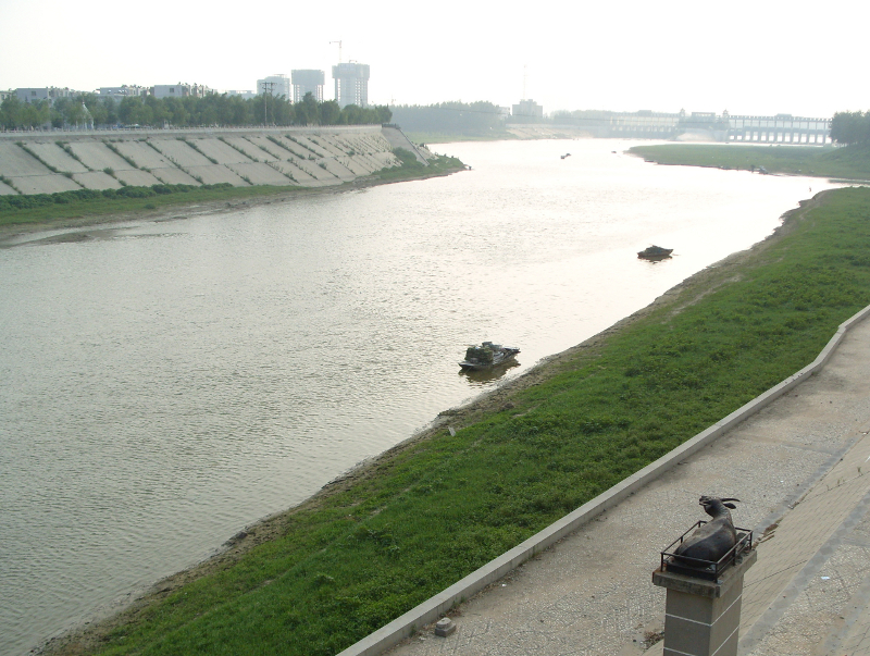 Shaying River near downtown of Zhoukou City | |
 Zhoukou in Henan | |
 Zhoukou Location in China | |
| Coordinates (Zhoukou municipal government): 33°38′12″N 114°42′05″E | |
| Country | People's Republic of China |
| Province | Henan |
| Area | |
| • Prefecture-level city | 11,959 km2 (4,617 sq mi) |
| • Urban | 141 km2 (54 sq mi) |
| • Metro | 1,454 km2 (561 sq mi) |
| Population (2020 census for total, 2018 otherwise)[2] | |
| • Prefecture-level city | 9,026,015 |
| • Density | 750/km2 (2,000/sq mi) |
| • Urban | 721,300 |
| • Urban density | 5,100/km2 (13,000/sq mi) |
| • Metro | 1,601,300 |
| • Metro density | 1,100/km2 (2,900/sq mi) |
| Time zone | UTC+8 (China Standard) |
| Postal code | 466000 |
| Area code(s) | 0394 |
| ISO 3166 code | CN-HA-16 |
| Vehicle registration | 豫P |
| GDP(2009) | CNY 111.17 billion[3] |
| Major Nationalities | Han |
| County-level divisions | 9 |
| Township-level divisions | 1 |
| Website | www |
Administration
The prefecture-level city of Zhoukou administers 2 districts, 1 county-level city and 7 counties.
- Chuanhui District (川汇区)
- Huaiyang District (淮阳区)
- Xiangcheng City (项城市)
- Shenqiu County (沈丘县)
- Dancheng County (郸城县)
- Luyi County (鹿邑县)
- Taikang County (太康县)
- Fugou County (扶沟县)
- Xihua County (西华县)
- Shangshui County (商水县)
| Map |
|---|

Geography
| Climate data for Zhoukou (Chuanhui District, 1981–2010 normals) | |||||||||||||
|---|---|---|---|---|---|---|---|---|---|---|---|---|---|
| Month | Jan | Feb | Mar | Apr | May | Jun | Jul | Aug | Sep | Oct | Nov | Dec | Year |
| Average high °C (°F) | 6.3 (43.3) |
9.6 (49.3) |
14.7 (58.5) |
21.7 (71.1) |
27.1 (80.8) |
31.6 (88.9) |
32.1 (89.8) |
30.9 (87.6) |
27.3 (81.1) |
22.2 (72.0) |
15.0 (59.0) |
8.4 (47.1) |
20.6 (69.0) |
| Daily mean °C (°F) | 1.3 (34.3) |
4.3 (39.7) |
9.2 (48.6) |
15.9 (60.6) |
21.3 (70.3) |
25.9 (78.6) |
27.5 (81.5) |
26.5 (79.7) |
22.0 (71.6) |
16.3 (61.3) |
9.2 (48.6) |
3.3 (37.9) |
15.2 (59.4) |
| Average low °C (°F) | −2.4 (27.7) |
0.2 (32.4) |
4.6 (40.3) |
10.7 (51.3) |
16.0 (60.8) |
20.9 (69.6) |
23.8 (74.8) |
22.9 (73.2) |
17.9 (64.2) |
11.8 (53.2) |
5.0 (41.0) |
−0.5 (31.1) |
10.9 (51.6) |
| Average precipitation mm (inches) | 17.0 (0.67) |
20.3 (0.80) |
38.9 (1.53) |
34.4 (1.35) |
74.3 (2.93) |
102.4 (4.03) |
217.9 (8.58) |
136.0 (5.35) |
82.1 (3.23) |
51.0 (2.01) |
31.4 (1.24) |
16.2 (0.64) |
821.9 (32.36) |
| Average relative humidity (%) | 68 | 66 | 67 | 68 | 70 | 69 | 80 | 82 | 77 | 73 | 72 | 69 | 72 |
| Source: China Meteorological Administration[4] | |||||||||||||
History
For thousands of years, Chen (now at Huaiyang) had been the center of this area and a nationally well-known city. The ancient city site founded at Pingliangtai (near Huaiyang) is over 4600 years old, which is one of the oldest cities in China.[5] According to the legend, Fu Xi, the first of the Three Sovereigns of ancient China, died in the city. During the Spring and Autumn period, Chen was the capital of Chen State and then annexed by Chu. Therefore, the area was usually referred to as "Chen Chu" in ancient times. The leaders of the first Chinese peasant uprising (the Dazexiang uprising) established the government at Chen.
The city's name "Zhoukou" is short for "Zhoujiakou", which literally means "Zhou's ferry". Located at the intersection of Jialu River and Shaying River, it started to develop as a river harbor of China's Inland Water Transport System in the early Ming dynasty. By the end of the 18th century, two towns along the rivers merged into one big town with several tens of thousand permanent residents. From the port, cargo could either be shipped south to the Yangtze River or north to the Yellow River. However, after the "sea ban" was canceled, sea transport began to play a major role on the trade between Jiangnan and North China, which diminished the utility of inland waterways. The cost of maintaining the river channels kept increasing because of the ever-rising river bed. The appearance of railways and modern roads in the early 20th century lead to a recession in the water transport business nearby. Finally, in the 1970s, a dam was built on the Shaying River, which cut the city's last waterway.
In 2000, the government of the Zhoukou prefecture-level city was founded. The old county-level city and its suburban area became Chuanhui District.
Economy
Zhoukou is a major agricultural producer in the province of Henan. Its economy is mainly based on the trade of agricultural products, such as grain, cotton, oil, meat and tobacco. In particular, Zhoukou is famous for the skin of the Huai Goat, a local breed of goat.
Transportation
Railways
- Luofu Railway (Luohe-Fuyang)
Expressways
- Nanluo Expressway (Nanjing-Luoyang)
- Shangzhou Expressway (Shangqiu-Zhoukou)
- Daguang Expressway (Daqing-Guangzhou)
- Yongdeng Expressway (Yongcheng-Dengfeng)
Highways
- China National Highway 311 (G311)
- China National Highway 106 (G106)
Education
Universities and Colleges
- Zhoukou Normal University (周口师范学院)
- Zhoukou Vocational College of Science and Technology (周口科技职业学院)
- Zhoukou Institute of Education (周口教育学院)
- Zhoukou Polytechnic (周口职业技术学院)
Schools[6]
- Zhoukou No.7 Middle School (周口七中)
- Huaiyang High School (淮阳中学)
- Zhoukou First High School (周口一高)
- High School of Fugou County (扶沟县高级中学)
- Xiangcheng First High School (项城一高)
- Shangshui First High School (商水一高)
Notable people
- Laozi (philosopher and central figure in Taoism)
- Wu Guang (leader of the Dazexiang uprising)
- Yuan Shikai (politician)
- Ji Hongchang (general)
- Yue Wenhai (governor)
- Shuping Wang (HIV researcher)
- Wei Rui (sanshou fighter and professional kickboxer)
- Zhang Zhilei (professional heavyweight boxer)
- Jia Aoqi (sanshou fighter and professional kickboxer)
- Xu Jiayin (Chinese businessman and founder of Evergrande Group)
Sister cities
 Petropavl (Petropavlovsk), Kazakhstan
 Taió, Santa Catarina, Brazil
References
- 最新人口信息 www.hongheiku.com (in Chinese). hongheiku. Retrieved 12 January 2021.
- "China: Hénán (Prefectures, Cities, Districts and Counties) - Population Statistics, Charts and Map". Citypopulation.de. Retrieved 28 November 2021.
- 2009年周口市经济运行情况分析. Ha.ststs.gov.cn (in Simplified Chinese).
- 中国气象数据网 – WeatherBk Data (in Chinese (China)). China Meteorological Administration. Retrieved 13 April 2020.
- 平粮台古城遗址. Archived from the original on 8 July 2011.
- 首批河南示范性高中名单. Zgxwyjy.cn.
External links
- Government website of Zhoukou (in Simplified Chinese)
Henan topics | |
|---|---|
Zhengzhou (capital) | |
| General |
|
| Geography |
|
| Education |
|
| Culture |
|
| Cuisine |
|
| Visitor attractions |
|
| |
Notes: *Provincial capitals, ★Sub-provincial cities, ☆Sub-provincial autonomous prefecture *Sub prefectural-level divisions, ✧"Comparatively larger city" (较大的市) as approved by the State Council | ||||||||||||||||||||||||||||||||||||||||||||||||||||||||||||||||
|  | |||||||||||||||||||||||||||||||||||||||||||||||||||||||||||||||
|
See also: List of prefectures in China, List of cities in China | ||||||||||||||||||||||||||||||||||||||||||||||||||||||||||||||||
На других языках
- [en] Zhoukou
[ru] Чжоукоу
Чжоуко́у (кит. упр. 周口, пиньинь Zhōukǒu) — городской округ в провинции Хэнань КНР. Название является сокращением от названия посёлка Чжоуцзякоу, существовавшего в этих местах при империях Мин и Цин, а также при Китайской республике.Другой контент может иметь иную лицензию. Перед использованием материалов сайта WikiSort.org внимательно изучите правила лицензирования конкретных элементов наполнения сайта.
WikiSort.org - проект по пересортировке и дополнению контента Википедии