world.wikisort.org - China
Nyingchi, also known as Linzhi and as Nyingtri, is a prefecture-level city in the southeast of the Tibet Autonomous Region in China. The administrative seat of Nyingchi is Bayi District.
This article may be expanded with text translated from the corresponding article in Chinese. (June 2020) Click [show] for important translation instructions.
|
Nyingchi
林芝市 · ཉིང་ཁྲི་གྲོང་ཁྱེར། | |
|---|---|
Prefecture-level city | |
 An intersection in Bayi, Bayi District, Nyingchi | |
 prefecture (orange) in Tibet Autonomous Region (light-orange) | |
| Coordinates (Nyingchi municipal government): 29°38′56″N 94°21′41″E | |
| Country | People's Republic of China |
| Autonomous region | Tibet |
| City seat | Bayi District (Bayi Town) |
| Area | |
| • Total | 116,175 km2 (44,855 sq mi) |
| Population | |
| • Total | 200,000 |
| • Density | 1.7/km2 (4.5/sq mi) |
| Time zone | UTC+8 (China Standard) |
| ISO 3166 code | CN-XZ-04 |
| Nyingchi | |||||||
|---|---|---|---|---|---|---|---|
| Chinese name | |||||||
| Chinese | 林芝 | ||||||
| |||||||
| Tibetan name | |||||||
| Tibetan | ཉིང་ཁྲི་ས། | ||||||
| |||||||
Nyingchi is the location of Buchu Monastery.
Economy
Tourism

The average elevation of Nyingchi is 3,040 meters (9,974 feet), which is the lowest compared with the other prefectures in Tibet. So, the risk of getting high-altitude sickness is relatively lower than other parts on the plateau. Guangdong province announced in 2012 that it plans to invest more than RMB 400 million (US$63 million) in Nyingchi's tourism industry. According to the plan, Guangdong will help build 22 "prosperous model villages" in Nyingchi in counties such as Bomê and Zayü.[1]
Transportation
It takes about 5 hours to travel from Lhasa to Nyingchi by a highway opened at the end of 2018.[2] Nyingchi is connected to Lhasa by the 435-kilometer Lhasa–Nyingchi railway, completed in 2021. The journey from Lhasa by train takes 2.5 hours.[3]
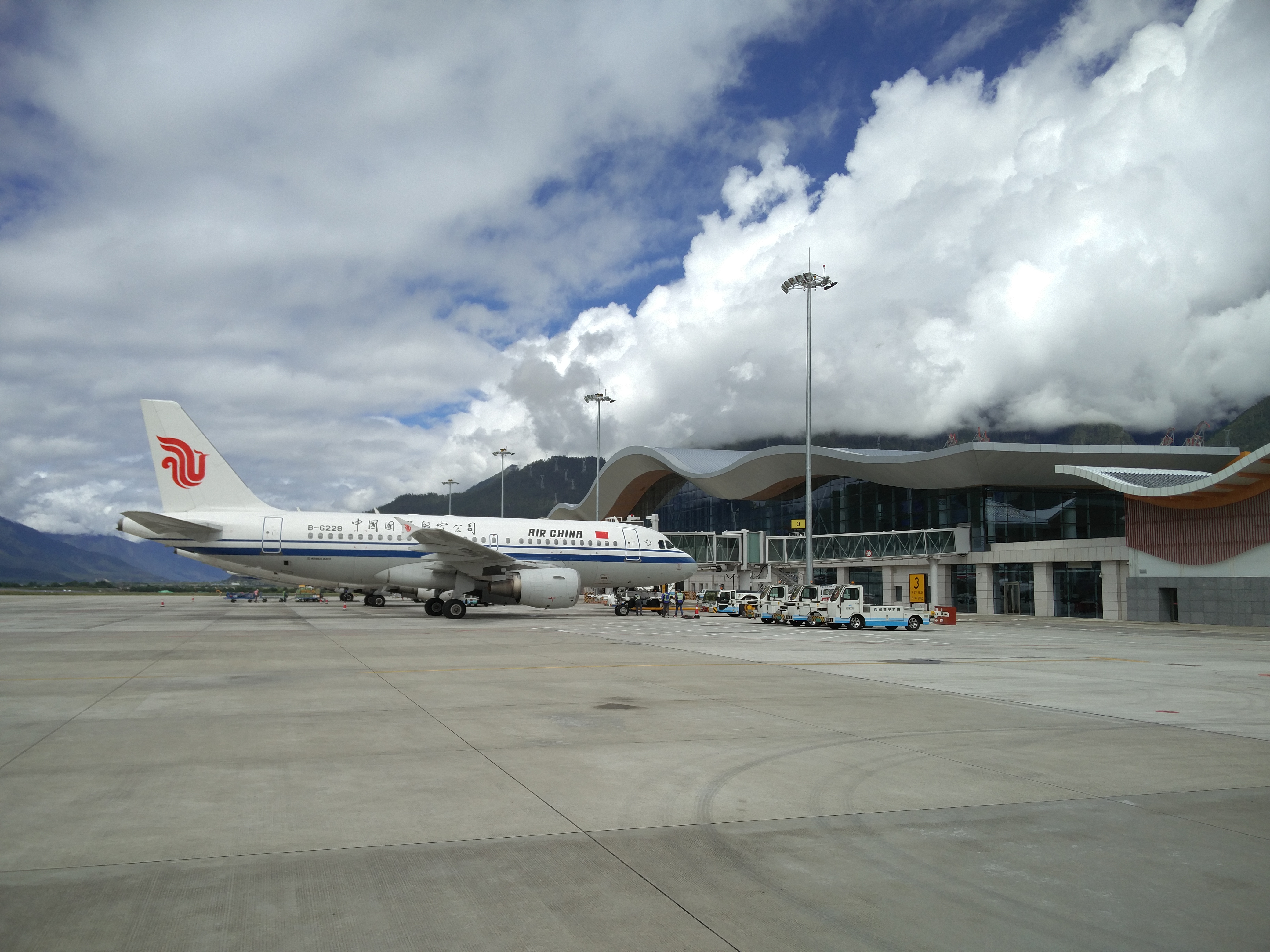
The Nyingchi Mainling Airport was opened in Nyingchi in March 2017, which may be used to support both commercial air traffic and the People's Liberation Army Air Force.[4]
Climate
Köppen-Geiger climate classification system classifies its climate as subtropical highland (Cwb).[5]
| Nyingchi Prefecture | ||||||||||||||||||||||||||||||||||||||||||||||||||||||||||||
|---|---|---|---|---|---|---|---|---|---|---|---|---|---|---|---|---|---|---|---|---|---|---|---|---|---|---|---|---|---|---|---|---|---|---|---|---|---|---|---|---|---|---|---|---|---|---|---|---|---|---|---|---|---|---|---|---|---|---|---|---|
| Climate chart (explanation) | ||||||||||||||||||||||||||||||||||||||||||||||||||||||||||||
| ||||||||||||||||||||||||||||||||||||||||||||||||||||||||||||
| ||||||||||||||||||||||||||||||||||||||||||||||||||||||||||||
| Climate data for Nyingchi (1981–2010 normals) | |||||||||||||
|---|---|---|---|---|---|---|---|---|---|---|---|---|---|
| Month | Jan | Feb | Mar | Apr | May | Jun | Jul | Aug | Sep | Oct | Nov | Dec | Year |
| Record high °C (°F) | 19.4 (66.9) |
20.2 (68.4) |
24.0 (75.2) |
25.3 (77.5) |
28.0 (82.4) |
29.0 (84.2) |
31.4 (88.5) |
29.6 (85.3) |
30.2 (86.4) |
24.5 (76.1) |
19.9 (67.8) |
16.7 (62.1) |
31.4 (88.5) |
| Average high °C (°F) | 8.9 (48.0) |
10.2 (50.4) |
13.5 (56.3) |
16.6 (61.9) |
19.5 (67.1) |
21.6 (70.9) |
22.3 (72.1) |
22.1 (71.8) |
20.5 (68.9) |
17.4 (63.3) |
13.7 (56.7) |
10.1 (50.2) |
16.4 (61.5) |
| Daily mean °C (°F) | 1.0 (33.8) |
2.8 (37.0) |
5.9 (42.6) |
8.9 (48.0) |
12.1 (53.8) |
15.1 (59.2) |
16.2 (61.2) |
15.7 (60.3) |
13.9 (57.0) |
10.3 (50.5) |
5.5 (41.9) |
1.7 (35.1) |
9.1 (48.4) |
| Average low °C (°F) | −4.7 (23.5) |
−2.3 (27.9) |
1.0 (33.8) |
3.8 (38.8) |
7.0 (44.6) |
10.8 (51.4) |
12.0 (53.6) |
11.6 (52.9) |
9.9 (49.8) |
5.6 (42.1) |
−0.3 (31.5) |
−4.2 (24.4) |
4.2 (39.5) |
| Record low °C (°F) | −15.3 (4.5) |
−13.3 (8.1) |
−10.1 (13.8) |
−4.6 (23.7) |
−1.6 (29.1) |
3.0 (37.4) |
3.9 (39.0) |
2.9 (37.2) |
−1.0 (30.2) |
−5.0 (23.0) |
−10.4 (13.3) |
−15.3 (4.5) |
−15.3 (4.5) |
| Average precipitation mm (inches) | 1.3 (0.05) |
4.4 (0.17) |
19.0 (0.75) |
46.2 (1.82) |
75.3 (2.96) |
119.2 (4.69) |
143.3 (5.64) |
122.2 (4.81) |
110.5 (4.35) |
45.4 (1.79) |
4.7 (0.19) |
1.0 (0.04) |
692.5 (27.26) |
| Average relative humidity (%) | 49 | 53 | 58 | 63 | 65 | 72 | 76 | 76 | 76 | 66 | 56 | 50 | 63 |
| Source 1: China Meteorological Administration[6] | |||||||||||||
| Source 2: Climate Source Database | |||||||||||||
Flora and fauna


"According to local forestry officials, Nyingchi hosts the country's largest primitive forest region that covers 26.4 billion cubic metres, storing over 800 million cubic metres of wood."[7] The forests of Bomi, Zayu and Loyu have ancient dragon spruces which reach heights of over 80 metres and diameters of 2.5 metres. Wildlife species include "the Bengal tiger, leopard, bear, snub-nosed monkey, antelope and lesser panda."[7]
"There are over 2,000 species of higher plants, including some 100 species of xylophyta, 165 species of medical herbs and fungus. Crops include "rice, peanut, apple, orange, banana, lemon." Agricultural products include medicinal materials, "edible fungus, orange, tangerine, sugar cane, honey peach, apple, pear, grape, walnut and other fruits." [7]
Administrative subdivisions
The two counties of Zayü (察隅县) and Mêdog (墨脱县), collectively known as part of South Tibet, are considered by the Chinese government to be under Chinese jurisdiction.
| Map | ||||||||
|---|---|---|---|---|---|---|---|---|
| # | Name | Hanzi | Hanyu Pinyin | Tibetan | Wylie | Population (2010 Census) | Area (km²) | Density (/km²) |
| 1 | Bayi District | 巴宜区 | Bāyí Qū | བྲག་ཡིབ་ཆུས། | brag yib chus | 54,702 | 8,536 | 6.40 |
| 2 | Gongbo'gyamda County | 工布江达县 | Gōngbùjiāngdá Xiàn | ཀོང་པོ་རྒྱ་མདའ་རྫོང་། | kong po rgya mda' rdzong | 29,929 | 12,960 | 2.30 |
| 3 | Mainling County | 米林县 | Mǐlín Xiàn | སྨན་གླིང་རྫོང་། | sman gling rdzong | 22,834 | 9,507 | 2.40 |
| 4 | Mêdog County | 墨脱县 | Mòtuō Xiàn | མེ་ཏོག་རྫོང་། | me tog rdzong | 10,963 | 31,394 | 0.34 |
| 5 | Bomê County | 波密县 | Bōmì Xiàn | སྤོ་མེས་རྫོང་། | spo mes rdzong | 33,480 | 16,770 | 1.99 |
| 6 | Zayü County | 察隅县 | Cháyú Xiàn | རྫ་ཡུལ་རྫོང་། | rdza yul rdzong | 27,255 | 31,305 | 0.87 |
| 7 | Nang County | 朗县 | Lǎng Xiàn | སྣང་རྫོང་། | snang rdzong | 15,946 | 4,114 | 3.87 |

References
- "China plans 'Swiss makeover' for tourism in southeast Tibet". CNN Travel. 2012-06-29. Archived from the original on 2020-12-19. Retrieved 2013-10-20.
- An "Attractive" Highway from Lhasa to Nyingchi Will Be Open Archived 2019-06-30 at the Wayback Machine, China Tibet Train Tours, October 23, 2018
- "Tibet's first bullet train line enters service". CNN. 30 June 2021.
- Singh, Mandeep (March 28, 2017). "A Quick Note On Rising People's Liberation Army Air Force Activities in Tibet". Delhi Defence Review. Retrieved March 29, 2017.
In March 2017, China opened an airport in Nyingchi, Tibet Autonomous Region (TAR), only 30 kilometers from the Line of Actual control (LAC) with India. This is the second largest airport in TAR and is closer to LAC than any other airport in the region. While the airport terminal is meant for civil aviation, it is known that Chinese airports, especially those in TAR, are essentially ‘dual-use’ – meant for both civil and military use. As Xinhua had announced in 2015, China is carrying out an ‘integration’ of civil-military airports in order to ‘strengthen aviation safety and combat support capabilities’. This will include joint maintenance of airport support facilities, joint flight safety support and joint airport management. Incidentally, one of the first airports to implement the aforesaid ‘integration’ was the Lhasa Gonggar Airport in TAR, having completed the process in 2015 itself. It can therefore be said that Nyingchi airport gives the People’s Liberation Army Air Force (PLAAF) an additional operational base in TAR, and one that is right opposite the Indian state of Arunachal Pradesh Overall, this development is in keeping with the recent increase in the tempo of PLAAF activities in TAR.
[dead link] - "Temperature, Climate graph, Climate table for Nyingchi". Climate-Data.org. Archived from the original on 2017-06-10. Retrieved 2017-03-20.
- 中国气象数据网 - WeatherBk Data (in Chinese (China)). China Meteorological Administration. Archived from the original on 2018-09-05. Retrieved 2020-04-15.
- "Tibet travel guide of Nyingchi Region, Bayi Town". Archived from the original on 2014-08-08. Retrieved 2013-10-20.
External links
- Tibetinfor.com
- Nyingchi information and travel guides at Nyingchi.com
Notes: *Provincial capitals, ★Sub-provincial cities, ☆Sub-provincial autonomous prefecture *Sub prefectural-level divisions, ✧"Comparatively larger city" (较大的市) as approved by the State Council | ||||||||||||||||||||||||||||||||||||||||||||||||||||||||||||||||
|  | |||||||||||||||||||||||||||||||||||||||||||||||||||||||||||||||
|
See also: List of prefectures in China, List of cities in China | ||||||||||||||||||||||||||||||||||||||||||||||||||||||||||||||||
| District | 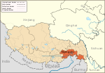 | |
|---|---|---|
| Counties |
| |
| Towns and villages | ||
| Geography | ||
Authority control | |
|---|---|
| General |
|
| National libraries | |
На других языках
- [en] Nyingchi
[ru] Ньингчи
Ньингчи (тиб. ཉིང་ཁྲི་ས་ཁུལ་; вайли: nying-khri sa khul; кит. упр. 林芝, пиньинь Línzhī, палл. Линьчжи) — городской округ на юго-востоке Тибетского автономного района (запад Китая). Помимо реально входящих в состав городского округа территорий китайское правительство причисляет к нему восточную часть индийского штата Аруначал-Прадеш, что оспаривается Индией.Другой контент может иметь иную лицензию. Перед использованием материалов сайта WikiSort.org внимательно изучите правила лицензирования конкретных элементов наполнения сайта.
WikiSort.org - проект по пересортировке и дополнению контента Википедии