world.wikisort.org - China
Lianhua County (simplified Chinese: 莲花县; traditional Chinese: 蓮花縣; pinyin: Liánhuā Xiàn) is a county in the west of Jiangxi province, China, bordering Hunan province to the west. It is the southernmost county-level division of the prefecture-level city of Pingxiang.
Lianhua County
莲花县 Lienhwa | |
|---|---|
County | |
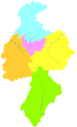 Lianhua is the southernmost division in this map of Pingxiang | |
 Pingxiang in Jiangxi | |
| Coordinates: 27°07′40″N 113°57′41″E | |
| Country | People's Republic of China |
| Province | Jiangxi |
| Prefecture-level city | Pingxiang |
| Area | |
| • Total | 1,072 km2 (414 sq mi) |
| Population ((2018)) | 279,400 |
| Time zone | UTC+8 (China Standard) |
| Postal code | 337100 |
Geography
Lianhua lies in the Luoxiao Mountains, somewhat north of Jinggangshan.
Revolutionary History
Hard on the Hunan border, Lianhua was the headquarters of the (South-)Eastern Hunan Red Army Independent Division, and thus the administrative centre for the Hunan-Jiangxi Soviet, a constituent part of the Chinese Soviet Republic of the early 1930s.
Administrative divisions
Lianhua County has 5 towns and 8 townships.[1]
- 5 towns
|
|
- 8 townships
|
|
Climate
| Climate data for Lianhua (1981–2010) | |||||||||||||
|---|---|---|---|---|---|---|---|---|---|---|---|---|---|
| Month | Jan | Feb | Mar | Apr | May | Jun | Jul | Aug | Sep | Oct | Nov | Dec | Year |
| Record high °C (°F) | 25.5 (77.9) |
30.6 (87.1) |
34.5 (94.1) |
35.2 (95.4) |
36.9 (98.4) |
37.3 (99.1) |
40.5 (104.9) |
41.1 (106.0) |
38.0 (100.4) |
37.3 (99.1) |
32.5 (90.5) |
25.5 (77.9) |
41.1 (106.0) |
| Average high °C (°F) | 10.4 (50.7) |
12.4 (54.3) |
16.3 (61.3) |
23.0 (73.4) |
27.7 (81.9) |
30.5 (86.9) |
34.1 (93.4) |
33.3 (91.9) |
29.6 (85.3) |
25.0 (77.0) |
19.3 (66.7) |
13.8 (56.8) |
23.0 (73.3) |
| Daily mean °C (°F) | 6.1 (43.0) |
8.2 (46.8) |
11.9 (53.4) |
17.9 (64.2) |
22.6 (72.7) |
25.8 (78.4) |
28.6 (83.5) |
27.7 (81.9) |
24.2 (75.6) |
19.2 (66.6) |
13.4 (56.1) |
8.0 (46.4) |
17.8 (64.1) |
| Average low °C (°F) | 3.2 (37.8) |
5.3 (41.5) |
8.7 (47.7) |
14.4 (57.9) |
18.8 (65.8) |
22.3 (72.1) |
24.3 (75.7) |
23.8 (74.8) |
20.5 (68.9) |
15.2 (59.4) |
9.4 (48.9) |
4.1 (39.4) |
14.2 (57.5) |
| Record low °C (°F) | −5.4 (22.3) |
−3.8 (25.2) |
−3.5 (25.7) |
1.9 (35.4) |
8.5 (47.3) |
13.1 (55.6) |
16.6 (61.9) |
17.9 (64.2) |
12.2 (54.0) |
2.4 (36.3) |
−2.1 (28.2) |
−8.8 (16.2) |
−8.8 (16.2) |
| Average precipitation mm (inches) | 85.0 (3.35) |
112.4 (4.43) |
180.8 (7.12) |
229.8 (9.05) |
234.3 (9.22) |
244.2 (9.61) |
122.4 (4.82) |
131.8 (5.19) |
81.8 (3.22) |
75.9 (2.99) |
76.0 (2.99) |
51.5 (2.03) |
1,625.9 (64.02) |
| Average relative humidity (%) | 82 | 83 | 83 | 82 | 80 | 82 | 76 | 79 | 80 | 78 | 78 | 78 | 80 |
| Source: China Meteorological Data Service Center[2] | |||||||||||||
References
- "南京市-行政区划网 www.xzqh.org" (in Chinese). XZQH. Retrieved 2012-05-24.
- 中国地面气候标准值月值(1981-2010) (in Simplified Chinese). China Meteorological Data Service Center. Retrieved 20 October 2018.
External links
На других языках
- [en] Lianhua County
[ru] Ляньхуа (уезд)
Ляньхуа́ (кит. упр. 莲花, пиньинь Liánhuā) — уезд городского округа Пинсян провинции Цзянси (КНР).Текст в блоке "Читать" взят с сайта "Википедия" и доступен по лицензии Creative Commons Attribution-ShareAlike; в отдельных случаях могут действовать дополнительные условия.
Другой контент может иметь иную лицензию. Перед использованием материалов сайта WikiSort.org внимательно изучите правила лицензирования конкретных элементов наполнения сайта.
Другой контент может иметь иную лицензию. Перед использованием материалов сайта WikiSort.org внимательно изучите правила лицензирования конкретных элементов наполнения сайта.
2019-2026
WikiSort.org - проект по пересортировке и дополнению контента Википедии
WikiSort.org - проект по пересортировке и дополнению контента Википедии