world.wikisort.org - China
Huichang County (simplified Chinese: 会昌县; traditional Chinese: 會昌縣; pinyin: Huìchāng Xiàn) is a county, under the jurisdiction of Ganzhou, in the south of Jiangxi province, People's Republic of China.
Huichang County
会昌县 Hweichang | |
|---|---|
County | |
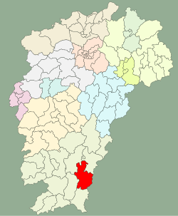 Location in Jiangxi | |
| Coordinates: 25°27′46″N 115°44′35″E | |
| Country | People's Republic of China |
| Province | Jiangxi |
| Prefecture-level city | Ganzhou |
| Seat | Wenwuba Town |
| Area | |
| • Total | 2,722.18 km2 (1,051.04 sq mi) |
| Population (2010)[1] | |
| • Total | 445,137 |
| • Density | 160/km2 (420/sq mi) |
| Postal Code | 342600 |
| Area code(s) | 0797 |
| Vehicle registration | 赣B |
| Website | www |
Population
The population of Huichang is 445,137 (2010),[1] including nations of Han (partly Hakka) and She.
Administration
Huichang has jurisdiction over 6 towns and 13 townships.[2] The seat of the county locates at the Wenwuba Town.[3]
- 6 Towns
|
|
- 13 Townships
|
|
Geography


Huichang is located in the southeast of Jiangxi province. The Xiang River and the Mian River merge here and form the Gong River.
Huichang has an area of 2722.18 km2.[1]
Climate
| Climate data for Huichang (1981−2010) | |||||||||||||
|---|---|---|---|---|---|---|---|---|---|---|---|---|---|
| Month | Jan | Feb | Mar | Apr | May | Jun | Jul | Aug | Sep | Oct | Nov | Dec | Year |
| Record high °C (°F) | 28.9 (84.0) |
31.9 (89.4) |
32.2 (90.0) |
34.7 (94.5) |
36.5 (97.7) |
38.3 (100.9) |
39.7 (103.5) |
39.9 (103.8) |
38.5 (101.3) |
36.2 (97.2) |
34.6 (94.3) |
29.0 (84.2) |
39.9 (103.8) |
| Average high °C (°F) | 14.0 (57.2) |
15.7 (60.3) |
19.2 (66.6) |
24.8 (76.6) |
28.7 (83.7) |
31.3 (88.3) |
34.3 (93.7) |
33.6 (92.5) |
30.7 (87.3) |
26.8 (80.2) |
21.6 (70.9) |
16.4 (61.5) |
24.8 (76.6) |
| Daily mean °C (°F) | 8.7 (47.7) |
10.9 (51.6) |
14.5 (58.1) |
20.0 (68.0) |
23.7 (74.7) |
26.5 (79.7) |
28.7 (83.7) |
28.0 (82.4) |
25.4 (77.7) |
21.0 (69.8) |
15.4 (59.7) |
10.0 (50.0) |
19.4 (66.9) |
| Average low °C (°F) | 5.3 (41.5) |
7.7 (45.9) |
11.3 (52.3) |
16.6 (61.9) |
20.2 (68.4) |
23.2 (73.8) |
24.5 (76.1) |
24.2 (75.6) |
21.7 (71.1) |
16.9 (62.4) |
11.2 (52.2) |
5.8 (42.4) |
15.7 (60.3) |
| Record low °C (°F) | −5.7 (21.7) |
−3.0 (26.6) |
−2.8 (27.0) |
5.2 (41.4) |
11.4 (52.5) |
15.9 (60.6) |
19.7 (67.5) |
19.5 (67.1) |
12.5 (54.5) |
4.7 (40.5) |
−0.6 (30.9) |
−7.0 (19.4) |
−7.0 (19.4) |
| Average precipitation mm (inches) | 67.8 (2.67) |
119.7 (4.71) |
201.2 (7.92) |
224.5 (8.84) |
241.2 (9.50) |
233.3 (9.19) |
114.8 (4.52) |
173.7 (6.84) |
108.2 (4.26) |
46.2 (1.82) |
48.1 (1.89) |
45.8 (1.80) |
1,624.5 (63.96) |
| Average relative humidity (%) | 80 | 82 | 83 | 82 | 81 | 81 | 75 | 79 | 80 | 77 | 78 | 78 | 80 |
| Source: China Meteorological Data Service Center[4] | |||||||||||||
Transport
- Ganzhou–Longyan Railway
External links
References
- "HUÌCHĀNG XIÀN (County)". citypopulation.de. Retrieved 2016-03-28.
- "南京市-行政区划网 www.xzqh.org" (in Chinese). XZQH. Retrieved 2012-05-24.
- "会昌县志". huichang.gov.cn (in Chinese). Archived from the original on 2013-08-24. Retrieved 2016-03-28.
- 中国地面气候标准值月值(1981-2010) (in Simplified Chinese). China Meteorological Data Service Center. Retrieved 16 August 2022.
Jiangxi topics | |
|---|---|
Nanchang (capital) | |
| General |
|
| Geography |
|
| Education |
|
| Culture |
|
| Visitor attractions |
|
| |
Authority control | |
|---|---|
| General | |
| National libraries | |
This Jiangxi location article is a stub. You can help Wikipedia by expanding it. |
На других языках
- [en] Huichang County
[ru] Хуэйчан
Хуэйча́н (кит. упр. 会昌, пиньинь Huìchāng) — уезд городского округа Ганьчжоу провинции Цзянси (КНР).Текст в блоке "Читать" взят с сайта "Википедия" и доступен по лицензии Creative Commons Attribution-ShareAlike; в отдельных случаях могут действовать дополнительные условия.
Другой контент может иметь иную лицензию. Перед использованием материалов сайта WikiSort.org внимательно изучите правила лицензирования конкретных элементов наполнения сайта.
Другой контент может иметь иную лицензию. Перед использованием материалов сайта WikiSort.org внимательно изучите правила лицензирования конкретных элементов наполнения сайта.
2019-2026
WikiSort.org - проект по пересортировке и дополнению контента Википедии
WikiSort.org - проект по пересортировке и дополнению контента Википедии