world.wikisort.org - China
Ruijin (Chinese: 瑞金; pinyin: Ruìjīn), also known as Ruijing from 1931 to 1934 is a county-level city of Ganzhou in the mountains bordering Fujian Province in the south-eastern part of Jiangxi Province. Formerly a county, Ruijin became a county-level city on May 18, 1994.
This article needs additional citations for verification. (January 2017) |
This article may be expanded with text translated from the corresponding article in Chinese. (May 2022) Click [show] for important translation instructions.
|
Ruijin
瑞金市 Juicheng, Juiking | |
|---|---|
County-level & Sub-prefectural city | |
 Ruijin | |
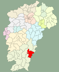 Location in Jiangxi | |
| Coordinates: 25°53′10″N 116°01′37″E | |
| Country | People's Republic of China |
| Province | Jiangxi |
| Prefecture-level city | Ganzhou |
| Postal Code | 342500 |
| Ruijin | |||||||||
|---|---|---|---|---|---|---|---|---|---|
| Chinese | 瑞金 | ||||||||
| Postal | Juicheng | ||||||||
| |||||||||
It is most famous as one of the earliest centers of Chinese communist activity. After being forced out of Jinggang Mountains in the late 1920s by the Kuomintang, the Communists fled here, taking advantage of Ruijin's relative isolation in the rugged mountains along Jiangxi's border with Fujian. In 1931, under Mao Zedong's leadership, the Chinese Soviet Republic was established here, with Ruijin serving as its de facto capital. By 1934, they had again been surrounded by Chiang Kai-shek's forces. It is from here that the famed "Long March" began.[citation needed]
Ruijin is a popular destination for red tourism and ecotourism. It is a pilgrimage for Maoists from China and around the globe.
Administrative divisions
Ruijin City has 7 towns and 10 townships.[1]
- 7 Towns
|
|
- 10 Townships
|
|
Climate
| Climate data for Ruijin (1981−2010) | |||||||||||||
|---|---|---|---|---|---|---|---|---|---|---|---|---|---|
| Month | Jan | Feb | Mar | Apr | May | Jun | Jul | Aug | Sep | Oct | Nov | Dec | Year |
| Record high °C (°F) | 27.9 (82.2) |
31.2 (88.2) |
31.7 (89.1) |
34.1 (93.4) |
35.8 (96.4) |
37.5 (99.5) |
40.4 (104.7) |
39.7 (103.5) |
37.4 (99.3) |
36.4 (97.5) |
33.5 (92.3) |
27.9 (82.2) |
40.4 (104.7) |
| Average high °C (°F) | 13.4 (56.1) |
15.1 (59.2) |
18.6 (65.5) |
24.5 (76.1) |
28.4 (83.1) |
31.1 (88.0) |
34.2 (93.6) |
33.5 (92.3) |
30.4 (86.7) |
26.5 (79.7) |
21.2 (70.2) |
16.0 (60.8) |
24.4 (75.9) |
| Daily mean °C (°F) | 8.3 (46.9) |
10.5 (50.9) |
14.0 (57.2) |
19.8 (67.6) |
23.6 (74.5) |
26.4 (79.5) |
28.8 (83.8) |
28.1 (82.6) |
25.3 (77.5) |
20.7 (69.3) |
15.2 (59.4) |
9.7 (49.5) |
19.2 (66.6) |
| Average low °C (°F) | 5.0 (41.0) |
7.3 (45.1) |
10.8 (51.4) |
16.3 (61.3) |
20.0 (68.0) |
23.0 (73.4) |
24.5 (76.1) |
24.3 (75.7) |
21.5 (70.7) |
16.5 (61.7) |
10.9 (51.6) |
5.5 (41.9) |
15.5 (59.8) |
| Record low °C (°F) | −5.2 (22.6) |
−2.5 (27.5) |
−2.1 (28.2) |
4.8 (40.6) |
11.4 (52.5) |
15.0 (59.0) |
19.4 (66.9) |
19.2 (66.6) |
12.5 (54.5) |
4.2 (39.6) |
−1.0 (30.2) |
−6.5 (20.3) |
−6.5 (20.3) |
| Average precipitation mm (inches) | 68.6 (2.70) |
121.1 (4.77) |
211.2 (8.31) |
216.3 (8.52) |
263.5 (10.37) |
262.8 (10.35) |
121.5 (4.78) |
146.5 (5.77) |
98.2 (3.87) |
50.4 (1.98) |
48.4 (1.91) |
43.8 (1.72) |
1,652.3 (65.05) |
| Average relative humidity (%) | 80 | 82 | 83 | 81 | 81 | 81 | 74 | 77 | 79 | 77 | 77 | 77 | 79 |
| Source: China Meteorological Data Service Center[2] | |||||||||||||
Transport
- Ganzhou–Longyan Railway
On 22 May 2016 the BBC reported that four cars fell into a sinkhole in Ruijin City.[3]
References
- "南京市-行政区划网 www.xzqh.org" (in Chinese). XZQH. Retrieved 2012-05-24.
- 中国地面气候标准值月值(1981-2010) (in Simplified Chinese). China Meteorological Data Service Center. Retrieved 16 August 2022.
- "Sinkhole swallows four cars in China". BBC News.
Authority control | |
|---|---|
| General | |
| National libraries | |
This Jiangxi location article is a stub. You can help Wikipedia by expanding it. |
На других языках
- [en] Ruijin
[ru] Жуйцзинь
Жуйцзи́нь (кит. упр. 瑞金, пиньинь Ruìjīn) — городской уезд городского округа Ганьчжоу провинции Цзянси (КНР).Другой контент может иметь иную лицензию. Перед использованием материалов сайта WikiSort.org внимательно изучите правила лицензирования конкретных элементов наполнения сайта.
WikiSort.org - проект по пересортировке и дополнению контента Википедии