world.wikisort.org - USA
Philadelphia, often called Philly, is the largest city in the Commonwealth of Pennsylvania,[6] the sixth largest city in the U.S., the second largest city in the Northeast megalopolis (behind New York City), and the 68th largest city in the world. Since 1854, the city has had the same geographic boundaries as Philadelphia County, the most populous county in Pennsylvania and the urban core of the Delaware Valley, the nation's seventh-largest and world's 35th-largest metropolitan region, with 6.096 million residents as of 2020[update].[9] The city's population as of the 2020 census was 1,603,797.
Philadelphia, Pennsylvania | |
|---|---|
Consolidated city-county | |
| City of Philadelphia | |
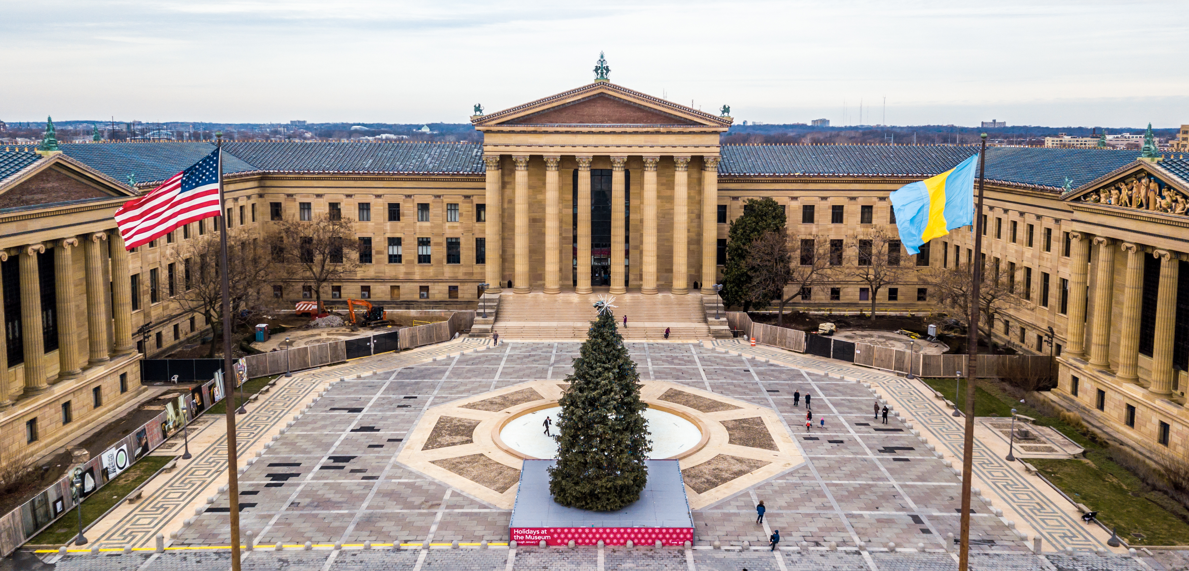
Clockwise from top: Center City skyline in 2020; City Hall; College Hall, Penn Campus; Museum of Art; Delancey Street row houses in Society Hill; Liberty Bell and Independence Hall | |
 Flag  Seal Logo | |
| Etymology: Ancient Greek: φίλος phílos (beloved, dear) and ἀδελφός adelphós (brother, brotherly) | |
| Nickname(s): "Philly", "The City of Brotherly Love", "The Athens of America",[1] and other nicknames of Philadelphia | |
| Motto: | |
 | |
 Interactive maps of Philadelphia | |
| Coordinates: 39°57′10″N 75°09′49″W | |
| Country | United States |
| State | Pennsylvania |
| County | Philadelphia |
| Historic countries | Kingdom of England Kingdom of Great Britain |
| Historic colony | Province of Pennsylvania |
| Founded | 1682[4] |
| Incorporated | October 25, 1701 |
| Founded by | William Penn |
| Government | |
| • Type | Mayor–council, consolidated city-county |
| • Body | Philadelphia City Council |
| • Mayor | Jim Kenney (D) |
| Area | |
| • Consolidated city-county | 142.70 sq mi (369.59 km2) |
| • Land | 134.28 sq mi (347.78 km2) |
| • Water | 8.42 sq mi (21.81 km2) |
| Elevation | 39 ft (12 m) |
| Population (2020)[6] | |
| • Consolidated city-county | 1,603,797 |
| • Rank | 6th in the United States 1st in Pennsylvania |
| • Density | 11,943.68/sq mi (4,611.53/km2) |
| • Metro | 6,245,051 (7th) |
| Demonym | Philadelphian |
| Time zone | UTC−5 (EST) |
| • Summer (DST) | UTC−4 (EDT) |
| ZIP Codes | 19092–19093, 19099, 191xx |
| Area codes | 215, 267, 445 |
| FIPS code | 42-60000 |
| GNIS feature ID | 1215531[8] |
| School district | Philadelphia School District |
| International airport | Philadelphia International Airport |
| Interstates | |
| U.S. Routes | |
| Commuter rail | SEPTA Regional Rail, NJ Transit |
| Rapid transit | Broad Street Line, Market–Frankford Line, PATCO Speedline |
| Waterways | Delaware River Schuylkill River |
| Website | www.phila.gov |


Philadelphia was founded in 1682 by William Penn, an English Quaker. The city served as capital of the Pennsylvania Colony during the British colonial era.[4][10] Philadelphia went on to play a historic and vital role in the 18th century as the central meeting place for the nation's founding fathers whose plans and actions in Philadelphia ultimately inspired and resulted in the American Revolution. Philadelphia hosted the First Continental Congress in 1774 following the Boston Tea Party, preserved the Liberty Bell, and hosted the Second Continental Congress during which the founders signed the Declaration of Independence, which historian Joseph Ellis has described as "the most potent and consequential words in American history."[11] Once the Revolutionary War commenced, both the Battle of Germantown and the Siege of Fort Mifflin were fought within Philadelphia's city limits.
The U.S. Constitution was later ratified in Philadelphia at the Philadelphia Convention of 1787. Philadelphia remained the nation's largest city until 1790, when it was surpassed by New York City, and served as the nation's first capital from May 10, 1775 until December 12, 1776 and on four subsequent occasions during and following the American Revolution, including from 1790 to 1800 while the new national capital of Washington, D.C. was under construction.
In the 19th and 20th centuries, Philadelphia became a major national industrial center and railroad hub. Its industrial jobs attracted European immigrants, most of whom initially came from Germany and Ireland, the two largest reported ancestry groups in the city as of 2015[update]. Later immigrant groups in the 20th century came from Italy and other Southern European and Eastern European countries.[12] In the early 20th century, Philadelphia became a prime destination for African Americans during the Great Migration after the American Civil War.[13] Puerto Ricans began moving to the city in large numbers in the period between World War I and II, and in even greater numbers in the post-war period.[14] The city's population doubled from one million to two million people between 1890 and 1950.
Philadelphia's many universities and colleges make it a top national center for education and academic research.[15][16] As of 2019[update], the Philadelphia metropolitan area was estimated to be the nation's ninth largest metropolitan economy with a gross metropolitan product (GMP) of $490 billion.[17] Philadelphia is the center of economic activity in Pennsylvania and is home to five Fortune 1000 companies. The Philadelphia skyline is expanding, with a market of almost 81,900 commercial properties in 2016,[18] including several nationally prominent skyscrapers.[19] Philadelphia has more outdoor sculptures and murals than any other American city.[20][21] Fairmount Park, when combined with the adjacent Wissahickon Valley Park in the same watershed, is one of the largest contiguous urban park areas in the United States.[22] The city is known for its arts, culture, cuisine, and colonial and Revolution-era history, attracting 42 million domestic tourists in 2016 who spent $6.8 billion, generating an estimated $11 billion in total economic impact in the city and surrounding four counties of Pennsylvania.[23] Philadelphia and the Delaware Valley have become a biotechnology[24] and venture capital hub; and the Philadelphia Stock Exchange, now owned by Nasdaq, tracks the Philadelphia Semiconductor Index, also known as the SOX.[25] Philadelphia is home to a culturally and philanthropically active LGBTQ+ community and culture. The city has five professional sports teams and has played an influential role in the development and evolution of American music, especially R&B, soul, and rock.[26][27]
Philadelphia has spawned many U.S. firsts, including the nation's first library (1731),[28] hospital (1751),[28] medical school (1765),[29] national capital (1774),[30] university (by some accounts) (1779),[31] stock exchange (1790),[28] zoo (1874),[32] and business school (1881).[33] Philadelphia contains 67 National Historic Landmarks, including the World Heritage Site of Independence Hall.[34] In 2015, Philadelphia was the first U.S. city to be named to the Organization of World Heritage Cities.[35][16] Throughout its history through the present day, a number of notable Philadelphians have proven influential across a broad range of fields, including government and politics, business, academia, public advocacy, art, music, and professional and Olympic sports.
History
Indigenous peoples
Prior to the arrival of Europeans in the early 17th century, the Philadelphia area was home to the Lenape (Delaware) Indians in the village of Shackamaxon. The Lenape are a Native American tribe and First Nations band government.[36] They are also called Delaware Indians,[37] and their historical territory was along the Delaware River watershed, western Long Island, and the Lower Hudson Valley.[lower-alpha 1] Most Lenape were pushed out of their Delaware homeland during the 18th century by expanding European colonies, exacerbated by losses from intertribal conflicts.[37] Lenape communities were weakened by newly introduced diseases, mainly smallpox, and violent conflict with Europeans. Iroquois people occasionally fought the Lenape. Surviving Lenape moved west into the upper Ohio River basin. The American Revolutionary War and United States' independence pushed them further west. In the 1860s, the United States government sent most Lenape remaining in the eastern United States to the Indian Territory (present-day Oklahoma and surrounding territory) under the Indian removal policy. In the 21st century, most Lenape reside in Oklahoma, with some communities living also in Wisconsin, Ontario (Canada), and in their traditional homelands.[citation needed]
Colonial
Europeans came to the Delaware Valley in the early 17th century, with the first settlements founded by the Dutch, who in 1623 built Fort Nassau on the Delaware River opposite the Schuylkill River in what is now Brooklawn, New Jersey. The Dutch considered the entire Delaware River valley to be part of their New Netherland colony. In 1638, Swedish settlers led by renegade Dutch established the colony of New Sweden at Fort Christina (present-day Wilmington, Delaware) and quickly spread out in the valley. In 1644, New Sweden supported the Susquehannocks in their war against Maryland colonists.[38] In 1648, the Dutch built Fort Beversreede on the west bank of the Delaware, south of the Schuylkill near the present-day Eastwick neighborhood, to reassert their dominion over the area. The Swedes responded by building Fort Nya Korsholm, or New Korsholm, named after a town in Finland with a Swedish majority. In 1655, a Dutch military campaign led by New Netherland Director-General Peter Stuyvesant took control of the Swedish colony, ending its claim to independence. The Swedish and Finnish settlers continued to have their own militia, religion, and court, and to enjoy substantial autonomy under the Dutch. An English fleet captured the New Netherland colony in 1664, though the situation did not change substantially until 1682 when the area was included in William Penn's charter for Pennsylvania.[39]

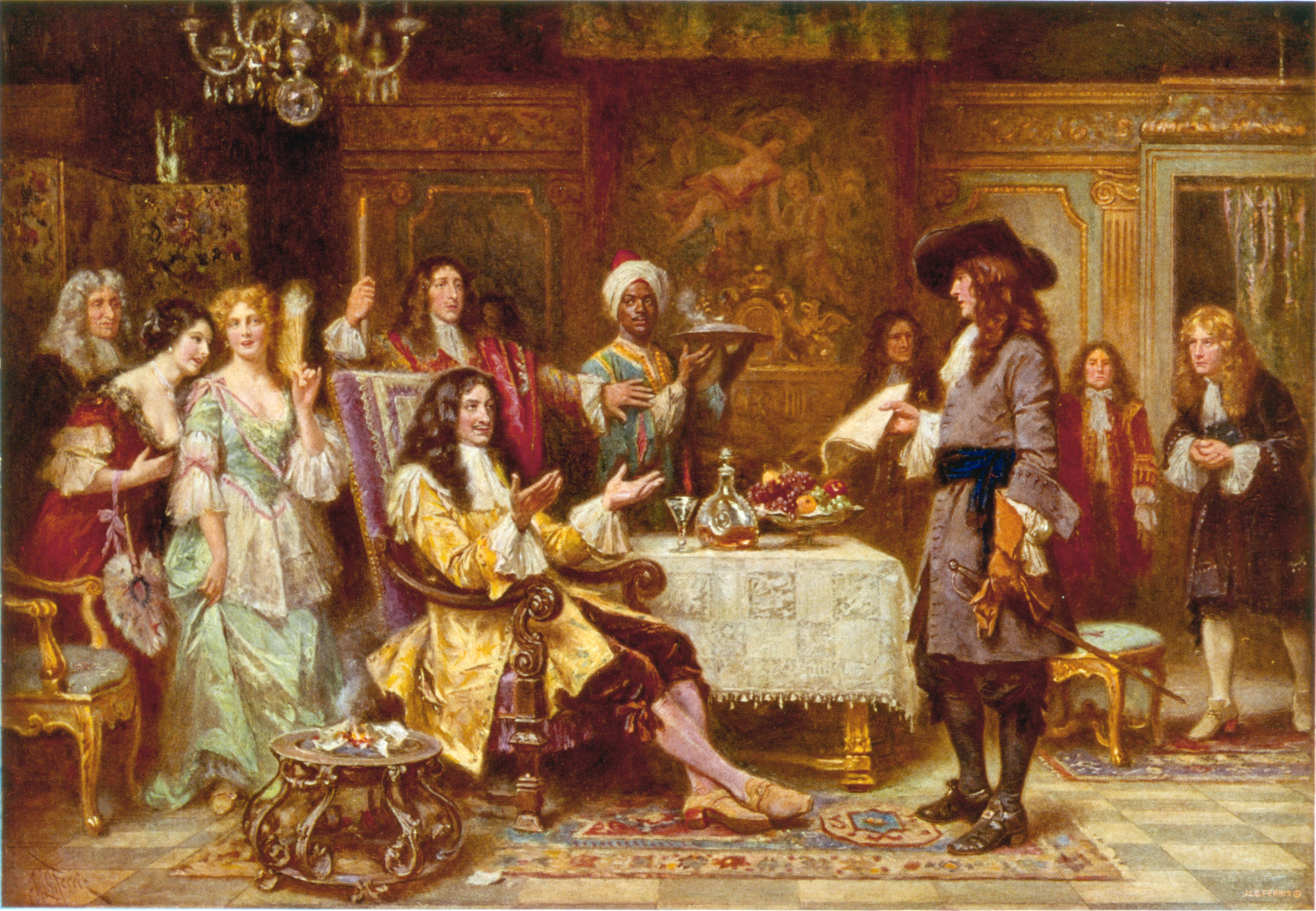
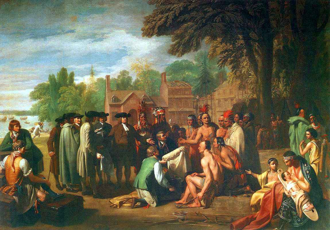
In 1681, in partial repayment of a debt, Charles II of England granted Penn a charter for what would become the Pennsylvania colony. Despite the royal charter, Penn bought the land from the local Lenape to be on good terms with the Native Americans and ensure peace for his colony.[40] Penn made a treaty of friendship with Lenape chief Tammany under an elm tree at Shackamaxon, in what is now the city's Fishtown neighborhood.[4] Penn named the city Philadelphia, which is Greek for "brotherly love," derived from the Ancient Greek terms φίλος phílos (beloved, dear) and ἀδελφός adelphós (brother, brotherly). There were a number of cities named Philadelphia in the Eastern Mediterranean during the Greek and Roman periods, including one (modern Alaşehir) mentioned as the site of an early Christian congregation in the Book of Revelation. As a Quaker, Penn had experienced religious persecution and wanted his colony to be a place where anyone could worship freely. This tolerance, far more than afforded by most other colonies, led to better relations with the local native tribes and fostered Philadelphia's rapid growth into America's most important city.[41]
Penn planned a city on the Delaware River to serve as a port and place for government. Hoping that Philadelphia would become more like an English rural town instead of a city, Penn laid out roads on a grid plan to keep houses and businesses spread far apart, with areas for gardens and orchards.
The city's inhabitants did not follow Penn's plans, however, as they crowded by the Delaware River port, and subdivided and resold their lots.[42] Before Penn left Philadelphia for the last time, he issued the Charter of 1701 establishing it as a city. Though poor at first, the city became an important trading center with tolerable living conditions by the 1750s. Benjamin Franklin, a leading citizen, helped improve city services and founded new ones, such as fire protection, a library, and one of the American colonies' first hospitals.
A number of philosophical societies were formed, which were centers of the city's intellectual life: the Philadelphia Society for Promoting Agriculture (1785), the Pennsylvania Society for the Encouragement of Manufactures and the Useful Arts (1787), the Academy of Natural Sciences (1812), and the Franklin Institute (1824).[43] These societies developed and financed new industries, attracting skilled and knowledgeable immigrants from Europe.
Revolution
![Declaration of Independence, a John Trumbull painting depicting the Committee of Five presenting their draft of the Declaration of Independence in Independence Hall on June 28, 1776. Historian Joseph Ellis has called the Declaration the most potent and consequential words in American history.[44]](http://upload.wikimedia.org/wikipedia/commons/f/f9/Declaration_of_Independence_%281819%29%2C_by_John_Trumbull.jpg)

Philadelphia's importance and central location in the colonies made it a natural center for America's revolutionaries. By the 1750s, Philadelphia had surpassed Boston as the largest city and busiest port in British America, and the second largest city in the entire British Empire after London.[45][46] Before the Revolutionary War, in 1774, as resentment of British colonial practices and support for independence was burgeoning in the colonies, Philadelphia hosted the First Continental Congress. From 1775 to 1781, Philadelphia hosted the Second Continental Congress,[47] which adopted the Declaration of Independence in what was then called the Pennsylvania State House (now Independence Hall) on July 4, 1776.
Historian Joseph Ellis, in 2007, described the Declaration of Independence as "the most potent and consequential words in American history,"[11] and its adoption represented a declaration of war, already ongoing since April 1775, against the British Army, which was then the most powerful military force in the world. Since the Declaration's July 4, 1776 adoption, its signing has been cited globally and repeatedly by various peoples of the world seeking independence and liberty. It also has been, since its adoption, the basis for annual celebration by Americans; in 1938, this celebration of the Declaration was formalized as Independence Day, one of only ten designated U.S. federal holidays.
After George Washington's defeat at the Battle of Brandywine in Chadds Ford Township, Pennsylvania on September 11, 1777, the revolutionary capital of Philadelphia was defenseless. The city prepared for what was seen as an inevitable British Army attack. Because bells could easily be recast into munitions, the Liberty Bell, then known as the Pennsylvania State Bell, along with bells from two Philadelphia churches, Christ Church and St. Peter's Church, were hastily taken down and transported by heavily-guarded wagon train out of the city. The Liberty Bell was taken to Zion German Reformed Church in Northampton Town (present-day Allentown), where it was hidden under the church's floor boards for nine months, from September 1777 until the British Army's departure from Philadelphia in June 1778, during the British occupation of Philadelphia.[48] Two Revolutionary War battles, the Siege of Fort Mifflin (September 26 to November 16, 1777) and the Battle of Germantown (October 4, 1777), were both fought within Philadelphia's city limits.
In Philadelphia, the Second Continental Congress adopted the Articles of Confederation on November 15, 1777, and the city later served as the meeting place for the Constitutional Convention, which ratified the Constitution in Independence Hall in Philadelphia on September 17, 1787.
Philadelphia served as capital of the United States for much of the colonial and early post-colonial periods, including for a decade, from 1790 to 1800, while the District of Columbia was being constructed and prepared to serve as the new nation's national capital.[49] In 1793, the largest yellow fever epidemic in U.S. history killed approximately 4,000 to 5,000 people in Philadelphia, or about 10% of the city's population.[50][51]

The state capital was moved to Lancaster in 1799, then Harrisburg in 1812, while the federal government was moved to Washington, D.C. in 1800 upon completion of the White House and U.S. Capitol building. Philadelphia remained the young nation's largest city until the late 18th century, serving as the nation's financial and cultural center, until ultimately being eclipsed in total population by New York City in 1790. In 1816, the city's free Black community founded the African Methodist Episcopal Church (AME), the first independent Black denomination in the country, and the first Black Episcopal Church. The free black community also established many schools for its children, with the help of Quakers. New York City surpassed Philadelphia in population by 1790. Large-scale construction projects for new roads, canals, and railroads made Philadelphia the first major industrial city in the United States.
19th century

Throughout the 19th century, Philadelphia hosted a variety of industries and businesses, the largest being textiles. Major corporations in the 19th and early 20th centuries included the Baldwin Locomotive Works, William Cramp & Sons Shipbuilding Company, and the Pennsylvania Railroad.[52] Established in 1870, the Philadelphia Conveyancers' Association was chartered by the state in 1871. Industry, along with the U.S. Centennial, was celebrated in 1876 with the Centennial Exposition, the first official World's fair in the United States.
Immigrants, mostly from Ireland and Germany, settled in Philadelphia and the surrounding districts. These immigrants were largely responsible for the first general strike in North America in 1835, in which workers in the city won the ten-hour workday. The city was a destination for thousands of Irish immigrants fleeing the Great Famine in the 1840s; housing for them was developed south of South Street and later occupied by succeeding immigrants. They established a network of Catholic churches and schools and dominated the Catholic clergy for decades. Anti-Irish, anti-Catholic nativist riots erupted in Philadelphia in 1844. The rise in population of the surrounding districts helped lead to the Act of Consolidation of 1854, which extended the city limits from the 2 square miles (5.2 km2) of Center City to the roughly 134 square miles (350 km2) of Philadelphia County.[53][54] In the latter half of the 19th century and leading into the 20th century, immigrants from Russia, Eastern Europe, and Italy, and African Americans from the southern U.S. settled in the city.[55]
Philadelphia was represented by the Washington Grays in the American Civil War. The African-American population of Philadelphia increased from 31,699 to 219,559 between 1880 and 1930.[56][57] Twentieth-century black newcomers were part of the Great Migration out of the rural south to northern and midwestern industrial cities.
20th and 21st centuries
By the 20th century, Philadelphia had an entrenched Republican political machine and a complacent population.[58] The first major reform came in 1917 when outrage over the election-year murder of a police officer led to the shrinking of the City Council from two houses to just one.[59] In July 1919, Philadelphia was one of more than 36 industrial cities nationally to suffer a race riot of ethnic whites against blacks during Red Summer, in post-World War I unrest, as recent immigrants competed with blacks for jobs. In the 1920s, the public flouting of Prohibition laws, organized crime, mob violence, and police involvement in illegal activities led to the appointment of Brig. Gen. Smedley Butler of the U.S. Marine Corps as director of public safety, but political pressure prevented any long-term success in fighting crime and corruption.[60]
In 1940, non-Hispanic whites constituted 86.8% of the city's population.[61] The population peaked at more than two million residents in 1950, then began to decline with the restructuring of industry, which led to the loss of many middle-class union jobs. In addition, suburbanization had enticed many of the more affluent residents to outlying railroad commuting towns and newer housing. The resulting reduction in Philadelphia's tax base and the resources of local government caused the city to struggle through a long period of adjustment, with it approaching bankruptcy by the late 1980s.[62][63]
Revitalization and gentrification of neighborhoods began in the late 1970s and continues into the 21st century, with much of the development occurring in the Center City and University City neighborhoods. After many of the old manufacturers and businesses left Philadelphia or shut down, the city started attracting service businesses and began to market itself more aggressively as a tourist destination. Contemporary glass-and-granite skyscrapers were built in Center City beginning in the 1980s. Historic areas such as Old City and Society Hill were renovated during the reformist mayoral era of the 1950s through the 1980s, making those areas among the most desirable neighborhoods in Center City. Many immigrants from around the world began to enter the U.S. through Philadelphia as their gateway. These developments have begun a reversal of the city's population decline between 1950 and 2000 during which it lost about one-quarter of its residents.[64][65] The city eventually began experiencing a growth in its population in 2007, which has continued with gradual yearly increases to the present.[66][67] Although Philadelphia is rapidly undergoing gentrification, the city actively maintains strategies to minimize displacement of homeowners in gentrifying neighborhoods.[68]
Geography

Topography
The geographic center of Philadelphia is about 40° 0′ 34″ north latitude and 75° 8′ 0″ west longitude. The 40th parallel north passes through neighborhoods in Northeast Philadelphia, North Philadelphia, and West Philadelphia including Fairmount Park. The city encompasses 142.71 square miles (369.62 km2), of which 134.18 square miles (347.52 km2) is land and 8.53 square miles (22.09 km2), or 6%, is water.[69] Natural bodies of water include the Delaware and Schuylkill rivers, the lakes in Franklin Delano Roosevelt Park, and Cobbs, Wissahickon, and Pennypack creeks. The largest artificial body of water is the East Park Reservoir in Fairmount Park.
The lowest point is sea level, while the highest point is in Chestnut Hill, about 446 feet (136 m) above sea level on Summit Street near the intersection of Germantown Avenue and Bethlehem Pike (example coordinates near high point: 40.07815 N, 75.20747 W).[70][71]
Philadelphia is situated on the Fall Line that separates the Atlantic coastal plain from the Piedmont.[72] The rapids on the Schuylkill River at East Falls were inundated by the completion of the dam at the Fairmount Water Works.[73]
The city is the seat of its own county. The adjacent counties are Montgomery to the northwest; Bucks to the north and northeast; Burlington County, New Jersey, to the east; Camden County, New Jersey, to the southeast; Gloucester County, New Jersey, to the south; and Delaware County to the southwest.
Cityscape

City planning

Philadelphia's central city was created in the 17th century following the plan by William Penn's surveyor Thomas Holme. Center City is structured with long, straight streets running nearly due east–west and north–south, forming a grid pattern between the Delaware and Schuylkill rivers that is aligned with their courses. The original city plan was designed to allow for easy travel and to keep residences separated by open space that would help prevent the spread of fire.[74] In keeping with the idea of a "Greene Countrie Towne", and inspired by the many types of trees that grew in the region, Penn named many of the east–west streets for local trees.[75] Penn planned the creation of five public parks in the city which were renamed in 1824[74] (new names in parentheses): Centre Square (Penn Square),[76] Northeast Square (Franklin Square), Southeast Square (Washington Square), Southwest Square (Rittenhouse Square), and Northwest Square (Logan Circle/Square).[77] Center City had an estimated 183,240 residents as of 2015[update], making it the second-most populated downtown area in the United States, after Midtown Manhattan in New York City.[78]
Philadelphia's neighborhoods are divided into large sections—North, Northeast, South, Southwest, West, and Northwest—surrounding Center City, which correspond closely with the city's limits before consolidation in 1854. Each of these large areas contains numerous neighborhoods, some of whose boundaries derive from the boroughs, townships, and other communities that constituted Philadelphia County before their inclusion within the city.[79]
The City Planning Commission, tasked with guiding growth and development of the city, has divided the city into 18 planning districts as part of the Philadelphia2035 physical development plan.[80][81] Much of the city's 1980 zoning code was overhauled from 2007 to 2012 as part of a joint effort between former mayors John F. Street and Michael Nutter. The zoning changes were intended to rectify incorrect zoning maps to facilitate future community development, as the city forecasts an additional 100,000 residents and 40,000 jobs will be added by 2035.
The Philadelphia Housing Authority (PHA) is the largest landlord in Pennsylvania. Established in 1937, the PHA is the nation's fourth-largest housing authority, serving about 81,000 people with affordable housing, while employing 1,400 on a budget of $371 million.[82] The Philadelphia Parking Authority works to ensure adequate parking for city residents, businesses and visitors.[83]
Architecture

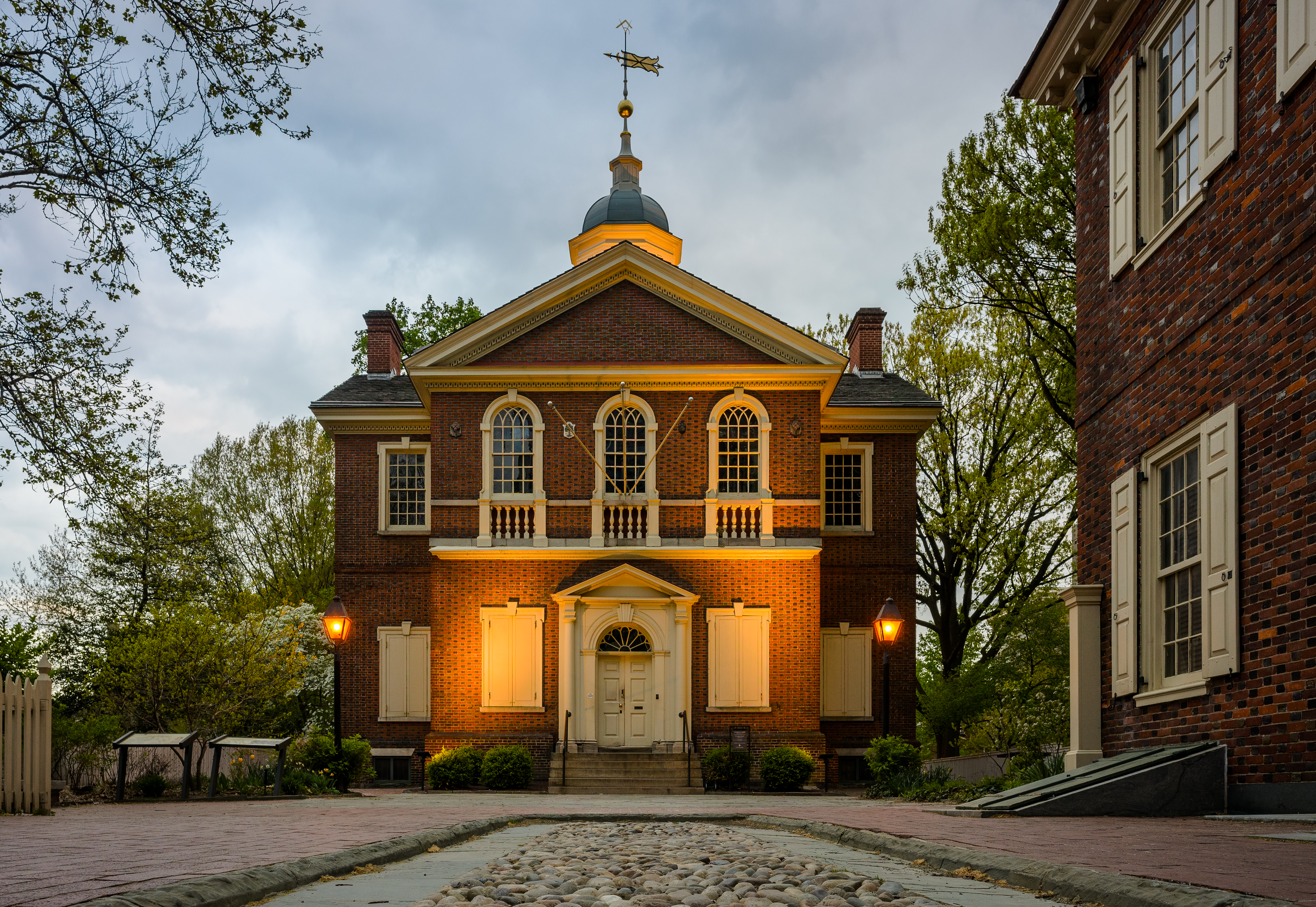
Philadelphia's architectural history dates back to colonial times and includes a wide range of styles. The earliest structures were constructed with logs, but brick structures were common by 1700. During the 18th century, the cityscape was dominated by Georgian architecture, including Independence Hall and Christ Church.
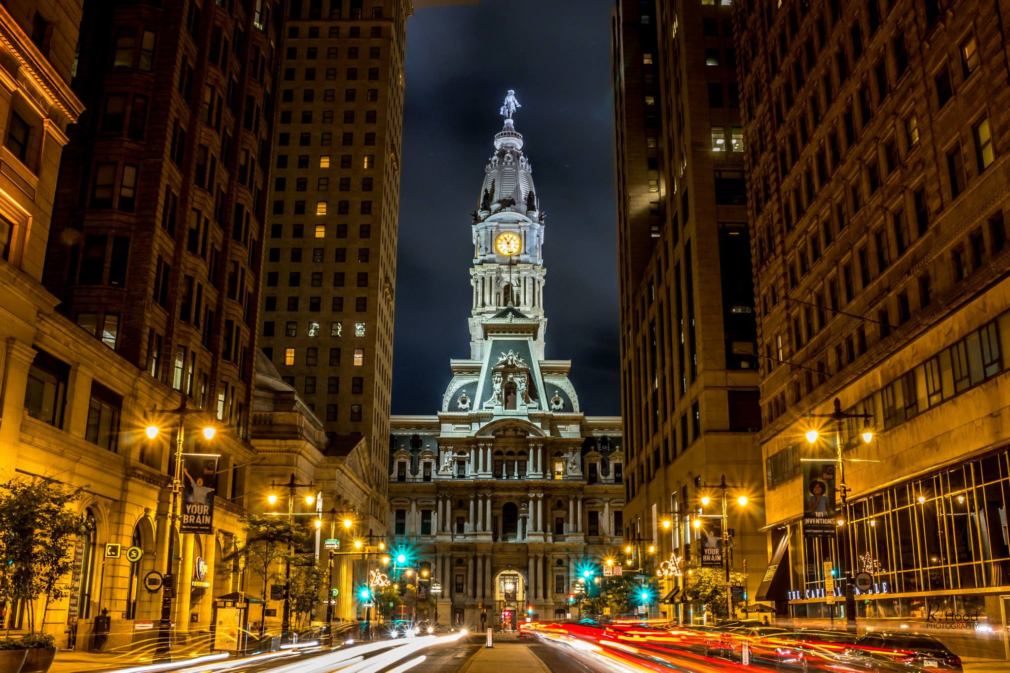
In the first decades of the 19th century, Federal and Greek Revival architecture were the dominant styles produced by Philadelphia architects such as Benjamin Latrobe, William Strickland, John Haviland, John Notman, Thomas Walter, and Samuel Sloan.[84] Frank Furness is considered Philadelphia's greatest architect of the second half of the 19th century. His contemporaries included John McArthur Jr., Addison Hutton, Wilson Eyre, the Wilson Brothers, and Horace Trumbauer. In 1871, construction began on the Second Empire-style Philadelphia City Hall. The Philadelphia Historical Commission was created in 1955 to preserve the cultural and architectural history of the city. The commission maintains the Philadelphia Register of Historic Places, adding historic buildings, structures, sites, objects and districts as it sees fit.[85]
In 1932, Philadelphia became home to the first modern International Style skyscraper in the United States, the PSFS Building, designed by George Howe and William Lescaze. The 548 ft (167 m) City Hall remained the tallest building in the city until 1987 when One Liberty Place was completed. Numerous glass and granite skyscrapers were built in Center City beginning in the late 1980s. In 2007, the Comcast Center surpassed One Liberty Place to become the city's tallest building. The Comcast Technology Center was completed in 2018, reaching a height of 1,121 ft (342 m), as the tallest building in the United States outside of Manhattan and Chicago.[19]
For much of Philadelphia's history, the typical home has been the row house. The row house was introduced to the United States via Philadelphia in the early 19th century and, for a time, row houses built elsewhere in the United States were known as "Philadelphia rows".[84] A variety of row houses are found throughout the city, from Federal-style continuous blocks in Old City and Society Hill to Victorian-style homes in North Philadelphia to twin row houses in West Philadelphia. While newer homes have been built recently, much of the housing dates to the 18th, 19th and early 20th centuries, which has created problems such as urban decay and vacant lots. Some neighborhoods, including Northern Liberties and Society Hill, have been rehabilitated through gentrification.[86][87]
![Elfreth's Alley, Our nation's oldest residential street, 1702–1836[88]](//upload.wikimedia.org/wikipedia/commons/thumb/2/29/Elfreth%27s_Alley%2C_Philadelphia%2C_2008.jpg/252px-Elfreth%27s_Alley%2C_Philadelphia%2C_2008.jpg) Elfreth's Alley, "Our nation's oldest residential street", 1702–1836[88]
Elfreth's Alley, "Our nation's oldest residential street", 1702–1836[88] Carpenters' Hall exhibiting Georgian architecture, 1770–1774
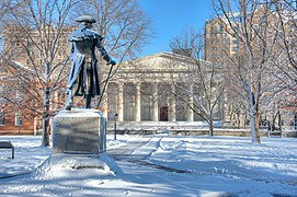 Second Bank of the United States exhibiting Greek Revival architecture, 1818–1824
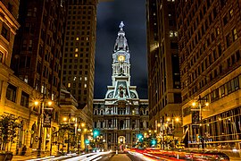 Second Empire-style Philadelphia City Hall, 1871–1901, from South Broad Street
 The Art Deco-style grand concourse at 30th Street Station, 1927–1933
![Elfreth's Alley, Our nation's oldest residential street, 1702–1836[88]](http://upload.wikimedia.org/wikipedia/commons/2/29/Elfreth%27s_Alley%2C_Philadelphia%2C_2008.jpg)


Parks

As of 2014[update], the total city parkland, including municipal, state and federal parks within the city limits, amounts to 11,211 acres (17.5 sq mi).[22] Philadelphia's largest park is Fairmount Park which includes the Philadelphia Zoo and encompasses 2,052 acres (3.2 sq mi) of the total parkland, while the adjacent Wissahickon Valley Park contains 2,042 acres (3.2 sq mi).[89] Fairmount Park, when combined with Wissahickon Valley Park, is one of the largest contiguous urban park areas in the United States.[22] The two parks, along with the Colonial Revival, Georgian and Federal-style mansions contained in them, have been listed as one entity on the National Register of Historic Places since 1972.[90]
Climate
| Philadelphia, Pennsylvania | ||||||||||||||||||||||||||||||||||||||||||||||||||||||||||||
|---|---|---|---|---|---|---|---|---|---|---|---|---|---|---|---|---|---|---|---|---|---|---|---|---|---|---|---|---|---|---|---|---|---|---|---|---|---|---|---|---|---|---|---|---|---|---|---|---|---|---|---|---|---|---|---|---|---|---|---|---|
| Climate chart (explanation) | ||||||||||||||||||||||||||||||||||||||||||||||||||||||||||||
| ||||||||||||||||||||||||||||||||||||||||||||||||||||||||||||
| ||||||||||||||||||||||||||||||||||||||||||||||||||||||||||||
According to the Köppen climate classification, Philadelphia falls under the northern periphery of the humid subtropical climate zone (Köppen Cfa),[91] whereas according to the Trewartha climate classification, the city has a temperate maritime climate (Do) limited to the north by the continental climate (Dc).[92] Summers are typically hot and muggy, fall and spring are generally mild, and winter is moderately cold. The plant life hardiness zones are 7a and 7b, representing an average annual extreme minimum temperature between 0 and 10 °F (−18 and −12 °C).[93]
Snowfall is highly variable with some winters having only light snow while others include major snowstorms. The normal seasonal snowfall averages 22.4 in (57 cm), with rare snowfalls in November or April, and rarely any sustained snow cover.[94] Seasonal snowfall accumulation has ranged from trace amounts in 1972–73 to 78.7 inches (200 cm) in the winter of 2009–10.[94][lower-alpha 2] The city's heaviest single-storm snowfall was 30.7 in (78 cm) which occurred in January 1996.[95]
Precipitation is generally spread throughout the year, with eight to eleven wet days per month,[96] at an average annual rate of 44.1 inches (1,120 mm), but historically ranging from 29.31 in (744 mm) in 1922 to 64.33 in (1,634 mm) in 2011.[94] The most rain recorded in one day occurred on July 28, 2013, when 8.02 in (204 mm) fell at Philadelphia International Airport.[94] Philadelphia has a moderately sunny climate with an average of 2,498 hours of sunshine annually, and a percentage of sunshine ranging from 47% in December to 61% in June, July, and August.[97]
The January daily average temperature is 33.7 °F (0.9 °C), though the temperature frequently rises to 50 °F (10 °C) during thaws and dips to 10 °F (−12 °C) for 2 or 3 nights in a normal winter.[citation needed] July averages 78.7 °F (25.9 °C), although heat waves accompanied by high humidity and heat indices are frequent, with highs reaching or exceeding 90 °F (32 °C) on 30 days of the year. The average window for freezing temperatures is November 6 thru April 2,[94] allowing a growing season of 217 days. Early fall and late winter are generally dry with February having the lowest average precipitation at 2.75 inches (70 mm). The dewpoint in the summer averages between 59.1 and 64.5 °F (15 and 18 °C).[94]
The highest recorded temperature was 106 °F (41 °C) on August 7, 1918, but temperatures at or above 100 °F (38 °C) are not common, with the last occurrence of such a temperature was July 21, 2019.[98] The lowest officially recorded temperature was −11 °F (−24 °C) on February 9, 1934.[98] Temperatures at or below 0 °F (−18 °C) are rare with the last such occurrence being January 19, 1994.[94] The record low maximum is 5 °F (−15 °C) on February 10, 1899, and December 30, 1880, while the record high minimum is 83 °F (28 °C) on July 23, 2011, and July 24, 2010.[99]
| Month | Jan | Feb | Mar | Apr | May | Jun | Jul | Aug | Sep | Oct | Nov | Dec | Year |
|---|---|---|---|---|---|---|---|---|---|---|---|---|---|
| Record high °F (°C) | 74 (23) |
79 (26) |
87 (31) |
95 (35) |
97 (36) |
102 (39) |
104 (40) |
106 (41) |
102 (39) |
96 (36) |
84 (29) |
73 (23) |
106 (41) |
| Mean maximum °F (°C) | 63.3 (17.4) |
63.5 (17.5) |
73.8 (23.2) |
84.3 (29.1) |
90.2 (32.3) |
94.8 (34.9) |
97.1 (36.2) |
94.8 (34.9) |
90.6 (32.6) |
82.6 (28.1) |
72.4 (22.4) |
64.2 (17.9) |
98.1 (36.7) |
| Average high °F (°C) | 41.3 (5.2) |
44.3 (6.8) |
52.8 (11.6) |
64.7 (18.2) |
74.4 (23.6) |
83.2 (28.4) |
87.8 (31.0) |
85.8 (29.9) |
78.9 (26.1) |
67.2 (19.6) |
55.9 (13.3) |
46.0 (7.8) |
65.2 (18.4) |
| Daily mean °F (°C) | 33.7 (0.9) |
35.9 (2.2) |
43.6 (6.4) |
54.5 (12.5) |
64.3 (17.9) |
73.5 (23.1) |
78.7 (25.9) |
76.8 (24.9) |
69.9 (21.1) |
58.2 (14.6) |
47.4 (8.6) |
38.6 (3.7) |
56.3 (13.5) |
| Average low °F (°C) | 26.0 (−3.3) |
27.5 (−2.5) |
34.3 (1.3) |
44.3 (6.8) |
54.2 (12.3) |
63.9 (17.7) |
69.6 (20.9) |
67.9 (19.9) |
60.9 (16.1) |
49.2 (9.6) |
38.8 (3.8) |
31.2 (−0.4) |
47.3 (8.5) |
| Mean minimum °F (°C) | 10.7 (−11.8) |
13.7 (−10.2) |
20.8 (−6.2) |
33.0 (0.6) |
43.1 (6.2) |
53.2 (11.8) |
62.2 (16.8) |
60.3 (15.7) |
49.5 (9.7) |
37.1 (2.8) |
26.4 (−3.1) |
19.0 (−7.2) |
8.6 (−13.0) |
| Record low °F (°C) | −7 (−22) |
−11 (−24) |
5 (−15) |
14 (−10) |
28 (−2) |
44 (7) |
51 (11) |
44 (7) |
35 (2) |
25 (−4) |
8 (−13) |
−5 (−21) |
−11 (−24) |
| Average precipitation inches (mm) | 3.13 (80) |
2.75 (70) |
3.96 (101) |
3.47 (88) |
3.34 (85) |
4.04 (103) |
4.38 (111) |
4.29 (109) |
4.40 (112) |
3.47 (88) |
2.91 (74) |
3.97 (101) |
44.11 (1,120) |
| Average snowfall inches (cm) | 7.1 (18) |
8.4 (21) |
3.6 (9.1) |
0.3 (0.76) |
0.0 (0.0) |
0.0 (0.0) |
0.0 (0.0) |
0.0 (0.0) |
0.0 (0.0) |
0.0 (0.0) |
0.2 (0.51) |
3.5 (8.9) |
23.1 (59) |
| Average precipitation days (≥ 0.01 in) | 11.0 | 9.7 | 10.9 | 10.9 | 11.0 | 10.3 | 10.1 | 8.9 | 9.3 | 9.1 | 8.6 | 11.0 | 120.8 |
| Average snowy days (≥ 0.1 in) | 4.1 | 3.8 | 2.0 | 0.2 | 0.0 | 0.0 | 0.0 | 0.0 | 0.0 | 0.0 | 0.1 | 1.8 | 12.0 |
| Average relative humidity (%) | 66.2 | 63.6 | 61.7 | 60.4 | 65.4 | 67.8 | 69.6 | 70.4 | 71.6 | 70.8 | 68.4 | 67.7 | 67.0 |
| Average dew point °F (°C) | 19.8 (−6.8) |
21.0 (−6.1) |
28.6 (−1.9) |
37.0 (2.8) |
49.5 (9.7) |
59.2 (15.1) |
64.6 (18.1) |
63.7 (17.6) |
57.2 (14.0) |
45.7 (7.6) |
35.6 (2.0) |
25.5 (−3.6) |
42.3 (5.7) |
| Mean monthly sunshine hours | 155.7 | 154.7 | 202.8 | 217.0 | 245.1 | 271.2 | 275.6 | 260.1 | 219.3 | 204.5 | 154.7 | 137.7 | 2,498.4 |
| Percent possible sunshine | 52 | 52 | 55 | 55 | 55 | 61 | 61 | 61 | 59 | 59 | 52 | 47 | 56 |
| Average ultraviolet index | 2 | 3 | 4 | 6 | 8 | 9 | 9 | 8 | 6 | 4 | 2 | 2 | 5 |
| Source 1: NOAA (relative humidity, dew point and sun 1961–1990)[102][97][94] | |||||||||||||
| Source 2: Weather Atlas (UV index)[103] | |||||||||||||
| Climate data for Philadelphia | |||||||||||||
|---|---|---|---|---|---|---|---|---|---|---|---|---|---|
| Month | Jan | Feb | Mar | Apr | May | Jun | Jul | Aug | Sep | Oct | Nov | Dec | Year |
| Average sea temperature °F (°C) | 41.8 (5.5) |
39.9 (4.4) |
41.2 (5.1) |
46.7 (8.2) |
53.9 (12.2) |
66.3 (19.0) |
74.0 (23.3) |
75.9 (24.4) |
71.4 (21.9) |
64.2 (17.9) |
55.1 (12.8) |
47.7 (8.8) |
56.5 (13.6) |
| Mean daily daylight hours | 10.0 | 11.0 | 12.0 | 13.0 | 14.0 | 15.0 | 15.0 | 14.0 | 12.0 | 11.0 | 10.0 | 9.0 | 12.2 |
| Source: Weather Atlas [103] | |||||||||||||
Air quality
Philadelphia County received an ozone grade of F and a 24-hour particle pollution rating of D in the American Lung Association's 2017 State of the Air report, which analyzed data from 2013 to 2015.[104][105] The city was ranked 22nd for ozone, 20th for short-term particle pollution, and 11th for year-round particle pollution.[106] According to the same report, the city experienced a significant reduction in high ozone days since 2001—from nearly 50 days per year to fewer than 10—along with fewer days of high particle pollution since 2000—from about 19 days per year to about 3—and an approximate 30% reduction in annual levels of particle pollution since 2000.[105] Five of the ten largest combined statistical areas (CSAs) were ranked higher for ozone: Los Angeles (1st), New York City (9th), Houston (12th), Dallas (13th), and San Jose (18th). Many smaller CSAs were also ranked higher for ozone including Sacramento (8th), Las Vegas (10th), Denver (11th), El Paso (16th), and Salt Lake City (20th); however, only two of those same ten CSAs—San Jose and Los Angeles—were ranked higher than Philadelphia for both year-round and short-term particle pollution.[106]
Demographics
| Year | Pop. | ±% |
|---|---|---|
| 1683 | 600 | — |
| 1731 | 12,000 | +1900.0% |
| 1790 | 28,522 | +137.7% |
| 1800 | 41,220 | +44.5% |
| 1810 | 53,722 | +30.3% |
| 1820 | 63,802 | +18.8% |
| 1830 | 80,462 | +26.1% |
| 1840 | 93,665 | +16.4% |
| 1850 | 121,376 | +29.6% |
| 1860 | 565,529 | +365.9% |
| 1870 | 674,022 | +19.2% |
| 1880 | 847,170 | +25.7% |
| 1890 | 1,046,964 | +23.6% |
| 1900 | 1,293,697 | +23.6% |
| 1910 | 1,549,008 | +19.7% |
| 1920 | 1,823,779 | +17.7% |
| 1930 | 1,950,961 | +7.0% |
| 1940 | 1,931,334 | −1.0% |
| 1950 | 2,071,605 | +7.3% |
| 1960 | 2,002,512 | −3.3% |
| 1970 | 1,948,609 | −2.7% |
| 1980 | 1,688,210 | −13.4% |
| 1990 | 1,585,577 | −6.1% |
| 2000 | 1,517,550 | −4.3% |
| 2010 | 1,526,006 | +0.6% |
| 2020 | 1,603,797 | +5.1% |
| U.S. Decennial Census[107] 2010–2020[6] | ||
According to the 2020 United States Census Bureau's tabulation, there were 1,603,797 people residing in Philadelphia, representing a 1.2% increase from the 2019 census.[67] After the 1950 census, when a record high of 2,071,605 was recorded, the city's population began a long decline. The population dropped to a low of 1,488,710 residents in 2006 before beginning to rise again. Between 2006 and 2017, Philadelphia added 92,153 residents. In 2017, the U.S. Census Bureau estimated that the racial composition of the city was 41.3% Black (non-Hispanic), 34.9% White (non-Hispanic), 14.1% Hispanic or Latino, 7.1% Asian, 0.4% Native American, 0.05% Pacific Islander, and 2.8% multiracial.[108]
| Census racial composition | 2019*[109] | 2010[110] | 2000 | 1990[111] | 1980[111] | 1970[111] |
|---|---|---|---|---|---|---|
| Black or African American (non-Hispanic) | 40.1% | 42.2% | 42.6% | 39.3% | 37.5% | 33.3%[lower-alpha 5] |
| White (non-Hispanic) | 34.2% | 36.9% | 42.5% | 52.1% | 57.1% | 63.8[lower-alpha 5] |
| Hispanic or Latino (of any race) | 15.2% | 12.3% | 8.5% | 5.6% | 3.8% | 2.4%[lower-alpha 5] |
| Asian | 7.5% | 6.3% | 4.5% | 2.7% | 1.1% | 0.3% |
| Pacific Islanders | 0.1% | 0.05% | 0.0% | 0.0% | ||
| Native Americans | 0.3% | 0.5% | 0.3% | 0.2% | 0.1% | 0.1% |
| Two or more races | 2.4% | 2.8% | 2.2% | n/a[112] | n/a | n/a |
* 2019 figures are estimates
The 2010 census redistricting data indicated that the racial makeup of the city was 644,287 (42.2%) Black (non-Hispanic), 562,585 (36.9%) White (non-Hispanic), 96,405 (6.3%) Asian (2.0% Chinese, 1.2% Indian, 0.9% Vietnamese, 0.4% Korean, 0.3% Filipino, 0.1% Japanese, and 1.4% other), 6,996 (0.5%) Native Americans, 744 (0.05%) Pacific Islanders, and 43,070 (2.8%) from two or more races. Hispanics or Latinos of any race were 187,611 persons (12.3%); 8.0% Puerto Rican, 1.0% Mexican, 0.3% Cuban, and 3.0% other. The racial breakdown of Philadelphia's Hispanic/Latino population was 63,636 (33.9%) White, 17,552 (9.4%) Black, 3,498 (1.9%) Native American, 884 (0.47%) Asian, 287 (0.15%) Pacific Islander, 86,626 (46.2%) from other races, and 15,128 (8.1%) from two or more races.[110] The five largest European ancestries reported in the 2010 census included Irish (13.0%), Italian (8.3%), German (8.2%), Polish (3.9%), and English (3.1%).[113]

The estimated average population density was 11,782 people per square mile (4,549/km2) in 2017. In 2010, the U.S. Census Bureau reported that 1,468,623 people (96.2% of the population) lived in households, 38,007 (2.5%) lived in non-institutionalized group quarters, and 19,376 (1.3%) were institutionalized.[110] In 2013, the city reported having 668,247 total housing units, down slightly from 670,171 housing units in 2010. As of 2013[update], 87 percent of housing units were occupied, while 13 percent were vacant, a slight change from 2010 where 89.5 percent of units were occupied, or 599,736 and 10.5 percent were vacant, or 70,435.[110][114] Of the city's residents, 32 percent reported having no vehicles available while 23 percent had two or more vehicles available, as of 2013[update].[114]
In 2010, 24.9 percent of households reported having children under the age of 18 living with them, 28.3 percent were married couples living together and 22.5 percent had a female householder with no husband present, 6.0 percent had a male householder with no wife present, and 43.2 percent were non-families. The city reported 34.1 percent of all households were individuals living alone, while 10.5 percent had someone living alone who was 65 years of age or older. The average household size was 2.45 and the average family size was 3.20.[110] In 2013, the percentage of women who gave birth in the previous 12 months who were unmarried was 56 percent. Of Philadelphia's adults, 31 percent were married or lived as a couple, 55 percent were not married, 11 percent were divorced or separated, and 3 percent were widowed.[114]
According to the U.S. Census Bureau, the median household income in 2013 was $36,836, down 7.9 percent from 2008 when the inflation-adjusted median household income was $40,008 (in 2013 dollars). For comparison, on an inflation-adjusted basis, the median household income among metropolitan areas was $60,482, down 8.2 percent in the same period, and the national median household income was $55,250, down 7.0 percent from 2008.[114] The city's wealth disparity is evident when neighborhoods are compared. Residents in Society Hill had a 2013 median household income of $93,720, while residents in one of North Philadelphia's districts reported the lowest median household income, $14,185.[114]
More recently, Philadelphia has experienced a large shift toward a younger age profile. In 2000, the city's population pyramid had a largely stationary shape. In 2013, the city took on an expansive pyramid shape, with an increase in the three millennial age groups, 20 to 24, 25 to 29, and 30 to 34. The city's 25- to 29-year-old age group was the city's largest age cohort.[114] According to the 2010 census, 343,837 (22.5%) were under the age of 18; 203,697 (13.3%) from 18 to 24; 434,385 (28.5%) from 25 to 44; 358,778 (23.5%) from 45 to 64; and 185,309 (12.1%) who were 65 years of age or older. The median age was 33.5 years. For every 100 females, there were 89.4 males; while among individuals age 18 and over, for every 100 females, there were 85.7 males.[110] The city had 22,018 births in 2013, down from a peak 23,689 births in 2008. Philadelphia's death rate was at its lowest in at least a half-century, 13,691 deaths in 2013.[114]
Immigration and cultural diversity
| Country | Population |
|---|---|
| 22,140 | |
| 13,792 | |
| 13,500 | |
| 11,382 | |
| 10,132 | |
| 9,186 | |
| 7,823 | |
| 6,898 | |
| 5,258 | |
| 4,385 |
Apart from economic growth, another factor contributing to the population increase is Philadelphia's rising immigration rate. Like the millennial population, Philadelphia's immigrant population is also growing rapidly. According to research by The Pew Charitable Trusts, the city's foreign-born population had increased by 69% between 2000 and 2016 to constitute nearly 20% of Philadelphia's work force,[116] and had doubled between 1990 and 2017 to constitute 13.8% of the city's total population, with the top five countries of origin being China by a significant margin, followed by the Dominican Republic, Jamaica, India, and Vietnam.[117]
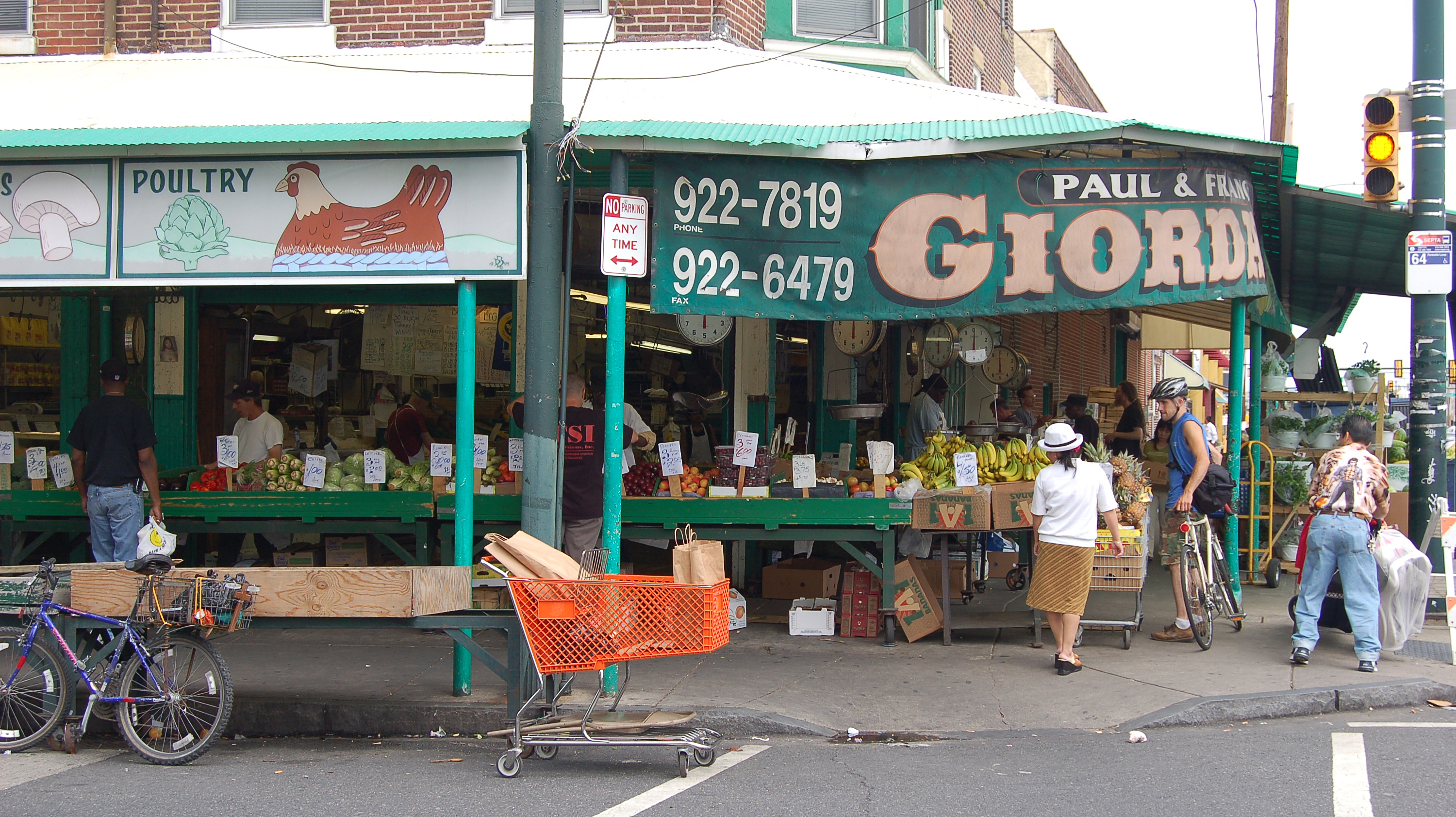
Irish, Italian, German, Polish, English, Russian, Ukrainian, and French constitute the largest European ethnic groups in the city.[113] Philadelphia has the second-largest Irish and Italian populations in the United States, after New York City. South Philadelphia remains one of the largest Italian neighborhoods in the country and is home to the Italian Market.
The Pennsport neighborhood and Gray's Ferry section of South Philadelphia, home to many Mummer clubs, are well known as Irish neighborhoods. The Kensington, Port Richmond, and Fishtown neighborhoods have historically been heavily Irish and Polish. Port Richmond is well known in particular as the center of the Polish immigrant and Polish-American community in Philadelphia, and it remains a common destination for Polish immigrants. Northeast Philadelphia, although known for its Irish and Irish-American population, is also home to a large Jewish and Russian population. Mount Airy in Northwest Philadelphia also contains a large Jewish community, while nearby Chestnut Hill is historically known as an Anglo-Saxon Protestant community.

Philadelphia has a significant gay and lesbian population. Philadelphia's Gayborhood, which is near Washington Square, is home to a large concentration of gay and lesbian friendly businesses, restaurants, and bars.[118][119]
The Black American population in Philadelphia is the third-largest in the country, after New York City and Chicago. West Philadelphia and North Philadelphia are largely African-American neighborhoods, but many are leaving those areas in favor of the Northeast and Southwest sections of Philadelphia. A higher proportion of African-American Muslims reside in Philadelphia than in most other cities in America. West Philadelphia and Southwest Philadelphia are also home to various significant Afro-Caribbean and African immigrant communities.[120]
The Puerto Rican population in Philadelphia is the second-largest on the mainland United States after New York City, and the second-fastest growing after Orlando.[121] Eastern North Philadelphia, particularly Fairhill and surrounding areas to the north and east, has one of the highest concentrations of Puerto Ricans outside Puerto Rico, with many large swaths of blocks being close to 100% Puerto Rican.[122][123] Large Puerto Rican and Dominican populations reside in North Philadelphia and the Northeast. In regard to other Latin American populations in Philadelphia, there are significant Mexican and Central American populations in South Philadelphia.[124]
![The paifang “Friendship Arch” (Chinese: 十街) at Chinatown, one of America’s largest, attracting Chinese immigrants from both New York City and China.[125]](http://upload.wikimedia.org/wikipedia/commons/3/3b/Friendship_Gate_Chinatown_Philadelphia_from_east.jpg)
Philadelphia's Asian American population originates mainly from China, India, Vietnam, South Korea, and the Philippines. Over 35,000 Chinese Americans lived in the city in 2015,[126] including a large Fuzhounese population. Center City hosts a growing Chinatown accommodating heavily traveled Chinese-owned bus lines to and from Chinatown, Manhattan in New York City, 95 miles to the north, as Philadelphia is experiencing significant Chinese immigration from New York City.[127] A large Korean community initially settled in the North Philadelphia neighborhood of Olney; however, the primary Koreatown has subsequently shifted northward, straddling the border with the adjacent suburb of Cheltenham in Montgomery County, while also growing in nearby Cherry Hill, New Jersey. South Philadelphia is also home to large Cambodian, Vietnamese, Thai, and Chinese communities.
Religion

According to a 2014 study by the Pew Research Center, 68% of the population of the city identified themselves as Christian.[128] Approximately 41% of Christians in the city and area professed attendance at a variety of churches that could be considered Protestant, while 26% professed Catholic beliefs.
The Protestant Christian community in Philadelphia is dominated by mainline Protestant denominations including the Evangelical Lutheran Church in America, United Church of Christ, the Episcopal Church in the United States, Presbyterian Church (USA) and American Baptist Churches USA. One of the most prominent mainline Protestant jurisdictions is the Episcopal Diocese of Pennsylvania. The African Methodist Episcopal Church was established in Philadelphia. Historically, the city has strong connections to the Quakers, Unitarian Universalism, and the Ethical Culture movement, all of which continue to be represented in the city. The Quaker Friends General Conference is based in Philadelphia. Evangelical Protestants making up less than 15% of the population were also prevalent. Evangelical Protestant bodies included the Anglican Church in North America, Lutheran Church—Missouri Synod, Presbyterian Church in America, and National Baptist Convention of America.

The Catholic community is primarily served by the Latin Catholic Archdiocese of Philadelphia, the Ukrainian Catholic Archeparchy of Philadelphia, and the Syro-Malankara Catholic Eparchy of the United States of America and Canada, though some independent Catholic churches exist throughout Philadelphia and its suburbs. The Latin Church-based jurisdiction is headquartered in the city, and its see is the Cathedral Basilica of Saints Peter and Paul. The Ukrainian Catholic jurisdiction is also headquartered in Philadelphia, and is seated at the Cathedral of the Immaculate Conception.
Less than 1% of Philadelphia's Christians were Mormons. The remainder of the Christian demographic is spread among smaller Protestant denominations and the Eastern and Oriental Orthodox among others. The Diocese of Eastern Pennsylvania (Orthodox Church in America) and Greek Orthodox Archdiocese of America (Ecumenical Patriarchate) divide the Eastern Orthodox in Philadelphia. The Russian Orthodox St. Andrew's Cathedral is in the city.
The same study says that other religions collectively compose about 8% of the population, including Judaism, Hinduism, Islam, Buddhism, and Sikhism.[129] Philadelphia has the fifth largest Muslim population among American cities.[130] The remaining 24% claimed no religious affiliation.
The Philadelphia metropolitan area's Jewish population was estimated at 206,000 in 2001, which was the sixth largest in the United States at that time.[131] Jewish traders were operating in southeastern Pennsylvania long before William Penn. Furthermore, Jews in Philadelphia took a prominent part in the War of Independence. Although the majority of the early Jewish residents were of Portuguese or Spanish descent, some among them had emigrated from Germany and Poland. About the beginning of the 19th century, a number of Jews from the latter countries, finding the services of the Congregation Mickvé Israel unfamiliar to them, resolved to form a new congregation which would use the ritual to which they had been accustomed.
African diasporic religions are practiced in some Latino and Hispanic and Caribbean communities in North and West Philadelphia.[132][133]
Languages
As of 2010[update], 79.12% (1,112,441) of Philadelphia residents age 5 and older spoke English at home as a primary language, while 9.72% (136,688) spoke Spanish, 1.64% (23,075) Chinese, 0.89% (12,499) Vietnamese, 0.77% (10,885) Russian, 0.66% (9,240) French, 0.61% (8,639) other Asian languages, 0.58% (8,217) African languages, 0.56% (7,933) Cambodian (Mon-Khmer), and Italian was spoken as a main language by 0.55% (7,773) of the population over the age of five. In total, 20.88% (293,544) of Philadelphia's population age 5 and older spoke a mother language other than English.[134]
Economy
| Top publicly traded companies headquartered in Philadelphia | ||
| Corporation | 2019 Rank | Revenue (billions) |
| Comcast | 32 | 94.5 |
| Aramark | 198 | 15.8 |
| FMC | 556 | 4.7 |
| Urban Outfitters | 634 | 4.0 |
| Carpenter Technology | 940 | 2.2 |
| Source: Fortune[135] | ||
Philadelphia is the center of economic activity in Pennsylvania with the headquarters of five Fortune 1000 companies within city limits. As of 2019[update], the Philadelphia metropolitan area is estimated to produce a gross metropolitan product (GMP) of $490 billion,[17] an increase from the $445 billion calculated by the Bureau of Economic Analysis for 2017,[136] representing the eighth largest U.S. metropolitan economy.
Philadelphia's economic sectors include financial services, health care, biotechnology, information technology, trade and transportation, manufacturing, oil refining, food processing, and tourism. Financial activities account for the largest economic sector of the metropolitan area, which is also one of the largest health education and research centers in the United States. Philadelphia's annualized unemployment rate was 7.8% in 2014, down from 10% the previous year.[114] This is higher than the national average of 6.2%. Similarly, the rate of new jobs added to the city's economy lagged behind the national job growth. In 2014, about 8,800 jobs were added to the city's economy. Sectors with the largest number of jobs added were in education and health care, leisure and hospitality, and professional and business services. Declines were seen in the city's manufacturing and government sectors.[114]
About 31.9% of the city's population was not in the labor force in 2015, the second highest percentage after Detroit. The city's two largest employers are the federal and city governments. Philadelphia's largest private employer is the University of Pennsylvania followed by the Children's Hospital of Philadelphia.[114] A study commissioned by the city's government in 2011 projected 40,000 jobs would be added to the city within 25 years, raising the number of jobs from 675,000 in 2010 to an estimated 715,000 by 2035.[137]
Corporations

The Philadelphia Stock Exchange is now owned by NASDAQ and tracks the Philadelphia Semiconductor Index, known in financial circles as the SOX.[25] The city is also home to the headquarters of cable television and internet service provider Comcast, insurance companies Cigna, Colonial Penn, and Independence Blue Cross, food services company Aramark, chemical makers FMC Corporation and Rohm and Haas, pharmaceutical companies GlaxoSmithKline, Amicus Therapeutics, Spark Therapeutics, apparel retailers Five Below and Urban Outfitters and its subsidiaries including Anthropologie, automotive parts retailer Pep Boys, and stainless steel producer Carpenter Technology Corporation. Other corporation headquarters include Rite Aid, Crown Holdings, and Brandywine Realty Trust. The headquarters of Boeing Rotorcraft Systems, and its main rotorcraft factory, are in the Philadelphia suburb of Ridley Park, while The Vanguard Group and the U.S. headquarters of Siemens Healthineers are headquartered in suburban Malvern.
Tech and biotech
Philadelphia is a hub for information technology and biotechnology.[24] Philadelphia and Pennsylvania are attracting new life sciences ventures.[138] The Philadelphia metropolitan area, comprising the Delaware Valley, has also become a growing hub for venture capital funding.[138]
Tourism

Philadelphia's history attracts many tourists, with the Independence National Historical Park (which includes the Liberty Bell, Independence Hall, and other historic sites) receiving over 5 million visitors in 2016.[139] The city welcomed 42 million domestic tourists in 2016 who spent $6.8 billion, generating an estimated $11 billion in total economic impact in the city and surrounding four counties of Pennsylvania.[23] The annual Naked Bike Ride attracts participants from around the United States and internationally to Philadelphia.
Trade and transportation
Philadelphia International Airport is undergoing a $900 million infrastructural expansion to increase passenger capacity and augment passenger experience;[140][141] while the Port of Philadelphia, having experienced the highest percentage growth by tonnage loaded in 2017 among major U.S. seaports, was in the process of doubling its shipping capacity to accommodate super-sized post-Panamax shipping vessels in 2018.[142] Philadelphia's 30th Street Station is the third-busiest Amtrak rail hub, following Penn Station in Manhattan and Union Station in Washington, D.C., transporting over 4 million inter-city rail passengers annually.[143]
Education
Primary and secondary education

Education in Philadelphia is provided by many private and public institutions. The School District of Philadelphia is the local school district, operating public schools, in all of the city.[144] The Philadelphia School District is the eighth largest school district in the United States[145] with 142,266 students in 218 traditional public schools and 86 charter schools as of 2014[update].[146]
The city's K-12 enrollment in district–run schools dropped from 156,211 students in 2010 to 130,104 students in 2015. During the same time period, the enrollment in charter schools increased from 33,995 students in 2010 to 62,358 students in 2015.[114] This consistent drop in enrollment led the city to close 24 of its public schools in 2013.[147] During the 2014 school year, the city spent an average of $12,570 per pupil, below the average among comparable urban school districts.[114]
Graduation rates among district-run schools, meanwhile, steadily increased in the ten years from 2005. In 2005, Philadelphia had a district graduation rate of 52%. This number increased to 65% in 2014, still below the national and state averages. Scores on the state's standardized test, the Pennsylvania System of School Assessment (PSSA) trended upward from 2005 to 2011 but subsequently decreased. In 2005, the district-run schools scored an average of 37.4% on math and 35.5% on reading. The city's schools reached their peak scores in 2011 with 59.0% on math and 52.3% on reading. In 2014, the scores dropped significantly to 45.2% on math and 42.0% on reading.[114]
Of the city's public high schools, including charter schools, only four performed above the national average on the SAT (1497 out of 2400[148]) in 2014: Masterman, Central, Girard, and MaST Community Charter School. All other district-run schools were below average.[114]
Higher education
Medical and research facilities of the University of Pennsylvania School of Medicine and the Children's Hospital of Philadelphia. Philadelphia has the third-largest student concentration on the East Coast, with more than 120,000 college and university students enrolled within the city and nearly 300,000 in the metropolitan area.[149] More than 80 colleges, universities, trade, and specialty schools are in the Philadelphia region. One of the founding members of the Association of American Universities is in the city, the University of Pennsylvania, an Ivy League institution with claims to be the First university in the United States.[150][31]
The city's largest university, as noted by number of students, is Temple University, followed by Drexel University.[151] The University of Pennsylvania, Temple University, Drexel University, and Thomas Jefferson University comprise the city's nationally ranked research universities. Philadelphia is also home to five schools of medicine: Drexel University College of Medicine, Perelman School of Medicine at the University of Pennsylvania, Philadelphia College of Osteopathic Medicine, Temple University School of Medicine, and Thomas Jefferson University's Sidney Kimmel Medical College. Hospitals, universities, and higher education research institutions in Philadelphia's four congressional districts received more than $252 million in National Institutes of Health grants in 2015.[152]
Other institutions of higher learning within the city's borders include:
- Chestnut Hill College
- Community College of Philadelphia
- Curtis Institute of Music
- Holy Family University
- La Salle University
- Moore College of Art and Design
- Peirce College
- Pennsylvania Academy of the Fine Arts
- Saint Joseph's University
- Spells Writing Lab, Inc.
- The Art Institute of Philadelphia
- The Restaurant School at Walnut Hill College
- University of the Arts
- University of the Sciences
Culture

Philadelphia is home to many national historical sites that relate to the founding of the United States. Independence National Historical Park is the center of these historical landmarks being one of the country's 22 UNESCO World Heritage Sites. Independence Hall, where the Declaration of Independence was signed, and the Liberty Bell are the city's most famous attractions. Other national historic sites include the homes of Edgar Allan Poe and Thaddeus Kosciuszko, early government buildings like the First and the Second Bank of the United States, Fort Mifflin, and the Gloria Dei (Old Swedes') Church.[153] Philadelphia alone has 67 National Historic Landmarks, the third most of any city in the country.[153]
Philadelphia's major science museums include the Franklin Institute, which contains the Benjamin Franklin National Memorial; the Academy of Natural Sciences; the Mütter Museum; and the University of Pennsylvania Museum of Archaeology and Anthropology. History museums include the National Constitution Center, the Museum of the American Revolution, the Philadelphia History Museum, the National Museum of American Jewish History, the African American Museum in Philadelphia, the Historical Society of Pennsylvania, the Masonic Library and Museum of Pennsylvania in the Masonic Temple, and the Eastern State Penitentiary. Philadelphia is home to the United States' first zoo[154] and hospital,[155] as well as Fairmount Park, one of America's oldest and largest urban parks,[22] founded in 1855.[156]
The city is home to important archival repositories, including the Library Company of Philadelphia, established in 1731 by Benjamin Franklin,[157] and the Athenaeum of Philadelphia, founded in 1814.[158] The Presbyterian Historical Society is the country's oldest denominational historical society, organized in 1852.[159]
Arts
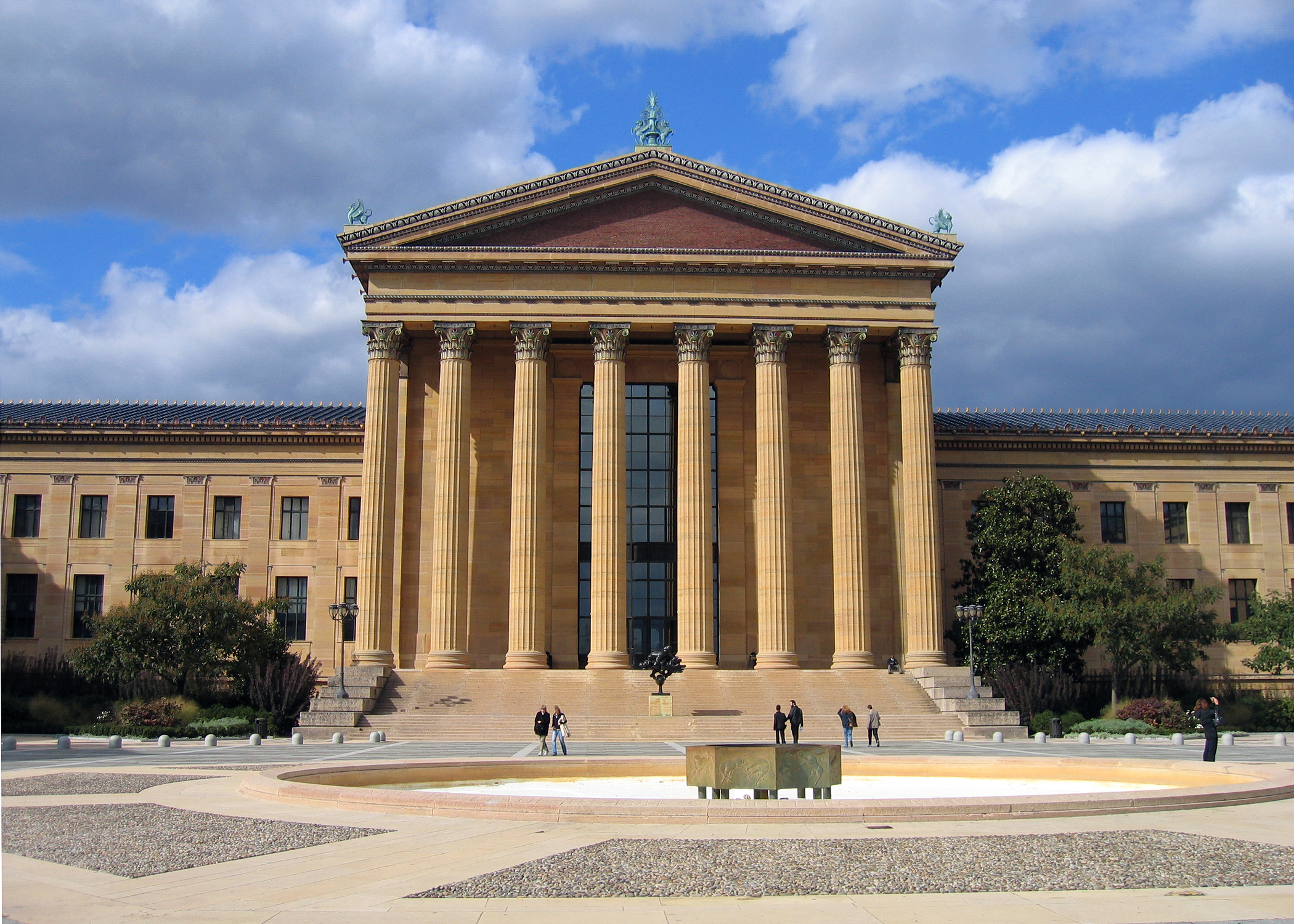
The city contains many art museums, such as the Pennsylvania Academy of the Fine Arts and the Rodin Museum, which holds the largest collection of work by Auguste Rodin outside France. The city's major art museum, the Philadelphia Museum of Art, is one of the largest art museums in the world. The long flight of steps to the Art Museum's main entrance became famous after the film Rocky (1976).[160]
Areas such as South Street and Old City have a vibrant night life. The Avenue of the Arts in Center City contains many restaurants and theaters, such as the Kimmel Center for the Performing Arts, home of the Philadelphia Orchestra, and the Academy of Music, home of Opera Philadelphia and the Pennsylvania Ballet.[160] The Wilma Theatre and the Philadelphia Theatre Company at the Suzanne Roberts Theatre produce a variety of new plays.[161][162] Several blocks to the east are the Lantern Theater Company at St. Stephens Episcopal Church;[163] and the Walnut Street Theatre, a National Historic Landmark stated to be the oldest and most subscribed-to theatre in the English-speaking world, founded in 1809.[164] In May 2019, the Walnut Street Theatre announced a major expansion to begin in 2020.[165]

Philadelphia has more public art than any other American city.[166] In 1872, the Association for Public Art (formerly the Fairmount Park Art Association) was created as the first private association in the United States dedicated to integrating public art and urban planning.[167] In 1959, lobbying by the Artists Equity Association helped create the Percent for Art ordinance, the first for a U.S. city.[168] The program, which has funded more than 200 pieces of public art, is administered by the Philadelphia Office of Arts and Culture, the city's art agency.[169] The city also has more murals than any other American city, due to the 1984 creation of the Department of Recreation's Mural Arts Program, which seeks to beautify neighborhoods and provide an outlet for graffiti artists. The program has funded more than 2,800 murals by professional, staff and volunteer artists and educated more than 20,000 youth in underserved neighborhoods throughout Philadelphia.[170]
The city is home to a number of art organizations including the regional art advocacy nonprofit Philadelphia Tri-State Artists Equity,[171] the Philadelphia Sketch Club, one of the country's oldest artists' clubs,[172] and The Plastic Club, started by women excluded from the Sketch Club.[173] Many Old City art galleries stay open late on the First Friday event of each month.[174] Annual events include film festivals and parades, the most famous being the Thanksgiving Day Parade and the Mummers Parade on New Year's Day.
Music

The Philadelphia Orchestra is generally considered one of the top five orchestras in the United States. The orchestra performs at the Kimmel Center[175] and has a summer concert series at the Mann Center for the Performing Arts.[176] Opera Philadelphia performs at the nation's oldest continually operating opera house—the Academy of Music.[160] The Philadelphia Boys Choir & Chorale has performed its music all over the world.[177] The Philly Pops plays orchestral versions of popular jazz, swing, Broadway, and blues songs at the Kimmel Center and other venues within the mid-Atlantic region.[178] The Curtis Institute of Music is one of the world's premier conservatories and among the most selective institutes of higher education in the United States.[179]
Philadelphia has played a prominent role in the music of the United States. The culture of American popular music has been influenced by significant contributions of Philadelphia area musicians and producers, in both the recording and broadcasting industries. In 1952, the teen dance party program called Bandstand premiered on local television, hosted by Bob Horn. The show was renamed American Bandstand in 1957 when it began national syndication on ABC, hosted by Dick Clark and produced in Philadelphia until 1964 when it moved to Los Angeles.[180] Promoters marketed youthful musical artists known as teen idols to appeal to the young audience. Philadelphia-born singers such as Frankie Avalon, James Darren, Eddie Fisher, Fabian Forte, and Bobby Rydell, along with South Philly-raised Chubby Checker, topped the music charts, establishing a clean-cut rock and roll image.
Philly soul music of the late 1960s–1970s is a highly produced version of soul music which led to later forms of popular music such as disco and urban contemporary rhythm and blues.[181] On July 13, 1985, John F. Kennedy Stadium was the American venue for the Live Aid concert.[182] The city also hosted the Live 8 concert, which attracted about 700,000 people to the Benjamin Franklin Parkway on July 2, 2005.[183] Famous rock and pop musicians from Philadelphia or its suburbs include Bill Haley & His Comets, Todd Rundgren and Nazz, Hall & Oates, The Hooters, Ween, Cinderella, and Pink. Local hip-hop artists include The Roots, DJ Jazzy Jeff & The Fresh Prince, Lil Uzi Vert, Beanie Sigel and his rap collective State Property, Schoolly D, Lisa "Left Eye" Lopes, and Meek Mill.
Cuisine
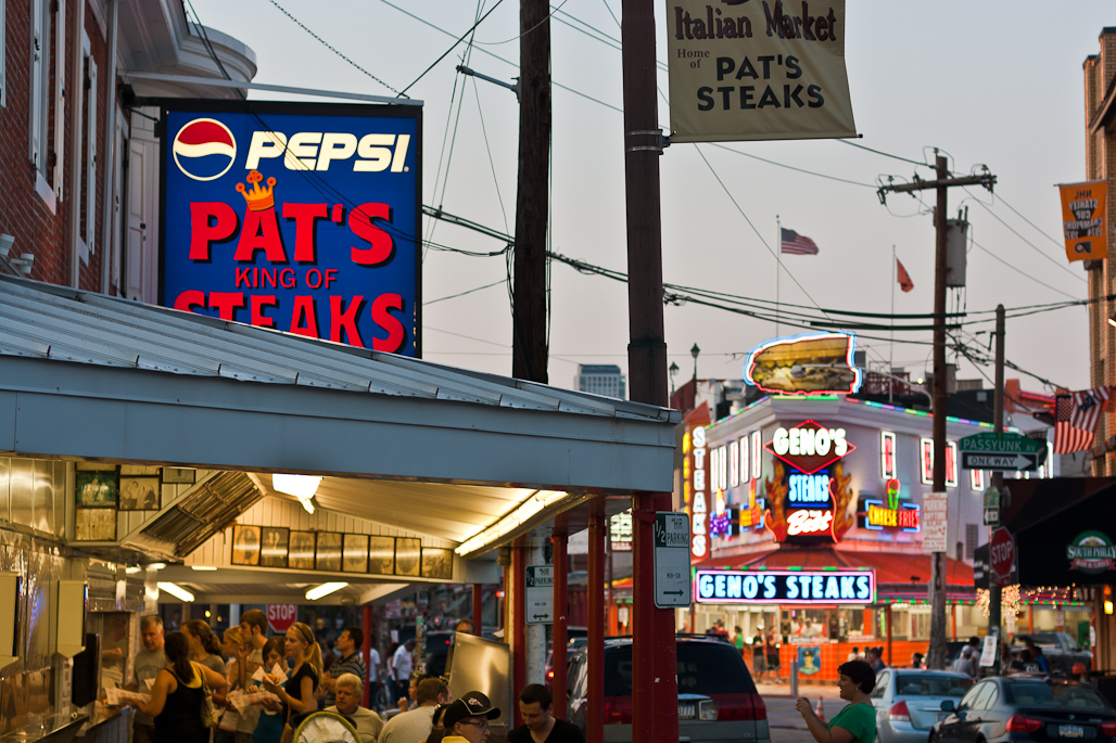
The city is known for its hoagies, stromboli, roast pork sandwich, scrapple, soft pretzels, water ice, Irish potato candy, tastykakes, and the cheesesteak sandwich which was developed by Italian immigrants.[184] The Philadelphia area has many establishments that serve cheesesteaks, including restaurants, taverns, delicatessens and pizza parlors.[185][186][187] The originator of the thinly-sliced steak sandwich in the 1930s, initially without cheese, is Pat's King of Steaks, which faces its rival Geno's Steaks, founded in 1966,[188] across the intersection of 9th Street and Passyunk Avenue in the Italian Market of South Philadelphia.[189]
McGillin's Olde Ale House, opened in 1860 on Drury Street in Center City, is the oldest continuously operated tavern in the city.[190] The City Tavern is a replica of a historic 18th-century building first opened in 1773, demolished in 1854 after a fire, and rebuilt in 1975 on the same site as part of Independence National Historical Park.[191] The tavern offers authentic 18th-century recipes, served in seven period dining rooms, three wine cellar rooms and an outdoor garden.[192]
The Reading Terminal Market is a historic food market founded in 1893 in the Reading Terminal building, a designated National Historic Landmark. The enclosed market is one of the oldest and largest markets in the country, hosting over a hundred merchants offering Pennsylvania Dutch specialties, artisan cheese and meat, locally grown groceries, and specialty and ethnic foods.[193]
Dialect
The traditional Philadelphia accent is considered by some linguists to be the most distinctive accent in North America.[194] The Philadelphia dialect, which is spread throughout the Delaware Valley and South Jersey, is part of a larger Mid-Atlantic American English family, a designation that also includes the Baltimore dialect. Additionally, it shares many similarities with the New York accent. Owing to over a century of linguistic data collected by researchers at the University of Pennsylvania under sociolinguist William Labov, the Philadelphia dialect has been one of the best-studied forms of American English.[195][196][lower-alpha 6] The accent is especially found within the Irish American and Italian American working-class neighborhoods.[197] Philadelphia also has its own unique collection of neologisms and slang terms.[198]
Sports


Philadelphia's first professional sports team was baseball's Athletics, organized in 1860.[199] The Athletics were initially an amateur league team that turned professional in 1871, and then became a founding team of the current National League in 1876.[200] The city is one of 13 U.S. cities to have teams in all four major league sports: the Philadelphia Phillies of Major League Baseball (MLB), the Philadelphia Eagles of the National Football League (NFL), the Philadelphia Flyers of the National Hockey League (NHL), and the Philadelphia 76ers of the National Basketball Association (NBA).[201] The Phillies, formed in 1883 as the Quakers and renamed in 1884,[202] are the oldest team continuously playing under the same name in the same city in the history of American professional sports.[203]
The Philadelphia metro area is also home to the Philadelphia Union of Major League Soccer (MLS). The Union began playing their home games in 2010 at PPL Park, a soccer-specific stadium in Chester, Pennsylvania.[204] The stadium's name was changed to Talen Energy Stadium in 2016[205] and to Subaru Park in 2020.[206]

Philadelphia was the second of eight American cities to have won titles in all four major leagues (MLB, NFL, NHL and NBA), and also has a title in soccer (from the now-defunct North American Soccer League in the 1970s). The city's professional teams and their fans endured 25 years without a championship, from the 76ers 1983 NBA Finals win[207] until the Phillies 2008 World Series win.[208][209] The lack of championships was sometimes attributed in jest to the Curse of Billy Penn after One Liberty Place became the first building to surpass the height of the William Penn statue on top of City Hall's tower in 1987.[210] After nine years passed without another championship, the Eagles won their first Super Bowl following the 2017 season.[211] In 2004, ESPN placed Philadelphia second on its list of The Fifteen Most Tortured Sports Cities.[212][213] Fans of the Eagles and Phillies were singled out as the worst fans in the country by GQ magazine in 2011, which used the subtitle of "Meanest Fans in America" to summarize incidents of drunken behavior and a history of booing.[214][215]
Major professional sports teams that originated in Philadelphia but which later moved to other cities include the Golden State Warriors basketball team—in Philadelphia from 1946 to 1962[216]—and the Oakland Athletics baseball team—originally the Philadelphia Athletics from 1901 to 1954 (a different Athletics team than the one mentioned above).[217]
Philadelphia is home to professional, semi-professional, and elite amateur teams in cricket, rugby league (Philadelphia Fight), and rugby union. Major running events in the city include the Penn Relays (track and field), the Philadelphia Marathon, and the Broad Street Run. The Philadelphia International Cycling Classic was held annually from 1985 to 2016, but not in 2017 due to insufficient sponsorship.[218] The Collegiate Rugby Championship is played every June at Talen Energy Stadium in Chester, Pennsylvania.[219]

Rowing has been popular in Philadelphia since the 18th century.[220] Boathouse Row is a symbol of Philadelphia's rich rowing history, and each Big Five member has its own boathouse.[221] Philadelphia hosts numerous local and collegiate rowing clubs and competitions, including the annual Dad Vail Regatta, which is the largest intercollegiate rowing event in North America with more than 100 U.S and Canadian colleges and universities participating;[222] the annual Stotesbury Cup Regatta, which is billed as the world's oldest and largest rowing event for high school students;[223][224] and the Head of the Schuylkill Regatta.[225] The regattas are held on the Schuylkill River and organized by the Schuylkill Navy, an association of area rowing clubs that has produced numerous Olympic rowers.[226]
The Philadelphia Spinners were a professional ultimate team in Major League Ultimate (MLU) until 2016. The Spinners were one of the original eight teams of the American Ultimate Disc League (AUDL) that began in 2012. They played at Franklin Field and won the inaugural AUDL championship and the final MLU championship in 2016.[227] The MLU was suspended indefinitely by its investors in December 2016.[228] As of 2018[update], the Philadelphia Phoenix continue to play in the AUDL.[229]
Philadelphia is home to the Philadelphia Big 5, a group of five NCAA Division I college basketball programs. The Big 5 are La Salle, Penn, Saint Joseph's, Temple, and Villanova universities.[230] The sixth NCAA Division I school in Philadelphia is Drexel University. Villanova won the 1985,[231] 2016,[232] and 2018[233] championship of the NCAA Division I men's basketball tournament. Philadelphia will be one of the eleven US host cities for the 2026 FIFA World Cup.
| Team | League | Sport | Venue | Capacity | Founded | Championships |
|---|---|---|---|---|---|---|
| Philadelphia Phillies | MLB | Baseball | Citizens Bank Park | 46,528 | 1883 | 1980, 2008 |
| Philadelphia Eagles | NFL | American football | Lincoln Financial Field | 69,176 | 1933 | 1948, 1949, 1960, 2017 |
| Philadelphia 76ers | NBA | Basketball | Wells Fargo Center | 21,600 | 1963 | 1966–67, 1982–83 |
| Philadelphia Flyers | NHL | Ice hockey | Wells Fargo Center | 19,786 | 1967 | 1973–74, 1974–75 |
| Philadelphia Union | MLS | Soccer | Subaru Park | 18,500 | 2010 | none |
| Philadelphia Wings | NLL | Lacrosse | Wells Fargo Center | 19,786 | 2018 | none |
| Philadelphia Fusion | OWL | Overwatch | Fusion Arena | 3,500 | 2017 | N/A |
Law and government

From a governmental perspective, Philadelphia County is a legal nullity, as all county functions were assumed by the city in 1952.[234] The city has been coterminous with the county since 1854.[54]
Philadelphia's 1952 Home Rule Charter was written by the City Charter Commission, which was created by the Pennsylvania General Assembly in an act of April 21, 1949, and a city ordinance of June 15, 1949. The existing city council received a proposed draft on February 14, 1951, and the electors approved it in an election held April 17, 1951.[235] The first elections under the new Home Rule Charter were held in November 1951, and the newly elected officials took office in January 1952.[234]

The city uses the strong-mayor version of the mayor–council form of government, which is led by one mayor in whom executive authority is vested. The mayor has the authority to appoint and dismiss members of all boards and commissions without the approval of the city council. Elected at-large, the mayor is limited to two consecutive four-year terms, but can run for the position again after an intervening term.[235]
Courts
Philadelphia County is coterminous with the First Judicial District of Pennsylvania. The Philadelphia County Court of Common Pleas is the trial court of general jurisdiction for the city, hearing felony-level criminal cases and civil suits above the minimum jurisdictional limit of $10,000. The court also has appellate jurisdiction over rulings from the Municipal and Traffic Courts, and some administrative agencies and boards. The trial division has 70 commissioned judges elected by the voters, along with about one thousand other employees.[236] The court also has a family division with 25 judges[237] and an orphans' court with three judges.[238]
![The James A. Byrne United States Courthouse at 601 Market Street houses the United States Court of Appeals for the Third Circuit[239] and the United States District Court for the Eastern District of Pennsylvania.[240]](http://upload.wikimedia.org/wikipedia/commons/d/df/James_A._Byrne_United_States_Courthouse.jpg)
As of 2018[update], the city's District Attorney is Larry Krasner, a Democrat.[241] The last Republican to hold the office is Ronald D. Castille, who left in 1991 and later served as the Chief Justice of the Pennsylvania Supreme Court from 2008 to 2014.[242]
The Philadelphia Municipal Court handles traffic cases, misdemeanor and felony criminal cases with maximum incarceration of five years, and civil cases involving $12,000 or less ($15,000 in real estate and school tax cases), and all landlord-tenant disputes. The municipal court has 27 judges elected by the voters.[243]
Pennsylvania's three appellate courts also have sittings in Philadelphia. The Supreme Court of Pennsylvania, the court of last resort in the state, regularly hears arguments in Philadelphia City Hall.[244] The Superior Court of Pennsylvania and the Commonwealth Court of Pennsylvania also sit in Philadelphia several times a year.[245][246] Judges for these courts are elected at large.[247] The state Supreme Court and Superior Court have deputy prothonotary offices in Philadelphia.[248][249]
Additionally, Philadelphia is home to the federal United States District Court for the Eastern District of Pennsylvania and the Court of Appeals for the Third Circuit, both of which are housed in the James A. Byrne United States Courthouse.[250][251]
Politics
The current mayor is Jim Kenney who won the election in November 2015.[252] Kenney's predecessor was Michael Nutter who had served two terms from 2009 to January 2016.[253] Kenney is a member of the Democratic Party as all Philadelphia mayors have been since 1952. Philadelphia City Council is the legislative branch which consists of ten council members representing individual districts and seven members elected at-large, all of whom are elected to four-year terms.[254] Democrats are currently the majority and hold 14 seats including nine of the ten districts and five at-large seats. Republicans hold two seats, one at-large seats and the Northeast-based Tenth District, while Working Families Party holds one at-large seat. The current council president is Darrell L. Clarke.[255]
As of December 31, 2016, there were 1,102,620 registered voters in Philadelphia.[256] Registered voters constitute 70.3% of the total population.[lower-alpha 7]
- Democratic: 853,140 (77.4%)
- Republican: 125,530 (11.4%)
- Other parties and unaffiliated: 123,950 (11.2%)[256]
| Year | Republican | Democratic | Third party | |||
|---|---|---|---|---|---|---|
| No. | % | No. | % | No. | % | |
| 2020 | 132,870 | 17.86% | 604,175 | 81.21% | 6,921 | 0.93% |
| 2016 | 108,748 | 15.32% | 584,025 | 82.30% | 16,845 | 2.37% |
| 2012 | 96,467 | 13.97% | 588,806 | 85.24% | 5,503 | 0.80% |
| 2008 | 117,221 | 16.33% | 595,980 | 83.00% | 4,824 | 0.67% |
| 2004 | 130,099 | 19.30% | 542,205 | 80.44% | 1,765 | 0.26% |
| 2000 | 100,959 | 17.99% | 449,182 | 80.04% | 11,039 | 1.97% |
| 1996 | 85,345 | 16.00% | 412,988 | 77.44% | 34,944 | 6.55% |
| 1992 | 133,328 | 20.90% | 434,904 | 68.16% | 69,826 | 10.94% |
| 1988 | 219,053 | 32.45% | 449,566 | 66.60% | 6,358 | 0.94% |
| 1984 | 267,178 | 34.60% | 501,369 | 64.94% | 3,555 | 0.46% |
| 1980 | 244,108 | 33.99% | 421,253 | 58.66% | 52,739 | 7.34% |
| 1976 | 239,000 | 32.03% | 494,579 | 66.28% | 12,618 | 1.69% |
| 1972 | 344,096 | 43.89% | 431,736 | 55.07% | 8,138 | 1.04% |
| 1968 | 254,153 | 29.90% | 525,768 | 61.85% | 70,196 | 8.26% |
| 1964 | 239,733 | 26.24% | 670,645 | 73.42% | 3,094 | 0.34% |
| 1960 | 291,000 | 31.79% | 622,544 | 68.02% | 1,733 | 0.19% |
| 1956 | 383,414 | 42.97% | 507,289 | 56.85% | 1,618 | 0.18% |
| 1952 | 396,874 | 41.40% | 557,352 | 58.15% | 4,321 | 0.45% |
| 1948 | 425,962 | 48.12% | 432,699 | 48.88% | 26,636 | 3.01% |
| 1944 | 346,380 | 40.96% | 496,367 | 58.70% | 2,883 | 0.34% |
| 1940 | 354,878 | 39.81% | 532,149 | 59.69% | 4,459 | 0.50% |
| 1936 | 329,881 | 36.94% | 539,757 | 60.45% | 23,310 | 2.61% |
| 1932 | 331,092 | 54.54% | 260,276 | 42.88% | 15,651 | 2.58% |
| 1928 | 420,320 | 59.99% | 276,573 | 39.48% | 3,703 | 0.53% |
| 1924 | 347,457 | 77.73% | 54,213 | 12.13% | 45,352 | 10.15% |
| 1920 | 307,826 | 73.43% | 90,151 | 21.50% | 21,235 | 5.07% |
| 1916 | 194,163 | 66.81% | 90,800 | 31.25% | 5,638 | 1.94% |
| 1912 | 91,944 | 36.53% | 66,308 | 26.35% | 93,438 | 37.12% |
| 1908 | 185,263 | 69.09% | 75,310 | 28.09% | 7,568 | 2.82% |
| 1904 | 227,709 | 80.85% | 48,784 | 17.32% | 5,161 | 1.83% |
| 1900 | 173,657 | 73.93% | 58,179 | 24.77% | 3,053 | 1.30% |
| 1896 | 176,462 | 72.06% | 63,323 | 25.86% | 5,102 | 2.08% |
| 1892 | 116,685 | 57.45% | 84,470 | 41.59% | 1,947 | 0.96% |
| 1888 | 111,358 | 54.20% | 92,786 | 45.16% | 1,300 | 0.63% |
| 1884 | 101,288 | 58.00% | 71,288 | 40.82% | 2,057 | 1.18% |
| 1880 | 97,220 | 55.92% | 76,330 | 43.91% | 294 | 0.17% |
Philadelphia was a bastion of the Republican Party from the American Civil War until the mid-1930s.[258][259] The city hosted the first Republican National Convention in 1856.[260] Democratic registrations increased after the Great Depression; however, the city was not carried by Democrat Franklin D. Roosevelt in his landslide victory of 1932 as Pennsylvania was one of only six states won by Republican Herbert Hoover. Voter turnout surged from 600,000 in 1932 to nearly 900,000 in 1936 and Roosevelt carried Philadelphia with over 60% of the vote. The city has voted Democratic in every presidential election since 1936. In 2008, Democrat Barack Obama drew 83% of the city's vote. Obama's win was even greater in 2012, capturing 85% of the vote. In 2016, Democrat Hillary Clinton won 82% of the vote.[257]
As a result of the declining population in the city and state,[261] Philadelphia has only three congressional districts of the 18 districts in Pennsylvania, based on the 2010 census apportionment:[262] the 2nd district, represented by Brendan Boyle; the 3rd, represented by Dwight Evans; and the 5th, represented by Mary Gay Scanlon.[263] All three representatives are Democrats though Republicans still have some support in the city, primarily in the Northeast.[264] Sam Katz ran competitive mayoral races as the Republican nominee in 1999 and 2003, losing to Democrat John Street both times.[265][266]
Pennsylvania's longest-serving Senator, Arlen Specter,[267] was an alumnus of the University of Pennsylvania who opened his first law practice in Philadelphia.[268] Specter served as a Republican from 1981 and as a Democrat from 2009, losing that party's primary in 2010 and leaving office in January 2011.[269] He had also been assistant counsel on the Warren Commission in 1964 and the city's district attorney from 1966 to 1974.[268]
Philadelphia has hosted various national conventions, including in 1848 (Whig), 1856 (Republican), 1872 (Republican), 1900 (Republican), 1936 (Democratic), 1940 (Republican), 1948 (Republican), 1948 (Progressive), 2000 (Republican), and 2016 (Democratic).[270] Philadelphia has been home to one vice president, George M. Dallas,[271] and one general of the American Civil War, George B. McClellan, who won his party's nomination for president but lost in the general election to Abraham Lincoln in 1864.[272] In May 2019, former U.S. Vice President Joe Biden chose Philadelphia to be his 2020 U.S. presidential campaign headquarters.[273]
Environmental policy
"Green Cities, Clean Water" is an environmental policy initiative based in Philadelphia, Pennsylvania, that has shown promising results in mitigating the effects of climate change.[274] The researchers on the policy have stated that despite such promising plans of green infrastructure building, "the city is forecasted to grow warmer, wetter, and more urbanized over the century, runoff and local temperatures will increase on average throughout the city".[274] Even though landcover predictive models on the effects of the policy initiative have indicated that green infrastructure could be useful at decreasing the amount of runoff in the city over time, the city government would have to expand its current plans and "consider the cobenefit of climate change adaptation when planning new projects'' in limiting the scope of city-wide temperature increase.[274]
Public safety
Police and law enforcement

According to a 2015 report by the Pew Charitable Trusts, the police districts with the highest rates of violent crime were Frankford (15th district) and Kensington (24th district) in the Near Northeast, and districts to the North (22nd, 25th, and 35th districts), West (19th district) and Southwest (12th district) of Center City. Each of those seven districts recorded more than a thousand violent crimes in 2014. The lowest rates of violent crime occurred in Center City, South Philadelphia, the Far Northeast, and Roxborough districts, the latter of which includes Manayunk.[114]
Philadelphia had 500 (503 according to some sources) murders in 1990, a rate of 31.5 per 100,000. An average of about 400 murders occurred each year for most of the 1990s. The murder count dropped in 2002 to 288, then rose to 406 by 2006, before dropping slightly to 392 in 2007.[275][276] A few years later, Philadelphia began to see a rapid decline in homicides and violent crime. In 2013, the city had 246 murders, which is a decrease of nearly 40% since 2006.[277] In 2014, 248 homicides were committed. The homicide rate rose to 280 in 2015, then fell slightly to 277 in 2016, before rising again to 317 in 2017.[278] Homicides increased dramatically in the late 2010s/early 2020s, reaching 499 homicides in 2020[275] and surpassing the 1990 "record" in 2021, with 501st murder on November 27 and 510 by the end of the month.[279]

In 2006, Philadelphia's homicide rate of 27.7 per 100,000 people was the highest of the country's 10 most populous cities.[280] In 2012, Philadelphia had the fourth-highest homicide rate among the country's most populous cities. The rate dropped to 16 homicides per 100,000 residents by 2014 placing Philadelphia as the sixth-highest city in the country.[114]
The number of shootings in the city has declined significantly since the early years of the 21st century. Shooting incidents peaked at 1,857 in 2006 before declining nearly 44 percent to 1,047 shootings in 2014.[114] Major crimes have decreased gradually since a peak in 2006 when 85,498 major crimes were reported. The number of reported major crimes fell 11 percent in three years to 68,815 occurrences in 2014. Violent crimes, which include homicide, rape, aggravated assault, and robbery, decreased 14 percent in three years to 15,771 occurrences in 2014.[114]

Philadelphia was ranked as the 76th most dangerous city in a 2018 report based on FBI data from 2016 for the rate of violent crimes per 1,000 residents in American cities with 25,000 or more people.[281] The latest four years of reports indicate a steady reduction in violent crime as the city placed 67th in the 2017 report,[282] 65th in 2016,[283] and 54th in 2015.[284]
In 2014, Philadelphia enacted an ordinance decriminalizing the possession of less than 30 grams of marijuana or 8 grams of hashish; the ordinance gave police officers the discretion to treat possession of these amounts as a civil infraction punishable by a $25 ticket, rather than a crime.[285][286] Philadelphia was at the time the largest city to decriminalize the possession of marijuana.[286] From 2013 to 2018, marijuana arrests in the city dropped by more than 85%.[285] The purchase or sale of marijuana remains a criminal offense in Philadelphia.[286]
Firefighting
The Philadelphia Fire Department provides fire protection and emergency medical services (EMS). The department's official mission is to protect public safety by quick and professional response to emergencies and the promotion of sound emergency prevention measures. This mandate encompasses all traditional firefighting functions, including fire suppression, with 60 engine companies and 30 ladder companies[287] as well as specialty and support units deployed throughout the city; specialized firefighting units for Philadelphia International Airport and the Port of Philadelphia; investigations conducted by the fire marshal's office to determine the origins of fires and develop preventive strategies; prevention programs to educate the public; and support services including research and planning, management of the fire communications center within the city's 911 system, and operation of the Philadelphia Fire Academy.
Media
Newspapers

Philadelphia's two major daily newspapers are The Philadelphia Inquirer, first published in 1829—the third-oldest surviving daily newspaper in the country—and the Philadelphia Daily News, first published in 1925.[288] The Daily News has been published as an edition of the Inquirer since 2009.[289] Recent owners of the Inquirer and Daily News have included Knight Ridder, The McClatchy Company, and Philadelphia Media Holdings, with the latter organization declaring bankruptcy in 2010.[290] After two years of financial struggle, the newspapers were sold to Interstate General Media in 2012.[290] The two newspapers had a combined daily circulation of 306,831 and a Sunday circulation of 477,313 in 2013[update]—the eighteenth largest circulation in the country—while the website of the newspapers, Philly.com,[291] was ranked thirteenth in popularity among online U.S. newspapers by Alexa Internet for the same year.[292]
Smaller publications include the Philadelphia Tribune published five days each week for the African-American community;[293] Philadelphia magazine, a monthly regional magazine;[294] Philadelphia Weekly, a weekly alternative newspaper;[295] Philadelphia Gay News, a weekly newspaper for the LGBT community;[296] The Jewish Exponent, a weekly newspaper for the Jewish community;[297] Al Día, a weekly newspaper for the Latino community;[298] and Philadelphia Metro, a free daily newspaper.[299]
Student-run newspapers include the University of Pennsylvania's The Daily Pennsylvanian,[300] Temple University's The Temple News,[301] and Drexel University's The Triangle.[302]
Radio
The first experimental radio license was issued in Philadelphia in August 1912 to St. Joseph's College. The first commercial AM radio stations began broadcasting in 1922: first WIP, then owned by Gimbels department store, followed by WFIL, then owned by Strawbridge & Clothier department store, and WOO, a defunct station owned by Wanamaker's department store, as well as WCAU and WDAS.[303]
As of 2018[update], the FCC lists 28 FM and 11 AM stations for Philadelphia.[304][305] As of December 2017, the ten highest-rated stations in Philadelphia were adult contemporary WBEB-FM (101.1), sports talk WIP-FM (94.1), classic rock WMGK-FM (102.9), urban adult contemporary WDAS-FM (105.3), classic hits WOGL-FM (98.1), album-oriented rock WMMR-FM (93.3), country music WXTU-FM (92.5), all-news KYW-AM (1060), talk radio WHYY-FM (90.9), and urban adult contemporary WRNB-FM (100.3).[306][307] Philadelphia is served by three non-commercial public radio stations: WHYY-FM (NPR),[308] WRTI-FM (classical and jazz),[309] and WXPN-FM (adult alternative music).[310]
Television

In the 1930s, the experimental station W3XE, owned by Philco, became the first television station in Philadelphia. The station became NBC's first affiliate in 1939, and later became KYW-TV (currently a CBS affiliate). WCAU-TV, WFIL-TV, and WHYY-TV were all founded by the 1960s.[303] In 1952, WFIL (renamed WPVI) premiered the television show Bandstand, which later became the nationally broadcast American Bandstand hosted by Dick Clark.[311]
Each commercial network has an affiliate in Philadelphia: KYW-TV 3 (CBS), WPVI-TV 6 (ABC), WCAU 10 (NBC), WPHL-TV 17 (MyNetworkTV), WFPA-CD 28 (UniMás), WTXF-TV 29 (Fox), WPSG 57 (The CW), WWSI 62 (Telemundo), and WUVP-DT 65 (Univision). The region is served also by public broadcasting stations WPPT-TV (Philadelphia), WHYY-TV (Wilmington, Delaware and Philadelphia), WLVT-TV (Lehigh Valley), and NJTV (New Jersey).[312]
Philadelphia has owned-and-operated stations for all five major English-language broadcast networks: NBC – WCAU-TV, CBS – KYW-TV, ABC – WPVI-TV, Fox – WTXF-TV, and The CW – WPSG-TV. The major Spanish-language networks are Univision – WUVP-DT, UniMás – WFPA-CD, and Telemundo – WWSI-TV.[312]
As of 2018[update], the city is the nation's fourth-largest consumer in media market, as ranked by the Nielsen Media Research firm, with nearly 2.9 million TV households.[313]
Infrastructure
Transportation

Philadelphia is served by the Southeastern Pennsylvania Transportation Authority (SEPTA) which operates buses, trains, rapid transit (subway and elevated trains), trolleys, and trackless trolleys (electric buses) throughout Philadelphia, the four Pennsylvania suburban counties of Bucks, Chester, Delaware, and Montgomery, in addition to service to Mercer County, New Jersey (Trenton) and New Castle County, Delaware (Wilmington and Newark, Delaware).[314] The city's subway system consists of two routes: the subway section of the Market–Frankford Line running east–west under Market Street which opened in 1905 to the west and 1908 to the east of City Hall,[315] and the Broad Street Line running north–south beneath Broad Street which opened in stages from 1928 to 1938.[316]

Beginning in the 1980s, large sections of the SEPTA Regional Rail service to the far suburbs of Philadelphia were discontinued due to a lack of funding for equipment and infrastructure maintenance.[317][318][319]
Philadelphia's 30th Street Station is a major railroad station on Amtrak's Northeast Corridor with 4.4 million passengers in 2017 making it the third-busiest station in the country after New York City's Pennsylvania Station and Washington's Union Station.[320] 30th Street Station offers access to Amtrak,[321] SEPTA,[322] and NJ Transit lines.[323] Over 12 million SEPTA and NJ Transit rail commuters use the station each year, and more than 100,000 people on an average weekday.[320]
The PATCO Speedline provides rapid transit service to Camden, Collingswood, Westmont, Haddonfield, Woodcrest (Cherry Hill), Ashland (Voorhees), and Lindenwold, New Jersey, from stations on Locust Street between 16th and 15th, 13th and 12th, and 10th and 9th Streets, and on Market Street at 8th Street.[324]
Airports
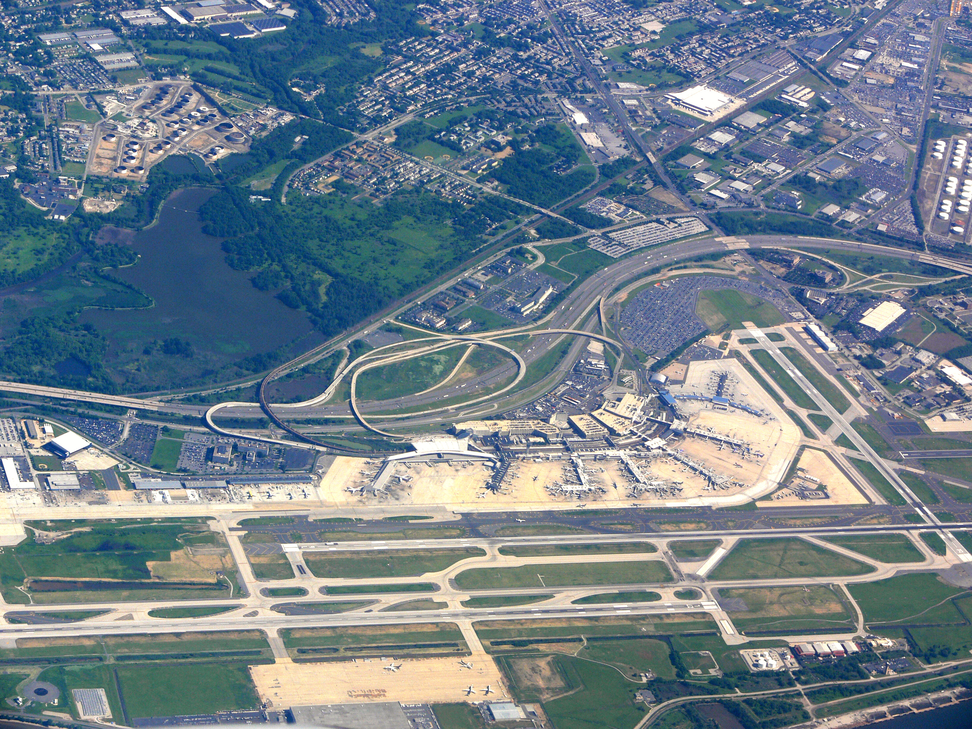
Two airports serve Philadelphia: the Philadelphia International Airport (PHL) is 7 mi (11 km) south-southwest of Center City on the boundary with Delaware County, providing scheduled domestic and international air service,[325] while Northeast Philadelphia Airport (PNE) is a general aviation relief airport in Northeast Philadelphia serving general and corporate aviation.[326] Philadelphia International Airport is among the busiest airports in the world measured by traffic movements (i.e., takeoffs and landings).[327] More than 30 million passengers pass through the airport annually on 25 airlines, including all major domestic carriers. The airport has nearly 500 daily departures to more than 120 destinations worldwide.[325] SEPTA's Airport Regional Rail Line provides direct service between Center City railroad stations and Philadelphia International Airport.[328]
Roads
William Penn planned Philadelphia with numbered streets traversing north and south, and streets named for trees, such as Chestnut, Walnut, and Mulberry, traversing east and west. The two main streets were named Broad Street (the north–south artery, since designated Pennsylvania Route 611) and High Street (the east–west artery, since renamed Market Street) converging at Centre Square which later became the site of City Hall.[329]

Interstate 95 (the Delaware Expressway) traverses the southern and eastern edges of the city along the Delaware River as the main north–south controlled-access highway, connecting Philadelphia with Newark, New Jersey and New York City to the north and with Baltimore and Washington, D.C. southward. The city is also served by Interstate 76 (the Schuylkill Expressway), which runs along the Schuylkill River, intersecting the Pennsylvania Turnpike at King of Prussia and providing access to Harrisburg and points west. Interstate 676 (the Vine Street Expressway) links I-95 and I-76 through Center City by running below street level between the eastbound and westbound lanes of Vine Street. Entrance and exit ramps for the Benjamin Franklin Bridge are near the eastern end of the expressway, just west of the I-95 interchange.[330]
The Roosevelt Boulevard and Expressway (U.S. 1) connect Northeast Philadelphia with Center City via I-76 through Fairmount Park. Woodhaven Road (Route 63) and Cottman Avenue (Route 73) serve the neighborhoods of Northeast Philadelphia, running between I-95 and the Roosevelt Boulevard. The Fort Washington Expressway (Route 309) extends north from the city's northern border, serving Montgomery County and Bucks County. U.S. Route 30 (Lancaster Avenue) extends westward from West Philadelphia to Lancaster.[330]
Interstate 476 (locally referred to as the Blue Route[331]) traverses Delaware County, bypassing the city to the west and serving the city's western suburbs, as well as providing a direct route to Allentown and points north, including the Poconos. Interstate 276 (the Pennsylvania Turnpike's Delaware River extension) acts as a bypass and commuter route to the north of the city as well as a link to the New Jersey Turnpike and New York City.[330]

The Delaware River Port Authority operates four bridges in the Philadelphia area across the Delaware River to New Jersey: the Walt Whitman Bridge (I-76), the Benjamin Franklin Bridge (I-676 and U.S. 30), the Betsy Ross Bridge (New Jersey Route 90), and the Commodore Barry Bridge (U.S. 322 in Delaware County, south of the city).[332] The Burlington County Bridge Commission maintains two bridges across the Delaware River: the Tacony–Palmyra Bridge which connects PA Route 73 in the Tacony section of Northeast Philadelphia with New Jersey Route 73 in Palmyra, Burlington County, and the Burlington–Bristol Bridge which connects NJ Route 413/U.S. Route 130 in Burlington, New Jersey with PA Route 413/U.S. 13 in Bristol Township, north of Philadelphia.[333]
Bus service
The Greyhound terminal is at 1001 Filbert Street (at 10th Street) in Center City, southeast of the Pennsylvania Convention Center and south of Chinatown.[334] Several other bus operators provide service at the Greyhound terminal including Fullington Trailways,[335] Martz Trailways,[336] Peter Pan Bus Lines,[337] and NJ Transit buses.[338]
Other intercity bus services include Megabus with stops at 30th Street Station and the visitor center for Independence Hall,[339] BoltBus (operated by Greyhound) at 30th Street Station,[340] OurBus at various stops in the city.
Rail
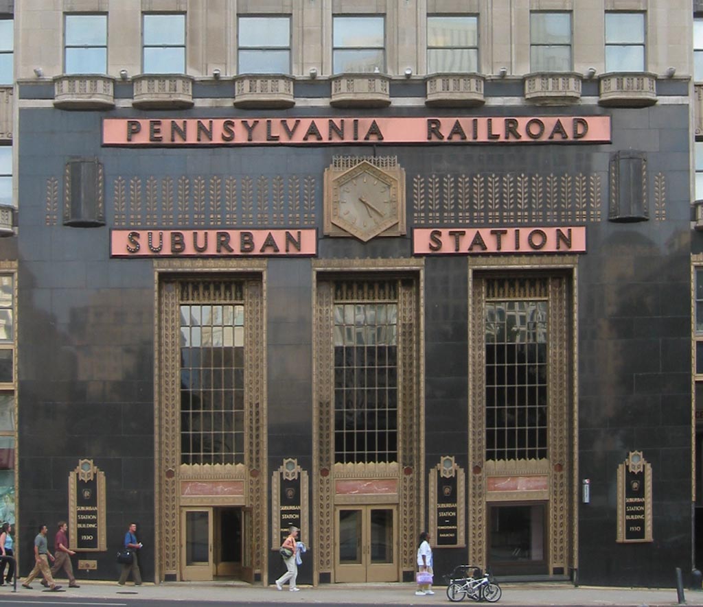
Since the early days of rail transportation in the United States, Philadelphia has served as a hub for several major rail companies, particularly the Pennsylvania Railroad and the Reading Railroad. The Pennsylvania Railroad first operated Broad Street Station, then 30th Street Station and Suburban Station, and the Reading Railroad operated Reading Terminal, now part of the Pennsylvania Convention Center. The two companies also operated competing commuter rail systems in the area. The two systems now operate as a single system under the control of SEPTA, the regional transit authority. Additionally, the PATCO Speedline subway system and NJ Transit's Atlantic City Line operate successor services to southern New Jersey.[341]
In 1911, Philadelphia had nearly 4,000 electric trolleys running on 86 lines.[342] In 2005, SEPTA reintroduced trolley service to the Girard Avenue Line, Route 15.[343] SEPTA operates six "subway-surface" trolleys that run on street-level tracks in West Philadelphia and subway tunnels in Center City, along with two surface trolleys in adjacent suburbs.[344]
Philadelphia is a regional hub of the federally owned Amtrak system, with 30th Street Station being a primary stop on the Washington-Boston Northeast Corridor and the Keystone Corridor to Harrisburg and Pittsburgh. 30th Street also serves as a major station for services via the Pennsylvania Railroad's former Pennsylvania Main Line to Chicago. As of 2018[update], 30th Street is Amtrak's third-busiest station in the country, after New York City and Washington.[143]
Walk Score ranks
A 2017 study by Walk Score ranked Philadelphia the fifth most walkable major city in the United States with a score of 79 out of 100, in the middle of the "very walkable" range. The city was just edged out by fourth place Miami (79.2), with the top three cities being New York, San Francisco, and Boston. Philadelphia placed fifth in the public transit friendly category, behind Washington, D.C., with the same three cities for walkability topping this category. The city ranked tenth in the bike friendly cities category, with the top three cities being Minneapolis, San Francisco and Portland.[345]
USA Today readers voted the Schuylkill River Trail the best urban trail in the nation in 2015.[346]
Utilities
Water purity and availability
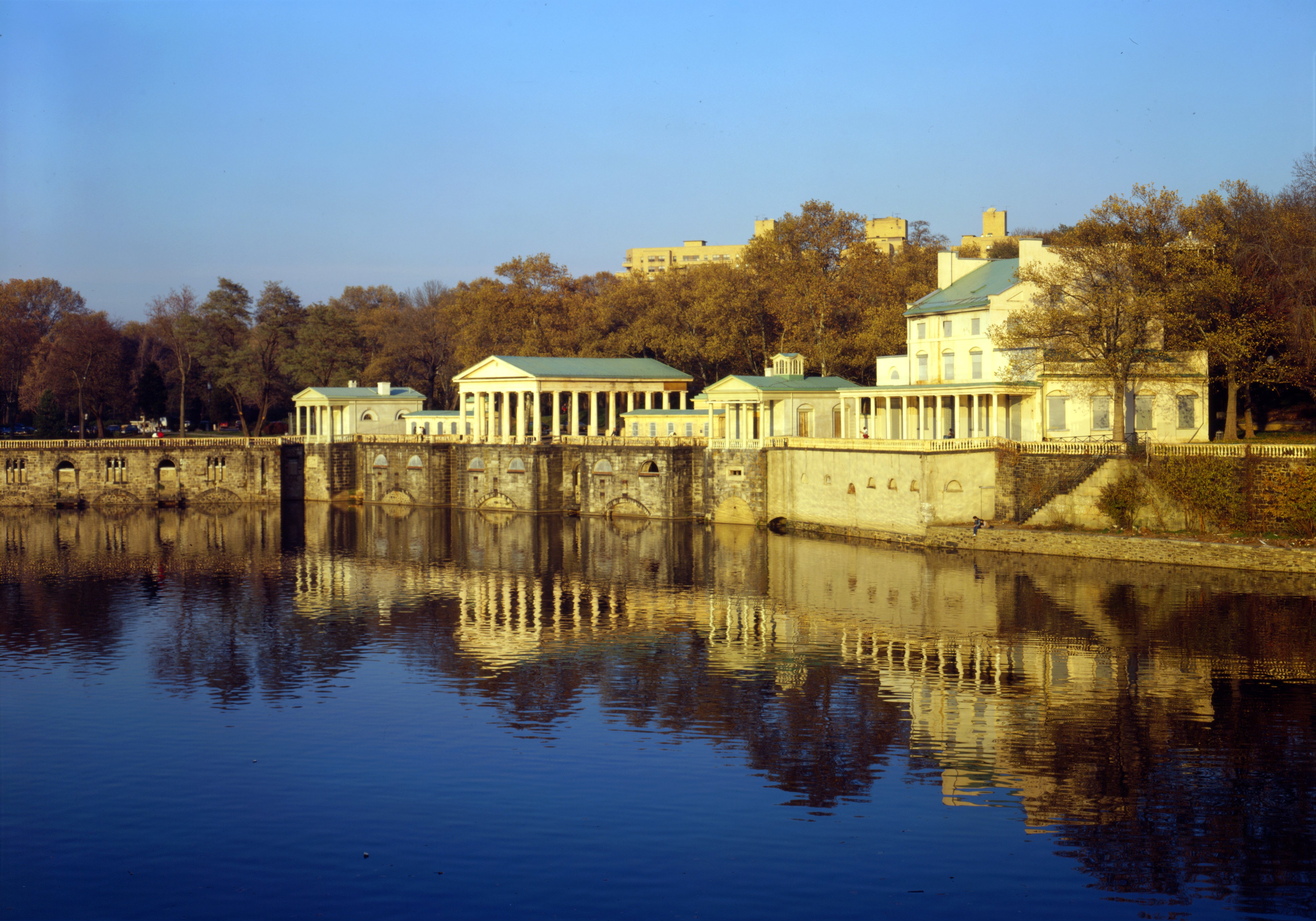
In 1815, Philadelphia began sourcing its water via the Fairmount Water Works on the Schuylkill River, the nation's first major urban water supply system. In 1909, the Water Works was decommissioned as the city transitioned to modern sand filtration methods.[347] Today, the Philadelphia Water Department (PWD) provides drinking water, wastewater collection, and stormwater services for Philadelphia, as well as surrounding counties. PWD draws about 57 percent of its drinking water from the Delaware River and the balance from the Schuylkill River.[348] The city has two filtration plants on the Schuylkill River and one on the Delaware River. The three plants can treat up to 546 million gallons of water per day, while the total storage capacity of the combined plant and distribution system exceeds one billion gallons. The wastewater system consists of three water pollution control plants, 21 pumping stations, and about 3,657 miles (5,885 km) of sewers.[348]
Electricity
Exelon subsidiary PECO Energy Company, founded as the Brush Electric Light Company of Philadelphia in 1881 and renamed Philadelphia Electric Company (PECO) in 1902, provides electricity to about 1.6 million customers and more than 500,000 natural gas customers in the southeastern Pennsylvania area including the city of Philadelphia and most of its suburbs.[349] PECO is the largest electric and natural gas utility in the state with 472 power substations and nearly 23,000 miles (37,000 km) of electric transmission and distribution lines, along with 12,000 miles (19,000 km) of natural gas transmission, distribution & service lines.[350]
Natural gas
Philadelphia Gas Works (PGW), overseen by the Pennsylvania Public Utility Commission, is the nation's largest municipally-owned natural gas utility. PGW serves over 500,000 homes and businesses in the Philadelphia area.[351] Founded in 1836, the company came under city ownership in 1987 and has been providing the majority of gas distributed within city limits. In 2014, the City Council refused to conduct hearings on a $1.86 billion sale of PGW, part of a two-year effort that was proposed by the mayor. The refusal led to the prospective buyer terminating its offer.[352][353]
Telecommunications
Southeastern Pennsylvania was assigned the 215 area code in 1947 when the North American Numbering Plan of the Bell System went into effect. The geographic area covered by the code was split nearly in half in 1994 when area code 610 was created, with the city and its northern suburbs retaining 215. Overlay area code 267 was added to the 215 service area in 1997, and 484 was added to the 610 area in 1999. A plan in 2001 to introduce a third overlay code to both service areas (area code 445 to 215, area code 835 to 610) was delayed and later rescinded.[354] Area code 445 was implemented as an overlay for area codes 215 and 267 starting on February 3, 2018.[355]
Notable people
Sister cities

| City | Country | Date |
|---|---|---|
| Florence[356] | Italy | 1964 |
| Tel Aviv[357] | Israel | 1966 |
| Toruń[358] | Poland | 1976 |
| Tianjin[359] | China | 1979 |
| Incheon[360] | South Korea | 1984 |
| Douala[361] | Cameroon | 1986 |
| Nizhny Novgorod[362] | Russia | 1992 |
| Frankfurt[363] | Germany | 2015 |
Philadelphia also has three partnership cities or regions:[364]
| City | Country | Date |
|---|---|---|
| Kobe[365] | Japan | 1986 |
| Abruzzo[366] | Italy | 1997 |
| Aix-en-Provence[367] | France | 1999 |
Philadelphia has eight official sister cities as designated by the Citizen Diplomacy International of Philadelphia:[364] Philadelphia has dedicated landmarks to its sister cities. The Sister Cities Park, a site of 0.5 acres (2,400 sq yd) at 18th and Benjamin Franklin Parkway within Logan Square, was dedicated in June 1976. The park was built to commemorate Philadelphia's first two sister city relationships, with Tel Aviv and Florence. The Toruń Triangle, honoring the sister city relationship with Toruń, Poland, was constructed in 1976, west of the United Way building at 18th Street and the Benjamin Franklin Parkway. Sister Cities Park was redesigned and reopened in 2012, featuring an interactive fountain honoring Philadelphia's sister and partnership cities, a café and visitor's center, children's play area, outdoor garden, and boat pond, as well as a pavilion built to environmentally friendly standards.[368][369]
The Chinatown Gate, erected in 1984 and crafted by artisans of Tianjin, stands astride 10th Street, on the north side of its intersection with Arch Street, as a symbol of the sister city relationship. The CDI of Philadelphia has participated in the U.S. Department of State's "Partners for Peace" project with Mosul, Iraq,[370] as well as accepting visiting delegations from dozens of other countries.[371]
See also
- Metropolitan areas in the Americas
- National Register of Historic Places listings in Philadelphia
- List of Pennsylvania state historical markers in Philadelphia County
Notes
- Description of the Lenape peoples (Delaware nations) historic territories inside the divides of the frequently mountainous landforms flanking the Delaware River's drainage basin. These terrains encompass from South to North and then counter-clockwise:
The Susquehanna-Delaware watershed divide the frequently contested 'hunting grounds' between the rival Susquehannock peoples and the Lenape peoples, whilst the Catskills and Berkshires played a similar boundary role in the northern regions of their original colonial era range.
- the shores from the east-shore mouth of the river and the sea coast to Western Long Island (all of both colonial New Amsterdam and New Sweden), and
- portions of Western Connecticut up to the latitude of the Massachusetts corner of today's boundaries—making the eastern bounds of their influence, thence their region extended:
- westerly past the region around Albany, New York to the Susquehanna River side of the Catskills, then
- southerly through the eastern Poconos outside the rival Susquehannock lands past Eastern Pennsylvania then southerly past the site of Colonial Philadelphia past the west bank mouth of the Delaware and extending south from that point along a stretch of sea coast in northern colonial Delaware.
- See North American blizzard of 2009#Snowfall (December 19–20, 2009), February 5–6, 2010 North American blizzard#Snowfall (February 5–6, 2010), and February 9–10, 2010 North American blizzard#Impact (February 9–10, 2010). The February 2010 storms contributed to a single month record accumulation of 51.5 in (131 cm). If no snow fell outside of February that season, 2009–10 would still rank as 5th-snowiest. See the Franklin Institute for a visual representation of seasonal snowfall.
- Mean monthly maxima and minima (i.e. the highest and lowest temperature readings during an entire month or year) calculated based on data at said location from 1991 to 2020.
- Official temperature and precipitation measurements for Philadelphia were taken at the Weather Bureau Office in downtown from January 1872 to 19 June 1940, and at Philadelphia Int'l from 20 June 1940 to the present.[100] Snowfall and snow depth records date to 1 January 1884 and 1 October 1948, respectively.[94] In 2006, snowfall measurements were moved to National Park, New Jersey directly across the Delaware River from the airport.[101]
- From 15% sample
- E.g., in the opening chapter of The Handbook of Language Variation and Change (ed. Chambers et al., Blackwell 2002), J.K. Chambers writes that "variationist sociolinguistics had its effective beginnings only in 1963, the year in which William Labov presented the first sociolinguistic research report"; the dedication page of the Handbook says that Labov's "ideas imbue every page".
- 1,102,620 / 1,567,872 = 70.3% (registered voters divided by 2016 population estimate)
References
- "Art & Artifacts: Discover the Library Company's Art and Artifact Collection – Athens of America". librarycompany.org. The Library Company of Philadelphia. Retrieved June 12, 2010.
- Robinson, Sam (November 5, 2013). "Behind Philadelphia Maneto: Dissecting The City Seal". Hidden City Philadelphia. Retrieved January 18, 2018.
- McDevitt, John (May 5, 2015). "Plaque Dedication Marks 120th Anniversary of Creation of Philadelphia's Flag". philadelphia.cbslocal.com. CBS Broadcasting Inc. Retrieved January 18, 2018.
- Weigley, RF; et al., eds. (1982). Philadelphia: A 300-Year History. New York and London: W. W. Norton & Company. pp. 4–5. ISBN 0-393-01610-2. OCLC 8532897.
- "2019 U.S. Gazetteer Files". United States Census Bureau. Retrieved July 28, 2020.
- "QuickFacts: Philadelphia city, Pennsylvania". United States Census Bureau. Retrieved August 19, 2021.
- "2020 Population and Housing State Data". United States Census Bureau. Retrieved August 22, 2021.
- "US Board on Geographic Names". United States Geological Survey. February 2, 2015. Retrieved January 31, 2008.
- "Population and housing state data," 2020 U.S. census
- Brookes, Karin (2005). Zoë Ross (ed.). Insight Guides: Philadelphia and Surroundings (Second (Updated) ed.). APA Publications. pp. 21–22. ISBN 1-58573-026-2.
- Ellis, Joseph (2007). American Creation: Triumphs and Tragedies at the Founding of the Republic. New York: Knopf. pp. 55–56. ISBN 978-0-307-26369-8.
- "American FactFinder – People Reporting Ancestry". factfinder.census.gov. U.S. Census Bureau. 2015. Archived from the original on February 14, 2020. Retrieved April 26, 2017.
Click on 'Add/Remove Geographies', enter 'Philadelphia', select city or county (same result either way), click on 'Show Table'.
- Great Migration – Black History – HISTORY.com, History.com, retrieved April 9, 2017
- The Puerto Rican Diaspora: Historical Perspectives, by Carmen Whalen and Víctor Vázquez-Hernández, Temple University Press, 2008, p. 90–91.
- Tucker, Laura (November 25, 2014). "Philadelphia". QS Quacquarelli Symonds Limited. Retrieved October 11, 2015.
- Sisak, Michael A. (November 6, 2015). "Philadelphia Becomes First World Heritage City in US". ABC News Internet Ventures. Archived from the original on November 8, 2015. Retrieved November 6, 2015.
- "U.S. metro areas – ranked by Gross Metropolitan Product (GMP) 2019 | Statistic". Statista. Retrieved May 31, 2019.
- "Philadelphia PA". CrediFi. Retrieved October 16, 2016.
- "Philadelphia's Newest Skyscraper: The Comcast Innovation and Technology Center". Visit Philadelphia. Retrieved April 3, 2015.
- "Gateway to Public Art in Philadelphia". fpaa.org. Fairmount Park Art Association. August 10, 2011. Archived from the original on August 10, 2011. Retrieved December 6, 2017.
according to the Smithsonian Institution, Philadelphia has more outdoor sculpture than any other city in the country [Save Outdoor Sculpture! program].
- "Mural Arts Philadelphia – Press kit" (PDF). muralarts.org. Mural Arts Philadelphia. Retrieved December 6, 2017.
Mural Arts Philadelphia is the nation's largest public art program...creating nearly 4,000 artworks that have transformed public spaces.
- "2014 City Park Facts" (PDF). tpl.org. The Trust for Public Land. pp. 9, 25, 28. Archived (PDF) from the original on September 20, 2016. Retrieved January 6, 2017.
- "Visit Philadelphia 2017 Annual Report" (PDF). visitphilly.com. Visit Philadelphia. p. 6. Retrieved December 5, 2017.
- Eramian, Daniel (November 2, 2020). "Is Philadelphia's biotech cluster faltering? Experts say no". STAT. Retrieved October 24, 2021.
- Lucas Downey and Somer Anderson (May 19, 2022). "Philadelphia Semiconductor Index (SOX)". Dotdash Meredith. Retrieved July 17, 2022.
- "Philly: the best sports city in America", The Stanford Daily," April 26, 2018
- "JJ Redick calls Philly 'the greatest sports town in America", Philly Voice, July 13, 2022
- "Philadelphia Firsts 1681–1899". USHistory. Retrieved April 30, 2015.
- "John Morgan (1735–1789)". Penn in the 18th Century. Archived from the original on July 3, 2008.
- "The Nine Capitals of the United States". United States Senate. Retrieved December 5, 2017.
- "The University of Pennsylvania: America's First University". upenn.edu. Archived from the original on July 11, 2006. Retrieved July 12, 2021.
- "About the Philadelphia Zoo". Philadelphia Zoo. Archived from the original on March 30, 2015. Retrieved April 30, 2015.
- "About Wharton". The Wharton School of the University of Pennsylvania. Retrieved April 30, 2015.
- "Independence Hall". UNESCO World Heritage Centre.
- "Philadelphia's new branding as World Heritage City" Archived March 6, 2018, at the Wayback Machine. ovpm.org. Organization of World Heritage Cities. Retrieved March 5, 2018
- Pritzker 422
- Josephy 188–189
- Jennings, Francis, (1984) The Ambiguous Iroquois. New York: Norton ISBN 0-393-01719-2
- Brookes, Karin; Gattuso, John; Harry, Lou; Jardim, Edward; Kraybill, Donald; Lewis, Susan; Nelson, Dave; Turkington, Carol (2005), Ross, Zoë (ed.), Insight Guides: Philadelphia and Surroundings (Second (Updated) ed.), APA Publications, pp. 21–22, ISBN 1-58573-026-2
- Insight Guides: Philadelphia and Surroundings. p. 21.
- Avery, Ron (1999). A Concise History of Philadelphia. Philadelphia: Otis Books. p. 19. ISBN 0-9658825-1-9.
- Philadelphia: A 300-Year History, pages 7, 14 – 16
- "Explore PA History website". Explorepahistory.com. Retrieved December 23, 2010.
- John Hazelton, The Historical Value of Trumbull's: Declaration of Independence, Pennsylvania Magazine of History and Biography, volume 31 (Historical Society of Pennsylvania, 1907), 38.
- Lew, Alan A. (2004). "Chapter 4 – The Mid-Atlantic and Megalopolis". Geography: USA. Northern Arizona University. Archived from the original on February 2, 2015.
- Rappleye, Charles (2010). Robert Morris: Financier of the American Revolution. New York City: Simon and Schuster. p. 13. ISBN 978-1-4165-7091-2.
- "View of Philadelphia, Circa 1770". Library of Congress. World Digital Library. 1770. Retrieved January 4, 2014.
- Nash, p. 19
- Insight Guides: Philadelphia and Surroundings, pages 30–33
- "Part 3: Philadelphia/The Yellow Fever Epidemic". Africans in America. PBS Online. 1998.
- Arnebeck, Bob (January 30, 2008). "A Short History of Yellow Fever in the US". Benjamin Rush, Yellow Fever and the Birth of Modern Medicine. Archived from the original on October 28, 2009. Retrieved December 4, 2008.
- Philadelphia: A 300-Year History, pages 214, 218, 428 – 429
- "A Brief History of Philadelphia". Philadelphia History. ushistory.org. Archived from the original on January 4, 2013. Retrieved December 14, 2006.
- "Consolidation Act of 1854". Retrieved September 17, 2014.
- Insight Guides: Philadelphia and Surroundings, pages 38–39
- "Notes on the historical development of population in West Philadelphia", University of Pennsylvania.
- "Detroit and the Great Migration, 1916–1929 by Elizabeth Anne Martin". Bentley Historical Library, University of Michigan. July 5, 2007. Archived from the original on June 15, 2008.
- Philadelphia: A 300-Year History, pages 535, 537
- Philadelphia: A 300-Year History, pages 563 – 564
- Philadelphia: A 300-Year History, pages 578 – 581
- "Race and Hispanic Origin for Selected Cities and Other Places: Earliest Census to 1990". U.S. Census Bureau. Archived from the original on August 12, 2012.
- "Continuing Economic Decline: A Foreboding Future for Philadelphia" (PDF). White Paper. October 15, 1996. Archived from the original (PDF) on September 10, 2015. Retrieved September 29, 2015.
- "Philadelphia's Changing Middle Class: After Decades of Decline, Prospects for Growth". www.pewtrusts.org. Retrieved September 29, 2015.
- Insight Guides: Philadelphia and Surroundings, pages 44–45
- A Concise History of Philadelphia, page 78
- "Census: Phila. keeps on growing" (archive). by Dylan Purcell and Karie Simmons. March 14, 2013. philly.com. Interstate General Media, LLC. Retrieved November 26, 2017.
- "QuickFacts Philadelphia County, Pennsylvania". United States Census Bureau. Retrieved April 18, 2019.
- Diana Lu (April 26, 2018). "Philly Fed: Homeowners in gentrifying neighborhoods suffer tax delinquency but not displacement". WHYY.org. Retrieved June 12, 2018.
- "2016 U.S. Gazetteer Files". United States Census Bureau. Retrieved May 25, 2018.
- "The National Map". nationalmap.gov. U.S. Geological Survey. Retrieved October 22, 2018.
- "Discovering Chestnut Hill: Discover Summit Street, a microcosm of 19th Century American architecture – Chestnut Hill Local Philadelphia PA". chestnuthilllocal.com. Chestnut Hill Community Association. August 17, 2016. Retrieved October 22, 2018.
- Railsback, Bruce. "The Fall Line." GEOL 1122: Earth's History of Global Change. University of Georgia Department of Geology.
- "Philadelphia Neighborhoods and Place Names, A–K". Philadelphia Information Locator System.
- Daly, Molly (February 4, 2011). "A Guide To Philadelphia's 'Squares'". CBS Philly. Retrieved April 29, 2015.
- Laura Turner Igoe, "Trees", The Encyclopedia of Greater Philadelphia; accessed 2021.01.29.
- "Philadelphia City Hall location". philadelphiabuildings.org. The Athenaeum of Philadelphia. Retrieved November 27, 2017.
- "Franklin Square History". Historic Philadelphia. Retrieved April 29, 2015.
- Maria Panaritis (April 22, 2015). "(Greater) Center City's population second only to Midtown Manhattan's". The Philadelphia Inquirer. Retrieved July 15, 2015.
- Insight Guides: Philadelphia and Surroundings. p. 58.
- "About Philadelphia2035". Archived from the original on May 3, 2015. Retrieved April 29, 2015.
- "Philadelphia 2035: The Comprehensive Plan". Philadelphia City Planning Commission. Retrieved April 29, 2015.
- "Philadelphia Housing Authority". Pha.phila.gov. Retrieved December 24, 2013.
- "Philadelphia Parking Authority: History". Philapark.org. Archived from the original on January 26, 2012. Retrieved December 24, 2013.
- Philadelphia: A 300-Year History. pp. 11, 41, 174–175, 251–253.
- "Philadelphia Historical Commission". Phila.gov. Retrieved April 11, 2009.
- Aitken, Joanne (June 3–19, 2004). "Breaking Ground". Philadelphia City Paper. Archived from the original on January 13, 2016.
- Mark Alan Hughes (June 1, 2000). "Dirt Into Dollars; Converting Vacant Land Into Valuable Development". Retrieved December 24, 2013.
- Historical marker on Elfreth's Alley
- "The City of Philadelphia, Emerald Ash Borer Management Plan" (PDF). dcnr.state.pa.us. The City of Philadelphia. 2012. p. 2. Archived (PDF) from the original on December 19, 2016. Retrieved January 6, 2017.
The City contains approximately 6,781 acres of watershed parks including East/West Fairmount Parks (2052 ac.), Wissahickon Valley Park (2042 ac.)
- "National Register of Historic Places – Fairmount Park – #72001151". focus.nps.gov. National Park Service. February 7, 1972. Archived from the original on December 30, 2016. Retrieved January 6, 2017.
Locations: Philadelphia; Both banks of Schuylkill River and Wissahickon Creek, from Spring Garden St. to Northwestern Ave.
- "Climate Summary for Philadelphia, Pennsylvania". Weatherbase. Retrieved September 17, 2014.
- Trewartha GT, Horn LH (1980) Introduction to climate, 5th edn. McGraw Hill, New York, NY
- "USDA Plant Hardiness Zone Map" Archived November 21, 2017, at the Wayback Machine. usda.gov. United States Department of Agriculture. Retrieved December 6, 2017. Note: high resolution map, may be slow to download.
- "NowData - NOAA Online Weather Data". National Oceanic and Atmospheric Administration. Retrieved April 13, 2016.
- Lipman, Don (January 7, 2013). "One wild storm: A look back at the 'Blizzard of '96'". Washington Post. Retrieved December 19, 2017.
- "Average Days of Precipitation, .01 Inches or more". Archived from the original on June 20, 2006. Retrieved July 28, 2006.
- "WMO Climate Normals for PHILADELPHIA/INT'L ARPT PA 1961–1990". National Oceanic and Atmospheric Administration. Retrieved July 18, 2020.
- "Philadelphia Record Highs and Lows". Retrieved April 3, 2007.
- "Threaded Station Extremes". Retrieved May 10, 2020.
Station=PA – Philadelphia (Center City records are 12 °F (−11 °C) on January 8, 2014, and January 19, 1997, for the record low maximum; and 87 °F (31 °C) on July 6, 1999, for the record high minimum)
- ThreadEx; search for location= "PA - Philadelphia", variable= "Station thread"
- Wood, Anthony R. "Snow total at airport gets a boost A new measuring station and technique likely contributed to two 8-inch-plus readings". Philly.com. The Inquirer. Archived from the original on July 28, 2014. Retrieved June 10, 2014.
- "Summary of Monthly Normals 1991-2020". National Oceanic and Atmospheric Administration. Retrieved June 13, 2021.
- "Philadelphia, Pennsylvania, USA - Monthly weather forecast and Climate data". Weather Atlas. Retrieved May 17, 2019.
- "State of the Air 2017 – Methodology and Acknowledgements". American Lung Association. Archived from the original on December 8, 2017. Retrieved December 8, 2017.
- "Philadelphia County – State of the Air 2017". American Lung Association. Retrieved December 7, 2017.
- "Most Polluted Cities". American Lung Association. Retrieved December 8, 2017.
- "Census of Population and Housing". Census.gov. Retrieved June 4, 2016.
- "2011–2017 American Community Survey 5-Year Estimates". United States Census Bureau. Archived from the original on February 13, 2020. Retrieved January 4, 2019.
- "Explore Census Data". data.census.gov.
- American FactFinder, United States Census Bureau. "Profile of General Population and Housing Characteristics: 2010 2010 Demographic Profile Data (Public Law 94-171) Summary File". U.S. Census Bureau, 2010 Census. Archived from the original on May 21, 2019. Retrieved August 12, 2011.
- "Pennsylvania – Race and Hispanic Origin for Selected Cities and Other Places: Earliest Census to 1990".
- United States Census Bureau. "How Does the Census 2000 Question on Race Differ from the 1990 Question?". census.gov. Archived from the original on November 27, 2001. Retrieved January 31, 2011.
- "People Reporting Ancestry: 2011–2015 American Community Survey 5-Year Estimates". United States Census Bureau. Archived from the original on February 13, 2020. Retrieved December 5, 2017.
- "Philadelphia 2015: The State of the City" (PDF). pewtrusts.org. The Pew Charitable Trusts. March 2015. Archived from the original (PDF) on June 6, 2017. Retrieved April 24, 2015.
- "The State of Immigrants in Philadelphia, 2019".
- Matt Katz (July 20, 2018). "Leaving New York to Find the American Dream in Philadelphia". The New York Times. Retrieved August 6, 2018.
- Jeff Gammage (May 10, 2019). "Welcome to Philly: Percentage of foreign-born city residents has doubled since 1990". The Philadelphia Inquirer. Retrieved May 10, 2019.
China is, far and away, the primary sending country, with 22,140 city residents who make up about 11 percent of the foreign-born population, according to a Pew Charitable Trusts analysis of Census data. Next is the Dominican Republic with 13,792, followed by Jamaica, 13,500; India, 11,382; and Vietnam, 10,132...About 230,000 Philadelphians are foreign-born. More than a quarter of residents are immigrants or have a foreign-born parent, Pew reported, and 23 percent speak a foreign language at home.
- "Exploring Gay Philadelphia". Visit Philadelphia. Archived from the original on July 24, 2015. Retrieved July 23, 2015.
- "Guide to Philadelphia's Gayborhood". CBS Local Media. June 5, 2013. Retrieved July 23, 2015.
- "Philadelphia immigration". Philadelphia immigration. August 5, 2013. Retrieved March 5, 2016.
- Laura Sanchez Ubanell (January 3, 2014). "Puerto Rico's population continues to decline as the economic plague persists". Voxxi. Archived from the original on January 3, 2014. Retrieved September 17, 2014.
- "Where is the "Latino Community" of Philadelphia?". Archived from the original on October 6, 2014. Retrieved September 21, 2014.
- "ZIP Code 19133, Philadelphia PA (Pennsylvania)". www.zip-codes.com.
- "Latino Philadelphia at a Glance" (PDF). Latino Philadelphia. Retrieved October 4, 2017.
- Matt Katz (July 20, 2018). "Leaving New York to Find the American Dream in Philadelphia". The New York Times. Retrieved July 16, 2022.
- "2011–2015 American Community Survey Selected Population Tables – Chinese alone, Philadelphia County, Pennsylvania". United States Census Bureau. Archived from the original on February 14, 2020. Retrieved June 3, 2018.
- Matt Katz (July 20, 2018). "Leaving New York to Find the American Dream in Philadelphia". The New York Times. Retrieved April 17, 2019.
- Major U.S. metropolitan areas differ in their religious profiles, Pew Research Center
- "America's Changing Religious Landscape". Pew Research Center: Religion & Public Life. May 12, 2015.
- Overcoming the World Missions Crisis: Thinking Strategically to Reach the World, Russell Penney, page 110, 2001
- "Philadelphia". Jewish Virtual Library.
- Levitt, Ross (December 30, 2009). "Group: Remains of more than 500 animals found at Philadelphia home". CNN.
- Joseph A. Slobodzian (January 15, 2012). "Man gets life sentence in killing over Santeria". The Philadelphia Inquirer – via NorthIowaToday.com.
- "Philadelphia County, Pennsylvania". Modern Language Association. Archived from the original on August 15, 2013. Retrieved August 10, 2013.
- "Fortune 500". Fortune. Retrieved October 10, 2019.
- "Gross domestic product (GDP) by metropolitan area". U.S. Bureau of Economic Analysis. September 18, 2018. Archived from the original on December 1, 2018. Retrieved November 30, 2018.
- "Citywide Vision Philadelphia2035" (PDF). City of Philadelphia Planning Committee. June 2011. p. 34 (38 in the PDF file). Retrieved November 26, 2017.
- Archived June 10, 2019, at the Wayback Machine Accessed April 18, 2019.
- "Park Statistics". Retrieved February 10, 2015.
- Linda Loyd (August 22, 2017). "Philly airport gets $16.5 million federal grant for runway improvements". The Philadelphia Inquirer. Retrieved June 3, 2018.
- Linda Loyd (May 22, 2017). "Airlines at PHL agree to $900 million in improvements". The Philadelphia Inquirer. Retrieved June 3, 2018.
- Hugh R. Morley (April 5, 2018). "After strongest US growth, Philadelphia port to double capacity". JOC. Retrieved June 3, 2018.
- "FY 2018 Company Profile" (PDF). www.amtrak.com. Archived (PDF) from the original on April 3, 2019. Retrieved April 18, 2019.
- "2020 CENSUS - SCHOOL DISTRICT REFERENCE MAP: Philadelphia County, PA" (PDF). U.S. Census Bureau. Retrieved July 22, 2022. - Text list
- "About Us – The School District of Philadelphia". Philadelphia School District. Retrieved April 27, 2015.
- "About Us – Schools – The School District of Philadelphia". Retrieved April 27, 2015.
- Hurdle, Jon (March 7, 2013). "Philadelphia Officials Vote to Close 23 Schools". The New York Times. Retrieved April 27, 2015.
- Jacobs, Peter (October 7, 2014). "The Average SAT Score Last Year Was Just Under 1500". Business Insider. Retrieved April 27, 2015.
- Florida, Richard (August 27, 2012). "America's Leading College Towns". Bloomberg.com. The Atlantic: City Lab. Retrieved April 27, 2015.
- Brownlee, David B.; Thomas, George E. (2000). Building America's First University: An Historical and Architectural Guide to the University of Pennsylvania. Philadelphia: University of Pennsylvania Press. ISBN 0812235150.
- Oliver, Sharon (October 21, 2011). "The Phila. area's biggest colleges". Philadelphia Business Journal. Retrieved April 27, 2015.
- "NIH Awards by Location & Organization". April 20, 2015. Archived from the original on June 19, 2015. Retrieved April 27, 2015.
- "Listing of National Historic Landmarks by State – Pennsylvania (169)" (PDF). National Park Service. January 2017. Retrieved October 4, 2017.
- "Philadelphia Zoo: About". Philadelphia Zoo. Archived from the original on March 30, 2015. Retrieved April 29, 2015.
- "About Penn Medicine: History". Penn Medicine. Retrieved March 4, 2018.
- "Philadelphia Park System History". City of Philadelphia. Archived from the original on March 30, 2015. Retrieved April 29, 2015.
- "Library Company of Philadelphia: Overview". librarycompany.org. The Library Company of Philadelphia. Retrieved March 4, 2018.
- "Athenaeum of Philadelphia: Mission and History" Archived January 7, 2013, at the Wayback Machine. philaathenaeum.org. The Athenaeum of Philadelphia. Retrieved March 4, 2018.
- "Presbyterian Historical Society: About". history.pcusa.org. The Presbyterian Historical Society. Retrieved March 4, 2018.
- Weeks, Jerome (August 2006). "Philly goes the distance". The Dallas Morning News. Archived from the original on August 20, 2006.
- "Wilma Theater history". wilmatheater.org. Retrieved March 2, 2018.
- "Philadelphia Theatre Company at the Suzanne Roberts Theatre". philadelphiatheatrecompany.org. Retrieved March 2, 2018.
- "Lantern Theater Company". lanterntheater.org. Retrieved March 2, 2018.
- "Walnut Street Theatre Historical Marker". ExplorePAhistory.com. Retrieved May 4, 2019.
- John Timpane (May 4, 2019). "Walnut Street Theatre announces a major expansion, set to start in 2020". The Philadelphia Inquirer. Retrieved May 4, 2019.
The Walnut Street Theatre announced Saturday evening that fund-raising is now underway for a substantial new wing of the building. Plans would expand the 210-year-old theater's footprint partway into the parking lot next door and add a 400-seat theater in the round. The three-story, 35,000-square-foot addition would break ground in May 2020 and be completed in 2022.
- "Public Art". Greater Philadelphia Tourism Marketing Corporation. Retrieved May 31, 2010.
- Aitken, Joanne (September 2, 2004). "Forget Paris". City Paper. Archived from the original on December 3, 2007.
- Wetenhall, John. "About A Brief History of Percent-For-Art in America" (PDF). Public Art Review. Archived from the original (PDF) on September 1, 2006. Retrieved September 24, 2006.
- "Office of Art and Culture". Retrieved December 24, 2013.
- "Mural Arts Program About page". Archived from the original on December 8, 2007. Retrieved November 27, 2007.
- Schira, Ron (January 20, 2013). "Art review: GoggleWorks' 'Artists Equity' show proves uneven". Reading Eagle. Retrieved November 27, 2019.
- "Art: Windfall". Time. January 15, 1940. Archived from the original on October 14, 2010. Retrieved March 2, 2018.
- Van Hook, Bailey (January 1, 2009). "The Early Career of Violet Oakley, Illustrator". Woman's Art Journal. 30 (1): 29–38. JSTOR 40605220.
- Jillian Wilson (January 5, 2017). "What To Do For First Friday In Philly This January". Visit Philadelphia. Retrieved March 2, 2018.
- "The Kimmel Center: Home of The Philadelphia Orchestra" Archived July 9, 2018, at the Wayback Machine. philorch.org. The Philadelphia Orchestra Association. Retrieved April 13, 2018.
- "Summer Home of The Philadelphia Orchestra: Mann Center for the Performing Arts" Archived July 9, 2018, at the Wayback Machine. philorch.org. The Philadelphia Orchestra Association. Retrieved April 13, 2018.
- "About Us". Philadelphia Boys Choir. Archived from the original on December 18, 2017. Retrieved March 2, 2018.
- "About The Philly POPS". phillypops.org. Encore Series, Inc. January 13, 2015. Retrieved March 2, 2018.
- Michael Tanenbaum (January 29, 2016). "Curtis Institute of Music ranked most selective college in U.S." Philly Voice. Retrieved January 28, 2020.
- Rodney Buxton "American Bandstand: U.S. Music Program" Archived August 3, 2018, at the Wayback Machine. museum.tv. Museum of Broadcast Communications. Retrieved April 9, 2018.
- "R&B » Soul » Philly Soul". allmusic.com. Retrieved March 2, 2018.
- "Live Aid 1985: A day of magic". CNN. Retrieved March 2, 2018.
- Rodney Kim (July 2, 2005). "Live 8 Philadelphia Review". Archived from the original on December 14, 2006. Retrieved April 24, 2007.
- Stuhldreher, Katie (July 30, 2007). "Rick's Steaks takes Reading Terminal Market dispute to court". philly.com. Archived from the original on January 24, 2008. Retrieved July 30, 2007.
- "Top 10 Spots for Authentic Philly Cheesesteaks". visitphilly.com. Retrieved March 5, 2018.
- "The Best Cheesesteaks in Philadelphia". foodnetwork.com. Retrieved March 5, 2018.
- "Find Philadelphia cheesesteak shops near you and order online for free". grubhub.com. Retrieved March 5, 2018.
- "About us: Geno's Steaks". genosteaks.com. Retrieved March 4, 2018.
- "Pat's King Of Steaks" Archived March 5, 2018, at the Wayback Machine. philly.com. Retrieved March 4, 2018.
- "McGillin's History". McGillin's Olde Ale House. Retrieved March 4, 2018.
- "City Tavern Timeline". citytavern.com. Retrieved March 4, 2018.
- "City Tavern: Private Affairs". citytavern.com. Retrieved March 4, 2018.
- "Reading Terminal Market: About the market". Reading Terminal Market. Retrieved March 4, 2018.
- New York Times Sunday Review, Loose Ends "The Sound of Philadelphia Fades Out" Daniel Nester March 1, 2014
- Gordon, Matthew J. (2006). "Interview with William Labov". Journal of English Linguistics. 34 (4): 332–51. doi:10.1177/0075424206294308. S2CID 144459634.
- Tom Avril (October 22, 2012). "Penn linguist Labov wins Franklin Institute award". The Philadelphia Inquirer. Retrieved October 23, 2012.
- Rocca, Mo (July 26, 2016). "An earful and accent that's distinctly Philly". CBS Interactive Inc. Retrieved February 14, 2017.
- "Philly Slang". PhillyTalk.com. Retrieved February 15, 2017.
- Jordan, David M (1999). The Athletics of Philadelphia: Connie Mack's White Elephants, 1901–1954. Jefferson, North Carolina: McFarland & Co. ISBN 0-7864-0620-8
- "Athletics (Philadelphia) (1871–1876)". retrosheet.org. Retrieved March 6, 2018.
- "76ers Team History". Philadelphia 76ers. Retrieved May 14, 2022.
- Purdy, Dennis (2006). The Team-by-Team Encyclopedia of Major League Baseball. New York City: Workman. ISBN 0-7611-3943-5.
- "History: Phillies Timeline (1800s)". Philadelphia Phillies. Archived from the original on October 14, 2014. Retrieved March 6, 2018.
- "MLS awards Philadelphia 2010 expansion team". February 28, 2008. Archived from the original on March 2, 2008. Retrieved February 28, 2008.
- "Talen Energy Assumes Stadium Naming Rights". Philadelphia Union. Retrieved December 1, 2015.
- "Subaru scores naming rights to Philly metro area MLS stadium". njbiz.com. February 18, 2020. Retrieved February 19, 2020.
- "1983 NBA Finals: Lakers vs. 76ers". basketball-reference.com. Retrieved March 6, 2018.
- "2008 World Series: Philadelphia Phillies over Tampa Bay Rays (4–1)". baseball-reference.com. Retrieved March 6, 2018.
- Chairusmi, Jim (June 12, 2007). "Does the Curse of Billy Penn Continue to Haunt Philadelphia?". The Wall Street Journal. Retrieved March 6, 2018.
- Matza, Michael (October 22, 2008). "Lifting the curse of William Penn". philly.com. Archived from the original on December 3, 2008. Retrieved March 6, 2018.
- Bergman, Jeremy (February 4, 2018). "Eagles QB Nick Foles wins Super Bowl LII MVP". National Football League. Archived from the original on February 5, 2018. Retrieved February 4, 2018.
- Sal Paolantonio. "The 15 Most Tortured Sports Cities". espn.com. ESPN Internet Ventures. Retrieved March 5, 2018.
- Baichwal, Ravi (June 10, 2010). "Philly reels from loss to Blackhawks". WLS. abclocal.go.com. Archived from the original on June 28, 2011. Retrieved February 25, 2011.
- Adam Winer (March 17, 2011). "The Worst Sports Fans in America". gq.com. Retrieved March 5, 2018.
- "Eagles, Phillies top GQ list of 'Worst Fans in America'". March 17, 2011. Retrieved June 13, 2015.
- "Behind The Name – Warriors". National Basketball Association. May 10, 2015. Retrieved May 11, 2015.
- Burgoyne, Tom (2004). Movin' on Up: Baseball and Phialdephia Then, Now, and Always. B B& A Publishers. p. 128. ISBN 0-9754419-3-0.
- "The Philadelphia International Cycling Classic Cancels 2017 Race" (archive). philadelphiainternationalcyclingclassic.com. Retrieved March 6, 2018.
- "Penn Mutual Collegiate Rugby Championship" Archived September 26, 2017, at the Wayback Machine. usasevenscrc.com. Retrieved March 6, 2018.
- Westcott, Rich. "The Early Years of Philadelphia Baseball". SABR. Retrieved November 7, 2014.
- "Boathouse Row". A View on Cities. Archived from the original on June 26, 2015. Retrieved June 26, 2015.
- "About the Dad Vail Regatta". Dad Vail Regatta Organizing Committee. Retrieved January 24, 2017.
- Staff (May. 13, 2007). "Stotesbury expecting record field" (archive). philly.com. Retrieved March 6, 2018.
- "About The Stotesbury Cup Regatta". January 7, 2015. Retrieved June 26, 2015.
- "Head of the Schuylkill Regatta History and Growth". Head of the Schuylkill Regatta. Archived from the original on March 6, 2018. Retrieved March 6, 2018.
- "Boathouse Row Clubs". Schuylkill Navy & Boathouse Row. Archived from the original on June 26, 2015. Retrieved June 26, 2015.
{{cite web}}: CS1 maint: unfit URL (link) - Charlie Eisenhood (December 8, 2016). "A Philly Talent Skirmish Highlights Waning Battle Between AUDL, MLU". ultiworld.com. Retrieved March 6, 2018.
- Charlie Eisenhood (December 21, 2016). "Major League Ultimate Suspends Operations: The league's investors pulled funding". ultiworld.com. Retrieved March 6, 2018.
- "Philadelphia Phoenix history". theaudl.com. Retrieved March 6, 2018.
- "History: A Family of Philadelphia Rivals". philadelphiabig5.org. Philadelphia Big 5. Retrieved April 9, 2018.
- Red, Christian (March 28, 2015). "30 years ago Villanova shocked Georgetown to win NCAA title". New York Daily News. Retrieved February 5, 2022.
- Mike DeCourcy (April 5, 2016). "Villanova beating UNC was the greatest NCAA championship game ever, period". sportingnews.com. Retrieved March 6, 2018.
- Schonbrun, Zach (April 2, 2018). "Juggernaut Villanova Crushes Michigan for N.C.A.A. Championship". The New York Times. Retrieved April 9, 2018.
- "City Charter Commission". Agency History. City of Philadelphia, Department of Records. November 8, 2000. Retrieved April 18, 2009.
- Charter Commission (1967) [1951]. "Philadelphia Home Rule Charter, Annotated" (PDF). City of Philadelphia. Archived from the original (PDF) on May 25, 2010. Retrieved January 31, 2010.
- "Trial Division". courts.phila.gov. First Judicial District of Pennsylvania. Retrieved February 6, 2018.
- "Family Division". courts.phila.gov. First Judicial District of Pennsylvania. Retrieved February 6, 2018.
- "Orphans' Court". courts.phila.gov. First Judicial District of Pennsylvania. Retrieved February 6, 2018.
- "Third Judicial Circuit". Retrieved June 2, 2012.
- "U.S. District Court, Eastern District of Pennsylvania". Retrieved June 2, 2012.
- Chris Brennan & Aubrey Whelan (November 7, 2017). "Larry Krasner wins race for Philly DA". philly.com. Philadelphia Inquirer. Retrieved February 6, 2018.
- Peter Hall (January 10, 2015). "Retiring Chief Justice Castille says he kept faith in fellow jurists". mcall.com. The Morning Call. Retrieved February 6, 2018.
- "MunicipalCourt". The Philadelphia Courts, First Judicial District of Pennsylvania. February 11, 2010. Retrieved February 11, 2010.
- "Courts>Supreme Court>Calendar". pacourts.us. The Unified Judicial System of Pennsylvania. Retrieved February 6, 2018.
- "Courts>Superior Court>Calendar". pacourts.us. The Unified Judicial System of Pennsylvania. Retrieved February 6, 2018.
- "Courts>Commonwealth Court>Calendar". pacourts.us. The Unified Judicial System of Pennsylvania. Retrieved February 6, 2018.
- "How Judges Are Elected". pacourts.us. The Unified Judicial System of Pennsylvania. Retrieved February 6, 2018.
- "Supreme Court Prothonotary's Addresses". pacourts.us. The Unified Judicial System of Pennsylvania. Retrieved February 6, 2018.
- "Superior Court Prothonotary's Addresses". pacourts.us. The Unified Judicial System of Pennsylvania. Retrieved February 6, 2018.
- "Court Info » Court Locations – Philadelphia". uscourts.gov. United States District Court for the Eastern District of Pennsylvania. Retrieved February 6, 2018.
- "About the Court » Court Location – Philadelphia". uscourts.gov. United States Court of Appeals for the Third Circuit. Retrieved February 6, 2018.
- Cuellar, Dann (November 4, 2015). "Jim Kenney elected mayor of Philadelphia". 6abc.com. ABC Inc., WPVI-TV. Retrieved February 28, 2018.
- "Michael Nutter easily wins a second term in City Hall". The Economist. November 12, 2011. Retrieved February 28, 2018.
- "The Philadelphia Code | Philadelphia Home Rule Charter | Article II Legislative Branch The Council – Its Election, Organization, Powers and Duties | Chapter 1 The Council | § 2–100. Number, Terms and Salaries of Councilmen". library.amlegal.com. American Legal Publishing Corp. Retrieved February 28, 2018.
- "Council Members". phlcouncil.com. The Council of the City of Philadelphia. Retrieved February 28, 2018.
- "The Administration of Voter Registration in Pennsylvania-2016 Report to the General Assembly" (PDF). PA Department of State. June 2017. Retrieved July 27, 2017.
- Leip, David. "Dave Leip's Atlas of U.S. Presidential Elections". uselectionatlas.org.
- Keels, Thomas H. (2016). "Contractor Bosses (1880s to 1930s)". philadelphiaencyclopedia.org. The Encyclopedia of Greater Philadelphia. Retrieved March 1, 2018.
- "Long before 2016 craziness, there was Philadelphia 1935". philly.com. The Philadelphia Inquirer. September 25, 2016. Retrieved March 1, 2018.
- "The Birth Of The Republican Party". republicanviews.org. Republican Views. August 29, 2015. Retrieved March 1, 2018.
- Kristin D. Burnett (November 2011). "Congressional Apportionment 2010 Census Briefs" (PDF). United States Census Bureau. Retrieved March 1, 2018.
- "Pennsylvania is currently represented by 18 individuals in the 435-member United States House of Representatives. Three districts cover parts of Philadelphia." Archived March 1, 2018, at the Wayback Machine. seventy.org. Committee of Seventy. Retrieved March 1, 2018.
- "Congress / Members of Congress / Pennsylvania". govtrack.us. Civic Impulse, LLC. Retrieved March 1, 2018.
- "Councilman Brian J. O'Neill | District 10 | Minority Leader". phlcouncil.com. The Council of the City of Philadelphia. Retrieved February 28, 2018.
- Clines, Francis X. (November 4, 1999). "Democrat Wins in a Squeaker Election for Mayor of Philadelphia". nytimes.com. The New York Times. Retrieved February 28, 2018.
- Clemetson, Lynette (November 5, 2003). "Philadelphia Easily Gives Second Term to Its Mayor". nytimes.com. The New York Times. Retrieved February 28, 2018.
- "Senator Arlen Specter to Teach At Penn Law". News and Stories. The University of Pennsylvania School of Law. Archived from the original on July 2, 2011. Retrieved February 24, 2012.
- "Specter, Arlen, (1930–2012)". bioguide.congress.gov. Biographical Directory of the United States Congress. Retrieved March 1, 2018.
- Toeplitz, Shira (May 18, 2010). "The admiral sinks Arlen Specter". politico.com. Politico. Retrieved March 1, 2018.
- Madonna, G. Terry (February 13, 2015). "Politically Uncorrected: Presidential nominees and Philadelphia conventions". Daily Local News. Archived from the original on April 14, 2016. Retrieved March 30, 2016.
- "George M. Dallas (1845–1849) – Vice President". millercenter.org. Miller Center of Public Affairs, University of Virginia. October 4, 2016. Retrieved March 1, 2018.
- "Historical Election Results: Electoral College Box Scores 1789–1996". archives.gov. National Archives and Records Administration. Retrieved March 1, 2018.
- Jonathan Tamari (May 16, 2019). "Joe Biden chooses Philadelphia for 2020 presidential campaign headquarters". The Philadelphia Inquirer. Retrieved May 17, 2019.
- Shade, Charlotte; Kremer, Peleg; Rockwell, Julia S.; Henderson, Keith G. (2020). "The effects of urban development and current green infrastructure policy on future climate change resilience". Ecology and Society. 25 (4): art37. doi:10.5751/ES-12076-250437. ISSN 1708-3087.
- "Philadelphia Homicides 1960-2020". mikenutterllc.com. February 10, 2021. Retrieved December 22, 2021.
- Bewley, Joel; Jan Hefler (December 11, 2006). "Four killings put 2006 total over '05 top". The Philadelphia Inquirer. Archived from the original on December 9, 2007.
- Zadrozny, Brandy (January 2014). "The Year in Murder: 2013 Marks a Historic Low for Many Cities". The Daily Beast. Retrieved February 25, 2014.
- "Crime Maps & Stats – Philadelphia Police Department". Retrieved January 24, 2017.
- McCrone, Brian X.; Chinchilla, Rudy (November 25, 2021). "'Sense of Lawlessness': With 500 Killings, 2021 Is Deadliest in Philly History". NBC10 Philadelphia. Retrieved December 22, 2021.
- "Philadelphia Homicides in 2007". Archived from the original on April 20, 2008.
- "NeighborhoodScout's Most Dangerous Cities – 2018: Top 100 Most Dangerous Cities in the U.S." neighborhoodscout.com. Location Inc. Archived from the original on March 5, 2018. Retrieved March 5, 2018.
- "2017: Top 100 Most Dangerous Cities in the U.S." (archive). neighborhoodscout.com Retrieved March 5, 2018.
- "2016: Top 100 Most Dangerous Cities in the U.S." (archive). neighborhoodscout.com Retrieved March 5, 2018.
- "2015: Top 100 Most Dangerous Cities in the U.S." (archive). neighborhoodscout.com Retrieved March 5, 2018.
- Trenae Nuri (October 19, 2018). "Activists to celebrate 4 years of marijuana decriminalization in Philadelphia". WHYY.
- Chris Goldstein (June 5, 2017). "3 years after decriminalization, Philly police still hooked on marijuana arrests". The Philadelphia Inquirer.
- "Fire Department". www.phila.gov. Retrieved June 14, 2019.
- Wilkinson, Gerry. "The History of the Philadelphia Inquirer". Philadelphia Press Association. Retrieved May 27, 2006.
- Davies, Dave (March 2, 2009). "Daily News to be labeled edition of Inquirer; no change to content, staff". Philly.com.
- Launder, William (April 2, 2012). "Philadelphia Newspapers Sold Yet Again". The Wall Street Journal. Retrieved April 30, 2015.
- philly.com. Philadelphia Media Network (Digital), LLC. Retrieved December 29, 2017.
- "2013 Top Media Outlets: Newspapers, Blogs, Consumer Magazines, Social Networks, Websites, and Broadcast Media" (PDF). BurrellesLuce. June 2013. Retrieved April 30, 2015.
- Philadelphia Tribune. phillytrib.com. Retrieved December 29, 2017.
- Philadelphia magazine. phillymag.com. Retrieved December 29, 2017.
- Philadelphia Weekly. philadelphiaweekly.com. Retrieved December 29, 2017.
- Philadelphia Gay News Archived December 27, 2017, at the Wayback Machine. epgn.com. Retrieved December 29, 2017.
- The Jewish Exponent. jewishexponent.com. Retrieved December 29, 2017.
- Al Día. aldianews.com. Retrieved December 29, 2017.
- Philadelphia Metro. metro.us. Retrieved December 29, 2017.
- The Daily Pennsylvanian. thedp.com. Retrieved December 29, 2017.
- The Temple News. temple-news.com. Retrieved December 29, 2017.
- The Triangle Archived September 18, 2017, at the Wayback Machine. thetriangle.org. Retrieved December 29, 2017.
- Bishop, Todd (January 7, 2000). "The Media: One revolution after another". Philadelphia Business Journal.
- "FM Query Results" (archive). fcc.gov. FCC. Retrieved January 14, 2018.
- "AM Query Results" (archive). fcc.gov. FCC. Retrieved January 14, 2018.
- "#9 Philadelphia PA" (archive). radio-online.com. Radio Online. Retrieved January 15, 2018.
- Venta, Lance (October 6, 2016). "WRNB Drops Old School 100.3 Branding ". radioinsight.com. RadioBB Networks. Retrieved January 15, 2018. "...the station's playlist had shifted back towards Urban AC."
- "WHYY Radio & Podcasts" whyy.org. WHYY Inc. Retrieved January 18, 2018.
- "WRTI 90.1 Your Classical and Jazz Source" wrti.org. WRTI-FM / Temple University. Retrieved January 18, 2018.
- "WXPN 88.5 FM :: Public Radio from the University of Pennsylvania". xpn.org. WXPN-FM / The Trustees of The University of Pennsylvania. Retrieved January 18, 2018.
- Ogden, Christopher (1999). Legacy: A Biography of Moses and Walter Annenberg. New York: Little, Brown and Company. ISBN 0-316-63379-8.
- "Market Name: Philadelphia, PA". tvb.org. Television Bureau of Advertising, Inc. Archived from the original on January 18, 2018. Retrieved January 17, 2018.
- "Nielsen 2017–18 TV Household DMA Ranks: Local Television Market Universe Estimates" (PDF). tvb.org. Television Bureau of Advertising, Inc. Archived from the original (PDF) on October 13, 2017. Retrieved January 17, 2018.
- "Clickable Regional Rail & Rail Transit Map". septa.org. SEPTA. Retrieved January 29, 2018.
- Cox (1967), p. 16.
- "Renovations to City Hall and 15th Street Stations | History". septa.org. SEPTA. Retrieved January 29, 2018.
- Mitchell, Matthew (April 1992). "SEPTA Budget for Fiscal 1993: Continued Rail Retrenchment". The Delaware Valley Association of Railroad Passengers.
- "The Delaware Valley Rail Passenger". dvarp.org. Delaware Valley Association of Rail Passengers. June 8, 1992. Archived from the original on May 7, 2016. Retrieved May 1, 2016.
- "Abandoned Rails: The Newtown Branch". www.abandonedrails.com. Retrieved May 1, 2016.
- "Commonwealth of Pennsylvania FY2017 Fact Sheet" (PDF). amtrak.com. Amtrak/National Railroad Passenger Corporation. November 2017. Retrieved January 28, 2018.
- "Amtrak: Philadelphia, Pennsylvania, 30th Street Station". amtrak.com. Amtrak/National Railroad Passenger Corporation. Retrieved January 29, 2018.
- "Connecting Transit Services". septa.org. SEPTA. Retrieved January 29, 2018.
- "NJ Transit: Philadelphia 30th Street" Archived January 26, 2018, at the Wayback Machine. njtransit.com. NJ Transit. Retrieved January 29, 2018.
- "PATCO Maps & Stations". ridepatco.org. Port Authority Transit Corporation. Retrieved January 29, 2018.
- "Philadelphia International Airport: About Us" Archived January 29, 2018, at the Wayback Machine. phl.org. Philadelphia International Airport. Retrieved January 29, 2018.
- "Northeast Philadelphia Airport" Archived January 29, 2018, at the Wayback Machine. phl.org. Philadelphia International Airport. Retrieved January 29, 2018.
- "Aircraft Movements: Landing and take-off of an aircraft". aci.aero. Airports Council International. Retrieved January 29, 2018.
- "SEPTA Airport Line Regional Rail Schedule". septa.org. SEPTA. Retrieved January 29, 2018.
- "William Penn Plans the City". virginia.edu. The University of Virginia. Retrieved January 29, 2018.
- "OpenStreetMap". openstreetmap.org. Retrieved January 29, 2018.
- "History of the Blue Route". I-476 Improvement Project. Pennsylvania Department of Transportation. Archived from the original on February 19, 2007. Retrieved January 30, 2018.
- "Delaware River Port Authority: Our Bridges". drpa.org. Delaware River Port Authority. Retrieved January 29, 2018.
- "Burlington County Bridge Commission: About Our Bridges". bcbridges.org. Burlington County Bridge Commission. Retrieved January 29, 2018.
- "Philadelphia Bus Station". greyhound.com. Greyhound. Retrieved January 29, 2018.
- "Trailways: Visit Philadelphia, PA". trailways.com. Retrieved January 29, 2018.
- "Martz Group: Locations (enter Philadelphia, PA)". martztrailways.com. Retrieved January 29, 2018.
- "Peter Pan: Philadelphia, PA Station". peterpanbus.com. Retrieved January 29, 2018.
- "NJ Transit: South Jersey to Philly (Market Street, Greyhound Bus Terminal and on weekdays at 30th Street Station)" Archived October 18, 2016, at the Wayback Machine. njtransit.com. Retrieved January 29, 2018.
- "Megabus Stops: Philadelphia, PA" Archived December 9, 2019, at the Wayback Machine. megabus.com. Retrieved January 29, 2018.
- "BoltBus Buy Tickets" Archived August 16, 2009, at the Wayback Machine. boltbus.com. Retrieved January 29, 2018.
- "Atlantic City with service to ..." (PDF). Archived from the original (PDF) on November 26, 2007. Retrieved November 26, 2007. (218 KB)
- "Trolley Lines". septa.org. SEPTA. Retrieved January 30, 2018.
- "Philadelphia's PCCs Return to Service." Railway Age. Vol. 205, No. 10, p. 30. October 1, 2005.
- "Trolley Schedules". septa.org. SEPTA. Retrieved January 30, 2018.
- "Most Walkable Cities in the United States: 2017". Walk Score. Archived from the original on December 16, 2017. Retrieved December 16, 2017.
- "Schuylkill River Trail Named Best Urban Trail in the Nation". Metro Corp. July 24, 2015. Retrieved February 9, 2017.
- "Fairmount Water Works: Our Story". Fairmount Water Works. Retrieved April 24, 2015.
- "About Philadelphia Water". City of Philadelphia. Retrieved April 24, 2015.
- "PECO: Company Information". PECO Energy Company. Retrieved January 29, 2017.
- "PECO_Investing_in_our_Community_Booklet". page 2. peco.com. PECO Energy Company. Retrieved January 30, 2018.
- "PGW: About Us". Philadelphia Gas Works. Archived from the original on April 18, 2015. Retrieved April 24, 2015.
- Maykuth, Andrew (October 28, 2014). "$1.86B sale of Philadelphia Gas Works is dead". The Philadelphia Inquirer. Archived from the original on May 12, 2015. Retrieved April 24, 2015.
- Hepp, Chris (December 8, 2014). "PGW deal latest casualty in Philly's Nutter-and-Clarke soap opera". The Philadelphia Inquirer. Archived from the original on May 16, 2015. Retrieved May 25, 2015.
- "PA 445 Implementation for 215/267 NPA Rescinded – 445 NPA Code Reclaimed" (PDF). Archived from the original (PDF) on February 11, 2007. Retrieved January 31, 2007. (64.5 KB)
- "445: Philadelphia, suburbs getting new area code (Pennsylvania)". January 31, 2018. (1.1 MiB)
- "Florence, Italy". Citizen Diplomacy International Philadelphia. Retrieved February 2, 2015.
- "Tel Aviv, Israel". Citizen Diplomacy International Philadelphia. Retrieved February 2, 2015.
- "Torun, Poland". Citizen Diplomacy International Philadelphia. Retrieved February 2, 2015.
- "Tianjin, China". Citizen Diplomacy International Philadelphia. Retrieved February 2, 2015.
- "Incheon, Korea". Citizen Diplomacy International Philadelphia. Retrieved February 2, 2015.
- "Douala, Cameroon". Citizen Diplomacy International Philadelphia. Retrieved February 2, 2015.
- "Nizhny Novgorod, Russia". Citizen Diplomacy International Philadelphia. Retrieved February 2, 2015.
- "Frankfurt am Main, Germany". Citizen Diplomacy International Philadelphia. Retrieved September 11, 2015.
- "Citizen Diplomacy International Philadelphia Sister Cities Program". cdiphila.org. Citizen Diplomacy International Philadelphia. Retrieved April 18, 2019.
- "Kobe, Japan". Citizen Diplomacy International Philadelphia. Retrieved February 2, 2015.
- "Abruzzo, Italy". International Visitors Council of Philadelphia. Retrieved February 2, 2015.
- "Aix-en-Provence, France". Citizen Diplomacy International Philadelphia. Retrieved February 2, 2015.
- "Sister Cities Park". ivc.org. International Visitors Council of Philadelphia. Archived from the original on January 16, 2013. Retrieved June 3, 2012.
- "Sister Cities Park History". centercityphila.org. Center City District|Central Philadelphia Development Corporation|Center City District Foundation. Retrieved December 16, 2017.
- IVC of Philadelphia Partners with Mosul, Iraq in Groundbreaking Program Archived May 11, 2011, at the Wayback Machine Retrieved January 26, 2011.
- Inbound delegations visiting Philadelphia Archived May 11, 2011, at the Wayback Machine Retrieved January 26, 2011.
Further reading
- Cox, Harold E. (1967). May, Jack (ed.). The Road from Upper Darby. The Story of the Market Street Subway-Elevated. New York, NY: Electric Railroaders' Association. OCLC 54770701.
External links
 Definitions from Wiktionary
 Media from Commons
 News from Wikinews
 Quotations from Wikiquote
 Texts from Wikisource
 Textbooks from Wikibooks
 Travel information from Wikivoyage
 Resources from Wikiversity
- City of Philadelphia government
- Encyclopedia of Greater Philadelphia – historical encyclopedia
- Historic Philadelphia – over 2 million photographs dating back to the late 1800s
- Greater Philadelphia GeoHistory Network – historical maps and atlases
- Daly, John; Weinberg, Allen (October 1966). Genealogy of Philadelphia County Subdivisions (Second ed.). Philadelphia Dept. of Records.
- philly.com – The Philadelphia Inquirer and Daily News
- Convention & Visitors Bureau
- Pennsylvania Convention Center
- 10 Towns that Changed America – WTTW; segment from 7:23–12:00 of 56-minute video
Nickname: City of Brotherly Love | |
| Topics |
|
| Government |
|
| Neighborhoods |
|
| Museums |
|
| Sports |
|
| Squares |
|
| Wards | |
| Related articles |
|
| |
Places adjacent to Philadelphia | ||||||||||||||||
|---|---|---|---|---|---|---|---|---|---|---|---|---|---|---|---|---|
| ||||||||||||||||
| |||||||||||||||||||||||||||||||||||||||||||||||||


Authority control | |
|---|---|
| General | |
| National libraries | |
| Other |
|
На других языках
- [en] Philadelphia
[ru] Филадельфия
Филаде́льфия (англ. Philadelphia американское произношение: [ˌfɪləˈdɛlfiə] ( слушать))[2][3] — один из старейших городов США, шестой по населению город страны и самый населённый город штата Пенсильвания, с населением 1 584 138 жителей (по предварительным данным за 2018 год). Население агломерации составляет 6 096 120 жителей. Расположен на реке Делавэр у побережья Атлантического океана[4].Другой контент может иметь иную лицензию. Перед использованием материалов сайта WikiSort.org внимательно изучите правила лицензирования конкретных элементов наполнения сайта.
WikiSort.org - проект по пересортировке и дополнению контента Википедии