world.wikisort.org - USA
Northumberland County is a county located in the U.S. state of Pennsylvania. As of the 2020 census, the population was 91,647.[1] Its county seat is Sunbury.[2]
Northumberland County | |
|---|---|
U.S. county | |
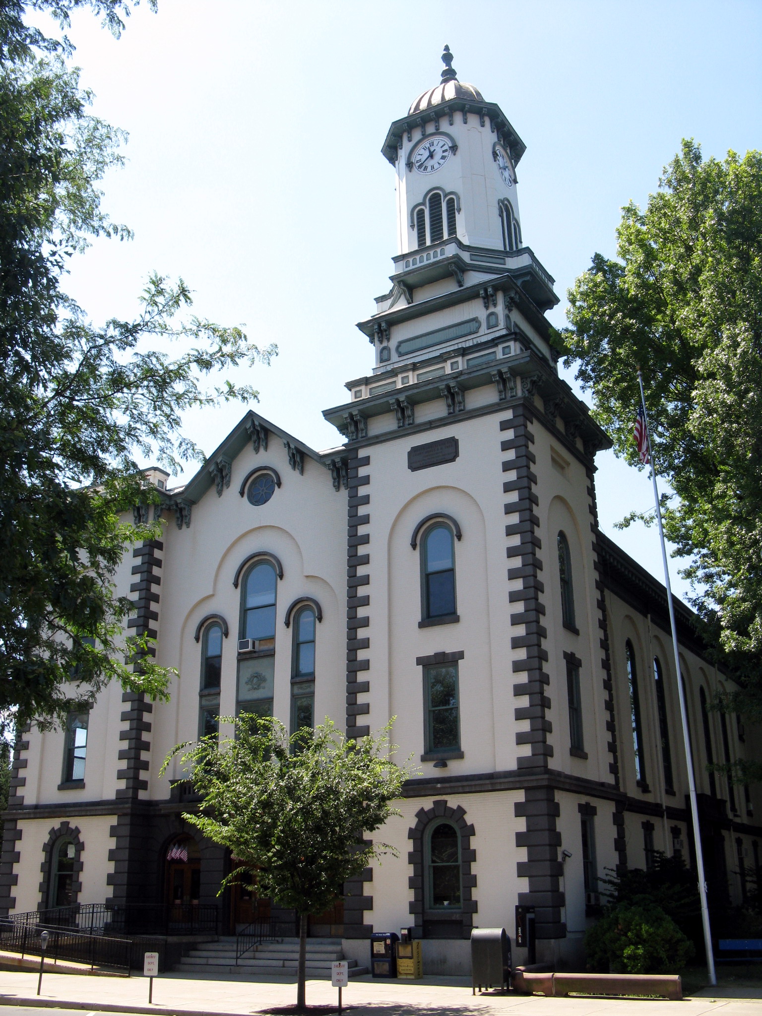 Northumberland County Courthouse | |
 Location within the U.S. state of Pennsylvania | |
 Pennsylvania's location within the U.S. | |
| Coordinates: 40°51′N 76°43′W | |
| Country | |
| State | |
| Founded | March 21, 1772 |
| Named for | Northumberland |
| Seat | Sunbury |
| Largest city | Sunbury |
| Area | |
| • Total | 478 sq mi (1,240 km2) |
| • Land | 458 sq mi (1,190 km2) |
| • Water | 19 sq mi (50 km2) 4.0%% |
| Population (2020) | |
| • Total | 91,647 |
| • Density | 204/sq mi (79/km2) |
| Time zone | UTC−5 (Eastern) |
| • Summer (DST) | UTC−4 (EDT) |
| Congressional districts | 9th, 12th |
| Website | www |
The county was formed in 1772 from parts of Lancaster, Berks, Bedford, Cumberland, and Northampton Counties and named for the county of Northumberland in northern England. Northumberland County is a fifth class county according to the Pennsylvania's County Code.[3] Northumberland County comprises the Sunbury, Pennsylvania Micropolitan Statistical Area, which is also included in the Bloomsburg-Berwick-Sunbury, PA Combined Statistical Area. Among its notable residents, Joseph Priestley, the Enlightenment chemist and theologian, left England in 1796 due to religious persecution and settled on the Susquehanna River. His former house (originally purchased by chemists from Pennsylvania State University after a colloquium that founded the American Chemical Society[4]) is a historical museum.[5]
History
Before European settlement the area was inhabited by the Akhrakouaeronon or Atrakouaehronon, a subtribe of the Susquehannock. By 1813 the area once comprising the sprawling county of Northumberland had been divided over time and allotted to other counties such that lands once occupied by Old Northumberland at its greatest extent are now found in Centre, Columbia, Luzerne, Lycoming, Mifflin, Union, Clearfield, Clinton, Montour, Bradford, Lackawanna, Susquehanna, Wyoming, Tioga, Potter, McKean, Warren, Venango, Snyder, and Schuylkill Counties.
Geography


According to the U.S. Census Bureau, the county has a total area of 478 square miles (1,240 km2), of which 458 square miles (1,190 km2) is land and 19 square miles (49 km2) (4.0%) is water.[6]
The county has a humid continental climate (Dfa/Dfb). Average temperatures in Sunbury range from 27.3 °F in January to 72.7 °F in July, while in Mount Carmel they range from 25.0 °F in January to 70.2 °F in July. [7]
The main river in Northumberland County is the Susquehanna River and the divergence of the 977 miles (1,572 km) long river into its two branches of navigable river and former divisions of the Pennsylvania Canal System. The Susquehanna River's tributaries in the county include the West Branch Susquehanna River, Chillisquaque Creek, Shamokin Creek, and the west flowing Mahanoy Creek, whose valley is a rail and road transportation corridor to Tamaqua and points thereafter either east, north, or south such that: east along rail or US 209 through Nesquehoning and historic Jim Thorpe; else northeast via Beaver Meadows leading north into Hazelton and the lower Wyoming Valley, or into the central Wyoming Valley skirting along the western Poconos via White Haven and Mountain Top; or otherwise head south through the Schuylkill Gap into Port Carbon and thence west to the Lancaster County or east via the greater Reading area into the lower Schuylkill Valley and Philadelphia. The county has mountains in the south and north, with the rest being mostly rolling hills.
Mountains
| Name | Height |
| Mahanoy Mountain | 433 meters |
| Big Mountain | 402 meters |
Major highways
 I-80
I-80 I-180
I-180 US 11
US 11 PA 44
PA 44 PA 45
PA 45 PA 54
PA 54 PA 61
PA 61 PA 125
 PA 147
 PA 225
 PA 254
 PA 405
 PA 487
 PA 642
 PA 890
 PA 901
Adjacent counties
- Lycoming County (north)
- Montour County (northeast)
- Columbia County (east)
- Schuylkill County (southeast)
- Dauphin County (south)
- Perry County (southwest)
- Juniata County (west)
- Snyder County (west)
- Union County (west)
Demographics
| Historical population | |||
|---|---|---|---|
| Census | Pop. | %± | |
| 1790 | 17,147 | — | |
| 1800 | 27,797 | 62.1% | |
| 1810 | 36,327 | 30.7% | |
| 1820 | 15,424 | −57.5% | |
| 1830 | 18,133 | 17.6% | |
| 1840 | 20,027 | 10.4% | |
| 1850 | 23,272 | 16.2% | |
| 1860 | 28,922 | 24.3% | |
| 1870 | 41,444 | 43.3% | |
| 1880 | 53,123 | 28.2% | |
| 1890 | 74,698 | 40.6% | |
| 1900 | 90,911 | 21.7% | |
| 1910 | 111,420 | 22.6% | |
| 1920 | 122,079 | 9.6% | |
| 1930 | 128,504 | 5.3% | |
| 1940 | 126,887 | −1.3% | |
| 1950 | 117,115 | −7.7% | |
| 1960 | 104,138 | −11.1% | |
| 1970 | 99,190 | −4.8% | |
| 1980 | 100,381 | 1.2% | |
| 1990 | 96,771 | −3.6% | |
| 2000 | 94,556 | −2.3% | |
| 2010 | 94,528 | 0.0% | |
| 2020 | 91,647 | −3.0% | |
| U.S. Decennial Census[8] 1790–1960[9] 1900–1990[10] 1990–2000[11] 2010–2017[12] 2010-2020[13] | |||
As of the census[14] of 2000, there were 94,556 people, 38,835 households, and 25,592 families residing in the county. The population density was 206 people per square mile (79/km2). There were 43,164 housing units at an average density of 94 per square mile (36/km2). The racial makeup of the county was 97.09% White, 1.52% Black or African American, 0.10% Native American, 0.22% Asian, 0.02% Pacific Islander, 0.47% from other races, and 0.58% from two or more races. 1.10% of the population were Hispanic or Latino of any race. 32.5% were of German, 12.9% Polish, 9.9% American, 8.2% Italian, 8.1% Irish and 5.8% Dutch ancestry. 95.8% spoke English and 1.5% Spanish as their first language.
There were 38,835 households, out of which 27.30% had children under the age of 18 living with them, 52.40% were married couples living together, 9.60% had a female householder with no husband present, and 34.10% were non-families. 30.20% of all households were made up of individuals, and 15.50% had someone living alone who was 65 years of age or older. The average household size was 2.34 and the average family size was 2.89.
In the county, the population was spread out, with 21.90% under the age of 18, 7.00% from 18 to 24, 27.70% from 25 to 44, 24.40% from 45 to 64, and 19.00% who were 65 years of age or older. The median age was 41 years. For every 100 females there were 96.30 males. For every 100 females age 18 and over, there were 92.80 males.
2020 Census
| Race | Num. | Perc. |
|---|---|---|
| White (NH) | 81,689 | 89% |
| Black or African American (NH) | 2,392 | 2.61% |
| Native American (NH) | 110 | 0.12% |
| Asian (NH) | 444 | 0.5% |
| Pacific Islander (NH) | 24 | 0.03% |
| Other/Mixed (NH) | 2,837 | 3.1% |
| Hispanic or Latino | 4,151 | 4.52% |
Micropolitan Statistical Area

The United States Office of Management and Budget[16] has designated Northumberland County as the Sunbury, PA Micropolitan Statistical Area (µSA). As of the 2010 census[17] the micropolitan area ranked 2nd most populous in the State of Pennsylvania and the 37th most populous in the United States with a population of 94,528. Northumberland County is also a part of the Bloomsburg–Berwick–Sunbury, PA Combined Statistical Area (CSA), which combines the population of Northumberland County as well as the Columbia, Montour, Snyder and Union County areas. The Combined Statistical Area ranked 8th in the State of Pennsylvania and 115th most populous in the United States with a population of 264,739.
Politics and government
| Year | Republican | Democratic | Third party | |||
|---|---|---|---|---|---|---|
| No. | % | No. | % | No. | % | |
| 2020 | 28,952 | 68.31% | 12,677 | 29.91% | 754 | 1.78% |
| 2016 | 25,427 | 68.89% | 9,788 | 26.52% | 1,692 | 4.58% |
| 2012 | 19,518 | 58.51% | 13,072 | 39.19% | 766 | 2.30% |
| 2008 | 19,018 | 55.75% | 14,329 | 42.00% | 767 | 2.25% |
| 2004 | 22,262 | 59.95% | 14,602 | 39.32% | 270 | 0.73% |
| 2000 | 18,142 | 54.56% | 13,670 | 41.11% | 1,442 | 4.34% |
| 1996 | 13,551 | 41.82% | 13,418 | 41.41% | 5,431 | 16.76% |
| 1992 | 15,057 | 42.07% | 12,814 | 35.80% | 7,921 | 22.13% |
| 1988 | 20,207 | 58.07% | 14,255 | 40.96% | 338 | 0.97% |
| 1984 | 22,109 | 61.13% | 13,748 | 38.01% | 308 | 0.85% |
| 1980 | 20,608 | 56.79% | 13,750 | 37.89% | 1,932 | 5.32% |
| 1976 | 19,283 | 49.60% | 18,939 | 48.72% | 654 | 1.68% |
| 1972 | 25,912 | 64.16% | 13,885 | 34.38% | 588 | 1.46% |
| 1968 | 22,366 | 53.38% | 17,013 | 40.60% | 2,520 | 6.01% |
| 1964 | 17,046 | 37.68% | 28,082 | 62.07% | 116 | 0.26% |
| 1960 | 27,568 | 55.31% | 22,233 | 44.61% | 40 | 0.08% |
| 1956 | 28,583 | 62.46% | 17,141 | 37.45% | 41 | 0.09% |
| 1952 | 28,861 | 61.71% | 17,789 | 38.04% | 119 | 0.25% |
| 1948 | 23,535 | 58.13% | 16,478 | 40.70% | 472 | 1.17% |
| 1944 | 21,995 | 51.81% | 20,333 | 47.90% | 122 | 0.29% |
| 1940 | 22,914 | 46.41% | 26,315 | 53.30% | 139 | 0.28% |
| 1936 | 21,758 | 40.06% | 31,849 | 58.63% | 711 | 1.31% |
| 1932 | 17,982 | 42.25% | 23,114 | 54.30% | 1,468 | 3.45% |
| 1928 | 30,949 | 61.30% | 19,249 | 38.12% | 292 | 0.58% |
| 1924 | 17,516 | 56.18% | 7,571 | 24.28% | 6,090 | 19.53% |
| 1920 | 17,288 | 58.44% | 9,854 | 33.31% | 2,439 | 8.25% |
| 1916 | 8,722 | 45.00% | 9,333 | 48.15% | 1,329 | 6.86% |
| 1912 | 2,371 | 12.39% | 6,802 | 35.53% | 9,971 | 52.08% |
| 1908 | 10,439 | 51.97% | 8,590 | 42.76% | 1,058 | 5.27% |
| 1904 | 11,219 | 62.41% | 5,936 | 33.02% | 822 | 4.57% |
| 1900 | 8,366 | 49.35% | 7,989 | 47.13% | 596 | 3.52% |
| 1896 | 8,659 | 51.68% | 7,367 | 43.97% | 730 | 4.36% |
| 1892 | 6,170 | 44.95% | 6,942 | 50.57% | 615 | 4.48% |
| 1888 | 6,288 | 48.96% | 6,257 | 48.72% | 297 | 2.31% |
As of November 7, 2022, there are 58,632 registered voters in Northumberland County.[19]
- Republican: 31,682 (54.04%)
- Democratic: 18,515 (31.58%)
- Independent: 5,547 (9.46%)
- Third Party: 2,888 (4.93%)
While county-level politics tend to be competitive, Northumberland is a Republican county in most statewide elections. The margins of victory in the county for the Republican presidential candidate in 2000, 2004, and 2008 have been 13, 21, and 14 percentage points, respectively. Governor Ed Rendell narrowly carried it against Lynn Swann while Republican Rick Santorum narrowly carried it against Bob Casey in 2006. The only Democratic statewide candidate to carry the county in 2008 was incumbent Auditor General Jack Wagner. In 2011, the election of Stephen Bridy resulted in a three-way split among the county commissioners.
County commissioners
- Kymberley Best, Democrat
- Joseph Klebon, Republican
- Samuel Schiccatano, Republican
Other county offices
- Clerk of Courts and Prothonotary, Jamie Saleski, Republican
- Controller, Christopher L. Grayson, Democrat
- District Attorney, Anthony Matulewicz III, Republican
- Recorder of Deeds and Register of Wills, Christina Mertz, Republican
- Sheriff, Robert J.Wolfe, Republican
- Treasurer, Kevin P. Gilroy, Republican
- Coroner, James F. Kelley, Democrat
State House of Representatives[20]
- Kurt Masser, Republican, 107th district
- Lynda Schlegel-Culver, Republican, 108th district
State Senator[20]
- John Gordner, Republican, 27th district
United States Representative
- Dan Meuser, Republican, 9th district
- Fred Keller, Republican, 12th district
United States Senate
- Pat Toomey, Republican
- Bob Casey Jr., Democrat
Education

Public school districts
- Danville Area School District (also in Montour County)
- Line Mountain School District
- Milton Area School District (also in Union County)
- Mount Carmel Area School District (also in Columbia County)
- Shamokin Area School District
- Shikellamy School District
- Southern Columbia Area School District (also in Columbia County)
- Warrior Run School District (also in Montour and Union Counties)
Career Tech school
Northumberland County Career Technology Center located in Coal Township
Intermediate Unit
Central Susquehanna Intermediate Unit 16 – The primary service area consists of: Columbia, Montour, Northumberland, Snyder and Union counties in central Pennsylvania. Provides a wide variety of education related services to school districts, private and parochial schools and hame schooled students.
Independent schools
- Bethesda Alternative School, Milton 7–12th grade
- Keefertown Parochial School 1–8th grade
- Maranatha Mennonite Christian School K-12th grade
- Meadowbrook Christian Academy PreK-12th grade
- Meadowview Christian Academy PreK-10th grade
- Northumberland Christian School PreK-12th grade
- Northwestern Academy 5–12th grade
- Our Lady of Lourdes Regional School preK–12th grade[21]
- Schwaben Creek School 1–8th grade
- Spring View Parochial School, Watsontown 1–9th grade
- St Louis De Monfort Academy, Herdon 7–12 grade[22]
- Sunbury Christian Academy, Northumberland K-12th grade[23]
- Sunny Slope Amish Parochial School 1–8th grade
- Telos Educational Services Tutoring Center, Montandon[24]
- Transfiguration Elementary School, Shamokin PreK-8th grade
- Watsontown Christian Academy, Watsontown PreK-12th grade
Communities
Under Pennsylvania law, there are four types of incorporated municipalities: cities, boroughs, townships, and, in one case, a town. The following cities, boroughs, and townships are located in Northumberland County:
Cities
Boroughs
Townships
Census-designated places
Census-designated places are geographical areas designated by the U.S. Census Bureau for the purposes of compiling demographic data. They are not actual jurisdictions under Pennsylvania law. Other unincorporated communities, such as villages, may be listed here as well.
Unincorporated communities
- Alaska[25]
- Asherton[25]
- Augustaville[25]
- Atlas
- Bear Gap[25]
- Bear Valley
- Big Mountain[25]
- Boyd[25]
- Boydtown[25]
- Burnside[25]
- Cabel[25]
- Caketown[25]
- Cameron[25]
- Chillisquaque[25]
- Chulasky[25]
- Coal Run
- Colonial Park[25]
- Connersville[25]
- Dalmatia
- Deibler[25]
- Delaware Run[25]
- Diamondtown[25]
- Dooleyville[25]
- Dewart
- Dornsife
- Dunkelbergers[25]
- East Lewisburg[25]
- Edgewood
- Elysburg
- Excelsior[25]
- Fairview-Ferndale
- Farnsworth[25]
- Fisherdale[25]
- Fishers Ferry
- Five Points[25]
- Gowen City
- Greenback[25]
- Greenbriar[25]
- Hamilton[25]
- Hebe[25]
- Helfenstein[25]
- Hickory Corners[25]
- Hunter[25]
- Kapp[25]
- Kapp Heights
- Keefers[25]
- Keiser[25]
- Kipps Run[25]
- Kline Grove[25]
- Kneass[25]
- Knoebels Grove[25]
- Kulps[25]
- Lantz[25]
- Leck Kill
- Line Mountain[25]
- Lithia Springs[25]
- Locust Gap
- Locust Summit[25]
- Malta
- Mandata
- Mayfair
- Meadowview
- Marshallton
- Merrian
- Mile Run
- Millers Crossroads
- Mount Carmel Junction
- Mount Pleasant
- Montandon
- Natalie
- North Hills
- Oak Park
- Oaklyn
- Otto
- Overlook
- Patricksburg
- Paxinos
- Point Breeze
- Potts Grove
- Purdytown
- Quitman
- Rebuck
- Ranshaw
- Red Cross
- Reed
- Resler
- Rushtown
- Sagon
- Selinsgrove Junction
- Seven Points
- Shady Acres
- Shamrock
- Snufftown
- South Danville
- Springtown
- Stonington
- Strong
- Sunnyside
- Tharptown (Uniontown)
- Trevorton
- Union Corner
- Urban
- Warrior Run
- West Cameron
- Wolfs Crossroads
- Wolverton
- Yordy
Population ranking
The population ranking of the following table is based on the 2010 census of Northumberland County.[26]
† county seat
| Rank | City/Town/etc. | Municipal type | Population (2010 Census) |
|---|---|---|---|
| 1 | † Sunbury | City | 9,905 |
| 2 | Shamokin | City | 7,374 |
| 3 | Milton | Borough | 7,042 |
| 4 | Mount Carmel | Borough | 5,893 |
| 5 | Northumberland | Borough | 3,804 |
| 6 | Kulpmont | Borough | 2,924 |
| 7 | Paxinos | CDP | 2,467 |
| 8 | Edgewood | CDP | 2,384 |
| 9 | Watsontown | Borough | 2,351 |
| 10 | Elysburg | CDP | 2,194 |
| 11 | Fairview-Ferndale | CDP | 2,139 |
| 12 | Riverside | Borough | 1,932 |
| 13 | Trevorton | CDP | 1,834 |
| 14 | Dewart | CDP | 1,471 |
| 15 | Marshallton | CDP | 1,441 |
| 16 | Montandon | CDP | 903 |
| 17 | Kapp Heights | CDP | 863 |
| 18 | Atlas | CDP | 809 |
| 19 | Turbotville | Borough | 705 |
| 20 | Marion Heights | Borough | 611 |
| 21 | Ranshaw | CDP | 510 |
| 22 | Tharptown (Uniontown) | CDP | 498 |
| 23 | Dalmatia | CDP | 488 |
| 24 | Snydertown | Borough | 339 |
| 25 | Herndon | Borough | 324 |
| 26 | McEwensville | Borough | 279 |
| 27 | Strong | CDP | 147 |
See also
- National Register of Historic Places listings in Northumberland County, Pennsylvania
References
- "U.S. Census Bureau QuickFacts: Northumberland County, Pennsylvania". Census.gov. Retrieved July 20, 2022.
- "Find a County". National Association of Counties. Archived from the original on May 31, 2011. Retrieved June 7, 2011.
- "PA County Code Newspaper Handbook". Pennsylvania Newspaper Association. 2005. Archived from the original on February 25, 2017.
- Archived March 23, 2012, at the Wayback Machine
- Joseph Priestley House Archived July 21, 2011, at the Wayback Machine. Joseph Priestley House. Retrieved on July 23, 2013.
- "2010 Census Gazetteer Files". United States Census Bureau. August 22, 2012. Retrieved March 9, 2015.
- "PRISM Climate Group at Oregon State University". Prism.oregonstate.edu. Retrieved July 20, 2022.
- "U.S. Decennial Census". United States Census Bureau. Retrieved March 9, 2015.
- "Historical Census Browser". University of Virginia Library. Archived from the original on August 11, 2012. Retrieved March 9, 2015.
- Forstall, Richard L., ed. (March 24, 1995). "Population of Counties by Decennial Census: 1900 to 1990". United States Census Bureau. Archived from the original on March 20, 2015. Retrieved March 9, 2015.
- "Census 2000 PHC-T-4. Ranking Tables for Counties: 1990 and 2000" (PDF). United States Census Bureau. April 2, 2001. Archived (PDF) from the original on December 18, 2014. Retrieved March 9, 2015.
- "State & County QuickFacts". United States Census Bureau. Archived from the original on June 6, 2011. Retrieved November 20, 2013.
- "Census 2020".
- "U.S. Census website". United States Census Bureau. Retrieved January 31, 2008.
- "P2 HISPANIC OR LATINO, AND NOT HISPANIC OR LATINO BY RACE – 2020: DEC Redistricting Data (PL 94-171) – Northumberland County, Pennsylvania".
- "Office of Management and Budget". The White House. Archived from the original on April 29, 2018. Retrieved August 5, 2015.
- Center for New Media and Promotions(C2PO). "2010 Census". census.gov. Retrieved August 5, 2015.
- Leip, David. "Dave Leip's Atlas of U.S. Presidential Elections". uselectionatlas.org. Archived from the original on March 23, 2018. Retrieved May 3, 2018.
- "Voter registration statistics by county". November 7, 2022.. Dos.state.pa.us. Retrieved on November 7, 2022.
- Center, Legislativate Data Processing. "Find Your Legislator". The official website for the Pennsylvania General Assembly. Archived from the original on April 28, 2017. Retrieved April 27, 2017.
- "Our Lady of Lourdes ONLINE!". Archived from the original on August 6, 2007.
- "St Louis de Montfort Academy". Archived from the original on December 26, 2013.
- "Sunbury Christian Academy". Archived from the original on February 4, 2014.
- Daily Item.com, New tutoring center opens, April 10, 2016
- Other Populated Places in Northumberland County (Map). PA HomeTownLocator. 2021. Retrieved March 4, 2021.
- Promotions, Center for New Media and. "US Census Bureau 2010 Census".
External links
Municipalities and communities of Northumberland County, Pennsylvania, United States | ||
|---|---|---|
County seat: Sunbury | ||
| Cities |  | |
| Boroughs | ||
| Townships | ||
| CDPs | ||
| Unincorporated communities | ||
| ||
Authority control | |
|---|---|
| General | |
| National libraries | |
| Other | |
На других языках
[de] Northumberland County (Pennsylvania)
Northumberland County[1] ist ein County im Bundesstaat Pennsylvania der Vereinigten Staaten. Bei der Volkszählung im Jahr 2020 hatte der County 91.647 Einwohner und eine Bevölkerungsdichte von 77 Einwohner pro Quadratkilometer.[2] Der Verwaltungssitz (County Seat) ist Sunbury.- [en] Northumberland County, Pennsylvania
[ru] Нортамберленд (округ, Пенсильвания)
Округ Нортамберленд (англ. Northumberland County) располагается в штате Пенсильвания, США. Официально образован 21-го марта 1772 года. По состоянию на 2010 год, численность населения составляла 94 528 человек.Другой контент может иметь иную лицензию. Перед использованием материалов сайта WikiSort.org внимательно изучите правила лицензирования конкретных элементов наполнения сайта.
WikiSort.org - проект по пересортировке и дополнению контента Википедии