world.wikisort.org - USA
Penn Hills is a township with home rule status in Allegheny County, Pennsylvania, United States. The population as of the 2010 census was 42,329.[3] Penn Hills is the second-largest municipality in Allegheny County, after the city of Pittsburgh.
Penn Hills, Pennsylvania | |
|---|---|
Home rule township | |
| Municipality of Penn Hills | |
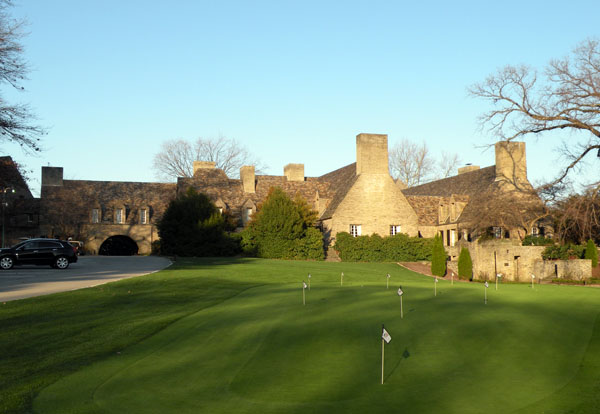 Longue Vue Club and Golf Course, founded in 1920 | |
|
Seal | |
| Motto: “A Home Rule Community” | |
 Location in Allegheny County and state of Pennsylvania | |
| Coordinates: 40°28′34″N 79°50′0″W | |
| Country | United States |
| State | Pennsylvania |
| County | Allegheny |
| Incorporated | 1850 |
| Government | |
| • Type | Home Rule Municipality |
| Area | |
| • Total | 19.36 sq mi (50.13 km2) |
| • Land | 19.12 sq mi (49.52 km2) |
| • Water | 0.24 sq mi (0.62 km2) |
| Population (2010) | |
| • Total | 42,329 |
| • Estimate (2018)[2] | 40,974 |
| • Density | 2,173.61/sq mi (839.24/km2) |
| Time zone | UTC−5 (Eastern (EST)) |
| • Summer (DST) | UTC−4 (EDT) |
| ZIP code | 15147, 15235 |
| Area code(s) | 412, 878 |
| FIPS code | 42-003-59032 |
| Website | http://www.pennhills.org |
History
In 1788, when Allegheny County was formed, the area now known as Penn Hills was part of Pitt Township. On January 16, 1850, Robert Logan, Thomas Davison and Daniel Bieber were appointed by the court to review the boundaries of a new township to be formed from the northern part of Wilkins. This new township was formed and named Adams, until August 1850 when the action of the court was reconsidered to change the name to McNair Township. The name was again changed to Penn Township by Act of Assembly and approved on February 10, 1851. In 1958 Penn Township became Penn Hills Township, and in 1976 Penn Hills became a home rule municipality. The earliest population was given in 1860, when there were 1,821 people living in Penn Township. The population grew to 2,685 in 1870 and 3,291 in 1880.
Geography
Penn Hills is located at 40°28′34″N 79°50′0″W (40.476218, -79.833302).[4]
According to the United States Census Bureau, the township has a total area of 19.3 square miles (50 km2), of which 19.0 square miles (49 km2) is land and 0.3 square miles (0.78 km2), or 1.40%, is water.
Penn Hills uses the ZIP codes of 15235 and 15147; and the community is within area codes 412 and 878.
Communities within Penn Hills
Neighborhoods within Penn Hills include Blackridge, Churchill Valley, Crescent Hills, Eastmont, Eastvue, Laketon Heights, Lincoln Park, Milltown, Nadine, Newfield, North Bessemer, Penn Ridge, Point Breeze, Rosedale, Sandy Creek, Shannon Heights, Universal, Valemont Heights, Gascola, Shadow Shuttle, Frankstown West, Frankstown Estates, Eastwood, and Verona Hilltop.
Streams
Penn Hills is bordered to the north by the Allegheny River. In addition, the waterways listed below flow through the Municipality:
- Plum Creek flows through the Municipality, creating the border with Plum Borough. The stream passes by North Bessemer Field, Milltown Community Park and Penn Hills Community Park before briefly entering into Oakmont and emptying into the Allegheny River.[5]
- Sandy Creek starts near the intersection of Verona Road and Graham Boulevard Extension and parallels Verona Road to its intersection with Sandy Creek Road where the stream turns and follows the road until it empties into the Allegheny River.
- Thompson Run begins near Linton Middle School and runs along Stotler Road, Frey Road and Thompson Run Road where it forms the Municipality's border with Monroeville. It eventually flows into the Monongahela River.
- Quigley Run forms near the Green Oaks Country Club and passes under Allegheny River Boulevard (PA 130) before directly emptying into the Allegheny River.
- Shades Run, in the Lincoln Park neighborhood, begins off of Tyler Road and flows under Lincoln Road, forming the Municipality's border with the City of Pittsburgh. It crosses under Allegheny River Boulevard (PA 130) before directly emptying into the Allegheny River.
- Duffs Run begins along Long Road in the Churchill Valley neighborhood before winding through the former Churchill Valley Country Club and running into Churchill and Wilkins Township before joining Thompson Run.
Surrounding communities
Penn Hills has ten land borders, including Verona and Oakmont to the north, Plum Borough to the east and northeast, Monroeville to the southeast, Wilkins Township, Churchill and Wilkinsburg to the south and the Pittsburgh neighborhoods of East Hills to the south, Homewood North to the southwest and Lincoln–Lemington–Belmar to the west.
The Allegheny River borders Penn Hills to the northwest with two neighborhoods running adjacent across the way: O'Hara Township and the borough of Blawnox.
Demographics
| Historical population | |||
|---|---|---|---|
| Census | Pop. | %± | |
| 1860 | 1,821 | — | |
| 1870 | 2,685 | 47.4% | |
| 1880 | 3,291 | 22.6% | |
| 1890 | 2,932 | −10.9% | |
| 1900 | 3,407 | 16.2% | |
| 1910 | 6,207 | 82.2% | |
| 1920 | 8,342 | 34.4% | |
| 1930 | 13,337 | 59.9% | |
| 1940 | 15,578 | 16.8% | |
| 1950 | 25,280 | 62.3% | |
| 1960 | 51,512 | 103.8% | |
| 1970 | 62,886 | 22.1% | |
| 1980 | 57,632 | −8.4% | |
| 1990 | 51,479 | −10.7% | |
| 2000 | 46,809 | −9.1% | |
| 2010 | 42,329 | −9.6% | |
| 2020 | 41,059 | −3.0% | |
| Sources:[6][7][8][9][10][11][12][13][14] | |||
As of the census[6] of 2010, there were 42,329 people living in the township. The population density was 2,268.2 people per square mile (949.7/km2). There were 20,355 housing units at an average density of 1,069.8 per square mile (413.0/km2). The racial makeup of the township was 60.03% (25,398) White, 37.03% (15,668) African American, 0.98% (409) Asian, 0.01% (4) Pacific Islander, 0.55% from (232) other races. Hispanic or Latino of any race were 1.41% (598) of the population. There is a sizable Italian American population in the township.[citation needed]
There were 19,490 households, out of which 26.3% had children under the age of 18 living with them, 51.1% were married couples living together, 13.5% had a female householder with no husband present, and 31.9% were non-families. 28.2% of all households were made up of individuals, and 13.2% had someone living alone who was 65 years of age or older. The average household size was 2.38 and the average family size was 2.91.
In the township the population was spread out, with 21.7% under the age of 18, 6.3% from 18 to 24, 27.0% from 25 to 44, 25.3% from 45 to 64, and 19.7% who were 65 years of age or older. The median age was 42 years. For every 100 females there were 88.6 males. For every 100 females age 18 and over, there were 84.0 males.
The median income for a household in the township was $39,960, and the median income for a family was $46,971. Males had a median income of $36,143 versus $27,331 for females. The per capita income for the township was $20,161. About 5.6% of families and 7.5% of the population were below the poverty line, including 10.8% of those under age 18 and 6.2% of those age 65 or over.
Education
Penn Hills is served by the Penn Hills School District, which includes: Penn Hills Elementary School, Linton Middle School, and Penn Hills High School.
Transportation
Interstate 376 runs through the southernmost part of Penn Hills, linking it and other eastern suburbs to downtown Pittsburgh.
Pennsylvania Route 791, more commonly referred to as Rodi Road, connects heavily traveled Frankstown Road (at PA-791's northern terminus) with I-376 at its southern terminus. Numerous restaurants, fast food locations, stores, gas stations, and hotels can be found on Rodi, as many truckers and travelers using I-376 use the Penn Hills exit to refuel or stay overnight.
For air travel, Pittsburgh International Airport, located in the western portion of the county, is most commonly used. However, the Allegheny County Airport in West Mifflin is also still in use.
Several bus lines of the Port Authority of Allegheny County offer service to Downtown Pittsburgh, and the Port Authority also has several routes and "flyers" located in Penn Hills.
Major roads
 I-376 /
  US 22 Penn Lincoln Parkway (Penn Hills is exit 81)
 PA 791 Rodi Road
 PA 380 Frankstown, Saltsburg Roads
 PA 130 Coal Hollow, Sandy Creek, Beulah Roads
 Yellow Belt The Yellow Belt runs through Penn Hills via Hulton, Frankstown, and Rodi Roads
 Green Belt The Green Belt is signed as Robinson Blvd, Verona Road, and Sandy Creek Road within Penn Hills
Government/elected officials
- Mayor - Pauline Calabrese
- Deputy Mayor - Catherine Sapp
- Council Member - John Petrucci
- Council Member - Frank Pecora
- Council Member - James Getsy
- Controller - Nicholas J. Futules
- Municipal Manager - Scott Andrejchak
- Deputy Clerk - Diane Gionta Fitzhenry
- District Justice - Anthony DeLuca Jr.
- US Congress - 14th District - Michael F. Doyle
- US Congress - 18th District - Conor Lamb
- State Senate - 43rd District - Jay Costa
- US Senate - Toomey, Patrick J.
- US Senate - Bob Casey Jr.
- State Legislature - 32nd District - Anthony M. DeLuca
Government and politics
The Penn Hills Government Center is located at 102 Duff Road. This is the home to all municipal offices, including the Penn Hills Police Department and Penn Hills EMS. All public safety divisions are dispatched by Allegheny County 911.[15]
| Year | Republican | Democratic | Third Parties |
|---|---|---|---|
| 2020 | 29% 7,008 | 69% 16,774 | 1% 256 |
| 2016 | 31% 6,762 | 68% 14,919 | 1% 125 |
| 2012 | 32% 7,017 | 68% 14,990 | 0% 199 |
Penn Hills Volunteer Fire Department
Station 1 - 7520 Mt. Carmel Rd
Station 2 - 5806 Verona Rd
Station 3 - 1701 Leechburg Rd
Station 4 - 1002 Center Ave
Station 5 - 2797 Robinson Blvd
Station 6 - 2240 Main St - CLOSED - DE-CERTIFIED (2016)
Station 7 - 125 Universal Rd
Fire Marshal - 102 Duff Rd
Fire Academy - 102 Duff Rd
Notable people
- Dion Bentley
- Barry Church
- Aaron Donald
- Scott Edgar (born 1955), college basketball coach
- Bill Fralic
- Kevin Peter Hall
- George Karl
- Abby Lee Miller
- Guy Primus
- Nisha Rajagopal
- Salima Rockwell
- Tom Tumulty
See also
- Blackridge, Pennsylvania
- Penn Hills School District
References
- "2016 U.S. Gazetteer Files". United States Census Bureau. Retrieved Aug 13, 2017.
- Bureau, U. S. Census. "U.S. Census website". United States Census Bureau. US Census Bureau. Retrieved 1 December 2019.
- "Race, Hispanic or Latino, Age, and Housing Occupancy: 2010 Census Redistricting Data (Public Law 94-171) Summary File (QT-PL), Penn Hills township, Allegheny County, Pennsylvania". United States Census Bureau. Retrieved September 29, 2011.
- "US Gazetteer files: 2010, 2000, and 1990". United States Census Bureau. 2011-02-12. Retrieved 2011-04-23.
- "Plum Creek". Geographic Names Information System. United States Geological Survey, United States Department of the Interior. Retrieved 2010-12-18.
- "U.S. Census website". United States Census Bureau. Retrieved 2008-01-31.
- "Population of Civil Divisions Less than Counties" (PDF). 1870 United States Census. U.S. Census Bureau. Retrieved 25 November 2013.
- "Population of Civil Divisions Less than Counties" (PDF). 1880 United States Census. U.S. Census Bureau. Retrieved 24 November 2013.
- "Population-Pennsylvania" (PDF). U.S. Census 1910. U.S. Census Bureau. Retrieved 22 November 2013.
- "Number and Distribution of Inhabitants:Pennsylvania-Tennessee" (PDF). Fifteenth Census. U.S. Census Bureau.
- "Number of Inhabitants: Pennsylvania" (PDF). 18th Census of the United States. U.S. Census Bureau. Retrieved 22 November 2013.
- "Pennsylvania: Population and Housing Unit Counts" (PDF). U.S. Census Bureau. Retrieved 22 November 2013.
- "Incorporated Places and Minor Civil Divisions Datasets: Subcounty Population Estimates: April 1, 2010 to July 1, 2012". U.S. Census Bureau. Archived from the original on 11 June 2013. Retrieved 25 November 2013.
- "Census 2020".
- Location of municipal building via Google Maps
- EL. "2012 Allegheny County election". Pittsburgh Tribune-Review. Retrieved 15 October 2017.
- EL. "2016 Pennsylvania general election results". Pittsburgh Post-Gazette. Retrieved 15 October 2017.
- "Election Night Reporting".
External links

Authority control | |
|---|---|
| General | |
| National libraries | |
На других языках
[de] Penn Hills Township
Penn Hills ist ein Township und Gemeinde (Home Rule Municipality) im Allegheny County im US-Bundesstaat Pennsylvania. Laut Volkszählung im Jahr 2010 hatte sie eine Einwohnerzahl von 42.329 auf einer Fläche von 50,1 km². Sie ist Teil der Metropolregion Pittsburgh und ein Vorort.- [en] Penn Hills, Pennsylvania
Другой контент может иметь иную лицензию. Перед использованием материалов сайта WikiSort.org внимательно изучите правила лицензирования конкретных элементов наполнения сайта.
WikiSort.org - проект по пересортировке и дополнению контента Википедии