world.wikisort.org - USA
Enlow is a census-designated place (CDP) in Allegheny County, Pennsylvania, United States. The community used to be part of the Imperial-Enlow CDP, and was split into two separate CDPs as of the 2010 census. The population was 1,013 at the 2010 census.[3]
Enlow, Pennsylvania | |
|---|---|
Census-designated place | |
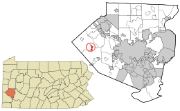 Location in Allegheny County and state of Pennsylvania | |
| Coordinates: 40°27′7″N 80°13′56″W | |
| Country | United States |
| State | Pennsylvania |
| County | Allegheny |
| Townships | Findlay, North Fayette |
| Area | |
| • Total | 0.72 sq mi (1.86 km2) |
| • Land | 0.72 sq mi (1.86 km2) |
| • Water | 0.00 sq mi (0.00 km2) |
| Population (2020)[2] | |
| • Total | 1,138 |
| • Density | 1,582.75/sq mi (611.44/km2) |
| Time zone | UTC-5 (Eastern (EST)) |
| • Summer (DST) | UTC-4 (EDT) |
| FIPS code | 42-23720 |
The CDP is located in North Fayette and Findlay townships.
History
Enlow Station was a stop on the Montour Railroad at the current location of Enlow.[4] The station was named for Amos Enlow, a farmer in the area.[5]
Geography
Enlow is located at 40°27′7″N 80°13′56″W (40.4520, -80.2323).[6]
According to the United States Census Bureau, the CDP had a total area of 0.7 square miles (1.8 km2), all of it land.
Demographics
| Historical population | |||
|---|---|---|---|
| Census | Pop. | %± | |
| 2020 | 1,138 | — | |
| U.S. Decennial Census[7][8] | |||
References
- "ArcGIS REST Services Directory". United States Census Bureau. Retrieved October 15, 2022.
- "Census Population API". United States Census Bureau. Retrieved Oct 12, 2022.
- "Race, Hispanic or Latino, Age, and Housing Occupancy: 2010 Census Redistricting Data (Public Law 94-171) Summary File (QT-PL), Enlow CDP, Pennsylvania". United States Census Bureau. Retrieved September 30, 2011.
- Allegheny County, Pennsylvania (Map). A. H. Mueller & Co. 1907.
- White, William A. (30 Aug 1953). "Imperial Had Fair Many Years Ago". Roving Reporter. The Pittsburgh Press. sec. 4, p. 5.
- "US Gazetteer files: 2010, 2000, and 1990". United States Census Bureau. 2011-02-12. Retrieved 2011-04-23.
- "Census of Population and Housing". Census.gov. Retrieved June 4, 2016.
- "Census Population API". United States Census Bureau. Retrieved Oct 15, 2022.
Pittsburgh–New Castle–Weirton combined statistical area | ||
| Counties |  | |
| Major cities | ||
| Cities and towns 15k–50k (in 2010) | ||
| Airports | ||
| Topics |
| |
| ||

Текст в блоке "Читать" взят с сайта "Википедия" и доступен по лицензии Creative Commons Attribution-ShareAlike; в отдельных случаях могут действовать дополнительные условия.
Другой контент может иметь иную лицензию. Перед использованием материалов сайта WikiSort.org внимательно изучите правила лицензирования конкретных элементов наполнения сайта.
Другой контент может иметь иную лицензию. Перед использованием материалов сайта WikiSort.org внимательно изучите правила лицензирования конкретных элементов наполнения сайта.
2019-2026
WikiSort.org - проект по пересортировке и дополнению контента Википедии
WikiSort.org - проект по пересортировке и дополнению контента Википедии