world.wikisort.org - USA
Beaver is a borough in and the county seat of Beaver County in the U.S. state of Pennsylvania.[3] It is located at the confluence of the Beaver and Ohio Rivers, approximately 30 miles (48 km) northwest of Pittsburgh. As of the 2020 census, the borough population was 4,838.[4] The borough is a Tree City USA community.[5]
Beaver, Pennsylvania | |
|---|---|
Borough | |
| Borough of Beaver | |
 The Beaver Municipal Building (1912) within the Beaver Historic District | |
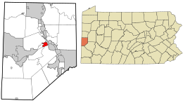 Location in Beaver County and the U.S. state of Pennsylvania. | |
| Coordinates: 40°41′41″N 80°18′27″W | |
| Country | United States |
| State | Pennsylvania |
| County | Beaver |
| Settled | 1792 |
| Incorporated | 1802 |
| Area | |
| • Total | 1.12 sq mi (2.91 km2) |
| • Land | 0.92 sq mi (2.37 km2) |
| • Water | 0.21 sq mi (0.54 km2) |
| Elevation | 791 ft (241 m) |
| Population (2020)[2] | |
| • Total | 4,438 |
| • Density | 4,844.98/sq mi (1,870.95/km2) |
| Time zone | UTC-5 (Eastern (EST)) |
| • Summer (DST) | UTC-4 (EDT) |
| Zip code | 15009 |
| Area code | 724 |
| FIPS code | 42-04688 |
| Website | http://www.beaverpa.us |
Robert Linn was the mayor of Beaver for 58 years, from 1946 to 2004, making him one of the longest serving mayors in the United States.
History

The area around Beaver was once home to Shawnee Indians, who were later displaced by groups such as the Mingoes and the Lenape. It was part of the Ohio Country that was in dispute during the French and Indian War.
Beaver became the site of Fort McIntosh, a Revolutionary War era Patriot frontier fort. After the war, the fort was the home of the First American Regiment, the oldest active unit in the US Army. The fort was abandoned in 1788 and razed a short time later. By then, the frontier had moved westward and there was no further need for a permanent garrison to protect the area.
The community was laid out in 1792. In 1800, it became the county seat of the newly formed Beaver County. The first county court was established in Beaver in 1804. Growth was steady until 1879 when the arrival of the Pittsburgh and Lake Erie Railroad caused a major growth spurt. In February 1884 a massive flood caused extensive damage. In 1974, an archeological excavation was conducted at the site of Fort McIntosh.
In late 2007, local officials proposed the consolidation of Beaver with Brighton Township. According to a report by the Governor's Center for Local Government Services, the two municipalities would possibly derive a significant financial benefit from uniting. Also being considered was the type of combination: either merger, in which one of the municipalities would be annexed by the other, or consolidation, in which the two would become a single new municipality under a new name. Any union would have required voter approval.[6]
Beaver Historic District
In 1996, almost the entire community was listed on the National Register of Historic Places as a historic district.[7] Centered on Beaver's commercial Third Street, the buildings in the Beaver Historic District date primarily to the nineteenth century, although some twentieth-century structures are present. Some of the district's most prominent buildings are five churches and the county courthouse, although most of the district consists of residential neighborhoods. Included in the boundaries of the district is the Matthew S. Quay House, the National Historic Landmark home of Beaver native Senator Matthew Quay, and the site of Fort McIntosh, a fort constructed in the 1780s.[8]
Geography
Beaver is located at 40°41′38″N 80°18′29″W (40.693865, -80.307944).[9]
According to the United States Census Bureau, the borough has a total area of 1.1 square miles (2.8 km2), of which 0.9 square miles (2.3 km2) is land and 0.2 square miles (0.5 km2) (13.89%) is water.
Surrounding and adjacent neighborhoods
Beaver borders three municipalities, with Brighton Township to the north, Bridgewater to the east, and Vanport Township to the west. Across the Ohio River to the south, Beaver runs adjacent with Monaca to the southeast, Center Township to the south, and Potter Township to the southwest.
Demographics
| Historical population | |||
|---|---|---|---|
| Census | Pop. | %± | |
| 1820 | 361 | — | |
| 1830 | 914 | 153.2% | |
| 1840 | 551 | −39.7% | |
| 1850 | 2,054 | 272.8% | |
| 1860 | 817 | −60.2% | |
| 1870 | 1,120 | 37.1% | |
| 1880 | 1,178 | 5.2% | |
| 1890 | 1,552 | 31.7% | |
| 1900 | 2,348 | 51.3% | |
| 1910 | 3,456 | 47.2% | |
| 1920 | 4,135 | 19.6% | |
| 1930 | 5,665 | 37.0% | |
| 1940 | 5,641 | −0.4% | |
| 1950 | 6,360 | 12.7% | |
| 1960 | 6,160 | −3.1% | |
| 1970 | 6,100 | −1.0% | |
| 1980 | 5,441 | −10.8% | |
| 1990 | 5,028 | −7.6% | |
| 2000 | 4,775 | −5.0% | |
| 2010 | 4,529 | −5.2% | |
| 2020 | 4,838 | 6.8% | |
| 2021 (est.) | 4,398 | [10] | −9.1% |
| Sources:[11][12][13][14][2] | |||
As of the census[12] of 2000, there were 4,775 people, 2,112 households, and 1,260 families residing in the borough. The population density was 5,119.3 people per square mile (1,982.4/km²). There were 2,297 housing units at an average density of 2,462.6 per square mile (953.6/km²). The racial makeup of the borough was 96.44% White, 2.64% African American, 0.13% Native American, 0.27% Asian, 0.27% from other races, and 0.25% from two or more races. Hispanic or Latino of any race were 0.88% of the population.
There were 2,112 households, out of which 23.2% had children under the age of 18 living with them, 49.6% were married couples living together, 8.1% had a female householder with no husband present, and 40.3% were non-families. 36.9% of all households were made up of individuals, and 19.9% had someone living alone who was 65 years of age or older. The average household size was 2.14 and the average family size was 2.83.
In the borough the population was spread out, with 19.2% under the age of 18, 6.8% from 18 to 24, 26.7% from 25 to 44, 25.3% from 45 to 64, and 22.1% who were 65 years of age or older. The median age was 43 years. For every 100 females, there were 91.4 males. For every 100 females age 18 and over, there were 88.9 males.
The median income for a household in the borough was $42,113, and the median income for a family was $57,208. Males had a median income of $43,198 versus $26,709 for females. The per capita income for the borough was $24,003. About 3.7% of families and 4.9% of the population were below the poverty line, including 7.1% of those under age 18 and 2.2% of those age 65 or over.
Education

Children in Beaver are served by the Beaver Area School District, which also serves Bridgewater, Brighton Township, and Vanport Township. The current schools serving Beaver are:
- College Square Elementary School – grades K-2
- Dutch Ridge Elementary School – grades 3-6
- Beaver Area Middle School – grades 7-8
- Beaver Area High School – grades 9-12
The Beaver Area Memorial Library started as a small collection of books in the basement of the Beaver Trust Co. in the 1940s and was run by the Beaver Civic Club. It eventually moved into the basement of a former high school on College Avenue in Beaver. In 1948, the Beaver County courts granted a charter for the official formation of the Beaver Memorial Library. A fundraiser was started in Beaver County in 1961 to raise the $130,000 to build a new establishment. The new building, which continues to serve as the public library today, was officially dedicated on April 8, 1962 and open to the public.
Notable people
- Daniel Agnew – Chief Justice of the Supreme Court of Pennsylvania
- John Allison – lawyer and United States Congressman[15]
- Rudyerd Boulton – ornithologist
- Amber Brkich-Mariano – winner of Survivor: All-Stars
- Nate Martin – co-founder & CEO of Puzzle Break, first American Escape Room company
- Tom McCreery – Major League Baseball player[16]
- Matthew Quay – United States Senator
- Harrison Holt Richardson - youngest member of the United States Antarctic Service Expedition
- Ralph Francis Scalera – United States District Court judge
- Jeff Shaver – former Major League Baseball player
- John Skorupan – former NFL Linebacker for the Buffalo Bills and the New York Giants
- W. E. Clyde Todd – ornithologist
- Ida Geer Weller — concert singer and clubwoman
- Florence Wickham – contralto opera singer
See also
- List of cities and towns along the Ohio River
References
- "ArcGIS REST Services Directory". United States Census Bureau. Retrieved October 12, 2022.
- "Census Population API". United States Census Bureau. Retrieved Oct 12, 2022.
- "Find a County". National Association of Counties. Archived from the original on 2012-07-12. Retrieved 2011-06-07.
- "Beaver borough, Pennsylvania". U.S. Census Bureau. Retrieved May 1, 2022.
- "2011 Tree Cities USA Communities in Pennsylvania". Arbor Day Foundation. May 2012. Retrieved 10 February 2013.
- Bruni, Jessica. "Analysis may back Beaver, Brighton merger," Beaver County Times, 2007-10-25, pp. A1, A3.
- "National Register Information System". National Register of Historic Places. National Park Service. March 13, 2009.
- Taylor, David S. National Register of Historic Places Inventory/Nomination: Beaver Historic District, National Park Service, 1996-07-06, Inventory of Beaver Historic District properties, and Accompanying map
- "US Gazetteer files: 2010, 2000, and 1990". United States Census Bureau. 2011-02-12. Retrieved 2011-04-23.
- Bureau, US Census. "City and Town Population Totals: 2020-2021". Census.gov. US Census Bureau. Retrieved 19 July 2022.
- "Census of Population and Housing". U.S. Census Bureau. Retrieved 11 December 2013.
- "U.S. Census website". United States Census Bureau. Retrieved 2008-01-31.
- "Incorporated Places and Minor Civil Divisions Datasets: Subcounty Resident Population Estimates: April 1, 2010 to July 1, 2012". Population Estimates. U.S. Census Bureau. Archived from the original on 11 June 2013. Retrieved 11 December 2013.
- "Census of Population and Housing". Census.gov. Retrieved June 4, 2016.
- Who Was Who in America, Historical Volume, 1607-1896. Marquis Who's Who. 1967.
- Reichler, Joseph L., ed. (1979) [1969]. The Baseball Encyclopedia (4th ed.). New York: Macmillan Publishing. ISBN 0-02-578970-8.
External links
 Media related to Beaver, Pennsylvania at Wikimedia Commons
- Official website

- Beaver Borough Police Department
Pittsburgh–New Castle–Weirton combined statistical area | ||
| Counties |  | |
| Major cities | ||
| Cities and towns 15k–50k (in 2010) | ||
| Airports | ||
| Topics |
| |
| ||
Municipalities and communities of Beaver County, Pennsylvania, United States | ||
|---|---|---|
County seat: Beaver | ||
| Cities |  | |
| Boroughs |
| |
| Townships | ||
| CDPs | ||
| Other communities |
| |
| Footnotes | ‡This populated place also has portions in an adjacent county or counties. | |
| ||
National Register of Historic Places in Beaver County, Pennsylvania | ||
|---|---|---|
| National Historic Landmarks |
| |
| National Historic Landmark District |
| |
| Historic districts |
| |
| Other properties |
| |
See also: National Register of Historic Places listings in Beaver County, Pennsylvania and List of National Historic Landmarks in Pennsylvania | ||
U.S. National Register of Historic Places | |
|---|---|
| Topics |
|
| Lists by state |
|
| Lists by insular areas |
|
| Lists by associated state |
|
| Other areas |
|
| Related |
|
| |
Places adjacent to Beaver, Pennsylvania | ||||||||||||||||
|---|---|---|---|---|---|---|---|---|---|---|---|---|---|---|---|---|
| ||||||||||||||||
Authority control | |
|---|---|
| General | |
| National libraries | |
На других языках
- [en] Beaver, Pennsylvania
[ru] Бивер (Пенсильвания)
Бивер (англ. Beaver) — боро в штате Пенсильвания (США). Административный центр округа Бивер. В 2010 году в боро проживал 4531 человек.Другой контент может иметь иную лицензию. Перед использованием материалов сайта WikiSort.org внимательно изучите правила лицензирования конкретных элементов наполнения сайта.
WikiSort.org - проект по пересортировке и дополнению контента Википедии