world.wikisort.org - USA
Gloucester County (/ˈɡlɒstər/) is a county located in the U.S. state of New Jersey. As of the 2020 U.S. census, the county's population was 302,294, representing an increase of 14,006 (4.9%) over the 2010 U.S. census of 288,288,[2] which, in turn, represented an increase of 33,615 (+13.2%) over the 254,673 counted in the 2000 U.S. census.[3]
Gloucester County | |
|---|---|
County | |
 Rowan College of South Jersey in Sewell at sunset, November 2010 | |
 Flag  Seal | |
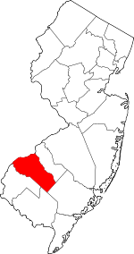 Location within the U.S. state of New Jersey | |
 New Jersey's location within the U.S. | |
| Coordinates: 39.71°N 75.14°W | |
| Country | |
| State | |
| Founded | 1686 |
| Named for | Gloucester / Gloucestershire, England |
| Seat | Woodbury[1] |
| Largest municipality | Washington Township (population) Franklin Township (area) |
| Government | |
| • Commission director | Frank J. DiMarco (D, Deptford Township, term ends December 31, 2022) |
| Area | |
| • Total | 337.18 sq mi (873.3 km2) |
| • Land | 322.00 sq mi (834.0 km2) |
| • Water | 15.17 sq mi (39.3 km2) 4.50% |
| Population (2020)[2] | |
| • Total | 302,294 |
| • Density | 900/sq mi (350/km2) |
| Congressional districts | 1st, 2nd |
| Website | www |
Gloucester County is located approximately 21 miles (34 km) southeast of Philadelphia and 52 miles (84 km) northwest of Atlantic City. It is part of the Camden, New Jersey metropolitan division of the Philadelphia-Camden-Wilmington metropolitan statistical area[4] and the Delaware Valley combined statistical area.[5] Geographically, the county is part of the South Jersey region. It is the only county in the state of New Jersey to border both Pennsylvania and Delaware.
History
Etymology
The county is named after the city and county of Gloucester in England.
History
Gloucester County's county seat is Woodbury, which was founded in 1683 and is the county's oldest municipality.[6] National Park in Gloucester County was the site of the American Revolutionary War's Battle of Red Bank, where Fort Mercer once stood. It is now the site of Red Bank Battlefield Park. The remains of the Royal Navy's HMS Augusta were laid in Red Bank until they were moved and subsequently re sunk in Gloucester City.
During the colonial era, Gloucester County's main industry sector was agriculture. Woodbury was the site of the county courthouse, the county jail, a Quaker meeting house (still in existence), and an inn located on the current location of Woodbury Crossings. Because of the county's many creeks leading to the Delaware River and the Atlantic Ocean, smuggling was very common in the county.
Geography and climate

As of the 2010 U.S. census, the county had a total area of 337.18 square miles (873.3 km2), including 322.00 square miles (834.0 km2) of land (95.5%) and 15.17 square miles (39.3 km2) of water (4.5%).[7]
Gloucester County is largely comprised of low-lying rivers and coastal plains. The highest elevation in the county is a slight rise along County Route 654 southeast of Monroe Township that reaches approximately 180 feet (55 m) above sea level. The county's lowest elevation is at sea level on the Delaware River.[8]
Places adjacent to Gloucester County, New Jersey | |
|---|---|
Climate and weather
Average temperatures in the county seat of Woodbury have ranged from a low of 26 °F (−3 °C) in January to a high of 87 °F (31 °C) in July. A record low of −11 °F (−24 °C) was recorded in February 1934 and a record high of 106 °F (41 °C) was recorded in August 1918. Average monthly precipitation ranged from 2.75 inches (70 mm) in February to 4.35 inches (110 mm) in July.[9] The county has a humid subtropical climate (Cfa). Average monthly temperatures in Newfield range from 33.0 °F in January to 76.6 °F in July.[10]
Demographics
| Historical population | |||
|---|---|---|---|
| Census | Pop. | %± | |
| 1790 | 13,363 | — | |
| 1800 | 16,115 | 20.6% | |
| 1810 | 19,744 | 22.5% | |
| 1820 | 23,089 | 16.9% | |
| 1830 | 28,431 | 23.1% | |
| 1840 | 25,438 | * | −10.5% |
| 1850 | 14,655 | * | −42.4% |
| 1860 | 18,444 | 25.9% | |
| 1870 | 21,562 | 16.9% | |
| 1880 | 25,886 | 20.1% | |
| 1890 | 28,649 | 10.7% | |
| 1900 | 31,905 | 11.4% | |
| 1910 | 37,368 | 17.1% | |
| 1920 | 48,224 | 29.1% | |
| 1930 | 70,802 | 46.8% | |
| 1940 | 72,219 | 2.0% | |
| 1950 | 91,727 | 27.0% | |
| 1960 | 134,840 | 47.0% | |
| 1970 | 172,681 | 28.1% | |
| 1980 | 199,917 | 15.8% | |
| 1990 | 230,082 | 15.1% | |
| 2000 | 254,673 | 10.7% | |
| 2010 | 288,288 | 13.2% | |
| 2020 | 302,294 | 4.9% | |
| Historical sources: 1790–1990[11] 1970–2010[12] 2010[13] 2020[2] * = Lost territory in previous decade.[14] | |||
Swedesboro and Bridgeport were among the earliest European settlements in New Jersey and were both part of the 17th century New Sweden colony. Gloucester County dates back to May 26, 1686 when courts were established separate from those in Burlington. On May 17, 1694, the county was officially formed and its boundaries defined as part of West Jersey. Portions of Gloucester County were set off on February 7, 1837 to create Atlantic County. On March 13, 1844, its boundaries were again defined as part of the creation of neighboring Camden County.[14] The county was named for the city of Gloucester and the county of Gloucestershire in England.[15]
2020 Census
As of the 2020 U.S. census, the county's population was 302,294, representing an increase of 14,006 (4.9%) from the 288,288 enumerated in the 2010 U.S. census,[2] which, in turn, was an increase of 33,615 (+13.2%) from the 254,673 counted in the 2000 U.S. census.[3]
Economy
Based on data from the Bureau of Economic Analysis, Gloucester County had a gross domestic product (GDP) of $14.4 billion in 2018, which was ranked 14th in the state and represented an increase of 1.3% from the previous year.[16]
Education
Colleges and universities
Rowan University in Glassboro is a public university that was founded in 1923 on a 25-acre (10 ha) site donated by the borough.[17]
Rowan College of South Jersey is the county college for Gloucester County. It was established in 1966 as Gloucester County College and opened to students two years later, in 1968. Its main campus is in Sewell and its two satellite campuses are in Vineland and Millville.[18]
School districts
School districts in Gloucester County include:[19][20][21][22]
- K-12
- Clayton Public Schools
- Deptford Township Schools
- Glassboro Public Schools
- Gloucester County Special Services School District
- Gloucester County Vocational-Technical School District
- Monroe Township Public Schools
- Paulsboro Public Schools
- Pitman School District
- Washington Township Public School District
- West Deptford Public Schools
- Woodbury Public Schools
- Secondary
- Clearview Regional High School District
- Delsea Regional School District
- Gateway Regional School District
- Kingsway Regional School District
- Elementary (K-6, except as indicated)
- East Greenwich Township School District
- Elk Township School District
- Franklin Township Public Schools
- Greenwich Township School District (K-8)
- Harrison Township School District
- Logan Township School District (K-8)
- Mantua Township School District
- National Park School District
- South Harrison Township School District
- Swedesboro-Woolwich School District – Consolidated
- Wenonah School District
- Westville School District
- Woodbury Heights School District
Vocational school
Gloucester County includes the Gloucester County Vocational-Technical School District, and one vocational school, the Gloucester County Institute of Technology in Deptford Township, a four-year vocational-technical high school that serves students from across Gloucester County.[23]
Municipalities
Gloucester County's 24 municipalities (with 2010 Census data for population, housing units and area) include:[24]
| Municipality (with map key) |
Map key | Municipal type |
Pop. | Housing Units |
Total Area |
Water Area |
Land Area |
Pop. Density |
Housing Density |
School District |
Communities[25] |
|---|---|---|---|---|---|---|---|---|---|---|---|
| Clayton | 2 | borough | 8,179 | 3,128 | 7.33 | 0.19 | 7.14 | 1,145.5 | 438.1 | Clayton | |
| Deptford Township |
20 | township | 30,561 | 12,361 | 17.61 | 0.25 | 17.36 | 1,760.3 | 712.0 | Deptford | Almonesson Good Intent Oak Valley CDP (3,483) |
| East Greenwich Township |
15 | township | 9,555 | 3,405 | 14.92 | 0.48 | 14.44 | 661.7 | 235.8 | Kingsway (7-12) East Greenwich (PK-6) | Mount Royal Mickleton Wolfert |
| Elk Township | 24 | township | 4,216 | 1,576 | 19.69 | 0.19 | 19.49 | 216.3 | 80.8 | Delsea (7-12) Elk Township (PK-6) | |
| Franklin Township |
23 | township | 16,820 | 6,104 | 56.47 | 0.56 | 55.91 | 300.9 | 109.2 | Delsea (7-12) Franklin Township (K-6) | Franklinville Malaga |
| Glassboro | 3 | borough | 18,579 | 6,590 | 9.22 | 0.04 | 9.18 | 2,022.9 | 717.5 | Glassboro | |
| Greenwich Township |
13 | township | 4,899 | 2,048 | 12.03 | 3.06 | 8.97 | 546.2 | 228.3 | Paulsboro (9-12) (S/R) Greenwich Township (K-8) | Billingsport Gibbstown CDP (3,739) |
| Harrison Township |
18 | township | 12,417 | 4,089 | 19.23 | 0.09 | 19.14 | 648.7 | 213.6 | Clearview (7-12) Harrison Township (PK-6) | Mullica Hill CDP (3,982) Richwood CDP (3,400, part) Ewan |
| Logan Township | 12 | township | 6,042 | 2,172 | 26.93 | 5.00 | 21.93 | 275.6 | 99.1 | Kingsway (7-12) (S/R) Logan (PK-6) | Beckett CDP (4,847) Bridgeport Repaupo |
| Mantua Township |
19 | township | 15,217 | 5,980 | 15.92 | 0.07 | 15.85 | 960.1 | 377.3 | Clearview (7-12) Mantua Township (PK-6) | Richwood CDP (59, part) Sewell |
| Monroe Township |
22 | township | 36,129 | 13,387 | 46.93 | 0.53 | 46.39 | 778.8 | 288.6 | Monroe Township | Cross Keys New Brooklyn Victory Lakes CDP (2,111) Williamstown CDP (15,567) |
| National Park | 9 | borough | 3,036 | 1,153 | 1.45 | 0.45 | 1.00 | 3,023.2 | 1,148.1 | Gateway (7-12) National Park (PK-6) | |
| Newfield | 1 | borough | 1,553 | 626 | 1.71 | 0.00 | 1.70 | 912.0 | 367.6 | Delsea (7-12) Franklin Township (K-6) (S/R) | |
| Paulsboro | 10 | borough | 6,097 | 2,533 | 2.60 | 0.71 | 1.90 | 3,216.4 | 1,336.2 | Paulsboro | |
| Pitman | 4 | borough | 9,011 | 3,705 | 2.31 | 0.04 | 2.27 | 3,976.1 | 1,634.8 | Pitman | |
| South Harrison Township |
17 | township | 3,162 | 1,056 | 15.73 | 0.05 | 15.68 | 201.7 | 67.4 | Kingsway (7-12) South Harrison (K-6) | Harrisonville |
| Swedesboro | 11 | borough | 2,584 | 1,004 | 0.76 | 0.03 | 0.72 | 3,568.4 | 1,386.5 | Kingsway (7-12) Swedesboro-Woolwich (K-6) | |
| Washington Township |
21 | township | 48,559 | 17,810 | 21.60 | 0.22 | 21.38 | 2,271.0 | 833.0 | Washington Township | Grenloch Hurffville Turnersville CDP (3,742) |
| Wenonah | 5 | borough | 2,278 | 860 | 0.98 | 0.01 | 0.97 | 2,342.8 | 884.4 | Gateway (7-12) Wenonah (K-6) | |
| West Deptford Township |
14 | township | 21,677 | 9,441 | 17.87 | 2.45 | 15.41 | 1,406.6 | 612.6 | West Deptford | Colonial Manor Greenfields Village Red Bank Thorofare |
| Westville | 8 | borough | 4,288 | 1,912 | 1.38 | 0.35 | 1.02 | 4,187.0 | 1,867.0 | Gateway (7-12) Westville (PK-6) | |
| Woodbury | 7 | city | 10,174 | 4,456 | 2.06 | 0.05 | 2.01 | 5,064.0 | 2,217.9 | Woodbury | |
| Woodbury Heights | 6 | borough | 3,055 | 1,125 | 1.23 | 0.01 | 1.22 | 2,499.4 | 920.4 | Gateway (7-12) Woodbury Heights (PK-6) | |
| Woolwich Township |
16 | township | 10,200 | 3,275 | 21.23 | 0.32 | 20.91 | 487.8 | 156.6 | Kingsway (7-12) Swedesboro-Woolwich (K-6) | |
| Gloucester County | county | 288,288 | 109,796 | 337.18 | 15.17 | 322.01 | 895.3 | 341.0 |
Transportation
Roads and highways
As of 2010[update], the county had 1,698.59 miles (2,733.62 km) of roadways, of which 1,126.99 miles (1,813.71 km) were maintained by the local municipality, 406.47 miles (654.15 km) by Gloucester County and 145.11 miles (233.53 km) by the New Jersey Department of Transportation, 2.22 miles (3.57 km) by the Delaware River Port Authority, 1.09 miles (1.75 km) by the South Jersey Transportation Authority and 16.71 miles (26.89 km) by the New Jersey Turnpike Authority.[26]
Various county, state, U.S. routes and interstates pass through the county. Major county highways include County Road 534, County Road 536, County Road 538, County Road 544, County Road 551, County Road 553, County Road 555, and County Road 557.
State Routes include Route 41, Route 42 (part of the North-South Freeway), Route 45, Route 47, Route 55, Route 77, Route 168, and Route 324 (only in Logan Township). The three U.S. routes that traverse include U.S. Route 130 in the northwest, U.S. Route 322 near the center, and U.S. Route 40 in the southern tip.
The Commodore Barry Bridge carries U.S. Route 322 between Chester, Pennsylvania and Logan Township, New Jersey.[27]
Interstate 295 is the only Interstate in the county which also runs through the northwest for about 14 miles (23 km). The New Jersey Turnpike passes through the county in the northwest. Only one turnpike interchange is located within Gloucester: Exit 2 in Woolwich Township.[28]
Public transportation
NJ Transit bus service between the county and the Philadelphia Greyhound Terminal is available on the 313, and 315 routes to Philadelphia. On the 400, 401 (from Salem), 402 (from Pennsville Township), 403, 408, 410 (from Bridgeton), and 412 (from Sewell) routes, with local service offered on the 455 (Cherry Hill to Paulsboro), and 463 (between Woodbury and the Avandale Park/Ride in Winslow Township) routes.[29][30]
The Glassboro–Camden Line is a proposed 18-mile (28.97 km) diesel multiple unit (DMU) light rail system that is planned to connect with the River LINE and PATCO Speedline in Camden and was previously anticipated to be in operation in 2019.[31][32] The lack of both an official project sponsor and identified funding source(s), have delayed the start of construction, making the 2019 timeframe unrealistic.
Located within Conrail's South Jersey/Philadelphia Shared Assets Area,[33] freight rail in the county travels along Penns Grove Secondary, the Salem Branch, and the Vineland Secondary. SMS Rail Lines handles interchanges with CSX Transportation and Norfolk Southern Railway.
Port
The Port of Paulsboro is located on the Delaware River and Mantua Creek in and around Paulsboro. Traditionally one of the nation's busiest for marine transfer operations of petroleum products, the port is being redeveloped as an adaptable omniport able to handle bulk, breakbulk cargo, and shipping containers. Studies completed in 2012[34][35] concluded that the port is well suited to become a center for the manufacture, assembly, and transport of wind turbines and platforms the development of wind power in New Jersey.[36][37][38][39][40][41]
Government
County Government
Gloucester County is governed by a Board of County Commissioners comprised of seven members who are elected at-large to three-year terms of office on a staggered basis in partisan elections, with either two or three seats coming up for election each November. At a reorganization meeting held each January, the Board selects a Director and a Deputy Director from among its members. In 2017, commissioners (then called freeholders) were paid $16,908 and the director was paid an annual salary of $17,908.[42] As of 2022[update], Gloucester County's Commissioners are (with terms for director and deputy director ending every December 31st):[43]
| Commissioner | Party, Residence, Term |
|---|---|
| Director Frank J. DiMarco | D, Deptford Township, 2022[44] |
| Deputy Director Heather Simmons | D, Glassboro, 2023[45] |
| Lyman J. Barnes | D, Logan Township, 2023[46] |
| Nicholas DeSilvio | R, Franklin Township, 2024[47] |
| Denice DiCarlo | D, West Deptford Township, 2022 (appointed to serve an unexpired term)[48] |
| Jim Jefferson | D, Woodbury, 2023[49] |
| Christopher Konawel Jr. | R, Glassboro, 2024[50] |
In February 2022, the Board of Commissioners appointed Denice DiCarlo to fill the seat expiring in December 2022 that had been held by Dan Christy until his resignation the previous month.[51][52]
Pursuant to Article VII Section II of the Constitution of New Jersey, each county in New Jersey is required to have three elected administrative officials known as "constitutional officers." These officials are the County Clerk and County Surrogate, both elected for five-year terms of office, and the County Sheriff, who is elected for a three-year term.[53] Gloucester County's constitutional officers are:[54]
| Title | Representative |
|---|---|
| County Clerk | James N. Hogan (D, Franklin Township; 2022),[55][56] |
| Sheriff | Jonathan M. Sammons (R, Elk Township; 2024)[57][58] |
| Surrogate | Giuseppe "Joe" Chila (D, Woolwich Township; 2022).[59][60] |
The Acting Gloucester County Prosecutor is Christine A. Hoffman, who was appointed in March 2020 to succeed Charles A. Fiore.[61] Gloucester County is a part of Vicinage 15 of the New Jersey Superior Court (along with Cumberland and Salem counties), seated in Woodbury in Gloucester County; the Assignment Judge for the vicinage is Benjamin C. Telsey. The Gloucester County Courthouse is in Woodbury.[62]
Federal representatives
Gloucester County is included in the 1st and 2nd Congressional Districts.[63][64]
For the 117th United States Congress, New Jersey's First Congressional District is represented by Donald Norcross (D, Camden).[65][66]
For the 117th United States Congress, New Jersey's Second Congressional District is represented by Jeff Van Drew (R, Dennis Township).[67]
State representatives
The county is part of the 3rd, 4th and 5th Districts in the New Jersey Legislature.
| District | Senator[68] | Assembly [68] | Municipalities |
|---|---|---|---|
| 3rd | Edward Durr (R) | Bethanne McCarthy Patrick (R)
Beth Sawyer (R) |
Clayton, East Greenwich Township, Elk Township, Franklin Township, Glassboro, Greenwich Township,
Logan Township, National Park, Newfield, Paulsboro, South Harrison Township, Swedesboro, West Deptford Township, Woodbury Heights and Woolwich Township. The remainder of this district includes portions of Cumberland County and all of Salem County. |
| 4th | Fred H. Madden (D) | Paul D. Moriarty (D)
Gabriela Mosquera (D) |
Monroe Township, Pitman Borough and Washington Township.
The remainder of this district covers portions of Camden County. |
| 5th | Nilsa Cruz-Perez (D) | William Spearman (D)
Bill Moen (D) |
Deptford Township, Harrison Township, Mantua Township, Wenonah, Westville and Woodbury.
The remainder of this district includes portions of Camden County, |
Politics
The county leans toward the Democratic Party, though to a slightly lesser degree than the state of New Jersey as a whole. As of October 1, 2021, there were a total of 230,545 registered voters in Gloucester County, of whom 89,073 (38.6%) were registered as Democrats, 57,779 (25.1%) were registered as Republicans and 80,776 (35.0%) were registered as unaffiliated. There were 2,917 voters (1.3%) registered to other parties.[69]
In the 2008 U.S. presidential election, Barack Obama carried Gloucester County by a 12.2% margin over John McCain, while Obama carried the state by 15.5% over McCain.[70] In the 2012 election, Barack Obama carried Gloucester County by an even larger margin, even as his support declined nationwide. In 2016, Donald Trump became the first Republican to win Gloucester County since 1988, when George H.W. Bush won it and New Jersey's electoral votes as well, the last time a Republican has done so. In the 2020 Presidential Election, Democrat Joe Biden was declared victor in the county in the closest Democratic victory in the county in the last 30 years.
| Year | Republican | Democratic | Third party | |||
|---|---|---|---|---|---|---|
| No. | % | No. | % | No. | % | |
| 2020 | 83,340 | 48.05% | 86,702 | 49.99% | 3,411 | 1.97% |
| 2016 | 67,544 | 47.82% | 66,870 | 47.34% | 6,840 | 4.84% |
| 2012 | 59,456 | 43.86% | 74,013 | 54.59% | 2,101 | 1.55% |
| 2008 | 60,315 | 43.10% | 77,267 | 55.21% | 2,364 | 1.69% |
| 2004 | 60,033 | 46.91% | 66,835 | 52.23% | 1,096 | 0.86% |
| 2000 | 42,315 | 39.44% | 61,095 | 56.94% | 3,888 | 3.62% |
| 1996 | 32,116 | 31.96% | 51,915 | 51.66% | 16,464 | 16.38% |
| 1992 | 37,335 | 35.69% | 42,425 | 40.55% | 24,859 | 23.76% |
| 1988 | 51,708 | 58.68% | 35,479 | 40.26% | 930 | 1.06% |
| 1984 | 54,041 | 62.08% | 32,702 | 37.57% | 307 | 0.35% |
| 1980 | 40,306 | 51.08% | 29,804 | 37.77% | 8,793 | 11.14% |
| 1976 | 34,888 | 46.33% | 38,726 | 51.43% | 1,688 | 2.24% |
| 1972 | 44,806 | 62.92% | 25,509 | 35.82% | 894 | 1.26% |
| 1968 | 30,596 | 44.52% | 27,438 | 39.92% | 10,697 | 15.56% |
| 1964 | 23,702 | 37.00% | 40,305 | 62.93% | 45 | 0.07% |
| 1960 | 32,474 | 52.16% | 29,752 | 47.79% | 33 | 0.05% |
| 1956 | 30,646 | 60.41% | 20,007 | 39.44% | 75 | 0.15% |
| 1952 | 25,103 | 54.89% | 20,536 | 44.90% | 98 | 0.21% |
| 1948 | 19,477 | 54.46% | 15,785 | 44.14% | 503 | 1.41% |
| 1944 | 16,684 | 48.28% | 17,758 | 51.39% | 113 | 0.33% |
| 1940 | 17,674 | 46.38% | 20,284 | 53.22% | 153 | 0.40% |
| 1936 | 15,813 | 43.18% | 20,516 | 56.02% | 293 | 0.80% |
| 1932 | 18,782 | 55.96% | 13,817 | 41.17% | 962 | 2.87% |
| 1928 | 25,627 | 79.34% | 6,594 | 20.41% | 81 | 0.25% |
| 1924 | 15,513 | 72.74% | 4,167 | 19.54% | 1,648 | 7.73% |
| 1920 | 11,693 | 66.60% | 4,869 | 27.73% | 995 | 5.67% |
| 1916 | 5,352 | 54.82% | 3,745 | 38.36% | 665 | 6.81% |
| 1912 | 1,856 | 21.12% | 3,364 | 38.29% | 3,566 | 40.59% |
| 1908 | 5,318 | 56.38% | 3,706 | 39.29% | 409 | 4.34% |
| 1904 | 4,829 | 59.14% | 2,818 | 34.51% | 518 | 6.34% |
| 1900 | 4,471 | 57.60% | 2,828 | 36.43% | 463 | 5.96% |
| 1896 | 4,727 | 59.02% | 2,981 | 37.22% | 301 | 3.76% |
On the state level, the county is far more competitive as in the 2009 Gubernatorial Election, Republican Chris Christie received 47% of the vote, defeating Democrat Jon Corzine, who received around 43%. In the 2013 gubernatorial election, Republican Chris Christie received 50,640 votes in the county (64.1%), ahead of Democrat Barbara Buono with 27,060 votes (34.2%). However, Gloucester County narrowly opted for Democrat Phil Murphy over Republican Kim Guadagno in the 2017 Gubernatorial Election. Then, in the 2021 Gubernatorial Election, the county voted for Republican Jack Ciattarelli over the Democratic incumbent, Governor Phil Murphy, making it one of three counties that Ciattarelli flipped.
Emergency services
Gloucester County is home to Gloucester County Emergency Management Services (GCEMS), the first county-based EMS agency in New Jersey, which provides emergency services to the municipalities of Clayton, Deptford Township, East Greenwich Township, Elk Township, Franklin Township, Glassboro, Greenwich Township, Harrison Township, Logan Township, Mantua Township, National Park, Newfield, Paulsboro, Pitman, South Harrison Township, Swedesboro, Wenonah, West Deptford Township, Westville, Woolwich Township, Woodbury, and Woodbury Heights.[72]
GCEMS was launched in September 2007 with the goal of providing emergency medical services to the residents of the county within nine minutes from the time of dispatch 90 percent of the time, which is considered to be the gold standard in EMS services. The program currently has twelve ambulances in service around the clock and three power shift ambulances on duty from the hours of 8 am to 8 pm seven days a week. GCEMS operates three Quick Response Vehicles (QRV) units that are located in West Deptford, Newfield, and South Harrison. The department operates from sixteen stations is spread strategically throughout Gloucester County. Its administrative offices are located at the county's Emergency Response Center at 1200 North Delsea Drive in Clayton.[73] It was the winner of the 2010 Outstanding Public EMS Agency by the State of New Jersey.[74]
Gloucester County's special weapons and tactics (SWAT) unit is comprised of police officers from departments within Gloucester County offering emergency services for SWAT-oriented scenarios, included barricaded and suicidal subjects, hostage rescues, high-risk warrant service, dignitary protection, and counterterrorism responses.[75]
Heroin overdoses
In 2014, the county heroin death rate was 17.3 deaths per 100,000 people, the fourth-highest rate in New Jersey and nearly seven times the national average.[76]
Notable people
- Corey Clement (born 1994), former professional football player, Dallas Cowboys, New York Giants, and Philadelphia Eagles (Glassboro)[77]
- Danielson, American Indie pop band (Clarksboro)[78]
- Linda Fiorentino (born 1958 or 1960), actress (Mantua Township)[79]
- Grace Helbig, comedian, actress, author, talk show host, and YouTube personality (Woodbury)[80]
- Michael Johns (born 1964), health care executive, former White House presidential speechwriter, conservative policy analyst and writer (Deptford Township)[81]
- Tara Lipinski (born 1982), Olympic gold medal winner, figure skating (Sewell)[82]
- Bryant McKinnie (born 1979), former professional football player, Baltimore Ravens, Miami Dolphins, and Minnesota Vikings (Woodbury)[83]
- J. Hampton Moore (1864–1950), former mayor of Philadelphia (Woodbury).[84]
- Milt Plum (born 1935), former professional football player, Cleveland Browns, Detroit Lions, Los Angeles Rams, and New York Giants (Westville)[85]
- Jimmy Rollins (born 1978), former professional baseball player, Chicago White Sox, Los Angeles Dodgers, and Philadelphia Phillies (Woolwich Township)[86]
- Stephen Mallozzi (born 2001), NASCAR Camping World Truck Series driver for Reaume Brothers Racing (Swedesboro) [87]
- Patti Smith (born 1946), punk rock musician (Deptford Township)[88]
- Steve Squyres (born 1956), former professor, Cornell University, and principal investigator of the Mars Exploration Rover mission (Wenonah)[89]
- Charles C. Stratton (1796–1859), New Jersey governor and former Member of Congress (Swedesboro)[90]
Recreation
Gloucester County Historical Society
The Gloucester County Historical Society, founded in 1903, maintains a collection of materials and artifacts related to the history of South Jersey. Hunter–Lawrence–Jessup House in Woodbury displays many of these artifacts.[91]
National protected area
- Great Egg Harbor River (part)
See also
- National Register of Historic Places listings in Gloucester County, New Jersey
References
- New Jersey County Map, New Jersey Department of State. Accessed July 10, 2017.
- , United States Census Bureau. Accessed June 22, 2022.
- DP-1 – Profile of General Demographic Characteristics: 2000; Census 2000 Summary File 1 (SF 1) 100-Percent Data for Gloucester County, New Jersey, United States Census Bureau. Accessed September 30, 2013.
- May 2012 Metropolitan and Nonmetropolitan Area Definitions, Bureau of Labor Statistics. Accessed October 4, 2013.
- Revised Delineations of Metropolitan Statistical Areas, Micropolitan Statistical Areas, and Combined Statistical Areas, and Guidance on Uses of the Delineations of These Areas, Office of Management and Budget, February 28, 2013. Accessed October 4, 2013
- History of Woodbury Archived 2006-10-06 at the Wayback Machine, accessed January 26, 2007.
- Census 2010 U.S. Gazetteer Files: New Jersey Counties, United States Census Bureau, Backed up by the Internet Archive as of June 11, 2012. Accessed October 4, 2013.
- New Jersey County High Points, Peakbagger.com. Accessed October 4, 2013.
- "Monthly Averages for Woodbury, New Jersey". The Weather Channel. Retrieved October 13, 2012.
- Climate at "Prism," Oregon State University
- Forstall, Richard L. Population of states and counties of the United States: 1790 to 1990 from the Twenty-one Decennial Censuses, pp. 108–109. United States Census Bureau, March 1996. ISBN 9780934213486. Accessed October 3, 2013.
- New Jersey: 2010 - Population and Housing Unit Counts; 2010 Census of Population and Housing, p. 6, CPH-2-32. United States Census Bureau, August 2012. Accessed August 29, 2016.
- DP1 – Profile of General Population and Housing Characteristics: 2010 Demographic Profile Data for Gloucester County, New Jersey Archived February 13, 2020, at archive.today, United States Census Bureau. Accessed March 26, 2016.
- Snyder, John P. The Story of New Jersey's Civil Boundaries: 1606–1968, Bureau of Geology and Topography; Trenton, New Jersey; 1969. p. 137. Accessed January 21, 2013.
- Kane, Joseph Nathan; and Aiken, Charles Curry. The American Counties: Origins of County Names, Dates of Creation, and Population Data, 1950–2000, p. 112. Scarecrow Press, 2005. ISBN 0810850362. Accessed January 21, 2013.
- Local Area Gross Domestic Product, 2018, Bureau of Economic Analysis, released December 12, 2019. Accessed December 12, 2019.
- "From Normal to Extraordinary: The History of Rowan University"
- Visit the Gloucester Campus, Rowan College of South Jersey. Accessed June 22, 2022.
- New Jersey School Directory for Gloucester County, New Jersey Department of Education. Accessed August 1, 2022.
- Search for Public School Districts in Gloucester County, New Jersey, National Center for Education Statistics. Accessed August 1, 2022.
- 2020 Census School District Reference Map for Gloucester County, NJ, United States Census Bureau. Accessed September 1, 2022.
- 2020 Census School District Reference List for Gloucester County, NJ, United States Census Bureau. Accessed September 1, 2022.
- About GCIT, Gloucester County Institute of Technology. Accessed June 22, 2022.
- GCT-PH1: Population, Housing Units, Area, and Density: 2010 – County – County Subdivision and Place from the 2010 Census Summary File 1 for Gloucester County, New Jersey Archived February 14, 2020, at archive.today, United States Census Bureau. Accessed March 25, 2017.
- Locality Search, State of New Jersey. Accessed March 25, 2017.
- Gloucester County Mileage by Municipality and Jurisdiction, New Jersey Department of Transportation, March 2019. Accessed December 26, 2020.
- The Commodore Barry Bridge, a cantilever bridge that spans the Delaware River from Chester, Pennsylvania to Bridgeport in Logan Township, New Jersey., Library of Congress. Accessed June 22, 2022.
- Travel resources, New Jersey Turnpike Authority. Accessed June 22, 2022.
- Gloucester County Bus / Rail Connections, NJ Transit, backed up by the Internet Archive as of July 26, 2010. Accessed April 1, 2017.
- South Jersey Transit Guide Archived 2018-09-29 at the Wayback Machine, Cross County Connection, as of April 1, 2010. Accessed April 1, 2017.
- "Fact Sheet 2013" (PDF). Glassboro-Camden Line. DVPA & PATCO. Retrieved April 8, 2012.
- "NJ Transit Board Advances South Jersey Transportation Projects" (Press release). New Jersey Transit. December 9, 2009. Retrieved April 8, 2012.
- "Conrail in South Jersey". Conrail Historical Society. Archived from the original on October 5, 2013. Retrieved July 14, 2013.
- Laday, Jason (December 11, 2012). "Paulsboro port site vetted by wind energy firm". South Jersey Times. Retrieved July 17, 2013.
- "AWC Study Confirms Feasibility Of Paulsboro Marine Terminal Site". North American Wind Power. April 25, 2013. Retrieved July 17, 2013.
- "AWC to Build Manufacturing Facility in Paulsboro, USA". Off shore Wind Biz. December 6, 2012. Retrieved July 27, 2013.
- Merritt, Athena D. (January 19, 2009). "$250M port will be built in Paulsboro". Philadelphia Business Journal. Retrieved July 8, 2013.
- Forand, Rebecca (April 23, 2013). "Port of Paulsboro could be construction site for off-shore wind structures". South Jersey Times. Retrieved July 8, 2013.
- Belier, Carolyn (April 24, 2013). "Companies Betting Big on New Jersey's Offshore Wind". WCAU. Retrieved July 8, 2013.
- Paciolla, Christina (February 2012). "The Port of Paulsboro". South Jersey Biz. Retrieved July 8, 2013.
- Loyd, Linda (April 13, 2012). "Construction under way at new Paulsboro port". Philadelphia Inquirer. Retrieved July 8, 2013.
- Gallo Jr., Bill. "How much are you paying your county freeholders?", NJ.com, July 26, 2017. Accessed February 11, 2020. "Freeholder director: $17,908; Other freeholders: $16,908"
- County Commissioners, Gloucester County, New Jersey. Accessed February 13, 2022.
- Frank J. DiMarco, Gloucester County, New Jersey. Accessed February 13, 2022.
- Heather Simmons, Gloucester County, New Jersey. Accessed February 13, 2022.
- Lyman Barnes, Gloucester County, New Jersey. Accessed February 13, 2022.
- Nicholas DeSilvio, Gloucester County, New Jersey. Accessed February 13, 2022.
- Denice DiCarlo, Gloucester County, New Jersey. Accessed February 13, 2022.
- Jim Jefferson, Gloucester County, New Jersey. Accessed February 13, 2022.
- Christopher Konawel Jr., Gloucester County, New Jersey. Accessed February 13, 2022.
- Smith, Joseph P. "Christy resigns Gloucester County commission seat, Democrat faced re-election in November", Courier-Post, January 27, 2022. Accessed February 13, 2022. "Gloucester County Commissioner Daniel Christy has resigned his office, citing increased work responsibilities in a new position with the International United Brotherhood of Carpenters."
- County Commissioners Meeting Agenda for February 6, 2022, Gloucester County, New Jersey. Accessed February 13, 2022. "Clerk of the Board, Laurie J. Burns, reads a letter certifying the appointment of Denice DiCarlo to the vacant Democratic Commissioner seat to the Board of County Commissioners of the County of Gloucester."
- New Jersey State Constitution (1947), Article VII, Section II, Paragraph 2, New Jersey Department of State. Accessed June 10, 2018.
- Row Officers, Gloucester County, New Jersey. Accessed February 13, 2022.
- James N. Hogan, Gloucester County. Accessed February 13, 2022.
- Members List: Clerks, Constitutional Officers Association of New Jersey. Accessed February 13, 2022.
- Jonathan M. Sammons, Gloucester County. Accessed February 13, 2022.
- Members List: Sheriffs, Constitutional Officers Association of New Jersey. Accessed February 13, 2022.
- Surrogate Giuseppe Chila, Gloucester County. Accessed February 13, 2022.
- Members List: Surrogates, Constitutional Officers Association of New Jersey. Accessed February 13, 2022.
- "Christine A. Hoffman Appointed Acting Gloucester County Prosecutor; Prosecutor Charles A. Fiore Resigns", New Jersey Attorney General, March 5, 2020. Accessed December 5, 2020. "Attorney General Gurbir S. Grewal announced that he has appointed Christine A. Hoffman to serve as Acting Gloucester County Prosecutor, replacing Charles A. Fiore, who resigned as Prosecutor effective noon today."
- Cumberland/Gloucester/Salem Counties, New Jersey Courts. Accessed June 22, 2022.
- 2012 Congressional Districts by County, New Jersey Department of State Division of Elections. Accessed October 4, 2013.
- Plan Components Report, New Jersey Department of State Division of Elections, December 23, 2011. Accessed October 4, 2013.
- Directory of Representatives: New Jersey, United States House of Representatives. Accessed January 3, 2019.
- Full Biography, Congressman Donald Norcross. Accessed January 3, 2019. "Donald and his wife Andrea live in Camden City and are the proud parents of three grown children and grandparents of two."
- Directory of Representatives: New Jersey, United States House of Representatives. Accessed January 3, 2019.
- "New Jersey Legislature - Legislative Roster". www.njleg.state.nj.us. Retrieved June 15, 2021.
- Statewide Voter Registration Summary as of October 1, 2021, New Jersey Department of State. Accessed July 28, 2022.
- U.S. Election Atlas
- Leip, David. "Dave Leip's Atlas of U.S. Presidential Elections". uselectionatlas.org. Retrieved June 9, 2018.
- Gloucester County EMS Frequently Asked Questions, Gloucester County, New Jersey. Accessed August 11, 2020. "Twenty Two municipalities currently have joined the GCEMS family: Clayton, East Greenwich, Glassboro, Greenwich, Logan, Mantua, National Park, Paulsboro, Pitman, Swedesboro, West Deptford, Woolwich, Harrison, South Harrison, Wenonah, Elk Woodbury Heights, Franklin Township, Newfield, Woodbury, Westville, and Deptford. Additional County of Gloucester municipalities are welcome to request service from GCEMS."
- "Gloucester County Celebrates Emergency Medical Services Week", Gloucester County press release, dated May 21, 2008. Accessed June 28, 2008.
- "2010 EMS Award Recipients", November 12, 2010, New Jersey Statewide Conference on EMS. Accessed October 4, 2013.
- Gloucester County SWAT Team, Gloucester County, New Jersey. Accessed June 30, 2015.
- Polhamus, Andy. "Inside the N.J. town with a heroin death-rate 25 times the national average", NJ.com, January 29, 2016. Accessed October 22, 2017. "In Gloucester County, the heroin death rate was 17.3 deaths per 100,000 people in 2014 -- nearly seven times the national average, according to the New Jersey Department of Health. Only Atlantic, Camden and Cape May counties had a higher death rate that year."
- Spadaro, Dave. "Corey Clement; Glassboro’s NFL rookie finds a home with the Eagles", South Jersey Magazine, November 2017. Accessed September 4, 2018. "Corey Clement, a 22-year-old running back in his first season for the Philadelphia Eagles, regaled reporters who approached his locker at Lincoln Financial Field with stories of growing up in nearby Glassboro, of driving past the stadium as a kid and dreaming of playing there one day."
- "Danielson". Encyclopedia.com. Cenage.
- Donahue, Deirdre (May 27, 1985). "Leggy Linda Fiorentino Says Gotcha! to Some of the Silver Screen's Cutest Virgin Hunks". PEOPLE.com.
- Roy, Melony (April 24, 2015). "Woodbury Heights YouTube Star Gets Her Own Cable Network Show". KYW-TV.
- House editorial. "Different cup of tea", Gloucester County Times, February 24, 2010
- Longman, Jere (February 21, 1998). "Dynamo on the Ice: Tara Kristen Lipinski". The New York Times.
- "Bryant McKinnie" (PDF). woodbury.nj.us.
- "Moore, Joseph Hampton (1864-1950)". Biographical Directory of the U.S. Congress.
- "Milt Plum". Pro Football Archives.
- Shryock, Bob. "Local took his shot at fame", Gloucester County Times, December 13, 2007, backed up by the Internet Archive as of December 15, 2007. Accessed May 31, 2018. "A recent column about famous Gloucester County residents, sparked by Woolwich Township transplant Jimmy Rollins being named National League MVP, encouraged readers to submit their own nominations to the unofficial list of luminaries."
- Leon, Matt. , 1-on-1 with Matt Leon, August 3, 2022. "'Get behind the wheel and make it work': How Swedesboro's Stephen Mallozzi achieved a NASCAR dream"
- LaGorce, Tammy. "Patti Smith, New Jersey's Truest Rock-Poet", The New York Times, December 11, 2005. Accessed June 22, 2022. "But of all the ways to know Patti Smith, few people, including Ms. Smith, would think to embrace her as Deptford Township's proudest export."
- Pensiero, Nicole (April 2013). "All in the Family - SouthJerseyMagazine.com". South Jersey Magazine.
- "Stratton, Charles Creighton (1796-1859)". Biographical Directory of the U.S. Congress.
- About Us, Gloucester County Historical Society. Accessed January 27, 2018.
External links
- Gloucester County Historic Photos, Part I (Clayton, New Jersey to Harrison Township, New Jersey)
- Gloucester County Historic Photos, Part II (Logan Township, New Jersey to South Harrison, New Jersey)
- Gloucester County Historic Photos, Part III (Swedesboro, New Jersey to Woolwich Township, New Jersey)
Municipalities and communities of Gloucester County, New Jersey, United States | ||
|---|---|---|
County seat: Woodbury | ||
| City |  | |
| Boroughs | ||
| Townships | ||
| CDPs | ||
| Other communities | ||
| Footnotes | ‡This populated place also has portions in an adjacent county or counties | |
| ||
State of New Jersey | |
|---|---|
Trenton (capital) | |
| Topics |
|
| Society |
|
| Regions |
|
| Counties | |
| Major cities and towns |
|
Delaware Valley | ||
|---|---|---|
| Counties |  | |
| Major cities | ||
| Cities and towns 50k-99k |
| |
| Cities and towns 30k-50k | ||
| See also |
| |
На других языках
[de] Gloucester County (New Jersey)
Das Gloucester County[1] ist ein County im US-Bundesstaat New Jersey. Der Verwaltungssitz (County Seat) ist Woodbury.[2]- [en] Gloucester County, New Jersey
[ru] Глостер (округ, Нью-Джерси)
Округ Гло́стер (англ. Gloucester County) — округ штата Нью-Джерси, США. Занимает площадь 324,72 км2. Согласно переписи населения 2000 года, в округе Глостер проживало 255 701 человек. По оценке Бюро переписи населения США, к 2009 году население увеличилось на 13,4%, до 289 920 человек.[1] Глостер является частью так называемой городской округи Филадельфии-Кэмдена-Вильмингтона (англ. Philadelphia-Camden-Wilmington Metropolitan Area). В городе Вудбери располагается административный центр округа. Крупнейшим населённым пунктом округа является Глэссборо.Другой контент может иметь иную лицензию. Перед использованием материалов сайта WikiSort.org внимательно изучите правила лицензирования конкретных элементов наполнения сайта.
WikiSort.org - проект по пересортировке и дополнению контента Википедии