world.wikisort.org - USA
Middlesex County is located in central New Jersey, United States, extending inland from the Raritan Valley region to the northern portion of the Jersey Shore. As of the 2020 United States Census, the county's population was enumerated at 863,162,[3] making Middlesex the state's third-most populous county.[4] Middlesex County's population in 2020 represented a growth of 53,304 (6.6%) from the 809,858 residents counted at the 2010 census.[5] Middlesex County is part of the New York metropolitan area and many communities within the county serve as commuter towns to and from New York City and other points north.
Middlesex County | |
|---|---|
County | |
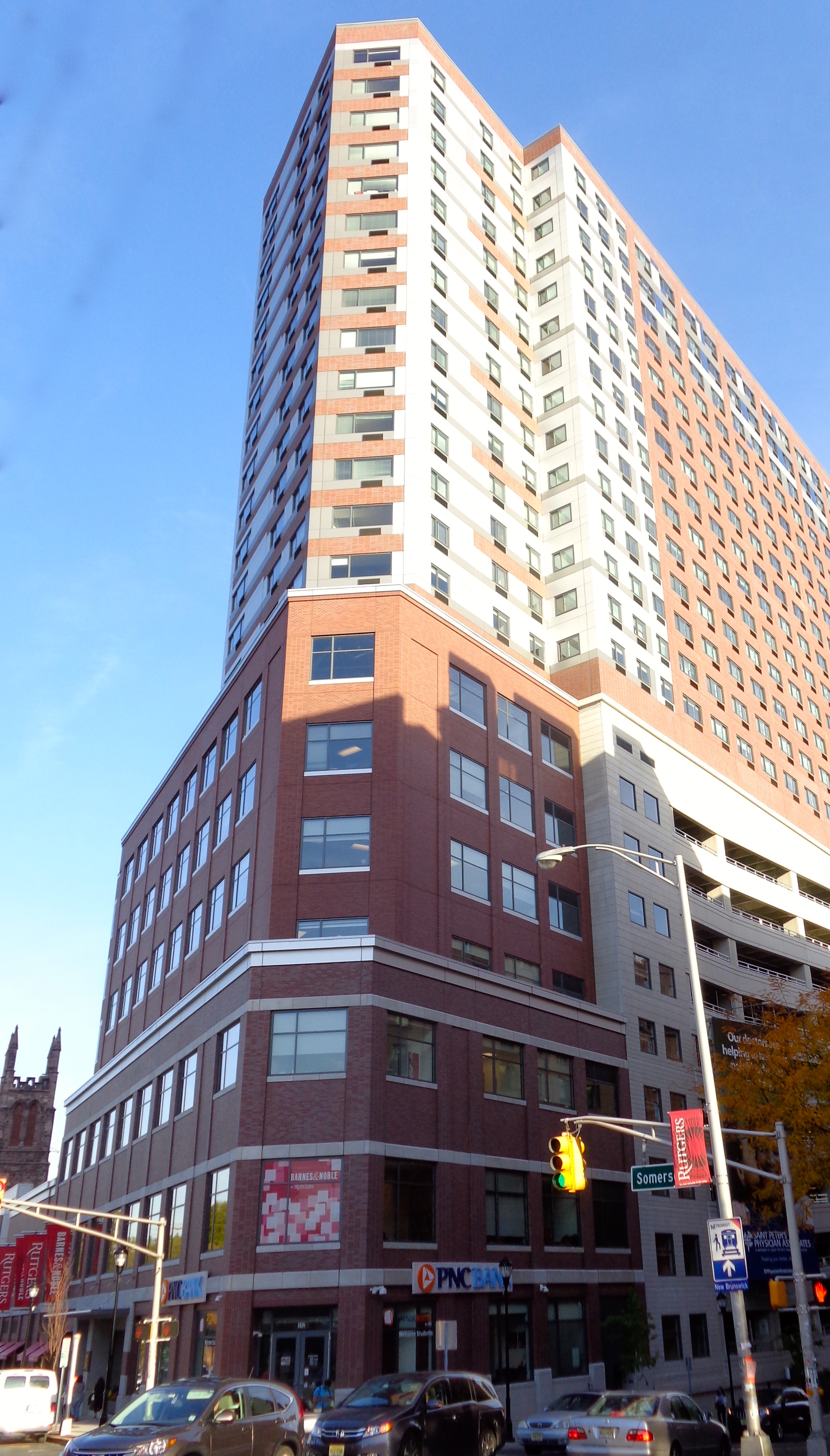
 The main campus of Rutgers University, New Jersey's flagship of higher education, in New Brunswick, a center for the sciences, arts, and cultural activities, and the county seat of Middlesex County | |
 Seal | |
| Nickname: The Greatest County in the Land[1] | |
 Location within the U.S. state of New Jersey | |
 New Jersey's location within the U.S. | |
| Coordinates: 40.44°N 74.41°W | |
| Country | |
| State | |
| Founded | 1683 |
| Named for | Historic English county of Middlesex |
| Seat | New Brunswick[2] |
| Largest city | Edison (population) Monroe Township (area) |
| Government | |
| • Commissioner director | Ronald G. Rios (D, term ends December 31, 2024) |
| Area | |
| • Total | 322.83 sq mi (836.1 km2) |
| • Land | 308.91 sq mi (800.1 km2) |
| • Water | 13.91 sq mi (36.0 km2) 4.31% |
| Population (2020) | |
| • Total | 863,162 (3rd in NJ) |
| • Density | 2,794.2/sq mi (1,078.8/km2) |
| Time zone | UTC−5 (Eastern) |
| • Summer (DST) | UTC−4 (EDT) |
| Congressional districts | 6th, 12th |
| Website | www |

The county is located in the middle of the Northeast megalopolis of the U.S. Its county seat is the city of New Brunswick, a center for the sciences, arts, and cultural activities, and the headquarters of the state's flagship academic institution, Rutgers University.[2] The center of population of the state of New Jersey is also located within Middlesex County, in East Brunswick, just east of the New Jersey Turnpike.[6] Middlesex County hosts an extensive transportation network, including several rail stations along the heavily traveled Northeast Corridor Line of the New Jersey Transit commuter rail system, as well as the intersection of the New Jersey Turnpike and the Garden State Parkway, the state's two busiest motor vehicle roadways, in Woodbridge Township. Middlesex County holds the nickname, The Greatest County in the Land.[1] The county is located in the Central Jersey region.
The county was primarily settled due to its optimal location along the Raritan River[7] and was established as of March 7, 1683 as part of the Province of East Jersey and was partitioned as of October 31, 1693 into the townships of Piscataway, Perth Amboy, and Woodbridge. Adjacent Somerset County was established on May 14, 1688, created from portions of Middlesex County.[8] The county's first court met in June 1683 in Piscataway, and held session at alternating sites over the next century in Perth Amboy, Piscataway, and Woodbridge before relocating permanently to New Brunswick in 1778.[9] Despite its status as a residential, commercial, and industrial stronghold and a centrally accessible transportation hub, Middlesex is also home to an extensive public park system with expansive greenways, totaling more than 6,300 acres (2,500 ha).[10] Middlesex County is most demographically notable as the U.S. county with the highest concentration of Asian Indians, at nearly 20% in 2020, spanning the county's boundaries between Little India, Edison/Iselin in the north and Monroe Township at its southern tip.
Geography and climate
Middlesex has a hot-summer humid continental climate (Dfa) which borders a humid subtropical climate (Cfa) on Raritan Bay and Arthur Kill. Average monthly temperatures in downtown New Brunswick range from 31.7 °F in January to 75.6 °F in July, while in South Amboy they range from 32.3 °F in January to 75.9 °F in July. In recent years, average temperatures in the county seat of New Brunswick have ranged from a low of 22 °F (−6 °C) in January to a high of 86 °F (30 °C) in July, although a record low of −13 °F (−25 °C) was recorded in January 1984 and a record high of 103 °F (39 °C) was recorded in July 1999. Average monthly precipitation ranged from 2.98 inches (76 mm) in February to 5.08 inches (129 mm) in July.[11]
According to the 2010 Census, the county had a total area of 322.83 square miles (836.1 km2), including 308.91 square miles (800.1 km2) of land (95.7%) and 13.91 square miles (36.0 km2) of water (4.3%).[12] The county is named after the historic English county of Middlesex.[13]
Bisected by the Raritan River, the county is topographically typical of Central Jersey in that it is largely flat. The majority of the county is located on the inner coastal plain, with the remainder of the county being located on the Eastern Piedmont. The elevation ranges from sea level to 300 feet (91 m) above sea level on a hill scaled by Major Road/ Sand Hill Road near Route 1 in South Brunswick Township.[14]
Places adjacent to Middlesex County, New Jersey | ||||||||||||||||
|---|---|---|---|---|---|---|---|---|---|---|---|---|---|---|---|---|
| ||||||||||||||||
| New Brunswick, New Jersey | ||||||||||||||||||||||||||||||||||||||||||||||||||||||||||||
|---|---|---|---|---|---|---|---|---|---|---|---|---|---|---|---|---|---|---|---|---|---|---|---|---|---|---|---|---|---|---|---|---|---|---|---|---|---|---|---|---|---|---|---|---|---|---|---|---|---|---|---|---|---|---|---|---|---|---|---|---|
| Climate chart (explanation) | ||||||||||||||||||||||||||||||||||||||||||||||||||||||||||||
| ||||||||||||||||||||||||||||||||||||||||||||||||||||||||||||
| ||||||||||||||||||||||||||||||||||||||||||||||||||||||||||||
Demographics

| Historical population | |||
|---|---|---|---|
| Census | Pop. | %± | |
| 1790 | 15,956 | — | |
| 1800 | 17,890 | 12.1% | |
| 1810 | 20,381 | 13.9% | |
| 1820 | 21,470 | 5.3% | |
| 1830 | 23,157 | 7.9% | |
| 1840 | 21,893 | * | −5.5% |
| 1850 | 28,635 | 30.8% | |
| 1860 | 34,812 | 21.6% | |
| 1870 | 45,029 | 29.3% | |
| 1880 | 52,286 | 16.1% | |
| 1890 | 61,754 | 18.1% | |
| 1900 | 79,762 | 29.2% | |
| 1910 | 114,426 | 43.5% | |
| 1920 | 162,334 | 41.9% | |
| 1930 | 212,208 | 30.7% | |
| 1940 | 217,077 | 2.3% | |
| 1950 | 264,872 | 22.0% | |
| 1960 | 433,856 | 63.8% | |
| 1970 | 583,813 | 34.6% | |
| 1980 | 595,893 | 2.1% | |
| 1990 | 671,780 | 12.7% | |
| 2000 | 750,162 | 11.7% | |
| 2010 | 809,858 | 8.0% | |
| 2020 | 863,162 | 6.6% | |
| Historical sources: 1790-1990[15] 1970-2010[16] 2020[3] * = Lost territory in previous decade.[8] | |||
Asian community
Middlesex County is prominently known for its significant concentration of Asian Indians. The growing Little India is a South Asian-focused commercial strip in Middlesex County, the U.S. county with the highest concentration of Asian Indians.[17][18][19] The Oak Tree Road strip runs for about one-and-a-half miles through Edison and neighboring Iselin in Woodbridge Township, near the area's sprawling Chinatown and Koreatown, running along New Jersey Route 27.[20] It is the largest and most diverse South Asian cultural hub in the United States.[21][22] Monroe Township in Middlesex County has experienced a particularly rapid growth rate in its Indian American population, with an estimated 5,943 (13.6%) as of 2017,[23] which was 23 times the 256 (0.9%) counted as of the 2000 Census; and Diwali is celebrated by the township as a Hindu holiday. Carteret's Punjabi Sikh community, variously estimated at upwards of 3,000, is the largest concentration of Sikhs in New Jersey.[24] In Middlesex County, election ballots are printed in English, Spanish, Gujarati, Hindi, and Punjabi.[25]
As of 2017 Census estimates, there were 201,243 people of Asian descent in Middlesex County accounting for 24% of the county's total population.[26] At 61.57% of the population of Asian descent, Indian Americans accounted for 12.93% (104,705 people) of the county's total population in 2010, increasing to 127,875 (15.3%, the highest of any U.S. county) by 2017, more than that of the other Asian sub-groups combined.[26][27]
2020 Census
As of the Census of 2020, the county had 863,162 people, 285,906 households, and 209,808 families. The population density was 2,794 inhabitants per square mile (1,078.8/km2). There were 315,521 housing units at an average density of 1,021.4 per square mile (394.4/km2). The county's racial makeup was 41.9% White, 9.8% African American, 0.53% Native American, 26.5% Asian, and 9.06% from two or more races. Hispanic or Latino of any race were 22.4% of the population.
There were 285,906 households, of which 34.6% had children under the age of 18 living with them, 56.9% were married couples living together, 24.2% had a female householder with no husband present, 14.2% had a male householder with no wife present and 26.6% were non-families. 14.8% of all households were made up of individuals, and 10.8% had someone living alone who was 65 years of age or older. The average household size was 2.80 and the average family size was 3.32.
About 21.6% of the county's population was under age 18, 9.3% was from age 18 to 24, 40.1% was from age 15 to 44, and 15.5% was age 65 or older. The median age was 39.3 years. The gender makeup of the county was 49.4% male and 50.5% female. For every 100 females, there were 97.8 males.
The county's median household income was $93,418, and the median family income was $107,149. About 8.8% of the population were below the poverty line, including 11.1% of those under age 18 and 8.8% of those age 65 or over.[28]
2010 Census

The 2010 United States census counted 809,858 people, 281,186 households, and 203,016 families in the county. The population density was 2,621.6 per square mile (1,012.2/km2). There were 294,800 housing units at an average density of 954.3 per square mile (368.5/km2). The racial makeup was 58.60% (474,589) White, 9.69% (78,462) Black or African American, 0.34% (2,777) Native American, 21.40% (173,293) Asian, 0.03% (251) Pacific Islander, 6.99% (56,569) from other races, and 2.95% (23,917) from two or more races. Hispanic or Latino of any race were 18.40% (148,975) of the population.[5]
Of the 281,186 households, 34.4% had children under the age of 18; 55.9% were married couples living together; 11.8% had a female householder with no husband present and 27.8% were non-families. Of all households, 22.5% were made up of individuals and 8.9% had someone living alone who was 65 years of age or older. The average household size was 2.8 and the average family size was 3.29.[5]
22.9% of the population were under the age of 18, 10.2% from 18 to 24, 28.3% from 25 to 44, 26.3% from 45 to 64, and 12.3% who were 65 years of age or older. The median age was 37.2 years. For every 100 females, the population had 96.4 males. For every 100 females ages 18 and older there were 94 males.[5]
Government
County government
Middlesex County is governed by a Board of Commissioners, which is comprised of seven members who are elected at-large on a partisan basis to serve three-year terms of office on a staggered basis, with either two or three seats coming up for election each year as part of the November general election. At an annual reorganization meeting held in January, the board selects from among its members a Commissioner Director and deputy director. The Commissioner Director appoints commissioners to serve as chairpersons and members on the various committees which oversee county departments.[29] Middlesex County also elects three "constitutional officers" whose existence is laid out in the New Jersey Constitution. The County Clerk and Surrogate serve five-year terms and the Sheriff serves a three-year term of office.[30][31][32] In 2016, freeholders were paid $23,438 and the freeholder director was paid an annual salary of $24,428, though Ronald Rios has accepted a salary of $8,340 as director.[33]
As of 2022[update], Middlesex County's Commissioners (with terms for director and deputy ending every December 31st) are:[29][34][35]
| Commissioner | Party, Residence, Term |
|---|---|
| Director Ronald G. Rios | D, Carteret, 2024[36] |
| Deputy Director Shanti Narra | D, North Brunswick, 2024[37] |
| Claribel A. "Clary" Azcona-Barber | D, New Brunswick, 2022[38] |
| Charles Kenny | D, Woodbridge Township, 2022[39] |
| Leslie Koppel | D, Monroe Township, 2024[40] |
| Chanelle Scott McCullum | D, Piscataway, 2022[41] |
| Charles E. Tomaro | D, Edison, 2023[42] |
Article VII Section II of the New Jersey State Constitution requires each county in New Jersey have three elected administrative officials known as "constitutional officers." These officers are the County Clerk and County Surrogate (both elected for five-year terms of office) and the County Sheriff (elected for a three-year term).[43] Middlesex county's constitutional officers are:[34][44]
| Title | Representative |
|---|---|
| County Clerk | Nancy Pinkin (D, East Brunswick, 2025)[45][46] |
| Sheriff | Mildred S. Scott (D, Piscataway, 2022)[47][48] |
| Surrogate | Claribel Cortes (D, North Brunswick, 2026)[49][50] |
The Middlesex County Prosecutor is Chris Kubereit who was sworn in as acting County Prosecutor in September 2019, replacing Andrew C. Carey of Monroe Township.[51][52] Middlesex County constitutes Vicinage 8 of the New Jersey Superior Court; the vicinage is seated at the Middlesex County Courthouse, at 56 Paterson Street in New Brunswick.[53] The Middlesex Vicinage also has facilities for the Family Part at the Middlesex County Family Courthouse at 120 New Street, also in New Brunswick; there are also other facilities in New Brunswick and Perth Amboy for Probation.[53] The Assignment Judge for Vicinage 8 is Alberto Rivas.[53]
Federal Representatives
The 6th and 12th Congressional Districts cover the county.[54][55]
For the 117th United States Congress, New Jersey's Sixth Congressional District is represented by Frank Pallone (D, Long Branch).[56][57]
For the 117th United States Congress, New Jersey's Twelfth Congressional District is represented by Bonnie Watson Coleman (D, Ewing Township).[58][59]
State Representatives
| District | Senator[60] | Assembly[60] | Municipalities |
|---|---|---|---|
| 12th | Samuel D. Thompson (R) | Ronald S. Dancer (R)
Robert D. Clifton (R) |
Old Bridge (65,898). The remainder of this district covers portions of Burlington County, |
| 14th | Linda R. Greenstein (D) | Wayne DeAngelo (D)
Daniel R. Benson (D) |
Cranbury Township (4,012), Jamesburg (5,291), Monroe Township (39,132), Plainsboro (23,071)
and Spotswood (8,269). The remainder of this district covers portions of Mercer County. |
| 16th | Andrew Zwicker (D) | Sadaf F. Jaffer (D)
Roy Freiman (D) |
South Brunswick (45,942). The remainder of this district covers portions of Hunterdon County,
Mercer County and Somerset County. |
| 17th | Bob Smith (D) | Joseph V. Egan (D)
Joseph Danielsen (D) |
Milltown Borough (6,988), New Brunswick (55,960), North Brunswick (41,848) and Piscataway (56,923).
The remainder of this district covers portions of Somerset County. |
| 18th | Patrick J. Diegnan (D) | Robert Karabinchak (D)
Sterley Stanley (D) |
East Brunswick (48,010), Edison (100,693), Helmetta (2,475), Highland Park (13,883), Metuchen (14,048),
South Plainfield (23,956) and South River (16,001). |
| 19th | Joe F. Vitale (D) | Craig Coughlin (D)
Yvonne Lopez (D) |
Carteret (23,589), Perth Amboy (51,678), Sayreville (44,292), South Amboy (8,772) and Woodbridge (100,450). |
| 22nd | Nicholas Scutari (D) | James J. Kennedy (D)
Linda S. Carter (D) |
Dunellen (7,252) and Middlesex Borough (13,662). The remainder of this district covers portions of Somerset County
and Union County. |
Sheriffs
Thomas N. Acken served as the sheriff in 1891. Joseph Spicuzzo served in 2014 and was arrested for bribery.[61] Mildred S. Scott is the current county sheriff, she was sworn in on January 1, 2011, as the first female sheriff of Middlesex County and the first African-American sheriff in the state of New Jersey.[62]
Politics
As of August 1, 2020, there were a total of 545,795 registered voters in Middlesex County, of which 229,982 (42.1%) were registered as Democrats, 84,258 (15.4%) were registered as Republicans and 224,058 (41.1%) were registered as Unaffiliated. There were 7,497 (1.4%) voters registered to other parties.[63] After being a Republican stronghold in the late 19th and early 20th centuries, Middlesex County leaned Democratic for much of the 20th century beginning with Franklin Roosevelt's victory in the county in 1932. Throughout the twentieth century, in close elections, the county would always vote Democratic, sometimes by solid margins, but the county was willing to flip Republican in the midst of nationwide Republican landslides in the 1970s and 1980s. However, since the 1990s, Middlesex County has become a Democratic stronghold at the national level.
In 2008, Barack Obama carried Middlesex County by a much larger 21.8% margin over John McCain, Obama taking 60.2% of the vote to McCain's 38.4%, while Obama won New Jersey overall by 15.5% over McCain.[64] In 2012, Obama won an even more commanding victory in the county, receiving 63.2% of the vote to Republican Mitt Romney's 35.6%, a Democratic victory margin of 27.6%, while carrying New Jersey overall by 17.8%.[65] Like much of the New York City metropolitan area, Middlesex County was one of the few parts of the country to swing even harder in Obama's favor in 2012 compared to 2008, even as he lost ground nationally. Some credit the swing towards Obama to his response towards Superstorm Sandy, which hit the New York City metro area in late October 2012, just a few days before the election.[66] In 2016, Democrat Hillary Clinton carried Middlesex County by a tighter 21.4% margin over Republican Donald Trump, while Clinton won New Jersey overall by 14.1% over Trump. In 2020, Democrat Joe Biden carried Middlesex County by a margin of 22.03%, a slight improvement from 2016, with Biden taking 60.22% of the vote to Donald Trump's 38.19%.[67]
| Year | Republican | Democratic | Third party | |||
|---|---|---|---|---|---|---|
| No. | % | No. | % | No. | % | |
| 2020 | 143,467 | 38.19% | 226,250 | 60.22% | 5,975 | 1.59% |
| 2016 | 122,953 | 37.42% | 193,044 | 58.76% | 12,560 | 3.82% |
| 2012 | 107,310 | 35.55% | 190,555 | 63.13% | 3,995 | 1.32% |
| 2008 | 123,695 | 38.43% | 193,812 | 60.21% | 4,367 | 1.36% |
| 2004 | 126,492 | 42.76% | 166,628 | 56.33% | 2,685 | 0.91% |
| 2000 | 93,545 | 36.14% | 154,998 | 59.88% | 10,306 | 3.98% |
| 1996 | 82,433 | 31.90% | 145,201 | 56.20% | 30,752 | 11.90% |
| 1992 | 108,701 | 38.10% | 128,824 | 45.16% | 47,746 | 16.74% |
| 1988 | 143,422 | 54.30% | 117,149 | 44.35% | 3,548 | 1.34% |
| 1984 | 160,221 | 59.82% | 104,905 | 39.17% | 2,727 | 1.02% |
| 1980 | 122,354 | 50.73% | 97,304 | 40.34% | 21,548 | 8.93% |
| 1976 | 113,539 | 47.14% | 122,859 | 51.01% | 4,466 | 1.85% |
| 1972 | 149,033 | 61.41% | 88,397 | 36.42% | 5,264 | 2.17% |
| 1968 | 96,515 | 42.79% | 103,339 | 45.82% | 25,676 | 11.38% |
| 1964 | 63,370 | 29.39% | 151,196 | 70.12% | 1,052 | 0.49% |
| 1960 | 83,025 | 41.60% | 116,095 | 58.18% | 436 | 0.22% |
| 1956 | 100,071 | 60.54% | 64,538 | 39.05% | 677 | 0.41% |
| 1952 | 73,577 | 50.32% | 70,234 | 48.03% | 2,413 | 1.65% |
| 1948 | 49,810 | 42.86% | 61,634 | 53.04% | 4,766 | 4.10% |
| 1944 | 45,232 | 42.12% | 60,504 | 56.35% | 1,642 | 1.53% |
| 1940 | 41,709 | 38.26% | 67,140 | 61.59% | 164 | 0.15% |
| 1936 | 32,959 | 34.57% | 61,679 | 64.69% | 702 | 0.74% |
| 1932 | 32,673 | 40.45% | 45,997 | 56.94% | 2,111 | 2.61% |
| 1928 | 38,714 | 52.35% | 34,908 | 47.20% | 328 | 0.44% |
| 1924 | 34,556 | 62.28% | 16,373 | 29.51% | 4,553 | 8.21% |
| 1920 | 29,334 | 69.70% | 11,618 | 27.60% | 1,136 | 2.70% |
| 1916 | 11,851 | 53.51% | 9,975 | 45.04% | 320 | 1.44% |
| 1912 | 4,743 | 25.78% | 8,186 | 44.49% | 5,470 | 29.73% |
| 1908 | 11,270 | 57.51% | 7,966 | 40.65% | 359 | 1.83% |
| 1904 | 10,117 | 57.22% | 6,996 | 39.57% | 569 | 3.22% |
| 1900 | 9,347 | 55.19% | 7,191 | 42.46% | 399 | 2.36% |
| 1896 | 9,304 | 58.73% | 5,976 | 37.72% | 563 | 3.55% |
In the 2009 Gubernatorial Election, Republican Chris Christie received 47% of the vote, defeating incumbent Democrat Corzine, who received around 45%.[69] In the 2013 Gubernatorial Election, incumbent governor Chris Christie improved on his margin in Middlesex County from 2009, carrying the county by about 18% over Democrat Barbara Buono, with Christie receiving 58% of the vote to Buono's 40%.[70] In the 2017 Gubernatorial Election, Democrat Phil Murphy won Middlesex County with a wide 17% margin over Republican Kim Guadagno, with Murphy getting 57% of the vote to Guadagno's 40% of the vote.[71] In the 2021 gubernatorial election, Republican Jack Ciattarelli received 43.4% of the vote (90,297 ballots cast) to Democrat Phil Murphy's 55.9% (8116,352 votes).
Transportation
Middlesex County hosts various county roads, state routes, US routes, and interstate highways, as well as toll highways. As of May 2010[update], the county had a total of 2,584.38 miles (4,159.16 km) of roadways, of which 2,118.08 miles (3,408.72 km) were maintained by the municipality, 292.16 miles (470.19 km) by Middlesex County and 131.48 miles (211.60 km) by the New Jersey Department of Transportation, 41.49 miles (66.77 km) by the New Jersey Turnpike Authority and 1.17 miles (1.88 km) by the Port Authority of New York and New Jersey.[72][73]
County roads include CR 501, CR 514, CR 516 (only in Old Bridge), CR 520 (only in Old Bridge), CR 522, CR 527, CR 529, CR 531, CR 535, and CR 539 (only in Cranbury).

The state routes are: Route 18, Route 26 (only in North Brunswick – entirely concurrent with Livingston Avenue), Route 27, Route 28, Route 32, Route 33 (only in Monroe Township), Route 34 (only in Old Bridge), Route 35, Route 91 (concurrent with Jersey Avenue in North Brunswick and entering New Brunswick), Route 171, Route 172 (only in New Brunswick), Route 184 and Route 440.
U.S. Routes include: Route 1, Route 9, Route 1/9 (only in Woodbridge) and Route 130.
The county also includes some limited access highways and Interstates as well. Middlesex County hosts the southern end of I-287 which turns into Route 440 that connects to the Outerbridge Crossing. The Garden State Parkway passes through the eastern part of the county, which features nine interchanges and the northern start/end of the split-roadways (Express & Local Lanes). The New Jersey Turnpike carries I-95 through the center of the county. The Turnpike has five interchanges in Middlesex County: Exit 12 in Carteret, Exit 11 in Woodbridge, Exit 10 in Edison, Exit 9 in East Brunswick and Exit 8A in Monroe Township.[74]
The New Jersey Department of Transportation is upgrading the Route 18 "avenue" to a freeway between the Route 1 interchange all the way up to the new 18 Extension in Piscataway.[75]
The Turnpike Authority planned to build Route 92, which was to start near the intersection of Ridge Road & Route 1 in South Brunswick to Interchange 8A in Monroe Township. This plan was cancelled on December 1, 2006.
The southern end of the "dual-dual" configuration (inner car lanes and outer truck lanes) used to be one mile south of Interchange 8A at the border of Cranbury and Monroe Township. It was relocated to Exit 6 in Mansfield Township in Burlington County after the Turnpike widening project was completed in early November 2014.[76]
Public transportation
NJ Transit provides Middlesex County with frequent commuter rail service along the North Jersey Coast Line,[77] Northeast Corridor Line,[78] and Raritan Valley Line.[79] The North Jersey Coast Line runs through the eastern part of the county. The Northeast Corridor Line runs through the northern and central part of the county. The Raritan Valley Line serves Dunellen and is accessible to other communities along the county's northern border with Union and Somerset counties.
Intercity rail service is provided by Amtrak. The routes that run through Middlesex County are the Acela Express, Keystone, Northeast Regional, and Vermonter services, although only the Keystone and Northeast Regional have regular stops within Middlesex County, at either New Brunswick or Metropark station. The Acela service also occasionally stops at Metropark.
Bus service in Middlesex County is provided by New Jersey Transit, Coach USA's Suburban Transit, the extensive Rutgers Campus bus network,[80] the MCAT shuttle system,[81] and DASH buses.[82] There are bus routes that serve all townships in the county on weekdays,[83] and studies are being conducted to create the New Brunswick Bus Rapid Transit system.
Education
Higher education
- Middlesex County College (Edison - main campus; New Brunswick, Perth Amboy)[84]
- Rutgers University New Brunswick Campus (New Brunswick, Piscataway)[85]
- Rutgers Biomedical and Health Sciences (New Brunswick)[86]
- Princeton University – Forrestal Campus (Plainsboro)[87]
- DeVry University (North Brunswick)[88]
- Chamberlain University (North Brunswick)
- New Brunswick Theological Seminary (New Brunswick Campus)[89]
K-12 schools
School districts, all officially designated as K-12, include:[90]
- Carteret Borough School District
- Cranbury Township School District
- Dunellen Borough School District
- East Brunswick Township School District
- Edison Township School District
- Highland Park Borough School District
- Jamesburg Borough School District
- Metuchen Borough School District
- Middlesex Borough School District
- Milltown Borough School District
- Monroe Township School District
- New Brunswick City School District
- North Brunswick Township School District
- Old Bridge Township School District
- Perth Amboy City School District
- Piscataway Township School District
- Sayreville Borough School District
- South Amboy City School District
- South Brunswick Township School District
- South Plainfield Borough School District
- South River Borough School District
- Spotswood Borough School District
- West Windsor-Plainsboro Regional School District
- Woodbridge Township School District
Healthcare
The county offers more than 1,900 inpatient beds among five major hospitals.[91][92]
| Hospital | Town | Type | Beds | Health Network |
|---|---|---|---|---|
| JFK Medical Center | Edison | Acute | 498[93] | Hackensack Meridian Health |
| PSE&G Children's Specialized Hospital | New Brunswick | Pediatric Rehabiltation | 140[94] | RWJBarnabas Health |
| Raritan Bay Medical Center (Old Bridge) | Old Bridge | Acute | 113[95] | Hackensack Meridian Health |
| Raritan Bay Medical Center (Perth Amboy) | Perth Amboy | Acute | 388[95] | Hackensack Meridian Health |
| Robert Wood Johnson University Hospital | New Brunswick | Major Teaching | 465[96] | RWJBarnabas Health |
| The Bristol-Myers Squibb Children's Hospital | New Brunswick | Acute Pediatric | 105[97] | RWJBarnabas Health |
| Rutgers Cancer Institute of New Jersey | New Brunswick | Research, Cancer | RWJBarnabas Health | |
| St. Peter's University Hospital | New Brunswick | Acute Teaching | 478[98] | Saint Peters HCS |
| Penn Medicine Princeton Medical Center | Plainsboro | Acute Teaching | 305[99] | Penn Medicine |
Economy
Major non-governmental employers in Middlesex County include the following, grouped by ranges of employees:[100][101]
- 9,010: Rutgers University
- 5,000 – 5,249: Robert Wood Johnson University Hospital
- 3,500 – 3,749: Bristol-Myers Squibb, Wakefern Food Corporation
- 3,000 – 3,249: Merrill Lynch & Company, Novo Nordisk
- 2,750 – 2,999: Johnson & Johnson, Prudential Insurance Company, Silverline Building Products, St. Peter's University Hospital, Telcordia Technologies
- 2,500 – 2,749: JFK Medical Center, Raritan Bay Medical Center
- 2,000 – 2,249: Pathmark
- 1,750 – 1,999: Home Depot, United Parcel Service
- 1,500 – 1,749: Amerada Hess Corporation, Dow Jones & Company, Siemens AG
- 1,250 – 1,499: AT&T, BASF (formerly Engelhard)
- 1,000 – 1,249: Aetna, Fujitsu, Prudential
- Undisclosed: Canon, Japanese company specializing in imaging products.
Municipalities


The 25 municipalities in Middlesex County (with 2010 Census data for population, housing units and area in square miles) are:[102] Other, unincorporated communities in the county are listed next to their parent municipality. Many of these areas are census-designated places that have been defined by the United States Census Bureau for enumeration purposes within a Township and for which 2010 population data is included in parentheses.
| Municipality | Map key |
Municipal type |
Population | Housing units |
Total area |
Water area |
Land area |
Pop. density |
Housing density |
Unincorporated communities |
|---|---|---|---|---|---|---|---|---|---|---|
| Carteret | 1 | Borough | 22,844 | 8,148 | 5.00 | 0.58 | 4.42 | 5,171.1 | 1,844.4 | Chrome West Carteret |
| Cranbury | 24 | Township | 3,857 | 1,371 | 13.40 | 0.15 | 13.25 | 291.2 | 103.5 | Cranbury CDP (2,181) Cranbury Station Wyckoffs Mills |
| Dunellen | 14 | Borough | 7,227 | 2,683 | 1.05 | 0.00 | 1.05 | 6,894.8 | 2,559.7 | |
| East Brunswick | 20 | Township | 47,512 | 17,367 | 22.27 | 0.57 | 21.70 | 2,189.6 | 800.4 | Brookview Dunhams Corner Fairview Knolls Farrington Lake Heights Gillilandtown Halls Corner Herberts Jamesburg Park Lawrence Brook Manor Newton Heights Old Bridge Orchard Heights Patricks Corner Paulas Corner Tanners Corner Washington Heights Westons Mills |
| Edison | 17 | Township | 99,967 | 36,302 | 30.64 | 0.70 | 29.94 | 3,339.0 | 1,212.5 | Bonhamtown Clara Barton Greensand Haven Homes Lahiere Lincoln Park Lindenau Martins Landing Menlo Park New Dover New Durham Nixon North Edison Oak Tree Phoenix Potters Pumptown Raritan Manor Sand Hills Stelton Valentine Washington Park |
| Helmetta | 7 | Borough | 2,178 | 920 | 0.91 | 0.06 | 0.85 | 2,562.9 | 1,082.6 | |
| Highland Park | 11 | Borough | 13,982 | 6,203 | 1.82 | 0.01 | 1.81 | 7,728.1 | 3,428.5 | |
| Jamesburg | 8 | Borough | 5,915 | 2,267 | 0.88 | 0.01 | 0.88 | 6,741.8 | 2,583.9 | |
| Metuchen | 12 | Borough | 13,574 | 5,440 | 2.77 | 0.00 | 2.76 | 4,910.4 | 1,967.9 | Jefferson Park Robinvale |
| Middlesex | 15 | Borough | 13,635 | 5,148 | 3.54 | 0.02 | 3.52 | 3,876.2 | 1,463.5 | |
| Milltown | 9 | Borough | 6,893 | 2,698 | 1.60 | 0.04 | 1.55 | 4,443.0 | 1,739.0 | |
| Monroe Township | 23 | Township | 39,132 | 18,002 | 42.23 | 0.26 | 41.97 | 932.3 | 428.9 | Applegarth Clearbrook Clearbrook Park CDP (2,667) Concordia CDP (3,092) Gravel Hill Half Acre Hoffman Jamesburg Gardens Matchaponix Middlesex Downs Mounts Mills Old Church Outcalt Prospect Plains Rossmoor CDP (2,666) Shore Road Estates Spotswood Manor Texas Tracy Union Valley Whittingham CDP (2,476) Wyckoffs Mills |
| New Brunswick | 10 | City | 55,181 | 15,053 | 5.79 | 0.56 | 5.23 | 10,556.4 | 2,879.7 | Edgebrook Feaster Park Lincoln Park Raritan Gardens Westons Mills |
| North Brunswick | 21 | Township | 40,742 | 15,045 | 12.27 | 0.27 | 12.00 | 3,396.2 | 1,254.1 | Adams Berdines Corner Black Horse Franklin Park Georges Road Maple Meade Patricks Corner Red Lion |
| Old Bridge | 19 | Township | 65,375 | 24,638 | 40.78 | 2.72 | 38.06 | 1,717.7 | 647.3 | Browntown Brownville CDP (2,383) Brunswick Gardens Cheesequake Cottrell Corners Laurence Harbor CDP (6,536) Madison Park CDP (7,144) Matchaponix Moerls Corner Morristown Old Bridge CDP (23,753) Parlin Redshaw Corner Runyon Sayerwood South South Old Bridge Texas |
| Perth Amboy | 2 | City | 50,814 | 16,556 | 5.96 | 1.26 | 4.70 | 10,806.8 | 3,521.0 | Barber Harbor Terrace John J Delaney Homes Maurer William Dunlap Homes |
| Piscataway | 16 | Township | 56,044 | 17,777 | 19.03 | 0.19 | 18.83 | 2,975.5 | 943.8 | Fieldville New Market Newtown North Stelton Possumtown Randolphville Raritan Landing Riverview Manor Society Hill CDP (3,829) |
| Plainsboro | 25 | Township | 22,999 | 10,089 | 12.21 | 0.42 | 11.78 | 1,951.6 | 856.1 |
Plainsboro Center CDP (2,712) |
| Sayreville | 4 | Borough | 42,704 | 16,393 | 18.70 | 2.86 | 15.84 | 2,695.7 | 1,034.8 | Crossmans Ernston Gillespie Laurel Park MacArthur Manor Melrose Morgan Morgan Heights Parlin Phoenix Runyon Sayre Woods Sayreville Junction Sayreville Station |
| South Amboy | 3 | City | 8,631 | 3,576 | 2.69 | 1.15 | 1.55 | 5,577.1 | 2,310.7 | Mechanicsville Thomas J Dohany Homes |
| South Brunswick | 22 | Township | 43,417 | 15,708 | 41.04 | 0.39 | 40.65 | 1,068.1 | 386.4 | Cottageville Dayton CDP (7,063) Deans Franklin Park Fresh Ponds Heathcote CDP (5,821) Kendall Park CDP (9,339) Kingston CDP (1,222) Little Rocky Hill Monmouth Junction CDP (2,887) Sand Hills South Brunswick Terrace |
| South Plainfield | 13 | Borough | 23,385 | 8,093 | 8.36 | 0.03 | 8.33 | 2,808.5 | 971.9 | Avon Park Samptown |
| South River | 5 | Borough | 16,008 | 5,957 | 2.92 | 0.15 | 2.77 | 5,781.4 | 2,151.4 | Newton Heights |
| Spotswood | 6 | Borough | 8,257 | 3,242 | 2.47 | 0.20 | 2.27 | 3,642.2 | 1,430.1 | East Spotswood Outcalt |
| Woodbridge | 18 | Township | 99,585 | 36,124 | 24.51 | 1.29 | 23.21 | 4,290.0 | 1,556.2 | Avenel CDP (17,011) Boynton Beach Colonia CDP (17,795) Edgars Fords CDP (15,187) Hazelton Hopelawn Iselin CDP (18,695) Keasbey Lynn Woodoaks Menlo Park Terrace Port Reading CDP (3,728) Sand Hills Sewaren CDP (2,756) Shore View Woodbridge CDP (19,265) Woodbridge Oaks |
Parks and recreation

- Donaldson Park
- Carteret Park
- Carteret Waterfront Park
- Edison Park
- Fords Park
- Johnson Park
- Medwick Park
- Merrill Park
- Raritan Bay Waterfront Park
- Roosevelt Park
- Spring Lake Park
- Thompson Park
- Warren Park
- Old Bridge Waterfront Walkway
- Alvin P. Williams Memorial Park
- Ambrose & Doty's Brooks Park
- Davidson's Mill Pond Park
- Ireland Brook Park
- Jamesburg Park Conservation Area
- John A. Phillips Open Space Preserve
- John A. Phillips Park
- Catherine Von Ohlen Park
See also
- Little India (Middlesex County, New Jersey)
- National Register of Historic Places listings in Middlesex County, New Jersey
References
- Middlesex County The Greatest County in the Land Archived 2016-10-28 at the Wayback Machine, County of Middlesex, New Jersey. Accessed October 27, 2016.
- New Jersey County Map Archived 2017-03-13 at the Wayback Machine, New Jersey Department of State. Accessed July 10, 2017.
- QuickFacts Middlesex County, New Jersey, United States Census Bureau. Accessed June 19, 2022.
- Annual and Cumulative Estimates of Resident Population Change for Counties in New Jersey and County Rankings: April 1, 2020 to July 1, 2021, United States Census Bureau. Accessed June 1, 2022.
- DP1 - Profile of General Population and Housing Characteristics: 2010 Demographic Profile Data for Middlesex County, New Jersey, United States Census Bureau. Accessed January 22, 2013.
- Population and Population Centers by State: 2000 Archived 2001-12-12 at the Wayback Machine, United States Census Bureau. Accessed July 5, 2011. (see map of location)
- History Archived 2016-10-17 at the Wayback Machine, Middlesex County, NJ. Accessed March 24, 2018.
- Snyder, John P. The Story of New Jersey's Civil Boundaries: 1606-1968 Archived 2012-06-05 at the Wayback Machine, Bureau of Geology and Topography; Trenton, New Jersey; 1969. p. 161. Accessed October 1, 2013.
- History of the Grand Jury Archived 2013-10-04 at the Wayback Machine, Middlesex County, New Jersey. Accessed October 1, 2013. "By June 19, 1683, the first County Court was held at Piscataway. It sat alternately in Piscataway and Woodbridge until 1688 when Perth Amboy was added as one of the three alternate sites. In 1778, New Brunswick became the most prime town in the county and at that time the Middlesex County Courts were transferred there."
- "At a Glance - Middlesex County, the Greatest County in the Land!". Archived from the original on November 18, 2016. Retrieved December 3, 2016.
- Monthly Averages for New Brunswick, New Jersey Archived 2013-07-08 at the Wayback Machine, The Weather Channel. Accessed October 13, 2012.
- Census 2010 U.S. Gazetteer Files: New Jersey Counties Archived 2015-05-18 at the Wayback Machine, United States Census Bureau. Accessed May 10, 2015.
- Kane, Joseph Nathan; and Aiken, Charles Curry. The American Counties: Origins of County Names, Dates of Creation, and Population Data, 1950-2000, p. 202. Scarecrow Press, 2005. ISBN 0810850362. Accessed January 22, 2013.
- New Jersey County High Points Archived 2015-05-18 at the Wayback Machine, Peakbagger.com. Accessed October 5, 2013.
- Forstall, Richard L. Population of states and counties of the United States: 1790 to 1990 from the Twenty-one Decennial Censuses, pp. 108-109. United States Census Bureau, March 1996. ISBN 9780934213486. Accessed October 3, 2013.
- New Jersey: 2010 - Population and Housing Unit Counts; 2010 Census of Population and Housing Archived 2013-07-23 at the Wayback Machine, p. 6, CPH-2-32. United States Census Bureau, August 2012. Accessed August 29, 2016.
- Genovese, Peter (November 16, 2012). "Big business in Little India: Commerce flourishes in vibrant ethnic neighborhood". nj.com.
- "Eat Street: Oak Tree Road, Iselin, N.J." SAVEUR. March 31, 2011.
- Joseph Berger. "A Place Where Indians, Now New Jerseyans, Thrive". The New York Times. Retrieved August 22, 2016.
- Shaftel, David (March 9, 2017). "Indo-Chinese Food Is Hard to Find, Except in New Jersey". The New York Times.
- King, Kate (September 25, 2017). "'Little India' Thrives in Central New Jersey". Wall Street Journal – via www.wsj.com.
- Burke, Monte. "How Indo-Americans Created The Ultimate Neighborhood Bank". Forbes.
- DP05: ACS DEMOGRAPHIC AND HOUSING ESTIMATES from the 2013-2017 American Community Survey 5-Year Estimates for Monroe township, Middlesex County, New Jersey Archived 2020-02-13 at archive.today, United States Census Bureau. Accessed February 11, 2019.
- Kevin Coyne. "Turbans Make Targets, Some Sikhs Find". The New York Times. Retrieved April 28, 2019.
- "State of New Jersey Department of State". State of New Jersey. Retrieved May 29, 2017.
- "ACS DEMOGRAPHIC AND HOUSING ESTIMATES 2013-2017 American Community Survey 5-Year Estimates". U.S. Census Bureau. Archived from the original on February 13, 2020. Retrieved February 15, 2017.
- Ensslin, John C.; and Sheingold, Dave. "Census: Asian Indians one of the fastest growing groups in North Jersey" Archived 2012-09-30 at the Wayback Machine, The Record (Bergen County), May 29, 2011. Accessed January 22, 2013. "Middlesex County has by far the largest Indian-American population, with about 104,705 people, followed by Hudson County, with 37,236, and Bergen County, with 24,973."
- "Middlesex County | Census Data". United States Census Bureau. 2020. Retrieved January 19, 2022.
{{cite web}}: CS1 maint: url-status (link) - Board of County Commissioners, Middlesex County, New Jersey. Accessed June 19, 2022. "County Commissioner is a term used by all 21 of New Jersey's counties to describe county legislators. The residents of Middlesex County's 25 municipalities elect seven persons at-large to staggered three-year terms in the November general election to serve as members of the Board of County Commissioners. Every January, the Board selects one County Commissioner to serve as Director and another to serve as Deputy Director and all County Commissioners serve as chairpersons and members of various committees to oversee County departments."
- History of the County Clerk's Office Archived 2013-08-26 at the Wayback Machine, Constitutional Officers Association of New Jersey. Accessed October 21, 2017.
- History of the County Sheriff's Office Archived 2013-08-26 at the Wayback Machine, Constitutional Officers Association of New Jersey. Accessed October 21, 2017.
- History of the Surrogate's Court Archived 2013-08-26 at the Wayback Machine, Constitutional Officers Association of New Jersey. Accessed October 21, 2017.
- Gallo Jr., Bill. "Which N.J. county freeholders are paid the most?" Archived 2017-10-26 at the Wayback Machine, NJ.com, March 11, 2016. Accessed October 25, 2017. "Freeholder director: $24,438 (Current Freeholder Director Don Rios has opted to take a salary of only $8,340.); Other freeholders: $23,438"
- Elected Officials, Middlesex County, New Jersey. Accessed June 19, 2022.
- 2022 County Data Sheet, Middlesex County, New Jersey. Accessed June 19, 2022.
- Ronald G. Rios, Middlesex County, New Jersey. Accessed June 19, 2022.
- Shanti Narra, Middlesex County, New Jersey. Accessed June 19, 2022.
- Claribel A. Azcona-Barber, Middlesex County, New Jersey. Accessed June 19, 2022.
- Charles Kenny, Middlesex County, New Jersey. Accessed June 19, 2022.
- Leslie Koppel, Middlesex County, New Jersey. Accessed June 19, 2022.
- Chanelle Scott McCullum, Middlesex County, New Jersey. Accessed June 19, 2022.
- Charles E. Tomaro, Middlesex County, New Jersey. Accessed June 19, 2022.
- New Jersey State Constitution (1947), Article VII, Section II, Paragraph 2, New Jersey Department of State. Accessed June 19, 2022.
- Constitutional Officers, Middlesex County, New Jersey. Accessed June 19, 2022.
- Nancy J. Pinkin, Middlesex County, New Jersey. Accessed June 19, 2022.
- Clerks, Constitutional Officers Association of New Jersey. Accessed June 19, 2022.
- Sheriff Mildred S. Scott, Middlesex County, New Jersey. Accessed June 19, 2022.
- Sheriffs, Constitutional Officers Association of New Jersey. Accessed June 19, 2022.
- Claribel Cortes, Middlesex County, New Jersey. Accessed June 19, 2022.
- Surrogates, Constitutional Officers Association of New Jersey. Accessed June 19, 2022.
- The Prosecutor's Office Archived 2017-10-29 at the Wayback Machine, Middlesex County, New Jersey. Accessed October 28, 2017.
- "Governor Chris Christie Files Nominations" Archived 2016-06-21 at the Wayback Machine, Governor of New Jersey Chris Christie, press release dated June 3, 2014. Accessed October 26, 2017. "Prosecutorial Nominations - Nominate for appointment Andrew C. Carey (Monroe Township, Middlesex)"
- Middlesex Vicinage Archived 2017-10-10 at the Wayback Machine, New Jersey Courts. Accessed October 21, 2017.
- 2012 Congressional Districts by County Archived 2012-05-26 at the Wayback Machine, New Jersey Department of State Division of Elections. Accessed October 6, 2013.
- Plan Components Report Archived 2013-12-04 at the Wayback Machine, New Jersey Department of State Division of Elections, December 23, 2011. Accessed October 6, 2013.
- Directory of Representatives: New Jersey, United States House of Representatives. Accessed January 3, 2019.
- Biography, Congressman Frank Pallone Jr. Accessed January 3, 2019. "Frank Pallone, Jr., was born in Long Branch, New Jersey, where he grew up and still resides."
- Directory of Representatives: New Jersey, United States House of Representatives. Accessed January 3, 2019.
- Biography, Congresswoman Bonnie Watson Coleman. Accessed January 3, 2019. "Watson Coleman and her husband William reside in Ewing Township and are blessed to have three sons; William, Troy, and Jared and three grandchildren; William, Kamryn and Ashanee."
- "New Jersey Legislature - Legislative Roster". www.njleg.state.nj.us. Retrieved May 11, 2021.
- "How A Crooked Former Sheriff Persuaded The State To Let Him Out Of Prison". NJ.com. February 1, 2016. Archived from the original on February 4, 2018. Retrieved February 3, 2018.
- Strunsky, Steve. "The duties, pay and -- for most -- pensions of N.J.'s 21 sheriffs", NJ Advance Media for NJ.com, January 29, 2018, updated May 15, 2019. Accessed February 9, 2022. "Middlesex County Sheriff Mildred Scott, a Democrat, was elected in 2010, making her the first African-American woman to be elected sheriff in New Jersey, and the first woman sheriff in Middlesex."
- "NJ Voter Registration by County" (PDF). NJ DOS - NJ Division of Elections.
- U.S. Election Atlas Archived 2010-07-22 at the Wayback Machine
- "New Jersey Division of Elections Official General Election Results" (PDF). Archived from the original (PDF) on May 9, 2013. Retrieved February 4, 2014.
- Cohen, Micah (November 19, 2012). "The 2012 Election, in a Relative Sense". FiveThirtyEight.
- "Election Results 2020". Middlesex County. Archived from the original on November 20, 2020. Retrieved November 20, 2020.
- "Archived copy". Archived from the original on March 23, 2018. Retrieved March 18, 2018.
{{cite web}}: CS1 maint: archived copy as title (link) - "Historic Election Results". Middlesex County. Retrieved November 20, 2020.
- "Historic Election Results". Middlesex County. Retrieved November 20, 2020.
- "Historic Election Results". Middlesex County. Retrieved November 20, 2020.
- Middlesex County Mileage by Municipality and Jurisdiction, New Jersey Department of Transportation, March 2019. Accessed December 25, 2020.
- Route 440 Straight Line Diagram, New Jersey Department of Transportation, May 2016. Accessed December 25, 2020
- Travel Map Archived 2017-10-25 at the Wayback Machine, New Jersey Turnpike Authority. Accessed October 24, 2017.
- NJDOT breaks ground on project to completeRoute 18 extension to Interstate 287 in Piscataway; Project is designed to improve mobility and promote economic development in central New Jersey Archived 2012-04-02 at the Wayback Machine, New Jersey Department of Transportation press release, dated February 15, 2012. Accessed October 6, 2013.
- Gov. Christie, NJDOT Commissioner FoxPraise $2.3 Billion NJ Turnpike Infrastructure Investment Project Archived 2014-11-03 at the Wayback Machine, New Jersey Turnpike Authority. Accessed November 3, 2014.
- North Jersey Coast Line Archived 2013-07-23 at the Wayback Machine, NJ Transit. Accessed August 24, 2014.
- Northeast Corridor Line Archived 2014-07-12 at the Wayback Machine, NJ Transit. Accessed August 24, 2014.
- Raritan Valley Line Archived 2013-10-15 at the Wayback Machine, NJ Transit. Accessed August 24, 2014.
- Campus Buses/Shuttle Service, Rutgers University. Accessed November 6, 2019.
- Middlesex County Area Transit (MCAT), Middlesex County. Accessed November 6, 2019.
- DASH Bus Routes Archived 2013-06-15 at the Wayback Machine, Ridewise. Accessed October 9, 2016.
- Middlesex County Transit Guide, Middlesex County. Accessed November 6, 2019.
- Locations Archived 2015-09-05 at the Wayback Machine, Middlesex County College. Accessed September 17, 2015.
- One Community, Five Campuses Archived 2015-09-06 at the Wayback Machine, Rutgers University–New Brunswick. Accessed September 17, 2015.
- Locations and Directions Archived 2015-09-07 at the Wayback Machine, Rutgers Biomedical and Health Sciences. Accessed September 17, 2015.
- Forrestal Campus Archived 2008-07-05 at the Wayback Machine, Princeton University. Accessed July 23, 2008.
- North Brunswick Campus Archived 2015-09-05 at the Wayback Machine, DeVry University. Accessed September 17, 2015.
- "Our Locations".
- "2020 CENSUS - SCHOOL DISTRICT REFERENCE MAP: Middlesex County, NJ" (PDF). U.S. Census Bureau. Retrieved August 6, 2022. - Text list
- Health Care Archived 2015-09-18 at the Wayback Machine, Middlesex County, New Jersey. Accessed September 17, 2015.
- Healthcare in Middlesex County, New Jersey Archived 2017-10-22 at the Wayback Machine, Middlesex County, NJ Convention & Visitors Bureau. Accessed September 17, 2015.
- About JFK Medical Center Archived September 6, 2015, at the Wayback Machine, JFK Medical Center. Accessed September 17, 2015. "Founded in 1967, JFK Medical Center is a non-profit, 498-bed community hospital, serving residents of Middlesex, Union and Somerset counties in Central New Jersey."
- Children's Specialized Hospital, U.S. News & World Report. Accessed February 9, 2022.
- Fact Sheet Archived 2015-09-05 at the Wayback Machine Raritan Bay Medical Center. Accessed September 17, 2015. "Licensed for 501 beds with a medical staff of more than 600, RBMC provides medical-surgical, maternity, pediatric, diagnostic imaging, laboratory and general and critical care, as well as adult behavioral health, emergency and interventional cardiac and same day surgery services... 388 licensed beds at Perth Amboy location; 113 licensed beds at Old Bridge location"
- About Archived September 5, 2015, at the Wayback Machine, Robert Wood Johnson University Hospital. Accessed September 17, 2015.
- "The Bristol-Myers Squibb Children's Hospital at Robert Wood Johnson University Hospital". www.childrenshospitals.org. Retrieved March 22, 2020.
- Home Page Archived 2011-01-10 at the Wayback Machine, St. Peter's University Hospital. Accessed September 17, 2015. "From our simple beginnings in 1907, Saint Peter's has grown to become a technologically advanced, 478-bed teaching hospital that provides a broad array of services to the community. Saint Peter's University Hospital, a member of the Saint Peter's Healthcare System, is a non-profit, acute care facility sponsored by the Roman Catholic Diocese of Metuchen, NJ."
- PHCS Facts Archived 2015-09-21 at the Wayback Machine, University Medical Center of Princeton at Plainsboro. Accessed September 17, 2015.
- MAJOR EMPLOYERS LOCATED IN MIDDLESEX COUNTY, NEW JERSEY Archived 2010-12-27 at the Wayback Machine, Middlesex County Department of Economic Development, March 2006. Accessed July 5, 2007.
- "Major Employers in Middlesex County - Edison Chamber of Commerce, NJ". www.edisonchamber.com. Retrieved May 10, 2020.
- GCT-PH1: Population, Housing Units, Area, and Density: 2010 - County -- County Subdivision and Place from the 2010 Census Summary File 1 for Middlesex County, New Jersey, United States Census Bureau. Accessed January 19, 2014.
External links
- Middlesex County official website Retrieved July 1, 2008.
- . The American Cyclopædia. 1879.
- Middlesex County's municipal borders, and unincorporated communities, localities & place names at https://www.state.nj.us/transportation/refdata/gis/maps/middlesex.pdf

State of New Jersey | |
|---|---|
Trenton (capital) | |
| Topics |
|
| Society |
|
| Regions |
|
| Counties | |
| Major cities and towns |
|
Authority control | |
|---|---|
| General | |
| National libraries | |
| Other |
|
На других языках
[de] Middlesex County (New Jersey)
Middlesex County[1] ist ein County im US-Bundesstaat New Jersey. Bei der Volkszählung im Jahr 2020 hatte das County 863.162 Einwohner und eine Bevölkerungsdichte von 1076 Einwohnern pro Quadratkilometer. Der Verwaltungssitz (County Seat) ist New Brunswick.- [en] Middlesex County, New Jersey
[ru] Мидлсекс (округ, Нью-Джерси)
Округ Мидлсекс (англ. Middlesex County) — округ штата Нью-Джерси, США. Согласно переписи населения 2000 года, в округе Мидлсекс проживало 750 162 человек. По оценке Бюро переписи населения США, к 2009 году население увеличилось на 5,4 %, до 790 738 человек.[1] Мидлсекс официально является частью Нью-Йоркской агломерации. В городе Нью-Брансуик располагается административный центр округа. Крупнейший город округа — Эдисон.Другой контент может иметь иную лицензию. Перед использованием материалов сайта WikiSort.org внимательно изучите правила лицензирования конкретных элементов наполнения сайта.
WikiSort.org - проект по пересортировке и дополнению контента Википедии