world.wikisort.org - Japan
Ōita (大分市, Ōita-shi) is the capital city of Ōita Prefecture, located on the island of Kyushu, Japan.
This article needs additional citations for verification. (January 2010) |
Ōita
大分市 | |
|---|---|
Core city | |
| Ōita City | |
 From top, left to right: Funai Castle, Monkeys in Mount Takasaki, Motomachi Stone Buddhas, Ōita Stadium, Old Ōita Bank, Shopping street in central Ōita | |
 Flag  Seal | |
 Location of Ōita in Ōita Prefecture | |
 Ōita Location in Japan | |
| Coordinates: 33°14′0″N 131°36′24″E | |
| Country | Japan |
| Region | Kyushu |
| Prefecture | Ōita Prefecture |
| Government | |
| • Mayor | Kiichiro Sato (since April 2015) |
| Area | |
| • Total | 502.38 km2 (193.97 sq mi) |
| Population (June 1, 2019) | |
| • Total | 477,715 |
| • Density | 950/km2 (2,500/sq mi) |
| Time zone | UTC+09:00 (JST) |
| City hall address | 2–31 Niage-machi, Ōita-shi, Ōita-ken 870-8504 |
| Website | www |
| Symbols | |
| Flower | Camellia sasanqua |
| Tree | Elaeocarpus sylvestris |
On January 1, 2005, the town of Notsuharu (from Ōita District) and the town of Saganoseki (from Kitaamabe District) were merged into Ōita.
Demographics and geography

Ōita is the most populous city in Ōita Prefecture. As of March 31, 2017, the city has an estimated population of 478,491, with 216,853 households and a population density of 950 persons per km2.[1] The total area of the city is 502.39 km2.
The city is bordered by City of Beppu to the northwest, City of Yufu to the west, City of Taketa to the southwest, City of Bungo-ōno to the south, and City of Usuki to the southeast. The north of the city faces Beppu Bay and the Seto Inland Sea.
Economy
During the 1960s and 1970s, an industrial region was formed along the Beppu Gulf coast. Among the plants in the region were flagship plants of Nippon Steel and Showa Denko.
In the 1970s, Toshiba and Canon built and expanded their plants in inland area. By then, the city emerged as a major production center of electronics products such as LSIs and digital cameras.
The downtown and shopping districts are located to the north of Oita Station. Recently, however, the area has been gradually declining, because the main commercial areas have been dispersed due to the construction of big shopping malls in the suburbs.
History
The Ōita area is historically known as Funai (府内), the capital of Bungo Province (豊後国).
During the Sengoku period (15th–16th centuries), the powerful Ōtomo clan based in Funai and the area prospered as a key port of trade with Portugal and Ming-dynasty China. Ōtomo Sōrin, a famous Christian daimyō, first introduced western culture. It was in Funai that the first western style hospital was built and the first Japanese choir was formed.
Climate
Ōita has a humid subtropical climate (Köppen climate classification Cfa) with hot summers and cool winters. Precipitation is significant throughout the year, but is somewhat lower in winter.
| Climate data for Oita (1991–2020 normals, extremes 1887–present) | |||||||||||||
|---|---|---|---|---|---|---|---|---|---|---|---|---|---|
| Month | Jan | Feb | Mar | Apr | May | Jun | Jul | Aug | Sep | Oct | Nov | Dec | Year |
| Record high °C (°F) | 24.6 (76.3) |
25.5 (77.9) |
29.3 (84.7) |
31.2 (88.2) |
32.7 (90.9) |
35.4 (95.7) |
37.8 (100.0) |
37.6 (99.7) |
36.5 (97.7) |
32.8 (91.0) |
28.0 (82.4) |
25.0 (77.0) |
37.8 (100.0) |
| Average high °C (°F) | 10.7 (51.3) |
11.5 (52.7) |
14.6 (58.3) |
19.7 (67.5) |
24.1 (75.4) |
26.5 (79.7) |
30.9 (87.6) |
32.2 (90.0) |
28.2 (82.8) |
23.3 (73.9) |
18.1 (64.6) |
13.0 (55.4) |
21.1 (70.0) |
| Daily mean °C (°F) | 6.5 (43.7) |
7.2 (45.0) |
10.2 (50.4) |
14.8 (58.6) |
19.3 (66.7) |
22.6 (72.7) |
26.8 (80.2) |
27.7 (81.9) |
24.2 (75.6) |
19.1 (66.4) |
13.8 (56.8) |
8.7 (47.7) |
16.8 (62.2) |
| Average low °C (°F) | 2.6 (36.7) |
3.0 (37.4) |
5.9 (42.6) |
10.3 (50.5) |
15.0 (59.0) |
19.3 (66.7) |
23.5 (74.3) |
24.3 (75.7) |
20.9 (69.6) |
15.2 (59.4) |
9.5 (49.1) |
4.6 (40.3) |
12.8 (55.0) |
| Record low °C (°F) | −7.3 (18.9) |
−7.8 (18.0) |
−5.2 (22.6) |
−2.1 (28.2) |
1.7 (35.1) |
7.2 (45.0) |
14.0 (57.2) |
14.1 (57.4) |
8.8 (47.8) |
2.0 (35.6) |
−2.0 (28.4) |
−6.1 (21.0) |
−7.8 (18.0) |
| Average precipitation mm (inches) | 49.8 (1.96) |
64.1 (2.52) |
99.2 (3.91) |
119.7 (4.71) |
133.6 (5.26) |
313.6 (12.35) |
261.3 (10.29) |
165.7 (6.52) |
255.2 (10.05) |
144.8 (5.70) |
72.9 (2.87) |
47.1 (1.85) |
1,727 (67.99) |
| Average snowfall cm (inches) | 0 (0) |
0 (0) |
0 (0) |
0 (0) |
0 (0) |
0 (0) |
0 (0) |
0 (0) |
0 (0) |
0 (0) |
0 (0) |
0 (0) |
1 (0.4) |
| Average precipitation days (≥ 0.5 mm) | 5.9 | 7.7 | 10.0 | 10.0 | 9.7 | 14.0 | 12.0 | 10.6 | 11.1 | 7.7 | 6.9 | 5.5 | 111.0 |
| Average relative humidity (%) | 62 | 63 | 65 | 65 | 68 | 77 | 77 | 75 | 74 | 70 | 69 | 64 | 69 |
| Mean monthly sunshine hours | 149.4 | 149.1 | 175.0 | 190.1 | 194.6 | 135.7 | 180.8 | 202.8 | 151.5 | 164.2 | 148.2 | 151.2 | 1,992.4 |
| Source: Japan Meteorological Agency[2][3] | |||||||||||||
Landmarks and points of interest


Takasaki mountain (高崎山) that borders Beppu is famous for wild monkeys, specifically the Japanese macaque.
At the entrance to the Takasaki-yama park is the "Marine Palace" aquarium, also known as "Umi Tamago", or "Sea Egg".[4]
The Ōita Stadium, also known as Big Eye or Kyushu Oil Dome, is situated along the city expressway. It is the home field of the J. League football club Oita Trinita and is used for large local events.
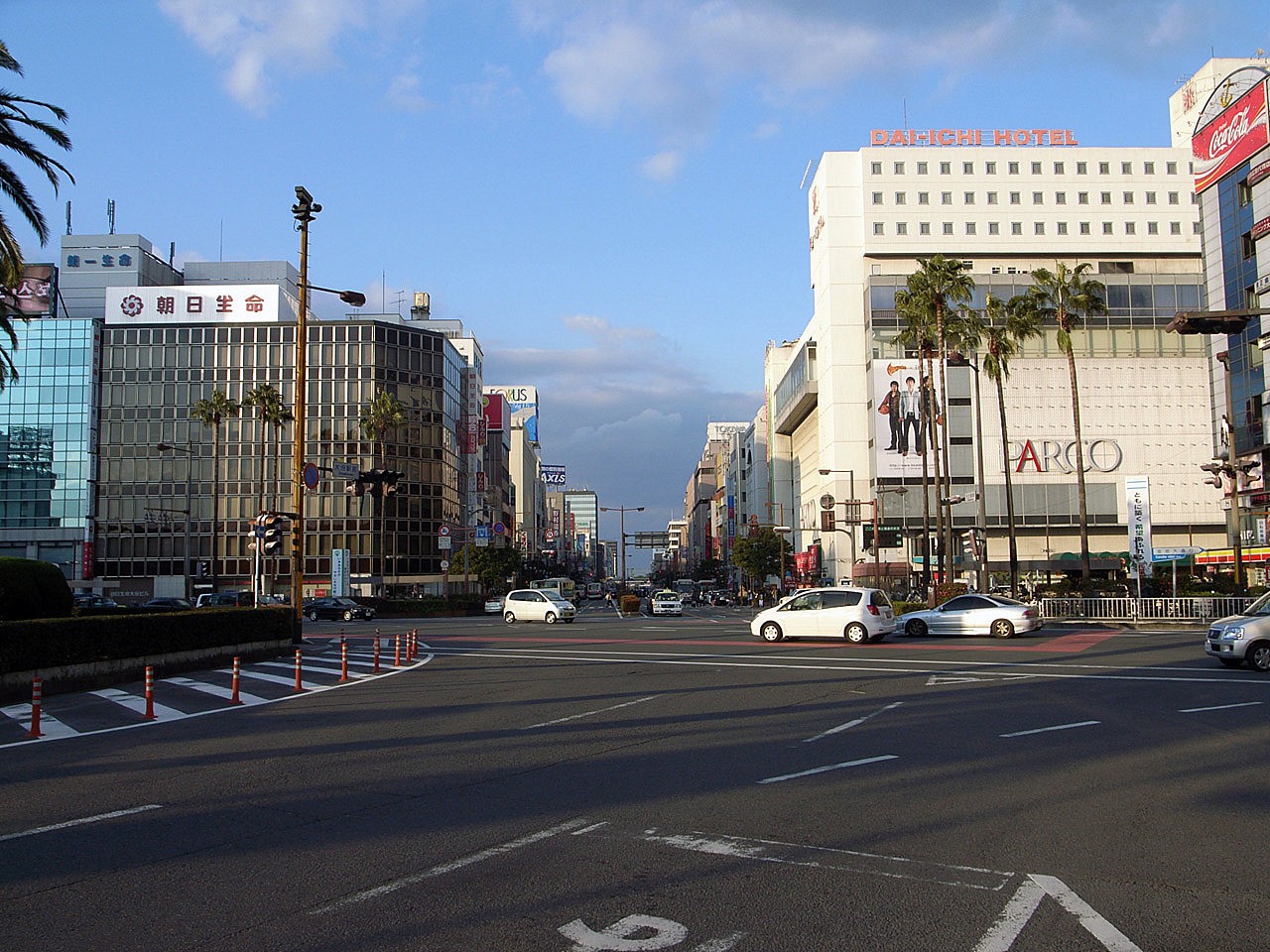
In the middle of the city, there are many shops and department stores. Some major departmental stores include Tokiwa, Parco, Frespo Kasugaura, and D Plaza. There are also shopping malls in the suburbs, such as Tokiwa Wasada Town and Park Place Oita.
Outside the city, scenic spots include mountain plateaus, seaside villages and towns renowned for onsen (geothermal hot springs).
Ōita is also famous for the intestines of puffer fish.
Toriten is another famous food in this city.
JNR C55 53 is the locomotive on display in the park. (See JNR C55)
Transportation

The principal railway station of the city is Ōita Station where Nippō Main Line, Kyūdai Main Line, and Hōhi Main Line of JR Kyushu gathers. The luxury Aru Ressha train was designed by Eiji Mitooka. It runs between Ōita and Hita and is in service to also revive tourism and the local economy.[5]
Buses are the primary mode of transportation in Oita, run by two main bus service companies. The Oita Bus Company operates bus routes in the city. The Oita Kotsu Company runs north of the city. For long-distance bus services, these two companies, as well as Kamenoi Bus Company operate bus routes from Oita to main place of Kyushu, such as Fukuoka and Kumamoto, and Osaka, Nagoya and more.
Oita Airport is located nearby, at Kunisaki, and used to be accessible via hovercraft, which takes about 30 minutes. However, this service has been suspended since late 2009. Other ways of accessing the airport is by bus, taxi or a private vehicle.
The Ōita Expressway, Higashikyushu Expressway, National Route 10 and National Route 210 all run through the city.
Many ships depart from the Port of Oita, to places such as Kansai, and Shikoku.
Sports
Annual sporting events include:
- Beppu-Oita Mainichi Marathon, which traces a path between Ōita and its neighbouring city of Beppu. The competition has been held every year since 1952 and is classed as an IAAF Silver Label road race.[6]
- The Kyūshū Ekiden, beginning in Nagasaki and ending in Fukuoka, the world's longest relay race
Sporting events held in Oita include:
- 1966 National Sports Festival of Japan
- 2001 Kirin Cup
- 2002 FIFA World Cup
- 2003, 2006, 2007 Kirin Challenge Cup
- 2005 J. League All-Star Soccer
- 2019 Rugby World Cup
Sports teams and facilities
| Club | Sports | League | Venue | Established |
|---|---|---|---|---|
| Oita Trinita | Football | J. League Division 1 |
Ōita Stadium | 1994 (as Oita Trinity, changed to current name from 1999) |
| Vasagey Oita | Futsal | F. League | Oita Prefectural General Gymnasium | 2003 |
| Oita Miyoshi Weisse Adler | Volleyball | V.League | Toto Oita factory gymnasium | 1996 (as Miyoshi Department of Cardiology EKG, changed to current name from 2006) |
Education
Oita City operates all public elementary and junior high schools, while the prefecture operates the high schools.
National universities
- Oita University
Prefectural universities
- Oita University of Nursing and Health Sciences
Private universities
- Nippon Bunri University
- Beppu University – Oita Campus
- Ritsumeikan Asia Pacific University
High schools
- Ōita Uenogaoka High School
- Ōita Oginodai High School
- Ōita Kōgyō High School
- Ōita Shōgyō High School
- Ōita Tsurusaki High School
- Ōita Nishi High School
- Ōita Higashi High School
- Ōita Hofu High School (middle and high school)
- Ōita Maizuru High School
- Ōita Minami High School
- Geijutsu Midorigaoka High School
- Jōhō Kagaku High School
- Tsurusaki Kōgyō High School
Notable people from Ōita
- Mao Abe, singer-songwriter
- Takamasa Anai, judo wrestler
- Yuya Ando, baseball player
- Chiyotaikai Ryūji, sumo wrestler
- Eri Fukatsu, actress
- Arata Isozaki, architect
- Yūko Kotegawa, actress
- Atsuhiro Miura, football player
- Daisuke Miyazaki, handball player
- Tomiichi Murayama, 81st Prime Minister of Japan
- Shigeichi Nagano, photographer
- Yūsuke Santamaria, tarento
- Rino Sashihara, HKT48, former AKB48
- Seiichi Uchikawa, baseball player
- Naomi Zaizen, actress
- Misa Eto, former Nogizaka46
- Sosuke Genda, baseball player
- Kenichi Shinoda (also known as Shinobu Tsukasa), Yakuza godfather, current kumicho of Yamaguchi-gumi, Japan's largest Yakuza organization
Sister cities
 Aveiro, Portugal (1978)[citation needed]
 Wuhan, Hubei, China (1979)[citation needed]
 Austin, Texas, United States (1990)[citation needed]
- Guangzhou, Guangdong, China (1997)[citation needed]
 San Cristóbal, Táchira, Venezuela[citation needed]
 Vitória, Espírito Santo, Brazil[citation needed]
 Lausanne, Switzerland[citation needed]
References
- "Official website of Ōita city" (in Japanese). Japan: Ōita City. Retrieved 19 April 2017.
- 気象庁 / 平年値(年・月ごとの値). Japan Meteorological Agency. Retrieved May 19, 2021.
- "47815: Oita (Japan)". ogimet.com. OGIMET. 22 June 2022. Retrieved 23 June 2022.
- "大分マリーンパレス水族館「うみたまご」公式サイト". Retrieved 10 January 2019.
- "Luxury 'dream train' designed over 100 years ago goes into service in Kyushu". The Japan Times. Tokyo. August 8, 2015. Archived from the original on 29 September 2015.
- Beppu-Oita Mainichi Marathon. ARRS (2009-12-24). Retrieved on 2010-02-08.
External links
- Ōita City official website (in Japanese)
- Ōita City official website (in English)
Ōita (capital) | ||
| Core city | ||
| Cities | ||
| Districts | ||
List of mergers in Ōita Prefecture | ||
| 2,000,000 and more | |
|---|---|
| 1,000,000–1,999,999 | |
| 500,000–999,999 | |
| 200,000–499,999 |
|
Authority control | |
|---|---|
| General | |
| National libraries | |
| Scientific databases | |
| Other |
|
На других языках
[de] Ōita
Ōita (japanisch 大分市, -shi) ist eine Großstadt und Hafenstadt sowie Verwaltungssitz der Präfektur Ōita und liegt auf der japanischen Insel Kyūshū an der Beppu-Bucht.- [en] Ōita (city)
[es] Ōita
La ciudad de Ōita (大分市, Ōita-shi?) es la capital de la prefectura homónima en Japón.[ru] Оита (город)
О́ита (яп. 大分市 О:ита-си) — центральный город Японии, административный центр префектуры Оита. Расположен на острове Кюсю, на юго-западной стороне Внутреннего Японского моря.Другой контент может иметь иную лицензию. Перед использованием материалов сайта WikiSort.org внимательно изучите правила лицензирования конкретных элементов наполнения сайта.
WikiSort.org - проект по пересортировке и дополнению контента Википедии