world.wikisort.org - India
The Srinagar District is one of the 20 districts of the Indian union territory of Jammu and Kashmir. Situated in the centre of the Kashmir Valley, it is the second-most populous district of the union territory after Jammu District as per the 2011 national census,[4] and is home to the summer capital city of Srinagar (with the city of Jammu serving as the territory's winter capital).[5] Likewise, the city of Srinagar also serves as the Srinagar District's headquarters.
Srinagar District | |
|---|---|
District of Jammu and Kashmir | |
 | |
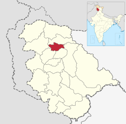 Map of Indian-administered Jammu and Kashmir with the Srinagar District highlighted red | |
| Coordinates: 34°05′N 74°50′E | |
| Country | |
| Union territory | Jammu and Kashmir |
| Headquarters | Srinagar |
| Tehsils |
|
| Government | |
| • District Magistrate | Mohammad Aijaz (IAS) |
| Area | |
| • Total | 1,979 km2 (764 sq mi) |
| Population (2011)[1] | |
| • Total | 1,250,173 |
| • Density | 630/km2 (1,600/sq mi) |
| Languages | |
| • Official | Kashmiri, Urdu, Hindi, Dogri, English[2][3] |
| Time zone | UTC+05:30 (IST) |
| Literacy | 69.41% |
| Website | http://srinagar.nic.in/ |
Administration
Srinagar district has 2 Sub-Divisions i.e. Srinagar West and Srinagar East.
7 Tehsils are:
- Central Shalteng
- Chanapora/ Natipora
- Eidgah
- Khanyar
- Pantha chowk
- Srinagar North
- Srinagar South.
This district has 4 Blocks[6]
- Harwan
- Qammerwari
- Khonmoh
- Srinagar
These blocks consist of a number of panchayats and villages.
Politics
Srinagar District has 1 parliamentary constituency i.e. Srinagar and 8 assembly constituencies:
Demographics
| Year | Pop. | ±% |
|---|---|---|
| 1901 | 184,676 | — |
| 1911 | 204,583 | +10.8% |
| 1921 | 223,223 | +9.1% |
| 1931 | 255,778 | +14.6% |
| 1941 | 291,522 | +14.0% |
| 1951 | 333,554 | +14.4% |
| 1961 | 375,587 | +12.6% |
| 1971 | 489,042 | +30.2% |
| 1981 | 608,244 | +24.4% |
| 1991 | 789,450 | +29.8% |
| 2001 | 1,027,670 | +30.2% |
| 2011 | 1,236,829 | +20.4% |
| † 1951 and 1991 populations are estimated Source: [8] | ||
According to the 2011 census Srinagar district has a population of 1,236,829,[4] roughly equal to the nation of Estonia[11] or the US state of New Hampshire.[12] This gives it a ranking of 381st in India (out of a total of 640).[4] The district has a population density of 703 inhabitants per square kilometre (1,820/sq mi).[4] Its population growth rate over the decade 2001–2011 was 20.35%.[4] Srinagar has a sex ratio of 900 females for every 1,000 males[4] (this varies with religion), and a literacy rate of 69.41%.[4]
| Srinagar district: religion, gender ratio, and % urban of population, according to the 2011 Census.[9] | |||||||||
|---|---|---|---|---|---|---|---|---|---|
| Hindu | Muslim | Christian | Sikh | Buddhist | Jain | Other | Not stated | Total | |
| Total | 42,540 | 1,177,342 | 2,746 | 12,187 | 285 | 74 | 2 | 1,653 | 1,236,829 |
| 3.44% | 95.19% | 0.22% | 0.99% | 0.02% | 0.01% | 0.00% | 0.13% | 100.00% | |
| Male | 35,925 | 605,244 | 1,771 | 6,975 | 171 | 39 | 1 | 998 | 651,124 |
| Female | 6,615 | 572,098 | 975 | 5,212 | 114 | 35 | 1 | 655 | 585,705 |
| Gender ratio (% female) | 15.6% | 48.6% | 35.5% | 42.8% | 40.0% | 47.3% | 50.0% | 39.6% | 47.4% |
| Sex ratio (no. of females per 1,000 males) |
184 | 945 | 551 | 747 | – | – | – | 656 | 900 |
| Urban | 42,513 | 1,160,071 | 2,743 | 12,185 | 285 | 74 | 2 | 1,643 | 1,219,516 |
| Rural | 27 | 17,271 | 3 | 2 | 0 | 0 | 0 | 10 | 17,313 |
| % Urban | 99.9% | 98.5% | 99.9% | 100.0% | 100.0% | 100.0% | 100.0% | 99.4% | 98.6% |
At the time of the 2011 census, 94.13% of the population spoke Kashmiri and 1.88% Urdu as their first language.[10] Most kashmiris can speak urdu.[5]
Weather
| Climate data for Srinagar (1971–1986) | |||||||||||||
|---|---|---|---|---|---|---|---|---|---|---|---|---|---|
| Month | Jan | Feb | Mar | Apr | May | Jun | Jul | Aug | Sep | Oct | Nov | Dec | Year |
| Average high °C (°F) | 7.0 (44.6) |
8.2 (46.8) |
14.1 (57.4) |
20.5 (68.9) |
24.5 (76.1) |
29.6 (85.3) |
30.1 (86.2) |
29.6 (85.3) |
27.4 (81.3) |
22.4 (72.3) |
15.1 (59.2) |
8.2 (46.8) |
19.7 (67.5) |
| Average low °C (°F) | −2 (28.4) |
−0.7 (30.7) |
3.4 (38.1) |
7.9 (46.2) |
10.8 (51.4) |
14.9 (58.8) |
18.1 (64.6) |
17.5 (63.5) |
12.1 (53.8) |
5.8 (42.4) |
0.9 (33.6) |
−1.5 (29.3) |
7.3 (45.1) |
| Average precipitation mm (inches) | 48 (1.9) |
68 (2.7) |
121 (4.8) |
85 (3.3) |
68 (2.7) |
39 (1.5) |
62 (2.4) |
76 (3.0) |
28 (1.1) |
33 (1.3) |
28 (1.1) |
54 (2.1) |
710 (27.9) |
| Average precipitation days (≥ 1.0 mm) | 6.6 | 7.3 | 10.2 | 8.8 | 8.1 | 5.7 | 7.9 | 6.8 | 3.5 | 2.8 | 2.8 | 5.1 | 75.6 |
| Source: HKO[13] | |||||||||||||
Places of worship
- Jamia Ahlehadees Markazi Masjid Madina Chowk Gow Kadal
- Hari Parbat
- Hazratbal Shrine
- Jamia Masjid, Srinagar, one of the oldest mosques in Kashmir
- Shah-i-Hamadan Mosque
- Shrine of Makhdoom Sahib
- Shankaracharya temple, possibly the oldest shrine in Kashmir

See also
- List of colleges in Srinagar
- List of schools in Srinagar
References
- "Srinagar District". 24 November 2020.
- "The Jammu and Kashmir Official Languages Act, 2020" (PDF). The Gazette of India. 27 September 2020. Retrieved 27 September 2020.
- "Parliament passes JK Official Languages Bill, 2020". Rising Kashmir. 23 September 2020. Retrieved 23 September 2020.
- "District Census 2011". Census2011.co.in. 2011. Retrieved 20 July 2020.
- 2011 census J&K
- , Srinagar District, Jammu and Kashmir.
- "ERO's and AERO's". CEO JK. Chief Electoral Officer, Jammu and Kashmir.
- "A-2 Decadal Variation In Population Since 1901". Censusindia.gov.in. Retrieved 9 August 2019.
- C-1 Population By Religious Community – Jammu & Kashmir (Report). Office of the Registrar General & Census Commissioner, India. Retrieved 28 July 2020.
- C-16 Population By Mother Tongue – Jammu & Kashmir (Report). Office of the Registrar General & Census Commissioner, India. Retrieved 18 July 2020.
- US Directorate of Intelligence. "Country Comparison:Population". Archived from the original on 13 June 2007. Retrieved 1 October 2011.
Estonia 1,282,963 July 2011 est.
- "2010 Resident Population Data". U. S. Census Bureau. Retrieved 30 September 2011.
New Hampshire 1,316,470
- "Climatological Information for Srinigar, India". Hong Kong Observatory. November 2010. Retrieved 19 November 2017.
External links
- Official website
- Greater Kashmir, daily English newspaper from Srinagar, Kashmir
- Soan Meeraas, A Kashmiri newspaper from Srinagar, Kashmir
Places adjacent to Srinagar district | ||||||||||||||||
|---|---|---|---|---|---|---|---|---|---|---|---|---|---|---|---|---|
| ||||||||||||||||
Capital: Srinagar (Summer); Jammu (Winter) | |||||
| History |
| ||||
| Government and politics |
| ||||
| Culture and places | |||||
| Districts and divisions |
| ||||
| Cities | |||||
| Towns |
| ||||
| Famous villages | |||||
| Regions |
| ||||
| Railways | |||||
| Roads |
| ||||
| Local elections |
| ||||
| Sports |
| ||||
| Other topics |
| ||||
Authority control | |
|---|---|
| General |
|
| National libraries | |
На других языках
[de] Srinagar (Distrikt)
Der Distrikt Srinagar (Urdu: ضلع سری نگر) ist ein Verwaltungsdistrikt im indischen Unionsterritorium Jammu und Kashmir.- [en] Srinagar district
[ru] Шринагар (округ)
Шринагар (англ. Srinagar) или Сринагар — округ в индийской союзной территории Джамму и Кашмир, в регионе Кашмир. Административный центр — город Шринагар. Площадь округа — 294 км². По данным всеиндийской переписи 2011 года население округа составляло 1 250 173 человек. Уровень грамотности взрослого населения составлял 71,2 %[1].Другой контент может иметь иную лицензию. Перед использованием материалов сайта WikiSort.org внимательно изучите правила лицензирования конкретных элементов наполнения сайта.
WikiSort.org - проект по пересортировке и дополнению контента Википедии