world.wikisort.org - India
Rajouri or Rajpur (/rəˈdʒɔːri/; Pahari: 𑠤𑠬𑠑𑠶𑠤𑠮, راجوری; Sanskrit: राजपुर, IAST: Rājapurī) is a city in Rajouri district in the union territory of Jammu and Kashmir, India. It is located about 155 kilometres (96 mi) from Srinagar and 150 km (93 mi) from Jammu city on the Poonch Highway. The city is the location of the birthplace of Sikh Rajput General Banda Singh Bahadur. Baba Ghulam Shah Badshah University is also situated in this district.
Rajouri
Rājpur | |
|---|---|
City | |
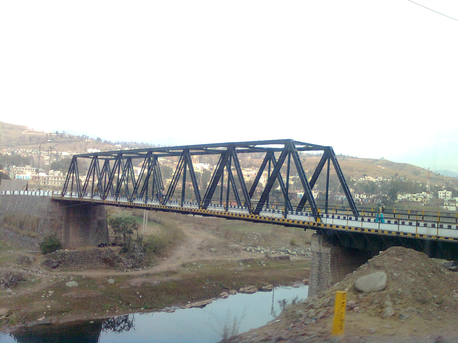
 View of old Jhula Bridge at Medina Colony, Rajouri. | |
 Rajouri Location in Jammu and Kashmir, India  Rajouri Rajouri (India) | |
| Coordinates: 33°23′N 74°19′E | |
| Country | |
| Union Territory | Jammu and Kashmir |
| District | Rajouri |
| Settled | 623 BC |
| Government | |
| • Type | Municipal Committee |
| • Body | Rajouri Municipal Committee |
| Elevation | 915 m (3,002 ft) |
| Population (2011)[1] | |
| • Total | 41,552 (Including Kheora and Jawahar Nagar) 642,415 (in Rajouri district) |
| Languages | |
| • Official | Dogri, Hindi, Kashmiri, Urdu, English[2][3] |
| • Spoken | Pahari, Gujari |
| Time zone | UTC+5:30 (IST) |
| Website | rajouri rajouri |
History
Ancient History
This section needs expansion. You can help by adding to it. (April 2018) |
Rajouri was Ruled by Many Rulers Palas, Jaral Rajputs For 12th - 19th Century & Dogra Rajput Dynasty. Rajouri, finds its mention in the travelogue of Chinese traveler Hiuen-Tsang who visited the town in 632 A.D. and described it as a part of Kashmiri dominion. Later was included in the domain called Darabhisanga which comprised the hilly stretch from Poonch to Kashmir. Those days Laharkote in Poonch district and Rajouri had emerged as two powerful states of the area.
According to F.E.Pargitor, second branch of Aryan emigrants crossed Himalayas in the north and west and settled in Rajouri and Poonch area. Rajouri, Bhimber and Naushera were included within the territory of Abhisar, which was one of the hill states of Punjab Kingdom. Early records of fragmentary nature show that in 4th century B.C. there existed in the north west of India a federal type of political set up in which Abhisar with its capital Rajouri was also included. At the time of Alexander's invasion, Rajouri was at the height of its glory. In Mauryan period, the town of Rajouri was a great trade centre.
Albaruni visited Rajouri with Sultan Masud (Son of Sultan Mahmud) in 1036 C.E. In his book "India" he wrote name of Rajouri as Raja Vari. Srivar, the writer of 'Raj Tirangini' written during the administration of Sultan Zain-Ul-Abdin, also named this area as Raja Vari. It is believed that Raja Vari is a variant of Rajapuri. Mirza Zafarulla Khan, the writer of 'Tarikh Rajgan-E-Rajour' illustrated in his book that this place was in the beginning known as Raj-Avar and then altered from Rajour to Rajouri. But the old people in the villages still label the place as Rajour. With the course of time the name changed from Raja's Raj Avar to Raja Puri, Rajpuri to Raj Vari, Raj Vari to Raj Vara, Raj Vara to Raj Avar, Raj Avar to Rajour and then Rajour to Rajouri. As per Rajtirangini of Kalhan, Rajouri emerged as principality in about 1003 C.E. The first ruler of this kingdom was Raja Prithvi Paul. From 1033 to 1194 C.E. Raja Prithvi Paul defended Pir Panchal Pass at the time of incursion of Sultan Mehmud in 1021 C.E. Raja Sangram Paul safeguarded his Principality Rajouri when Raja Harash of Kashmir attacked his country in 1089 A.D. Sangram Paul fought so courageously that Raja Harash was obliged to return from Prithvi Paul fort without capturing Rajouri. Jaral Rajputs Muslim Rajas rebuilt Rajouri city at the time of their rule. A number of forts, sarais, mosques and baradaris were constructed.
As per 'Tarikh-Rajgan-e-Rajour" Noor-Ud-Din who migrated from Punjab to Rajouri revolted against Raja Amna Paul. Raja Amna Paul was killed in the revolt and Noor-Ud-Din became the Raja of Rajouri. In this way Raja Noor-Ud-Din aid the foundation of Jaral Rajput Muslim rule in Rajouri in 1194 A.D. to 21 October 1846 A.D. Rajouri Principality remained governed by Jaral Rajas. The renowned Rajas of this dynasty were Raja Noor-Ud-Din (1194 A.D.), Raja Anwar Khan (1252 A.D.), Raja SardarKhan (1289 A.D.), Raja Shah-Ud-Din (1412 A.D.), Raja Mast Wali Khan (1565 A.D.), Raja Taj-Ud-Din (1604 A.D.), Raja Anayat Ullah Khan (1648 A.D.), Raja Azmat Ullah Khan (1683 A.D.), Raja Izzat Ullah Khan (1760 A.D.), Raja Karam Ullah Khan (1676 A.D.), Raja Aggar Ullah Khan (1808 A.D.) and Raja Raheem Ullah Khan (1819 A.D.). Raja Raheem Ullah Khan was the last Muslim Ruler of Rajouri who governed this principality upto 21 October 1846.[4]
Early Modern History
During the Mughal rule, the Muslim Jarral Rajput rulers or Raja agreed to a treaty with the Mughal Empire and thus, were given the title 'Raja' and 'Mirza'. Descendants of the Jarral Rajput Dynasty continue to use these titles. In 1813, Gulab Singh of Jammu captured Rajouri for the Sikh Empire of Maharaja Ranjit Singh, by defeating Raja Agar Ullah Khan.[5] After this, Rajouri became part of the Sikh Empire. But parts of it were given as jagirs to Rahim Ullah Khan (a half-brother of Agar Ullah Khan) and other parts to Gulab Singh.[6]
Following the First Anglo-Sikh War and the Treaty of Amritsar (1846), all the territories between the Ravi River and the Indus were transferred to Gulab Singh, and he was recognised as an independent Maharaja of Jammu and Kashmir. Thus Rajouri became a part of the princely state of Jammu and Kashmir.[7] Gulab Singh changed the name of Rajouri to Rampur. He appointed Mian Hathu as Governor of Rajouri, who remained in Rajouri up to 1856.[8] Mian Hathu constructed a stunning temple in between Thanna Nallah in close proximity to Rajouri city. He also built Rajouri Fort at Dhannidhar village.[citation needed]
After Mian Hathu, Rajouri was transformed into a tehsil and affiliated with Bhimber district. In 1904, this tehsil was separated from Bhimber and affiliated with the Reasi district.[7]
The area of Rajouri principality included proper Rajouri, Thanna, Bagla Azim Garh, Behrote, Chingus, Darhal, Nagrota and Phalyana etc
Partition
After the Partition of India and the accession of Jammu and Kashmir to India in October 1947, there followed the First Kashmir War between India and Pakistan. The Pakistani raiders, along with the rebels and deserters from the western districts of the state, captured Rajouri on 7 November 1947. The 30,000 Hindus and Sikhs living in Rajouri were reportedly killed, wounded or abducted.[9][10][11] Rajouri was recaptured on 12 April 1948 by the 19 Infantry Brigade of the Indian Army under the command of Second Lieutenant Rama Raghoba Rane. Rane, despite being wounded, launched a bold tank assault by conveying the tanks over the Tawi river bed in order to avoid the road blocks along the main road.[12] When the Indian Army entered the town, the captors had fled, having destroyed most of the town and killing all its inhabitants. After the arrival of the Army, some 1,500 refugees that had fled to the hills, including women and children, returned to the town.[13]
The ceasefire line at the end of the War ran to the west of the Rajouri-Reasi district.
Inside India
Soon after the war, the Rajouri and Reasi tehsils were separated. The Rajouri tehsil was merged with the Indian-administered Poonch district to form the Poonch-Rajouri district.[7] The Reasi tehsil was merged with the Udhampur district.
On 1 January 1968, the two tehsils were reunited and the resulting district was named the Rajouri district.[7]
The Reasi tehsil was also separated out in 2006 into a separate Reasi district. The present Rajouri district comprises the 1947 Rajouri tehsil.
Rajouri witnessed some of the toughest fighting during the Second Kashmir War in 1965. Pakistani infiltration in Kashmir during Operation Gibraltar caused Rajouri to be initially captured from the Indian Army by undercover Pakistani commandos with the aid of local Mujahideen. But the wider operation failed and, with all-out war with India looming, Pakistan withdrew its troops. Major Malik Munawar Khan Awan, a Pakistani commando officer who led the attack on Rajouri on the night of 15 September 1965, was later awarded the title "King of Rajouri" by the Government of Pakistan.[14]
Geography and Education
Rajouri is located at 33.38°N 74.3°E.[15] It has an average elevation of 915 metres (3001 feet).
Rajouri has its own deemed University Baba Ghulam Shah Badshah University popularly known as BGSBU which offers various Diploma, UG and PG courses. It also has one Government Medical College GMC Rajouri along with other degree colleges.
Climate
The climate of Rajouri is somewhat cooler than the other surrounding plains. Summers are short and pleasant. The summer temperature generally does not exceed 41 degrees. Winters are cool and chilly characterized with rainfall due to western disturbances. Snowfall is scanty but may occur in cool months like that of December 2012. Average rainfall is 769 millimetres (26.3 in) in the wettest months The average temperature of summer is 29'C and average temperature of winter is 16'C .[16]
Demographics
Religion in Rajouri Town (2011)[17]
At the 2011 census,[18] Rajouri itself had a population of 37,552 while the population within the municipal limits was 41,552. Males constituted 57% of the population and females 43%. Rajouri had an average literacy rate of 77%, higher than the national average of 75.5%: male literacy was 83% and female literacy was 68%. 12% of the population was under 6 years of age. The people are mostly Gujjars and Paharis.
Religion
Hinduism is the largest religion in Rajouri town followed by over 57% of the people. Islam is the second-largest religion with 37.08% adherents. Christianity and Sikhism form 0.51% and 5.09% of the population respectively.[17]
Transport
Air
Rajouri Airport is located 1 km from the town but currently is non-operational. The nearest airport to Rajouri is Jammu Airport which located 154 kilometres from Rajouri and is a 4 hr drive. Helicopter services linking Rajouri district to Jammu started on September 13, 2017 but it was aborted lator.[19]
Rail
Rajouri doesn't have its own railway station. The nearest railway station to Rajouri is Jammu Tawi railway station which is located at a distance of 151 kilometres from the town and is a 4 hr drive. There are plans to connect Rajouri by rail through the Jammu–Poonch Railway Line in the near future.[20]
Road
Rajouri is well-connected by road to other towns, villages and cities of Jammu and Kashmir. The NH 144A passes through Rajouri.
References
- "Rajouri District Population Census 2011-2022, Jammu and Kashmir literacy sex ratio and density".
- "The Jammu and Kashmir Official Languages Act, 2020" (PDF). The Gazette of India. 27 September 2020. Retrieved 27 September 2020.
- "Parliament passes JK Official Languages Bill, 2020". Rising Kashmir. 23 September 2020. Retrieved 23 September 2020.
- "History | Rajouri,Government of Jammu and Kashmir | India".
- Panikkar, Gulab Singh 1930, p. 31.
- Panikkar, Gulab Singh 1930, p. 40.
- Sudhir S. Bloeria, Militancy in Rajouri and Poonch, South Asia Terrorism Portal, 2001.
- Bloeria, Sudhir S. (2000), Pakistan's Insurgency Vs India's Security: Tackling Militancy in Kashmir, Manas Publications, p. 37, ISBN 978-81-7049-116-3
- Prasad, Sri Nandan; Pal, Dharm (1 January 1987). Operations in Jammu & Kashmir, 1947-48. History Division, Ministry of Defence, Government of India. pp. 49–50.
- V. K. Singh, Leadership in the Indian Army 2005, p. 160.
- Ramachandran, Empire's First Soldiers 2008, p. 171.
- Rama Raghoba Rane received a Param Vir Chakra for his gallantry.
- Sarkar, Outstanding Victories of the Indian Army 2016, pp. 37–40.
- Niaz, Anjum (21 April 2013). "The 20-watt fountain of energy". Dawn.
- Falling Rain Genomics, Inc - Rajouri[permanent dead link]
- IMD Archived 2012-03-15 at the Wayback Machine
- "Rajouri Town Population". Census India. Retrieved 27 September 2020.
- "Census of India 2001: Data from the 2001 Census, including cities, villages and towns (Provisional)". Census Commission of India. Archived from the original on 16 June 2004. Retrieved 1 November 2008.
- Service, Tribune News. "Poonch, Rajouri get chopper services". Tribuneindia News Service. Retrieved 7 July 2022.
- "Centre nod to Jammu-Poonch rail line after several years". Daily Excelsior. 23 December 2018. Retrieved 24 December 2018.
Bibliography
- Panikkar, K. M. (1930), Gulab Singh, London: Martin Hopkinson Ltd
- Ramachandran, D. P. (2008), Empire's First Soldiers, Lancer Publishers, pp. 171–, ISBN 978-0-9796174-7-8
- Sarkar, Col. Bhaskar (2016), Outstanding Victories of the Indian Army, 1947-1971, Lancer Publishers, pp. 40–, ISBN 978-1-897829-73-8
- Singh, V. K. (2005), Leadership in the Indian Army: Biographies of Twelve Soldiers, SAGE Publications, pp. 160–, ISBN 978-0-7619-3322-9
Capital: Srinagar (Summer); Jammu (Winter) | |||||
| History |
| ||||
| Government and politics |
| ||||
| Culture and places | |||||
| Districts and divisions |
| ||||
| Cities | |||||
| Towns |
| ||||
| Famous villages | |||||
| Regions |
| ||||
| Railways | |||||
| Roads |
| ||||
| Local elections |
| ||||
| Sports |
| ||||
| Other topics |
| ||||
Authority control | |
|---|---|
| General |
|
| National libraries | |
На других языках
[de] Rajouri
Rajouri (auch Rajauri; Hindi .mw-parser-output .Deva{font-size:120%}@media all and (min-width:800px){.mw-parser-output .Deva{font-size:calc(120% - ((100vw - 800px)/80))}}@media all and (min-width:1000px){.mw-parser-output .Deva{font-size:100%}}राजौरी) ist eine Stadt (Municipal Committee) im äußersten Westen des indischen Unionsterritoriums Jammu und Kashmir.- [en] Rajouri
[ru] Раджаури
Раджаури — город и техсил в округе Раджоури в Джамму и Кашмире, Индия. В древности этот город назывался Раджапури/Раджапура. Город долгое время был в округе Пунч, но 1 января 1968 был выделен в отдельный округ.[1]Другой контент может иметь иную лицензию. Перед использованием материалов сайта WikiSort.org внимательно изучите правила лицензирования конкретных элементов наполнения сайта.
WikiSort.org - проект по пересортировке и дополнению контента Википедии