world.wikisort.org - India
Bandipore district (also spelt as Bandipora or Bandipur) is one of the 20 districts in the Indian union territory of Jammu and Kashmir. Bandipore town is the administrative headquarters of the district. Bandipore, a township with peculiar scenic beauty is located in the foothills of the snow-clad peaks of Harmukh overlooking the shores of Wular Lake and has produced hundreds of scholars and intellectuals. The district is famous for its tourist places such as Wular Vintage Park, Athwatoo and Gurez valley. Before 1947, this town was a big trade and literary centre of Kashmir. This district was carved out from the erstwhile Baramulla district in 2007. The district is bounded by Kupwara district from the north, Baramulla district from west and Kargil district in Ladakh and Ganderbal district from the east. This district occupies an area of 398 km2.[1] The district has a population of 392,232 as per 2011 census.
Bandipore
Bandpur Bandipora, Bandipur | |
|---|---|
District of Jammu and Kashmir | |
| Bandipora | |
 Wular Lake, largest freshwater lake in India | |
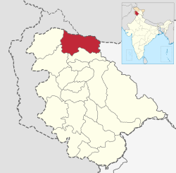 Location in Jammu and Kashmir, India | |
| Coordinates: 34°25′12″N 74°39′00″E | |
| Country | |
| Union Territory | Jammu and Kashmir |
| Division | Kashmir Division |
| Seat | Bandipore |
| Government | |
| • MLA | Vacant (NA) |
| • District Development Council | Chairman: Abdul Gani Bhat, V.C: Kaunser Shafeeq |
| Area | |
| • Total | 345 km2 (133 sq mi) |
| • Urban | 49.6 km2 (19.2 sq mi) |
| • Rural | 295.4 km2 (114.1 sq mi) |
| Population (2011)[2] | |
| • Total | 392,232 |
| • Density | 1,100/km2 (2,900/sq mi) |
| Demonym(s) | Bandiporia, Bandipuriya, Bandiporiyan, Bandporuek |
| Languages | |
| • Official | Kashmiri, Urdu, Hindi, Dogri, English[3][4] |
| Time zone | Indian Standard Time |
| Deputy commissioner | Owais Ahmed Rana |
| Website | bandipore |
Education
Some of the institutions and colleges of Bandipur Which provide quality education to the students of district Bandipore
- Govt Girls Higher Secondary School, Plan Bandipora
- Govt NM Boys Higher School Kaloosa
- Govt Higher Secondary school Quilmuqam
- Govt Polytechnic College
- Govt HKM Degree College Patushay
- Islamiya Model School Patushay
- Govt Middle School Patushay
8.Kendriya Vidyalaya BSF Bandipur.
- Al-Noor College Of Education moder
- Mehboobul Aalam College Of Education
- Govt High School Bagh]
- Govt High School Qazipora bandipora
- Muslim Model School Qazipora Watapora
- Army Good Will School Aythmulla
- Shaheen College Of Education
- Govt Higher Sec. School Nadihal
- Govt Higher Sec. School Aloosa
- Govt Higher Sec. School Aragam
- Govt Secondary School Mantrigam
- Govt Secondary School Bonakoot
- Eaglets Public Secondary School Plan
- SMS Islamia Model Higher Secondary School, Garoora
- Government Higher Secondary School, Arin
Divisions
The district comprises seven tehsils: Ajas, Aloosa, Bandipore, Sumbal, Hajin, Gurez and Tulail. The district has three Vidhan Sabha constituencies: Gurez, Bandipore and Sonawari. All of these are part of Baramulla Lok Sabha constituency. The district comprises twelve community development blocks: Aloosa, Arin, Baktoor, Bandipore, Bonkoot, Ganastan, Gurez, Hajin, Naidkhai, Nowgam, Sumbal and Tulail.
Demographics
According to the 2011 census Bandipore district has a population of 392,232,[7] roughly equal to the nation of Maldives.[8] This gives it a ranking of 561st in India (out of a total of 640).[7] The district has a population density of 1,117 inhabitants per square kilometre (2,890/sq mi) .[7] Its population growth rate over the decade 2001–2011 was 26.31%.[7] Bandipore has a sex ratio of 899 females for every 1000 males[7] (this varies with religion), and a literacy rate of 57.82%.[7]
| Bandipore district: religion, gender ratio, and % urban of population, according to the 2011 Census.[5] | |||||||||
|---|---|---|---|---|---|---|---|---|---|
| Hindu | Muslim | Christian | Sikh | Buddhist | Jain | Other | Not stated | Total | |
| Total | 8,439 | 382,006 | 572 | 555 | 44 | 17 | 2 | 597 | 392,232 |
| 2.15% | 97.39% | 0.15% | 0.14% | 0.01% | 0.00% | 0.00% | 0.15% | 100.00% | |
| Male | 8,061 | 198,322 | 380 | 520 | 40 | 8 | 0 | 349 | 207,680 |
| Female | 378 | 183,684 | 192 | 35 | 4 | 9 | 2 | 248 | 184,552 |
| Gender ratio (% female) | 4.5% | 48.1% | 33.6% | 6.3% | 9.1% | 52.9% | 100.0% | 41.5% | 47.1% |
| Sex ratio (no. of females per 1,000 males) |
47 | 926 | 505 | 67 | – | – | – | 711 | 889 |
| Urban | 2,549 | 62,557 | 91 | 50 | 18 | 2 | 2 | 92 | 65,361 |
| Rural | 5,890 | 319,449 | 481 | 505 | 26 | 15 | 0 | 505 | 326,871 |
| % Urban | 30.2% | 16.4% | 15.9% | 9.0% | 40.9% | 11.8% | 100.0% | 15.4% | 16.7% |
At the time of the 2011 census, 82.39% of the population spoke Kashmiri, 8,82% Gojri, 4.18% Shina, 1.91% Pahari and 1.27% Hindi as their first language.[6]
See also
- Wular Lake
- Gurez Valley
- Patushay
- QUIL MUQAM
- Aathwatoo
References
- Srivastava, Dayawanti; et al., eds. (2010). India 2010, A Reference Annual (PDF). New Delhi: Publications Division, Ministry of Information and Broadcasting, Government of Indiaand. p. 1142. ISBN 978-81-230-1617-7. Archived from the original (PDF) on 29 December 2010. Retrieved 21 January 2011.
- "Archived copy" (PDF). www.censusindia.gov.in. Archived from the original (PDF) on 19 September 2013. Retrieved 9 August 2022.
{{cite web}}: CS1 maint: archived copy as title (link) - "The Jammu and Kashmir Official Languages Act, 2020" (PDF). The Gazette of India. 27 September 2020. Retrieved 27 September 2020.
- "Parliament passes JK Official Languages Bill, 2020". Rising Kashmir. 23 September 2020. Retrieved 23 September 2020.
- C-1 Population By Religious Community – Jammu & Kashmir (Report). Office of the Registrar General & Census Commissioner, India. Retrieved 28 July 2020.
- C-16 Population By Mother Tongue – Jammu & Kashmir (Report). Office of the Registrar General & Census Commissioner, India. Retrieved 18 July 2020.
- "District Census 2011". Census2011.co.in. 2011. Retrieved 30 September 2011.
- US Directorate of Intelligence. "Country Comparison:Population". Archived from the original on 13 June 2007. Retrieved 1 October 2011.
Maldives 394,999 July 2011 est.
External links
Capital: Srinagar (Summer); Jammu (Winter) | |||||
| History |
| ||||
| Government and politics |
| ||||
| Culture and places | |||||
| Districts and divisions |
| ||||
| Cities | |||||
| Towns |
| ||||
| Famous villages | |||||
| Regions |
| ||||
| Railways | |||||
| Roads |
| ||||
| Local elections |
| ||||
| Sports |
| ||||
| Other topics |
| ||||
Authority control | |
|---|---|
| General |
|
| National libraries | |
На других языках
[de] Bandipore (Distrikt)
Der Distrikt Bandipore (Urdu ضلع بانڈی پورہ), auch Bandipora, ist ein Distrikt im Kaschmirtal im Unionsterritorium Jammu und Kashmir in Indien.- [en] Bandipore district
[ru] Бандипора (округ)
Бандипора (англ. Bandipora) — округ в индийской союзной территории Джамму и Кашмир, в регионе Кашмир. Образован в 2007 году из части территории округа Барамулла. Административный центр — город Бандипора. По данным всеиндийской переписи 2001 года население округа составляло 306 511 человек.Другой контент может иметь иную лицензию. Перед использованием материалов сайта WikiSort.org внимательно изучите правила лицензирования конкретных элементов наполнения сайта.
WikiSort.org - проект по пересортировке и дополнению контента Википедии