world.wikisort.org - USA
Warwick (/ˈwɔːrwɪk/ WOR-wik or /ˈwɒrɪk/ WORR-ik) is a city in Kent County, Rhode Island, the third largest city in the state with a population of 82,823 at the 2020 census. It is located approximately 12 miles (19 km) south of downtown Providence, Rhode Island, 63 miles (101 km) southwest of Boston, Massachusetts, and 171 miles (275 km) northeast of New York City.
City of Warwick | |
|---|---|
City | |
Warwick City Hall, Brush Neck Cove, the Caleb Greene House, and T. F. Green Airport | |
 Seal | |
 Location in Kent County, Rhode Island | |
| Coordinates: 41°43′N 71°25′W | |
| Country | United States |
| State | Rhode Island |
| County | Kent |
| Founded | 1642 |
| Incorporated (town) | August 8, 1647 |
| Incorporated (city) | April 21, 1931 |
| Named for | Warwick, England |
| Government | |
| • Type | Mayor-council |
| • Mayor | Frank Picozzi (I) |
| • City Council | William Foley (D) Jeremy M. Rix (D) Timothy Howe (D) Jim McElroy (D) Edgar N. Ladouceur (D) Donna M. Travis (D) Steven McAllister (D) Anthony Sinapi (D) Vincent Gebhart (D) |
| Area | |
| • Total | 49.75 sq mi (128.85 km2) |
| • Land | 35.00 sq mi (90.65 km2) |
| • Water | 14.75 sq mi (38.20 km2) |
| Elevation | 20 ft (6 m) |
| Population (2020)[3] | |
| • Total | 82,823 |
| • Density | 2,366.30/sq mi (913.64/km2) |
| Time zone | UTC−5 (Eastern) |
| • Summer (DST) | UTC−4 (Eastern) |
| ZIP Codes | 02886, 02888–02889 |
| Area code | 401 |
| FIPS code | 44-74300[4] |
| GNIS feature ID | 1220018[2] |
| Website | www.warwickri.gov |


Warwick was founded by Samuel Gorton in 1642 and has witnessed major events in American history. It was decimated during King Philip's War (1675–1676) and was the site of the Gaspee Affair, the first act of armed resistance against the British, preceding even the Boston Tea Party, and a significant prelude to the American Revolution. Warwick was also the home of Revolutionary War General Nathanael Greene, George Washington's second-in-command, and Civil War General George S. Greene, a hero of the Battle of Gettysburg. Today, it is home to Rhode Island's main airport, T. F. Green Airport, which serves the Providence area and also functions as a reliever for Logan International Airport in Boston, Massachusetts.
Early history
Warwick was colonized by Europeans in 1642. The city was named after a town with the same name located in England.[5] Samuel Gorton claims that Narragansett Nation Sachem Miantonomi sold him the Shawhomett Purchase for 144 fathoms of wampum. This included the towns of Coventry and West Warwick, Rhode Island. However, the transaction was dubious from the start. Sachems Sacononoco and Pumham claimed that Miantonomi had sold the land without asking for their approval. They took their case to Boston, where they placed their lands under Massachusetts rule. In 1643, Massachusetts Bay Colony sent a militia force to Shawomett to arrest Gorton and his followers. After a tense standoff, all but three of the Gortonists surrendered to the Massachusetts forces. This event caused the other three colonies on Narragansett Bay (Providence Plantations, Portsmouth, and Newport) to unite and get a British royal charter allowing them to form the Colony of Rhode Island and Providence Plantations.[6]: 302
In 1648, Gorton was granted a British charter by Robert Rich, 2nd Earl of Warwick, Lord Admiral and head of the Parliamentary Commission on Plantation Affairs. Because of this, the name of the settlement was changed from Shawhomett to Warwick. Massachusetts Bay Colony continued to lay claim to the area, but it made no further effort to enforce it.[6]
In 1772, Warwick was the scene of the first violent act against the British Crown in the Gaspee Affair. Local patriots boarded the Gaspee,[7] a revenue cutter that enforced the Stamp Act 1765 and Townshend Acts in Narragansett Bay. It was here that the first blood was spilled in the American Revolution when Gaspee's commanding officer Lt. Dudingston was shot and seriously wounded during the struggle for the ship. The Gaspee was stripped of all cannons and arms, then burned.[8]
During the Revolution, Warwick militiamen participated in the battles of Montreal, Quebec, Saratoga, Monmouth, and Trenton, and they were present for the British surrender at Yorktown in 1781.
Transportation
Major traversing highways include:
 Interstate 95
 Interstate 295
 Route 37
- T. F. Green Airport Connector Road
Interstate 95 is the major thoroughfare of Rhode Island, with the first southbound exit in Warwick at Jefferson Boulevard, and ending with the Route 117 interchange, near the Apponaug rotaries. Interstate 295 connects to the main highway at exit 11, providing direct travel to Woonsocket and Massachusetts. Smaller routes include Route 37 (Lincoln Avenue Freeway) connecting 295 to U.S. Route 1, and the Airport Connector Road.
The Rhode Island T. F. Green International Airport is the main airport serving Rhode Island, and is located in Warwick. The name was changed for T.F. Green Airport in 2021.[9] T. F. Green Airport is a station on the Providence/Stoughton Commuter Rail Line, providing weekday service to Providence Station and Boston's South Station.[10]
Climate
| Month | Jan | Feb | Mar | Apr | May | Jun | Jul | Aug | Sep | Oct | Nov | Dec | Year |
|---|---|---|---|---|---|---|---|---|---|---|---|---|---|
| Record high °F (°C) | 70 (21) |
72 (22) |
90 (32) |
98 (37) |
96 (36) |
98 (37) |
102 (39) |
104 (40) |
100 (38) |
88 (31) |
81 (27) |
77 (25) |
104 (40) |
| Mean maximum °F (°C) | 59 (15) |
58 (14) |
67 (19) |
79 (26) |
87 (31) |
92 (33) |
95 (35) |
93 (34) |
88 (31) |
79 (26) |
70 (21) |
62 (17) |
97 (36) |
| Average high °F (°C) | 38.3 (3.5) |
40.5 (4.7) |
47.7 (8.7) |
58.9 (14.9) |
68.9 (20.5) |
77.7 (25.4) |
83.6 (28.7) |
82.2 (27.9) |
74.8 (23.8) |
63.8 (17.7) |
53.2 (11.8) |
43.4 (6.3) |
61.1 (16.2) |
| Daily mean °F (°C) | 30.2 (−1.0) |
32.0 (0.0) |
38.9 (3.8) |
49.3 (9.6) |
59.1 (15.1) |
68.2 (20.1) |
74.4 (23.6) |
73.0 (22.8) |
65.6 (18.7) |
54.4 (12.4) |
44.5 (6.9) |
35.5 (1.9) |
52.1 (11.2) |
| Average low °F (°C) | 22.1 (−5.5) |
23.5 (−4.7) |
30.2 (−1.0) |
39.6 (4.2) |
49.2 (9.6) |
58.8 (14.9) |
65.2 (18.4) |
63.9 (17.7) |
56.5 (13.6) |
45.1 (7.3) |
35.8 (2.1) |
27.6 (−2.4) |
43.1 (6.2) |
| Mean minimum °F (°C) | 4 (−16) |
7 (−14) |
15 (−9) |
29 (−2) |
38 (3) |
47 (8) |
56 (13) |
54 (12) |
43 (6) |
32 (0) |
22 (−6) |
12 (−11) |
2 (−17) |
| Record low °F (°C) | −13 (−25) |
−17 (−27) |
1 (−17) |
11 (−12) |
29 (−2) |
39 (4) |
48 (9) |
40 (4) |
32 (0) |
20 (−7) |
6 (−14) |
−12 (−24) |
−17 (−27) |
| Average precipitation inches (mm) | 3.96 (101) |
3.44 (87) |
4.90 (124) |
4.29 (109) |
3.37 (86) |
3.81 (97) |
2.91 (74) |
3.59 (91) |
4.17 (106) |
4.18 (106) |
4.27 (108) |
4.65 (118) |
47.54 (1,208) |
| Average snowfall inches (cm) | 10.3 (26) |
10.5 (27) |
6.4 (16) |
0.6 (1.5) |
0.0 (0.0) |
0.0 (0.0) |
0.0 (0.0) |
0.0 (0.0) |
0.0 (0.0) |
0.2 (0.51) |
1.0 (2.5) |
7.6 (19) |
36.6 (93) |
| Average precipitation days (≥ 0.01 in) | 11.2 | 10.3 | 11.6 | 11.7 | 12.2 | 10.8 | 9.3 | 9.1 | 9.1 | 10.2 | 9.6 | 11.9 | 127.0 |
| Average snowy days (≥ 0.1 in) | 5.7 | 5.4 | 3.7 | 0.4 | 0.0 | 0.0 | 0.0 | 0.0 | 0.0 | 0.1 | 0.6 | 3.4 | 19.3 |
| Average relative humidity (%) | 63.9 | 63.0 | 62.9 | 61.4 | 66.6 | 70.1 | 71.0 | 72.5 | 73.0 | 70.2 | 68.9 | 67.0 | 67.5 |
| Average dew point °F (°C) | 16.3 (−8.7) |
17.4 (−8.1) |
25.0 (−3.9) |
33.1 (0.6) |
45.0 (7.2) |
55.6 (13.1) |
61.5 (16.4) |
61.0 (16.1) |
53.8 (12.1) |
42.6 (5.9) |
33.3 (0.7) |
22.1 (−5.5) |
38.9 (3.8) |
| Mean monthly sunshine hours | 171.7 | 172.6 | 215.6 | 225.1 | 254.9 | 274.1 | 290.6 | 262.8 | 233.0 | 208.7 | 148.0 | 148.6 | 2,605.7 |
| Percent possible sunshine | 58 | 58 | 58 | 56 | 57 | 60 | 63 | 61 | 62 | 61 | 50 | 52 | 58 |
| Average ultraviolet index | 1 | 2 | 4 | 6 | 7 | 8 | 8 | 8 | 6 | 4 | 2 | 1 | 5 |
| Source 1: NOAA (relative humidity, dew point, and sun 1961–1990)[12][13][14] | |||||||||||||
| Source 2: Weather Atlas [15] | |||||||||||||
| Climate data for Providence | |||||||||||||
|---|---|---|---|---|---|---|---|---|---|---|---|---|---|
| Month | Jan | Feb | Mar | Apr | May | Jun | Jul | Aug | Sep | Oct | Nov | Dec | Year |
| Average sea temperature °F (°C) | 41.4 (5.2) |
38.1 (3.4) |
38.7 (3.8) |
44.1 (6.7) |
50.9 (10.5) |
59.6 (15.3) |
67.0 (19.4) |
69.3 (20.7) |
66.7 (19.3) |
61.6 (16.4) |
54.2 (12.3) |
47.7 (8.8) |
53.3 (11.8) |
| Source: Weather Atlas [15] | |||||||||||||
Geography
Warwick is located at 41°43′N 71°25′W (41.7181, −71.4152).[16]
According to the United States Census Bureau, the city has a total area of 49.6 square miles (128 km2), of which 35.5 square miles (92 km2) of it is land and 14.1 square miles (37 km2) of it (28.46%) is water.
The following villages are located in Warwick:
- Apponaug[17]
- Arnold's Neck[17]
- Brush Neck Cove[17]
- Buttonwoods[17]
- Cedar Tree Point[17]
- Chepiwanoxet[17]
- Coles[17]
- Conimicut[17]
- Cowesett[17]
- Duby Grove[17]
- East Natick[17]
- Gaspee point[17]
- Greenwood[17]
- Governor Francis Farms[17]
- Hillsgrove[17]
- Hoxsie[17]
- Lakewood[17]
- Lincoln Park[17]
- Nausauket[17]
- Natick[17]
- Norwood[17]
- Oakland Beach[17]
- Old Buttonwoods[17]
- Pawtuxet Village (also in Cranston)[17]
- Pocasset[17]
- Pontiac (also in Cranston)[17]
- Potowomut[17]
- Riverview[17]
- Shawomet[17]
- Warwick Neck[17]
- Wildes Corner[17]
Demographics
| Historical population | |||
|---|---|---|---|
| Census | Pop. | %± | |
| 1830 | 5,529 | — | |
| 1840 | 6,726 | 21.6% | |
| 1850 | 7,740 | 15.1% | |
| 1860 | 8,916 | 15.2% | |
| 1870 | 10,453 | 17.2% | |
| 1880 | 12,164 | 16.4% | |
| 1890 | 17,761 | 46.0% | |
| 1900 | 21,316 | 20.0% | |
| 1910 | 26,629 | 24.9% | |
| 1920 | 13,481 | −49.4% | |
| 1930 | 23,196 | 72.1% | |
| 1940 | 28,757 | 24.0% | |
| 1950 | 43,028 | 49.6% | |
| 1960 | 68,504 | 59.2% | |
| 1970 | 83,694 | 22.2% | |
| 1980 | 87,123 | 4.1% | |
| 1990 | 85,427 | −1.9% | |
| 2000 | 85,808 | 0.4% | |
| 2010 | 82,672 | −3.7% | |
| 2020 | 82,823 | 0.2% | |
| U.S. Decennial Census[3] | |||
Warwick is officially a part of the Providence metropolitan area, which has a population of 1,600,852 in 2010 census. As of the census[4] of 2020, there were 82,976 people, with 35,469 households in the city. The population density was 2,366.3 inhabitants per square mile (913.6/km2). The racial makeup of the city was 90.1% White, 2.1% African American, 0.4% Native American, 3.3% Asian, 0.0% Pacific Islander, and 3.0% from two or more races. Hispanic or Latino of any race were 5.9% of the population.
As of the 2000 Census, there were 35,517 households, out of which 27.4% had children under the age of 18 living with them, 50.7% were married couples living together, 10.2% had a female householder with no husband present, and 35.3% were non-families. 29.8% of all households were made up of individuals, and 13.2% had someone living alone who was 65 years of age or older. The average household size was 2.39 and the average family size was 2.99.
In the city, the population was spread out, with 21.9% under the age of 18, 6.7% from 18 to 24, 30.1% from 25 to 44, 24.3% from 45 to 64, and 17.0% who were 65 years of age or older. The median age was 40 years. For every 100 females, there were 90.8 males. For every 100 females age 18 and over, there were 87.2 males.
The median income for a household in the city was $46,483, and the median income for a family was $56,225. Males had a median income of $39,455 versus $28,946 for females. The per capita income for the city was $23,410. About 4.2% of families and 5.9% of the population were below the poverty line, including 6.4% of those under age 18 and 7.5% of those age 65 or over.
Government
| Year | GOP | DEM | Others |
|---|---|---|---|
| 2020 | 42.20% 19,578 | 55.70% 25,845 | 2.19% 1,018 |
| 2016 | 44.25% 18,338 | 48.35% 20,038 | 7.39% 3,064 |
| 2012 | 37.21% 15,027 | 60.54% 24,448 | 2.24% 905 |
| 2008 | 38.37% 16,541 | 59.85% 25,802 | 1.79% 770 |
| 2004 | 41.02% 16,640 | 57.10% 23,164 | 1.87% 760 |
| 2000 | 32.37% 12,741 | 60.85% 23,948 | 6.78% 2,669 |
| 1996 | 26.83% 10,414 | 59.64% 23,152 | 13.53% 5,254 |
| 1992 | 29.88% 13,348 | 45.90% 20,504 | 24.22% 10,822 |
| 1988 | 45.29% 18,052 | 54.34% 21,662 | 0.37% 149 |
Warwick is split into three districts in the Rhode Island Senate which are currently held by Democrats Michael McCaffrey (District 29), Jeanine Calkin (District 30), and Kendra Anderson (District 31). The town is a part of Rhode Island's 2nd congressional district, which is currently represented by Democrat James Langevin. It is traditionally Democratic in presidential elections; no Republican has carried it in over three decades.
Economy
It is considered part of the Pawtuxet River Valley . Before its dissolution, Eckerd Corporation had its headquarters in Warwick.[19]
The ten largest employers in Warwick are Kent Memorial Hospital, Citizens Bank- Warwick Call Center, UPS, MetLife, City of Warwick, Leviton Manufacturing, Wal-Mart, Community College of Rhode Island, J.C. Penney, Kenney Manufacturing, and Inskip Automall.
Notable people
- Bill Almon, MLB player who attended Warwick Veterans Memorial High School
- Rocco Baldelli, MLB player and Minnesota Twins manager who attended Bishop Hendricken High School
- John Belluso, playwright
- Clarence Otis Bigelow, pharmacist and banker
- John Brown, American merchant and participant in the Gaspee Affair; Brown University is named for him
- Marnee Carpenter, actress
- Thomas Holden, American general and Rhode Island Supreme Court justice
- John Hynes, Head coach of the NHL Nashville Predators, born in Warwick
- Martha McSally, Senator from Arizona (2019–2020), born and raised in Warwick
- Walt Mossberg, personal technology journalist and editor, born and raised in Warwick who attended Pilgrim High School
- Nolan North, voice actor who attended Bishop Hendricken High School
- David Petrarca, notable director of TV, film and theatre including Game of Thrones.
- Dave Shalansky, actor, attended Toll Gate High School
- Kyle Smith, Vice president of player personnel of the Atlanta Falcons
- Chris Terreri, NHL goalie attended Pilgrim High School
- Dan Wheeler, MLB pitcher attended Pilgrim High School
- Fred Whittingham, NFL player and coach, attended Warwick Veterans Memorial High School
- James Woods, actor, attended Pilgrim High School in 1965[20][21]
Education

Local public schools are operated by Warwick Public Schools.[22] Toll Gate High School and Pilgrim High School are the two comprehensive public high schools located in Warwick. The two public middle schools are Winman Junior High School and Warwick Veterans Junior High School. Aldrich Junior High School and Gorton Junior High School closed in 2016 as part of the school consolidation project.[23] The school department is headed by superintendent Lynn Dambruch.[24]
Bishop Hendricken High School is an all-male college preparatory Catholic high school located in Warwick.[25] Rocky Hill School is a Pre-K–12 co-ed secular country day school located on Warwick's isolated Potowomut peninsula. The school lists an East Greenwich address, despite being geographically included as part of the city of Warwick.[26]
The Community College of Rhode Island Knight Campus is also located in Warwick on the former Knight Estate.[27]
Sister cities
 Fornelli, Molise, Italy
References
- Mean monthly maxima and minima (i.e. the expected highest and lowest temperature readings at any point during the year or given month) calculated based on data at said location from 1991 to 2020.
- Official records for Providence kept at downtown from November 1904 to May 1932 and at T. F. Green Airport since June 1932.[11]
- "ArcGIS REST Services Directory". United States Census Bureau. Retrieved October 12, 2022.
- U.S. Geological Survey Geographic Names Information System: Warwick, Rhode Island
- "Census Population API". United States Census Bureau. Retrieved Oct 12, 2022.
- "U.S. Census website". United States Census Bureau. Retrieved 2008-01-31.
- "Welcome to Warwick History". www.warwickhistory.com. Retrieved 2018-01-30.
- Austin, John Osborne (1887). Genealogical Dictionary of Rhode Island. Albany, New York: J. Munsell's Sons. ISBN 978-0-8063-0006-1.
- This version of the story is told by Ephraim Bowen and John Mawney in Staples, William R., The Documentary History of the Destruction of the Gaspee, (Providence, R.I.: Knowles, Vose, and Anthony, 1845), p. 14–16. These men had taken part in burning Gaspee and made these statements in 1826.
- "Joseph Bucklin V Biography". Joseph Bucklin Society. Retrieved 3 December 2016.
- Gagosz, Alexa (May 12, 2021). "R.I. House votes to rename T.F. Green Airport". The Boston Globe. Retrieved May 13, 2021.
- Authority, Massachusetts Bay Transportation. "Providence/Stoughton Line < Commuter Rail < Schedules & Maps < MBTA - Massachusetts Bay Transportation Authority". mbta.com. Retrieved 2018-01-30.
- ThreadEx
- "NowData – NOAA Online Weather Data". National Oceanic and Atmospheric Administration. Retrieved May 30, 2021.
- "Station: Providence T F Green AP, RI". U.S. Climate Normals 2020: U.S. Monthly Climate Normals (1991-2020). National Oceanic and Atmospheric Administration. Retrieved May 30, 2021.
- "WMO Climate Normals for PROVIDENCE/GREEN STATE, RI 1961–1990". National Oceanic and Atmospheric Administration. Retrieved September 17, 2020.
- "Providence, Rhode Island, USA - Monthly weather forecast and Climate data". Weather Atlas. Retrieved July 4, 2019.
- "US Gazetteer files: 2010, 2000, and 1990". United States Census Bureau. 2011-02-12. Retrieved 2011-04-23.
- RI.gov: Cities & Towns
- "Previous Election Results". www.elections.state.ri.us. Archived from the original on 2012-10-27.
- "Contacting Us." Eckerd Corporation. Retrieved on June 19, 2010. "Mail: 50 Service Ave., Warwick, RI 02886."
- "1965 Pilgrim High School Yearbook". www.classmates.com. Retrieved 2018-01-30.
- Botelho, Jessica A. "James Woods recently retires from acting, now selling RI home". WJAR. Retrieved 2018-01-30.
- Warwick Public Schools website
- "Warwick Public Schools Consolidation". sites.google.com. Retrieved 2018-01-30.
- "Office of the Superintendent". Warwick Public Schools. Retrieved 2018-01-30.
- "Bishop Hendricken Catholic High School - Rhode Island". Bishop Hendricken High School. Retrieved 2018-01-30.
- "RI Private School- Pre-School, Prep School, Rhode Island". Rocky Hill School. Retrieved 2018-01-30.
- "Home Page – Community College of Rhode Island". www.ccri.edu. Retrieved 2018-01-30.
External links
Municipalities and communities of Kent County, Rhode Island, United States | ||
|---|---|---|
County seat: East Greenwich | ||
| City |  | |
| Towns | ||
| CDP | ||
| Villages | ||
| ||
State of Rhode Island | |
|---|---|
Providence (capital) | |
| Topics |
|
| Society |
|
| Regions |
|
| Cities | |
| Towns |
|
| Islands | 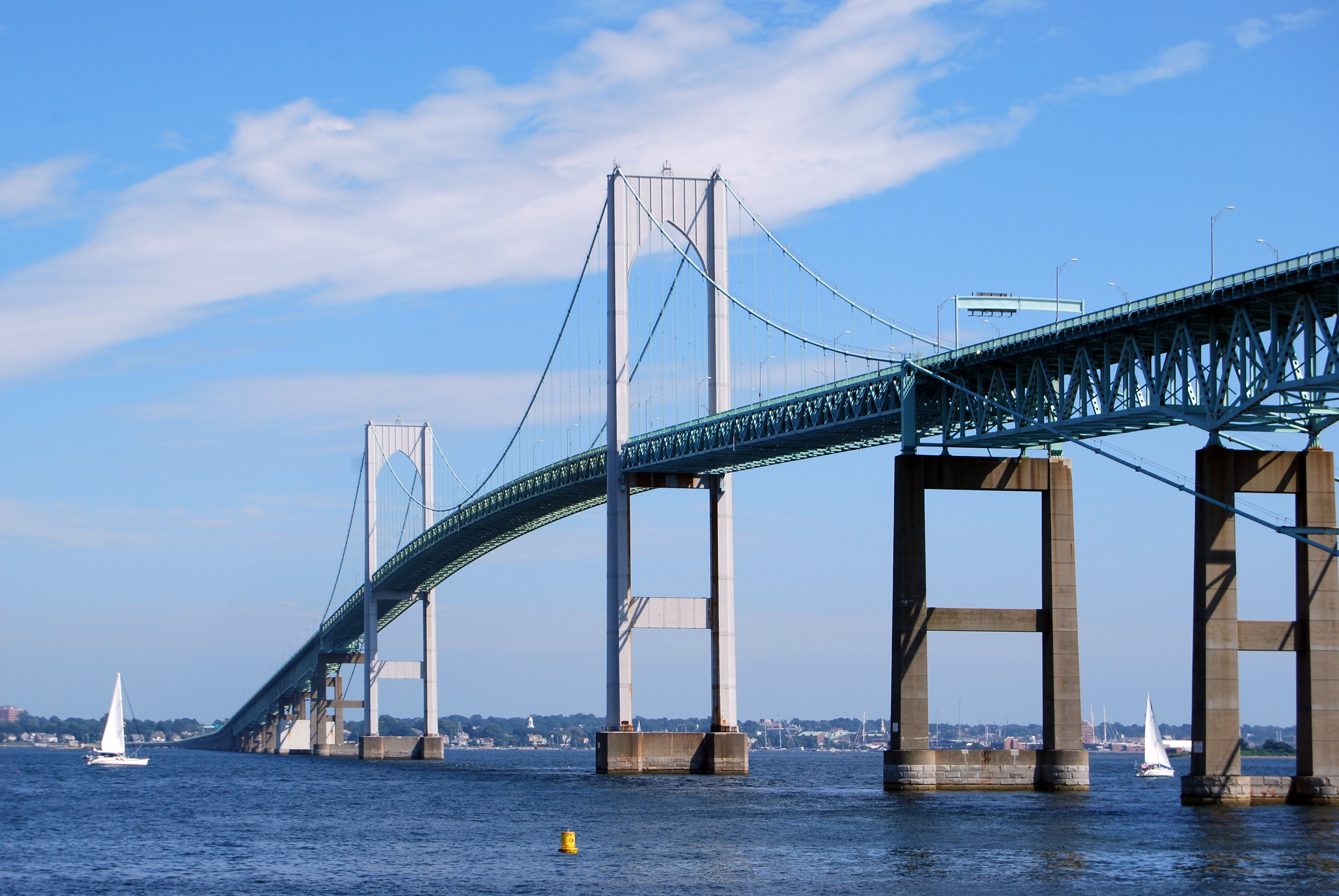 | |
|---|---|---|
| Major rivers | ||
| Cities & towns | ||
| Bridges |
| |
Authority control | |
|---|---|
| General | |
| National libraries | |
| Other |
|
На других языках
[de] Warwick (Rhode Island)
Die Stadt Warwick ist mit 82.934 Einwohnern (2020) die drittgrößte Stadt im US-Bundesstaat Rhode Island.[1] Sie verfügt mit dem T. F. Green Airport über einen zentral gelegenen Flughafen.- [en] Warwick, Rhode Island
[ru] Уорик (Род-Айленд)
Уорик (англ. Warwick) — город, расположенный в округе Кент (штат Род-Айленд, США) с населением в 82 672 человека (согласно статистическим данным переписи 2010 года) — третий по количеству жителей в штате.Другой контент может иметь иную лицензию. Перед использованием материалов сайта WikiSort.org внимательно изучите правила лицензирования конкретных элементов наполнения сайта.
WikiSort.org - проект по пересортировке и дополнению контента Википедии