world.wikisort.org - USA
Stoneham (/ˈstoʊnəm/ STO-nəm) is a town in Middlesex County, Massachusetts, nine miles (14.5 km) north of downtown Boston. Its population was 23,244 at the 2020 census.[1] Its proximity to major highways and public transportation offer convenient access to Boston and the North Shore coastal region and beaches of Massachusetts. The town is the birthplace of the Olympic figure-skating medalist Nancy Kerrigan and is the location of the Stone Zoo.
Parts of this article (those related to demographics) need to be updated. (March 2020) |
Stoneham, Massachusetts | |
|---|---|
Town | |
 Welcome to Stoneham, Massachusetts | |
 Seal | |
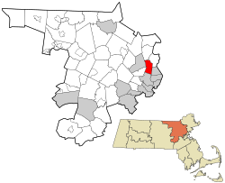 Location in Middlesex County in Massachusetts | |
| Coordinates: 42°28′48″N 71°06′00″W | |
| Country | |
| State | |
| County | Middlesex |
| Region | New England |
| Settled | 1645 |
| Incorporated | 1725 |
| Government | |
| • Type | Open town meeting |
| Area | |
| • Total | 17.4 km2 (6.7 sq mi) |
| • Land | 15.9 km2 (6.2 sq mi) |
| • Water | 1.5 km2 (0.6 sq mi) |
| Elevation | 47 m (155 ft) |
| Population (2020) | |
| • Total | 23,244 |
| • Density | 1,300/km2 (3,500/sq mi) |
| Time zone | UTC-5 (Eastern) |
| • Summer (DST) | UTC-4 (Eastern) |
| ZIP code | 02180 |
| Area code | 339 / 781 |
| FIPS code | 25-67665 |
| GNIS feature ID | 0618235 |
| Website | https://www.stoneham-ma.gov |


History
The earliest documented mention of the territory now called Stoneham dates to 1632 when, on February 7, Governor Winthrop and his party came upon this area. They found Spot Pond and ate their lunch on a place they called Cheese Rock, now known as Bear Hill.[2] Stoneham is situated on the traditional territory of the Massachusett and Pawtucket peoples.[3]
Stoneham was first settled by colonists in 1634 and was originally a part of Charlestown. In 1678, there were six colonists with their families, all in the northeast part of the town, probably because of its proximity to the settlement in Reading (now Wakefield).[4]
By 1725, the population of the area, called "Charlestown End", had increased until there were 65 male inhabitants paying taxes;[5] however, they were miles away from the settlement in Charlestown and could not conveniently reach its church or school. For this reason, Captain Benjamin Geary and 53 other residents of the area petitioned Charlestown to allow them to be separated. The town refused their petition at first, but on December 17, 1725, the General Court passed an act to establish the new township of Stoneham, separating it from Charlestown, and releasing its residents from the obligation to pay taxes to Charlestown, provided that within two years they would erect a suitable church and hire a minister and a schoolmaster.[6]

The town's first meeting-house was erected in 1726, as was its Burying Ground [now known as the Old Burying Ground and listed on the National Register of Historic Places in 1984.] The first church was organized in 1729, with members being released from the congregations in Reading and Melrose to form it. In the same year, the town voted to raise £9 for the building of a school, and chose a committee to hire a schoolmaster.[7] Stoneham remained a small town during the colonial era. Traces of its colonial history are still to be seen in the Spot Pond Archeological District of the Middlesex Fells Reservation. During the Industrial Revolution, Stoneham prospered as a major shoe-manufacturing center.
Government
Stoneham is part of the Massachusetts's 5th congressional district and is represented by Katherine Clark. The United States Senators are Ed Markey and Elizabeth Warren. Part of the 31st Middlesex District, Mike Day represents the district in the Massachusetts House of Representatives. He replaced Jason Lewis who now represents Stoneham in the Massachusetts Senate for the 5th Middlesex Senate district.
Geography
Stoneham is located at 42°28′48″N 71°5′54″W (42.480145, −71.098352).[8]
According to the United States Census Bureau, the town has a total area of 6.7 square miles (17.4 km2), of which 6.2 square miles (15.9 km2) is land and 0.6 square miles (1.5 km2), or 8.36%, is water.
Stoneham has two exits off Interstate 93, Winchester Highlands and Montvale Avenue and one exit off Interstate 95, Route 28.
Stoneham borders the following cities or towns: Woburn, Winchester, Medford, Melrose, Wakefield, and Reading.
Demographics
| Year | Pop. | ±% |
|---|---|---|
| 1850 | 2,085 | — |
| 1860 | 3,206 | +53.8% |
| 1870 | 4,513 | +40.8% |
| 1880 | 4,890 | +8.4% |
| 1890 | 6,155 | +25.9% |
| 1900 | 6,197 | +0.7% |
| 1910 | 7,090 | +14.4% |
| 1920 | 7,873 | +11.0% |
| 1930 | 10,060 | +27.8% |
| 1940 | 10,765 | +7.0% |
| 1950 | 13,229 | +22.9% |
| 1960 | 17,821 | +34.7% |
| 1970 | 20,725 | +16.3% |
| 1980 | 21,424 | +3.4% |
| 1990 | 22,203 | +3.6% |
| 2000 | 22,219 | +0.1% |
| 2010 | 21,437 | −3.5% |
| 2020 | 23,244 | +8.4% |
| * = population estimate. Source: United States census records and Population Estimates Program data.[9][10][11][12][13][14][15][16][17][18] | ||
At the 2000 census,[19] there were 22,219 people, 9,050 households and 5,873 families residing in the town. The population density was 3,614.1 per square mile (1,394.9/km2). There were 9,289 housing units at an average density of 1,510.9 per square mile (583.2/km2). The racial makeup was 95.01% White, 2.61% Asian, 0.89% Black or African American, 0.05% Native American, 0.04% Pacific Islander, 0.59% from other races, and 0.90% from two or more races. Hispanic or Latino of any race were 1.79% of the population.
There were 9,050 households, of which 26.7% had children under the age of 18 living with them, 53.1% were married couples living together, 8.8% had a female householder with no husband present, and 35.1% were non-families. 30.1% of all households were made up of individuals, and 13.3% had someone living alone who was 65 years of age or older. The average household size was 2.42 and the average family size was 3.07.
21.0% of the population were under the age of 18, 5.9% from 18 to 24, 30.4% from 25 to 44, 24.3% from 45 to 64, and 18.5% who were 65 years of age or older. The median age was 41 years. For every 100 females, there were 89.0 males. For every 100 females age 18 and over, there were 85.6 males.
The median household income was $56,605 and the median family income was $71,334. Males had a median income of $46,797 and females $37,274. The per capita income was $27,599. About 3.0% of families and 4.1% of the population were below the poverty line, including 5.7% of those under age 18 and 5.5% of those age 65 or over.
Transportation
Stoneham is inside the Route 128 belt that delineates the core of metropolitan Boston. Public transportation is available in or near Stoneham. The Tri-Community Greenway path goes through Stoneham accessible to walkers/bikers. The Oak Grove subway station is 3.8 miles (6.1 km) from Stoneham Center, in Malden, and is the northern terminus of the MBTA's Orange Line. Several commuter rail stations are in bordering communities of Melrose, Winchester, Wakefield, Reading, Medford, Woburn and Malden, each providing transportation to Boston's North Station. The MBTA's 132 bus route travels through Stoneham Center, offering transportation to the Orange Line at Oak Grove and Malden Station. And the MBTA's 325 Express Bus to downtown Boston offers limited service. Interstate 93 passes through Stoneham, and Route 128/Interstate 95 passes just to the north of the town.
Education
Stoneham has one public high school (Stoneham High School) and one public middle school (Stoneham Central Middle School). There are also three public elementary schools (Colonial Park School, Robin Hood School and South School) in the town.
The private Seventh-day Adventist school Greater Boston Academy offers programs for Pre-K to grade 8, and Saint Patrick School, a Catholic school, conducts programs from Pre-K level to grade 8.
Media
Stoneham is served by Boston television and radio stations, the Boston Herald, the Boston Globe and the Stoneham Independent newspaper. Stoneham has a community-access television station, StonehamTV, which broadcasts locally produced content on Comcast, Verizon and RCN cable systems.[20]
Nine O'Clock Horn
The Nine O'clock Horn, or Nine O'clock Bell/Alarm, is a horn that goes off from the Stoneham Fire Station every day at 9 a.m. and 9 p.m. Originally, the number of blasts of the horn was used to signal different groups to fight fires or alert the town of other emergencies such as a missing child. The 9 a.m and 9 p.m. horns are officially used to test the alert system, however Stoneham Fire staff have stated that these horns remain primarily as a tradition. The horn system is entirely automated.
There have been a few occasions when the bell has not rung, including the September 11, 2001 attacks, and the Boston Marathon Bombing.
Notable people
- Harland Bartholomew, urban planner, active 1911–1962
- Frank N. Blanchard (1888–1937), herpetologist, born in Stoneham
- William Francis Buckley (1927–1985), US Army Officer and CIA Bureau Chief, kidnapped and killed in Lebanon
- Mario Cantone (born 1959), comedian and actor
- Mike Colman, ice hockey player for the 1991–1992 San Jose Sharks
- Elisha S. Converse (1820–1904), inventor, manufacturer, philanthropist
- Sandro Corsaro, American animator and author, active from 2002
- Tom Dockrell, ice hockey player and coach for Colgate Raiders, 1950–1951
- Richard B. Fitzgibbon Jr. (1920–1956), among the first Americans killed in the Vietnam War
- Charles Gibbons (1901–1968), Speaker of the Massachusetts House of Representatives and 1958 candidate for governor[21]
- Jonathan Goff, linebacker for the New York Giants, 2008–2011
- Josh Gondelman (born 1985), comedian, writer for HBO's Last Week Tonight with John Oliver
- George J. Hall (1921–1946), U.S. Army soldier and Medal of Honor recipient in World War II
- Nathaniel Hayward (1808–1865), inventor and manufacturer
- Chris J. Johnson (born 1977), actor
- Nancy Kerrigan, figure skating medalist at the 1992 and 1994 Olympic Games
- Killer Kowalski, professional wrestler active 1947–1993
- Jay Larson, comedian, actor
- John "Pie" McKenzie, National Hockey League player; member of the 1970 and 1972 Stanley Cup-winning Boston Bruins
- Joe McLaughlin, American football player 1979–1984, linebacker for the Green Bay Packers and New York Giants
- Matt Mira (born 1983), comedian and podcaster
- Carol Sloane (born 1937), jazz singer
- Joe Vitiello, Major League Baseball player from 1995–2003
- Taylor von Kriegenbergh (born 1988), professional poker player
- Steve Yarbrough (born 1956), novelist and professor
Sports
In addition to the high school sports programs at Stoneham High School, Stoneham also has the Stoneham Sabers amateur team in the Yawkey Baseball League of Greater Boston.[22]
See also
- National Register of Historic Places listings in Stoneham, Massachusetts
- Stone Zoo
- People from Stoneham, Massachusetts
References
- "Census - Geography Profile: Stoneham town, Middlesex County, Massachusetts". United States Census Bureau. Retrieved September 29, 2021.
- William B. Stevens (1891). History of Stoneham, Massachusetts. Stoneham, Mass.: F.L. & W.E. Whittier. p. 10.
Stoneham, Massachusetts.
- "NativeLand.ca". Native-land.ca - Our home on native land. Retrieved February 8, 2018.
- Stevens, p. 14.
- R. H. Howard and Henry E. Crocker, ed. (1880). A History of New England. Vol. 1. Boston: Crocker & Co. p. 202.
- Stevens, p. 37
- Stevens, pp. 42–43.
- "US Gazetteer files: 2010, 2000, and 1990". United States Census Bureau. February 12, 2011. Retrieved April 23, 2011.
- "Total Population (P1), 2010 Census Summary File 1". American FactFinder, All County Subdivisions within Massachusetts. United States Census Bureau. 2010.
- "Massachusetts by Place and County Subdivision - GCT-T1. Population Estimates". United States Census Bureau. Retrieved July 12, 2011.
- "1990 Census of Population, General Population Characteristics: Massachusetts" (PDF). US Census Bureau. December 1990. Table 76: General Characteristics of Persons, Households, and Families: 1990. 1990 CP-1-23. Retrieved July 12, 2011.
- "1980 Census of the Population, Number of Inhabitants: Massachusetts" (PDF). US Census Bureau. December 1981. Table 4. Populations of County Subdivisions: 1960 to 1980. PC80-1-A23. Retrieved July 12, 2011.
- "1950 Census of Population" (PDF). Bureau of the Census. 1952. Section 6, Pages 21-10 and 21-11, Massachusetts Table 6. Population of Counties by Minor Civil Divisions: 1930 to 1950. Retrieved July 12, 2011.
- "1920 Census of Population" (PDF). Bureau of the Census. Number of Inhabitants, by Counties and Minor Civil Divisions. Pages 21-5 through 21-7. Massachusetts Table 2. Population of Counties by Minor Civil Divisions: 1920, 1910, and 1920. Retrieved July 12, 2011.
- "1890 Census of the Population" (PDF). Department of the Interior, Census Office. Pages 179 through 182. Massachusetts Table 5. Population of States and Territories by Minor Civil Divisions: 1880 and 1890. Retrieved July 12, 2011.
- "1870 Census of the Population" (PDF). Department of the Interior, Census Office. 1872. Pages 217 through 220. Table IX. Population of Minor Civil Divisions, &c. Massachusetts. Retrieved July 12, 2011.
- "1860 Census" (PDF). Department of the Interior, Census Office. 1864. Pages 220 through 226. State of Massachusetts Table No. 3. Populations of Cities, Towns, &c. Retrieved July 12, 2011.
- "1850 Census" (PDF). Department of the Interior, Census Office. 1854. Pages 338 through 393. Populations of Cities, Towns, &c. Retrieved July 12, 2011.
- "U.S. Census website". United States Census Bureau. Retrieved 2008-01-31.
- "Stoneham TV - TV Created by You!". Stoneham TV. Retrieved 4 April 2018.
- Kestenbaum, Lawrence. "The Political Graveyard: Index to Politicians: Gibbons". politicalgraveyard.com. Retrieved April 4, 2018.
- "Milestones, September 15, 1958". Time. September 15, 1958. Archived from the original on August 27, 2013. Retrieved April 4, 2018. - Dan Guttenplan (August 22, 2012). "Somerville Alibrandis will face Stoneham Sabers in Yawkey League semifinals". Somerville Journal.
Further reading
- History of Stoneham, Massachusetts by William Burnham Stevens, published 1891, 352 pages.
- History of Middlesex County, Massachusetts, Volume 1 (A-H), Volume 2 (L-W) compiled by Samuel Adams Drake, published 1879 and 1880. 572 and 505 pages. Stoneham article by Silas Dean in volume 2 pages 339–356.
- Vital Records of Stoneham, Massachusetts, to the End of the Year 1849 By Stoneham (Mass.), Essex Institute, published 1918.
- 1871 Atlas of Massachusetts. by Wall & Gray.Map of Massachusetts. Map of Middlesex County.
External links
- Town of Stoneham official website Archived 2013-01-22 at the Wayback Machine
- The Stoneham Independent (newspaper)
- Stoneham Chamber of Commerce
- Stoneham Public Library
- StonehamTV
| ||||||||||||||||||||
| General Information | ||||||||||||||||||||
| Institutions |
| |||||||||||||||||||
| Attractions |
| |||||||||||||||||||
| Notable Residents |
| |||||||||||||||||||
| Natl. Hist. Places (Houses) |
| |||||||||||||||||||
| Natl. Hist. Places (Buildings) |
| |||||||||||||||||||
| ||||||||||||||||||||
| ||||||||||||||||||||
Municipalities and communities of Middlesex County, Massachusetts, United States | ||
|---|---|---|
| Cities |  | |
| Towns |
| |
| CDPs |
| |
| Other villages |
| |
| Footnotes | ‡This populated place also has portions in an adjacent county or counties | |
| ||
Authority control | |
|---|---|
| General | |
| National libraries | |
| Other |
|
На других языках
[de] Stoneham (Massachusetts)
Stoneham ist eine Kleinstadt im Middlesex County des Bundesstaats Massachusetts in den Vereinigten Staaten. Die Einwohnerzahl beträgt 23.244 (Stand 2020). Die Siedlung ist Teil der Metropolregion Greater Boston.- [en] Stoneham, Massachusetts
[es] Stoneham (Massachusetts)
Stoneham es un pueblo ubicado en el condado de Middlesex en el estado estadounidense de Massachusetts. En el Censo de 2020 tenía una población de 23,244 habitantes y una densidad poblacional de 3,500 personas por km².[3][ru] Стонем (Массачусетс)
Сто́нем[2] (англ. Stoneham) — городок (town) в округе Мидлсекс, штат Массачусетс, США. Примерно четверть населения составляют выходцы из Италии и ещё четверть — из Ирландии[3].Другой контент может иметь иную лицензию. Перед использованием материалов сайта WikiSort.org внимательно изучите правила лицензирования конкретных элементов наполнения сайта.
WikiSort.org - проект по пересортировке и дополнению контента Википедии