world.wikisort.org - USA
Weymouth is a city[2] in Norfolk County, Massachusetts, and one of 13 municipalities in the state to have city forms of government while retaining "town of" in their official names.[3] It is named after Weymouth, Dorset, a coastal town in England, and is the second-oldest settlement in Massachusetts, second only to Plymouth.[4] It is one of the South Shore's more affordable towns and offers a short commute into Boston, MBTA bus and rail service, and a town beach.
Town of Weymouth | |
|---|---|
City | |
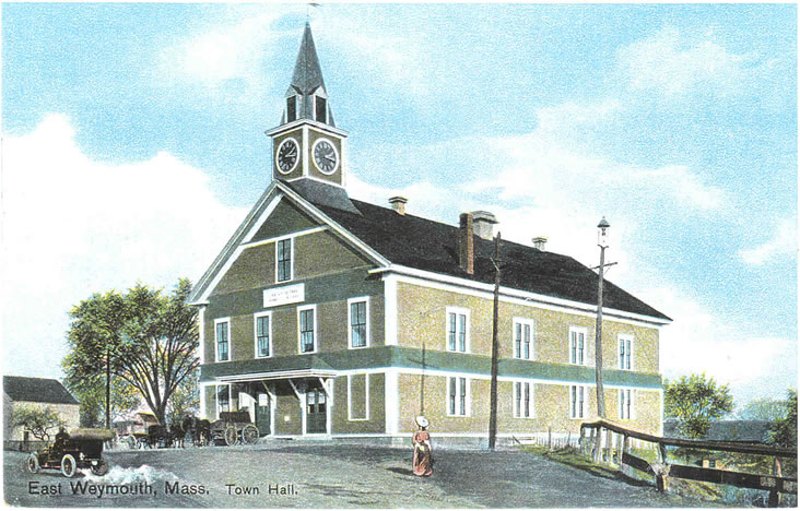
 Town Hall, built in 1928 as a replica of the Old State House in Boston | |
 Flag  Seal | |
| Motto(s): Latin: Laborare Est Vincere ("To Work Is to Conquer") | |
 Location in Norfolk County in Massachusetts | |
| Coordinates: 42°13′15″N 70°56′25″W | |
| Country | |
| State | |
| County | |
| Settled | 1622 |
| Incorporated | September 2, 1635 |
| Government | |
| • Type | Mayor-council |
| • Mayor | Bob Hedlund (R) |
| Area | |
| • Total | 21.57 sq mi (55.88 km2) |
| • Land | 16.77 sq mi (43.42 km2) |
| • Water | 4.81 sq mi (12.45 km2) |
| Elevation | 200 ft (27 m) |
| Population (2020) | |
| • Total | 57,437 |
| • Density | 3,426.01/sq mi (1,322.79/km2) |
| Time zone | UTC−5 (Eastern) |
| • Summer (DST) | UTC−4 (Eastern) |
| ZIP Codes | 02188–02191 |
| Area code | 339/781 |
| FIPS code | 25-78865 |
| GNIS feature ID | 0619462 |
| Website | www |
As of the 2020 census, Weymouth had a total population of 57,437.[5]
Demographics
| Year | Pop. | ±% |
|---|---|---|
| 1840 | 3,738 | — |
| 1850 | 5,369 | +43.6% |
| 1860 | 7,742 | +44.2% |
| 1870 | 9,010 | +16.4% |
| 1880 | 10,570 | +17.3% |
| 1890 | 10,866 | +2.8% |
| 1900 | 11,324 | +4.2% |
| 1910 | 12,895 | +13.9% |
| 1920 | 15,057 | +16.8% |
| 1930 | 20,882 | +38.7% |
| 1940 | 23,868 | +14.3% |
| 1950 | 32,690 | +37.0% |
| 1960 | 48,177 | +47.4% |
| 1970 | 54,610 | +13.4% |
| 1980 | 55,601 | +1.8% |
| 1990 | 54,063 | −2.8% |
| 2000 | 53,988 | −0.1% |
| 2010 | 53,743 | −0.5% |
| 2020 | 57,437 | +6.9% |
| * = population estimate. Source: United States census records and Population Estimates Program data.[6][7][8][9][10][11][12][13][14][15] Source: U.S. Decennial Census[16] | ||
As of the 2010 census, there were 53,743 people, 22,435 households, and 13,595 families residing in the city. The population density was 3,174.2 people per square mile (1,225.4/km2). There were 22,573 housing units at an average density of 1,327.1 per square mile (512.4/km2). 64% housing units were owner-occupied and 35% of housing units were renter-occupied. The racial makeup of the city was 82.7% White, 5.2% Black or African American, 0.2% Native American, 5.7% Asian, 0.0% Pacific Islander, 0.6% from other races, and 2.2% from two or more races. Hispanic or Latino of any race were 3.1% of the population.[17]
There were 22,028 households, out of which 27.3% had children under the age of 18 living with them, 48.6% were married couples living together, 10.3% had a female householder with no husband present, and 26.8% were non-families, 37% of which were non-family households with residents over 65 years of age. 30.6% of all households were made up of individuals, and 11.1% had someone living alone who was 65 years of age or older. The average household size was 2.42 and the average family size was 3.08.
In the city, the population was spread out, with 22.0% under the age of 18, 6.6% from 18 to 24, 32.7% from 25 to 44, 23.4% from 45 to 64, and 15.4% who were 65 years of age or older. The median age was 38 years. For every 100 females, there were 90.4 males. For every 100 females age 18 and over, there were 86.3 males.
The median income for a household in the city was $68,665, and the median income for a family was $52,083. Males had a median income of $42,497 versus $35,963 for females. The per capita income for was $24,976. About 9.1% of families and 9.8% of the population were below the poverty line, including 8.3% of those under age 18 and 9.4% of those age 65 or over.
Weymouth has the 10th highest Irish population in the United States, at 33%.[18] As "white flight" occurred in inner-city Boston exacerbated by the start of the cross-district busing program, in the 1960s and 70s thousands of white (predominantly of Irish descent) Bostonians moved to middle/working class suburbs such as Weymouth and Quincy. The blue collar city culture (example: The Boston accent) of places like South Boston and Dorchester is prevalent in the neighborhoods of Weymouth. Weymouth has colloquially been referred to as "Suburban Southie" and "Southie on the South Shore" due to the high influx of South Boston residents and Irish Catholic culture in the town. This trend continues in a different way again today as some longtime South Boston residents are now being priced out due to gentrification. Many are moving out to the more affordable towns on the South Shore.
Demographic breakdown by ZIP code
Income
Data is from the 2009–2013 American Community Survey 5-Year Estimates.[19][20][21]
| Rank | ZIP Code (ZCTA) | Per capita income |
Median household income |
Median family income |
Population | Number of households |
|---|---|---|---|---|---|---|
| Norfolk County | $44,692 | $84,916 | $108,943 | 677,296 | 257,451 | |
| 1 | 02190 (South Weymouth) | $36,124 | $77,329 | $98,442 | 16,733 | 6,719 |
| 2 | 02188 (Weymouth Landing) | $35,954 | $68,366 | $80,799 | 14,655 | 6,220 |
| Massachusetts | $35,763 | $66,866 | $84,900 | 6,605,058 | 2,530,147 | |
| Weymouth | $32,832 | $68,113 | $81,987 | 54,366 | 22,526 | |
| 3 | 02191 (North Weymouth) | $31,652 | $64,365 | $86,588 | 8,369 | 3,558 |
| 4 | 02189 (East Weymouth) | $29,185 | $60,059 | $78,079 | 14,609 | 6,029 |
| United States | $28,155 | $53,046 | $64,719 | 311,536,594 | 115,610,216 | |
Geography

Weymouth is located at 42°12′23″N 70°56′45″W (42.206458, −70.945919).[22]
According to the United States Census Bureau, the city has an area of 21.6 square miles (56 km2), of which 17 square miles (44 km2) is land and 4.6 square miles (12 km2) (comprising 21.29%) is water.
Weymouth contains the Weymouth Back River and the Weymouth Fore River; its surroundings, formerly industrial, are now set aside as parks and natural areas, including Webb Memorial State Park. There are many streets named after people and trees.
Weymouth residents often designate which of four "districts" they live in:
- North Weymouth is considered anything north of the intersection of Church Street, North Street and Green Street. Some of the sites around North Weymouth are Great Esker Park, George Lane Beach, Webb State Park, the Wessagusset Yacht Club, Boston skyline views, and the Abigail Adams Historical Society. Historically North Weymouth was a blue collar area, However, recently it has started to include up-and-coming waterfront property that rivals similar in pricier towns. Many small cottages are being bought up and redone on the waterfront. This is notable on streets such as Regatta Road. North Weymouth is the most densely populated area of the town.
- South Weymouth is mostly south of Route 3. South Weymouth is home to the former Naval Air base that is being redeveloped into residential and commercial properties and is one of the areas biggest development projects. South Shore Hospital and Weymouth High School are in South Weymouth. South Weymouth has its own town square called Columbian Square.
- East Weymouth is somewhat in the center of Weymouth, including Whitman's Pond, Jackson Square, and Town Hall. East Weymouth has several fine examples of Victorian homes, including Queen Anne, shingle, and colonial revival homes. Some particularly fine examples of these homes are being restored on Hillcrest Road. East Weymouth has many longtime working class residents who take pride in their hometown.
- Weymouth Landing spans a mile around Weston Park. After recent years of blight in the main commercial area it is being redeveloped. Weymouth Landing is the border between Weymouth and Braintree and is where the Fore River splits into tributaries.
Weymouth is bordered on the north by Hingham Bay and Boston Harbor. Weymouth's territory includes Grape Island, Slate Island, and Sheep Island, all part of the Boston Harbor Islands National Recreation Area. Weymouth is bordered on the west by Quincy, Braintree, and Holbrook. It is bordered on the south by Abington and Rockland. Weymouth is bordered on the east by Hingham.
Climate
The climate in this area is characterized by hot, humid summers and generally mild to cool winters. According to the Köppen Climate Classification system, Weymouth has a humid subtropical climate, abbreviated "Cfa" on climate maps.[23]
| Climate data for Weymouth, Massachusetts | |||||||||||||
|---|---|---|---|---|---|---|---|---|---|---|---|---|---|
| Month | Jan | Feb | Mar | Apr | May | Jun | Jul | Aug | Sep | Oct | Nov | Dec | Year |
| Average high °F (°C) | 39 (4) |
42 (6) |
49 (9) |
59 (15) |
70 (21) |
79 (26) |
85 (29) |
83 (28) |
75 (24) |
65 (18) |
54 (12) |
43 (6) |
61.9 (16.6) |
| Daily mean °F (°C) | 30 (−1) |
32 (0) |
40 (4) |
49 (9) |
59 (15) |
69 (21) |
74 (23) |
73 (23) |
65 (18) |
54 (12) |
45 (7) |
35 (2) |
52.1 (11.2) |
| Average low °F (°C) | 21 (−6) |
23 (−5) |
30 (−1) |
39 (4) |
48 (9) |
58 (14) |
64 (18) |
63 (17) |
55 (13) |
44 (7) |
36 (2) |
26 (−3) |
42.2 (5.7) |
| Average precipitation inches (cm) | 4 (10) |
4 (10) |
4 (10) |
3.9 (9.9) |
3.2 (8.1) |
2.8 (7.1) |
2.8 (7.1) |
3.8 (9.7) |
3.3 (8.4) |
3.8 (9.7) |
4.5 (11) |
4.2 (11) |
44.3 (113) |
| Source: Weatherbase[24] | |||||||||||||
Transportation
Weymouth is served by several MBTA bus routes as well as three MBTA Commuter Rail stations: two on the Greenbush Line, at Weymouth Landing and near Jackson Square, and one on the Old Colony Line at South Weymouth. Numbered routes that pass through Weymouth include Massachusetts Routes 3, 3A, 18, 53, 58 and 139.
Government
Weymouth was founded in 1635, from the territory known as Wessagusett which was described in 1622—just two years after the Pilgrims landed in Plymouth. Weymouth held the distinction of having the oldest continuous town meeting form of government, for 365 years. In 1999, Weymouth residents voted to change to a city form of government. David M. Madden was elected as the city's first mayor and took office in 2000.
On July 10, 2007, Mayor David M. Madden announced he would not seek reelection. In 2008, Susan Kay was elected as the new mayor of Weymouth.
On November 3, 2015, Republican state senator Bob Hedlund was elected as the new mayor of Weymouth, succeeding long-incumbent mayor Susan M. Kay. Hedlund assumed office on January 4, 2016.
Weymouth is part of the Massachusetts Senate's Plymouth and Norfolk district.
Weymouth is one of the few places in the United States where self-service gas stations are illegal. The ban was introduced in 1977.[25]
| Voter Registration and Party Enrollment as of October 15, 2008[26] | |||||
|---|---|---|---|---|---|
| Party | Number of Voters | Percentage | |||
| Democratic | 12,254 | 35.45% | |||
| Republican | 3,690 | 10.68% | |||
| Independent | 18,497 | 53.52% | |||
| Libertarian | 123 | 0.36% | |||
| Total | 34,564 | 100% | |||
Education
Weymouth High School is the only high school in Weymouth. Prior to 2005, grades eight and nine were housed in Weymouth Junior High while grades ten, eleven, and twelve comprised the High School. This changed with the construction of a new wing on the Junior High building in South Weymouth, which subsequently became the new Weymouth High School housing grades nine through twelve. The old Weymouth High School in East Weymouth was converted into the Maria Weston Chapman Middle School. More than 2,000 students attend the high school. A brand new athletic surface was completed in 2005, giving Weymouth High School an artificial turf field and a track surface.
In 2008 Boston Magazine ranked Weymouth High School eighth among Boston-area high schools in academic performance and eighteenth in cost efficiency.[27] In June 2021, Weymouth High School was placed into a state program for schools or districts that disproportionately suspend nonwhite students or students with disabilities.[28]
There is one Weymouth Middle School in East Weymouth. There are two campuses and are down the street from each other. The campuses are called Chapman Campus and Adams Campus.
Abigail Adams Middle School has now been set for 5th and 6th grades and Maria Weston Chapman Middle School 7th and 8th grades in 2010. With Chapman going to be rebuilt within the next few years due to poor upkeep of the current school.
There are eight primary schools and one early childhood center, five of which are named after Weymouth's Congressional Medal of Honor recipients.
- Academy Avenue Primary School
- Frederick C. Murphy Primary School
- Thomas V. Nash Jr. Primary School
- Lawrence W. Pingree Primary School
- William Seach Primary School
- Ralph Talbot Primary School
- Thomas W. Hamilton School
- Wessagusset Primary School
- Elden H. Johnson Early Childhood Center
There is one Public Charter School which Weymouth is associated to
- South Shore Charter Public School (located in Norwell Massachusetts)
In addition, there are four private schools in Weymouth.
- South Shore Christian Academy, an independent, Christian, college preparatory day school for students in grades K–12. SSCA also operates a pre-school program.
- Sacred Heart Elementary School, a Catholic elementary school under the direction of the Archdiocese of Boston for grades Pre-K–4. This school is associated with St. Francis Xavier.
- First Baptist Christian, an elementary school for grades Pre-K–8, under the direction of the First Baptist Church of Weymouth.
- St. Francis Xavier, a Catholic elementary school under the direction of St. Francis Parish. This school is for grades 5–8 and is associated with Sacred Heart Elementary School
History
A failed colony
Weymouth was settled in 1622 as Wessagusset Colony founded by Thomas Weston, who had been the main financial backer of Plymouth Colony.[29] The settlement was a failure, as the 60 men from London were ill-prepared for the hardships required for survival. They also may have lacked the motivation of the Pilgrims, as this colony was purely economic in motivation and the men had not brought their families.[30]

By winter, poor planning and bad management led to supplies running out, and the Plymouth colonists had little to share. The situation grew desperate and Weymouth men began to sell their clothes, hire themselves out as laborers, and even steal from the local Massachusett Indians. The Indians were soon taunting the Weymouth men and robbing them of what little food they gathered clamming and foraging in the woods.[31] By now, many in the colony were starving or ill, and law and order had broken down. The lowest point came when a settler was accused of stealing supplies from the Massachusetts, and the Massachusett leaders demanded the thief's execution; the Weymouth men complied, but legend has it that they may have executed a dying, sick settler instead.[31]
By April 1623, word came of conflict between American Indians and the Virginia colonists, and tension increased between the Wessagusset colonists and the Indians. Massachusetts and other tribes began plotting to attack and destroy what was left of the floundering colony and the more successful Plymouth Colony. Wampanoag Chief Massasoit heard about the plot but soon fell ill and nearly died. A party from the Plymouth Colony came to his village and nursed him back to health, and he warned them of the plot.[31] Governor William Bradford decided to preempt the planned attack, and sent Myles Standish to Weymouth with the Plymouth militia and their Indian guide Hobbamock to end the threat. Using the promise of a meal of pork, Standish lured five of the more bellicose Massachusett Indians inside the stockade, including Wituwamat, a large man who had belittled Standish because he was short and had bragged about murdering a number of French shipwreck survivors. Once inside, there was a brief struggle and the Indian leaders were killed.
Ten of the original 60 colonists starved to death and two others were killed in conflicts with the Indians. Forty-five colonists joined Plymouth or went north to Maine, and from there most returned to England. Three men who had left the colony to live among the Indians as laborers could not be warned in time and were subsequently killed by them after Standish had released the women and children.[31]
Robert Gorges attempted to form a colony at the site later that year as the center of a more royalist and Anglican system of government for New England.[30] He brought William Morrell as religious leader and expected Governor Bradford to acknowledge his supremacy and act as his agent.[30] Within weeks, the New England winter caused Gorges to leave with most of the settlers.[29] Those who remained formed the nucleus of the permanent settlement.[32] and the oldest in what would become Massachusetts Bay Colony.[33] In 1630, it was officially incorporated into the Massachusetts Bay Colony; the name was changed to Weymouth in 1635 with the addition of 100 families under the leadership of Joseph Hull. These groups experienced some difficulty integrating together, especially due to conflicting pressures from the Puritans of Boston and the Pilgrims of Plymouth, but Weymouth was a stable and prominent town with its current boundaries by 1635.[30] It was included as part of Suffolk County when it was formed on May 10, 1643. The oldest surviving house in Weymouth is the Bickman House (c. 1650) located at 84 Sea Street.[34]
Post-colonization
Weymouth was heavily involved in the shoemaking industry from the first years of the 18th century right through to 1973, when the Stetson Shoe Company closed its doors. The building is currently being used for medical offices.[35]
The original town hall was destroyed by fire in 1914 and was replaced in 1928 with a town hall that is a replica of the old Massachusetts State House in Boston. In May 2018, Massachusetts Governor Charlie Baker designated a tract of land near Lakeview Manor and the eastern and northern borders of Whitman's Pond as an "opportunity zone" under the Congressional Tax Cuts and Jobs Act of 2017.[36]
Points of interest
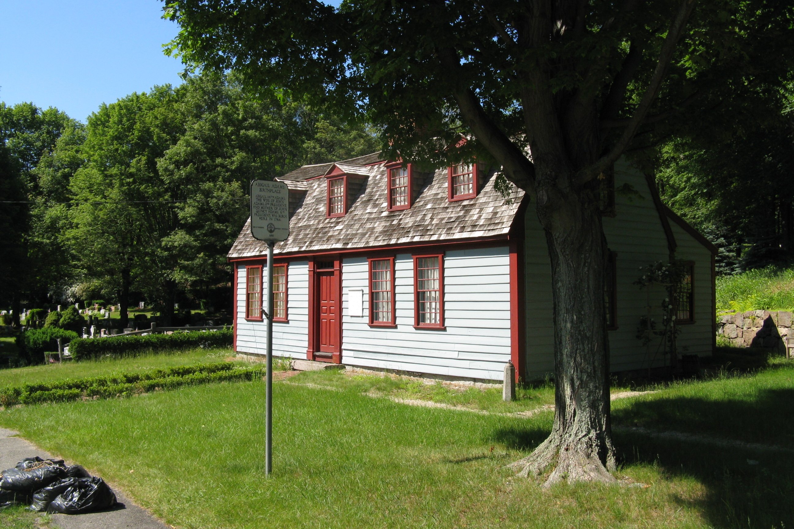
- The house where Abigail Adams, wife of President John Adams and mother to President John Quincy Adams, was born is in Weymouth.
- A portion of the former South Weymouth Naval Air Station, which was closed in 1996 under the Base Realignment and Closure Act, was located in Weymouth. The property has been slated for development, which will be called Union Point. Plans include a parkway, residences, a sports facility, and a movie studio.
- Union Point Sports Complex, a 25-acre (10 ha) sports complex that is the home venue of the New England Free Jacks of Major League Rugby.
Parks
Weymouth has 43 parks, playgrounds, memorials, recreation areas and facilities:[37]
Notable people
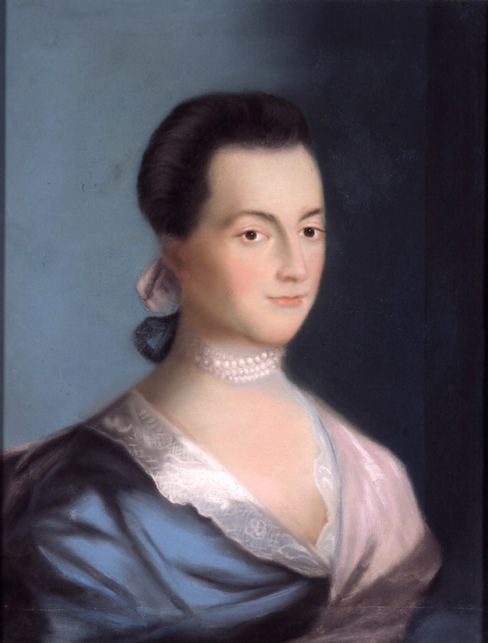


- Abigail Adams, wife of President John Adams[38]
- Chris Bagley, soccer player
- James L. Bates, colonel in the Union Army during the American Civil War
- Tobin Bell, actor, most known for his role as Jigsaw in the movie Saw
- Rodney Butcher, professional golfer
- Scott Caldwell (born 1991), professional soccer player
- Jim Carey, former professional hockey goaltender from 1994 to 1999 and Vezina trophy winner in 1996
- Paul Carey, ice hockey center
- Marcy Carsey, television writer/producer
- Maria Weston Chapman, abolitionist, executive committee member of the American Anti-Slavery Society in 1839, organizer of the Boston Female Anti-Slavery Society, and editor of The Liberator and The Liberty Bell[39]
- Michael J. Connor, Vice Admiral in the United States Navy, Commander, US Submarine Forces (COMNAVSUBFOR) 2012–2015
- Rob and Nate Corddry, correspondents for The Daily Show
- Charlie Coyle, professional hockey player for the Boston Bruins (2019–)
- William Cranch, judge and the second reporter of decisions of the Supreme Court of the US
- Beatrice Farnham, 20th-century artist and entrepreneur
- Flip Gordon (Travis Gordon Lopes Jr.), professional wrestler
- Mike Hazen, Major League Baseball executive, Arizona Diamondbacks vice president
- Hal Holbrook, Academy Award-nominated actor
- Mark Holden, professional hockey goaltender for the Montreal Canadiens and Winnipeg Jets
- Newland H. Holmes, politician who served as President of the Massachusetts Senate from 1957 to 1958
- Dan Howley, Major League Baseball manager with the St. Louis Browns and the Cincinnati Reds
- Paul K. Hurley, 24th Chief of Chaplains of the United States Army
- Elden H. Johnson, US Army soldier and a recipient of the US military's highest decoration—the Medal of Honor—for his actions in World War II
- George Jung, a.k.a. "Boston George", subject of the 2001 film Blow, highly successful member of the Medellín Drug Cartel
- Tim Karalexis, professional soccer player
- Margaret D. Klein, Rear Admiral, in the United States Navy, Commander, US Expeditionary Strike Group Five (ESG-5), 82nd Commandant of Midshipmen at the United States Naval Academy (first woman to serve as commandant)
- Gilbert N. Lewis, physical chemist
- Dave Lindstrom, former professional football player for Kansas City Chiefs
- George Little, US Naval Officer, two destroyers have been named USS Little in his honor
- Charles G. Long, second Assistant Commandant of the Marine Corps, recipient of the Marine Corps Brevet Medal
- Elias Mann, composer
- Allan R. McKinnon, former politician who served as a member of the Massachusetts State Senate from 1970 to 1984, Deputy Secretary of Transportation from 1985 to 1988, and Chairman of the Massachusetts Turnpike Authority from 1988 to 1996
- Patrick V. McNamara, Democratic Senator (1955–1966) from Michigan
- Joe Mulligan, Major League Baseball pitcher who played briefly for the Boston Red Sox during the 1934 season
- Bob Neumeier, sportscaster for NBC Sports
- James Peckham1956 was a participant for the US Olympic Greco Roman Wrestling team; Head Coach Greco Roman Olympic Wrestling team 1976[40]
- Warren G. Phillips, inducted into the National Teachers Hall of Fame in 2010
- Richard Robbins, Academy Award-nominated film score composer
- Abby Rosmarin, model and writer
- Frank Salemme, mobster
- Gary Lee Sampson, spree killer
- Bobby Sheehan, former professional hockey player from 1969 to 1983
- Mark Shields, political pundit and liberal commentator
- Ralph Talbot, first U.S. Marine Corps aviator to be awarded the Medal of Honor for "exceptionally meritorious service and extraordinary heroism" while attached to Squadron C, US 1st Marine Aviation Force, in France during World War I
- Jared Terrell (born 1995), basketball player in the Israeli Basketball Premier League, played at URI
- Albert Tirrell, first person acquitted of murder in the US using the sleepwalking defense
- Kurt Walker, NHL player
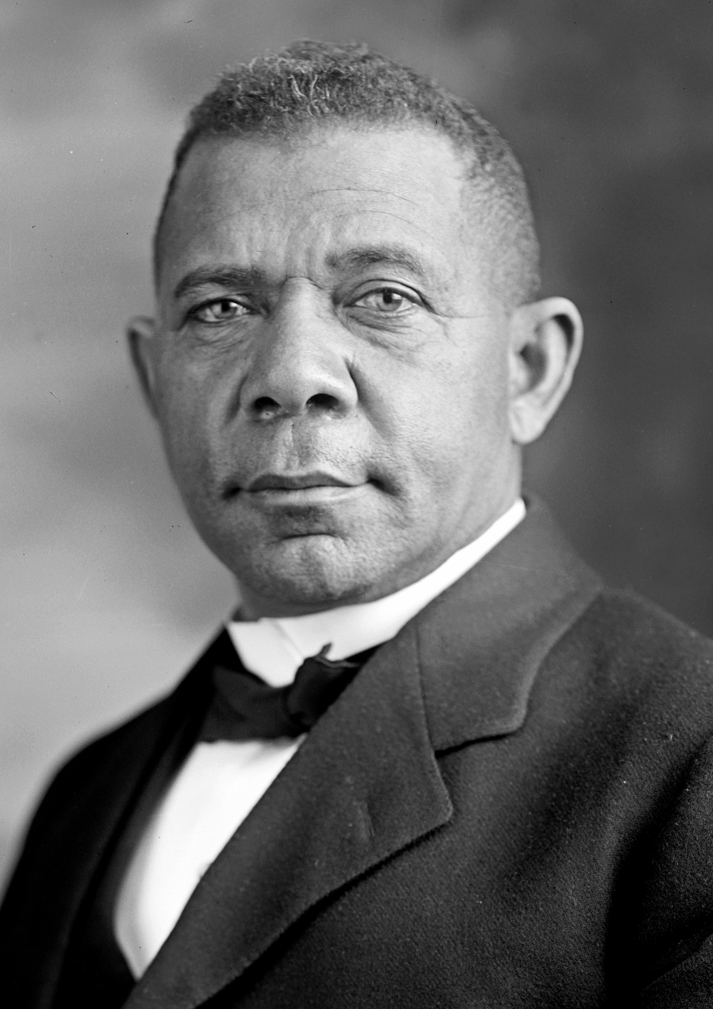
- Booker T. Washington, African-American educator, author, and civic leader, owned a vacation home at 825 Main Street, 1902–1903[41][42]
- Frank Lloyd Wright, architect, lived in Weymouth briefly as a child when his father was a minister at the Weymouth Unitarian Universalist Church
- David Wyman, author of several books on the responses of the US to Nazi Germany's persecution of and programs to exterminate Jews
- Paul Zukauskas, professional football player, Cleveland Browns
See also
- Mayor-council government
References
- "2020 U.S. Gazetteer Files". United States Census Bureau. Retrieved May 21, 2022.
- Although it is called the "Town of Weymouth," it is a statutory city of Massachusetts. See Office of the Secretary of the Commonwealth.
- "CIS: Massachusetts City and Town Incorporation and Settlement Dates". www.sec.state.ma.us.
- Adams, Charles Francis; Nash, Gilbert (1905). Wessagusset and Weymouth. p. 1.
- "Census - Geography Profile: Weymouth Town city, Norfolk County, Massachusetts". United States Census Bureau. Retrieved September 29, 2021.
- "Total Population (P1), 2010 Census Summary File 1". American FactFinder, All County Subdivisions within Massachusetts. United States Census Bureau. 2010.
- "Massachusetts by Place and County Subdivision - GCT-T1. Population Estimates". United States Census Bureau. Retrieved July 12, 2011.
- "1990 Census of Population, General Population Characteristics: Massachusetts" (PDF). US Census Bureau. December 1990. Table 76: General Characteristics of Persons, Households, and Families: 1990. 1990 CP-1-23. Retrieved July 12, 2011.
- "1980 Census of the Population, Number of Inhabitants: Massachusetts" (PDF). US Census Bureau. December 1981. Table 4. Populations of County Subdivisions: 1960 to 1980. PC80-1-A23. Retrieved July 12, 2011.
- "1950 Census of Population" (PDF). Bureau of the Census. 1952. Section 6, Pages 21-10 and 21-11, Massachusetts Table 6. Population of Counties by Minor Civil Divisions: 1930 to 1950. Retrieved July 12, 2011.
- "1920 Census of Population" (PDF). Bureau of the Census. Number of Inhabitants, by Counties and Minor Civil Divisions. Pages 21-5 through 21-7. Massachusetts Table 2. Population of Counties by Minor Civil Divisions: 1920, 1910, and 1920. Retrieved July 12, 2011.
- "1890 Census of the Population" (PDF). Department of the Interior, Census Office. Pages 179 through 182. Massachusetts Table 5. Population of States and Territories by Minor Civil Divisions: 1880 and 1890. Retrieved July 12, 2011.
- "1870 Census of the Population" (PDF). Department of the Interior, Census Office. 1872. Pages 217 through 220. Table IX. Population of Minor Civil Divisions, &c. Massachusetts. Retrieved July 12, 2011.
- "1860 Census" (PDF). Department of the Interior, Census Office. 1864. Pages 220 through 226. State of Massachusetts Table No. 3. Populations of Cities, Towns, &c. Retrieved July 12, 2011.
- "1850 Census" (PDF). Department of the Interior, Census Office. 1854. Pages 338 through 393. Populations of Cities, Towns, &c. Retrieved July 12, 2011.
- "Census of Population and Housing". Census.gov. Retrieved June 4, 2015.
- 2010 American Fact Finder
- http://www.epodunk.com/top10/irish/index.html ePodunk Irish Index
- "SELECTED ECONOMIC CHARACTERISTICS 2009-2013 American Community Survey 5-Year Estimates". U.S. Census Bureau. Archived from the original on 2020-02-12. Retrieved 2015-01-12.
- "ACS DEMOGRAPHIC AND HOUSING ESTIMATES 2009-2013 American Community Survey 5-Year Estimates". U.S. Census Bureau. Archived from the original on 2020-02-12. Retrieved 2015-01-12.
- "HOUSEHOLDS AND FAMILIES 2009-2013 American Community Survey 5-Year Estimates". U.S. Census Bureau. Archived from the original on 2020-02-12. Retrieved 2015-01-12.
- "US Gazetteer files: 2010, 2000, and 1990". United States Census Bureau. 2011-02-12. Retrieved 2011-04-23.
- "Weymouth, Massachusetts Köppen Climate Classification (Weatherbase)". Weatherbase.
- "Weatherbase.com". Weatherbase. 2013. Retrieved on October 26, 2013.
- https://www.patriotledger.com/news/20190426/weymouth-holds-tight-to-41-year-ban-on-self-service-gas-pumps [bare URL]
- "Registration and Party Enrollment Statistics as of October 15, 2008" (PDF). Massachusetts Elections Division. Retrieved 2010-05-08.
- "The Best Public High Schools". Archived from the original on 2012-07-22. Retrieved 2010-01-08.
- Trufant, Jessica (June 11, 2021). "Black students disproportionately suspended at schools in Quincy, Weymouth, Plymouth". The Patriot Ledger. Gannett. Retrieved June 12, 2021.
- http://www.weymouth.ma.us/history/index.asp?id=2598 Archived 2011-05-04 at the Wayback Machine Weymouth the First Hundred Years by Ted Clark
- https://books.google.com/books?id=lJJuAAAAMAAJ Historical sketch of Weymouth, Massachusetts, from 1622-1884 by Gilbert Nash
- Mayflower: A story of Courage, Community, and War, Viking Press 2006 by Nathaniel Philbrick, pages 140-153
- Jeannette Paddock Nichols; Roy Franklin Nichols. The republic of the United States: a history, Volume 1. p. 48.
- Moore, Jacob Bailey (1848). Lives of the governors of New Plymouth, and Massachusetts bay. p. 235.
- "Archived copy" (PDF). Archived from the original (PDF) on 2019-10-22. Retrieved 2019-10-22.
{{cite web}}: CS1 maint: archived copy as title (link) - "Archived copy". Archived from the original on 2006-10-29. Retrieved 2006-10-24.
{{cite web}}: CS1 maint: archived copy as title (link) - Baker, Ed (May 2, 2018). "Opportunity Zone designated near Weymouth's Whitman's Pond". Weymouth News. GateHouse Media. Retrieved January 1, 2019.
- Parks & Recreation – Weymouth MA, Town of Weymouth, Massachusetts, retrieved June 22, 2017
- Who Was Who in America, Historical Volume, 1607–1896. Marquis Who's Who. 1967.
- Sullivan, Debbie Sargent; Tighe, Joanne Palmieri (2001). Images of America: Weymouth. Portsmouth, NH: Arcadia Publishing. p. 13. ISBN 978-0-7385-0926-6.
- "Jim Peckham Bio, Stats, and Results". Olympics at Sports-Reference.com. Archived from the original on 2020-04-18.
- Historical Timeline - North Weymouth Civic Association, North Weymouth Civic Association, 6 April 2012, retrieved February 16, 2016
- Harlan, Louis R. (1983), Booker T. Washington: The Wizard of Tuskegee, New York, NY: Oxford University Press, p. 282, ISBN 0-19-503202-0
External links
- Town of Weymouth
- The Weymouth News Archived 2009-01-07 at the Wayback Machine
- Weymouth History
- Answer Book/Weymouth: Everything you need to know
Municipalities and communities of Norfolk County, Massachusetts, United States | ||
|---|---|---|
County seat: Dedham | ||
| Cities |  | |
| Towns | ||
| CDPs |
| |
| Other villages | ||
| ||
Commonwealth of Massachusetts | |
|---|---|
Boston (capital) | |
| Topics |
|
| Society |
|
| Regions |
|
| Counties | |
| Cities |
|
Authority control | |
|---|---|
| General | |
| National libraries | |
| Other |
|
На других языках
[de] Weymouth (Massachusetts)
Weymouth ist eine Stadt im Norfolk County des Bundesstaats Massachusetts in den Vereinigten Staaten. Sie gehört zur Metropolregion Greater Boston.- [en] Weymouth, Massachusetts
[es] Weymouth (Massachusetts)
Weymouth es una ciudad ubicada en el condado de Norfolk, en el Estado estadounidense de Massachusetts. Según el censo de 2020, tiene una población de 57.437 habitantes.[2]Другой контент может иметь иную лицензию. Перед использованием материалов сайта WikiSort.org внимательно изучите правила лицензирования конкретных элементов наполнения сайта.
WikiSort.org - проект по пересортировке и дополнению контента Википедии