world.wikisort.org - USA
Bristol is a town in Bristol County, Rhode Island, US as well as the historic county seat.[4] The town is built on the traditional territories of the Pokanoket Wampanoag.[5] It is a deep water seaport named after Bristol, England.
Town of Bristol | |
|---|---|
Town | |
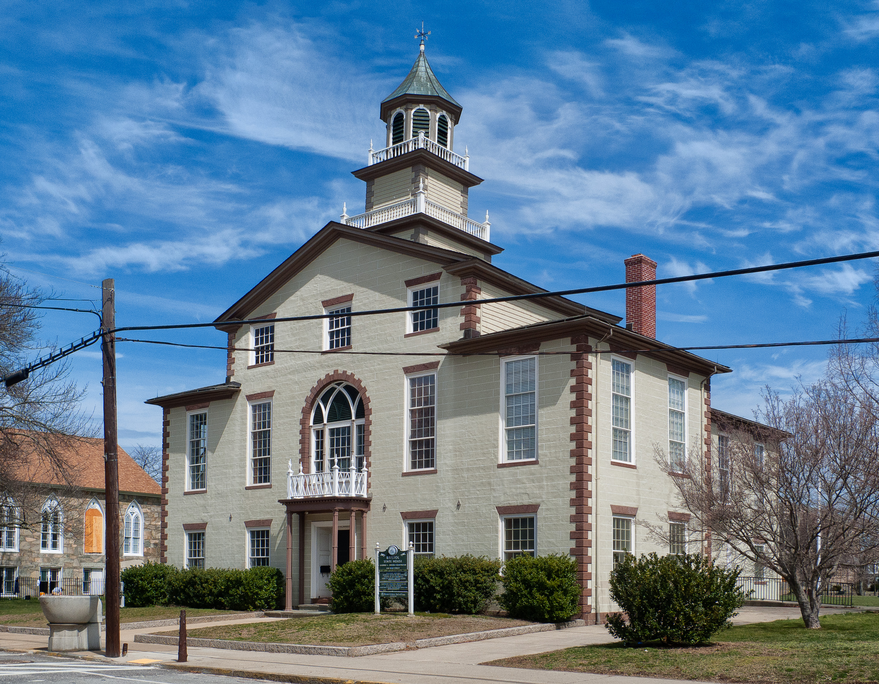
 (L–R) Walley School (1896), First Baptist Church, and Bristol County Statehouse/Courthouse (1816) | |
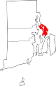
 Location in Bristol County and the state of Rhode Island | |
| Coordinates: 41°41′3″N 71°16′7″W | |
| Country | United States |
| State | Rhode Island |
| County | Bristol |
| Settled | 1680 |
| Incorporated | October 28, 1681 |
| Annexed from Massachusetts | January 27, 1747 |
| Government | |
| • Type | Council-Manager |
| • Town Administrator | Steven Contente (I) |
| • Town Council |
|
| • Town Clerk | Melissa Cordeiro (D) |
| Area | |
| • Total | 20.6 sq mi (53.4 km2) |
| • Land | 10.1 sq mi (26.2 km2) |
| • Water | 10.5 sq mi (27.2 km2) |
| Elevation | 0–131 ft (0–40 m) |
| Population (2020) | |
| • Total | 22,493 |
| • Density | 2,224/sq mi (858.5/km2) |
| Time zone | UTC−5 (EST) |
| • Summer (DST) | UTC−4 (EDT) |
| ZIP Code | 02809 |
| Area code | 401 |
| FIPS code | 44-09280[1] |
| GNIS feature ID | 1220083[2] |
| Demonym | Bristolian[3] ("brihs-TOH-lee-an") |
| Website | www.bristolri.us |
The population of Bristol was 22,493 at the 2020 census. Major industries include boat building and related marine industries, manufacturing, and tourism. The town's school system is united with that of the neighboring town of Warren. Prominent communities include Portuguese-Americans, mostly Azoreans, and Italian-Americans.
History
Early colonization
Before the Pilgrims arrived in 1620, the Pokanokets occupied much of Southern New England, including Plymouth. They had previously suffered from a series of plagues which killed off large segments of their population, and their leader, the Massasoit Osamequin, befriended the early settlers.[6]: 10 King Philip's War was a conflict between the Plymouth settlers and the Pokanokets and allied tribes, and it began in the neighboring area of Swansea, Massachusetts. Metacomet made nearby Mount Hope (a corruption of the Pokanoket word Montaup) his base of operations; he died following an ambush by Captain Benjamin Church on August 12, 1676.[6]: 11 "Massasoit's Seat" is a rocky ledge on the mountain which was a lookout site for enemy ships on Mount Hope Bay.
After the war concluded, four Boston merchants—Stephen Burton, Nathaniel Byfield, Nathaniel Oliver, and John Walley—purchased a tract of land known as "Mount Hope Neck and Poppasquash Neck" as part of the Plymouth Colony.[7] Other settlers included John Gorham and Richard Smith. A variant of the Indian name Metacomet is now the name of a main road in Bristol: Metacom Avenue (RI Route 136).[6]: 11 Bristol was a town of Massachusetts until the Crown transferred it to the Rhode Island Colony in 1747.[6]: 11
Slave trade and the DeWolf family
The DeWolf family was among the earliest settlers of Bristol. Bristol and Rhode Island became a center of slave trading. James DeWolf, a leading slave trader, later became a United States Senator from Rhode Island. Beginning in 1769 and continuing until 1820 (over a decade after the slave trade was outlawed in the Atlantic), the DeWolf family trafficked people out of West Africa, enslaving them and bringing them to work on DeWolf-owned plantations, or selling them to be auctioned at ports in places such as Havana, Cuba and Charleston, South Carolina. In Cuba, sugar and molasses, harvested/created by enslaved Africans, was brought back to Rhode Island to DeWolf-owned distilleries. By the end of 1820, the DeWolf family had trafficked and enslaved over 10,000 African people. James DeWolf died as the second wealthiest person in the United States.[8]
As it did in many northern towns and port cities, slavery built the wealth of Bristol, which processed various materials, such as cotton, created or harvested through the use of slave labor.[8] Quakers from Rhode Island were involved early in the abolition movement, although abolition was a divisive issue among Quakers, resulting in the creation of new Quaker groups.[9]
The history of the DeWolf family, as well as Bristol's and the northern United States' participation in slavery, are covered in the 2008 documentary Traces of the Trade: A Story from the Deep North, in the 2008 companion memoir Inheriting the Trade: A Northern Family Confronts Its Legacy as the Largest Slave-Trading Dynasty in U.S. History by Thomas Norman DeWolf,[10] and the 2014 historical study James DeWolf and the Rhode Island Slave Trade by Cynthia Mestad Johnson.[11]
American Revolution

During the American Revolutionary War, the British Royal Navy bombarded Bristol twice. On October 7, 1775, a group of ships led by Captain Wallace and HMS Rose sailed into town and demanded provisions. When refused, Wallace shelled the town, causing much damage. The attack was stopped when Lieutenant Governor William Bradford rowed out to Rose to negotiate a cease-fire, but then a second attack took place on May 25, 1778. This time, 500 British and Hessian troops marched through the main street (now called Hope Street (RI Route 114)) and burnt 30 barracks and houses, taking some prisoners to Newport.
Other history and current day
Until 1854, Bristol was one of the five state capitals of Rhode Island.
Bristol is home to Roger Williams University, named for Rhode Island founder Roger Williams.
The southerly terminus of the East Bay Bike Path[12] is located at Independence Park on Bristol Harbor. The bike path continues north to India Point Park in Providence, R.I., mostly constructed following an abandoned railroad right of way. Some of the best views of Narragansett Bay can be seen along this corridor. This path is a valued commodity to Bristol; it allows bikers, roller skaters, and walkers to enjoy the area. The construction of the East Bay Bike Path was highly contested by Bristol residents before construction because of the potential of crime, but it has become a welcome asset to the community and the anticipated crime was non-existent.
The Bristol-based boat company Herreshoff built five consecutive America's Cup Defenders between 1893 and 1920. The Colt Estate, now known as Colt State Park, was home to Samuel P. Colt, nephew of the man famous for the arms company, and founder of the United States Rubber Company, later called Uniroyal and the largest rubber company in the nation. Colt State Park lies on manicured gardens abutting the West Passage of Narragansett Bay, and is popular for its views of the waterfront and sunsets.
Bristol is the site of the National Historic Landmark Joseph Reynolds House built in 1700. The Marquis de Lafayette and his staff used the building as headquarters in 1778 during the Battle of Rhode Island.[13]
Fourth of July parade

Bristol has the oldest continuously celebrated Independence Day festivities in the United States. The first mention of a celebration comes from July 1777, when a British officer noted sounds coming from across Narragansett Bay:
This being the first anniversary of the Declaration of Independence of the Rebel Colonies, they ushered in the morning by firing 13 cannons, one for each colony, we suppose. At sunset, the rebel frigates fired another round of 13 guns, each one after the other. As the evening was very still and fine the echo of the guns down the Bay had a grand effect.[14]
The annual official and historic celebrations (Patriotic Exercises) were established in 1785 by Rev. Henry Wight of the First Congregational Church and veteran of the Revolutionary War, and later by Rev. Wight as the Parade, and continue today, organized by the Bristol Fourth of July Committee.[15] The festivities officially start on June 14, Flag Day, beginning a period of outdoor concerts, soapbox car races and a firefighters' muster at Independence Park. The celebration climaxes on July 4 with the oldest annual parade in the United States, "The Military, Civic and Firemen's Parade", an event that draws over 200,000 people from Rhode Island and around the world. These elaborate celebrations give Bristol its nickname, "America's most patriotic town".
Bristol is represented in the parade with hometown groups like the Bristol Train of Artillery and the Bristol County Fifes and Drums.[16]
Geography
Bristol is situated on 10.1 square miles (26 km2) of a peninsula (the smaller sub-peninsula on the west is called Poppasquash), with Narragansett Bay on its west and Mount Hope Bay on its east. According to the United States Census Bureau, the town has a total area of 20.6 square miles (53.4 km2), of which, 10.1 square miles (26.2 km2) of it is land and 10.5 square miles (27.2 km2) of it (50.99%) is water. Bristol's harbor is home to over 800 boat moorings in seven mooring fields.
Climate
| Climate data for Bristol, Rhode Island | |||||||||||||
|---|---|---|---|---|---|---|---|---|---|---|---|---|---|
| Month | Jan | Feb | Mar | Apr | May | Jun | Jul | Aug | Sep | Oct | Nov | Dec | Year |
| Record high °F (°C) | 67 (19) |
64 (18) |
80 (27) |
89 (32) |
91 (33) |
94 (34) |
98 (37) |
96 (36) |
93 (34) |
83 (28) |
74 (23) |
70 (21) |
98 (37) |
| Average high °F (°C) | 38 (3) |
40 (4) |
47 (8) |
58 (14) |
68 (20) |
77 (25) |
83 (28) |
82 (28) |
74 (23) |
64 (18) |
53 (12) |
43 (6) |
61 (16) |
| Average low °F (°C) | 21 (−6) |
22 (−6) |
29 (−2) |
38 (3) |
48 (9) |
58 (14) |
64 (18) |
63 (17) |
56 (13) |
45 (7) |
35 (2) |
27 (−3) |
42 (6) |
| Record low °F (°C) | −7 (−22) |
−7 (−22) |
2 (−17) |
18 (−8) |
31 (−1) |
41 (5) |
50 (10) |
49 (9) |
35 (2) |
27 (−3) |
14 (−10) |
4 (−16) |
−7 (−22) |
| Average precipitation inches (mm) | 3.66 (93) |
3.34 (85) |
4.52 (115) |
3.90 (99) |
3.54 (90) |
3.90 (99) |
3.54 (90) |
4.03 (102) |
3.90 (99) |
4.64 (118) |
3.90 (99) |
4.52 (115) |
47.39 (1,204) |
| Average snowfall inches (cm) | 10 (25) |
10 (25) |
7.1 (18) |
1 (2.5) |
0 (0) |
0 (0) |
0 (0) |
0 (0) |
0 (0) |
0 (0) |
1 (2.5) |
7.1 (18) |
36.2 (91) |
| Source 1: [17] | |||||||||||||
| Source 2: [18] | |||||||||||||
Demographics
| Year | Pop. | ±% |
|---|---|---|
| 1748 | 1,069 | — |
| 1755 | 1,080 | +1.0% |
| 1774 | 1,209 | +11.9% |
| 1776 | 1,067 | −11.7% |
| 1782 | 1,032 | −3.3% |
| 1790 | 1,406 | +36.2% |
| 1800 | 1,678 | +19.3% |
| 1810 | 2,698 | +60.8% |
| 1820 | 3,197 | +18.5% |
| 1830 | 3,084 | −3.5% |
| 1840 | 3,490 | +13.2% |
| 1850 | 4,616 | +32.3% |
| 1860 | 5,271 | +14.2% |
| 1870 | 5,302 | +0.6% |
| 1880 | 6,028 | +13.7% |
| 1890 | 5,478 | −9.1% |
| 1900 | 6,901 | +26.0% |
| 1910 | 8,565 | +24.1% |
| 1920 | 11,375 | +32.8% |
| 1930 | 11,953 | +5.1% |
| 1940 | 11,159 | −6.6% |
| 1950 | 12,320 | +10.4% |
| 1960 | 14,570 | +18.3% |
| 1970 | 17,860 | +22.6% |
| 1980 | 20,128 | +12.7% |
| 1990 | 21,625 | +7.4% |
| 2000 | 22,469 | +3.9% |
| 2010 | 22,954 | +2.2% |
| 2020 | 22,493 | −2.0% |
| U.S. Decennial Census[19][20] | ||
As of the 2010 census Bristol had a population of 22,954. The ethnic and racial composition of the population was 94.9% non-Hispanic white, 0.8% Black, 0.1% Native American, 0.9% Asian, 0.4% some other race, 1.4% from two or more races and 2.0% Hispanic or Latino of any race.[21]
As of the census[1] of 2000, there were 22,469 people, 8,314 households, and 5,653 families residing in the town. The population density was 2,222.2 inhabitants per square mile (858.0/km2). There were 8,705 housing units at an average density of 860.9 per square mile (332.4/km2). The ethnic group makeup of the town was 97.14% White, 1.29% Hispanic or Latino (of any race), 0.67% Asian, 0.62% Black, 0.16% Native American, 0.04% Pacific Islander, 0.33% other ethnic group, and 1.03% from two or more races.
Government
| Year | GOP | DEM | Others |
|---|---|---|---|
| 2016 | 38.26% 4,080 | 54.11% 5,771 | 7.63% 814 |
| 2012 | 36.11% 3,707 | 61.94% 6,359 | 1.96% 201 |
| 2008 | 35.39% 3,834 | 63.08% 6,833 | 1.53% 166 |
| 2004 | 38.30% 4,000 | 60.10% 6,276 | 1.60% 167 |
| 2000 | 32.20% 3,065 | 62.13% 5,914 | 5.67% 540 |
| 1996 | 26.15% 2,293 | 62.42% 5,474 | 11.44% 1,003 |
| 1992 | 28.00% 2,818 | 49.87% 5,018 | 22.13% 2,227 |
| 1988 | 42.51% 3,538 | 57.02% 4,746 | 0.47% 39 |
In the Rhode Island Senate, Bristol is split into three senatorial districts, all Democratic:
- District 10: Walter S. Felag, Jr.
- District 11: James A. Seveney
- District 32: Cynthia Armour Coyne
At the federal level, Bristol is a part of Rhode Island's 1st congressional district and is currently represented by Democrat David N. Cicilline. In presidential elections, Bristol is a Democratic stronghold, as no Republican presidential nominee has won the town since prior to the 1988 election.[22][when?]
Points of interest and Registered Historic Places
 Welcome sign
 Bristol Town Common
 Town Hall and War Memorial
 The Bristol County Statehouse/Courthouse
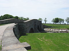 Colt State Park
 Mt. Hope Bridge


- America's Cup Hall of Fame
- Blithewold Mansion, Gardens and Arboretum
- Bristol Art Museum[23]
- Bristol County Courthouse (Rhode Island)
- Bristol County Jail
- Bristol Customshouse and Post Office
- Bristol Ferry Lighthouse
- Bristol Waterfront Historic District
- Coggeshall Farm Museum[24] (c. 1790)
- Colt State Park
- Juniper Hill Cemetery
- Herreshoff Marine Museum
- Linden Place, home of the DeWolfs, Colts
- Longfield (Charles Dana Gibson house)
- Mount Hope Bridge
- Mount Hope Farm
- Poppasquash Farms Historic District
- Joseph Reynolds House
- Roger Williams University
- Roger Williams University School of Law
Notable people
- William Thomas "Billy" Andrade, golfer with the PGA Tour; born in Bristol
- Ethel Barrymore Colt, silent film and stage actress; member of the influential Barrymore family
- Benjamin Bourne, US congressman and federal judge; born in Bristol
- William Bradford (1729–1808), physician, lawyer, and President pro tempore of the US Senate; lived and died in Bristol
- Jonathan Russell Bullock, federal and Rhode Island Supreme Court judge; born in Bristol
- Ambrose Burnside, railroad executive, US senator, 30th governor of Rhode Island, and Union Army general; lived and died in Bristol
- Sean Callery, Emmy-winning composer, raised in Bristol
- Mary Cantwell, journalist, magazine editor, author and member of The New York Times editorial board; grew up in Bristol
- Mary H. Gray Clarke (born 1835), correspondent
- Samuel P. Colt, entrepreneur, child labor advocate, and Rhode Island state representative; lived in Bristol
- Mark Anthony DeWolf (1726–1793) was the fourth child of Charles DeWolf, the only one who returned to America. He became the patriarch of the Bristol branch of the DeWolf family; he was a merchant and slave trader.
- James DeWolf (1764–1837), son of Mark Anthony DeWolf. He was one of the richest men of his time, making the majority of his fortune in the slave trade.
- General George W. DeWolf (1778–1844), a grandson of Mark Anthony DeWolf. He was a slave trader and the original owner of Linden Place
- Jonathan DeFelice, president of Saint Anselm College; lived in Bristol
- Rebecca Donovan, novelist
- Nancy Dubuc, businesswoman
- Ramon Guiteras, surgeon and urologist, born and buried in Bristol
- Nathanael Herreshoff, naval architect and mechanical engineer, designed several undefeated America's Cup winners; born in Bristol
- Gilbert C. Hoover, USN admiral involved in the nuclear bomb project
- Edward L. Leahy, US senator and federal judge; born in Bristol
- Ira Magaziner, senior adviser for policy development to the Clinton administration; Chairman of the Clinton Foundation Policy Board; lives in Bristol
- Pat McGee, musician (Pat McGee Band)
- Alyssa Merkle-Deschenes, National Director of Biomedical Engineering at CREF/ Steward Healthcare, former New England Patriots cheerleader
- Anthony Quinn, actor (Zorba the Greek, Lawrence of Arabia, Viva Zapata!, Lust for Life); twice won the Academy Award for Best Supporting Actor (1952, 1956); lived in Bristol. He loved his home so much that he requested, and was given permission by the town, to be buried on his property
- Norman Rene, theater and film director; born in Bristol
- John Saffin, merchant and author (A Brief and Candid Answer to Samuel Sewall's The Selling of Joseph, 1700); lived in Bristol
- Chris Santos, executive chef and owner of the Stanton Social and Beauty & Essex, judge on Chopped (Food Network TV), born in Bristol
See also
- DeWolf family, a prominent local family which made their fortune in the slave trade
References
- "U.S. Census website". United States Census Bureau. Retrieved 2008-01-31.
- "US Board on Geographic Names". United States Geological Survey. 2007-10-25. Retrieved 2008-01-31.
- MacKay, Scott (October 7, 2013). "Why I'll Never Call Myself a Bristolian". One Square Mile (story series). Rhode Island Public Radio. Archived from the original on 22 August 2014. Retrieved 8 June 2021.
- "Find a County". National Association of Counties. Archived from the original on 2011-05-31. Retrieved 2011-06-07.
- Ahlquist, Steve (26 August 2017). "Po Metacom Camp responds to Brown letter disputing Pokanoket legitimacy". RI Future. Archived from the original on 22 September 2017. Retrieved 8 June 2021.
- Susan Cirillo; Lombard John Pozzi (1980). Bristol: Three Hundred Years. Providence, Rhode Island: Franklin Graphics. OCLC 6811058.
- Warren, Elizabeth Sargent; Pamela A. Kennedy (1990). Historic and Architectural Resources of Bristol, Rhode Island (PDF). Providence, RI: Rhode Island Historical Preservation Commission. p. 7. OCLC 23833645. Retrieved 9 August 2021.
- "Synopsis". Traces of the Trade. 2008-06-14. Retrieved 2020-04-29.
- Faulkner, Carol (2011). Lucretia Mott's Heresy: Abolition and Women's Rights in Nineteenth-Century America. Philadelphia: University of Pennsylvania Press. ISBN 978-0-8122-0500-8. OCLC 844843687.
- DeWolf, Thomas Norman (2008). Inheriting the Trade: A Northern Family Confronts Its Legacy as the Largest Slave-Trading Dynasty in U.S. History. Boston: Beacon Press. ISBN 9780807072813. OCLC 134989752. Retrieved 8 June 2021.
- Johnson, Cynthia Mestad (2014). James DeWolf and the Rhode Island Slave Trade. Charleston, SC: The History Press. ISBN 9781626194793. OCLC 869920838. Retrieved 8 June 2021.
- Archived May 17, 2008, at the Wayback Machine
- Archived July 4, 2007, at the Wayback Machine
- Simpson, Richard V. (2002). Bristol: Montaup to Poppasuash (RI). Making of America. Mount Pleasant, S.C.: Arcadia Publishing. ISBN 0-738523-56-9.
- "Annual Fourth of July Celebration | Bristol, Rhode Island". July4thbristolri.com. Retrieved 2013-07-01.
- Bristol County Fifes and Drums
- MSN weather records and averages for Bristol, RI
- MyForecast.co for snowfall averages
- "Census of Population and Housing". Census.gov. Retrieved June 4, 2016.
- Snow, Edwin M. (1867). Report upon the Census of Rhode Island 1865. Providence, RI: Providence Press Company.
- 2010 general profile of population and housing characteristics of Bristol from the US Census
- "Previous Election Results". State of Rhode Island Board of Elections. Archived from the original on 21 April 2021. Retrieved 8 June 2021.
- Bristol Art Museum
- Coggeshall Farm Museum
Further reading
- Simpson, Richard V. (2008). Historic Bristol: Tales from an Old Rhode Island Seaport. Charleston, SC: The History Press. ISBN 9781596293526. OCLC 175286354.
External links
- Official Town Website
- Destination Bristol—official tourism site
Municipalities and communities of Bristol County, Rhode Island, United States | ||
|---|---|---|
County seat: Bristol | ||
| Towns |
|  |
| ||
State of Rhode Island | |
|---|---|
Providence (capital) | |
| Topics |
|
| Society |
|
| Regions |
|
| Cities | |
| Towns |
|
| Islands | 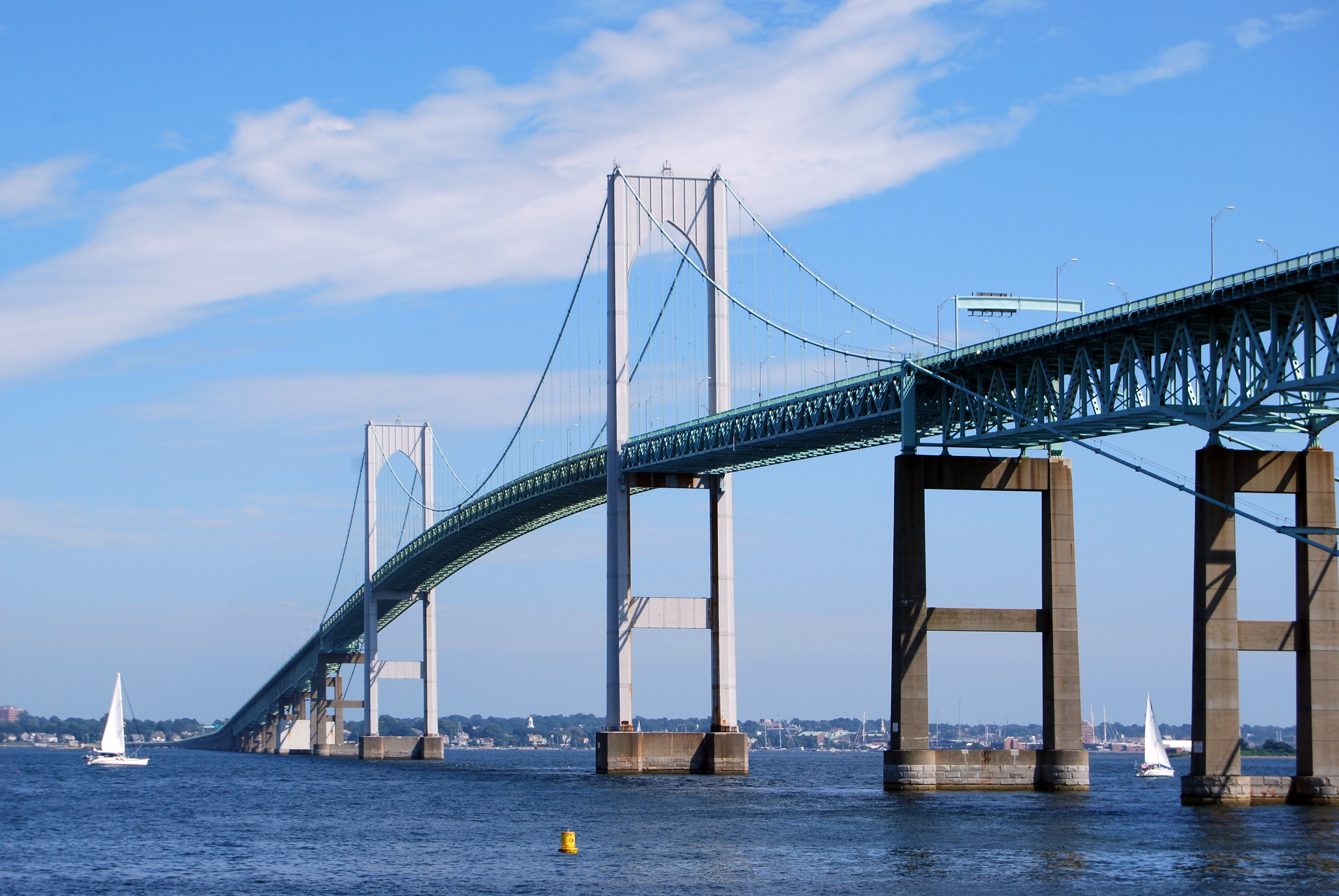 | |
|---|---|---|
| Major rivers | ||
| Cities & towns |
| |
| Bridges |
| |
Authority control | |
|---|---|
| General | |
| National libraries | |
| Other |
|
Другой контент может иметь иную лицензию. Перед использованием материалов сайта WikiSort.org внимательно изучите правила лицензирования конкретных элементов наполнения сайта.
WikiSort.org - проект по пересортировке и дополнению контента Википедии