world.wikisort.org - USA
Glocester is a town in Providence County, Rhode Island, United States. The population was 9,974 as of the 2020 census. The villages of Chepachet and Harmony are in Glocester. Putnam Pike (U.S. Route 44) runs through the town center of Glocester into Putnam, Connecticut.
Glocester, Rhode Island | |
|---|---|
Town | |
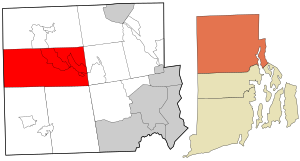 Location in Providence County and the state of Rhode Island. | |
| Coordinates: 41°53′27″N 71°41′26″W | |
| Country | United States |
| State | Rhode Island |
| County | Providence |
| Incorporated | 20 February 1731 |
| Government | |
| • Type | Town meeting |
| • Town Council | Julian Forgue (R) Walter M.O. Steere, III (R) Stephen Arnold (R) William Worthy (R) William E. Reichart (I) |
| • Town Moderator | Kevin P. Walsh (R) |
| • Town Clerk | Jean M. Fecteau (R) |
| Area | |
| • Total | 56.8 sq mi (147.2 km2) |
| • Land | 54.8 sq mi (142.0 km2) |
| • Water | 2.0 sq mi (5.2 km2) |
| Elevation | 597 ft (182 m) |
| Population (2020) | |
| • Total | 9,974 |
| • Density | 182/sq mi (70.2/km2) |
| Time zone | UTC−5 (Eastern (EST)) |
| • Summer (DST) | UTC−4 (EDT) |
| ZIP Codes | 02814 (Chepachet), 02829 (Harmony), 02857 (North Scituate) |
| Area code | 401 |
| FIPS code | 44-30340[2] |
| GNIS feature ID | 1220070[1] |
| Website | Town of Glocester |
History
Glocester was originally named Gloucester for Henry Stuart, Duke of Gloucester.[3] The Town of Gloucester was part of Providence until 1731 when it became an independent town.[4] North Glocester was incorporated as the separate town of Burrillville in 1806. At the same time the residents of Gloucester voted to change the spelling of the town to Glocester to differentiate it from Gloucester, Massachusetts. Glocester is an ancient variant spelling of Gloucester.
During the American Revolution, Loyalists from Newport were exiled in Glocester to Stephen Keach's farm, including Thomas Vernon, a Tory from Newport, who described Glocester residents in 1776 as:
inclined much to talk of liberty...It is amazing what false and erroneous opinions and ideas these people have entertained...The religion of the people of this town consists entirely of New Light Baptists. The custom of Dipping is much in vogue in this and the neighboring towns.[5]
Samuel Willard (physician) made rounds on smallpox victims in North Glocester during the late 18th century.[6]
The Dorr Rebellion began in Glocester in 1841.
Since 1927 the Ancient and Horribles Parade has been an annual Fourth of July tradition in Chepachet, where residents create traditional and satirical political floats.
See also "Foster, Rhode Island: History" for further information.
Geography
According to the United States Census Bureau, the town has a total area of 56.8 square miles (147 km2), of which 54.8 square miles (142 km2) is land and 2.0 square miles (5.2 km2) (3.55%) is water. Some bodies of water in Glocester include, Waterman Reservoir.
Demographics
| Historical population | |||
|---|---|---|---|
| Census | Pop. | %± | |
| 1790 | 4,025 | — | |
| 1800 | 4,009 | −0.4% | |
| 1810 | 2,310 | −42.4% | |
| 1820 | 2,504 | 8.4% | |
| 1830 | 2,521 | 0.7% | |
| 1840 | 2,304 | −8.6% | |
| 1850 | 2,872 | 24.7% | |
| 1860 | 2,427 | −15.5% | |
| 1870 | 2,385 | −1.7% | |
| 1880 | 2,250 | −5.7% | |
| 1890 | 2,095 | −6.9% | |
| 1900 | 1,402 | −33.1% | |
| 1910 | 1,404 | 0.1% | |
| 1920 | 1,389 | −1.1% | |
| 1930 | 1,693 | 21.9% | |
| 1940 | 2,099 | 24.0% | |
| 1950 | 2,682 | 27.8% | |
| 1960 | 3,397 | 26.7% | |
| 1970 | 5,160 | 51.9% | |
| 1980 | 7,550 | 46.3% | |
| 1990 | 9,227 | 22.2% | |
| 2000 | 9,948 | 7.8% | |
| 2010 | 9,746 | −2.0% | |
| 2020 | 9,974 | 2.3% | |
| U.S. Decennial Census[7][8] | |||
As of the census[2] of 2000, there were 9,948 people, 3,559 households, and 2,818 families residing in the town. The population density was 181.5 inhabitants per square mile (70.1/km2). There were 3,786 housing units at an average density of 69.1 per square mile (26.7/km2). The racial makeup of the town was 98.48% White, 0.34% African American, 0.15% Native American, 0.24% Asian, 0.10% from other races, and 0.68% from two or more races. Hispanic or Latino of any race were 0.65% of the population.
There were 3,559 households, out of which 38.0% had children under the age of 18 living with them, 66.4% were married couples living together, 8.6% had a female householder with no husband present, and 20.8% were non-families. 15.8% of all households were made up of individuals, and 6.0% had someone living alone who was 65 years of age or older. The average household size was 2.80 and the average family size was 3.14.
In the town, the population was spread out, with 26.8% under the age of 18, 6.4% from 18 to 24, 31.6% from 25 to 44, 26.1% from 45 to 64, and 9.2% who were 65 years of age or older. The median age was 38 years. For every 100 females, there were 100.0 males. For every 100 females age 18 and over, there were 95.6 males.
The median income for a household in the town was $57,537, and the median income for a family was $62,679. Males had a median income of $39,112 versus $29,071 for females. The per capita income for the town was $22,914. About 3.4% of families and 4.4% of the population were below the poverty line, including 6.4% of those under age 18 and 1.9% of those age 65 or over.
Education
Glocester is the home to both West Glocester Elementary School in West Glocester and the Fogarty Memorial School in Harmony. Students of both would attend both Ponaganset Middle School and Ponaganset High School for secondary education.
Notable people

- Charles J. Fogarty, Rhode Island Rhode Island state senator and 67th Lieutenant Governor of Rhode Island; lived in Glocester
- Ray Fogarty, Rhode Island state representative, lived in Glocester
- Charles H. Page, Rhode Island politician; born in Glocester
- Arthur Steere, businessman and Rhode Island state senator, born in Glocester
National Historic Sites in Glocester
- Chepachet Village Historic District
- Cherry Valley Archeological Site, RI-279
- Glocester Town Pound (1748)
- Harmony Chapel and Cemetery (1816)
- Manton-Hunt-Farnum Farm (1793)
See also
 Rhode Island portal
References
- U.S. Geological Survey Geographic Names Information System: Glocester, Rhode Island
- "U.S. Census website". United States Census Bureau. Retrieved 2008-01-31.
- Dictionary of world place names derived from British names, by Adrian Room, Edition: illustrated, Published by Taylor & Francis, 1989, pg. 68 ISBN 0-415-02811-6, ISBN 978-0-415-02811-0
- Elizabeth A. Perry, A brief history of the town of Glocester, Rhode Island (Providence Press Co., Printers, 1886)
- Diary of Thomas Vernon pgs. 9, 26
- Backofen, Walter A (2001). Elias Frost, M.D., and his strategy for being remembered. p. 6. OCLC: 58438763.
- "Census of Population and Housing". Census.gov. Retrieved June 4, 2016.
- Snow, Edwin M. (1867). Report upon the Census of Rhode Island 1865. Providence, RI: Providence Press Company.
External links
- Town of Glocester website
- Chepachet Fire Department
- Glocester Heritage Society
- Glocester Libraries, Chepachet
- Harmony Library, Harmony
Municipalities and communities of Providence County, Rhode Island, United States | ||
|---|---|---|
County seat: Providence | ||
| Cities |
|  |
| Towns | ||
| CDPs |
| |
| Other villages |
| |
| ||
State of Rhode Island | |
|---|---|
Providence (capital) | |
| Topics |
|
| Society |
|
| Regions |
|
| Cities | |
| Towns |
|
| Authority control |
|
|---|
На других языках
[de] Glocester
Glocester ist eine Town im Providence County in Rhode Island in den Vereinigten Staaten. Die Bevölkerungszahl betrug 9746 nach dem Zensus von 2010.- [en] Glocester, Rhode Island
Другой контент может иметь иную лицензию. Перед использованием материалов сайта WikiSort.org внимательно изучите правила лицензирования конкретных элементов наполнения сайта.
WikiSort.org - проект по пересортировке и дополнению контента Википедии