world.wikisort.org - USA
Sherborn is a town in Middlesex County, Massachusetts, United States. Located in Boston's MetroWest region, is in area code 508 and has the ZIP code 01770. As of the 2020 U.S. Census, the town population was 4,401.[1]
Sherborn, Massachusetts | |
|---|---|
Town | |
 Sherborn Community Center | |
 Seal | |
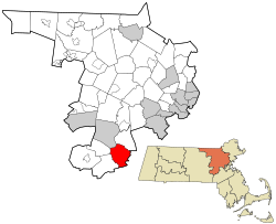 Location in Middlesex County in Massachusetts | |
| Coordinates: 42°14′20″N 71°22′13″W | |
| Country | United States |
| State | Massachusetts |
| County | Middlesex |
| Settled | 1652 |
| Incorporated | 1674 |
| Government | |
| • Type | Open town meeting |
| Area | |
| • Total | 16.2 sq mi (41.9 km2) |
| • Land | 16.0 sq mi (41.3 km2) |
| • Water | 0.2 sq mi (0.6 km2) |
| Elevation | 175 ft (53 m) |
| Population (2020) | |
| • Total | 4,401 |
| • Density | 275.1/sq mi (106.6/km2) |
| Time zone | UTC-5 (Eastern) |
| • Summer (DST) | UTC-4 (Eastern) |
| ZIP code | 01770 |
| Area code | 508 / 774 |
| FIPS code | 25-61380 |
| GNIS feature ID | 0618233 |
| Website | www.sherbornma.org |
Sherborn shares its highly ranked public school system with the town of Dover. In addition to Dover, Sherborn is bordered by the towns of Natick, Framingham, Ashland, Millis, Holliston, and Medfield.
History
Primarily a farming community until the early part of the 20th century, Sherborn now is a bedroom town for Boston and the surrounding hi-tech area.
Early settlement
The whole Charles River valley from South Natick to the falls at Medway kept its Indian name "Boggestow"; it was sought out by the English because of the abundant marsh grass growing on the wide flood plain. The earliest Sherborn land owned by the English took the form of large (200–1074 acres) grants called "farmes" made by the General Court beginning in the 1640s to individuals for payment of services rendered to the colony. These owners later sold land to settlers, the first resale being to Thomas Holbrook, and Nicholas Wood in 1652. They and successive settlers bought those wilderness lands and lived there while retaining their citizenship in the nearest incorporated town: Medfield.
Town
By 1674 Boggestow had grown sufficiently to be incorporated as a new town (i.e. the land had never been part of another town) and was arbitrarily named "Sherborne" by the General Court. The original area was of such an awkward shape that the General Court allowed an exchange of 4,000 acres (16 km2) with the Natick Indians in 1679; and it was that new land which formed most of the present town. Henry Sherburne was Associate Judge of the Court at Strawberry Bank, 1651–1652; Town Clerk & Treasurer 1656; Commissioner 1658; and Deputy to the Massachusetts General Court in 1660—this could explain the origin of the town's name.
In the decade after King Philip's War (1675–1676) Sherborn settlers organized the local government and drew up a Social Covenant, paid the Indians for land title, attracted a saw miller, built a Meeting House and called the first minister, and granted home lots throughout most of the present town. In the second decade they formed a town militia company, hired a schoolmaster, and acquired a gristmill. Thus by 1700 they had become an "established" town.
General development
Throughout the 17th, 18th and 19th centuries Sherborn remained a small and relatively self-sufficient farming community. Little industry developed because of the lack of good water power, although there continued to be saw and gristmills on several of the small, intermittent streams. However, apples grew well, and there were always small cider mills. With the coming of both the railroad and steam power one mill developed further, John Holbrook and Sons, until by the 1890s it was advertised as the "largest refined cider mill in the world". At that time it pressed over 1.25 million gallons of cider per season and exported "Champagne" cider as far west as Nebraska and Texas and as far east as England and Belgium.
In the late 18th century and early 19th century several small cottage industries developed, particularly along North Main Street. They produced guns, shoes, willow baskets, whips, pitchforks and edge tools. Cranberries became an important crop, as well as mixed farming and dairying. Crops and crafts were sold in the Boston markets via stagecoach and later railroad.
The early 20th century saw several new trends. In the early 1900s several wealthy families moved into different parts of town and built estates for either year-round or summer use. Those remaining today are located primarily along the Charles River—the area of first settlement. Dairy and poultry raising increased in importance, as did service related jobs.
Following World War II the town began to change rapidly from one with a relatively static population (c. 1500) to a growing and transient one. Developments were built in 1, 2, and 3-acre (12,000 m2) zones. The disappearance of family farms accelerated as the town became increasingly suburban; today estate-farms form most of the few farms which remain. Over 50% of the town's area is open space. The town is trying hard to retain its rural character; but that is increasingly difficult as land prices and taxes escalate.

In the late 1990s and the early 21st century, the downtown area underwent significant expansion, including the construction of a new fire department, the addition of a skate park for the town's youth in 2002, and in 2005, new stores in a lot previously occupied by a decrepit, closed gas station. C & L Frosty's is a popular diner in the downtown area, as well as "The Heritage" which is a recently renovated inn previously known and owned as the "Sherborn Inn". Many people also visit the Sherborn Library which currently is undergoing a serious renovation as voted by the town (one million dollars were allocated to them to build a recreations room, purchase some art to decorate the walls, and a number of other new features). Today, most of the children attend the Pine Hill Elementary School for grades 1–5, and most Sherborn students attend the joint Middle/High School shared with the adjacent town of Dover for grades 6–12.
Houses
Because the town was relatively poor in the late 19th century and early 20th century, few people "modernized" their old houses by tearing them down and rebuilding. As a result, many of the houses built in the 18th century and early 19th century remain, as well as six or more with portions dating from the late 17th century. Two National Register Historic Districts have been established to include the old Town Center and a two-mile (3 km) strip along North Main Street; and scattered individual houses have also been listed: a total of 77 old houses. A very small Town Historic District also exists in the old Town Center. There are many houses that still stand that were built before the Revolutionary War.
The former house of Colonel Samuel Bullard (1733–1807) was acquired by developers in the 1980s for adaptive reuse as an inn. Sadly however, the structure was almost entirely demolished, leaving but a few of the most basic of framing timbers. Only a handful of interior architectural features survived the destruction consisting mostly of a mantle piece, a chair rail and some wainscotting. The present structure, incorporating the few remaining described features, was built in the 1980s and was first known as The Sherborn Inn. It is now named Heritage of Sherborn. Because of the destruction of the Bullard House, the house and site designation as historic, was removed from The National Register of Historic Places and Sites as well as The Massachusetts Historical Register.
The Rev. Edmund Dowse House (Greek Revival at 25 Farm Rd) was built in 1838 for the Rev. Edmund Dowse, the first pastor of the Evangelical Society (now the Pilgrim Church) in Sherborn, MA. It was listed on the National Register of Historic Places in 1986.
Many old antique houses have hiding places along the Underground Railroad built back in the 1800s. They have trap doors, secret rooms, and old passages for runaway slaves.
Civil War
Several Sherborn-born freemen enlisted in the all-black 54th Massachusetts Regiment in 1863, including brothers Amos Benjamin Green and James Washington Green, the sons of Sherborn-born James Green and his wife Maria Green, née Cobb, of Natick, Massachusetts. Both served in Company D, which fought at the Battle of Fort Wagner.
Post-Civil War
Unique to Sherborn are its three memorials on Main Street: one built in 1924 that is publicly owned and honors those who fought in American wars dating back to King Philip's War; the second memorial, built in 1994, is privately owned and honors great pacifists in history; the third memorial, on the grounds of the Pacifist Memorial and built in 2003, honors the noble tradition of cruelty-free living through vegetarian and vegan lifestyles.
The War Memorial features a bronze statue named Memory which was created by Cyrus Dallin and is flanked by bronze plaques bearing the names of Sherborn residents who were killed in all of America's wars.
The Pacifist Memorial features a bronze statue of Mahatma Gandhi, created by Lado Goudjabidze, and is surrounded by six brick walls with over 75 bronze plaques bearing quotations from great pacifists including Gandhi, Muhammad Ali, Mother Teresa, Albert Einstein, Martin Luther King, Jr. and John Lennon. Beyond the brick walls is a cremation cemetery for conscientious objectors.
The Sacred Cow Animal Rights Memorial is where Emily the Cow is buried beneath her life-sized bronze statue. Surrounding the statue are granite stones with bronze plaques bearing inspiring quotes from notable vegetarians.
Geography
The town is located 18 miles (29 km) southwest of Boston. According to the United States Census Bureau, the town has a total area of 16.2 square miles (42 km2), of which 16.0 square miles (41 km2) is land and 0.2 square miles (0.52 km2), or 1.36%, is water, with much of that located in Farm Pond.
Demographics
| Year | Pop. | ±% |
|---|---|---|
| 1850 | 1,043 | — |
| 1860 | 1,129 | +8.2% |
| 1870 | 1,062 | −5.9% |
| 1880 | 1,401 | +31.9% |
| 1890 | 1,381 | −1.4% |
| 1900 | 1,483 | +7.4% |
| 1910 | 1,428 | −3.7% |
| 1920 | 1,558 | +9.1% |
| 1930 | 943 | −39.5% |
| 1940 | 1,022 | +8.4% |
| 1950 | 1,245 | +21.8% |
| 1960 | 1,806 | +45.1% |
| 1970 | 3,309 | +83.2% |
| 1980 | 4,049 | +22.4% |
| 1990 | 3,989 | −1.5% |
| 2000 | 4,200 | +5.3% |
| 2010 | 4,119 | −1.9% |
| 2020 | 4,401 | +6.8% |
| * = population estimate. Source: United States census records and Population Estimates Program data.[2][3][4][5][6][7][8][9][10][11] | ||
As of the census[12] of 2000, there were 4,200 people, 1,423 households, and 1,222 families residing in the town. The population density was 263.1 inhabitants per square mile (101.6/km2). There were 1,451 housing units at an average density of 90.9/sq mi (35.1/km2). The racial makeup of the town was 96.50% White, 0.38% African American, 0.05% Native American, 2.40% Asian, 0.26% from other races, and 0.40% from two or more races. Hispanic or Latino of any race were 1.12% of the population.
There were 1,423 households, out of which 46.2% had children under the age of 18 living with them, 77.5% were married couples living together, 6.3% had a female householder with no husband present, and 14.1% were non-families. 12.4% of all households were made up of individuals, and 6.0% had someone living alone who was 65 years of age or older. The average household size was 2.95 and the average family size was 3.22.
In the town, the population was spread out, with 31.9% under the age of 18, 3.2% from 18 to 24, 22.9% from 25 to 44, 30.7% from 45 to 64, and 11.3% who were 65 years of age or older. The median age was 41 years. For every 100 females, there were 93.4 males. For every 100 females age 18 and over, there were 89.6 males.
According to the 2007 U.S. census, the median income for a household in the town was $223,444, and the median income for a family was $164,063. Males had a median income of $181,291 versus $85,909 for females. The per capita income for the town was about $73,420. About 0.7% of families and 2.3% of the population were below the poverty line, including 2.4% of those under age 18 and 5.6% of those age 65 or over.
Government
The town is governed by a combination of elected and appointed volunteers and a few key salaried officials. Since town government was set up c. 1678 it has been run by the Select Board[13] (5 at present) and the traditional open Town Meeting, at which all citizens vote annually on major expenditures and policies. There is no industry zoned in the town. Property taxes support town government and services. Public services are minimal and homeowners rely on individual wells and septic systems. There is a full-time Police Force and Highway Dept. and both a volunteer "call" Fire Dept. and a rescue Squad, all highly trained. The town has three churches and a modern public library. The schools are small and excellent; the elementary school is local, whereas the junior and senior high schools are regionalized with Dover, a town located to the east. Town Boards and other organizations depend almost entirely upon volunteer participation, as they have for over three hundred years.
Sherborn is part of the Massachusetts Senate's Norfolk, Bristol and Middlesex district.
Education
There is a public elementary school called Pine Hill School. The majority of middle school and high school students in Sherborn attend the Dover-Sherborn Middle School and the Dover-Sherborn High School, respectively, which are both located in Dover, Massachusetts. There are also 2 preschools in Sherborn center, ECDC and Pine Hill preschool.
Notable people
- Cattle Annie, female bandit of the American Old West, worked for a time as a domestic in Sherborn after her release from the corrections facility in Framingham[14]
- Eli Dershwitz, Under-20 World Saber Champion, and US Olympic saber fencer
- Stephanie Deshpande, contemporary American painter, best known for her portraits and narrative paintings. Her work depicts allegorical themes. She grew up in Sherborn and graduated from Dover-Sherborn High School in 1993
- John Halamka, physician and technology leader, maintains a well-read blog that alternates between discussing his thoughts on health IT and his experiences restoring a farm in Sherborn
- Dan Itse, engineer and inventor who serves in the New Hampshire House of Representatives, was reared in Sherborn and graduated in 1976 from Dover-Sherborn High School
- Stan McDonald, jazz clarinetist and recording artist, lives in Sherborn and regularly performs with his band The Blue Horizon Jazz Band at the Sherborn Inn
- Mel Robbins, on-air CNN commentator, television host, life coach, author, motivational speaker, and contributing editor for Success (magazine). Robbins is best known for her coverage of the George Zimmerman trial and host of A&E's Monster In-Laws
- Jedediah Sanger, born in Sherborn in 1751 and lived there until after the Revolutionary War
- Chad Urmston, lead singer of the band Dispatch and former frontman for State Radio, attended Dover-Sherborn High School
See also
- Greater Boston
- MetroWest
- National Register of Historic Places listings in Sherborn, Massachusetts
- Open town meeting
References
- "Census - Geography Profile: Sherborn town, Middlesex County, Massachusetts". United States Census Bureau. Retrieved November 6, 2021.
- "Total Population (P1), 2010 Census Summary File 1". American FactFinder, All County Subdivisions within Massachusetts. United States Census Bureau. 2010.
- "Massachusetts by Place and County Subdivision - GCT-T1. Population Estimates". United States Census Bureau. Retrieved July 12, 2011.
- "1990 Census of Population, General Population Characteristics: Massachusetts" (PDF). US Census Bureau. December 1990. Table 76: General Characteristics of Persons, Households, and Families: 1990. 1990 CP-1-23. Retrieved July 12, 2011.
- "1980 Census of the Population, Number of Inhabitants: Massachusetts" (PDF). US Census Bureau. December 1981. Table 4. Populations of County Subdivisions: 1960 to 1980. PC80-1-A23. Retrieved July 12, 2011.
- "1950 Census of Population" (PDF). Bureau of the Census. 1952. Section 6, Pages 21-10 and 21-11, Massachusetts Table 6. Population of Counties by Minor Civil Divisions: 1930 to 1950. Retrieved July 12, 2011.
- "1920 Census of Population" (PDF). Bureau of the Census. Number of Inhabitants, by Counties and Minor Civil Divisions. Pages 21-5 through 21-7. Massachusetts Table 2. Population of Counties by Minor Civil Divisions: 1920, 1910, and 1920. Retrieved July 12, 2011.
- "1890 Census of the Population" (PDF). Department of the Interior, Census Office. Pages 179 through 182. Massachusetts Table 5. Population of States and Territories by Minor Civil Divisions: 1880 and 1890. Retrieved July 12, 2011.
- "1870 Census of the Population" (PDF). Department of the Interior, Census Office. 1872. Pages 217 through 220. Table IX. Population of Minor Civil Divisions, &c. Massachusetts. Retrieved July 12, 2011.
- "1860 Census" (PDF). Department of the Interior, Census Office. 1864. Pages 220 through 226. State of Massachusetts Table No. 3. Populations of Cities, Towns, &c. Retrieved July 12, 2011.
- "1850 Census" (PDF). Department of the Interior, Census Office. 1854. Pages 338 through 393. Populations of Cities, Towns, &c. Retrieved July 12, 2011.
- "U.S. Census website". United States Census Bureau. Retrieved 2008-01-31.
- "Select Board's Office | Sherborn MA".
- "Cattle Annie & Little Britches". Ranch Diva Outfitters. Archived from the original on January 17, 2012. Retrieved December 27, 2012.
External links
Municipalities and communities of Middlesex County, Massachusetts, United States | ||
|---|---|---|
| Cities |  | |
| Towns |
| |
| CDPs |
| |
| Other villages |
| |
| Footnotes | ‡This populated place also has portions in an adjacent county or counties | |
| ||
Authority control | |
|---|---|
| General | |
| National libraries | |
| Other |
|
Другой контент может иметь иную лицензию. Перед использованием материалов сайта WikiSort.org внимательно изучите правила лицензирования конкретных элементов наполнения сайта.
WikiSort.org - проект по пересортировке и дополнению контента Википедии