world.wikisort.org - USA
Kansas is a state located in the Midwestern United States. According to the 2010 United States Census, Kansas is the 34th most populous state with 2,853,132 inhabitants and the 13th largest by land area spanning 81,758.72 square miles (211,754.1 km2) of land.[1] Kansas is divided into 105 counties and contains 627 incorporated municipalities consisting of cities.[2]
This article needs to be updated. (April 2021) |

City requirements
All incorporated communities in Kansas are called cities, unlike in some states where some are called towns or villages. (11 of 50 states only have cities).
Once a city is incorporated in Kansas, it will continue to be a city even after falling below the minimum required to become a city, and even if the minimum is later raised.[3] A city can de-incorporate, but if citizens decide to re-incorporate at a later date, then new minimum requirements must be met.
By State law, cities in Kansas are divided into three classes.
- Cities of the 3rd Class - When a city incorporates, it becomes a city of the 3rd class. To incorporate, a city must generally have either 300 inhabitants or 300 or more platted lots served by water and sewer lines. This minimum requirement has increased since older historical minimum requirements.
- Cities of the 2nd Class - A city may petition to become a city of the 2nd class when its population is more than 2,000 but less than 15,000. A city whose population is between 2,000 and 5,000 may elect to remain a city of the 3rd class, but must become a city of the 2nd class when it reaches 5,000 population.
- Cities of the 1st Class - A city may petition to become a city of the 1st class when its population reaches 15,000. A city whose population is between 15,000 and 25,000 may elect to remain a city of the 2nd class but must become a city of the 1st class when it reaches 25,000 population.
Highest population listing
Population data based on 2010[4] census and 2020[5] census with over 5,000 people. The city of Topeka, in addition to being the county seat for Shawnee County, is the state capital.


| Rank | City | 2020 Census[5] | 2010 Census[4] | Change | County |
|---|---|---|---|---|---|
| 1 | Wichita † | 397,532 | 382,368 | +3.97% | Sedgwick |
| 2 | Overland Park | 197,238 | 173,372 | +13.77% | Johnson |
| 3 | Kansas City † | 156,607 | 145,786 | +7.42% | Wyandotte |
| 4 | Olathe † | 141,290 | 125,872 | +12.25% | Johnson |
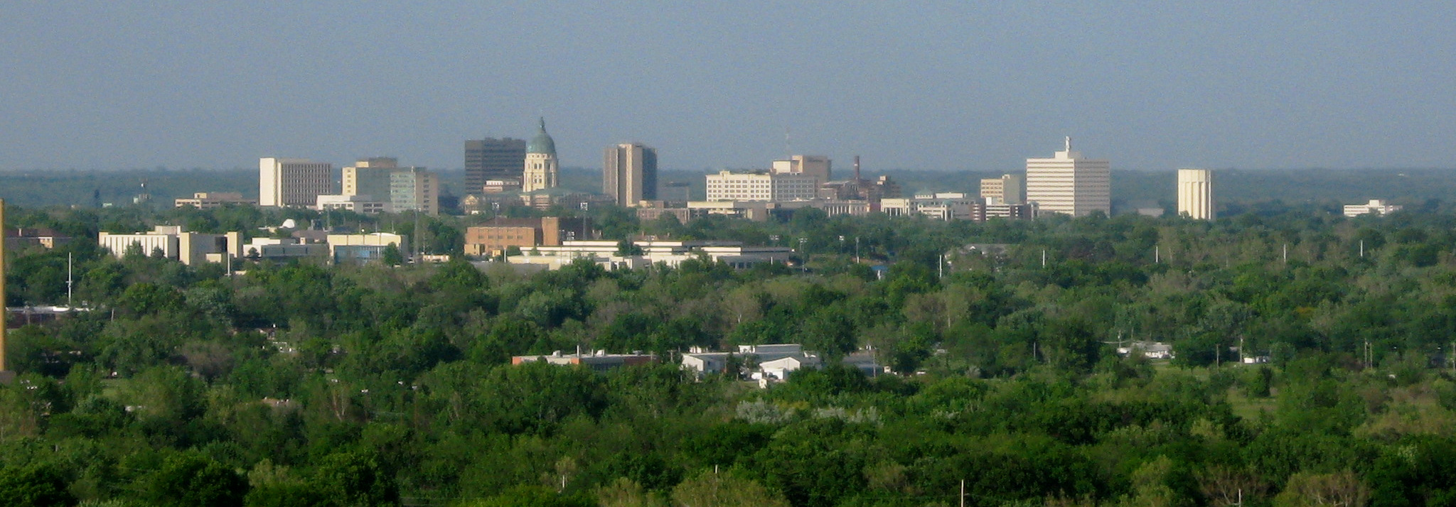
| 5 | Topeka † | 126,587 | 127,473 | −0.70% | Shawnee |
| 6 | Lawrence † | 94,934 | 87,643 | +8.32% | Douglas |
| 7 | Shawnee | 67,311 | 62,209 | +8.20% | Johnson |
| 8 | Lenexa | 57,434 | 48,190 | +19.18% | Johnson |
| 9 | Manhattan † | 54,100 | 52,281 | +3.48% | Riley |
| 10 | Salina † | 46,889 | 47,707 | −1.71% | Saline |
| 11 | Hutchinson † | 40,006 | 42,080 | −4.93% | Reno |
| 12 | Leavenworth † | 37,351 | 35,251 | +5.96% | Leavenworth |
| 13 | Leawood | 33,902 | 31,867 | +6.39% | Johnson |
| 14 | Garden City † | 28,151 | 26,658 | +5.60% | Finney |
| 15 | Dodge City † | 27,788 | 27,340 | +1.64% | Ford |
| 16 | Derby | 25,625 | 22,158 | +15.65% | Sedgwick |
| 17 | Emporia † | 24,139 | 24,916 | −3.12% | Lyon |
| 18 | Gardner | 23,287 | 19,123 | +21.77% | Johnson |
| 19 | Prairie Village | 22,957 | 21,447 | +7.04% | Johnson |
| 20 | Junction City † | 22,932 | 23,353 | −1.80% | Geary |
| 21 | Hays † | 21,116 | 20,510 | +2.95% | Ellis |
| 22 | Pittsburg | 20,646 | 20,233 | +2.04% | Crawford |
| 23 | Liberal † | 19,825 | 20,525 | −3.41% | Seward |
| 24 | Newton † | 18,602 | 19,132 | −2.77% | Harvey |
| 25 | Andover | 14,892 | 11,791 | +26.30% | Butler |
| 26 | Great Bend † | 14,733 | 15,995 | −7.89% | Barton |
| 27 | McPherson † | 14,082 | 13,155 | +7.05% | McPherson |
| 28 | El Dorado † | 12,870 | 13,021 | −1.16% | Butler |
| 29 | Ottawa † | 12,625 | 12,649 | −0.19% | Franklin |
| 30 | Arkansas City | 11,974 | 12,415 | −3.55% | Cowley |
| 31 | Winfield † | 11,777 | 12,301 | −4.26% | Cowley |
| 32 | Haysville | 11,262 | 10,826 | +4.03% | Sedgwick |
| 33 | Lansing | 11,239 | 11,265 | -0.23% | Leavenworth |
| 34 | Merriam | 11,098 | 11,003 | +0.86% | Johnson |
| 35 | Atchison † | 10,885 | 11,021 | −1.23% | Atchison |
| 36 | Mission | 9,954 | 9,323 | +6.77% | Johnson |
| 37 | Parsons | 9,600 | 10,500 | −8.57% | Labette |
| 38 | Augusta | 9,256 | 9,274 | -0.19% | Butler |
| 39 | Coffeyville | 8,826 | 10,295 | −14.27% | Montgomery |
| 40 | Chanute | 8,722 | 9,119 | −4.35% | Neosho |
| 41 | Independence † | 8,548 | 9,483 | −9.86% | Montgomery |
| 42 | Park City | 8,333 | 7,297 | +14.20% | Sedgwick |
| 43 | Bel Aire | 8,262 | 6,769 | +22.06% | Sedgwick |
| 44 | Spring Hill | 7,952 | 5,437 | +46.26% | Johnson |
| 45 | Bonner Springs | 7,837 | 7,314 | +7.15% | Wyandotte |
| 46 | Wellington † | 7,715 | 8,172 | −5.59% | Sumner |
| 47 | Fort Scott † | 7,552 | 8,087 | −6.62% | Bourbon |
| 48 | Valley Center | 7,340 | 6,822 | +7.59% | Sedgwick |
| 49 | Basehor | 6,896 | 4,664 | +49.49% | Leavenworth |
| 50 | Roeland Park | 6,871 | 6,731 | +2.08% | Johnson |
| 51 | Pratt † | 6,603 | 6,835 | −3.39% | Pratt |
| 52 | Abilene † | 6,460 | 6,844 | −5.61% | Dickinson |
| 53 | Eudora | 6,408 | 6,136 | +4.43% | Douglas |
| 54 | Mulvane | 6,286 | 6,111 | +2.86% | Sedgwick |
| 55 | De Soto | 6,118 | 5,720 | +6.96% | Johnson |
| 56 | Ulysses † | 5,788 | 6,161 | −6.05% | Grant |
| 57 | Paola † | 5,768 | 5,602 | +2.96% | Miami |
| 58 | Maize | 5,735 | 3,420 | +67.69% | Sedgwick |
| 59 | Tonganoxie | 5,573 | 4,996 | +11.55% | Leavenworth |
| 60 | Colby † | 5,570 | 5,387 | +3.40% | Thomas |
| 61 | Iola † | 5,396 | 5,704 | −5.40% | Allen |
| 62 | Concordia † | 5,111 | 5,395 | −5.26% | Cloud |
| 63 | Goddard | 5,084 | 4,344 | +17.03% | Sedgwick |
Military installations
- See Kansas forts and posts for a historical list
As a supplement to the list of cities, the following military installations are provided because of their relative size in active duty and/or service members living on the post and their location within the borders of the state of Kansas. The table values for "Population in Quarters" includes reported totals of active duty, family, civilians, reservists, and retired personnel living on the installation.
As of 2016, over 85,000 people live on military installations in Kansas—including over 25,000 active duty personnel. Although not considered "cities", these military installations certainly should be considered as population centers of note.[6][7][8]
| Installation | Population in quarters | Active duty personnel | County |
|---|---|---|---|
| Fort Riley | 54,957 | 18,553 | Riley and Geary[6] |
| McConnell Air Force Base | 17,523 | 2,989 | Sedgwick[7] |
| Fort Leavenworth | 12,733 | 5,383 | Leavenworth[8] |
Alphabetical listing
A
B
- Baldwin City
- Barnard
- Barnes
- Bartlett
- Basehor
- Bassett
- Baxter Springs
- Bazine
- Beattie
- Bel Aire
- Belle Plaine
- Belleville
- Beloit
- Belpre
- Belvue
- Benedict
- Bennington
- Bentley
- Benton
- Bern
- Beverly
- Bird City
- Bison
- Blue Mound
- Blue Rapids
- Bluff City
- Bogue
- Bonner Springs
- Brewster
- Bronson
- Brookville
- Brownell
- Bucklin
- Buffalo
- Buhler
- Bunker Hill
- Burden
- Burdett
- Burlingame
- Burlington
- Burns
- Burr Oak
- Burrton
- Bushong
- Bushton
- Byers
C
- Caldwell
- Cambridge
- Caney
- Canton
- Carbondale
- Carlton
- Cassoday
- Cawker City
- Cedar
- Cedar Point
- Cedar Vale
- Centralia
- Chanute
- Chapman
- Chase
- Chautauqua
- Cheney
- Cherokee
- Cherryvale
- Chetopa
- Cimarron
- Circleville
- Claflin
- Clay Center
- Clayton
- Clearwater
- Clifton
- Climax
- Clyde
- Coats
- Coffeyville
- Colby
- Coldwater
- Collyer
- Colony
- Columbus
- Colwich
- Concordia
- Conway Springs
- Coolidge
- Copeland
- Corning
- Cottonwood Falls
- Council Grove
- Courtland
- Coyville
- Cuba
- Cullison
- Culver
- Cunningham
D
E
F
G
- Galatia
- Galena
- Galesburg
- Galva
- Garden City
- Garden Plain
- Gardner
- Garfield
- Garnett
- Gas
- Gaylord
- Gem
- Geneseo
- Geuda Springs
- Girard
- Glade
- Glasco
- Glen Elder
- Goddard
- Goessel
- Goff
- Goodland
- Gorham
- Gove City
- Grainfield
- Grandview Plaza
- Great Bend
- Greeley
- Green
- Greenleaf
- Greensburg
- Grenola
- Gridley
- Grinnell
- Gypsum
H
- Haddam
- Halstead
- Hamilton
- Hamlin
- Hanover
- Hanston
- Hardtner
- Harper
- Hartford
- Harveyville
- Havana
- Haven
- Havensville
- Haviland
- Hays
- Haysville
- Hazelton
- Hepler
- Herington
- Herndon
- Hesston
- Hiawatha
- Highland
- Hill City
- Hillsboro
- Hoisington
- Holcomb
- Hollenberg
- Holton
- Holyrood
- Hope
- Horace
- Horton
- Howard
- Hoxie
- Hoyt
- Hudson
- Hugoton
- Humboldt
- Hunnewell
- Hunter
- Huron
- Hutchinson
I
J
K
L
- Labette
- La Crosse
- La Cygne
- La Harpe
- Lake Quivira
- Lakin
- Lancaster
- Lane
- Langdon
- Lansing
- Larned
- Latham
- Latimer
- Lawrence
- Leavenworth
- Le Roy
- Leawood
- Lebanon
- Lebo
- Lecompton
- Lehigh
- Lenexa
- Lenora
- Leon
- Leona
- Leonardville
- Leoti
- Lewis
- Liberal
- Liberty
- Liebenthal
- Lincoln Center
- Lincolnville
- Lindsborg
- Linn
- Linn Valley
- Linwood
- Little River
- Logan
- Lone Elm
- Longford
- Long Island
- Longton
- Lorraine
- Lost Springs
- Louisburg
- Louisville
- Lucas
- Luray
- Lyndon
- Lyons
M
- Macksville
- Madison
- Mahaska
- Maize
- Manchester
- Manhattan
- Mankato
- Manter
- Maple Hill
- Mapleton
- Marion
- Marquette
- Marysville
- Matfield Green
- Mayetta
- Mayfield
- McCracken
- McCune
- McDonald
- McFarland
- McLouth
- McPherson
- Meade
- Medicine Lodge
- Melvern
- Menlo
- Meriden
- Merriam
- Milan
- Milford
- Miltonvale
- Minneapolis
- Minneola
- Mission
- Mission Hills
- Mission Woods
- Moline
- Montezuma
- Moran
- Morganville
- Morland
- Morrill
- Morrowville
- Moscow
- Mound City
- Mound Valley
- Moundridge
- Mount Hope
- Mulberry
- Mullinville
- Mulvane
- Munden
- Muscotah
N
O
P
- Palco
- Palmer
- Paola
- Paradise
- Park
- Park City
- Parker
- Parkerfield
- Parkerville
- Parsons
- Partridge
- Pawnee Rock
- Paxico
- Peabody
- Penalosa
- Perry
- Peru
- Phillipsburg
- Pittsburg
- Plains
- Plainville
- Pleasanton
- Plevna
- Pomona
- Portis
- Potwin
- Powhattan
- Prairie View
- Prairie Village
- Pratt
- Prescott
- Preston
- Pretty Prairie
- Princeton
- Protection
Q
R
S
- Sabetha
- St. Francis
- St. George
- St. John
- St. Marys
- St. Paul
- Salina
- Satanta
- Savonburg
- Sawyer
- Scammon
- Scandia
- Schoenchen
- Scott City
- Scottsville
- Scranton
- Sedan
- Sedgwick
- Selden
- Seneca
- Severance
- Severy
- Seward
- Sharon
- Sharon Springs
- Shawnee
- Silver Lake
- Simpson
- Smith Center
- Smolan
- Soldier
- Solomon
- South Haven
- South Hutchinson
- Spearville
- Speed
- Spivey
- Spring Hill
- Stafford
- Stark
- Sterling
- Stockton
- Strong City
- Sublette
- Summerfield
- Sun City
- Susank
- Sylvan Grove
- Sylvia
- Syracuse
T
U
V
W
- WaKeeney
- Wakefield
- Waldo
- Waldron
- Wallace
- Walnut
- Walton
- Wamego
- Washington
- Waterville
- Wathena
- Waverly
- Webber
- Weir
- Wellington
- Wellsville
- West Mineral
- Westmoreland
- Westphalia
- Westwood
- Westwood Hills
- Wetmore
- Wheaton
- White City
- White Cloud
- Whitewater
- Whiting
- Wichita
- Willard
- Williamsburg
- Willis
- Willowbrook
- Wilmore
- Wilsey
- Wilson
- Winchester
- Windom
- Winfield
- Winona
- Woodbine
- Woodston
X
- none
Y
Z
Fictional cities
- Flowers, Kansas, from the book The Van Gogh Cafe, located on I-70 interstate.
- Jericho, Kansas, setting of the 2006 TV series Jericho, located approximately where the real cities of Colby and Oakley are located in northwest Kansas.
- Rustwater, Kansas, the setting of the 1992 film Leap of Faith.
- Smallville, Kansas, childhood hometown of fictional character Superman.
- Stubbville, Kansas, the town the "people train" passes through near Wichita in the film Planes, Trains, and Automobiles.
- Nowhere, Kansas, the nearest town to the main farmhouse in the 1999 animated series Courage the Cowardly Dog.
- Rachel, Kansas, the setting of the 1966 film, The Ghost and Mr. Chicken.
- Pork Corners, Kansas, hometown of Sgt. Orville Snorkel of Beetle Bailey comics.
See also
- Kansas census statistical areas
- Kansas locations by per capita income
- Kansas license plate county codes
- List of counties in Kansas
- List of townships in Kansas
- List of unincorporated communities in Kansas
- List of ghost towns in Kansas
- Lists of places in Kansas
References
- "GCT-PH1 – Population, Housing Units, Area, and Density: 2010 – State — Place and (in selected states) County Subdivision". 2010 United States Census. United States Census Bureau. Archived from the original on February 13, 2020. Retrieved August 8, 2016.
- "Kansas: 2010 Population and Housing Unit Counts 2010 Census of Population and Housing" (PDF). 2010 United States Census. United States Census Bureau. September 2012. p. III-2. Retrieved August 8, 2016.
- Census - Places; census.gov
- "2010 Census Redistricting Data (Public Law 94-171) Summary File". American FactFinder2. U.S. Census Bureau, 2010 Census. Retrieved 30 January 2013.[dead link]
- "U.S. Census Bureau QuickFacts: Kansas". www.census.gov. Retrieved 2021-08-30.
- "Military Installations (Fort Riley, Kansas)". Department of Defense. Retrieved September 13, 2016.
- "Military Installations (McConnell AFB, Kansas)". Department of Defense. Archived from the original on October 14, 2016. Retrieved September 13, 2016.
- "Military Installations (Fort Leavenworth, Kansas)". Department of Defense. Retrieved September 13, 2016.
External links
- Additional information
- Kansas Department of Transportation (KDOT): Intrastate mileage between cities
- Historical Directory of Kansas Towns
- Photos, maps and other images
- City maps from KDOT
Другой контент может иметь иную лицензию. Перед использованием материалов сайта WikiSort.org внимательно изучите правила лицензирования конкретных элементов наполнения сайта.
WikiSort.org - проект по пересортировке и дополнению контента Википедии